Coed Dolgelynnen

Wood, Forest in Merionethshire

Wales

Coed Dolgelynnen

River Dovey near Derwenlas
River Dovey near Derwenlas Credit: Chris Morgan

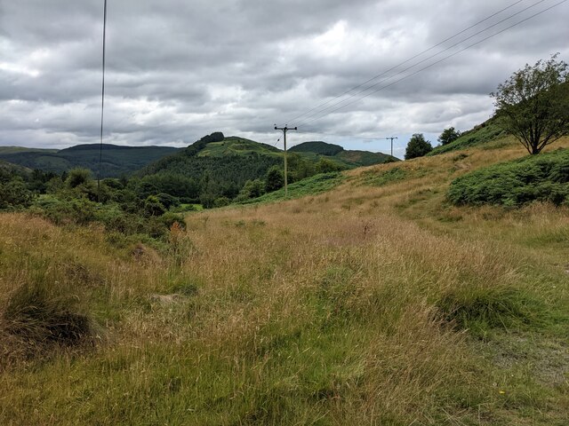
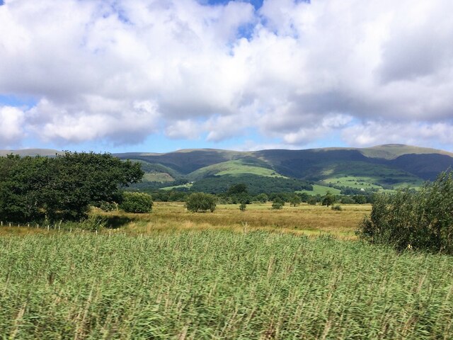
Coed Dolgelynnen, located in Merionethshire, Wales, is a picturesque wood or forest that offers a tranquil and enchanting experience for nature lovers. Covering an area of approximately 200 hectares, this ancient woodland is nestled within the Snowdonia National Park, a designated Area of Outstanding Natural Beauty.

The forest boasts a diverse range of tree species, including oak, beech, birch, and ash, creating a rich and vibrant habitat for a variety of flora and fauna. The lush greenery and dense canopy provide a haven for many bird species, such as woodpeckers, tits, and finches, making it a popular spot for birdwatchers.

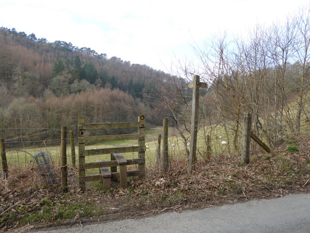
Visitors to Coed Dolgelynnen can explore a network of well-maintained footpaths that wind their way through the woodland. These paths offer stunning views of the surrounding landscape, including the nearby Cader Idris mountain range and the Mawddach Estuary.

The forest also features a small picnic area, allowing visitors to relax and enjoy the peaceful surroundings. Additionally, there are several picnic tables strategically placed along the trails, providing opportunities for picnickers to pause and soak in the natural beauty.

Coed Dolgelynnen is managed by the National Trust, ensuring the preservation and conservation of this idyllic woodland. The Trust also organizes various events and activities throughout the year to engage visitors and promote awareness of the natural environment.

Overall, Coed Dolgelynnen offers a serene and idyllic retreat for those seeking a peaceful escape amidst nature's beauty. Whether it's a leisurely stroll, birdwatching, or simply enjoying a picnic, this forest provides a memorable experience for all who visit.

If you have any feedback on the listing, please let us know in the comments section below.

Coed Dolgelynnen Images

Images are sourced within 2km of 52.584142/-3.8856222 or Grid Reference SH7200. Thanks to Geograph Open Source API. All images are credited.

River Dovey near Derwenlas
Old milestone by Hen Gapel, Derwenlas This classic old Welsh slate milestone stands in front of Hen Gapel, Derwenlas alongside the A487. The top is damaged and it appears to have two lots of inscriptions both apparently indicating 2 miles to Machynlleth. The milestone isn't marked on any maps I've seen, but does appear to be equidistant between milestones 'Mach 1', which is now in a cut off section of the A487 (if the MS exists), and 'Mach 3' further west, which may have been lost to an RTC, where there is a hole in the hedge. 
For a wider view of this milestone see <a href="https://www.geograph.org.uk/photo/7519195">SN7299 : Derwenlas by the A487, and a milestone</a>

Inscription reads:-
         2 M
MA(CH)
2 M.

Surveyed

Milestone Society National ID: MOT_AYMC15
Old milestone by Hen Gapel, Derwenlas
This classic old Welsh slate milestone stands in front of Hen Gapel, Derwenlas alongside the A487. The top is damaged and it appears to have two lots of inscriptions both apparently indicating 2 miles to Machynlleth. The milestone isn't marked on any maps I've seen, but does appear to be equidistant between milestones 'Mach 1', which is now in a cut off section of the A487 (if the MS exists), and 'Mach 3' further west, which may have been lost to an RTC, where there is a hole in the hedge. For a wider view of this milestone see SN7299 : Derwenlas by the A487, and a milestone Inscription reads:- 2 M MA(CH) 2 M. Surveyed Milestone Society National ID: MOT_AYMC15
Derwenlas by the A487, and a milestone Looking west along the A487 in Derwenlas. On the right there is a slate milestone in front of Hen Gapel <a href="https://www.geograph.org.uk/photo/7519171">SN7299 : Old milestone by Hen Gapel, Derwenlas</a>
Derwenlas by the A487, and a milestone
Looking west along the A487 in Derwenlas. On the right there is a slate milestone in front of Hen Gapel SN7299 : Old milestone by Hen Gapel, Derwenlas
A487 roadworks near Morben
A487 at Bryn Siriol
A487 at Bryn Siriol
Luxuriant vegetation on the roadside
Moorland by the side of the road
A487 near Derwenlas
A487 near Derwenlas
From a Macchynlleth-Aberystwyth train, bend in the River Dovey
From a Machynlleth-Aberystwyth train, alongside the river Dovey
From a Machynlleth-Aberystwyth train, reed beds by the Dovey
Wales Coast Path/Glyndwr's Way The path continues along this road, which later becomes more of a forest track, for just over 3k.
Wales Coast Path/Glyndwr's Way
The path continues along this road, which later becomes more of a forest track, for just over 3k.
The parting of the Ways Glyndwr's Way goes off left on its meandering mid-Wales route to Knighton, meanwhile the Wales Coast Path continues ahead down the road
The parting of the Ways
Glyndwr's Way goes off left on its meandering mid-Wales route to Knighton, meanwhile the Wales Coast Path continues ahead down the road
The road to Glaspwll The road is descending sharply
The road to Glaspwll
The road is descending sharply
Wales Coast Path The Glaspwll road drops down but the Coast path hops over the stile to cut a corner and avoid a quarter mile descent/ascent
Wales Coast Path
The Glaspwll road drops down but the Coast path hops over the stile to cut a corner and avoid a quarter mile descent/ascent
Hillside field with sheep
Wales Coast Path crossing Nant Rhisglog
The road to Garthgwynion The Wales Coast path going through Coed Garthgwynion
The road to Garthgwynion
The Wales Coast path going through Coed Garthgwynion
Show me another place!

Coed Dolgelynnen is located at Grid Ref: SH7200 (Lat: 52.584142, Lng: -3.8856222)

Unitary Authority: Gwynedd

Police Authority: North Wales

What 3 Words

///butterfly.denser.jots. Near Machynlleth, Powys

Related Wikis

Machynlleth transmitting station

The Machynlleth transmitting station is a broadcasting and telecommunications facility located on a hill about 2.5 kilometres (1.6 mi) west of the town...

Derwenlas

Derwenlas is a hamlet in northern Powys, Wales. It is part of the community of Cadfarch. Part of the historic county of Montgomeryshire (Sir Drefaldwyn...

Llugwy Hall

Llugwy is the name of an old property near Pennal, a village on the A493 road in southern Gwynedd, Wales, on the north bank of the Afon Dyfi/River Dovey...

Morben

Morben is a hamlet in northern Powys, Wales. Part of the historic county of Montgomeryshire (Sir Drefaldwyn) from 1536 to 1974, it lies on the Afon Dyfi...

Ysgol Bro Hyddgen

Ysgol Bro Hyddgen is a bilingual, all-age (4-19) school situated in Machynlleth, Powys. The school is a combination of two previous schools, namely Machynlleth...

Celtica (visitor centre)

Celtica was an educational guest centre located in Machynlleth, Wales. Formed in 1995, Celtica provided domestic and foreign tourists with information...

Plas Machynlleth

Plas Machynlleth is the former Welsh residence of the Marquesses of Londonderry. It is situated in the market town of Machynlleth in Powys (formerly Montgomeryshire...

Machynlleth F.C.

Machynlleth Football Club (Welsh: Clwb Pêl Droed Machynlleth) is a Welsh football team based in Machynlleth, Powys, Wales. They played in the Ardal Leagues...

Nearby Amenities

Located within 500m of 52.584142,-3.8856222
Source: npe
Lat/Long: 52.5806662/-3.883689
Power: pole
Source: bing
Lat/Long: 52.5821442/-3.8811926
Power: pole
Source: bing
Lat/Long: 52.5827716/-3.8821433
Power: pole
Source: bing
Lat/Long: 52.5835889/-3.8851166
Power: pole
Source: bing
Lat/Long: 52.5815607/-3.8803061
Power: pole
Source: bing
Lat/Long: 52.582343/-3.8880898
Power: pole
Source: bing
Lat/Long: 52.5838244/-3.8837794
Power: pole
Source: bing
Lat/Long: 52.5833225/-3.8829962
Power: pole
Source: bing
Lat/Long: 52.5841903/-3.8841631
Power: pole
Source: bing
Lat/Long: 52.5815069/-3.8901578
Power: pole
Source: bing
Lat/Long: 52.5830617/-3.8861828
Power: pole
Source: bing
Lat/Long: 52.5818247/-3.8893827
Power: pole
Source: bing
Lat/Long: 52.5826331/-3.8873844
Place: farm
Lat/Long: 52.5843217/-3.8825077
Power: pole
Lat/Long: 52.5884541/-3.8851624
Power: pole
Lat/Long: 52.5884003/-3.8863158
Man Made: mast
Tower Construction: lattice
Tower Type: communication
Lat/Long: 52.5864213/-3.8855419
The data included in this document is from www.openstreetmap.org. The data is made available under ODbL.

Have you been to Coed Dolgelynnen?

Leave your review of Coed Dolgelynnen below (or comments, questions and feedback).