Allt Tŷ-cam

Wood, Forest in Cardiganshire

Wales

Allt Tŷ-cam

A tractor on the track Forestry work continues in the hills of Coed Ty-llwyd. The tractor was being used to haul out removed timber.
A tractor on the track Credit: John Lucas

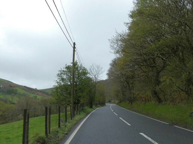
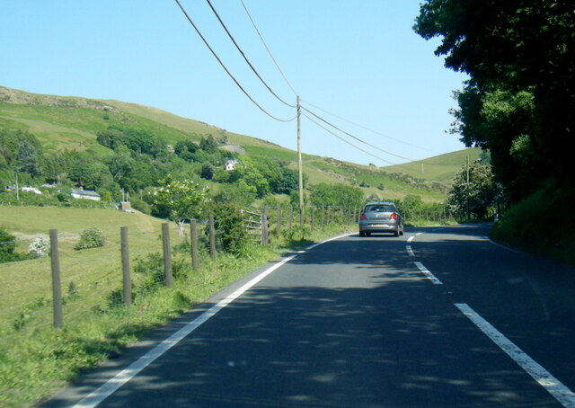
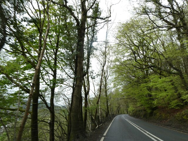
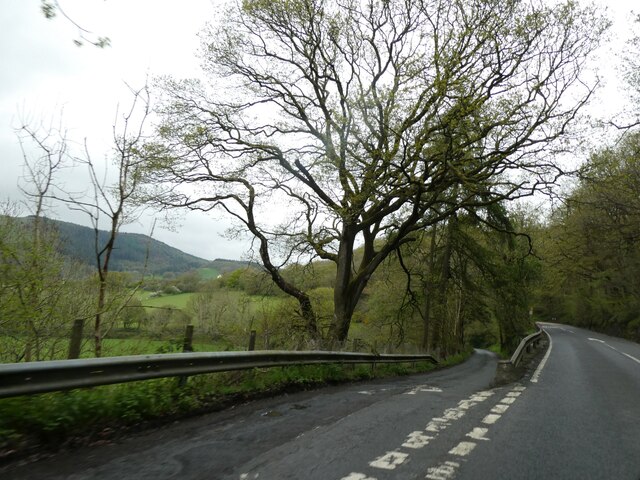
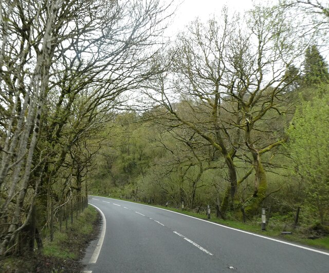
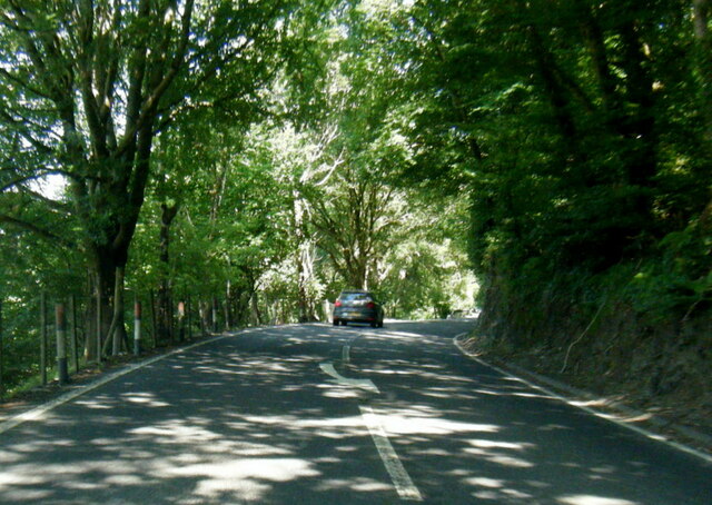
Allt Tŷ-cam is a picturesque woodland located in Cardiganshire, Wales. The woodland covers an area of approximately 500 acres and is nestled within the stunning Cambrian Mountains. It is a popular destination for nature enthusiasts, hikers, and those seeking tranquility amidst the beauty of nature.

The woodland is home to a diverse range of flora and fauna, including ancient oak and beech trees, carpeted forest floors with bluebells and wildflowers, and a variety of bird species. The trees in Allt Tŷ-cam are known for their impressive height and age, with some oak trees estimated to be over 500 years old.

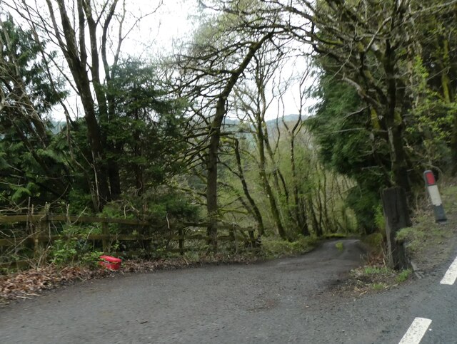
The woodland offers numerous walking trails, allowing visitors to explore and immerse themselves in the peaceful surroundings. The trails are well-maintained, providing easy access to the different areas of the woodland. Along the way, hikers can enjoy breathtaking views of the surrounding mountains, valleys, and streams.

Allt Tŷ-cam also holds historical significance, with remnants of ancient settlements and stone structures scattered throughout the woodland. These traces of human presence add an intriguing layer to the natural beauty of the area.

The woodland is carefully managed by local authorities to preserve its ecological balance and protect its unique biodiversity. Visitors are encouraged to respect the environment and adhere to designated paths to minimize their impact on the delicate ecosystem.

Allt Tŷ-cam offers an idyllic retreat for anyone seeking solace in nature, with its enchanting woodland, diverse wildlife, and stunning vistas. Whether one chooses to explore the trails or simply sit quietly and absorb the tranquility, a visit to Allt Tŷ-cam is sure to leave a lasting impression.

If you have any feedback on the listing, please let us know in the comments section below.
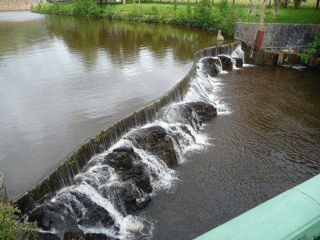
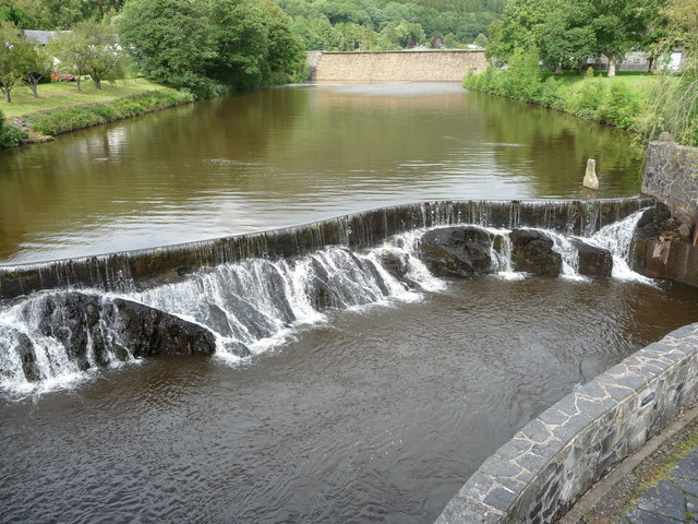
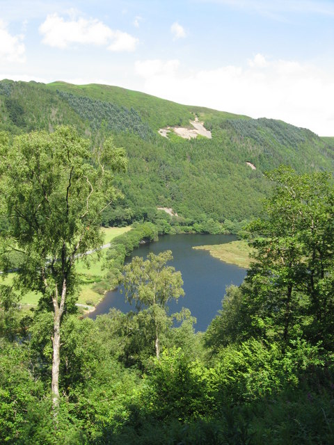
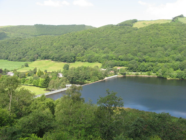
Allt Tŷ-cam Images

Images are sourced within 2km of 52.402335/-3.9310438 or Grid Reference SN6880. Thanks to Geograph Open Source API. All images are credited.
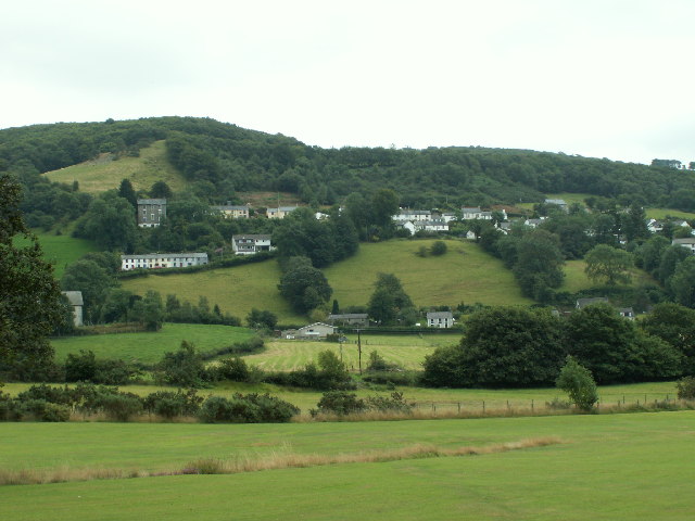
A tractor on the track Forestry work continues in the hills of Coed Ty-llwyd. The tractor was being used to haul out removed timber.
A tractor on the track
Forestry work continues in the hills of Coed Ty-llwyd. The tractor was being used to haul out removed timber.
A44 skirting the valley above Nant Brwyno The A44 is a major road in the United Kingdom that runs for 155 miles from Oxford in southern England to Aberystwyth in west Wales.
<span class="nowrap"><a title="http://www.sabre-roads.org.uk/wiki/index.php?title=A44" rel="nofollow ugc noopener" href="http://www.sabre-roads.org.uk/wiki/index.php?title=A44">Link</a><img style="margin-left:2px;" alt="External link" title="External link - shift click to open in new window" src="https://s1.geograph.org.uk/img/external.png" width="10" height="10"/></span>  SABRE
<span class="nowrap"><a title="https://en.wikipedia.org/wiki/A44_road" rel="nofollow ugc noopener" href="https://en.wikipedia.org/wiki/A44_road">Link</a><img style="margin-left:2px;" alt="External link" title="External link - shift click to open in new window" src="https://s1.geograph.org.uk/img/external.png" width="10" height="10"/></span>  Wikipedia
A44 skirting the valley above Nant Brwyno
The A44 is a major road in the United Kingdom that runs for 155 miles from Oxford in southern England to Aberystwyth in west Wales. LinkExternal link SABRE LinkExternal link Wikipedia
A44 west of Cwmbrwyno
Posh Paws Dog grooming venture at Goginan
Posh Paws
Dog grooming venture at Goginan
Allt Ty-cam [hill] With Neuadd Parc Farm visible, bottom left. Viewed from Aberffrwd.
Allt Ty-cam [hill]
With Neuadd Parc Farm visible, bottom left. Viewed from Aberffrwd.
A44 in woodland west of Goginan The A44 is a major road in the United Kingdom that runs for 155 miles from Oxford in southern England to Aberystwyth in west Wales.
<span class="nowrap"><a title="http://www.sabre-roads.org.uk/wiki/index.php?title=A44" rel="nofollow ugc noopener" href="http://www.sabre-roads.org.uk/wiki/index.php?title=A44">Link</a><img style="margin-left:2px;" alt="External link" title="External link - shift click to open in new window" src="https://s1.geograph.org.uk/img/external.png" width="10" height="10"/></span>  SABRE
<span class="nowrap"><a title="https://en.wikipedia.org/wiki/A44_road" rel="nofollow ugc noopener" href="https://en.wikipedia.org/wiki/A44_road">Link</a><img style="margin-left:2px;" alt="External link" title="External link - shift click to open in new window" src="https://s1.geograph.org.uk/img/external.png" width="10" height="10"/></span>  Wikipedia
A44 in woodland west of Goginan
The A44 is a major road in the United Kingdom that runs for 155 miles from Oxford in southern England to Aberystwyth in west Wales. LinkExternal link SABRE LinkExternal link Wikipedia
This way to Penbryn and the valley; side road from A44 The A44 is a major road in the United Kingdom that runs for 155 miles from Oxford in southern England to Aberystwyth in west Wales.
<span class="nowrap"><a title="http://www.sabre-roads.org.uk/wiki/index.php?title=A44" rel="nofollow ugc noopener" href="http://www.sabre-roads.org.uk/wiki/index.php?title=A44">Link</a><img style="margin-left:2px;" alt="External link" title="External link - shift click to open in new window" src="https://s1.geograph.org.uk/img/external.png" width="10" height="10"/></span>  SABRE
<span class="nowrap"><a title="https://en.wikipedia.org/wiki/A44_road" rel="nofollow ugc noopener" href="https://en.wikipedia.org/wiki/A44_road">Link</a><img style="margin-left:2px;" alt="External link" title="External link - shift click to open in new window" src="https://s1.geograph.org.uk/img/external.png" width="10" height="10"/></span>  Wikipedia
This way to Penbryn and the valley; side road from A44
The A44 is a major road in the United Kingdom that runs for 155 miles from Oxford in southern England to Aberystwyth in west Wales. LinkExternal link SABRE LinkExternal link Wikipedia
Goginan's abandoned church by A44
Side road from A44 to Blaendyffryn The A44 is a major road in the United Kingdom that runs for 155 miles from Oxford in southern England to Aberystwyth in west Wales.
<span class="nowrap"><a title="http://www.sabre-roads.org.uk/wiki/index.php?title=A44" rel="nofollow ugc noopener" href="http://www.sabre-roads.org.uk/wiki/index.php?title=A44">Link</a><img style="margin-left:2px;" alt="External link" title="External link - shift click to open in new window" src="https://s1.geograph.org.uk/img/external.png" width="10" height="10"/></span>  SABRE
<span class="nowrap"><a title="https://en.wikipedia.org/wiki/A44_road" rel="nofollow ugc noopener" href="https://en.wikipedia.org/wiki/A44_road">Link</a><img style="margin-left:2px;" alt="External link" title="External link - shift click to open in new window" src="https://s1.geograph.org.uk/img/external.png" width="10" height="10"/></span>  Wikipedia
Side road from A44 to Blaendyffryn
The A44 is a major road in the United Kingdom that runs for 155 miles from Oxford in southern England to Aberystwyth in west Wales. LinkExternal link SABRE LinkExternal link Wikipedia
A44 in Blaendyffryn Woods The A44 is a major road in the United Kingdom that runs for 155 miles from Oxford in southern England to Aberystwyth in west Wales.
<span class="nowrap"><a title="http://www.sabre-roads.org.uk/wiki/index.php?title=A44" rel="nofollow ugc noopener" href="http://www.sabre-roads.org.uk/wiki/index.php?title=A44">Link</a><img style="margin-left:2px;" alt="External link" title="External link - shift click to open in new window" src="https://s1.geograph.org.uk/img/external.png" width="10" height="10"/></span>  SABRE
<span class="nowrap"><a title="https://en.wikipedia.org/wiki/A44_road" rel="nofollow ugc noopener" href="https://en.wikipedia.org/wiki/A44_road">Link</a><img style="margin-left:2px;" alt="External link" title="External link - shift click to open in new window" src="https://s1.geograph.org.uk/img/external.png" width="10" height="10"/></span>  Wikipedia
A44 in Blaendyffryn Woods
The A44 is a major road in the United Kingdom that runs for 155 miles from Oxford in southern England to Aberystwyth in west Wales. LinkExternal link SABRE LinkExternal link Wikipedia
A44 south of Penbryn Farm
A44 in Goginan
A44 in Goginan
Goginan chapel
Goginan chapel
The Statkraft Rheidol Visitor Centre in Cwm Rheidol Statkraft is the company that operates the dam and powerstation here. The visitor centre is for the many visitors that come here car touring or walking or to ride the nearby railway and provides history and info on the area and the industry here.
The Statkraft Rheidol Visitor Centre in Cwm Rheidol
Statkraft is the company that operates the dam and powerstation here. The visitor centre is for the many visitors that come here car touring or walking or to ride the nearby railway and provides history and info on the area and the industry here.
Weir on the Afon Rheidol below Cwm Rheidol Reservoir Styled to look naturalistic, this weir looks very photogenic.
Weir on the Afon Rheidol below Cwm Rheidol Reservoir
Styled to look naturalistic, this weir looks very photogenic.
Weir and dam on the Afon Rheidol at Cwm Rheidol Reservoir All still very redolent of its 1960's heyday. Very nicely styled though, an uninformed visitor would hardly notice that it's all part of a man-made reservoir with powerstation etc.
Weir and dam on the Afon Rheidol at Cwm Rheidol Reservoir
All still very redolent of its 1960's heyday. Very nicely styled though, an uninformed visitor would hardly notice that it's all part of a man-made reservoir with powerstation etc.
The Rheidol Stag and Rheidol River As viewed from the Vale of Rheidol Railway.
The Rheidol Stag and Rheidol River
As viewed from the Vale of Rheidol Railway.
View towards Cwm Rheidol Reservoir dam As viewed from the Vale of Rheidol Railway.
View towards Cwm Rheidol Reservoir dam
As viewed from the Vale of Rheidol Railway.
Show me another place!

Allt Tŷ-cam is located at Grid Ref: SN6880 (Lat: 52.402335, Lng: -3.9310438)

Unitary Authority: Ceredigion

Police Authority: Dyfed Powys

What 3 Words

///enlighten.unsigned.sensitive. Near Bow Street, Ceredigion

Related Wikis

Melindwr

Melindwr is a community in the county of Ceredigion, Wales, to the east of Aberystwyth and is 71.6 miles (115.1 km) from Cardiff and 173.8 miles (279.7...

Goginan

Goginan is a small village in Ceredigion, about 7 miles outside Aberystwyth on the A44 between Ponterwyd and Capel Bangor. The Afon Melindwr runs through...

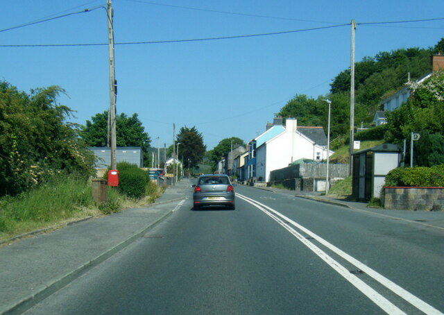
Aberffrwd, Ceredigion

Aberffrwd is a village in the Welsh principal area of Ceredigion. It has a railway station on the narrow-gauge Vale of Rheidol Railway, which was operated...

Dollwen

Dollwen is a hamlet in the community of Melindwr, Ceredigion, Wales, which is 72.1 miles (116 km) from Cardiff and 173.6 miles (279.4 km) from London...

Aberffrwd railway station

Aberffrwd railway station is a railway station serving Aberffrwd in Ceredigion in Mid-Wales, and is an intermediate stop on the preserved Vale of Rheidol...

Afon Rheidol

The Afon Rheidol ("river Rheidol") is a river in Ceredigion, Wales, 19 miles (31 km) in length. The source is Plynlimon. Receiving an average annual rainfall...

Cwmbrwyno

Cwmbrwyno is a hamlet in the community of Melindwr, Ceredigion, Wales, which is 71.2 miles (114.7 km) from Cardiff and 172.3 miles (277.3 km) from London...

Nantyronen railway station

Nantyronen railway station is a railway station serving Nantyronen in Ceredigion in Mid-Wales. It is an intermediate station and request stop on the preserved...

Nearby Amenities

Located within 500m of 52.402335,-3.9310438
Power: pole
Lat/Long: 52.4012831/-3.9280524
Power: pole
Lat/Long: 52.4007954/-3.9293935
Power: pole
Lat/Long: 52.4000524/-3.9314106
Power: pole
Lat/Long: 52.3990541/-3.9340552
Power: pole
Lat/Long: 52.4019639/-3.9262017
Power: pole
Source: bing
Lat/Long: 52.4033483/-3.9328534
Power: pole
Source: bing
Lat/Long: 52.4051123/-3.9304555
Power: pole
Source: bing
Lat/Long: 52.4018264/-3.9371824
Power: pole
Source: bing
Lat/Long: 52.4029687/-3.9334273
Power: pole
Source: bing
Lat/Long: 52.4022159/-3.9359325
Power: pole
Source: bing
Lat/Long: 52.4038589/-3.9321721
Power: pole
Source: bing
Lat/Long: 52.4059616/-3.928358
Power: pole
Source: bing
Lat/Long: 52.4023828/-3.9348865
Power: pole
Source: bing
Lat/Long: 52.404353/-3.9314854
Power: pole
Source: bing
Lat/Long: 52.404736/-3.9309597
Power: pole
Source: bing
Lat/Long: 52.402517/-3.9339852
Power: pole
Source: bing
Lat/Long: 52.405829/-3.9294335
Power: pole
Source: bing
Lat/Long: 52.4054494/-3.9300102
Ford: yes
Lat/Long: 52.3981162/-3.9331045
Power: pole
Lat/Long: 52.4049357/-3.936587
Power: pole
Lat/Long: 52.4046706/-3.9353156
Power: pole
Lat/Long: 52.4051075/-3.9339182
Power: pole
Lat/Long: 52.4055477/-3.9325368
Power: pole
Lat/Long: 52.4060091/-3.9311394
Power: pole
Lat/Long: 52.4059796/-3.9292726
Power: pole
Lat/Long: 52.4060664/-3.9283767
Ford: yes
Lat/Long: 52.4026651/-3.9294738
The data included in this document is from www.openstreetmap.org. The data is made available under ODbL.

Have you been to Allt Tŷ-cam?

Leave your review of Allt Tŷ-cam below (or comments, questions and feedback).