Coed Pennyglannau

Wood, Forest in Merionethshire

Wales

Coed Pennyglannau

St Twrog's Parish Church, Maentwrog
St Twrog's Parish Church, Maentwrog Credit: John H Darch

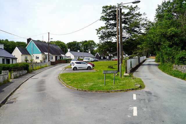
Coed Pennyglannau is a stunning woodland area located in Merionethshire, a county in northwest Wales. Nestled amidst the picturesque landscapes, this enchanting forest covers an area of approximately 200 acres. The woodland is characterized by its dense canopy of towering trees, including oak, beech, and birch, creating a diverse and captivating ecosystem.

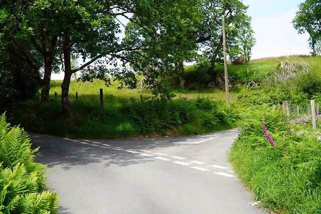
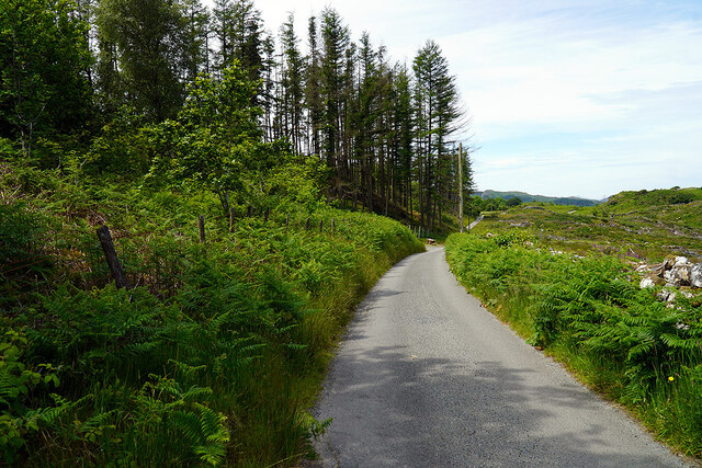
The forest offers a tranquil retreat for nature enthusiasts and outdoor adventurers alike, with its abundance of walking trails and scenic viewpoints. Visitors can explore the well-maintained paths that wind through the woods, immersing themselves in the natural beauty that surrounds them. The vibrant flora and fauna found within Coed Pennyglannau provide a haven for a wide range of wildlife, including deer, foxes, and a variety of bird species, making it a popular spot for birdwatchers and wildlife photographers.

In addition to its natural wonders, Coed Pennyglannau also holds historical significance. The woodland is believed to have been inhabited since ancient times, with remnants of Iron Age settlements and burial mounds discovered in the area. These archaeological finds add a sense of mystery and intrigue to the forest, enticing history enthusiasts to explore its hidden secrets.

Coed Pennyglannau is easily accessible, with ample parking facilities and well-marked routes. It is a popular destination for family outings, picnics, and weekend getaways. Whether you are seeking solitude and serenity or an adventure in nature, Coed Pennyglannau offers an unforgettable experience in the heart of Merionethshire.

If you have any feedback on the listing, please let us know in the comments section below.

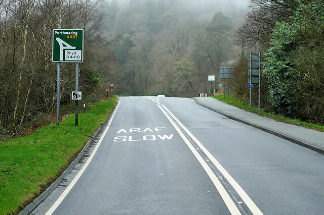
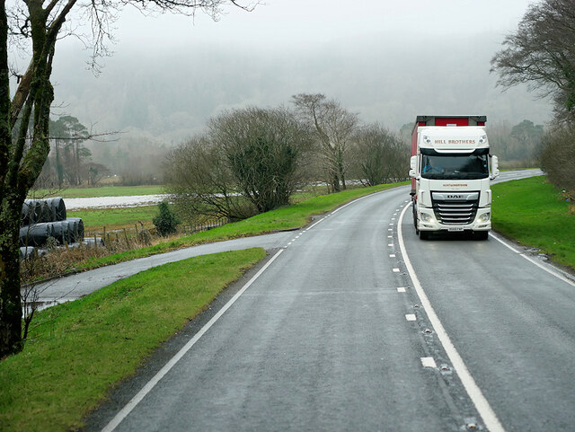
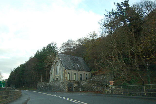
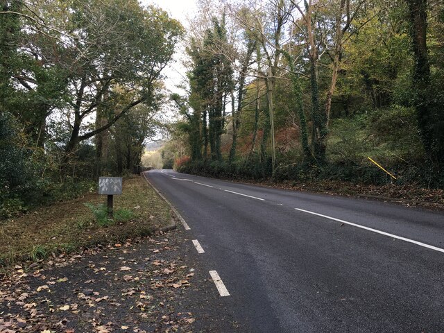
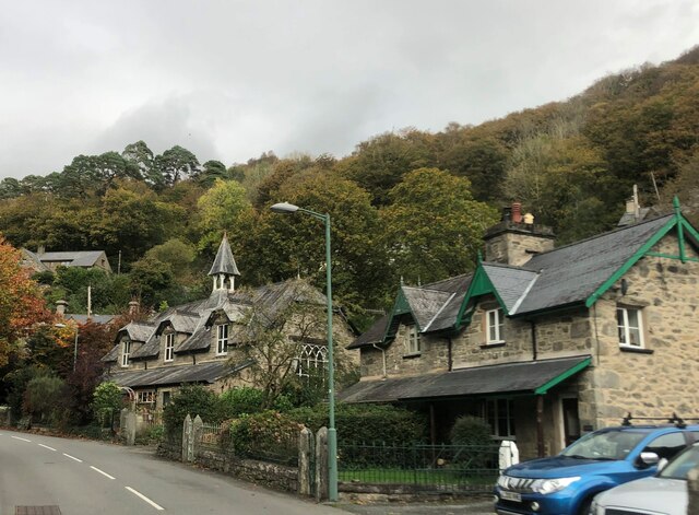
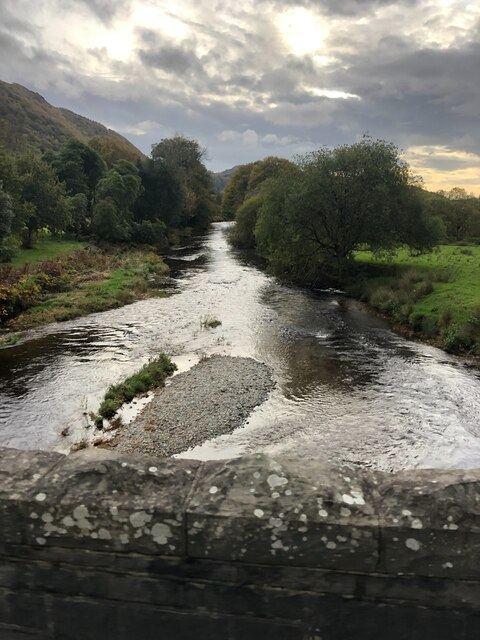
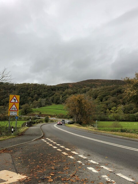
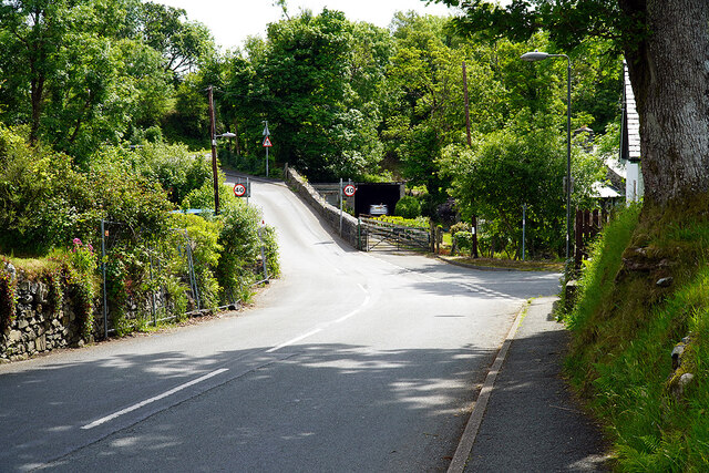
Coed Pennyglannau Images

Images are sourced within 2km of 52.936492/-3.9774713 or Grid Reference SH6739. Thanks to Geograph Open Source API. All images are credited.
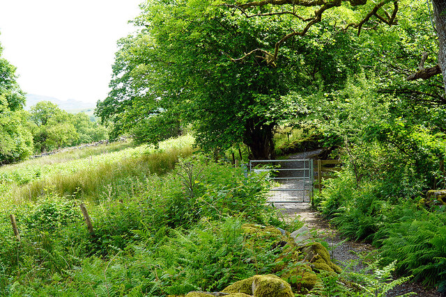
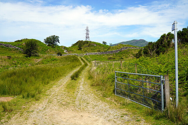
St Twrog's Parish Church, Maentwrog
A496 passing Ffatri Farm The A496 is a major coastal and mountainous road in southern Snowdonia. It runs for almost 33 miles from Blaenau Ffestiniog to Llanelltyd, via Harlech. The road passes through a diverse landscape, including the mountainous region of Blaenau Ffestiniog.
A496 passing Ffatri Farm
The A496 is a major coastal and mountainous road in southern Snowdonia. It runs for almost 33 miles from Blaenau Ffestiniog to Llanelltyd, via Harlech. The road passes through a diverse landscape, including the mountainous region of Blaenau Ffestiniog.
Layby on the A496, Vale of Ffestiniog The A496 is a major coastal and mountainous road in southern Snowdonia. It runs for almost 33 miles from Blaenau Ffestiniog to Llanelltyd, via Harlech. The road passes through a diverse landscape, including the mountainous region of Blaenau Ffestiniog.
Layby on the A496, Vale of Ffestiniog
The A496 is a major coastal and mountainous road in southern Snowdonia. It runs for almost 33 miles from Blaenau Ffestiniog to Llanelltyd, via Harlech. The road passes through a diverse landscape, including the mountainous region of Blaenau Ffestiniog.
A487, Maentwrog The A487 is one of the most important roads in Wales. It covers the majority of the west coast from St Davids to Menai Bridge, and is a primary route for most of its length, including a section where it multiplexes with the A470, another important north-south road. Along the way, it runs through two national parks: Snowdonia and Pembrokeshire Coast. Despite its length and importance, it is predominantly single carriageway, although the road has been upgraded in numerous places. It is 174 miles long.
<span class="nowrap"><a title="http://www.sabre-roads.org.uk/wiki/index.php?title=A487" rel="nofollow ugc noopener" href="http://www.sabre-roads.org.uk/wiki/index.php?title=A487">Link</a><img style="margin-left:2px;" alt="External link" title="External link - shift click to open in new window" src="https://s1.geograph.org.uk/img/external.png" width="10" height="10"/></span>
A487, Maentwrog
The A487 is one of the most important roads in Wales. It covers the majority of the west coast from St Davids to Menai Bridge, and is a primary route for most of its length, including a section where it multiplexes with the A470, another important north-south road. Along the way, it runs through two national parks: Snowdonia and Pembrokeshire Coast. Despite its length and importance, it is predominantly single carriageway, although the road has been upgraded in numerous places. It is 174 miles long. LinkExternal link
A487 near Tan-y-bwlch The A487 is one of the most important roads in Wales. It covers the majority of the west coast from St Davids to Menai Bridge, and is a primary route for most of its length, including a section where it multiplexes with the A470, another important north-south road. Along the way, it runs through two national parks: Snowdonia and Pembrokeshire Coast. Despite its length and importance, it is predominantly single carriageway, although the road has been upgraded in numerous places. It is 174 miles long.
<span class="nowrap"><a title="http://www.sabre-roads.org.uk/wiki/index.php?title=A487" rel="nofollow ugc noopener" href="http://www.sabre-roads.org.uk/wiki/index.php?title=A487">Link</a><img style="margin-left:2px;" alt="External link" title="External link - shift click to open in new window" src="https://s1.geograph.org.uk/img/external.png" width="10" height="10"/></span>
A487 near Tan-y-bwlch
The A487 is one of the most important roads in Wales. It covers the majority of the west coast from St Davids to Menai Bridge, and is a primary route for most of its length, including a section where it multiplexes with the A470, another important north-south road. Along the way, it runs through two national parks: Snowdonia and Pembrokeshire Coast. Despite its length and importance, it is predominantly single carriageway, although the road has been upgraded in numerous places. It is 174 miles long. LinkExternal link
DAF Truck on the A487 near Plas Farm The A487 is one of the most important roads in Wales. It covers the majority of the west coast from St Davids to Menai Bridge, and is a primary route for most of its length, including a section where it multiplexes with the A470, another important north-south road. Along the way, it runs through two national parks: Snowdonia and Pembrokeshire Coast. Despite its length and importance, it is predominantly single carriageway, although the road has been upgraded in numerous places. It is 174 miles long.
<span class="nowrap"><a title="http://www.sabre-roads.org.uk/wiki/index.php?title=A487" rel="nofollow ugc noopener" href="http://www.sabre-roads.org.uk/wiki/index.php?title=A487">Link</a><img style="margin-left:2px;" alt="External link" title="External link - shift click to open in new window" src="https://s1.geograph.org.uk/img/external.png" width="10" height="10"/></span>
DAF Truck on the A487 near Plas Farm
The A487 is one of the most important roads in Wales. It covers the majority of the west coast from St Davids to Menai Bridge, and is a primary route for most of its length, including a section where it multiplexes with the A470, another important north-south road. Along the way, it runs through two national parks: Snowdonia and Pembrokeshire Coast. Despite its length and importance, it is predominantly single carriageway, although the road has been upgraded in numerous places. It is 174 miles long. LinkExternal link
Chapel at Maentwrog The old chapel beside the A487 at Maentwrog.  The picture is taken from a car crossing the Afon Dwyryd bridge in the Vale of Ffestiniog at the junction with the A496.
Chapel at Maentwrog
The old chapel beside the A487 at Maentwrog. The picture is taken from a car crossing the Afon Dwyryd bridge in the Vale of Ffestiniog at the junction with the A496.
A496 near Maentwrog
A496 near Maentwrog
The Old School, Maentwrog Grade II listed late C19 school in the centre of the village
The Old School, Maentwrog
Grade II listed late C19 school in the centre of the village
The River Dwyryd from Maentwrog Bridge
The A487 at its junction with the A496 Maentwrog Road
A road out from Gellilydan Leads to the A487 road.
A road out from Gellilydan
Leads to the A487 road.
Coed y Llwyn Houses on the edge of Gellilydan. The minor road on the right runs over the hills and joins the A496 road near Maentwrog power station <a href="https://www.geograph.org.uk/gridref/SH65423962">SH65423962</a>.
Coed y Llwyn
Houses on the edge of Gellilydan. The minor road on the right runs over the hills and joins the A496 road near Maentwrog power station SH65423962.
Gate on the Cambrian Way Here the long distance path runs by the grounds of Cae Einion Alan [residential house]. To the left is cycle route 82 which emerges by the Trawsfynydd power station building.
Gate on the Cambrian Way
Here the long distance path runs by the grounds of Cae Einion Alan [residential house]. To the left is cycle route 82 which emerges by the Trawsfynydd power station building.
Gate on cycle route 82 The route leads to Trawfynydd power station and beyond.
Gate on cycle route 82
The route leads to Trawfynydd power station and beyond.
On the Cambrian Way - briefly The Cambrian Way branches here, heading for Maentwrog. My route is to the left, heading for Ivy Bridge to cross Afon Prysor.
On the Cambrian Way - briefly
The Cambrian Way branches here, heading for Maentwrog. My route is to the left, heading for Ivy Bridge to cross Afon Prysor.
Mountain road through Coed Pennyglannau Most of the forestry on the right has been clear-felled.
Mountain road through Coed Pennyglannau
Most of the forestry on the right has been clear-felled.
Track leading to Ty'n-y-bryn A farm track, not marked as a right of way, nor is it access land. However, it does converge with a public path by the wall ahead, hence the ladder stile. The path eventually joins the Cambrian Way, between Maentwrog and Gellilydan, by a somewhat meandering route. The track now forms part of the new Maentwrog Circular walk <span class="nowrap"><a title="https://www.visitsnowdonia.info/maentwrog-circular-walk" rel="nofollow ugc noopener" href="https://www.visitsnowdonia.info/maentwrog-circular-walk">Link</a><img style="margin-left:2px;" alt="External link" title="External link - shift click to open in new window" src="https://s1.geograph.org.uk/img/external.png" width="10" height="10"/></span>
Track leading to Ty'n-y-bryn
A farm track, not marked as a right of way, nor is it access land. However, it does converge with a public path by the wall ahead, hence the ladder stile. The path eventually joins the Cambrian Way, between Maentwrog and Gellilydan, by a somewhat meandering route. The track now forms part of the new Maentwrog Circular walk LinkExternal link
Show me another place!

Coed Pennyglannau is located at Grid Ref: SH6739 (Lat: 52.936492, Lng: -3.9774713)

Unitary Authority: Gwynedd

Police Authority: North Wales

What 3 Words

///gazes.trading.museum. Near Maentwrog, Gwynedd

Related Wikis

Ceunant Llennyrch National Nature Reserve

Ceunant Llennyrch National Nature Reserve is one of several woodland reserves in the Vale of Ffestiniog in Gwynedd, Wales and runs from Llyn Trawsfynydd...

Maentwrog

Maentwrog () is a village and community in the Welsh county of Merionethshire (now part of Gwynedd), lying in the Vale of Ffestiniog just below Blaenau...

Gellilydan

Gellilydan () is a village in the Welsh county of Gwynedd, in Maentwrog community. It lies 4 miles (6.4 km) south-south-east of Blaenau Ffestiniog. The...

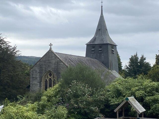
St Twrog's Church, Maentwrog

Saint Twrog's Church is in the village of Maentwrog in the Welsh county of Gwynedd, lying in the Vale of Ffestiniog, within the Snowdonia National Park...

Coed Camlyn National Nature Reserve

Coed Camlyn National Nature Reserve is a nature reserve located south of the village of Maentwrog in Gwynedd, Wales. Rising steeply from the River Dwyryd...

Tan-y-Bwlch, Maentwrog

Tan-y-Bwlch (Welsh for Under the pass/gap) lies in the Snowdonia National Park in North Wales and is primarily known as the location of Tan-y-Bwlch railway...

Maentwrog power station

Maentwrog power station was built by the North Wales Power Company and supplied electricity to North Wales, Deeside and Cheshire. It exploits the water...
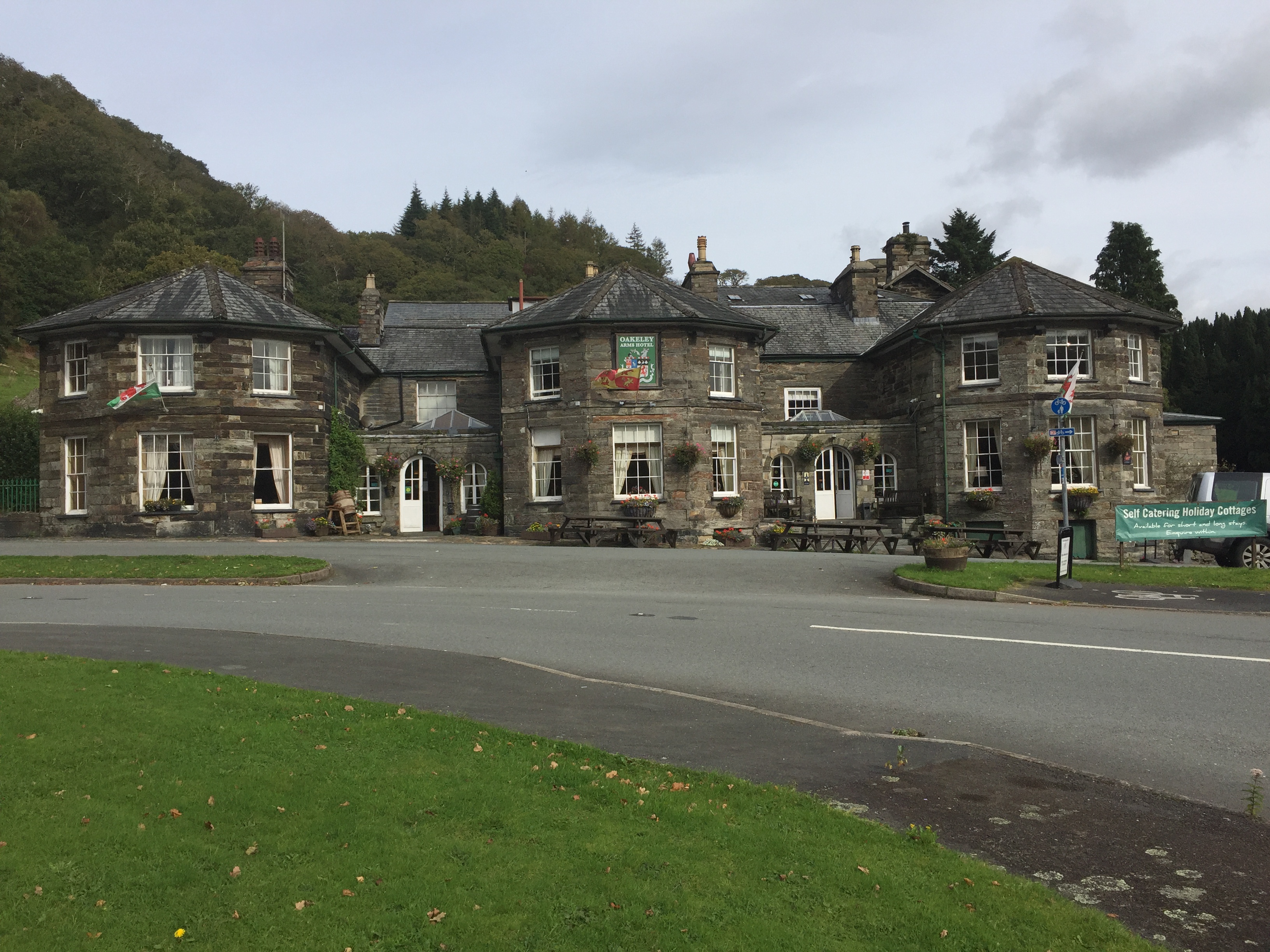
Oakeley Arms Hotel

The Oakeley Arms Hotel is a Grade II listed hotel near Maentwrog in North Wales. The original building dates back to the 17th century, and was once part...

Nearby Amenities

Located within 500m of 52.936492,-3.9774713
Power: tower
Lat/Long: 52.9363893/-3.9812403
Power: pole
Lat/Long: 52.9363604/-3.98433
Power: pole
Lat/Long: 52.9370585/-3.9802262
Power: tower
Lat/Long: 52.9384067/-3.9752322
Power: pole
Lat/Long: 52.9366093/-3.9828279
Power: tower
Lat/Long: 52.9371383/-3.9790393
Power: pole
Lat/Long: 52.9372373/-3.9791745
Power: pole
Lat/Long: 52.9368615/-3.981401
Power: tower
Lat/Long: 52.9390176/-3.9733968
Power: tower
Lat/Long: 52.9375758/-3.9777534
Power: pole
Lat/Long: 52.9374572/-3.9760202
Power: pole
Lat/Long: 52.9380165/-3.9722436
Power: pole
Lat/Long: 52.9381975/-3.9706772
Power: pole
Lat/Long: 52.9377718/-3.973896
Power: pole
Lat/Long: 52.9348208/-3.9843255
Power: pole
Lat/Long: 52.9343358/-3.9830434
Power: pole;tower
Lat/Long: 52.9391706/-3.973633
Power: pole
Lat/Long: 52.9395386/-3.9727618
Power: pole
Lat/Long: 52.939111/-3.9726165
Power: pole
Lat/Long: 52.9399195/-3.9729037
Power: pole
Lat/Long: 52.9385181/-3.9754052
Power: pole
Lat/Long: 52.9380521/-3.9767553
Power: pole
Lat/Long: 52.937644/-3.9779716
Power: pole
Lat/Long: 52.9383316/-3.9723342
Barrier: stile
Bicycle: no
Foot: yes
Material: wood
Stile: ladder
Lat/Long: 52.9396301/-3.9825693
The data included in this document is from www.openstreetmap.org. The data is made available under ODbL.

Have you been to Coed Pennyglannau?

Leave your review of Coed Pennyglannau below (or comments, questions and feedback).