Burpham

Settlement in Surrey Guildford

England

Burpham

Liberal Democrats at The Hall With local elections tomorrow in many areas of the country, The Hall, built in 1909, looks like it's being used as an office by one of the parties.
Liberal Democrats at The Hall Credit: Des Blenkinsopp

Burpham is a small village located in the county of Surrey, England. Situated approximately 3 miles east of Guildford, it lies on the northern banks of the River Wey. With a rich history dating back to the Saxon era, Burpham has evolved into a charming residential area that offers a peaceful and picturesque setting.

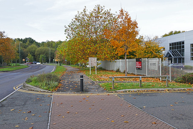
The village is known for its beautiful surroundings, encompassing lush green fields, meadows, and woodlands. It benefits from its close proximity to the Surrey Hills Area of Outstanding Natural Beauty, offering residents and visitors ample opportunities for outdoor activities such as hiking, cycling, and exploring the countryside.

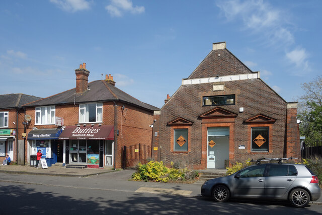
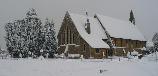
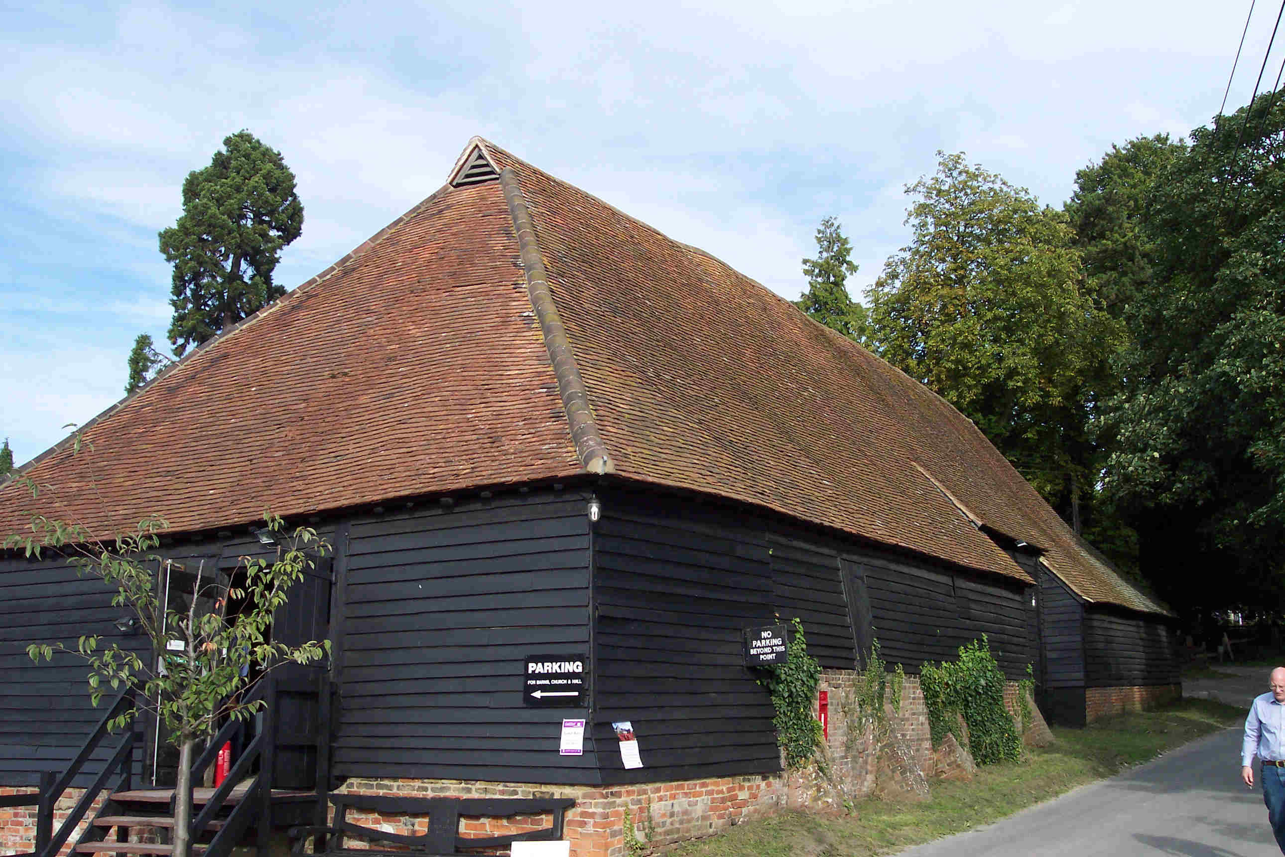
Burpham is home to a mix of architectural styles, with some buildings dating back to the 16th century. The village features a range of residential properties, including characterful cottages, modern houses, and luxurious mansions. The local community is close-knit and friendly, with various social and recreational activities taking place throughout the year.

Amenities in Burpham include a selection of shops, cafes, and restaurants, providing residents with convenient access to everyday necessities. The village also boasts a primary school, making it an attractive location for families with young children.

Transport links are excellent, with easy access to the A3 road and Guildford town center. Burpham is served by regular bus services, allowing residents to travel to nearby towns and cities. The village also benefits from its own railway station, providing direct connections to London and other major destinations.

Overall, Burpham offers a harmonious blend of natural beauty, historical charm, and modern convenience, making it an idyllic place to live or visit in Surrey.

If you have any feedback on the listing, please let us know in the comments section below.

Burpham Images

Images are sourced within 2km of 51.259411/-0.545326 or Grid Reference TQ0152. Thanks to Geograph Open Source API. All images are credited.

Liberal Democrats at The Hall With local elections tomorrow in many areas of the country, The Hall, built in 1909, looks like it's being used as an office by one of the parties.
Liberal Democrats at The Hall
With local elections tomorrow in many areas of the country, The Hall, built in 1909, looks like it's being used as an office by one of the parties.
Red Rose Restaurant With the unmistakeable look of a former pub, the Red Rose Restaurant on Bellfields Road is still in the catering trade serving Bangladeshi food.
Red Rose Restaurant
With the unmistakeable look of a former pub, the Red Rose Restaurant on Bellfields Road is still in the catering trade serving Bangladeshi food.
No Parking, No Grazing An unusual combination of prohibitions. I don't think I've seen this one before.
The entry to White House Lane, a private road over a patch of access land called Stringer's Common beside Jacobs Well Road.
No Parking, No Grazing
An unusual combination of prohibitions. I don't think I've seen this one before. The entry to White House Lane, a private road over a patch of access land called Stringer's Common beside Jacobs Well Road.
Pond on the Common A pond in the corner of a bit of parkland beside Jacobs Well Road.
Pond on the Common
A pond in the corner of a bit of parkland beside Jacobs Well Road.
Selco Builders Warehouse Business premises on Moorfield Road.
Selco Builders Warehouse
Business premises on Moorfield Road.
Moorfield Road The main feeder road for the Slyfield Industrial Area near Guildford. The woods beyond the traffic lights is the Stoke Hill area of Stringers Common.
Moorfield Road
The main feeder road for the Slyfield Industrial Area near Guildford. The woods beyond the traffic lights is the Stoke Hill area of Stringers Common.
Pond, Jacob's Well Trees on the banks of the small pond on the green beside Jacob's Well Road.
Pond, Jacob's Well
Trees on the banks of the small pond on the green beside Jacob's Well Road.
Jacob's Well Road Looking northeast along Jacob's Well Road from the junction with the A320, Woking Road.
Jacob's Well Road
Looking northeast along Jacob's Well Road from the junction with the A320, Woking Road.
Jacob's Well Looking northeast along Jacob's Well Road with the recreation area off to the left.
Jacob's Well
Looking northeast along Jacob's Well Road with the recreation area off to the left.
Pond, Jacob's Well Green The pond on the green to the north of Jacob's Well Road.
Pond, Jacob's Well Green
The pond on the green to the north of Jacob's Well Road.
White House Lane, Jacob's Well The entrance to White House Lane off Jacob's Well Road.
White House Lane, Jacob's Well
The entrance to White House Lane off Jacob's Well Road.
Jacob's Well recreation area The children's play area beside White House Lane on the recreation area.
Jacob's Well recreation area
The children's play area beside White House Lane on the recreation area.
Jacob's Well Road Looking northeast along Jacob's Well Road as it reaches the village boundary.
Jacob's Well Road
Looking northeast along Jacob's Well Road as it reaches the village boundary.
Bellfields, Guildford Spar and petrol station, at the northern edge of the village development.
Bellfields, Guildford
Spar and petrol station, at the northern edge of the village development.
Red Rose, Bellfields, Guildford Indian restaurant, located on Bellfields Road.
Red Rose, Bellfields, Guildford
Indian restaurant, located on Bellfields Road.
Willow tree on Clay Lane, Jacobswell
Moorfield Road at the junction of Woking Road
Houses in Queenhythe Road
Show me another place!

Burpham is located at Grid Ref: TQ0152 (Lat: 51.259411, Lng: -0.545326)

Administrative County: Surrey

District: Guildford

Police Authority: Surrey

What 3 Words

///congratulations.free.quench. Near West Clandon, Surrey

Nearby Locations

Burpham

Related Wikis

Burpham, Surrey

There is also a Burpham in West Sussex, England near Arundel.Burpham is a suburb of Guildford, a town in Surrey, England with an historic village centre...

George Abbot School

George Abbot School is a coeducational secondary school and sixth form with academy status in Burpham, north-east of the town centre of Guildford providing...

Riverside Park, Guildford

Riverside Park is a 61.6-hectare (152-acre) Local Nature Reserve in Guildford in Surrey. It is owned by Guildford Borough Council and the National Trust...

Woking Hundred

See Woking for the town or Borough of Woking for the district.Woking was a hundred in what is now Surrey, England. It includes the town of Woking and the...

Sutton Place, Surrey

Sutton Place, 3 miles (4.8 km) north-east of Guildford in Surrey, is a large Grade I listed Tudor prodigy house built c. 1525 by Sir Richard Weston (d...

St Peter's Catholic School, Guildford

St Peter's Catholic School, colloquially known as St Peter's, is a co-educational secondary school and sixth form located in Guildford, Surrey, England...

Borough of Guildford

The Borough of Guildford is a local government district with borough status in Surrey, England. With around half of the borough's population, Guildford...

Guildford (UK Parliament constituency)

Guildford is a constituency in Surrey represented in the House of Commons of the UK Parliament since 2019 by Angela Richardson, a Conservative. == Constituency... ==

Nearby Amenities

Located within 500m of 51.259411,-0.545326
Kerb: raised
Traffic Calming: island
Lat/Long: 51.2573076/-0.539121
Burpham
Place: suburb
Wikidata: Q5000292
Lat/Long: 51.2582851/-0.5450315
Turning Circle
Lat/Long: 51.2566632/-0.5483283
Sloped Curb: both
Tactile Paving: no
Lat/Long: 51.2589731/-0.5452833
Crossing
Lat/Long: 51.2596879/-0.5442043
Sloped Curb: left
Tactile Paving: no
Lat/Long: 51.2572809/-0.5404893
Barrier: entrance
Lat/Long: 51.2597062/-0.5445091
Crossing
Lat/Long: 51.2620999/-0.5455685
Crossing
Bicycle: yes
Crossing: traffic_signals
Crossing Ref: toucan
Lat/Long: 51.2606204/-0.5447022
Crossing
Bicycle: yes
Crossing: traffic_signals
Crossing Ref: toucan
Lat/Long: 51.2605634/-0.5449275
Bicycle Parking
Lat/Long: 51.2607955/-0.5476205
Crossing
Bicycle: yes
Crossing: uncontrolled
Kerb: lowered
Sloped Curb: yes
Source: DigitalGlobe-Standard
Lat/Long: 51.2615707/-0.5477827
Atm
Check Date: 2023-12-06
Operator: HSBC
Lat/Long: 51.2589587/-0.5446452
Post Box
Collection Plate: CP8D
Collection Times: Mo-Fr 09:00; Sa 07:00
Last Checked: 2021-08-05
Old Ref: GU4 38
Operator: Royal Mail
Operator Wikidata: Q638098
Post Box Type: pillar
Ref: GU4 38D
Royal Cypher: EIIR
Royal Cypher Wikidata: Q33102113
Lat/Long: 51.2621584/-0.5414656
Post Box
Collection Plate: not visible
Collection Times: Mo-Fr 09:00; Sa 07:00
Last Checked: 2021-08-05
Old Ref: GU4 14
Operator: Royal Mail
Operator Wikidata: Q638098
Post Box Type: lamp
Ref: GU4 14D
Royal Cypher: EIIR
Royal Cypher Wikidata: Q33102113
Lat/Long: 51.2629164/-0.5463303
Crossing
Crossing: flush
Sloped Curb: flush
Tactile Paving: no
Lat/Long: 51.2574101/-0.5412643
Crossing
Crossing: unmarked
Sloped Curb: no
Source: P151-0280
Tactile Paving: no
Lat/Long: 51.257774/-0.5427622
Parking
Toilets Wheelchair: yes
Wheelchair: yes
Wheelchair Description: Several Blue Badge spaces near step free entrances, 4 at front and 2 at side. Accessible WCs inside.
Lat/Long: 51.2566205/-0.5402737
Ace Bicycles
Postal Code: GU4 7JS
Shop: bicycle
Source: phot set P151-0290 to 307
Lat/Long: 51.2579169/-0.5456059
Fuel
Sainsbury's
Addr City: Burpham, Guildford
Addr Postcode: GU4 7JU
Brand: Sainsbury's
Brand Wikidata: Q152096
Brand Wikipedia: en:Sainsbury's
Operator: Sainsbury's Supermarkets Ltd
Phone: +44 1483 506767
Source: receipt from visit
Website: https://stores.sainsburys.co.uk/0652/burpham
Wheelchair: yes
Wheelchair Description: Step free, automatic doors. Pinpoint Call System. Hearing Loop at one till.
Lat/Long: 51.2616903/-0.5464964
Post Box
Collection Plate: CP8
Collection Times: Mo-Fr 16:00; Sa 10:30
Last Checked: 2021-08-05
Operator: Royal Mail
Operator Wikidata: Q638098
Post Box Type: pillar
Ref: GU4 53
Royal Cypher: EIIR
Royal Cypher Wikidata: Q33102113
Lat/Long: 51.2613307/-0.544557
Atm
Lat/Long: 51.2614858/-0.5444512
Atm
Lat/Long: 51.2614973/-0.5444365
Cafe
Starbucks
Addr City: Burpham, Guildford
Addr Country: GB
Addr Housename: Inside Burpham Sainsbury's
Addr Postcode: GU4 7JU
Addr Street: Clay Lane
Brand: Starbucks
Brand Wikidata: Q37158
Brand Wikipedia: en:Starbucks
Cuisine: coffee_shop
Fhrs Authority: Guildford
Fhrs Id: 649462
Fhrs Local Authority Id: 2907
Note: This cafe occupies part of the Burpham Sainsbury's building but it has its own entrance and exit door. Customers can also access the cafe to and from the store.
Official Name: Starbucks Coffee
Operator: Starbucks
Phone: +44 1483 301082
Source: receipt from visit
Takeaway: yes
Website: https://www.starbucks.com/store-locator/store/2839/burpham-sainsburys-bowlers-farm-lane-starbucks-c-o-sainsburys-burpham
Lat/Long: 51.2615743/-0.5441538
Post Box
Collection Times: Mo-Fr 09:00; Sa 07:00
Operator: Royal Mail
Ref: GU1 257
Royal Cypher: EIIR
Lat/Long: 51.2551444/-0.5473568
Bluebells B&B
Addr City: Guildford
Addr Housenumber: 21
Addr Postcode: GU1 1YH
Tourism: guest_house
Lat/Long: 51.2564477/-0.5462548
Addr Housenumber: 28
Lat/Long: 51.2563993/-0.5455682
Addr Housenumber: 1
Lat/Long: 51.2553411/-0.5475423
Addr Housenumber: 2
Lat/Long: 51.2551048/-0.5471561
Police
Burpham
Lat/Long: 51.2572122/-0.5441301
Burpham Parade
Power: substation
Ref: 171840
Lat/Long: 51.258057/-0.545052
Post Box
Collection Plate: CP1
Collection Times: Mo-Fr 17:00; Sa 12:00
Last Checked: 2021-07-29
Operator: Royal Mail
Post Box Type: pillar
Ref: GU4 214
Royal Cypher: EVIIIR
Royal Cypher Wikidata: Q33102195
Source: survey
Lat/Long: 51.2580543/-0.5456551
Old Phone: +44 1483 572850
Removed Amenity: telephone
Lat/Long: 51.2580366/-0.5456689
Bicycle Parking
Bicycle Parking: stands
Capacity: 6
Covered: no
Lat/Long: 51.2580457/-0.5457065
Post Box
Collection Plate: CP1D
Collection Times: Mo-Fr 09:00; Sa 07:00
Last Checked: 2021-08-05
Old Ref: GU4 253
Operator: Royal Mail
Operator Wikidata: Q638098
Post Box Mounting: brick_pillar
Post Box Type: wall
Ref: GU4 253D
Royal Cypher: EIIR
Royal Cypher Wikidata: Q33102113
Lat/Long: 51.2597371/-0.5391045
Booth: K6
Old Phone: +44 1483 567724
Postal Code: GU4 7HX
Removed Amenity: telephone
Lat/Long: 51.2597232/-0.5390906
Bus Stop
Great Oaks Park
Addr Street: London Road
Naptan AtcoCode: 40004407240A
Naptan Bearing: SW
Naptan CommonName: Great Oaks Park
Naptan Indicator: Just after
Naptan Landmark: Great Oaks Park
Naptan NaptanCode: surapmtd
Naptan PlusbusZoneRef: GUILDFD
Naptan Street: London Road
Naptan Verified: no
Public Transport: platform
Source: naptan_import
Website: http://nextbuses.mobi/WebView/BusStopSearch/BusStopSearchResults/surapmtd?currentPage=0
Wheelchair: yes
Wheelchair Description: No nearby opposite stop, on A3 slip road.
Lat/Long: 51.2624263/-0.5412238
Bus Stop
New Inn Lane
Addr City: Burpham
Addr Street: Glendale Drive
Bench: no
Naptan AtcoCode: 40004407241A
Naptan Bearing: NE
Naptan CommonName: New Inn Lane
Naptan Indicator: Just after
Naptan Landmark: New Inn Lane
Naptan NaptanCode: surapmtg
Naptan PlusbusZoneRef: GUILDFD
Naptan Street: Glendale Drive
Naptan Verified: no
Public Transport: platform
Shelter: no
Sloped Curb: both
Source: naptan_import
Tactile Paving: no
Toilets Wheelchair: no
Website: http://www.mytraveline.mobi/WebView/BusStopSearch/BusStopSearchResults/surapmtg?currentPage=0
Wheelchair: yes
Wheelchair Description: Narrow pavement at stop. Nearest stop for ASTOLAT - Step-free route via tactile crossing with island on New Inn Lane. Step-free to stop opposite via driveways.
Lat/Long: 51.2577251/-0.5397192
Bus Stop
Glendale Drive
Naptan AtcoCode: 40004407242A
Naptan Bearing: NE
Naptan CommonName: Glendale Drive
Naptan Indicator: NE-bound
Naptan Landmark: Glendale Drive
Naptan NaptanCode: surapmtj
Naptan PlusbusZoneRef: GUILDFD
Naptan Street: Glendale Drive
Naptan Verified: no
Public Transport: platform
Source: naptan_import
Toilets Wheelchair: no
Website: http://nextbuses.mobi/WebView/BusStopSearch/BusStopSearchResults/surapmtj?currentPage=0
Wheelchair: yes
Wheelchair Description: Step-free to stop opposite via driveways
Lat/Long: 51.2604591/-0.5387594
Bus Stop
Glendale Drive
Naptan AtcoCode: 40004407242B
Naptan Bearing: SW
Naptan CommonName: Glendale Drive
Naptan Indicator: SW-bound
Naptan Landmark: Glendale Drive
Naptan NaptanCode: surapmtm
Naptan PlusbusZoneRef: GUILDFD
Naptan Street: Glendale Drive
Naptan Verified: no
Public Transport: platform
Source: naptan_import
Website: http://nextbuses.mobi/WebView/BusStopSearch/BusStopSearchResults/surapmtm?currentPage=0
Wheelchair: yes
Wheelchair Description: Step-free to stop opposite via driveways
Lat/Long: 51.2605314/-0.538423
Bus Stop
Winterhill Way
Addr Street: Winterhill Way
Naptan AtcoCode: 40004407243A
Naptan Bearing: NW
Naptan CommonName: Winterhill Way
Naptan Indicator: NW-bound
Naptan Landmark: Winterhill Way
Naptan NaptanCode: surapmtp
Naptan PlusbusZoneRef: GUILDFD
Naptan Street: Winterhill Way
Naptan Verified: no
Public Transport: platform
Source: naptan_import
Website: http://nextbuses.mobi/WebView/BusStopSearch/BusStopSearchResults/surapmtp?currentPage=0
Wheelchair: limited
Wheelchair Description: No easy step free route or crossing to opposite stop.
Lat/Long: 51.2617899/-0.5407479
Bus Stop
Burpham Shops
Bench: yes
Bin: yes
Check Date Shelter: 2023-12-06
Naptan AtcoCode: 40004407244A
Naptan Bearing: NE
Naptan CommonName: Green Man
Naptan Indicator: Opp
Naptan Landmark: Green Man
Naptan NaptanCode: surapmtw
Naptan PlusbusZoneRef: GUILDFD
Naptan Street: London Road
Naptan Verified: no
Public Transport: platform
Shelter: yes
Source: naptan_import
Tactile Paving: no
Lat/Long: 51.2593919/-0.5447623
Bus Stop
Burpham Shops
Bench: yes
Bin: yes
Naptan AtcoCode: 40004407244B
Naptan Bearing: SW
Naptan CommonName: Green Man
Naptan Indicator: O/s
Naptan Landmark: Green Man
Naptan NaptanCode: surapmwa
Naptan PlusbusZoneRef: GUILDFD
Naptan Street: London Road
Naptan Verified: no
Public Transport: platform
Shelter: yes
Source: naptan_import
Tactile Paving: no
Website: http://www.mytraveline.mobi/WebView/BusStopSearch/BusStopSearchResults/surapmwa?currentPage=0
Lat/Long: 51.2578853/-0.5459626
Bus Stop
Woodruff Avenue
Bench: yes
Bin: yes
Check Date Shelter: 2023-11-28
Naptan AtcoCode: 40004407245B
Naptan Bearing: SW
Naptan CommonName: Woodruff Avenue
Naptan Indicator: adj
Naptan Landmark: Woodruff Avenue
Naptan NaptanCode: surapmwm
Naptan PlusbusZoneRef: GUILDFD
Naptan Street: London Road
Naptan Verified: no
Public Transport: platform
Shelter: yes
Source: naptan_import
Lat/Long: 51.2560473/-0.5477703
Bus Stop
Woodruff Avenue
Bench: no
Bin: no
Naptan AtcoCode: 40004407245C
Naptan Bearing: NE
Naptan CommonName: Woodruff Avenue
Naptan Indicator: Just after
Naptan Landmark: Woodruff Avenue
Naptan NaptanCode: surapmwp
Naptan PlusbusZoneRef: GUILDFD
Naptan Street: London Road
Naptan Verified: no
Public Transport: platform
Source: naptan_import
Lat/Long: 51.2564524/-0.5475454
Bus Stop
Winterhill Way
Addr Street: Winterhill Way
Naptan AtcoCode: 40004407284A
Naptan Bearing: SE
Naptan CommonName: Winterhill Way
Naptan Indicator: SE-bound
Naptan Landmark: Winterhill Way
Naptan NaptanCode: surapwdm
Naptan PlusbusZoneRef: GUILDFD
Naptan Street: Winterhill Way
Naptan Verified: no
Public Transport: platform
Source: naptan_import
Website: http://nextbuses.mobi/WebView/BusStopSearch/BusStopSearchResults/surapwdm?currentPage=0
Wheelchair: limited
Wheelchair Description: No easy step free route or crossing to opposite stop.
Lat/Long: 51.2616142/-0.5399142
Bus Stop
New Inn Lane
Addr City: Burpham
Addr Street: Glendale Drive
Bench: no
Naptan AtcoCode: 40004407285A
Naptan Bearing: SW
Naptan CommonName: New Inn Lane
Naptan Indicator: Just Before
Naptan Landmark: New Inn Lane
Naptan NaptanCode: surapwdp
Naptan PlusbusZoneRef: GUILDFD
Naptan Street: Glendale Drive
Naptan Verified: no
Public Transport: platform
Shelter: no
Sloped Curb: both
Source: naptan_import
Tactile Paving: no
Toilets Wheelchair: no
Website: http://www.mytraveline.mobi/WebView/BusStopSearch/BusStopSearchResults/surapwdp?currentPage=0
Wheelchair: yes
Wheelchair Description: Step-free to opposite stop via driveways.
Lat/Long: 51.2579113/-0.539429
Bus Stop
Bowers Farm Drive
Bench: yes
Bin: no
Naptan AtcoCode: 40004407452A
Naptan Bearing: SW
Naptan CommonName: Bowers Farm Drive
Naptan Indicator: On
Naptan Landmark: Bowers Farm Road
Naptan NaptanCode: suratjtp
Naptan PlusbusZoneRef: GUILDFD
Naptan Street: Bowers Farm Drive
Naptan Verified: no
Public Transport: platform
Shelter: yes
Source: naptan_import
Lat/Long: 51.2625458/-0.5462078
Bus Stop
Sainsburys
Bench: yes
Bin: yes
Naptan AtcoCode: 40004407458A
Naptan Bearing: SE
Naptan CommonName: Sainsburys
Naptan Indicator: adj
Naptan Landmark: Burpham Sainsburys
Naptan NaptanCode: suratmaj
Naptan PlusbusZoneRef: GUILDFD
Naptan Street: Clay Lane
Naptan Verified: no
Public Transport: platform
Shelter: yes
Source: naptan_import
Wheelchair Description: Sloped path to Sainsbury's. Light controlled crossing to stop opposite.
Lat/Long: 51.2606153/-0.5445553
Barrier: cycle_barrier
Lat/Long: 51.2608963/-0.5513422
Crossing
Bicycle: yes
Crossing: uncontrolled
Kerb: lowered
Sloped Curb: yes
Source: DigitalGlobe-Standard
Lat/Long: 51.2616314/-0.547865
Barrier: entrance
Lat/Long: 51.2619304/-0.5492541
Barrier: entrance
Lat/Long: 51.2593546/-0.5465401
Barrier: entrance
Lat/Long: 51.2612266/-0.5497649
Crossing
Button Operated: yes
Crossing: traffic_signals
Crossing Island: no
Crossing Ref: pelican
Kerb: lowered
Source: sas
Tactile Paving: yes
Traffic Signals: pedestrian_crossing
Traffic Signals Sound: yes
Traffic Signals Vibration: yes
Lat/Long: 51.2579947/-0.545957
Sloped Curb: no
Tactile Paving: no
Lat/Long: 51.2583514/-0.5452218
Sloped Curb: no
Tactile Paving: no
Lat/Long: 51.2582322/-0.5454257
Post Office
Burpham Post Office
Addr City: Burpham, Guildford
Addr Housenumber: 214
Addr Postcode: GU4 7JS
Addr Street: London Road
Branch: Burpham
Brand: Post Office
Brand Wikidata: Q1783168
Check Date: 2023-12-09
Contact Website: https://www.postoffice.co.uk/branch-finder/0589233/burpham
Note: in McColl's
Operator: Post Office Ltd
Ref Pol Id: 256
Source: receipt
Wheelchair: limited
Wheelchair Description: Door sill under 7cm. Sensory support signage was at entrance BUT Loop system NOT working on visit
Lat/Long: 51.2577869/-0.5456349
InterSport
Check Date: 2023-12-06
Operator: Guildford Schools and Sports
Phone: +44 1483 577835
Shop: sports
Source: phot set P151-0290 to 307
Wheelchair: limited
Lat/Long: 51.2576641/-0.5458153
Addr City: Guildford
Addr Country: GB
Addr Housenumber: 51
Addr Street: New Inn Lane
Lat/Long: 51.257575/-0.5392371
Addr City: Guildford
Addr Country: GB
Addr Housenumber: 17
Addr Street: New Inn Lane
Lat/Long: 51.258289/-0.5427719
Wine Rack
Addr City: Burpham, Guildford
Addr Country: GB
Addr Housenumber: 216
Addr Postcode: GU4 7JS
Addr Street: London Road
Fhrs Authority: Guildford
Fhrs Id: 728863
Fhrs Local Authority Id: 1733
Note: This shop is an Evri Parcel Shop for Sending, Returning and Collecting parcels.
Phone: +44 1483 572555
Shop: alcohol
Source: phot set P151-0290 to 307
Source 1: receipt from visit
Source 2: visit to store
Website: https://www.winerack.co.uk/stores/guildford/
Wheelchair: limited
Wheelchair Description: Fixed steel ramp over door sill
Lat/Long: 51.2578702/-0.5456451
Addr City: Guildford
Addr Country: GB
Addr Housenumber: 35
Addr Street: New Inn Lane
Lat/Long: 51.2579472/-0.5412493
Car Wash
Platinum Hand Car Wash
Automated: no
Self Service: no
Lat/Long: 51.2588335/-0.5446354
Crossing
Crossing: uncontrolled
Crossing Island: yes
Kerb: lowered
Tactile Paving: yes
Lat/Long: 51.2574269/-0.5400923
Addr City: Guildford
Addr Country: GB
Addr Housenumber: 27
Addr Street: New Inn Lane
Source Addr: P151-0340
Lat/Long: 51.2580998/-0.5419125
Barrier: entrance
Bicycle: no
Foot: yes
Lat/Long: 51.2568667/-0.5403435
Addr City: Guildford
Addr Country: GB
Addr Housenumber: Plot 2
Addr Street: The Brambles
Fixme Name: The Hawthorne (could be brand name)
Lat/Long: 51.2584494/-0.5434345
Crossing
Check Date Crossing: 2023-12-09
Crossing: unmarked
Sloped Curb: both
Tactile Paving: yes
Lat/Long: 51.2578714/-0.5461667
Addr City: Guildford
Addr Country: GB
Addr Housenumber: 13
Addr Street: New Inn Lane
Lat/Long: 51.2586356/-0.543564
Sloped Curb: both
Tactile Paving: no
Lat/Long: 51.257987/-0.545667
Note: island ends opposite bus shelter
Lat/Long: 51.2578963/-0.5460497
Restaurant
Rajdoot
Addr City: Guildford
Addr Country: GB
Addr Housenumber: 220
Addr Postcode: GU4 7JS
Addr Street: London Road
Check Date: 2023-12-06
Cuisine: indian
Fhrs Authority: Guildford
Fhrs Id: 649411
Fhrs Local Authority Id: 2404
Phone: +44 1483 451278
Source: phot set P151-0290 to 307
Wheelchair: limited
Wheelchair Description: Low step. Check toilets when open
Lat/Long: 51.2579785/-0.5455541
Cook Burpham
Addr City: Guildford
Addr Country: GB
Addr Housenumber: 4
Addr Postcode: GU1 1YP
Addr Street: Kingpost Parade
Check Date: 2023-12-07
Fhrs Authority: Guildford
Fhrs Id: 649879
Fhrs Local Authority Id: 4570
Shop: convenience
Source: phot set P151-0290 to 307
Wheelchair: limited
Wheelchair Description: very low door sill www.cookfood.netfor on line ordering
Lat/Long: 51.258233/-0.5452677
Cafe
The Bakery
Addr City: Guildford
Addr Country: GB
Addr Housenumber: 3
Addr Postcode: GU1 1YP
Addr Street: Kingpost Parade
Atm: yes
Check Date: 2023-12-07
Fhrs Authority: Guildford
Fhrs Id: 649306
Fhrs Local Authority Id: 1366
Source: phot set P151-0290 to 307
Wheelchair: yes
Wheelchair Description: very low door sill
Lat/Long: 51.2582081/-0.5453379
Crossing
Crossing: flush
Sloped Curb: flush
Tactile Paving: no
Lat/Long: 51.2573465/-0.5407614
Post Box
Collection Plate: CP7D
Collection Times: Mo-Fr 09:00; Sa 07:00
Last Checked: 2021-08-05
Old Ref: GU4 278
Operator: Royal Mail
Operator Wikidata: Q638098
Post Box Type: lamp
Ref: GU4 278D
Royal Cypher: EIIR
Royal Cypher Wikidata: Q33102113
Source: P151-0276 on 2011-06-07
Source 1: survey
Lat/Long: 51.2573764/-0.5411523
Coronet Cleaning Centre
Check Date: 2023-12-07
Phone: +44 1483 563670
Shop: dry_cleaning
Source: photo set P151-0290 to 307 on 2011-06-07
Lat/Long: 51.2583181/-0.5449551
Crossing
Crossing: unmarked
Sloped Curb: both
Tactile Paving: no
Lat/Long: 51.2583173/-0.5429753
Crossing
Crossing: unmarked
Sloped Curb: both
Tactile Paving: no
Lat/Long: 51.257318/-0.5404738
Addr City: Guildford
Addr Country: GB
Addr Housenumber: Plot 39
Addr Street: The Brambles
Lat/Long: 51.2583358/-0.5430374
Crossing
Check Date Crossing: 2023-12-06
Crossing: unmarked
Sloped Curb: both
Tactile Paving: no
Lat/Long: 51.2576484/-0.5461927
Restaurant
Shangri-La
Addr City: Guildford
Addr Country: GB
Addr Housenumber: 7
Addr Postcode: GU1 1YP
Addr Street: Kingpost Parade
Check Date: 2023-12-09
Cuisine: chinese
Fhrs Authority: Guildford
Fhrs Id: 855800
Fhrs Local Authority Id: 5863
Opening Hours: Tu-Su 17:00+
Phone: +44 1483 502778
Source: phot set P151-0290 to 307
Wheelchair: limited
Wheelchair Description: Low step Check toilet accessibility when open
Lat/Long: 51.2583039/-0.5450498
Crossing
Bench: no
Crossing: unmarked
Shelter: no
Sloped Curb: both
Tactile Paving: no
Lat/Long: 51.2575298/-0.5397324
Dentist
Burpham Dental Care
Check Date: 2023-12-06
Opening Hours: Mo-Fr 08:30-17:30
Source: P151-0286
Lat/Long: 51.2588237/-0.5444026
Source: P151-0269
Traffic Calming: bump
Lat/Long: 51.2571745/-0.5405242
Sloped Curb: no
Tactile Paving: no
Lat/Long: 51.2581051/-0.5454843
Kerb: raised
Traffic Calming: island
Lat/Long: 51.2576096/-0.5409787
Addr City: Guildford
Addr Country: GB
Addr Housename: Lambousa
Addr Housenumber: 45
Addr Street: New Inn Lane
Lat/Long: 51.2577171/-0.5401867
White Barnes
Check Date: 2023-12-09
Shop: flooring
Source: phot set P151-0290 to 307
Lat/Long: 51.2581218/-0.5454303
Addr City: Guildford
Addr Country: GB
Addr Housenumber: 26
Addr Street: New Inn Lane
Source Addr: P151-0339 on 2011-06-07
Lat/Long: 51.2581129/-0.5419804
Crossing
Crossing: unmarked
Crossing Island: no
Kerb: lowered
Tactile Paving: yes
Lat/Long: 51.2587459/-0.544691
Crossing
Check Date Crossing: 2023-12-06
Crossing: unmarked
Sloped Curb: both
Tactile Paving: yes
Lat/Long: 51.2591138/-0.5449406
Bench
Backrest: yes
Check Date: 2023-12-06
Colour: brown
Seats: 3
Lat/Long: 51.2593683/-0.5447764
Fast Food
Seafare
Addr City: Guildford
Addr Country: GB
Addr Housenumber: 206
Addr Postcode: GU4 7JS
Addr Street: London Road
Cuisine: fish_and_chips
Fhrs Authority: Guildford
Fhrs Id: 649372
Fhrs Local Authority Id: 2058
Source: phot set P151-0290 to 307
Wheelchair: yes
Wheelchair Description: Low step
Lat/Long: 51.2575919/-0.5458788
Morrisons Daily
Addr City: Guildford
Addr Country: GB
Addr Housenumber: 214
Addr Postcode: GU4 7JS
Addr Street: London Road
Brand: Morrisons Daily
Brand Wikidata: Q99752411
Shop: convenience
Website: https://my.morrisons.com/storefinder/66532/morrisons-daily-guildford-burpham-london-rd
Wheelchair: limited
Lat/Long: 51.2578133/-0.5456928
Crossing
Check Date Crossing: 2023-12-06
Crossing: unmarked
Sloped Curb: both
Tactile Paving: yes
Lat/Long: 51.2590777/-0.5448413
Addr City: Guildford
Addr Country: GB
Addr Housenumber: 47
Addr Street: New Inn Lane
Lat/Long: 51.2576726/-0.5398747
Addr City: Guildford
Addr Country: GB
Addr Housenumber: 11
Addr Street: New Inn Lane
Lat/Long: 51.258669/-0.5437445
Addr City: Guildford
Addr Country: GB
Addr Housenumber: 19
Addr Street: New Inn Lane
Lat/Long: 51.2582762/-0.5426817
Seymours
Check Date: 2023-12-07
Phone: +44 1483 300667
Shop: estate_agent
Website: www.seymours-estate.co.uk
Lat/Long: 51.25827/-0.5452112
Sloped Curb: no
Source: P151-0284
Tactile Paving: no
Lat/Long: 51.2586178/-0.5444605
Crossing
Check Date Crossing: 2023-12-06
Crossing: unmarked
Sloped Curb: both
Tactile Paving: no
Lat/Long: 51.2581358/-0.5457344
Crossing
Lat/Long: 51.2603559/-0.543861
Crossing
Crossing: unmarked
Tactile Paving: yes
Lat/Long: 51.2600152/-0.5442486
Crossing
Lat/Long: 51.2602594/-0.5437939
Crossing
Lat/Long: 51.2600319/-0.5440702
ASTOLAT
Addr City: Guildford
Office: company
Toilets Wheelchair: yes
Wheelchair: limited
Wheelchair Description: Dedicated Blue Badge spaces near front and side entrances. Step free entry with automatic doors at front. Accessible WCs. Meeting rooms with Hearing Loop. Lift to upper floor available.
Lat/Long: 51.2568607/-0.5402977
Lodge Brothers
Check Date: 2023-12-06
Shop: funeral_directors
Wheelchair: yes
Lat/Long: 51.2575407/-0.5459435
M & R Barber + Brew
Shop: hairdresser
Lat/Long: 51.2582953/-0.5451275
The Beach
Check Date: 2023-12-09
Leisure: tanning_salon
Lat/Long: 51.2581697/-0.5453847
Bus Stop
Weylea Avenue
Bench: no
Bin: no
Public Transport: platform
Shelter: no
Lat/Long: 51.2569846/-0.5510578
Crossing
Bicycle: yes
Crossing: traffic_signals
Crossing Ref: toucan
Kerb: lowered
Sloped Curb: yes
Source: DigitalGlobe-Standard
Lat/Long: 51.2621925/-0.5479154
Traffic Signals
Source: DigitalGlobe-Standard
Traffic Signals Direction: forward
Lat/Long: 51.2621544/-0.547902
Crossing
Bicycle: yes
Crossing: traffic_signals
Crossing Ref: toucan
Kerb: lowered
Sloped Curb: yes
Source: DigitalGlobe-Standard
Lat/Long: 51.2621992/-0.5478563
Crossing
Bicycle: yes
Crossing: uncontrolled
Kerb: lowered
Sloped Curb: yes
Source: DigitalGlobe-Standard
Lat/Long: 51.2625411/-0.5483111
Traffic Signals
Source: DigitalGlobe-Standard
Traffic Signals Direction: forward
Lat/Long: 51.2622285/-0.547865
Toilets
Female: yes
Male: yes
Toilets Access: yes
Toilets Disposal: flush
Toilets Wheelchair: yes
Lat/Long: 51.2604865/-0.5479978
Historic: memorial
Lat/Long: 51.2607071/-0.547549
Kindergarten
Peter Rabbit Nursery
Addr City: Guildford
Addr Country: GB
Addr Postcode: GU4 7JU
Addr Street: Clay Lane
Addr Unit: Pavilion, Sutherland Memorial Park
Fhrs Authority: Guildford
Fhrs Id: 1091908
Fhrs Local Authority Id: 11142
Lat/Long: 51.2606661/-0.5478251
Fast Food
Subway
Addr City: Burpham, Guildford
Addr Country: GB
Addr Housenumber: 224
Addr Postcode: GU4 7HR
Addr Street: London Road
Brand: Subway
Brand Wikidata: Q244457
Brand Wikipedia: en:Subway (restaurant)
Contact Website: https://restaurants.subway.com/united-kingdom/en/guildford/224-london-road
Cuisine: sandwich
Fhrs Authority: Guildford
Fhrs Id: 1098467
Fhrs Local Authority Id: 10954
Opening Hours: 08:00-20:00
Operator: Subway IP Inc
Source: receipt from visit
Takeaway: yes
Lat/Long: 51.2590489/-0.5444603
Traffic Signals
Traffic Signals Direction: forward
Lat/Long: 51.2579709/-0.5459794
Traffic Signals
Traffic Signals Direction: forward
Lat/Long: 51.2580181/-0.5459325
Waste Basket
Colour: black
Covered: yes
Source: survey
Lat/Long: 51.2596666/-0.5383924
Timpson
Addr City: Burpham, Guildford
Addr Housename: Outside Burpham Sainsbury's
Brand: Timpson
Brand Wikidata: Q7807658
Brand Wikipedia: en:Timpson (retailer)
Shop: locksmith
Source: survey
Website: https://www.timpson.co.uk/stores/burpham-sainsburys
Lat/Long: 51.2612226/-0.5445753
Bicycle Parking
Bicycle Parking: stands
Capacity: 8
Covered: no
Lat/Long: 51.2617523/-0.5490624
Defibrillator
Defibrillator Location: On exterior wall on corner of store, on side facing London Road
Emergency: defibrillator
Indoor: no
Ref GB The Circuit: 87935675-F509-43CA-9809-AEA100C9CE37
Lat/Long: 51.2583794/-0.5457184
Inscription: Kingpost Parade
Man Made: village_sign
Lat/Long: 51.2580789/-0.5457022
Beyond the Mirror
Shop: hairdresser
Lat/Long: 51.2577661/-0.5457349
Stevensons
Clothes: children
Shop: clothes
Lat/Long: 51.2577169/-0.5457835
The data included in this document is from www.openstreetmap.org. The data is made available under ODbL.

Have you been to Burpham?

Leave your review of Burpham below (or comments, questions and feedback).