Burpham

Settlement in Sussex Arun

England

Burpham

Black Rabbit pub sign
Black Rabbit pub sign Credit: Ian Cunliffe

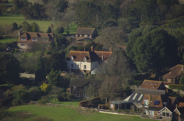
Burpham is a small village located in the county of Sussex, England. Situated amidst picturesque countryside, it is nestled within the South Downs National Park, offering residents and visitors stunning views and access to a range of outdoor activities.

The village itself is characterized by its traditional English charm, with quaint cottages and historic buildings lining its streets. One of the notable landmarks is the St. Mary the Virgin Church, which dates back to the 12th century and displays beautiful architectural features.

Despite its small size, Burpham boasts a close-knit community that takes pride in its rural heritage. The village is home to a primary school, providing education for the local children, and a village hall that serves as a central hub for community activities and events.

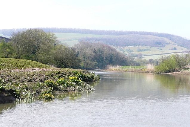
Surrounded by rolling hills and meandering rivers, Burpham offers a tranquil setting for nature enthusiasts. The nearby River Arun provides opportunities for fishing and boating, while the surrounding countryside is ideal for walking, hiking, and cycling. The South Downs Way, a long-distance footpath, passes close by, allowing visitors to explore the scenic landscapes of the national park.

Although Burpham may lack the amenities and services found in larger towns, it compensates with its idyllic countryside and a strong sense of community. For those seeking a peaceful retreat in a rural setting, Burpham is a charming destination worth exploring.

If you have any feedback on the listing, please let us know in the comments section below.
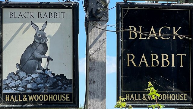
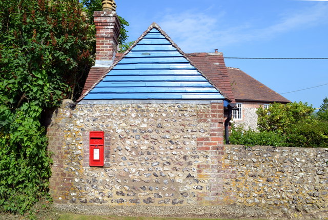
Burpham Images

Images are sourced within 2km of 50.869949/-0.522735 or Grid Reference TQ0408. Thanks to Geograph Open Source API. All images are credited.

Black Rabbit pub sign
Black Rabbit pub
Black Rabbit pub
Landscape south-east of the Burgh in late September A wider view of the scene shown in <a href="https://www.geograph.org.uk/photo/4684072">TQ0510 : Downland arable south-east of the Burgh, late September</a>  On the last day of September the low evening sun casts shadows across a newly-drilled field.
Landscape south-east of the Burgh in late September
A wider view of the scene shown in TQ0510 : Downland arable south-east of the Burgh, late September On the last day of September the low evening sun casts shadows across a newly-drilled field.
South Stoke
South Stoke
Bridge over the River Arun
South Stoke South Stoke is nestled in the bend in the River Arun; the fields are heavily flooded and don't normally look like this
South Stoke
South Stoke is nestled in the bend in the River Arun; the fields are heavily flooded and don't normally look like this
Flooding in the Arun Valley This made it impossible to take the public footpath back to Amberley; we had to retrace our steps.
Flooding in the Arun Valley
This made it impossible to take the public footpath back to Amberley; we had to retrace our steps.
Footpath Near North Stoke One of the better stretches, with evidence of some tree thinning to the east of the path, which has resulted in a more open view.
Footpath Near North Stoke
One of the better stretches, with evidence of some tree thinning to the east of the path, which has resulted in a more open view.
View Towards the South Downs Drainage channel near South Stoke.
View Towards the South Downs
Drainage channel near South Stoke.
Drainage Channel Located near South Stoke, just south of the South Downs.
Drainage Channel
Located near South Stoke, just south of the South Downs.
Drainage Channel Located near South Stoke, just south of the South Downs.
Drainage Channel
Located near South Stoke, just south of the South Downs.
Drainage Channel Located near South Stoke, just south of the South Downs.
Drainage Channel
Located near South Stoke, just south of the South Downs.
Over the Drainage Channel Stile near South Stoke, taking the footpath towards a bridleway.
Over the Drainage Channel
Stile near South Stoke, taking the footpath towards a bridleway.
South Stoke, West Sussex Flint, brick and wooden building in the hamlet of South Stoke, West Sussex.
South Stoke, West Sussex
Flint, brick and wooden building in the hamlet of South Stoke, West Sussex.
Post Box, South Stoke South Stoke is a hamlet near Arundel, West Sussex.
Post Box, South Stoke
South Stoke is a hamlet near Arundel, West Sussex.
Stile, South Stoke A stile for accessing the path along The River Arun at South Stoke, West Sussex.
Stile, South Stoke
A stile for accessing the path along The River Arun at South Stoke, West Sussex.
St Leonard's Church, South Stoke <span class="nowrap"><a title="http://www.westsussex.info/south-stoke.shtml" rel="nofollow ugc noopener" href="http://www.westsussex.info/south-stoke.shtml">Link</a><img style="margin-left:2px;" alt="External link" title="External link - shift click to open in new window" src="https://s1.geograph.org.uk/img/external.png" width="10" height="10"/></span>
<span class="nowrap"><a title="https://en.wikipedia.org/wiki/South_Stoke%2C_West_Sussex" rel="nofollow ugc noopener" href="https://en.wikipedia.org/wiki/South_Stoke%2C_West_Sussex">Link</a><img style="margin-left:2px;" alt="External link" title="External link - shift click to open in new window" src="https://s1.geograph.org.uk/img/external.png" width="10" height="10"/></span>
St Leonard's Church, South Stoke
St Leonard's Church, South Stoke The bell tower of St Leonard's Church, South Stoke, West Sussex.
<span class="nowrap"><a title="https://en.wikipedia.org/wiki/South_Stoke%2C_West_Sussex" rel="nofollow ugc noopener" href="https://en.wikipedia.org/wiki/South_Stoke%2C_West_Sussex">Link</a><img style="margin-left:2px;" alt="External link" title="External link - shift click to open in new window" src="https://s1.geograph.org.uk/img/external.png" width="10" height="10"/></span>
<span class="nowrap"><a title="http://www.westsussex.info/south-stoke.shtml" rel="nofollow ugc noopener" href="http://www.westsussex.info/south-stoke.shtml">Link</a><img style="margin-left:2px;" alt="External link" title="External link - shift click to open in new window" src="https://s1.geograph.org.uk/img/external.png" width="10" height="10"/></span>
St Leonard's Church, South Stoke
The bell tower of St Leonard's Church, South Stoke, West Sussex. LinkExternal link LinkExternal link
Show me another place!

Burpham is located at Grid Ref: TQ0408 (Lat: 50.869949, Lng: -0.522735)

Administrative County: West Sussex

District: Arun

Police Authority: Sussex

What 3 Words

///dandelions.generally.hike. Near Arundel, West Sussex

Nearby Locations

Wepham Burpham

Related Wikis

Burpham

Burpham is a rural village and civil parish in the Arun District of West Sussex, England. The village is on an arm of the River Arun slightly less than...

South Stoke, West Sussex

South Stoke is a rural village and civil parish in the Arun District of West Sussex, England. It is centred two miles (3 km) north of Arundel also on...

Arun Banks

Arun Banks is a 25.8-hectare (64-acre) biological Site of Special Scientific Interest north of Arundel in West Sussex.This site consists of a tidal stretch...

Warningcamp

Warningcamp is a village and civil parish in the Arun District of West Sussex, England. It is 1 mile (1.6 km) east of Arundel, on the east bank of the...

WWT Arundel

WWT Arundel is one of ten wildfowl and wetland nature reserves managed by the Wildfowl and Wetlands Trust, a nature conservation charity in the United...

Arundel F.C.

Arundel Football Club is a football club based in Arundel, West Sussex, England. They are currently members of the Southern Combination Division One and...

Arundel Castle

Arundel Castle is a restored and remodelled medieval castle in Arundel, West Sussex, England. It was established by Roger de Montgomery in the 11th century...

Arundel Blackfriars

Arundel Blackfriars, otherwise Dominican Priory, Arundel, was a friary of the Dominican Order in Arundel, West Sussex, England. The date of foundation...

Nearby Amenities

Located within 500m of 50.869949,-0.522735
Burpham
Is In: West Sussex, England, UK
Place: village
Source: npe
Lat/Long: 50.8703012/-0.5226417
Wepham
Is In: West Sussex, England, UK
Place: village
Source: npe
Wikidata: Q5000291
Lat/Long: 50.8667879/-0.5177518
Barrier: stile
Foot: yes
Lat/Long: 50.8685252/-0.5247384
Barrier: kissing_gate
Foot: yes
Lat/Long: 50.8684003/-0.5247506
Barrier: stile
Foot: yes
Lat/Long: 50.8682614/-0.5236375
Barrier: stile
Lat/Long: 50.8695307/-0.5222421
Barrier: stile
Lat/Long: 50.8684149/-0.521731
Barrier: stile
Foot: yes
Lat/Long: 50.8682433/-0.5203557
Barrier: stile
Foot: yes
Lat/Long: 50.8673357/-0.5181215
Telephone
Booth: K6
Covered: booth
Lat/Long: 50.866555/-0.5199515
Post Box
Brand: Royal Mail
Brand Wikidata: Q638098
Brand Wikipedia: en:Royal Mail
Collection Plate: CP7D
Collection Times: Mo-Fr 09:00; Sa 07:00
Operator: Royal Mail
Operator Wikidata: Q638098
Post Box Type: lamp
Ref: BN18 1298D
Royal Cypher: EIIR
Royal Cypher Wikidata: Q33102113
Lat/Long: 50.8664952/-0.5192701
Naptan AtcoCode: 4400LH0825
Naptan Bearing: NE
Naptan BusStopType: CUS
Naptan CommonName: Unnamed Road
Naptan Indicator: HAR
Naptan Landmark: Hail & Ride
Naptan NaptanCode: wsxgatjp
Naptan Street: Unnamed Road
Naptan Verified: no
Noname: yes
Source: naptan_import
Lat/Long: 50.8682597/-0.5235047
Naptan AtcoCode: 4400LH0826
Naptan Bearing: SW
Naptan BusStopType: CUS
Naptan CommonName: Unnamed Road
Naptan Indicator: HAR
Naptan Landmark: Hail & Ride
Naptan NaptanCode: wsxgatjt
Naptan Street: Unnamed Road
Naptan Verified: no
Noname: yes
Source: naptan_import
Lat/Long: 50.8682671/-0.5233766
Post Box
Brand: Royal Mail
Brand Wikidata: Q638098
Brand Wikipedia: en:Royal Mail
Collection Plate: CP7
Collection Times: Mo-Fr 16:15; Sa 10:00
Operator: Royal Mail
Operator Wikidata: Q638098
Post Box Type: lamp
Ref: BN18 1299
Royal Cypher: EIIR
Royal Cypher Wikidata: Q33102113
Lat/Long: 50.8703684/-0.521998
Barrier: stile
Lat/Long: 50.87115/-0.5238761
Barrier: stile
Foot: yes
Lat/Long: 50.8667922/-0.5254049
Bench
Backrest: yes
Seats: 3
Lat/Long: 50.8712583/-0.5250078
Bench
Backrest: yes
Seats: 3
Lat/Long: 50.8712771/-0.5250031
Bench
Backrest: yes
Seats: 3
Lat/Long: 50.8713029/-0.5249753
Telephone
Booth: K6
Covered: booth
Lat/Long: 50.8703972/-0.5219418
Bench
Backrest: yes
Seats: 3
Lat/Long: 50.8701015/-0.5242815
Bench
Backrest: yes
Lat/Long: 50.8699288/-0.5242617
Bench
Backrest: yes
Lat/Long: 50.8699174/-0.524248
Defibrillator
Emergency: defibrillator
Indoor: no
Lat/Long: 50.8699241/-0.5241997
Power: pole
Source: Bing
Lat/Long: 50.8694268/-0.5214657
Power: pole
Source: Bing
Lat/Long: 50.8703332/-0.5197424
Power: pole
Source: Bing
Lat/Long: 50.8714453/-0.5167517
Power: pole
Source: Bing
Lat/Long: 50.8708597/-0.518699
Bench
Backrest: yes
Seats: 3
Lat/Long: 50.8700979/-0.5242585
Access: yes
Barrier: stile
Bicycle: no
Foot: yes
Horse: no
Motor Vehicle: no
Lat/Long: 50.8673346/-0.5219691
Barrier: stile
Bicycle: no
Foot: yes
Horse: no
Motor Vehicle: no
Lat/Long: 50.8677877/-0.5212851
The data included in this document is from www.openstreetmap.org. The data is made available under ODbL.

Have you been to Burpham?

Leave your review of Burpham below (or comments, questions and feedback).