Burntwood Pentre

Settlement in Flintshire

Wales

Burntwood Pentre

A55, North Wales Expressway near Ewloe The A55, also known as the North Wales Expressway (Gwibffordd Gogledd Cymru), is the major road in North Wales running for 88 miles between Chester and Holyhead via Conwy and Bangor. 

The A55 is a very high quality road, much of it rebuilt since the 1970s in response to traffic problems in Colwyn Bay, Colwyn and Llandudno caused by traffic having to pass through town centres on totally unsuitable streets, (especially in Conwy where lorries often scraped their paintwork as they passed through 12th century arches in the town's walls), leading to the construction of an east-west expressway bypassing the urban centres. It is a dual carriageway primary route for its entire length with the exception of the point where it crosses the Britannia Bridge over the Menai Strait. All of its junctions are grade separated except for two roundabouts; one east of Penmaenmawr and one in Llanfairfechan. The road originally ran from Chester to Bangor but was extended parallel to the A5 across Anglesey right into Holyhead Docks in 2001.

<span class="nowrap"><a title="http://www.sabre-roads.org.uk/wiki/index.php?title=A55" rel="nofollow ugc noopener" href="http://www.sabre-roads.org.uk/wiki/index.php?title=A55">Link</a><img style="margin-left:2px;" alt="External link" title="External link - shift click to open in new window" src="https://s1.geograph.org.uk/img/external.png" width="10" height="10"/></span>  SABRE
A55, North Wales Expressway near Ewloe Credit: David Dixon

Burntwood Pentre is a small village located in Flintshire, Wales. It is situated near the border with England and is surrounded by picturesque countryside. The village is known for its quaint charm and friendly community atmosphere.

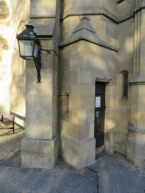
The village is home to a mix of traditional Welsh cottages and more modern housing developments. There are also a number of historic buildings in the area, including the local church which dates back to the 12th century.

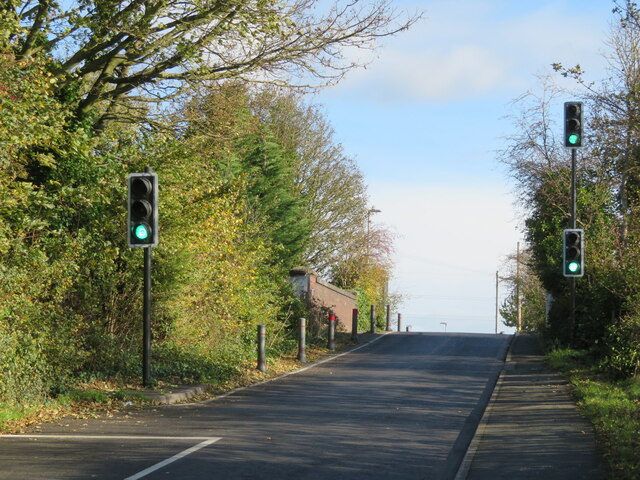
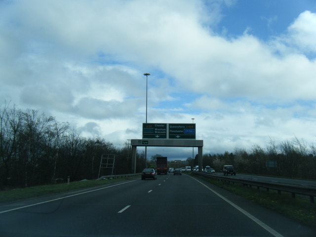
Burntwood Pentre has a small but thriving local economy, with a few shops, pubs, and restaurants serving the needs of residents. The village is also well-connected to the surrounding area, with good transport links to nearby towns and cities.

Overall, Burntwood Pentre is a peaceful and idyllic village, offering a relaxed pace of life for its residents. The surrounding countryside provides plenty of opportunities for outdoor activities such as hiking, cycling, and horseback riding. It is a popular destination for those looking to escape the hustle and bustle of city life and enjoy the beauty of the Welsh countryside.

If you have any feedback on the listing, please let us know in the comments section below.

Burntwood Pentre Images

Images are sourced within 2km of 53.174738/-3.062676 or Grid Reference SJ2964. Thanks to Geograph Open Source API. All images are credited.

A55, North Wales Expressway near Ewloe The A55, also known as the North Wales Expressway (Gwibffordd Gogledd Cymru), is the major road in North Wales running for 88 miles between Chester and Holyhead via Conwy and Bangor. 

The A55 is a very high quality road, much of it rebuilt since the 1970s in response to traffic problems in Colwyn Bay, Colwyn and Llandudno caused by traffic having to pass through town centres on totally unsuitable streets, (especially in Conwy where lorries often scraped their paintwork as they passed through 12th century arches in the town's walls), leading to the construction of an east-west expressway bypassing the urban centres. It is a dual carriageway primary route for its entire length with the exception of the point where it crosses the Britannia Bridge over the Menai Strait. All of its junctions are grade separated except for two roundabouts; one east of Penmaenmawr and one in Llanfairfechan. The road originally ran from Chester to Bangor but was extended parallel to the A5 across Anglesey right into Holyhead Docks in 2001.

<span class="nowrap"><a title="http://www.sabre-roads.org.uk/wiki/index.php?title=A55" rel="nofollow ugc noopener" href="http://www.sabre-roads.org.uk/wiki/index.php?title=A55">Link</a><img style="margin-left:2px;" alt="External link" title="External link - shift click to open in new window" src="https://s1.geograph.org.uk/img/external.png" width="10" height="10"/></span>  SABRE
A55, North Wales Expressway near Ewloe
The A55, also known as the North Wales Expressway (Gwibffordd Gogledd Cymru), is the major road in North Wales running for 88 miles between Chester and Holyhead via Conwy and Bangor. The A55 is a very high quality road, much of it rebuilt since the 1970s in response to traffic problems in Colwyn Bay, Colwyn and Llandudno caused by traffic having to pass through town centres on totally unsuitable streets, (especially in Conwy where lorries often scraped their paintwork as they passed through 12th century arches in the town's walls), leading to the construction of an east-west expressway bypassing the urban centres. It is a dual carriageway primary route for its entire length with the exception of the point where it crosses the Britannia Bridge over the Menai Strait. All of its junctions are grade separated except for two roundabouts; one east of Penmaenmawr and one in Llanfairfechan. The road originally ran from Chester to Bangor but was extended parallel to the A5 across Anglesey right into Holyhead Docks in 2001. LinkExternal link SABRE
Ewloe Interchange (Junction 34), North Wales Expressway (A55) The A55, also known as the North Wales Expressway (Gwibffordd Gogledd Cymru), is the major road in North Wales running for 88 miles between Chester and Holyhead via Conwy and Bangor. 

The A55 is a very high quality road, much of it rebuilt since the 1970s in response to traffic problems in Colwyn Bay, Colwyn and Llandudno caused by traffic having to pass through town centres on totally unsuitable streets, (especially in Conwy where lorries often scraped their paintwork as they passed through 12th century arches in the town's walls), leading to the construction of an east-west expressway bypassing the urban centres. It is a dual carriageway primary route for its entire length with the exception of the point where it crosses the Britannia Bridge over the Menai Strait. All of its junctions are grade separated except for two roundabouts; one east of Penmaenmawr and one in Llanfairfechan. The road originally ran from Chester to Bangor but was extended parallel to the A5 across Anglesey right into Holyhead Docks in 2001.

<span class="nowrap"><a title="http://www.sabre-roads.org.uk/wiki/index.php?title=A55" rel="nofollow ugc noopener" href="http://www.sabre-roads.org.uk/wiki/index.php?title=A55">Link</a><img style="margin-left:2px;" alt="External link" title="External link - shift click to open in new window" src="https://s1.geograph.org.uk/img/external.png" width="10" height="10"/></span>  SABRE
Ewloe Interchange (Junction 34), North Wales Expressway (A55)
The A55, also known as the North Wales Expressway (Gwibffordd Gogledd Cymru), is the major road in North Wales running for 88 miles between Chester and Holyhead via Conwy and Bangor. The A55 is a very high quality road, much of it rebuilt since the 1970s in response to traffic problems in Colwyn Bay, Colwyn and Llandudno caused by traffic having to pass through town centres on totally unsuitable streets, (especially in Conwy where lorries often scraped their paintwork as they passed through 12th century arches in the town's walls), leading to the construction of an east-west expressway bypassing the urban centres. It is a dual carriageway primary route for its entire length with the exception of the point where it crosses the Britannia Bridge over the Menai Strait. All of its junctions are grade separated except for two roundabouts; one east of Penmaenmawr and one in Llanfairfechan. The road originally ran from Chester to Bangor but was extended parallel to the A5 across Anglesey right into Holyhead Docks in 2001. LinkExternal link SABRE
Benchmark on Bannel Bridge, Bannel Lane, Buckley Ordnance Survey benchmark on the north parapet of Bannel Bridge, which carries Bannel Lane over the Wrexham to Bidston railway line. Levelled at 127.202m above Newlyn Datum, verified 1959. For a view of the bridge see <a href="https://www.geograph.org.uk/photo/7516810">SJ2963 : Railway Bridge on Bannel Lane, Buckley</a>                                     <span class="nowrap"><a title="https://www.bench-marks.org.uk/bm195190" rel="nofollow ugc noopener" href="https://www.bench-marks.org.uk/bm195190">Link</a><img style="margin-left:2px;" alt="External link" title="External link - shift click to open in new window" src="https://s1.geograph.org.uk/img/external.png" width="10" height="10"/></span>
Benchmark on Bannel Bridge, Bannel Lane, Buckley
Ordnance Survey benchmark on the north parapet of Bannel Bridge, which carries Bannel Lane over the Wrexham to Bidston railway line. Levelled at 127.202m above Newlyn Datum, verified 1959. For a view of the bridge see SJ2963 : Railway Bridge on Bannel Lane, Buckley LinkExternal link
Railway Bridge on Bannel Lane, Buckley Bannel Lane is very busy so the hump back railway bridge is controlled by traffic lights. There is an Ordnance Survey benchmark on the left/north parapet <a href="https://www.geograph.org.uk/photo/7499864">SJ2963 : Benchmark on Bannel Bridge, Bannel Lane, Buckley</a>
Railway Bridge on Bannel Lane, Buckley
Bannel Lane is very busy so the hump back railway bridge is controlled by traffic lights. There is an Ordnance Survey benchmark on the left/north parapet SJ2963 : Benchmark on Bannel Bridge, Bannel Lane, Buckley
Benchmark on Bistre Methodist Chapel, Spon Green, Buckley Ordnance Survey benchmark on the northeast corner of Bistre Methodist Chapel, Spon Green, Buckley. Levelled at 142.055m above Newlyn Datum, verified 1959. For a view of the chapel from the opposite side see <a href="https://www.geograph.org.uk/photo/7517001">SJ2863 : Bistre Methodist Chapel, Spon Green, Buckley</a>                
Benchmark database: <span class="nowrap"><a title="https://www.bench-marks.org.uk/bm195201" rel="nofollow ugc noopener" href="https://www.bench-marks.org.uk/bm195201">Link</a><img style="margin-left:2px;" alt="External link" title="External link - shift click to open in new window" src="https://s1.geograph.org.uk/img/external.png" width="10" height="10"/></span>
Benchmark on Bistre Methodist Chapel, Spon Green, Buckley
Ordnance Survey benchmark on the northeast corner of Bistre Methodist Chapel, Spon Green, Buckley. Levelled at 142.055m above Newlyn Datum, verified 1959. For a view of the chapel from the opposite side see SJ2863 : Bistre Methodist Chapel, Spon Green, Buckley Benchmark database: LinkExternal link
Bistre Methodist Chapel, Spon Green, Buckley Looking across Spon Green towards the Bistre Methodist Chapel. There is an Ordnance Survey benchmark on the other side of the building, on the far right hand corner <a href="https://www.geograph.org.uk/photo/7516911">SJ2863 : Benchmark on Bistre Methodist Chapel, Spon Green, Buckley</a>   In 2023 the chapel has closed its doors and a planning application has been made to convert it into living accommodation.
Bistre Methodist Chapel, Spon Green, Buckley
Looking across Spon Green towards the Bistre Methodist Chapel. There is an Ordnance Survey benchmark on the other side of the building, on the far right hand corner SJ2863 : Benchmark on Bistre Methodist Chapel, Spon Green, Buckley In 2023 the chapel has closed its doors and a planning application has been made to convert it into living accommodation.
Benchmark by Drury Lane, Drury near Buckley Ordnance Survey benchmark on the north side of Drury Lane, Drury. Levelled at 122.008m above Newlyn Datum, verified 1959. For a view of the road see <a href="https://www.geograph.org.uk/photo/7517148">SJ2964 : Drury Lane at its junction with Bank Lane, Drury</a> 
Benchmark database: <span class="nowrap"><a title="https://www.bench-marks.org.uk/bm195202" rel="nofollow ugc noopener" href="https://www.bench-marks.org.uk/bm195202">Link</a><img style="margin-left:2px;" alt="External link" title="External link - shift click to open in new window" src="https://s1.geograph.org.uk/img/external.png" width="10" height="10"/></span>
Benchmark by Drury Lane, Drury near Buckley
Ordnance Survey benchmark on the north side of Drury Lane, Drury. Levelled at 122.008m above Newlyn Datum, verified 1959. For a view of the road see SJ2964 : Drury Lane at its junction with Bank Lane, Drury Benchmark database: LinkExternal link
Drury Lane at its junction with Bank Lane, Drury There is an Ordnance Survey benchmark on the stone wall close to the speed-calming pads on the road <a href="https://www.geograph.org.uk/photo/7517127">SJ2964 : Benchmark by Drury Lane, Drury near Buckley</a>
Drury Lane at its junction with Bank Lane, Drury
There is an Ordnance Survey benchmark on the stone wall close to the speed-calming pads on the road SJ2964 : Benchmark by Drury Lane, Drury near Buckley
Benchmark in Mount Pleasant Road, Burntwood Pentre Ordnance Survey benchmark on an old bridge abutment, which is no longer a bridge, in Mount Pleasant Road, Burntwood Pentre. Levelled at 141.830m above Newlyn Datum. For a wider view see <a href="https://www.geograph.org.uk/photo/7517250">SJ2864 : Bridge abutment in Mount Pleasant Road, Burntwood Pentre</a> 
Benchmark database: <span class="nowrap"><a title="https://www.bench-marks.org.uk/bm195205" rel="nofollow ugc noopener" href="https://www.bench-marks.org.uk/bm195205">Link</a><img style="margin-left:2px;" alt="External link" title="External link - shift click to open in new window" src="https://s1.geograph.org.uk/img/external.png" width="10" height="10"/></span>
Benchmark in Mount Pleasant Road, Burntwood Pentre
Ordnance Survey benchmark on an old bridge abutment, which is no longer a bridge, in Mount Pleasant Road, Burntwood Pentre. Levelled at 141.830m above Newlyn Datum. For a wider view see SJ2864 : Bridge abutment in Mount Pleasant Road, Burntwood Pentre Benchmark database: LinkExternal link
Bridge abutment in Mount Pleasant Road, Burntwood Pentre The brick abutment is the only sign that there was ever a railway bridge crossing the road here. In times past this area was a hive of activity with brick and tile works as well as coal mines to power the furnaces, all long gone. There is an Ordnance Survey benchmark low down on the corner of the abutment, but it is partly hidden by ivy <a href="https://www.geograph.org.uk/photo/7517223">SJ2864 : Benchmark in Mount Pleasant Road, Burntwood Pentre</a>
Bridge abutment in Mount Pleasant Road, Burntwood Pentre
The brick abutment is the only sign that there was ever a railway bridge crossing the road here. In times past this area was a hive of activity with brick and tile works as well as coal mines to power the furnaces, all long gone. There is an Ordnance Survey benchmark low down on the corner of the abutment, but it is partly hidden by ivy SJ2864 : Benchmark in Mount Pleasant Road, Burntwood Pentre
Rivet benchmark on St Matthew's parish church tower, Buckley Ordnance Survey rivet benchmark on the south west buttress of  the tower of St Matthew's parish church, Buckley. Levelled at 160.413m above Newlyn Datum, verified 1959. For a view of the buttress see <a href="https://www.geograph.org.uk/photo/7518145">SJ2864 : Tower door of St Matthew's parish church, Buckley</a>                             
Benchmark database: <span class="nowrap"><a title="https://www.bench-marks.org.uk/bm102814" rel="nofollow ugc noopener" href="https://www.bench-marks.org.uk/bm102814">Link</a><img style="margin-left:2px;" alt="External link" title="External link - shift click to open in new window" src="https://s1.geograph.org.uk/img/external.png" width="10" height="10"/></span>
Rivet benchmark on St Matthew's parish church tower, Buckley
Ordnance Survey rivet benchmark on the south west buttress of the tower of St Matthew's parish church, Buckley. Levelled at 160.413m above Newlyn Datum, verified 1959. For a view of the buttress see SJ2864 : Tower door of St Matthew's parish church, Buckley Benchmark database: LinkExternal link
Tower door of St Matthew's parish church, Buckley There is an Ordnance Survey rivet benchmark on the angled buttress below the lamp <a href="https://www.geograph.org.uk/photo/7518130">SJ2864 : Rivet benchmark on St Matthew's parish church tower, Buckley</a>
Tower door of St Matthew's parish church, Buckley
There is an Ordnance Survey rivet benchmark on the angled buttress below the lamp SJ2864 : Rivet benchmark on St Matthew's parish church tower, Buckley
Benchmark on the Horse & Jockey in Drury Lane, Buckley Ordnance Survey benchmark on the side wall of the Horse & Jockey public house in Drury Lane, Buckley. Levelled at 157.070m above Newlyn Datum. For a wider view see <a href="https://www.geograph.org.uk/photo/7518246">SJ2864 : The side wall of the Horse & Jockey, Drury Lane, Buckley</a>                          
Benchmark database: <span class="nowrap"><a title="https://www.bench-marks.org.uk/bm195298" rel="nofollow ugc noopener" href="https://www.bench-marks.org.uk/bm195298">Link</a><img style="margin-left:2px;" alt="External link" title="External link - shift click to open in new window" src="https://s1.geograph.org.uk/img/external.png" width="10" height="10"/></span>
Benchmark on the Horse & Jockey in Drury Lane, Buckley
Ordnance Survey benchmark on the side wall of the Horse & Jockey public house in Drury Lane, Buckley. Levelled at 157.070m above Newlyn Datum. For a wider view see SJ2864 : The side wall of the Horse & Jockey, Drury Lane, Buckley Benchmark database: LinkExternal link
The side wall of the Horse & Jockey, Drury Lane, Buckley The side wall of the Horse & Jockey in Drury Lane has an Ordnance Survey benchmark <a href="https://www.geograph.org.uk/photo/7518234">SJ2864 : Benchmark on the Horse & Jockey in Drury Lane, Buckley</a>
The side wall of the Horse & Jockey, Drury Lane, Buckley
The side wall of the Horse & Jockey in Drury Lane has an Ordnance Survey benchmark SJ2864 : Benchmark on the Horse & Jockey in Drury Lane, Buckley
A55 sign gantry west of Ewloe Green
A55 eastbound at Ewloe
Buckley Station
Buckley Station
Buckley Station
Buckley Station
Show me another place!

Burntwood Pentre is located at Grid Ref: SJ2964 (Lat: 53.174738, Lng: -3.062676)

Unitary Authority: Flintshire

Police Authority: North Wales

What 3 Words

///puddles.rescuer.snowy. Near Buckley, Flintshire

Nearby Locations

Burntwood Pentre Drury

Related Wikis

Buckley Town F.C.

Buckley Town Football Club (Welsh: Clwb PĂȘl-Droed Tref Bwcle) is a Welsh football team based in Buckley, Flintshire, Wales. They currently play in the...

Etna Park

Etna Park is a park near the town of Buckley.The area was a clay hole during the Industrial Revolution, and was later used as a landfill. The site has...

St Matthew's Church, Buckley

St Matthew's Church, is in the town of Buckley, Flintshire, Wales. It is an active Anglican parish church in the Borderlands Mission Area, the archdeaconry...

District of Alyn and Deeside

Alyn and Deeside (Welsh: Alun a Glannau Dyfrdwy) was one of six local government districts in the county of Clwyd, north-east Wales from 1974 to 1996....

Related Videos

My nephew on holiday

Dancing the day away.

kiltwalk day 1, Deeside way, Scotland

left castkegate at 6am, stopped at inchmarlow, doing the "virtual" kiltwalk for northsounds cash for kids.

A World War Two Bunker | Flintshire Circular Walks

ComeWalkWithMe #WorldWarTwo #Bunker #Walks #Hikes #Flintshire #CircularWalks #Nature #Walking #Hiking Donate against ...

Dog Walking in Hawarden park

Rottweiler Chasing Shadows.

Nearby Amenities

Located within 500m of 53.174738,-3.062676
Drury
Created By: Potlatch 0.10b
Place: village
Wikidata: Q107032492
Lat/Long: 53.1726857/-3.0565865
Pub
The Glynne Arms
Wikidata: Q80581406
Lat/Long: 53.1725419/-3.0639799
Pub
The Parrot
Addr Postcode: CH7 3DX
Addr Street: Drury Lane
Fhrs Id: 1111650
Source Addr: FHRS Open Data
Wikidata: Q80581404
Lat/Long: 53.1725282/-3.0586548
Pub
The Burntwood
Addr Housenumber: 26
Addr Postcode: CH7 3EN
Addr Street: Burntwood Road
Fhrs Id: 1138222
Source Addr: FHRS Open Data
Wikidata: Q80581398
Lat/Long: 53.175744/-3.0595928
Building: community_centre
Lat/Long: 53.1736495/-3.0577217
Post Box
Lat/Long: 53.1751768/-3.0595648
Recycling
Buckley recycling centre
Addr City: Buckley
Addr Housename: Buckley recycling centre
Addr Postcode: CH7 3LY
Addr Street: Globe way
Owner: Flintshire county council
Ownership: municipal
Recycling Type: centre
Lat/Long: 53.1768972/-3.0668198
Burntwood
Name Cy: Burntwood Pentre
Name En: Burntwood Pentre
Place: village
Wikidata: Q107033220
Lat/Long: 53.1760518/-3.0594416
Bus Stop
Burntwood Pentre, Burntwood Road / Burnt Wood
Bus: yes
Naptan AtcoCode: 5120AWF80591
Naptan Bearing: SW
Naptan CommonName: Burnt Wood
Naptan Crossing: Pen-y-coed Road
Naptan Indicator: before
Naptan Landmark: Burnt Wood PH
Naptan LocalityName: Burntwood Pentre
Naptan NaptanCode: fliagtp
Naptan Street: Burntwood Road
Public Transport: platform
Source: naptan_import
Lat/Long: 53.1759004/-3.0597275
Barrier: block
Lat/Long: 53.1767456/-3.0661295
Orange GSM/UMTS
Man Made: tower
Lat/Long: 53.1777346/-3.0652645
Direction: 165
Generator Method: photovoltaic
Generator Output Electricity: yes
Generator Solar Modules: 12
Generator Source: solar
Generator Type: solar_photovoltaic_panel
Location: roof
Power: generator
Lat/Long: 53.171221/-3.066749
Bus Stop
Drury, Drury Lane / Glynne Arms
Bench: no
Bin: no
Bus: yes
Naptan AtcoCode: 5120AWF80587
Naptan Bearing: NW
Naptan CommonName: Glynne Arms
Naptan Crossing: Mount Pleasant Road
Naptan Indicator: o/s
Naptan Landmark: Glynne Arms PH
Naptan LocalityName: Drury
Naptan NaptanCode: fliagpd
Naptan Street: Drury Lane
Naptan Verified: no
Public Transport: platform
Shelter: no
Source: naptan_import
Tactile Paving: no
Lat/Long: 53.1725613/-3.0638284
Bus Stop
Drury, Drury Lane / Parrot Inn
Bench: yes
Bin: yes
Bus: yes
Naptan AtcoCode: 5120AWF80588
Naptan Bearing: W
Naptan CommonName: Parrot Inn
Naptan Crossing: Burntwood Road
Naptan Indicator: after
Naptan Landmark: Parrot Inn PH
Naptan LocalityName: Drury
Naptan NaptanCode: fliagwj
Naptan Street: Drury Lane
Naptan Verified: no
Public Transport: platform
Shelter: yes
Source: naptan_import
Lat/Long: 53.1724142/-3.0593544
Bus Stop
Burntwood Pentre, Burntwood Road / Burnt Wood
Bench: no
Bin: no
Bus: yes
Lit: yes
Naptan AtcoCode: 5120AWF80590
Naptan Bearing: NW
Naptan CommonName: Burnt Wood
Naptan Crossing: Pen-y-coed Road
Naptan Indicator: before
Naptan Landmark: Burnt Wood PH
Naptan LocalityName: Burntwood Pentre
Naptan NaptanCode: fliagmp
Naptan Street: Burntwood Road
Public Transport: platform
Shelter: no
Source: naptan_import
Tactile Paving: no
Lat/Long: 53.1751979/-3.0598667
Bus Stop
Drury, Burntwood Road / Parrot Inn
Bench: no
Bin: no
Bus: yes
Naptan AtcoCode: 5120AWF80589
Naptan Bearing: N
Naptan CommonName: Parrot Inn
Naptan Crossing: Drury Lane
Naptan Indicator: opp
Naptan Landmark: Parrot Inn PH
Naptan LocalityName: Drury
Naptan NaptanCode: fliagwm
Naptan Street: Burntwood Road
Naptan Verified: no
Public Transport: platform
Shelter: no
Source: naptan_import
Lat/Long: 53.1729311/-3.0589789
Bus Stop
Buckley, Drury Lane / Glynne Arms
Bench: no
Bin: no
Bus: yes
Naptan AtcoCode: 5120WDB21614
Naptan Bearing: SE
Naptan CommonName: Glynne Arms
Naptan Crossing: Mount Pleasant Road
Naptan Indicator: opp
Naptan Landmark: Glynne Arms PH
Naptan LocalityName: Buckley
Naptan NaptanCode: flijmad
Naptan Street: Drury Lane
Naptan Verified: no
Public Transport: platform
Shelter: no
Source: naptan_import
Tactile Paving: no
Lat/Long: 53.1726867/-3.0639853
Direction: S
Generator Method: photovoltaic
Generator Output Electricity: yes
Generator Solar Modules: 5
Generator Source: solar
Generator Type: solar_photovoltaic_panel
Location: ground
Power: generator
Lat/Long: 53.1715293/-3.0583412
Direction: 190
Generator Method: photovoltaic
Generator Output Electricity: yes
Generator Solar Modules: 15
Generator Source: solar
Generator Type: solar_photovoltaic_panel
Location: roof
Power: generator
Lat/Long: 53.1778086/-3.0589296
Bus Stop
Drury, Drury Lane / Parrot Inn
Bus: yes
Naptan AtcoCode: 5120FLX17079
Naptan Bearing: E
Naptan CommonName: Parrot Inn
Naptan Crossing: Burntwood Road
Naptan Indicator: o/s
Naptan Landmark: Parrot Inn PH
Naptan LocalityName: Drury
Naptan NaptanCode: fliagwa
Naptan Street: Drury Lane
Public Transport: platform
Source: naptan_import
Lat/Long: 53.1724808/-3.0587022
Bench
Backrest: yes
Material: wood
Lat/Long: 53.1767724/-3.0687949
Bench
Backrest: yes
Inscription: Pip's Bench
Material: wood
Lat/Long: 53.1748382/-3.0661934
Barrier: kissing_gate
Lat/Long: 53.1779785/-3.0597792
Barrier: kissing_gate
Lat/Long: 53.1762111/-3.0617099
Barrier: kissing_gate
Lat/Long: 53.1756224/-3.0621678
The data included in this document is from www.openstreetmap.org. The data is made available under ODbL.

Have you been to Burntwood Pentre?

Leave your review of Burntwood Pentre below (or comments, questions and feedback).