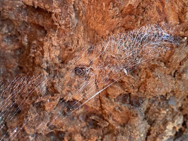
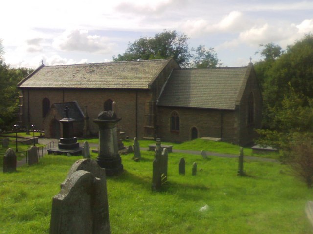
Green Plantation

Wood, Forest in Glamorgan
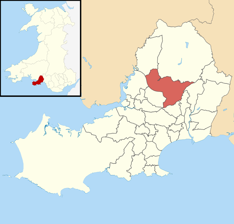
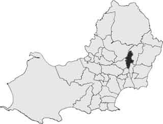
Wales

Green Plantation

Bridge and ford Bridge and ford crossing the Afon Llan. The road is very rutted and only really suitable for 4x4s.
Bridge and ford Credit: John Phoenix

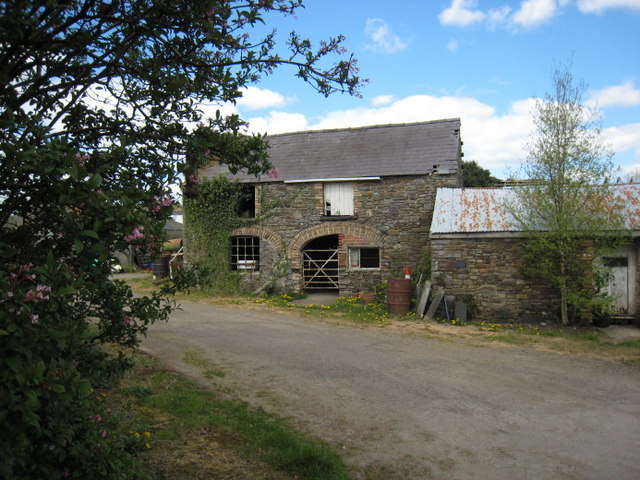
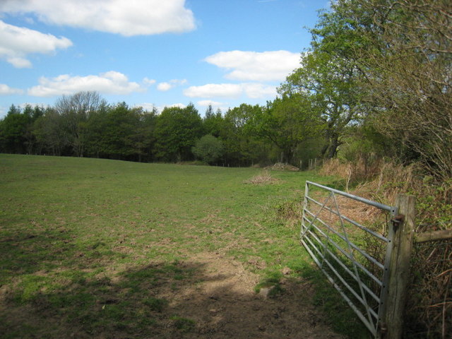
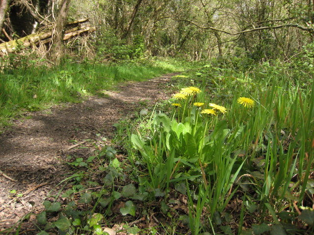
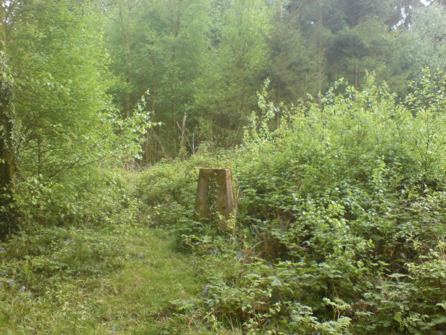
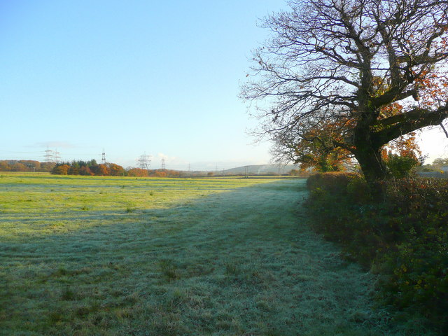
Green Plantation is a picturesque woodland located in Glamorgan, a county in South Wales, United Kingdom. Spanning an area of approximately 100 acres, it is known for its lush greenery and diverse ecosystem. The plantation is situated in a hilly terrain, providing visitors with breathtaking views of the surrounding landscape.

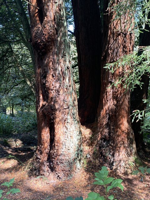
The woodland is primarily composed of deciduous trees, including oak, beech, and birch, which create a vibrant and ever-changing canopy throughout the year. This variety of trees supports a rich and diverse range of wildlife, making Green Plantation a haven for nature enthusiasts and birdwatchers.

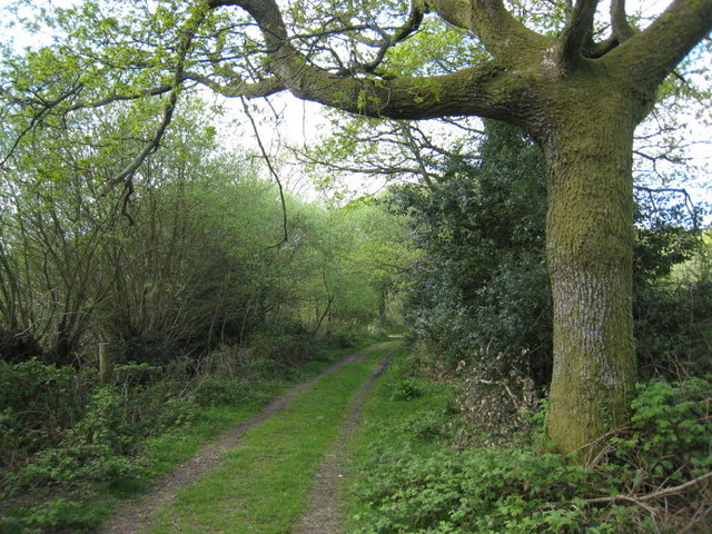
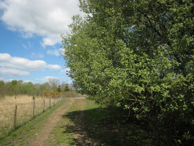
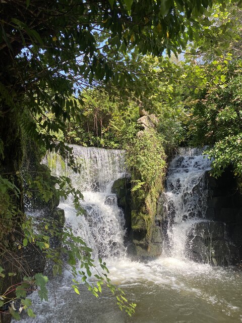
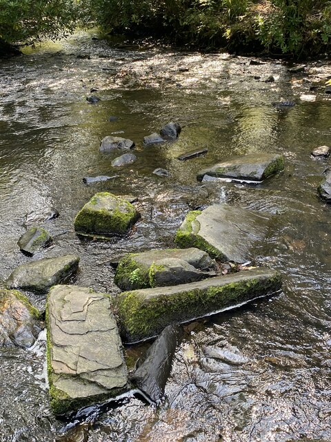
The plantation is crisscrossed by several well-maintained walking trails, allowing visitors to explore the woodland at their own pace. These trails lead to hidden gems within the plantation, such as serene ponds and babbling brooks, adding to the tranquility of the area.

Green Plantation is also home to a variety of flora and fauna. Wildflowers, ferns, and mosses carpet the forest floor, while squirrels, rabbits, and foxes can be spotted among the trees. The plantation is particularly known for its birdlife, with species such as woodpeckers, owls, and songbirds frequently spotted or heard within its boundaries.

Throughout the year, Green Plantation hosts various events and activities, such as guided nature walks, educational programs, and photography workshops. These initiatives aim to promote environmental awareness and appreciation for the natural beauty of the woodland.

In conclusion, Green Plantation in Glamorgan is a captivating woodland that offers visitors an opportunity to immerse themselves in nature's embrace. With its diverse range of flora and fauna, walking trails, and stunning views, it provides a peaceful retreat for individuals seeking solace in the beauty of the natural world.

If you have any feedback on the listing, please let us know in the comments section below.

Green Plantation Images

Images are sourced within 2km of 51.681139/-3.9712809 or Grid Reference SS6399. Thanks to Geograph Open Source API. All images are credited.

Bridge and ford Bridge and ford crossing the Afon Llan. The road is very rutted and only really suitable for 4x4s.
Bridge and ford
Bridge and ford crossing the Afon Llan. The road is very rutted and only really suitable for 4x4s.
Gellyfeddan. Diolch i'r perchenog am gael tynnu'r llun.

Thanks to the owner for permission to take the photo.
Gellyfeddan.
Diolch i'r perchenog am gael tynnu'r llun. Thanks to the owner for permission to take the photo.
I'r goedwig.  To the Forest. Cyrion Fforest Penllergaer.

The edge of Penllergaer Forest.
I'r goedwig. To the Forest.
Cyrion Fforest Penllergaer. The edge of Penllergaer Forest.
Helygen.  Willow. Coed cynhenid ar gyrion coedwig Penllergaer.

Native woods near Penllergaer.
Helygen. Willow.
Coed cynhenid ar gyrion coedwig Penllergaer. Native woods near Penllergaer.
Coed Penllergaer.  Penllergaer Forest. Llanerch dymunol iawn.

A pleasant clearing.
Coed Penllergaer. Penllergaer Forest.
Llanerch dymunol iawn. A pleasant clearing.
Llwybr bach.  The narrow path. Un o'r nifer o lwybrau sy'n gwneud y goedwig yn werth chweil.

Penllrergaer forest has many good walks.
Llwybr bach. The narrow path.
Un o'r nifer o lwybrau sy'n gwneud y goedwig yn werth chweil. Penllrergaer forest has many good walks.
Triangulation post in Penllegaer Forest Clearly unfit for the purpose it was created, this triangulation post is now almost invisible from the nearby footpath let alone being visible from miles around as Penllegaer Forest has since been planted and grown around it.
Triangulation post in Penllegaer Forest
Clearly unfit for the purpose it was created, this triangulation post is now almost invisible from the nearby footpath let alone being visible from miles around as Penllegaer Forest has since been planted and grown around it.
Pasture near Brynwhilhach Early morning; almost a frost.
Pasture near Brynwhilhach
Early morning; almost a frost.
Road to Felindre Looking north on a cold November morning.
Road to Felindre
Looking north on a cold November morning.
Pasture edge With a view to Mynydd Gelliwastad (213m) in the distance.
Pasture edge
With a view to Mynydd Gelliwastad (213m) in the distance.
Tircoed  Community Centre Tircoed is a large modern housing estate built in Penllergaer Forest over the last few years.  Much thought has been given to the estate (though the layout can be confusing if you don't know your way round) - it includes its own convenience store and a modern community centre.

A recent addition to this building is the antenna attached to the back of the building.  This is a quarter wave transmitter mast for the recently launched Radio Tircoed, a voluntary run community radio station.
Tircoed Community Centre
Tircoed is a large modern housing estate built in Penllergaer Forest over the last few years. Much thought has been given to the estate (though the layout can be confusing if you don't know your way round) - it includes its own convenience store and a modern community centre. A recent addition to this building is the antenna attached to the back of the building. This is a quarter wave transmitter mast for the recently launched Radio Tircoed, a voluntary run community radio station.
Radio Tircoed studios Behind the modern community centre for the newly built Tircoed housing estate are what appear to be two shipping containers. Their livery reveals that they are in fact the studios for Radio Tircoed which commenced broadcasting on 1st December 2008.

The station is self funded and is entirely run by volunteers and serves the communities of Tircoed, Penllergaer, Pontardulais, Gorseinon, Pontlliw and the M4 Corridor between junctions 47 and 48 - though the signal can be clearly heard much further.  

Along with its relatively powerful (for a community radio station) FM signal, the station also broadcasts on the internet on its web site, and DJs now frequently get requests from all over the world as well as the community in which it serves.

This was the original studio facility - it has since been replaced by a substantially larger structure.
Radio Tircoed studios
Behind the modern community centre for the newly built Tircoed housing estate are what appear to be two shipping containers. Their livery reveals that they are in fact the studios for Radio Tircoed which commenced broadcasting on 1st December 2008. The station is self funded and is entirely run by volunteers and serves the communities of Tircoed, Penllergaer, Pontardulais, Gorseinon, Pontlliw and the M4 Corridor between junctions 47 and 48 - though the signal can be clearly heard much further. Along with its relatively powerful (for a community radio station) FM signal, the station also broadcasts on the internet on its web site, and DJs now frequently get requests from all over the world as well as the community in which it serves. This was the original studio facility - it has since been replaced by a substantially larger structure.
Ordnance Survey Cut Mark This mostly buried OS cut mark can be found on the SW parapet of the railway bridge. It marks a point 62.868m above mean sea level.
Ordnance Survey Cut Mark
This mostly buried OS cut mark can be found on the SW parapet of the railway bridge. It marks a point 62.868m above mean sea level.
Swansea West Services, 2023 Interesting to note the walkway canopy has been removed since my last visit in 2013, <a href="https://www.geograph.org.uk/photo/3550352">SS6299 : Swansea West Services</a>.
Swansea West Services, 2023
Interesting to note the walkway canopy has been removed since my last visit in 2013, SS6299 : Swansea West Services.
Western Red Cedars Majestic trees in Valley Wood, Penllergaer.
Western Red Cedars
Majestic trees in Valley Wood, Penllergaer.
Waterfalls in Valley Wood, Penllergaer.
Rocky stream in Penllergaer Woods
Spider’s web on Western Red Cedar
Show me another place!

Green Plantation is located at Grid Ref: SS6399 (Lat: 51.681139, Lng: -3.9712809)

Unitary Authority: Swansea

Police Authority: South Wales

What 3 Words

///suffer.comb.actual. Near Morriston, Swansea

Related Wikis

Llangyfelach railway station

Llangyfelach railway station served the village of Llangyfelach, in the historical county of Glamorganshire, Wales, from 1923 to 1924 on the Swansea District...

West Wales Parkway railway station

West Wales Parkway (Welsh: Parcffordd Gorllewin Cymru; also proposed as Swansea North; Gogledd Abertawe and Parc Felindre) is a proposed railway station...

Llangyfelach

Llangyfelach is a village and community located in the City and County of Swansea, Wales, United Kingdom. Llangyfelach is situated about 4 miles north...

Llangyfelach (electoral ward)

Llangyfelach is an electoral ward in the county of Swansea, Wales, UK. It covers the communities of Llangyfelach and part of Mawr.The electoral ward consists...
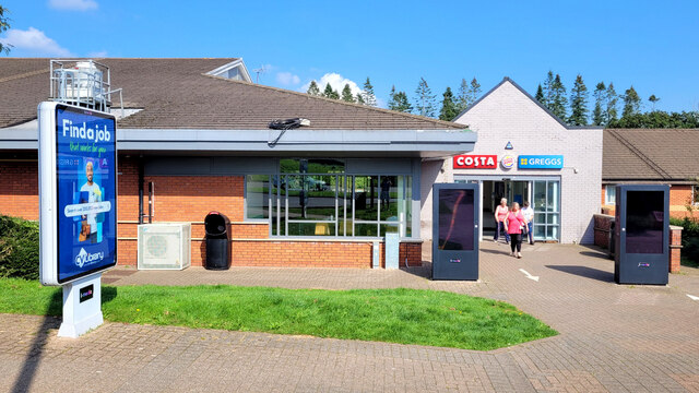
Swansea services

Swansea services (Welsh: Gwasanaethau Gorllewin Abertawe, "Swansea West services") is a motorway service station on the M4 motorway at Junction 47 near...

Tircoed forest village

Tircoed forest village is a suburb between the villages of Penllergaer and Pontlliw, Swansea, Wales. It is part of the Pontlliw and Tircoed community....

Mynydd-bach (electoral ward)

Mynydd-bach, formerly Mynyddbach (Welsh: Mynydd-bach) is the name of an electoral ward in the City and County of Swansea, Wales. Mynydd-bach is bounded...

Clase

Clase is a suburban district of the City and County of Swansea, Wales within the Mynydd-Bach ward. Clase approximates to the housing area south of Clasemont...

Nearby Amenities

Located within 500m of 51.681139,-3.9712809
Bus Stop
DVLA Park & Share
Bus: yes
Public Transport: platform
Lat/Long: 51.6826456/-3.9661944
Barrier: block
Bicycle: yes
Foot: yes
Lat/Long: 51.6795552/-3.9677247
Noexit: yes
Lat/Long: 51.6819182/-3.9661306
Noexit: yes
Lat/Long: 51.6821981/-3.967624
Noexit: yes
Lat/Long: 51.6795139/-3.9648861
Noexit: yes
Lat/Long: 51.6796921/-3.9663419
Noexit: yes
Lat/Long: 51.6802062/-3.9679447
Noexit: yes
Lat/Long: 51.6821563/-3.9642374
Llangyfelach
Abandoned Railway: station
Railway: site
Wikidata: Q110127886
Lat/Long: 51.677365/-3.9708191
Power: pole
Lat/Long: 51.6780091/-3.9763883
Noexit: yes
Lat/Long: 51.6802468/-3.969314
The data included in this document is from www.openstreetmap.org. The data is made available under ODbL.

Have you been to Green Plantation?

Leave your review of Green Plantation below (or comments, questions and feedback).