Allt Clwtpatrwm

Wood, Forest in Cardiganshire

Wales

Allt Clwtpatrwm

Ordnance Survey Cut Mark This OS cut mark can be found on the churn stand NW side of the road. It marks a point 146.120m above mean sea level. <a title="https://www.geograph.org.uk/photo/7454903" href="https://www.geograph.org.uk/photo/7454903">Link</a>
Ordnance Survey Cut Mark Credit: Adrian Dust

Allt Clwtpatrwm is a picturesque woodland located in the county of Cardiganshire, Wales. Covering an area of approximately 200 acres, this forested landscape offers a tranquil and serene environment for visitors to explore and enjoy.

The woodland is home to a diverse range of flora and fauna, with a rich variety of tree species such as oak, beech, and birch dominating the landscape. The forest floor is adorned with an array of wildflowers and ferns, creating a vibrant and colorful undergrowth.

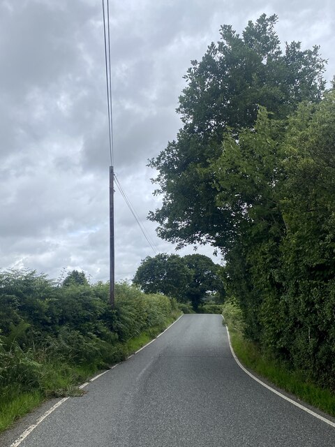
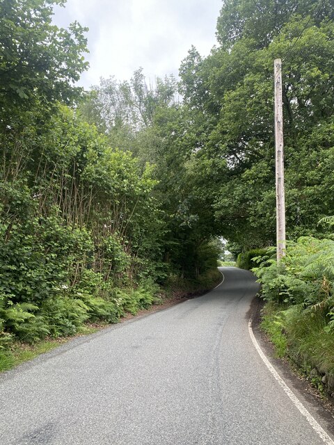
Allt Clwtpatrwm is crisscrossed by a network of well-maintained footpaths, allowing visitors to easily navigate through the woodland and discover its hidden gems. The paths meander through the trees, offering glimpses of scenic viewpoints and babbling brooks along the way.

The forest is a haven for wildlife enthusiasts, with numerous bird species such as woodpeckers, owls, and thrushes calling this woodland home. Mammals, including deer and squirrels, can also be spotted roaming freely in their natural habitat.

Visitors to Allt Clwtpatrwm can indulge in a range of outdoor activities such as hiking, birdwatching, and photography. The peaceful atmosphere and stunning natural beauty make it an ideal spot for relaxation and contemplation.

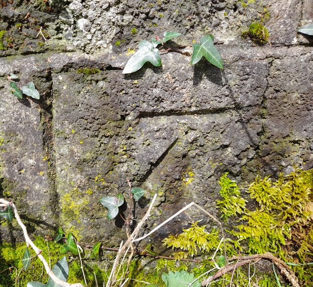
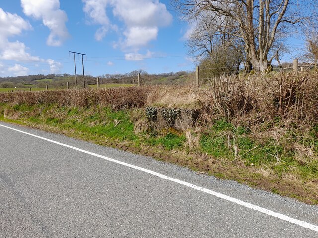
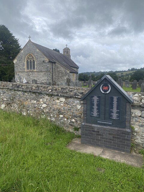
Additionally, the woodland has historical significance, with remnants of old stone walls and structures scattered throughout the area. These remnants provide a glimpse into the past and add a touch of intrigue to the forest's charm.

Overall, Allt Clwtpatrwm offers a captivating and enchanting experience for nature lovers and history enthusiasts alike. Its tranquil ambiance, diverse flora and fauna, and well-maintained trails make it a must-visit destination in Cardiganshire, Wales.

If you have any feedback on the listing, please let us know in the comments section below.

Allt Clwtpatrwm Images

Images are sourced within 2km of 52.154853/-4.0079509 or Grid Reference SN6252. Thanks to Geograph Open Source API. All images are credited.

Ordnance Survey Cut Mark This OS cut mark can be found on the churn stand NW side of the road. It marks a point 146.120m above mean sea level. <a title="https://www.geograph.org.uk/photo/7454903" href="https://www.geograph.org.uk/photo/7454903">Link</a>
Ordnance Survey Cut Mark
This OS cut mark can be found on the churn stand NW side of the road. It marks a point 146.120m above mean sea level. Link
Churn Stand There is an Ordnance Survey cut mark on the front of the stand. <a title="https://www.geograph.org.uk/photo/7454901" href="https://www.geograph.org.uk/photo/7454901">Link</a>
Churn Stand
There is an Ordnance Survey cut mark on the front of the stand. Link
A485 at Olmarch Isaf
A485 at Llangybi village boundary
Track to Greenhill Farm
Barred gateway at Penddol
B4343 near Llanfair Clygodau
St Mary’s Church Llanfair Clygodau.
St Mary’s Church
Llanfair Clygodau.
B4343 towards Llanddewi Brefi
Ordnance Survey Flush Bracket S0756 This can be found on the wall of a building in Llangybi.
For more detail see : <span class="nowrap"><a title="http://www.bench-marks.org.uk/bm801" rel="nofollow ugc noopener" href="http://www.bench-marks.org.uk/bm801">Link</a><img style="margin-left:2px;" alt="External link" title="External link - shift click to open in new window" src="https://s1.geograph.org.uk/img/external.png" width="10" height="10"/></span>
Ordnance Survey Flush Bracket S0756
This can be found on the wall of a building in Llangybi. For more detail see : LinkExternal link
Llangybi, NE on track-bed of Aberystwyth - Carmarthen line, 2003 The station had actually been behind the camera, i.e. SW, the station and line having been closed 22/2/65. (Cf. <a href="https://www.geograph.org.uk/photo/2544727">SN6152 : Course of old railway near Llangybi, Ceredigion</a>).
Llangybi, NE on track-bed of Aberystwyth - Carmarthen line, 2003
The station had actually been behind the camera, i.e. SW, the station and line having been closed 22/2/65. (Cf. SN6152 : Course of old railway near Llangybi, Ceredigion).
Ordnance Survey Cut Mark This OS cut mark can be found on the east face of St Cybi's Church. It marks a point 139.745m above mean sea level.
Ordnance Survey Cut Mark
This OS cut mark can be found on the east face of St Cybi's Church. It marks a point 139.745m above mean sea level.
Ordnance Survey Cut Mark This OS cut mark can be found on the SW parapet of the railway bridge. It marks a point 143.774m above mean sea level.
Ordnance Survey Cut Mark
This OS cut mark can be found on the SW parapet of the railway bridge. It marks a point 143.774m above mean sea level.
Ordnance Survey Cut Mark This OS cut mark can be found on the NE angle of Tancoed. It marks a point 155.110m above mean sea level.
Ordnance Survey Cut Mark
This OS cut mark can be found on the NE angle of Tancoed. It marks a point 155.110m above mean sea level.
Ordnance Survey Cut Mark This OS cut mark can be found on the SW parapet of Pont Llanfair. It marks a point 133.643m above mean sea level.
Ordnance Survey Cut Mark
This OS cut mark can be found on the SW parapet of Pont Llanfair. It marks a point 133.643m above mean sea level.
Ordnance Survey Cut Mark This OS cut mark can be found on the NE facing wall of the churchyard. It marks a point 137.352m above mean sea level.
Ordnance Survey Cut Mark
This OS cut mark can be found on the NE facing wall of the churchyard. It marks a point 137.352m above mean sea level.
Ordnance Survey Rivet This OS rivet can be found on the east parapet of the bridge. It marks a point 152.950m above mean sea level.
Ordnance Survey Rivet
This OS rivet can be found on the east parapet of the bridge. It marks a point 152.950m above mean sea level.
Road (B4343) near Penddol Looking north-eastward.
Road (B4343) near Penddol
Looking north-eastward.
Show me another place!

Allt Clwtpatrwm is located at Grid Ref: SN6252 (Lat: 52.154853, Lng: -4.0079509)

Unitary Authority: Ceredigion

Police Authority: Dyfed Powys

What 3 Words

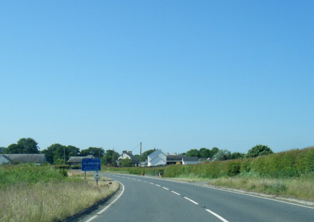
///sticking.worms.crumb. Near Llangybi, Ceredigion

Nearby Locations

Allt Clwtpatrwm

Related Wikis

Llanfair Clydogau

Llanfair Clydogau is a small village and community encompassing 3,232 hectares (7,990 acres), located about 4 miles (6.4 km) north-east of Lampeter on...

Llangybi railway station (Ceredigion)

Llangybi railway station, previously served the village and rural locale of Llangybi on the Carmarthen Aberystwyth Line in the Welsh county of Ceredigion...

Gogoyan

Gogoyan is a hamlet in the community of Llanddewibrefi, Ceredigion, Wales, which is 58.9 miles (94.8 km) from Cardiff and 171.1 miles (275.3 km) from...

Llangybi, Ceredigion

Llangybi is a village and parish in the south of Ceredigion, Wales. It is located on the A485 between Tregaron to the north and Lampeter to the south,...

Olmarch Halt railway station

Olmarch Halt railway station, previously served the hamlet and rural locale of Olmarch near Llanddewi-Brefi and Pont Llanio on the Carmarthen Aberystwyth...

Olmarch

Olmarch is a hamlet in the community of Llangybi, Ceredigion, Wales, which is 59.9 miles (96.4 km) from Cardiff and 172.1 miles (277 km) from London. Olmarch...

Caeau Llety-cybi

Caeau Llety-cybi is a Site of Special Scientific Interest in Ceredigion, west Wales. The lowland meadow site is managed by the Wildlife Trust of South...

Cockshead

Cockshead is a small village in the community of Llanddewi Brefi, Ceredigion, Wales, which is 59.9 miles (96.3 km) from Cardiff and 171.9 miles (276.5...

Nearby Amenities

Located within 500m of 52.154853,-4.0079509
Source: npe
Lat/Long: 52.1506791/-4.0070938
Source: npe
Lat/Long: 52.1537087/-4.0056965
Source: npe
Lat/Long: 52.1543059/-4.0045373
Created By: POI Editor
Source: npe
Lat/Long: 52.1553034/-4.0040631
Created By: POI Editor
Source: npe
Lat/Long: 52.1562786/-4.0017093
Place: farm
Lat/Long: 52.1526081/-4.0109398
Place: farm
Lat/Long: 52.1553333/-4.0121843
The data included in this document is from www.openstreetmap.org. The data is made available under ODbL.

Have you been to Allt Clwtpatrwm?

Leave your review of Allt Clwtpatrwm below (or comments, questions and feedback).