Tircoed Forest

Wood, Forest in Glamorgan

Wales

Tircoed Forest

Ordnance Survey Cut Mark This OS cut mark can be found on No72 Bryntirion Road. It marks a point 58.692m above mean sea level.
Ordnance Survey Cut Mark Credit: Adrian Dust

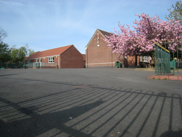
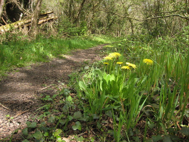
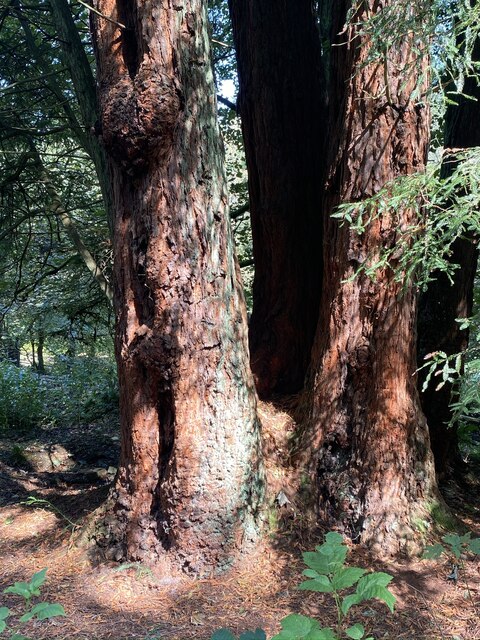
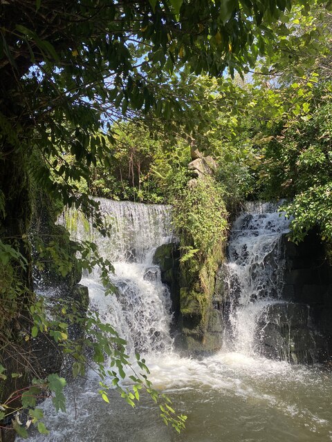
Tircoed Forest, located in Glamorgan, Wales, is a breathtaking woodland area that spans over 800 acres. Situated in the heart of the countryside, this forest is renowned for its natural beauty and diverse range of flora and fauna.

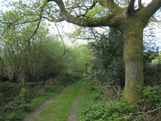
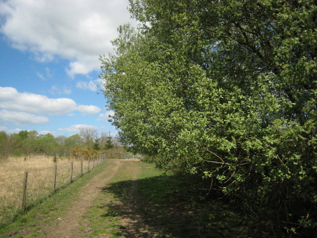
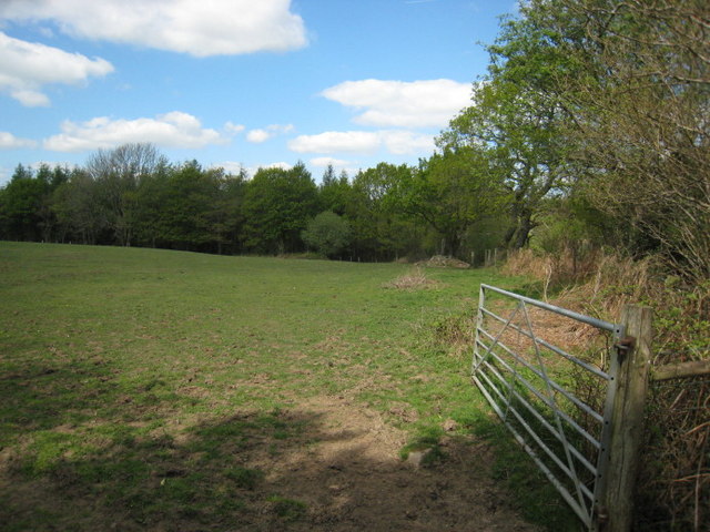
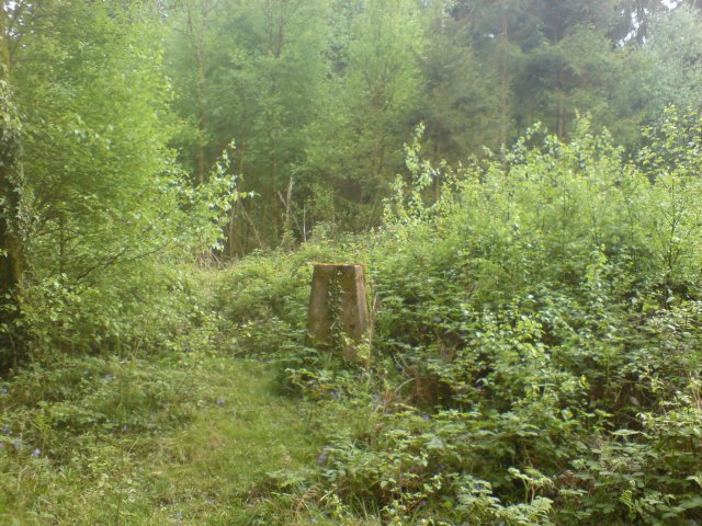
The forest comprises a mixture of broadleaf and coniferous trees, including oak, beech, pine, and spruce. These trees create a dense canopy, providing shelter for various wildlife species such as deer, foxes, badgers, and a vast array of bird species. The forest is also home to several rare and protected species, making it a significant site for conservation efforts.

Visitors to Tircoed Forest can enjoy a network of well-maintained walking and cycling trails that wind through the enchanting woodland. These trails cater to all fitness levels and offer stunning views of the surrounding landscape. Additionally, there are picnic areas and designated spots for camping, allowing visitors to immerse themselves in the tranquil ambiance of the forest.

Tircoed Forest also plays a crucial role in sustainable timber production. Managed by the Forestry Commission, the forest is periodically harvested to ensure a healthy and sustainable ecosystem. This careful management not only supports the local economy but also contributes to the overall health and vitality of the woodland.

Overall, Tircoed Forest is a must-visit destination for nature enthusiasts, offering a unique opportunity to explore and appreciate the wonders of the natural world. Whether it is a relaxing stroll through the woodland or an adventure-filled bike ride, this forest promises an unforgettable experience for all who visit.

If you have any feedback on the listing, please let us know in the comments section below.

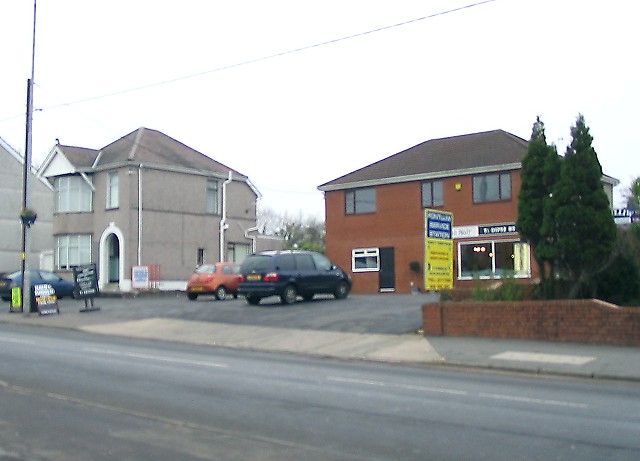
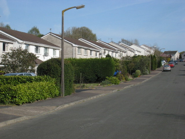
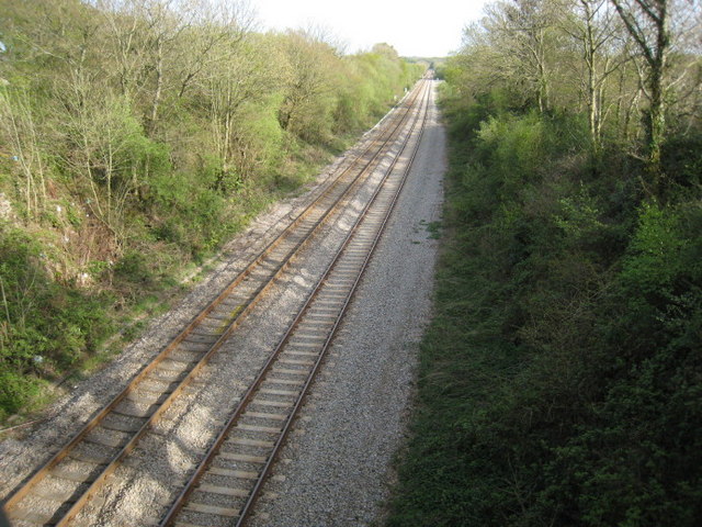
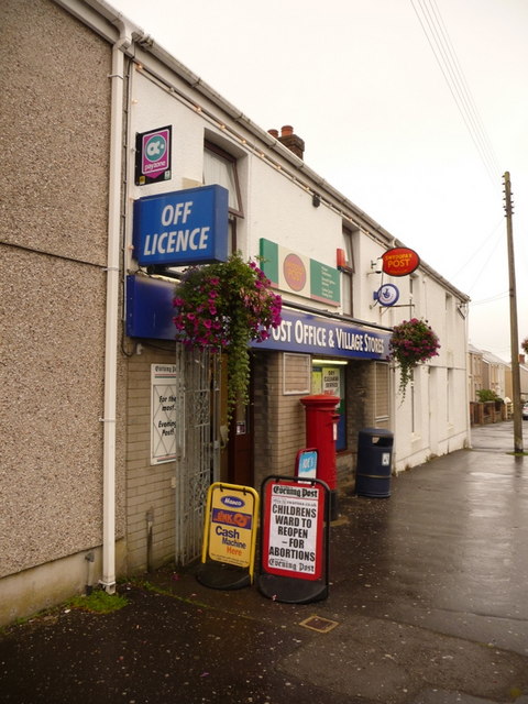
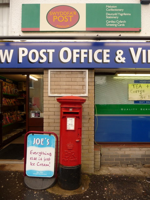
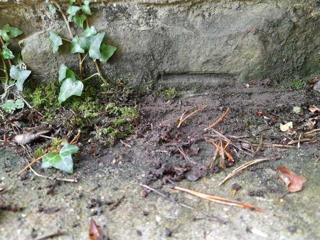
Tircoed Forest Images

Images are sourced within 2km of 51.680945/-3.9982072 or Grid Reference SS6199. Thanks to Geograph Open Source API. All images are credited.

Ordnance Survey Cut Mark This OS cut mark can be found on No72 Bryntirion Road. It marks a point 58.692m above mean sea level.
Ordnance Survey Cut Mark
This OS cut mark can be found on No72 Bryntirion Road. It marks a point 58.692m above mean sea level.
Former Pontlliw Service Station (Recreated) No longer a filling station, the site now bears a sign for car servicing. The house to the left of shot remains generally the same shape but has lost its rear chimney.
This shot recreates a 1937 photo from the Frith collection here <span class="nowrap"><a title="http://www.francisfrith.com/search/wales/west+glamorgan/pontlliw/photos/pontlliw_87906.htm" rel="nofollow ugc noopener" href="http://www.francisfrith.com/search/wales/west+glamorgan/pontlliw/photos/pontlliw_87906.htm">Link</a><img style="margin-left:2px;" alt="External link" title="External link - shift click to open in new window" src="https://s1.geograph.org.uk/img/external.png" width="10" height="10"/></span>
Former Pontlliw Service Station (Recreated)
No longer a filling station, the site now bears a sign for car servicing. The house to the left of shot remains generally the same shape but has lost its rear chimney. This shot recreates a 1937 photo from the Frith collection here LinkExternal link
Clos Glanlliw. Stad o dai rhwng y ffordd a'r rheilffordd.

An estate between the road and railway.
Clos Glanlliw.
Stad o dai rhwng y ffordd a'r rheilffordd. An estate between the road and railway.
Tua Pontlliw.  Tracks to Pontlliw. Cymerais y llun oddi ar y bont gul sy'n croesi'r cledrau.

Taken from the narrow bridge over the line.
Tua Pontlliw. Tracks to Pontlliw.
Cymerais y llun oddi ar y bont gul sy'n croesi'r cledrau. Taken from the narrow bridge over the line.
Ysgol Pontlliw.  Pontlliw School. Ysgol y pentref.

The village school.
Ysgol Pontlliw. Pontlliw School.
Ysgol y pentref. The village school.
I'r goedwig.  To the Forest. Cyrion Fforest Penllergaer.

The edge of Penllergaer Forest.
I'r goedwig. To the Forest.
Cyrion Fforest Penllergaer. The edge of Penllergaer Forest.
Helygen.  Willow. Coed cynhenid ar gyrion coedwig Penllergaer.

Native woods near Penllergaer.
Helygen. Willow.
Coed cynhenid ar gyrion coedwig Penllergaer. Native woods near Penllergaer.
Coed Penllergaer.  Penllergaer Forest. Llanerch dymunol iawn.

A pleasant clearing.
Coed Penllergaer. Penllergaer Forest.
Llanerch dymunol iawn. A pleasant clearing.
Llwybr bach.  The narrow path. Un o'r nifer o lwybrau sy'n gwneud y goedwig yn werth chweil.

Penllrergaer forest has many good walks.
Llwybr bach. The narrow path.
Un o'r nifer o lwybrau sy'n gwneud y goedwig yn werth chweil. Penllrergaer forest has many good walks.
Triangulation post in Penllegaer Forest Clearly unfit for the purpose it was created, this triangulation post is now almost invisible from the nearby footpath let alone being visible from miles around as Penllegaer Forest has since been planted and grown around it.
Triangulation post in Penllegaer Forest
Clearly unfit for the purpose it was created, this triangulation post is now almost invisible from the nearby footpath let alone being visible from miles around as Penllegaer Forest has since been planted and grown around it.
Tircoed  Community Centre Tircoed is a large modern housing estate built in Penllergaer Forest over the last few years.  Much thought has been given to the estate (though the layout can be confusing if you don't know your way round) - it includes its own convenience store and a modern community centre.

A recent addition to this building is the antenna attached to the back of the building.  This is a quarter wave transmitter mast for the recently launched Radio Tircoed, a voluntary run community radio station.
Tircoed Community Centre
Tircoed is a large modern housing estate built in Penllergaer Forest over the last few years. Much thought has been given to the estate (though the layout can be confusing if you don't know your way round) - it includes its own convenience store and a modern community centre. A recent addition to this building is the antenna attached to the back of the building. This is a quarter wave transmitter mast for the recently launched Radio Tircoed, a voluntary run community radio station.
Radio Tircoed studios Behind the modern community centre for the newly built Tircoed housing estate are what appear to be two shipping containers. Their livery reveals that they are in fact the studios for Radio Tircoed which commenced broadcasting on 1st December 2008.

The station is self funded and is entirely run by volunteers and serves the communities of Tircoed, Penllergaer, Pontardulais, Gorseinon, Pontlliw and the M4 Corridor between junctions 47 and 48 - though the signal can be clearly heard much further.  

Along with its relatively powerful (for a community radio station) FM signal, the station also broadcasts on the internet on its web site, and DJs now frequently get requests from all over the world as well as the community in which it serves.

This was the original studio facility - it has since been replaced by a substantially larger structure.
Radio Tircoed studios
Behind the modern community centre for the newly built Tircoed housing estate are what appear to be two shipping containers. Their livery reveals that they are in fact the studios for Radio Tircoed which commenced broadcasting on 1st December 2008. The station is self funded and is entirely run by volunteers and serves the communities of Tircoed, Penllergaer, Pontardulais, Gorseinon, Pontlliw and the M4 Corridor between junctions 47 and 48 - though the signal can be clearly heard much further. Along with its relatively powerful (for a community radio station) FM signal, the station also broadcasts on the internet on its web site, and DJs now frequently get requests from all over the world as well as the community in which it serves. This was the original studio facility - it has since been replaced by a substantially larger structure.
Pontlliw: the post office/stores An ironic local news headline is on display outside the village stores and post office.
Pontlliw: the post office/stores
An ironic local news headline is on display outside the village stores and post office.
Pontlliw: postbox № SA4 509, Swansea Road This Elizabeth II-reign postbox stands outside <a href="https://www.geograph.org.uk/photo/2025609">SN6101 : Pontlliw: the post office/stores</a> and is emptied finally at 5:30pm on weekdays and at 12:15pm on Saturdays.
Pontlliw: postbox № SA4 509, Swansea Road
This Elizabeth II-reign postbox stands outside SN6101 : Pontlliw: the post office/stores and is emptied finally at 5:30pm on weekdays and at 12:15pm on Saturdays.
Ordnance Survey Cut Mark This mostly buried OS cut mark can be found on the SW parapet of the railway bridge. It marks a point 62.868m above mean sea level.
Ordnance Survey Cut Mark
This mostly buried OS cut mark can be found on the SW parapet of the railway bridge. It marks a point 62.868m above mean sea level.
Swansea West Services, 2023 Interesting to note the walkway canopy has been removed since my last visit in 2013, <a href="https://www.geograph.org.uk/photo/3550352">SS6299 : Swansea West Services</a>.
Swansea West Services, 2023
Interesting to note the walkway canopy has been removed since my last visit in 2013, SS6299 : Swansea West Services.
Western Red Cedars Majestic trees in Valley Wood, Penllergaer.
Western Red Cedars
Majestic trees in Valley Wood, Penllergaer.
Waterfalls in Valley Wood, Penllergaer.
Show me another place!

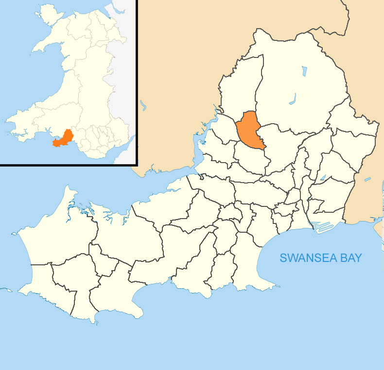
Tircoed Forest is located at Grid Ref: SS6199 (Lat: 51.680945, Lng: -3.9982072)

Unitary Authority: Swansea

Police Authority: South Wales

What 3 Words

///action.fishery.menu. Near Pontlliw, Swansea

Nearby Locations

Tircoed Forest

Related Wikis

Tircoed forest village

Tircoed forest village is a suburb between the villages of Penllergaer and Pontlliw, Swansea, Wales. It is part of the Pontlliw and Tircoed community....

Swansea services

Swansea services (Welsh: Gwasanaethau Gorllewin Abertawe, "Swansea West services") is a motorway service station on the M4 motorway at Junction 47 near...

Penllergaer

Penllergaer (Welsh: Penlle'r-gaer) is a village and community in the City and County of Swansea, Wales. It lies to the east of Gorseinon, within the electoral...

Penllergaer (electoral ward)

Penllergaer is the name of an electoral ward (and a community) in the City and County of Swansea, Wales, UK. Penllergaer has its own elected community...

Pontlliw and Tircoed

Pontlliw and Tircoed is a community and electoral ward in the north of the City and County of Swansea, Wales. It includes the villages of Pontlliw and...

Penllergare

Penllergare is a country park in Wales. It was the estate of John Dillwyn Llewelyn adjacent to what is now the village of Penllergaer, Swansea. Although...

Pontlliw

Pontlliw (Welsh spelling: Pont-lliw) is a village in the community of Pontlliw and Tircoed, part of the City and County of Swansea in Wales. The village...

Pont Lliw railway station

Pont Lliw railway station served the village of Pontlliw, in the historical county of Glamorganshire, Wales, from 1923 to 1924 on the Swansea District...

Nearby Amenities

Located within 500m of 51.680945,-3.9982072
Traffic Signals
Lat/Long: 51.6770834/-3.9972881
Traffic Signals
Traffic Signals: signal
Lat/Long: 51.6773949/-3.9962591
Fuel
Lat/Long: 51.6779054/-3.9948426
Tircoed
Created By: Potlatch 0.10e
Place: village
Wikidata: Q7809160
Lat/Long: 51.6823803/-3.9967146
Mini Roundabout
Direction: clockwise
Lat/Long: 51.6818117/-3.9987337
Bus Stop
Tircoed Forest Village
Bus: yes
Naptan AtcoCode: 5810AWC52378
Naptan Bearing: SW
Naptan CommonName: Tircoed Forest Village
Naptan NaptanCode: swadadj
Naptan Street: Y Cyswllt
Naptan Verified: no
Public Transport: platform
Source: naptan_import
Lat/Long: 51.6820852/-3.9973486
Power: tower
Ref: V62
Lat/Long: 51.6780422/-3.9941481
Power: tower
Ref: V65
Lat/Long: 51.6795429/-4.0037
Power: tower
Ref: V64
Lat/Long: 51.6790753/-4.0007068
Power: tower
Ref: V63
Lat/Long: 51.6785492/-3.997323
Fuel
Moto Services Swansea
Ele: 83
Fuel Diesel: yes
Fuel Octane 95: yes
Operator: Moto
Phone: +44 1792 896222
Source: GPS
Wikidata: Q7653728
Lat/Long: 51.677665/-3.9947432
Traffic Signals
Traffic Signals: signal
Lat/Long: 51.677456/-3.9961347
Barrier: stile
Foot: yes
Lat/Long: 51.6805047/-3.9953898
Post Box
Collection Times: Mo-Fr 17:00; Sa 11:00
Post Box Type: lamp
Ref: SA4 508
Royal Cypher: EIIR
Royal Cypher Wikidata: Q33102113
Lat/Long: 51.6822858/-3.9971164
Direction: SW
Generator Method: photovoltaic
Generator Output Electricity: yes
Generator Solar Modules: 7
Generator Source: solar
Generator Type: solar_photovoltaic_panel
Location: roof
Note: modules of mixed sizes
Power: generator
Lat/Long: 51.6815579/-3.993517
Direction: SW
Generator Method: photovoltaic
Generator Output Electricity: yes
Generator Solar Modules: 6
Generator Source: solar
Generator Type: solar_photovoltaic_panel
Location: roof
Note: modules of mixed sizes
Power: generator
Lat/Long: 51.6815881/-3.9935705
Direction: S
Generator Method: photovoltaic
Generator Output Electricity: yes
Generator Solar Modules: 16
Generator Source: solar
Generator Type: solar_photovoltaic_panel
Location: roof
Power: generator
Lat/Long: 51.6846954/-3.994343
Direction: 190
Generator Method: photovoltaic
Generator Output Electricity: yes
Generator Solar Modules: 8
Generator Source: solar
Generator Type: solar_photovoltaic_panel
Location: roof
Power: generator
Lat/Long: 51.6832968/-3.9966162
Direction: E
Generator Method: photovoltaic
Generator Output Electricity: yes
Generator Solar Modules: 6
Generator Source: solar
Generator Type: solar_photovoltaic_panel
Location: roof
Power: generator
Lat/Long: 51.6823132/-3.9973497
Direction: S
Generator Method: photovoltaic
Generator Output Electricity: yes
Generator Solar Modules: 10
Generator Source: solar
Generator Type: solar_photovoltaic_panel
Location: roof
Power: generator
Lat/Long: 51.6823348/-3.9972854
Man Made: charging_station
Operator: Gridserve
Operator Wikidata: Q89575318
Lat/Long: 51.678839/-3.9942028
Man Made: charging_station
Operator: Gridserve
Operator Wikidata: Q89575318
Lat/Long: 51.678706/-3.9937703
Charging Station
Gridserve
Contact Website: https://electrichighway.gridserve.com/swansea-services
Operator: Gridserve
Operator Wikidata: Q89575318
Lat/Long: 51.6787858/-3.9939594
Traffic Signals
Traffic Signals: signal
Lat/Long: 51.6770028/-3.9971936
Crossing
Crossing: unmarked
Crossing Island: no
Crossing Markings: no
Tactile Paving: no
Lat/Long: 51.6769842/-3.9954262
Information: board
Tourism: information
Lat/Long: 51.6789869/-3.9950312
The data included in this document is from www.openstreetmap.org. The data is made available under ODbL.

Have you been to Tircoed Forest?

Leave your review of Tircoed Forest below (or comments, questions and feedback).