Allt Castell-waun

Wood, Forest in Cardiganshire

Wales

Allt Castell-waun

Ordnance Survey Cut Mark This OS cut mark can be found on the NE angle of the chapel. It marks a point 175.647m above mean sea level.
Ordnance Survey Cut Mark Credit: Adrian Dust

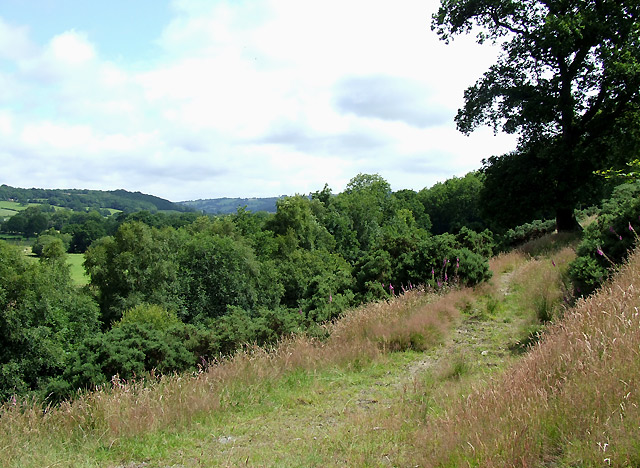
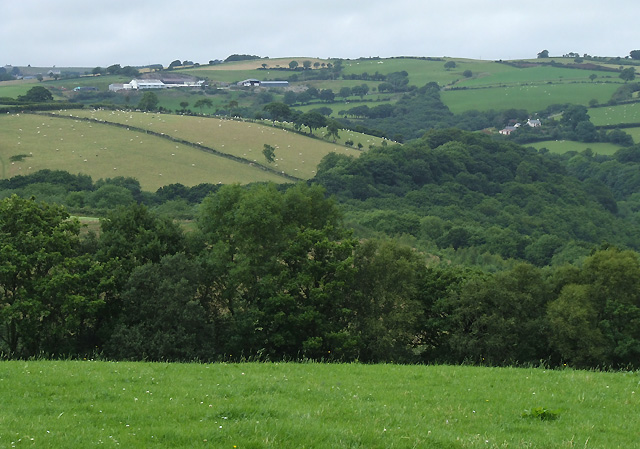
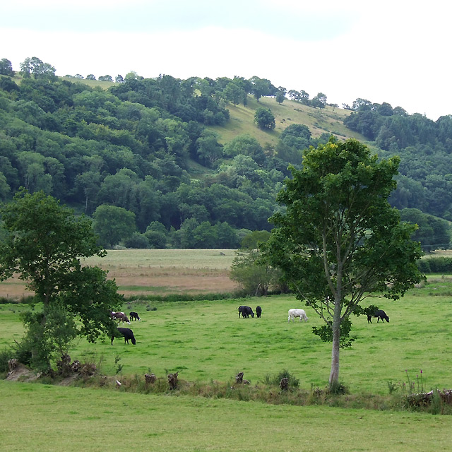
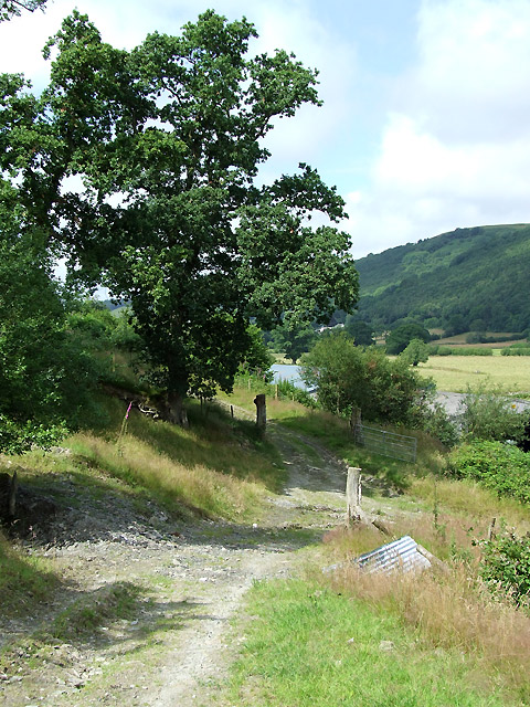
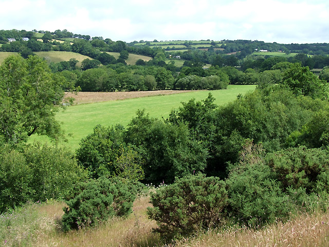
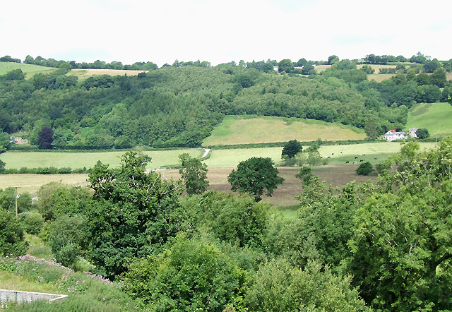
Allt Castell-waun is a picturesque woodland area located in Cardiganshire, Wales. The name translates to "Wood Castle-Meadow," reflecting its enchanting natural beauty and historical significance. This forested landscape covers an area of approximately 200 acres and is situated in close proximity to the village of Castell-waun.

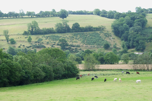
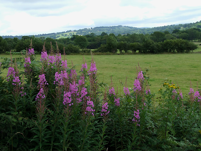
The woodland is characterized by a diverse range of tree species, including oak, beech, and birch, which create a lush and verdant atmosphere. The forest floor is adorned with a rich tapestry of wildflowers, adding bursts of color to the greenery. The area is also home to numerous wildlife species, such as red squirrels, deer, and a variety of bird species.

Allt Castell-waun has a long and fascinating history, dating back to ancient times. It is believed to have been used as a hunting ground by the Celts and later served as a defensive location during the medieval period. The remnants of a hillfort can still be seen within the woodland, adding an element of intrigue and mystery to the site.

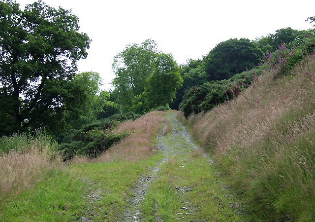
The forest offers a tranquil escape for visitors, with well-maintained walking trails that wind through the trees, allowing for exploration and appreciation of the natural surroundings. It is a popular destination for nature enthusiasts, hikers, and photographers, who are drawn to its serene atmosphere and breathtaking vistas.

Allt Castell-waun is not only a place of natural beauty but also a testament to the rich history and heritage of Cardiganshire. Whether one is seeking solace in nature or a glimpse into the past, this woodland is sure to captivate and inspire all who visit.

If you have any feedback on the listing, please let us know in the comments section below.

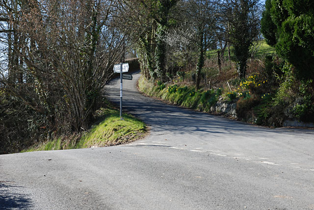
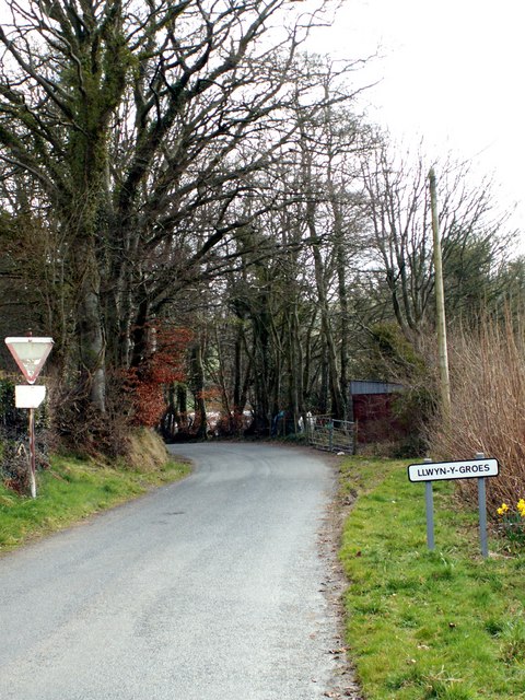
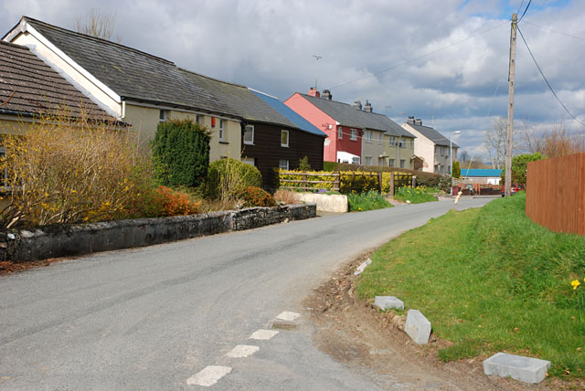
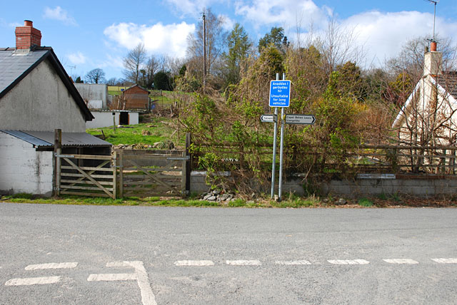
Allt Castell-waun Images

Images are sourced within 2km of 52.199446/-4.0423303 or Grid Reference SN6057. Thanks to Geograph Open Source API. All images are credited.

Ordnance Survey Cut Mark This OS cut mark can be found on the NE angle of the chapel. It marks a point 175.647m above mean sea level.
Ordnance Survey Cut Mark
This OS cut mark can be found on the NE angle of the chapel. It marks a point 175.647m above mean sea level.
Ordnance Survey Cut Mark This OS cut mark can be found on the churn stand NW side of the road. It marks a point 169.411m above mean sea level. <a title="https://www.geograph.org.uk/photo/7412363" href="https://www.geograph.org.uk/photo/7412363">Link</a>
Ordnance Survey Cut Mark
This OS cut mark can be found on the churn stand NW side of the road. It marks a point 169.411m above mean sea level. Link
Churn Stand There is an Ordnance Survey cut mark on the front of the stand. <a title="https://www.geograph.org.uk/photo/7412358" href="https://www.geograph.org.uk/photo/7412358">Link</a>
Churn Stand
There is an Ordnance Survey cut mark on the front of the stand. Link
Ordnance Survey Cut Mark This OS cut mark can be found on the gatepost north side of the road. It marks a point 164.967m above mean sea level.
Ordnance Survey Cut Mark
This OS cut mark can be found on the gatepost north side of the road. It marks a point 164.967m above mean sea level.
B4342 junction with a minor road to Bwlch-llan Here the B4342 descends to near the Afon Aeron, while the minor road heads uphill to serve several farms and other dwellings.
B4342 junction with a minor road to Bwlch-llan
Here the B4342 descends to near the Afon Aeron, while the minor road heads uphill to serve several farms and other dwellings.
Approaching Llwyn-y-groes from Gartheli
Main street, Llwyn-y-groes
Road junction, Llwyn-y-groes Where the lane from Olmarch meets the road between Llangeitho and Lampeter.
Road junction, Llwyn-y-groes
Where the lane from Olmarch meets the road between Llangeitho and Lampeter.
Footpath towards Capel Betws Lleucu, Ceredigion This footpath has traversed the lower slopes of the steep valley side for nearly two miles, and leads to Capel Betws Lleucu.
Footpath towards Capel Betws Lleucu, Ceredigion
This footpath has traversed the lower slopes of the steep valley side for nearly two miles, and leads to Capel Betws Lleucu.
Farmland and woodland west of Llangeitho, Ceredigion The valleys of Nant Arth (across the view, wooded) and Cwm Bwlch (straight ahead, also wooded) contrast with the farmland above the trees.
Farmland and woodland west of Llangeitho, Ceredigion
The valleys of Nant Arth (across the view, wooded) and Cwm Bwlch (straight ahead, also wooded) contrast with the farmland above the trees.
Hay bales west of Llangeitho, Ceredigion Many farmers told me that poor weather again had delayed grass cutting, but this one seems to have been ahead of the game.
Hay bales west of Llangeitho, Ceredigion
Many farmers told me that poor weather again had delayed grass cutting, but this one seems to have been ahead of the game.
Farmland south-west of Llangeitho, Ceredigion
Grazing by the Afon Aeron, Ceredigion The flood plain is about five hundred metres wide here, and there is always the possibility of flooding after persistent rain.
Grazing by the Afon Aeron, Ceredigion
The flood plain is about five hundred metres wide here, and there is always the possibility of flooding after persistent rain.
Rosebay Willowherb in the Aeron Valley, Ceredigion The flood plain is about five hundred metres wide here, and is land is used for grazing most of the year. What a shame Rosebay Willowherb is such a persistent weed; it is quite attractive in flower. It used to be uncommon in Britain. It is suspected by some botanists that the sudden spread of rosebay willowherb was due to the introduction of the North American form that has 72 chromosomes while the native form has 36 (according to the gardenorganic.org.uk website).
Rosebay Willowherb in the Aeron Valley, Ceredigion
The flood plain is about five hundred metres wide here, and is land is used for grazing most of the year. What a shame Rosebay Willowherb is such a persistent weed; it is quite attractive in flower. It used to be uncommon in Britain. It is suspected by some botanists that the sudden spread of rosebay willowherb was due to the introduction of the North American form that has 72 chromosomes while the native form has 36 (according to the gardenorganic.org.uk website).
Footpath to Capel Betws Lleucu, Ceredigion
Footpath and Aeron Valley, Ceredigion The path crosses a bridleway here at Dolau Aeron, turning right across the floodplain to the B4342 road, and ahead along the base of the wooded valley side, eventually to Abermeurig. The bridleway left straight up and over the hill leads to Llwyn-y-groes.
Footpath and Aeron Valley, Ceredigion
The path crosses a bridleway here at Dolau Aeron, turning right across the floodplain to the B4342 road, and ahead along the base of the wooded valley side, eventually to Abermeurig. The bridleway left straight up and over the hill leads to Llwyn-y-groes.
Across the Aeron Valley, Ceredigion
Across the Aeron Valley, Ceredigion The valley here has steep sides (often wooded) and a flat bottom about five hundred metres in width. In the centre of the image the bridleway from Llwyn-y-groes meets the B4342 150 metres to the left of Llwyn Morris farm.
Across the Aeron Valley, Ceredigion
The valley here has steep sides (often wooded) and a flat bottom about five hundred metres in width. In the centre of the image the bridleway from Llwyn-y-groes meets the B4342 150 metres to the left of Llwyn Morris farm.
Show me another place!

Allt Castell-waun is located at Grid Ref: SN6057 (Lat: 52.199446, Lng: -4.0423303)

Unitary Authority: Ceredigion

Police Authority: Dyfed Powys

What 3 Words

///messaging.hobble.cheater. Near Llangybi, Ceredigion

Related Wikis

Capel Betws Lleucu

Capel Betws Lleucu is a hamlet in Cardiganshire, Wales.SY postcode area SY 25 6 SN606583 == References == == External links == http://www.accuweather.com/en/gb/capel...

Llangeitho

Llangeitho is a village and community on the upper River Aeron in Ceredigion, Wales, about four miles (6 km) west of Tregaron and 11 kilometres (7 mi)...

Olmarch

Olmarch is a hamlet in the community of Llangybi, Ceredigion, Wales, which is 59.9 miles (96.4 km) from Cardiff and 172.1 miles (277 km) from London. Olmarch...

Nantcwnlle

Nantcwnlle is a community in Ceredigion, Wales, including the villages of Talsarn and Llwyn-y-groes. Daniel Rowland (1713–1790), was born in Nantcwnlle...

Cockshead

Cockshead is a small village in the community of Llanddewi Brefi, Ceredigion, Wales, which is 59.9 miles (96.3 km) from Cardiff and 171.9 miles (276.5...

Olmarch Halt railway station

Olmarch Halt railway station, previously served the hamlet and rural locale of Olmarch near Llanddewi-Brefi and Pont Llanio on the Carmarthen Aberystwyth...

Cors Nantcwnlle

Cors Nantcwnlle is a Site of Special Scientific Interest near Bwlchllan in Ceredigion, west Wales. Until the early twentieth century the site was renowned...

Caeau Llety-cybi

Caeau Llety-cybi is a Site of Special Scientific Interest in Ceredigion, west Wales. The lowland meadow site is managed by the Wildlife Trust of South...

Nearby Amenities

Located within 500m of 52.199446,-4.0423303
The data included in this document is from www.openstreetmap.org. The data is made available under ODbL.

Have you been to Allt Castell-waun?

Leave your review of Allt Castell-waun below (or comments, questions and feedback).