Allt Glan-March

Wood, Forest in Cardiganshire

Wales

Allt Glan-March

Ordnance Survey Cut Mark This OS cut mark can be found on the NE angle of the chapel. It marks a point 175.647m above mean sea level.
Ordnance Survey Cut Mark Credit: Adrian Dust

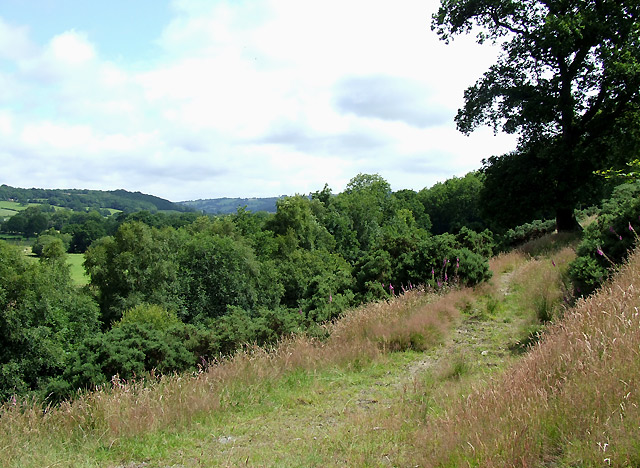
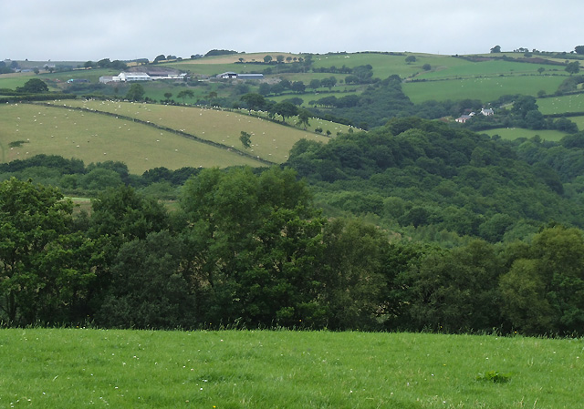
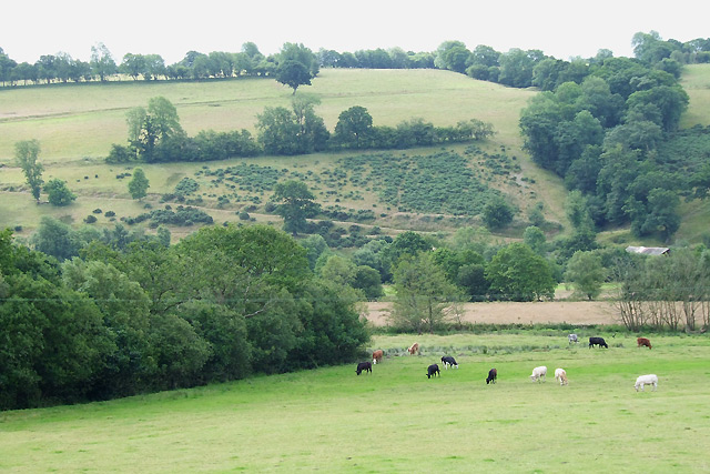
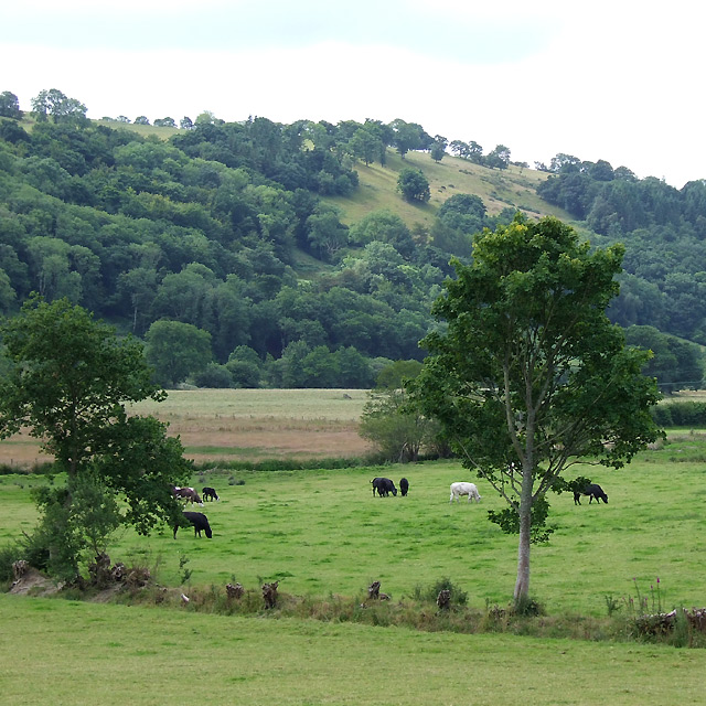
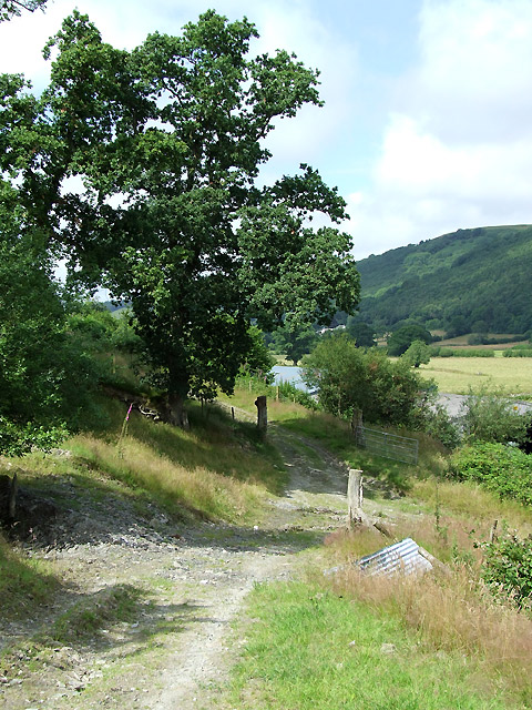
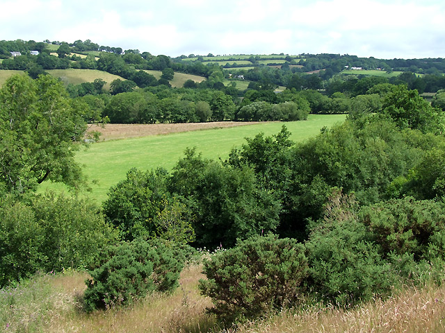
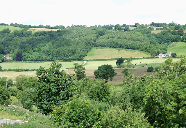
Allt Glan-March is a scenic woodland area located in the county of Cardiganshire, Wales. Situated near the village of Tregaron, this expansive forest covers an area of approximately 200 acres. Nestled within the Cambrian Mountains, Allt Glan-March offers visitors a tranquil and picturesque setting to explore.

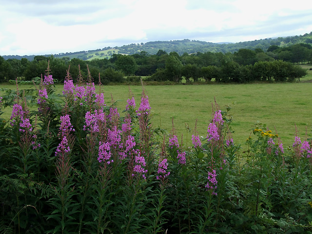
The woodland is primarily composed of native Welsh tree species, such as oak, birch, and rowan. These trees provide a rich habitat for a diverse range of flora and fauna, making Allt Glan-March a haven for nature enthusiasts and wildlife lovers. Rare and protected species, including red kites and pine martens, are often spotted within the forest, adding to its ecological significance.

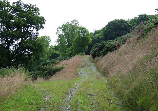
The forest is crisscrossed by a network of well-maintained footpaths and trails, allowing visitors to navigate through the woods easily. Hikers can enjoy breathtaking views of the surrounding countryside, as well as the meandering River Teifi, which borders the woodland on one side. There are also designated picnic areas and benches scattered throughout the forest, providing peaceful spots for visitors to relax and soak in the natural beauty.

Allt Glan-March is managed by the local authority, which ensures the preservation of the woodland's unique ecosystem and promotes responsible tourism. The forest is accessible year-round, with different seasons offering distinct experiences. In spring, the forest comes alive with vibrant wildflowers and birdsong, while autumn paints the landscape in hues of red, yellow, and orange.

Overall, Allt Glan-March in Cardiganshire is a hidden gem for those seeking a peaceful retreat in the heart of nature. With its diverse flora and fauna, well-marked trails, and stunning vistas, this woodland is a must-visit destination for outdoor enthusiasts and nature lovers alike.

If you have any feedback on the listing, please let us know in the comments section below.

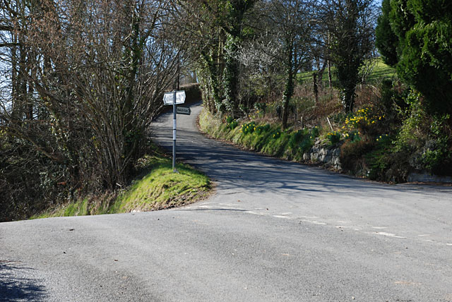
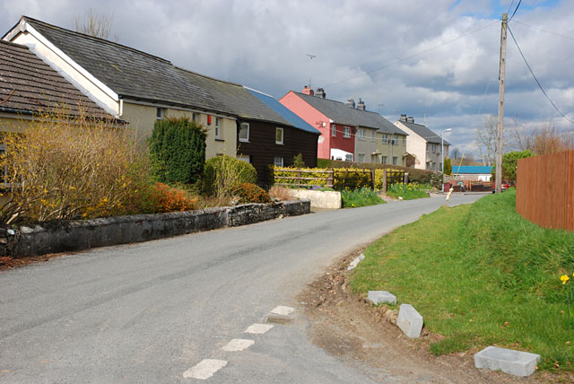
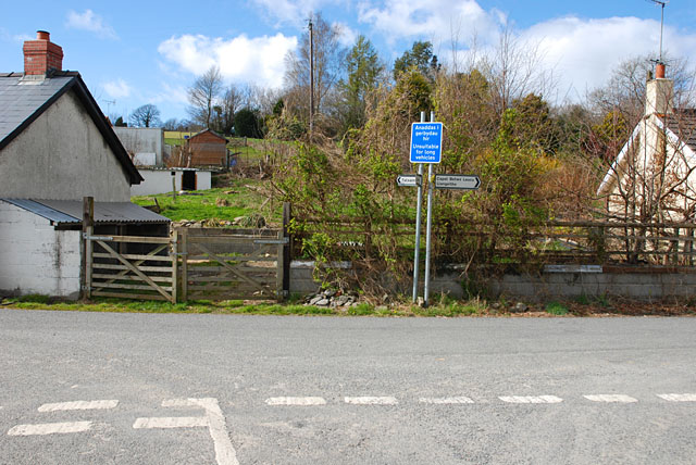
Allt Glan-March Images

Images are sourced within 2km of 52.200983/-4.0392837 or Grid Reference SN6057. Thanks to Geograph Open Source API. All images are credited.

Ordnance Survey Cut Mark This OS cut mark can be found on the NE angle of the chapel. It marks a point 175.647m above mean sea level.
Ordnance Survey Cut Mark
This OS cut mark can be found on the NE angle of the chapel. It marks a point 175.647m above mean sea level.
B4342 junction with a minor road to Bwlch-llan Here the B4342 descends to near the Afon Aeron, while the minor road heads uphill to serve several farms and other dwellings.
B4342 junction with a minor road to Bwlch-llan
Here the B4342 descends to near the Afon Aeron, while the minor road heads uphill to serve several farms and other dwellings.
Main street, Llwyn-y-groes
Road junction, Llwyn-y-groes Where the lane from Olmarch meets the road between Llangeitho and Lampeter.
Road junction, Llwyn-y-groes
Where the lane from Olmarch meets the road between Llangeitho and Lampeter.
Footpath towards Capel Betws Lleucu, Ceredigion This footpath has traversed the lower slopes of the steep valley side for nearly two miles, and leads to Capel Betws Lleucu.
Footpath towards Capel Betws Lleucu, Ceredigion
This footpath has traversed the lower slopes of the steep valley side for nearly two miles, and leads to Capel Betws Lleucu.
Farmland and woodland west of Llangeitho, Ceredigion The valleys of Nant Arth (across the view, wooded) and Cwm Bwlch (straight ahead, also wooded) contrast with the farmland above the trees.
Farmland and woodland west of Llangeitho, Ceredigion
The valleys of Nant Arth (across the view, wooded) and Cwm Bwlch (straight ahead, also wooded) contrast with the farmland above the trees.
Hay bales west of Llangeitho, Ceredigion Many farmers told me that poor weather again had delayed grass cutting, but this one seems to have been ahead of the game.
Hay bales west of Llangeitho, Ceredigion
Many farmers told me that poor weather again had delayed grass cutting, but this one seems to have been ahead of the game.
Farmland south-west of Llangeitho, Ceredigion
Grazing by the Afon Aeron, Ceredigion The flood plain is about five hundred metres wide here, and there is always the possibility of flooding after persistent rain.
Grazing by the Afon Aeron, Ceredigion
The flood plain is about five hundred metres wide here, and there is always the possibility of flooding after persistent rain.
Rosebay Willowherb in the Aeron Valley, Ceredigion The flood plain is about five hundred metres wide here, and is land is used for grazing most of the year. What a shame Rosebay Willowherb is such a persistent weed; it is quite attractive in flower. It used to be uncommon in Britain. It is suspected by some botanists that the sudden spread of rosebay willowherb was due to the introduction of the North American form that has 72 chromosomes while the native form has 36 (according to the gardenorganic.org.uk website).
Rosebay Willowherb in the Aeron Valley, Ceredigion
The flood plain is about five hundred metres wide here, and is land is used for grazing most of the year. What a shame Rosebay Willowherb is such a persistent weed; it is quite attractive in flower. It used to be uncommon in Britain. It is suspected by some botanists that the sudden spread of rosebay willowherb was due to the introduction of the North American form that has 72 chromosomes while the native form has 36 (according to the gardenorganic.org.uk website).
Footpath to Capel Betws Lleucu, Ceredigion
Footpath and Aeron Valley, Ceredigion The path crosses a bridleway here at Dolau Aeron, turning right across the floodplain to the B4342 road, and ahead along the base of the wooded valley side, eventually to Abermeurig. The bridleway left straight up and over the hill leads to Llwyn-y-groes.
Footpath and Aeron Valley, Ceredigion
The path crosses a bridleway here at Dolau Aeron, turning right across the floodplain to the B4342 road, and ahead along the base of the wooded valley side, eventually to Abermeurig. The bridleway left straight up and over the hill leads to Llwyn-y-groes.
Across the Aeron Valley, Ceredigion
Across the Aeron Valley, Ceredigion The valley here has steep sides (often wooded) and a flat bottom about five hundred metres in width. In the centre of the image the bridleway from Llwyn-y-groes meets the B4342 150 metres to the left of Llwyn Morris farm.
Across the Aeron Valley, Ceredigion
The valley here has steep sides (often wooded) and a flat bottom about five hundred metres in width. In the centre of the image the bridleway from Llwyn-y-groes meets the B4342 150 metres to the left of Llwyn Morris farm.
Afon Aeron at Dolau Aeron, Ceredigion
Afon Aeron east of Capel Betws Lleucu, Ceredigion
Grass by the Afon Aeron, Ceredigion The river flows behind the trees on the left.
Grass by the Afon Aeron, Ceredigion
The river flows behind the trees on the left.
Bridleway to Llwyn-y-groes, Ceredigion Dolau Aeron is the farm at the base of the wooded steep valley side, south of the river.
Bridleway to Llwyn-y-groes, Ceredigion
Dolau Aeron is the farm at the base of the wooded steep valley side, south of the river.
Show me another place!

Allt Glan-March is located at Grid Ref: SN6057 (Lat: 52.200983, Lng: -4.0392837)

Unitary Authority: Ceredigion

Police Authority: Dyfed Powys

What 3 Words

///belief.jumps.advice. Near Llangybi, Ceredigion

Related Wikis

Capel Betws Lleucu

Capel Betws Lleucu is a hamlet in Cardiganshire, Wales.SY postcode area SY 25 6 SN606583 == References == == External links == http://www.accuweather.com/en/gb/capel...

Llangeitho

Llangeitho is a village and community on the upper River Aeron in Ceredigion, Wales, about four miles (6 km) west of Tregaron and 11 kilometres (7 mi)...

Olmarch

Olmarch is a hamlet in the community of Llangybi, Ceredigion, Wales, which is 59.9 miles (96.4 km) from Cardiff and 172.1 miles (277 km) from London. Olmarch...

Cockshead

Cockshead is a small village in the community of Llanddewi Brefi, Ceredigion, Wales, which is 59.9 miles (96.3 km) from Cardiff and 171.9 miles (276.5...

Nantcwnlle

Nantcwnlle is a community in Ceredigion, Wales, including the villages of Talsarn and Llwyn-y-groes. Daniel Rowland (1713–1790), was born in Nantcwnlle...

Olmarch Halt railway station

Olmarch Halt railway station, previously served the hamlet and rural locale of Olmarch near Llanddewi-Brefi and Pont Llanio on the Carmarthen Aberystwyth...

Cors Nantcwnlle

Cors Nantcwnlle is a Site of Special Scientific Interest near Bwlchllan in Ceredigion, west Wales. Until the early twentieth century the site was renowned...

Llettum-ddu

Llettum-ddu is a hamlet in the community of Tregaron, Ceredigion, Wales, which is 61.3 miles (98.6 km) from Cardiff and 171.7 miles (276.3 km) from London...

Nearby Amenities

Located within 500m of 52.200983,-4.0392837
Give Way
Direction: forward
Lat/Long: 52.2045566/-4.0405733
Capel Betws Lleucu
Place: hamlet
Wikidata: Q14508465
Wikipedia: en:Capel Betws Lleucu
Lat/Long: 52.205029/-4.040287
Turning Loop
Lat/Long: 52.2033292/-4.0363851
The data included in this document is from www.openstreetmap.org. The data is made available under ODbL.

Have you been to Allt Glan-March?

Leave your review of Allt Glan-March below (or comments, questions and feedback).