Allt Cwm-seiri

Wood, Forest in Carmarthenshire

Wales

Allt Cwm-seiri

Llwyncelyn, Abergorlech Adfail o dy o'r enw Llwyncelyn yn Abergorlech / A ruined house known as Llwyncelyn (trans. 'hollybush') near Abergorlech
Llwyncelyn, Abergorlech Credit: Alan Richards

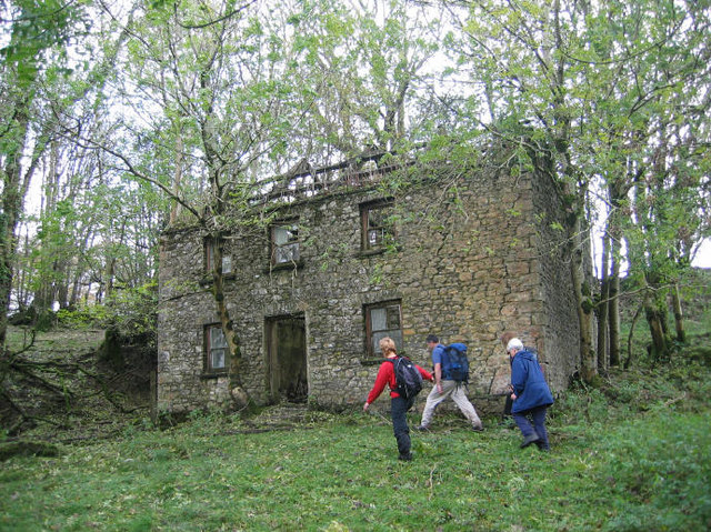
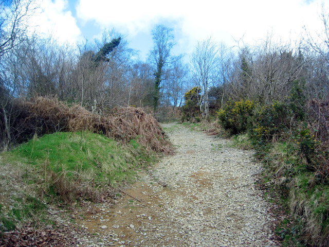
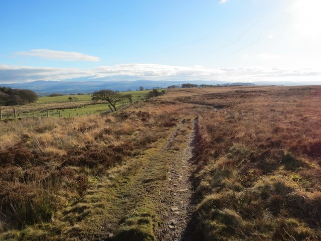
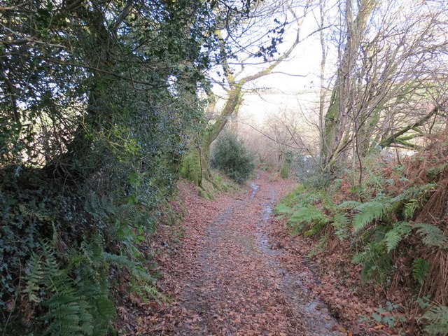
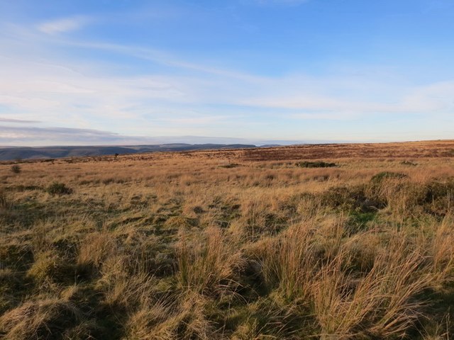
Allt Cwm-seiri is a picturesque woodland located in the county of Carmarthenshire, Wales. Covering an area of approximately 200 hectares, it is characterized by its dense forest and stunning natural beauty. The woodland is situated on the slopes of the Black Mountain, offering visitors breathtaking views of the surrounding landscape.

The area is home to a diverse range of flora and fauna, with a variety of tree species including oak, ash, and birch. The woodland floor is covered in a rich carpet of ferns, mosses, and wildflowers, creating a vibrant and enchanting atmosphere.

Allt Cwm-seiri is a haven for wildlife, providing habitats for numerous species. It is particularly renowned for its bird population, attracting birdwatchers from far and wide. Visitors may spot species such as redstarts, pied flycatchers, and wood warblers, among others. The woodland also supports a range of mammals, including badgers, foxes, and bats.

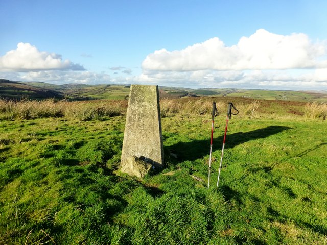
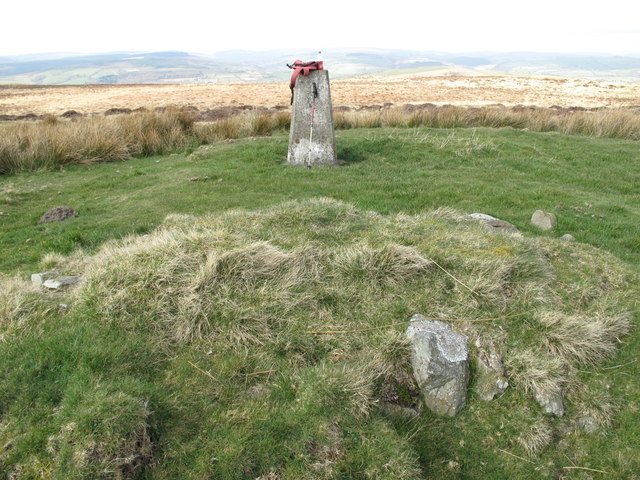
The woodland offers a network of well-maintained walking trails, allowing visitors to explore its natural wonders. These trails cater to all abilities, from leisurely strolls to more challenging hikes. Along the way, visitors will encounter stunning viewpoints, cascading waterfalls, and tranquil streams.

Allt Cwm-seiri is a popular destination for nature lovers, hikers, and photographers seeking to immerse themselves in the beauty of the Welsh countryside. It provides a peaceful and serene environment, offering an escape from the hustle and bustle of everyday life.

If you have any feedback on the listing, please let us know in the comments section below.

Allt Cwm-seiri Images

Images are sourced within 2km of 51.978492/-4.032699 or Grid Reference SN6033. Thanks to Geograph Open Source API. All images are credited.

Llwyncelyn, Abergorlech Adfail o dy o'r enw Llwyncelyn yn Abergorlech / A ruined house known as Llwyncelyn (trans. 'hollybush') near Abergorlech
Llwyncelyn, Abergorlech
Adfail o dy o'r enw Llwyncelyn yn Abergorlech / A ruined house known as Llwyncelyn (trans. 'hollybush') near Abergorlech
Ordnance Survey Cut Mark This OS cut mark can be found on the milk stand at Cilyllynfawr Farm. It marks a point 134.623m above mean sea level.
Ordnance Survey Cut Mark
This OS cut mark can be found on the milk stand at Cilyllynfawr Farm. It marks a point 134.623m above mean sea level.
Ordnance Survey Rivet This OS rivet can be found on the Milk Stand at Cilwr Farm. It marks a point 134.623m above mean sea level.
Ordnance Survey Rivet
This OS rivet can be found on the Milk Stand at Cilwr Farm. It marks a point 134.623m above mean sea level.
Ordnance Survey Rivet This OS rivet can be found on the Milk Stand at Cwm-gwlaw-fawr Farm. It marks a point 180.838m above mean sea level.
Ordnance Survey Rivet
This OS rivet can be found on the Milk Stand at Cwm-gwlaw-fawr Farm. It marks a point 180.838m above mean sea level.
Llwybr Cyhoeddus i Lansawel / Path to Llansawel Llwybr cyhoeddus yn dringo'r tyle mas o Gwm Cothi ac yn mynd i gyfeiriad pentre Llansawel.

A public footpath climbing out of the Cothi Valley and heading in the direction of Llansawel (trans. church of St Sawel).
Llwybr Cyhoeddus i Lansawel / Path to Llansawel
Llwybr cyhoeddus yn dringo'r tyle mas o Gwm Cothi ac yn mynd i gyfeiriad pentre Llansawel. A public footpath climbing out of the Cothi Valley and heading in the direction of Llansawel (trans. church of St Sawel).
Llwybr yn gadael y cilffordd / Path exiting the byway Llwybr cyhoeddus ar y chwith yn gadael cilffordd yng nghwm Cothi. Yn y pellter gellir gweld talen bwthyn o'r enw Cwm.

A public footpath on the left exiting a byway in the Cothi valley. In the distance the gable end of a cottage known as Cwm can be seen.
Llwybr yn gadael y cilffordd / Path exiting the byway
Llwybr cyhoeddus ar y chwith yn gadael cilffordd yng nghwm Cothi. Yn y pellter gellir gweld talen bwthyn o'r enw Cwm. A public footpath on the left exiting a byway in the Cothi valley. In the distance the gable end of a cottage known as Cwm can be seen.
Llwybr uwchben Nant Ffrainc / Path above Nant Ffrainc Llwybr cyhoeddus yn mynd i lawr y waered i gyfeiriad Nant Ffrainc.

A public footpath descending towards Nant Ffrainc (trans. Ffrainc stream)
Llwybr uwchben Nant Ffrainc / Path above Nant Ffrainc
Llwybr cyhoeddus yn mynd i lawr y waered i gyfeiriad Nant Ffrainc. A public footpath descending towards Nant Ffrainc (trans. Ffrainc stream)
Barn conversion at Bwlch y Rhyd
Bwlch y Rhyd
Bwlch y Rhyd
Farm track junction with B4310
Track across farmland above Abergorlech
Road towards Abergorlech
Pont Gorlech, Abergorlech
Mynydd Cynros Trac ar Fynydd Cynros yn mynd i gyfeiriad y de. Mae'n debygol taw ffurf wreiddiol 'cynros' oedd Cefn Rhos.  

Track on Mynydd Cynros going in a southernly direction. Probably, the original name of 'cynros' was Cefn Rhos (trans. Moor Ridge).
Mynydd Cynros
Trac ar Fynydd Cynros yn mynd i gyfeiriad y de. Mae'n debygol taw ffurf wreiddiol 'cynros' oedd Cefn Rhos. Track on Mynydd Cynros going in a southernly direction. Probably, the original name of 'cynros' was Cefn Rhos (trans. Moor Ridge).
Hen Heol Marchoglwyn Uchaf Old Road Hen heol ger Marchoglwyn Uchaf yn arwain i lawr y waered i gyfeiriad Nant Ffrainc a Ffarm Blaenwaun. 

Old road near Marchoglwyn Uchaf Farm descending the hill towards Nant Ffrainc Stream and Blaenwaun Farm
Hen Heol Marchoglwyn Uchaf Old Road
Hen heol ger Marchoglwyn Uchaf yn arwain i lawr y waered i gyfeiriad Nant Ffrainc a Ffarm Blaenwaun. Old road near Marchoglwyn Uchaf Farm descending the hill towards Nant Ffrainc Stream and Blaenwaun Farm
Mynydd Cynros Rhostir uwchben pentre Talyllychau /

Moorland above the village of Talley
Mynydd Cynros
Rhostir uwchben pentre Talyllychau / Moorland above the village of Talley
Banc Beili-Tew Started from track opposite Chapel Cemetery. Then grass - last 300-400m bracken but ways through and sheep grazing.

Name:Banc Beili-Tew
Hill number:5243
Height:278m / 912ft
Area:31C: South-West Wales
Class:Hu
Grid ref:SN 61606 34625
Summit feature:trig point: OS measurement
Drop:120m
Col:158m SN601350
Banc Beili-Tew
Started from track opposite Chapel Cemetery. Then grass - last 300-400m bracken but ways through and sheep grazing. Name:Banc Beili-Tew Hill number:5243 Height:278m / 912ft Area:31C: South-West Wales Class:Hu Grid ref:SN 61606 34625 Summit feature:trig point: OS measurement Drop:120m Col:158m SN601350
Mynydd Cynros Parked at Cilyllynfawr Farm and used right of way to reach the plantationon the east of the hill. Still dry and sunny for Mother's Day.
Name: Mynydd Cynros
Hill number: 2219
Height: 329m / 1079ft
Area: 31C: South-West Wales
Class: Ma
Grid ref: SN 62059 32690
Summit feature: ground within 3m of trig point
Drop: 221m
Col: 108m  SN633328
Mynydd Cynros
Parked at Cilyllynfawr Farm and used right of way to reach the plantationon the east of the hill. Still dry and sunny for Mother's Day. Name: Mynydd Cynros Hill number: 2219 Height: 329m / 1079ft Area: 31C: South-West Wales Class: Ma Grid ref: SN 62059 32690 Summit feature: ground within 3m of trig point Drop: 221m Col: 108m SN633328
Show me another place!

Allt Cwm-seiri is located at Grid Ref: SN6033 (Lat: 51.978492, Lng: -4.032699)

Unitary Authority: Carmarthenshire

Police Authority: Dyfed Powys

What 3 Words

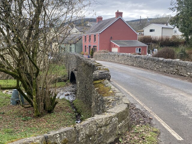
///gender.shrubbery.cobbles. Near Llansawel, Carmarthenshire

Related Wikis

Abergorlech

Abergorlech is a village 8 miles (13 km) to the north-west of Llandeilo in Carmarthenshire, Wales. It lies on the River Cothi on the B4310 road, between...

Talley Lakes

Upper Talley Lake (Welsh: Llyn Talyllychau Uchaf) and Lower Talley Lake (Welsh: Llyn Talyllychau Isaf) are two small lakes immediately north of the village...
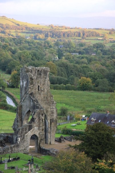
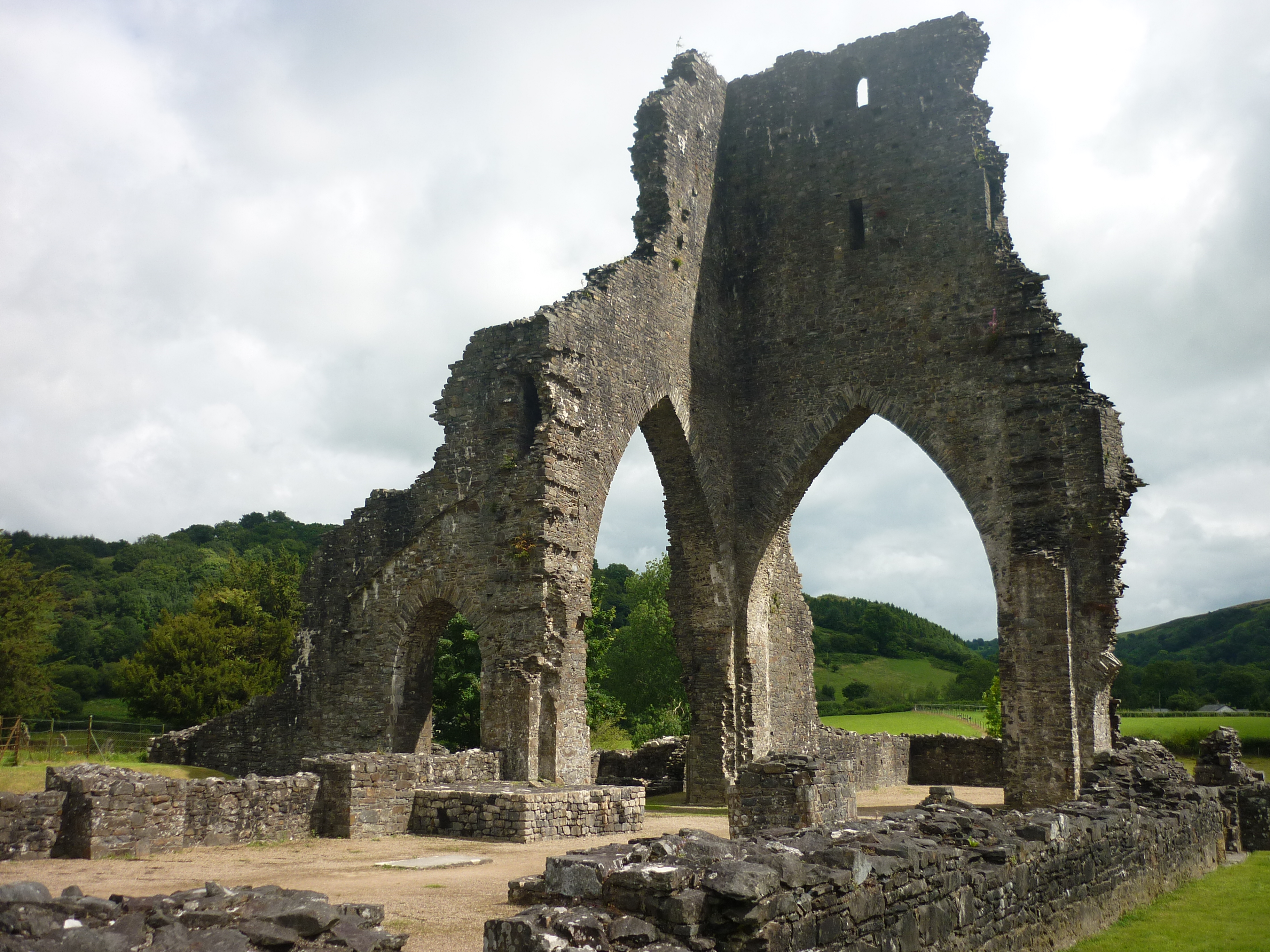
Talley Abbey

Talley Abbey (Welsh: Abaty Talyllychau) is a ruined former monastery of the Premonstratensians ("White Canons") in the village of Talley in Carmarthenshire...

Talley

Talley (Welsh: Talyllychau, historically Tal y Llychau) is a village and community in Carmarthenshire, Wales.The population taken at the 2011 census was...

Nearby Amenities

Located within 500m of 51.978492,-4.032699
Addr City: Talley
Addr Country: GB
Addr Housename: Cilwr Farm
Addr Postcode: SA19 7BQ
Lat/Long: 51.9758992/-4.0330176
The data included in this document is from www.openstreetmap.org. The data is made available under ODbL.

Have you been to Allt Cwm-seiri?

Leave your review of Allt Cwm-seiri below (or comments, questions and feedback).