Coed Cwm-gwlaw-isaf

Wood, Forest in Carmarthenshire

Wales

Coed Cwm-gwlaw-isaf

Llwyncelyn, Abergorlech Adfail o dy o'r enw Llwyncelyn yn Abergorlech / A ruined house known as Llwyncelyn (trans. 'hollybush') near Abergorlech
Llwyncelyn, Abergorlech Credit: Alan Richards

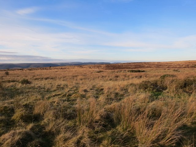
Coed Cwm-gwlaw-isaf is a captivating woodland located in the county of Carmarthenshire, Wales. With its lush greenery and tranquil atmosphere, it offers a serene escape from the hustle and bustle of everyday life.

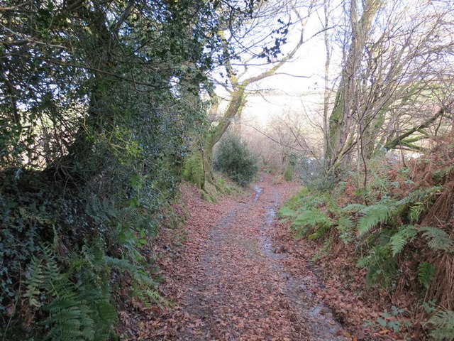
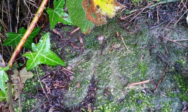
Covering an area of approximately 100 acres, this ancient woodland is a haven for nature enthusiasts and those seeking a peaceful retreat. The diverse range of trees found here includes oak, ash, beech, and birch, creating a rich tapestry of colors throughout the seasons. The woodland floor is adorned with an array of wildflowers, adding to its natural beauty.

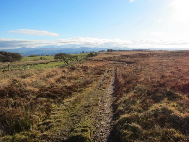
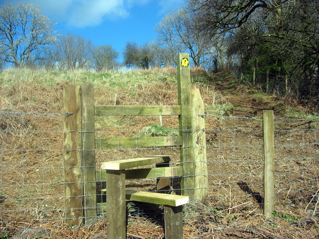
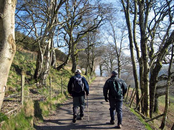
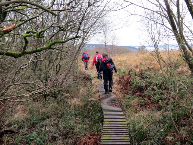
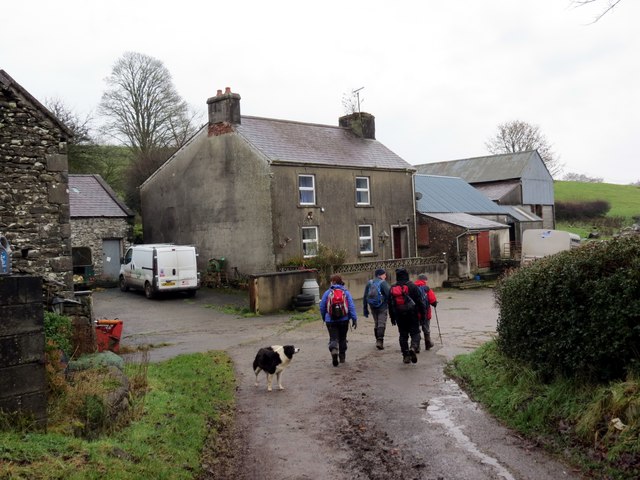
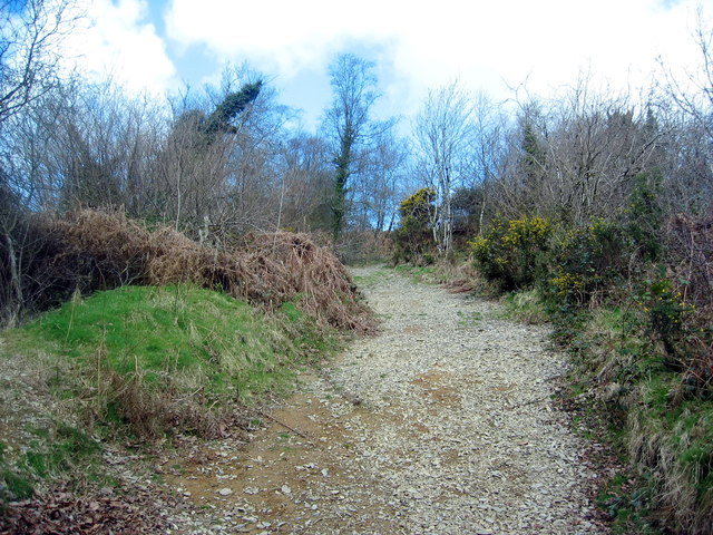
The woodland is crisscrossed with a network of footpaths and trails, allowing visitors to explore its hidden treasures. As you wander through the woodland, you may come across a babbling brook or a small waterfall, adding to the enchantment of the surroundings. Wildlife is abundant in Coed Cwm-gwlaw-isaf, with sightings of birds, butterflies, and small mammals being common.

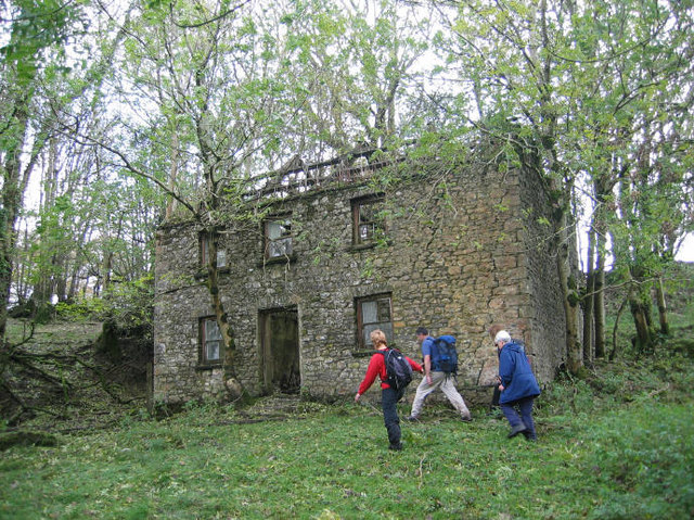
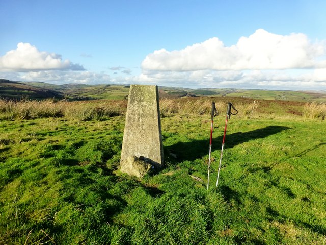
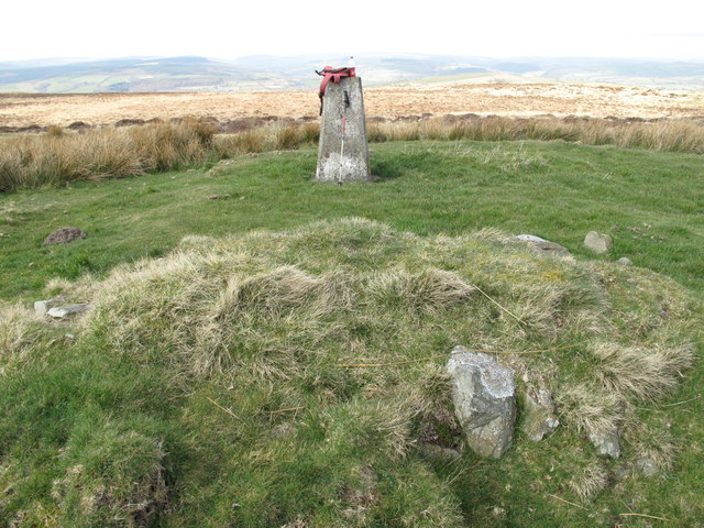
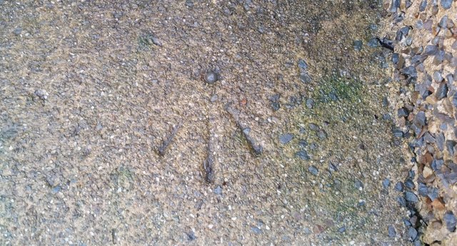
The woodland has a fascinating history, with evidence of human activity dating back thousands of years. Ancient burial mounds and the remains of a hillfort can still be found within its boundaries, providing a glimpse into the past.

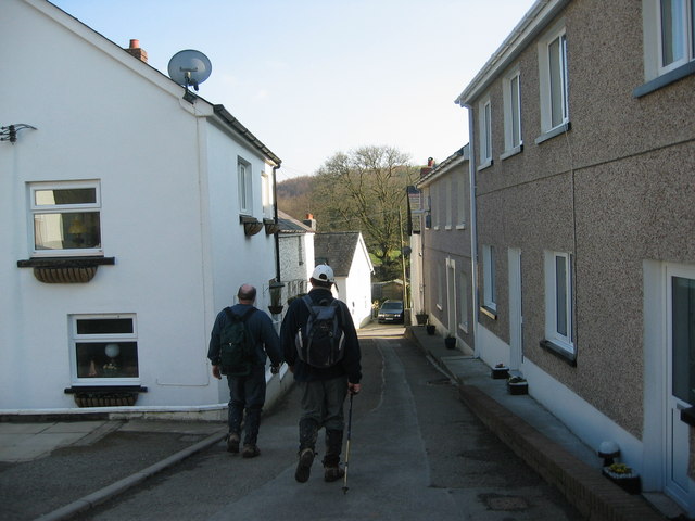
Coed Cwm-gwlaw-isaf is a popular destination for hikers, nature photographers, and families looking for a picnic spot. Its peaceful ambiance and natural beauty make it a true gem in the heart of Carmarthenshire.

If you have any feedback on the listing, please let us know in the comments section below.

Coed Cwm-gwlaw-isaf Images

Images are sourced within 2km of 51.980398/-4.0337609 or Grid Reference SN6033. Thanks to Geograph Open Source API. All images are credited.

Llwyncelyn, Abergorlech Adfail o dy o'r enw Llwyncelyn yn Abergorlech / A ruined house known as Llwyncelyn (trans. 'hollybush') near Abergorlech
Llwyncelyn, Abergorlech
Adfail o dy o'r enw Llwyncelyn yn Abergorlech / A ruined house known as Llwyncelyn (trans. 'hollybush') near Abergorlech
Abergorlech Cerddwyr yn cyrraedd pentre Abergorlech.

Walkers arriving at Abergorelch village.
Abergorlech
Cerddwyr yn cyrraedd pentre Abergorlech. Walkers arriving at Abergorelch village.
Mynydd Cynros Trac ar Fynydd Cynros yn mynd i gyfeiriad y de. Mae'n debygol taw ffurf wreiddiol 'cynros' oedd Cefn Rhos.  

Track on Mynydd Cynros going in a southernly direction. Probably, the original name of 'cynros' was Cefn Rhos (trans. Moor Ridge).
Mynydd Cynros
Trac ar Fynydd Cynros yn mynd i gyfeiriad y de. Mae'n debygol taw ffurf wreiddiol 'cynros' oedd Cefn Rhos. Track on Mynydd Cynros going in a southernly direction. Probably, the original name of 'cynros' was Cefn Rhos (trans. Moor Ridge).
Hen Heol Marchoglwyn Uchaf Old Road Hen heol ger Marchoglwyn Uchaf yn arwain i lawr y waered i gyfeiriad Nant Ffrainc a Ffarm Blaenwaun. 

Old road near Marchoglwyn Uchaf Farm descending the hill towards Nant Ffrainc Stream and Blaenwaun Farm
Hen Heol Marchoglwyn Uchaf Old Road
Hen heol ger Marchoglwyn Uchaf yn arwain i lawr y waered i gyfeiriad Nant Ffrainc a Ffarm Blaenwaun. Old road near Marchoglwyn Uchaf Farm descending the hill towards Nant Ffrainc Stream and Blaenwaun Farm
Mynydd Cynros Rhostir uwchben pentre Talyllychau /

Moorland above the village of Talley
Mynydd Cynros
Rhostir uwchben pentre Talyllychau / Moorland above the village of Talley
Banc Beili-Tew Started from track opposite Chapel Cemetery. Then grass - last 300-400m bracken but ways through and sheep grazing.

Name:Banc Beili-Tew
Hill number:5243
Height:278m / 912ft
Area:31C: South-West Wales
Class:Hu
Grid ref:SN 61606 34625
Summit feature:trig point: OS measurement
Drop:120m
Col:158m SN601350
Banc Beili-Tew
Started from track opposite Chapel Cemetery. Then grass - last 300-400m bracken but ways through and sheep grazing. Name:Banc Beili-Tew Hill number:5243 Height:278m / 912ft Area:31C: South-West Wales Class:Hu Grid ref:SN 61606 34625 Summit feature:trig point: OS measurement Drop:120m Col:158m SN601350
Mynydd Cynros Parked at Cilyllynfawr Farm and used right of way to reach the plantationon the east of the hill. Still dry and sunny for Mother's Day.
Name: Mynydd Cynros
Hill number: 2219
Height: 329m / 1079ft
Area: 31C: South-West Wales
Class: Ma
Grid ref: SN 62059 32690
Summit feature: ground within 3m of trig point
Drop: 221m
Col: 108m  SN633328
Mynydd Cynros
Parked at Cilyllynfawr Farm and used right of way to reach the plantationon the east of the hill. Still dry and sunny for Mother's Day. Name: Mynydd Cynros Hill number: 2219 Height: 329m / 1079ft Area: 31C: South-West Wales Class: Ma Grid ref: SN 62059 32690 Summit feature: ground within 3m of trig point Drop: 221m Col: 108m SN633328
Llwybr Blaen Cwm Stile Llwybr cyhoeddus yn dringo'r tyle i gyfeiriad pentre Llansawel.

A public footpath ascending the hill in the direction of Llansawel (trans. St Sawel's Church)
Llwybr Blaen Cwm Stile
Llwybr cyhoeddus yn dringo'r tyle i gyfeiriad pentre Llansawel. A public footpath ascending the hill in the direction of Llansawel (trans. St Sawel's Church)
Hen Heol Rhydodyn / Old Edwindsford Road Cerddwyr yn dilyn hen heol a gysylltai Abergorlech a Phlasty Rhydodyn.

Walkers following an old road which once linked Abergorlech with Edwnisford Mansion
Hen Heol Rhydodyn / Old Edwindsford Road
Cerddwyr yn dilyn hen heol a gysylltai Abergorlech a Phlasty Rhydodyn. Walkers following an old road which once linked Abergorlech with Edwnisford Mansion
Tuag at Lan / Towards Lan Cerddwyr yn dilyn llwybr estyll i gyfeiriad Ffarm y Lan. 

Walkers following a board walk in the direction of Lan Farm (trans. hill).
Tuag at Lan / Towards Lan
Cerddwyr yn dilyn llwybr estyll i gyfeiriad Ffarm y Lan. Walkers following a board walk in the direction of Lan Farm (trans. hill).
Blaenwaun Cerddwyr yn mynd heibio i Ffarm Blaenwaun. 

Walkers passing Blaenwaun Farm (trans. head of wet ground).
Blaenwaun
Cerddwyr yn mynd heibio i Ffarm Blaenwaun. Walkers passing Blaenwaun Farm (trans. head of wet ground).
Ordnance Survey Cut Mark This OS cut mark can be found on the milk stand at Cilyllynfawr Farm. It marks a point 134.623m above mean sea level.
Ordnance Survey Cut Mark
This OS cut mark can be found on the milk stand at Cilyllynfawr Farm. It marks a point 134.623m above mean sea level.
Ordnance Survey Rivet This OS rivet can be found on the Milk Stand at Cilwr Farm. It marks a point 134.623m above mean sea level.
Ordnance Survey Rivet
This OS rivet can be found on the Milk Stand at Cilwr Farm. It marks a point 134.623m above mean sea level.
Ordnance Survey Rivet This OS rivet can be found on the Milk Stand at Cwm-gwlaw-fawr Farm. It marks a point 180.838m above mean sea level.
Ordnance Survey Rivet
This OS rivet can be found on the Milk Stand at Cwm-gwlaw-fawr Farm. It marks a point 180.838m above mean sea level.
Llwybr Cyhoeddus i Lansawel / Path to Llansawel Llwybr cyhoeddus yn dringo'r tyle mas o Gwm Cothi ac yn mynd i gyfeiriad pentre Llansawel.

A public footpath climbing out of the Cothi Valley and heading in the direction of Llansawel (trans. church of St Sawel).
Llwybr Cyhoeddus i Lansawel / Path to Llansawel
Llwybr cyhoeddus yn dringo'r tyle mas o Gwm Cothi ac yn mynd i gyfeiriad pentre Llansawel. A public footpath climbing out of the Cothi Valley and heading in the direction of Llansawel (trans. church of St Sawel).
Llwybr yn gadael y cilffordd / Path exiting the byway Llwybr cyhoeddus ar y chwith yn gadael cilffordd yng nghwm Cothi. Yn y pellter gellir gweld talen bwthyn o'r enw Cwm.

A public footpath on the left exiting a byway in the Cothi valley. In the distance the gable end of a cottage known as Cwm can be seen.
Llwybr yn gadael y cilffordd / Path exiting the byway
Llwybr cyhoeddus ar y chwith yn gadael cilffordd yng nghwm Cothi. Yn y pellter gellir gweld talen bwthyn o'r enw Cwm. A public footpath on the left exiting a byway in the Cothi valley. In the distance the gable end of a cottage known as Cwm can be seen.
Llwybr uwchben Nant Ffrainc / Path above Nant Ffrainc Llwybr cyhoeddus yn mynd i lawr y waered i gyfeiriad Nant Ffrainc.

A public footpath descending towards Nant Ffrainc (trans. Ffrainc stream)
Llwybr uwchben Nant Ffrainc / Path above Nant Ffrainc
Llwybr cyhoeddus yn mynd i lawr y waered i gyfeiriad Nant Ffrainc. A public footpath descending towards Nant Ffrainc (trans. Ffrainc stream)
Heol ar bwys Tre-glôg / A road by near Tre-glôg Heol fach ar bwys anhedd-dy o'r enw Tre-glôg yn mynd i gyfeiriad y B4310.

A minor road near a property known as Tre-glôg (trans. settlement of the ?rock) heading towards the B4310.
Heol ar bwys Tre-glôg / A road by near Tre-glôg
Heol fach ar bwys anhedd-dy o'r enw Tre-glôg yn mynd i gyfeiriad y B4310. A minor road near a property known as Tre-glôg (trans. settlement of the ?rock) heading towards the B4310.
Show me another place!

Coed Cwm-gwlaw-isaf is located at Grid Ref: SN6033 (Lat: 51.980398, Lng: -4.0337609)

Unitary Authority: Carmarthenshire

Police Authority: Dyfed Powys

What 3 Words

///relaxed.cobble.users. Near Llansawel, Carmarthenshire

Related Wikis

Abergorlech

Abergorlech is a village 8 miles (13 km) to the north-west of Llandeilo in Carmarthenshire, Wales. It lies on the River Cothi on the B4310 road, between...

Talley Lakes

Upper Talley Lake (Welsh: Llyn Talyllychau Uchaf) and Lower Talley Lake (Welsh: Llyn Talyllychau Isaf) are two small lakes immediately north of the village...

Talley Abbey

Talley Abbey (Welsh: Abaty Talyllychau) is a ruined former monastery of the Premonstratensians ("White Canons") in the village of Talley in Carmarthenshire...

Talley

Talley (Welsh: Talyllychau, historically Tal y Llychau) is a village and community in Carmarthenshire, Wales.The population taken at the 2011 census was...

Edwinsford

Edwinsford is a small hamlet situated about the historic Edwinsford Estate and fishery on the river Cothi, a tributary of the River Tywi, in Carmarthenshire...

Llansawel

Llansawel is a village and community in Carmarthenshire, Wales, about ten miles north of Llandeilo. It covers an area of 4,079 hectares (15.75 sq mi)....

Talley transmitting station

The Talley television relay station is sited on high ground to the north of the village of Talley in Carmarthenshire. It was originally built in 1986 as...

Llansawel transmitting station

The Llansawel television relay station is sited on high ground to the north of the village of Llansawel in Carmarthenshire, South Wales. It was originally...

Have you been to Coed Cwm-gwlaw-isaf?

Leave your review of Coed Cwm-gwlaw-isaf below (or comments, questions and feedback).