Allt Cefnllwynpiod

Wood, Forest in Cardiganshire

Wales

Allt Cefnllwynpiod

Old railway overbridge A farm crossing over the trackbed of the long closed Aberystwyth to Carmarthen railway line. The track also forms a right of way but you will need to don your waders to cross Afon Ystwyth a short distance ahead.
Old railway overbridge Credit: John Lucas

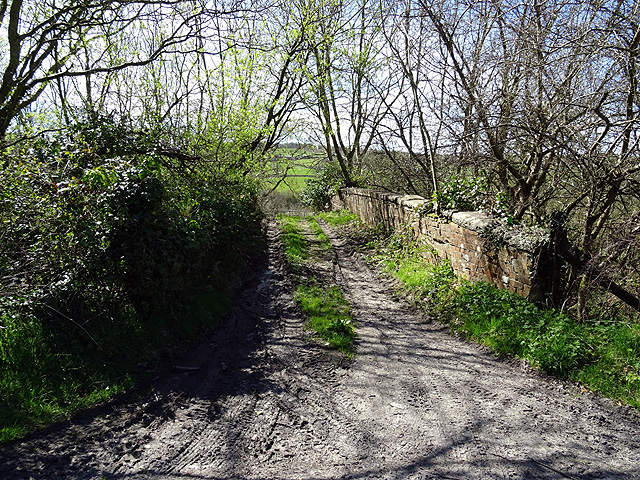
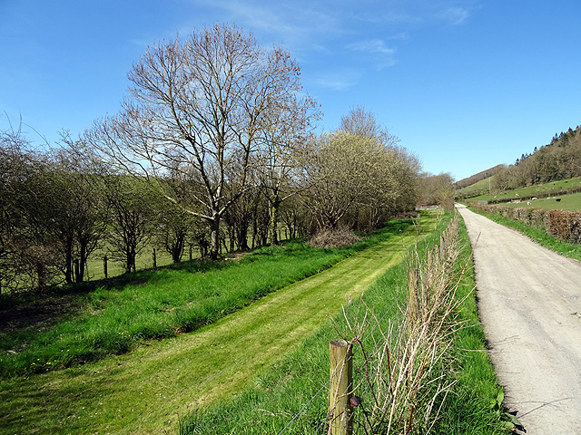
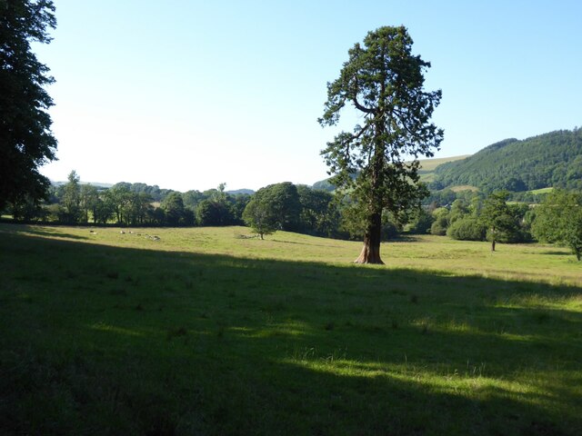
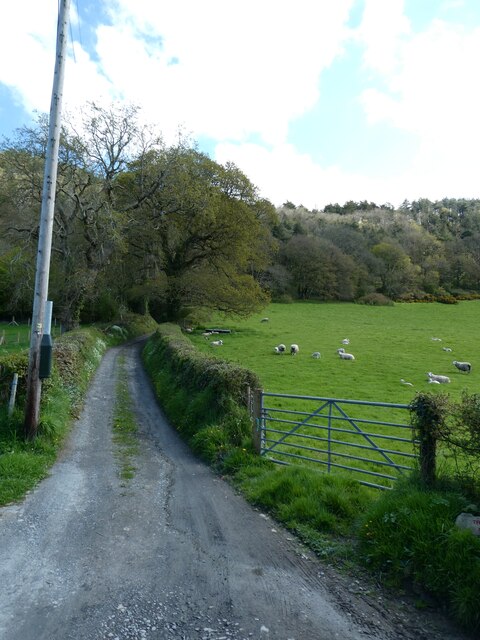
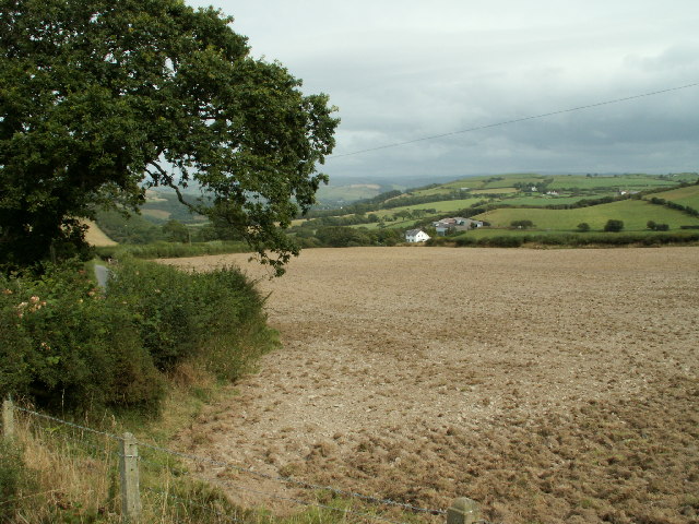
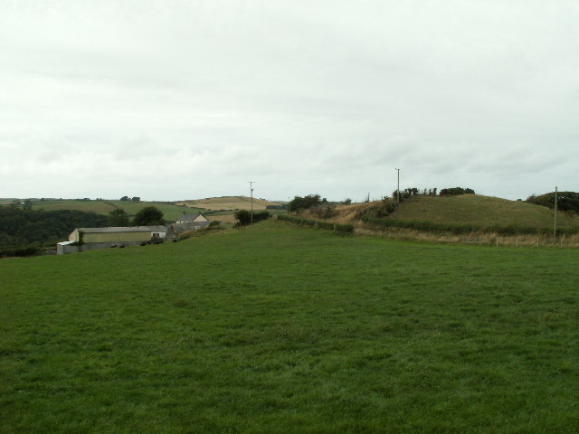
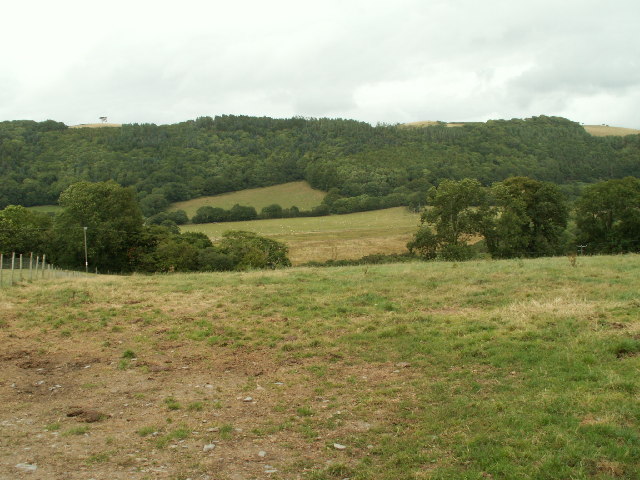
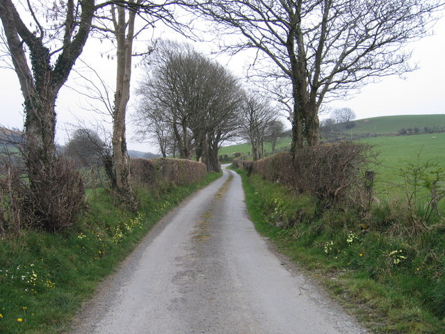
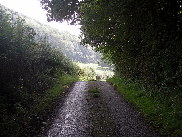
Allt Cefnllwynpiod is a beautiful wooded area located in Cardiganshire, Wales. Covering an area of approximately 100 acres, it is known for its dense and diverse forest that is home to a wide variety of flora and fauna.

The woodland is predominantly composed of native tree species such as oak, beech, and birch, creating a rich and vibrant habitat. The canopy of the forest provides shelter and nesting sites for numerous bird species including woodpeckers, owls, and songbirds.

The forest floor is adorned with a colourful display of wildflowers during the spring and summer months, including bluebells, primroses, and foxgloves. This creates a picturesque setting and attracts a range of insects and butterflies.

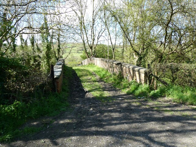
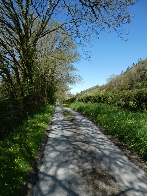
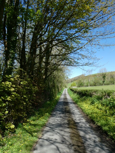
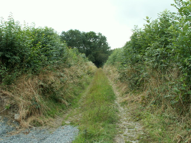
Allt Cefnllwynpiod is crisscrossed by several walking trails, allowing visitors to explore the natural beauty of the area. These trails offer stunning views of the surrounding countryside and provide opportunities for birdwatching and wildlife spotting.

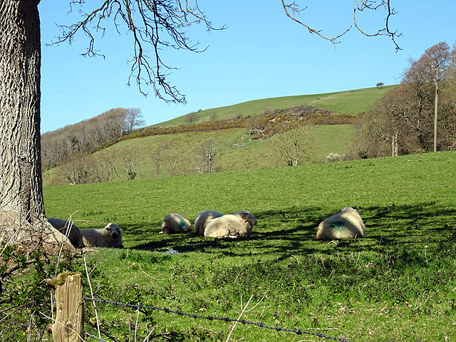
The woodland is also home to a small population of deer, which can occasionally be spotted grazing in the clearings. This adds to the charm and tranquillity of the area, making it a popular destination for nature lovers and outdoor enthusiasts.

Overall, Allt Cefnllwynpiod is a haven of biodiversity, offering a peaceful escape from the hustle and bustle of everyday life. Whether you are seeking a leisurely stroll or a chance to immerse yourself in nature, this woodland is a must-visit destination in Cardiganshire.

If you have any feedback on the listing, please let us know in the comments section below.

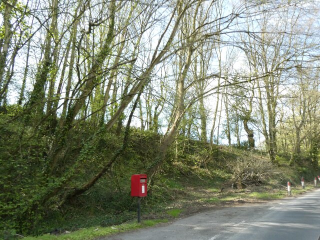
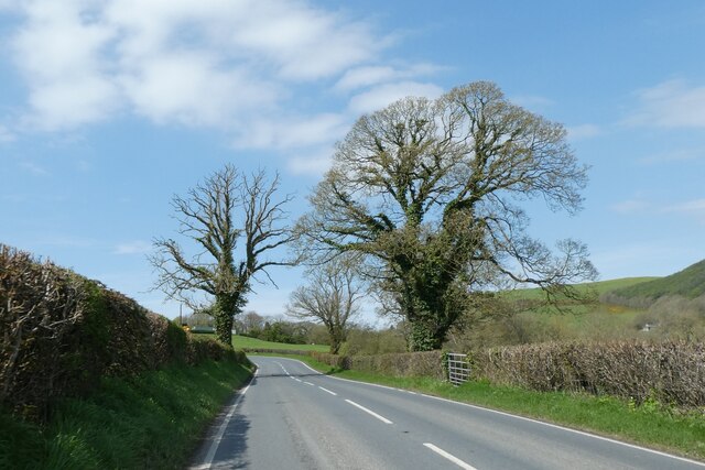
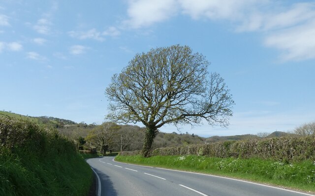
Allt Cefnllwynpiod Images

Images are sourced within 2km of 52.358987/-4.0510767 or Grid Reference SN6075. Thanks to Geograph Open Source API. All images are credited.

Old railway overbridge A farm crossing over the trackbed of the long closed Aberystwyth to Carmarthen railway line. The track also forms a right of way but you will need to don your waders to cross Afon Ystwyth a short distance ahead.
Old railway overbridge
A farm crossing over the trackbed of the long closed Aberystwyth to Carmarthen railway line. The track also forms a right of way but you will need to don your waders to cross Afon Ystwyth a short distance ahead.
The Ystwyth Trail The Ystwyth Trail runs along the paved road here as it heads towards Llanfarian. The trackbed of the old Carmarthen to Aberystwyth railway runs to the left of the mown strip seen here.
The Ystwyth Trail
The Ystwyth Trail runs along the paved road here as it heads towards Llanfarian. The trackbed of the old Carmarthen to Aberystwyth railway runs to the left of the mown strip seen here.
Shade from the sun Sheep shelter from the April sunshine at Tyllwyd Farm.
Shade from the sun
Sheep shelter from the April sunshine at Tyllwyd Farm.
Abermad House Abermad House is a nursing care home in the Ystwyth valley  For more information see: <a href="https://www.geograph.org.uk/photo/4516251">SN6076 : Abermad House</a>
Abermad House
Abermad House is a nursing care home in the Ystwyth valley For more information see: SN6076 : Abermad House
Parkland in the Ystwyth valley Tree in parkland in Ystwyth valley.
Parkland in the Ystwyth valley
Tree in parkland in Ystwyth valley.
Bridge over former railway, near Tynrhelyg This track leads to the river and the site of a ford
Bridge over former railway, near Tynrhelyg
This track leads to the river and the site of a ford
Cycle route (NCN81) near Tynrhelyg towards Llanfarian
Cycle route to Llanfarian (NCN81)
Track to Cwm Cati
Track to Cwm Cati
Pull-off for postbox near Glanmad
Trees by A485
Trees by A485
Wildflowers on the verge, by the A485
Ploughed farmland Recently ploughed farmland to the east of Blaenplwyf
Ploughed farmland
Recently ploughed farmland to the east of Blaenplwyf
Farmland, Ochrgader Pasture looking towards Ochrgader farm
Farmland, Ochrgader
Pasture looking towards Ochrgader farm
Trackway, Cwm Perlla Old lane with high hedges on either side
Trackway, Cwm Perlla
Old lane with high hedges on either side
Farmland, Ystywth valley Rough pasture running down to the valley of the Ystwyth SE of Llanfarian. The woodland opposite is on the far side of the river.
Farmland, Ystywth valley
Rough pasture running down to the valley of the Ystwyth SE of Llanfarian. The woodland opposite is on the far side of the river.
Lon Wledig rhwng Llanilar a Llangwyryfon / Country Lane between Llanilar and Llangwyryfon Lon Wledig rhwng Llanilar a Llangwyryfon gyda briallu a bob ochr / Country Lane between Llanilar and Llangwyryfon with primroses on both sides
Lon Wledig rhwng Llanilar a Llangwyryfon / Country Lane between Llanilar and Llangwyryfon
Lon Wledig rhwng Llanilar a Llangwyryfon gyda briallu a bob ochr / Country Lane between Llanilar and Llangwyryfon with primroses on both sides
Track to Craig-y-bwch (NCR 81/82)
Show me another place!

Allt Cefnllwynpiod is located at Grid Ref: SN6075 (Lat: 52.358987, Lng: -4.0510767)

Unitary Authority: Ceredigion

Police Authority: Dyfed Powys

What 3 Words

///mimed.cries.give. Near Llanilar, Ceredigion

Nearby Locations

Allt Cefnllwynpiod

Related Wikis

Ystwyth Trail

The Ystwyth Trail is a 21-mile (34 km) multi-use rail trail linking Aberystwyth, Llanfarian, Ystrad Meurig and Tregaron in Ceredigion, Wales. Cycling and...

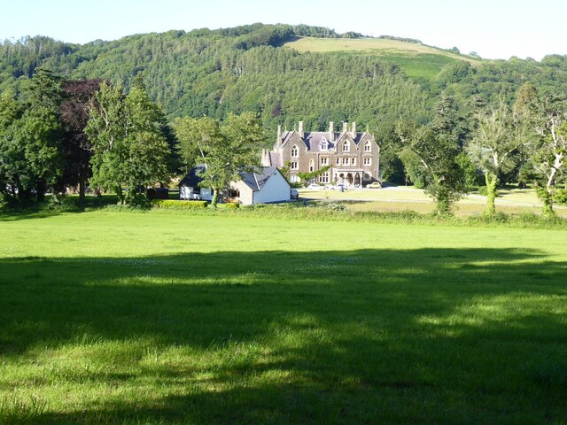
Castle Hill, Ceredigion

Castle Hill is an area and country estate in the community of Llanilar, Ceredigion, Wales, which is 70.2 miles (112.9 km) from Cardiff and 175.8 miles...

Llanilar railway station

Llanilar railway station was on the Carmarthen to Aberystwyth Line (originally called the Manchester and Milford Railway before being transferred to the...

Llanilar

Llanilar is a village and community in Ceredigion, Wales, about 4 kilometres (2.5 mi) southeast of Aberystwyth. It is the eponym of the hundred of Ilar...

Llanfarian

Llanfarian is a village, electoral ward and community in the district county of Ceredigion, Mid-Wales, south of the administrative centre Aberystwyth....

Chancery, Ceredigion

Chancery (Welsh: Rhydgaled) is a hamlet in Llanfarian community, in the district county of Ceredigion, Mid-Wales, south of the administrative centre Aberystwyth...

Blaenplwyf

Blaenplwyf (Pontllanio previously) is a village in Ceredigion, to the southwest of Aberystwyth. It is noted for the Blaenplwyf transmitting station, which...

Llanrhystyd Road railway station

Llanrhystyd Road railway station was located on the Carmarthen to Aberystwyth Line, originally called the Manchester and Milford Railway, before being...

Nearby Amenities

Located within 500m of 52.358987,-4.0510767
Source: npe
Lat/Long: 52.3613911/-4.0460632
Source: npe
Lat/Long: 52.3598943/-4.0440134
Power: tower
Lat/Long: 52.3593726/-4.0439881
Power: tower
Lat/Long: 52.3563978/-4.0486015
Power: tower
Lat/Long: 52.3554116/-4.0505702
Power: tower
Lat/Long: 52.3545008/-4.0511335
Power: tower
Lat/Long: 52.3579147/-4.0455813
Power: pole
Source: bing
Lat/Long: 52.3567417/-4.0497387
Power: pole
Source: bing
Lat/Long: 52.3564698/-4.0501517
Power: pole
Source: bing
Lat/Long: 52.3575641/-4.0485746
Power: pole
Source: bing
Lat/Long: 52.3609581/-4.0467882
Power: pole
Source: bing
Lat/Long: 52.3612365/-4.0467936
Power: pole
Source: bing
Lat/Long: 52.3556737/-4.0502805
Power: pole
Source: bing
Lat/Long: 52.3582717/-4.0481991
Power: pole
Source: bing
Lat/Long: 52.3613381/-4.0469116
Power: pole
Source: bing
Lat/Long: 52.3553459/-4.0501222
Power: pole
Source: bing
Lat/Long: 52.3592808/-4.0476626
Power: pole
Source: bing
Lat/Long: 52.3602309/-4.0471745
Power: pole
Source: bing
Lat/Long: 52.3615425/-4.0471539
Power: pole
Lat/Long: 52.3617211/-4.0470225
Power: pole
Source: bing
Lat/Long: 52.3629743/-4.0490789
Power: pole
Lat/Long: 52.3627237/-4.0473516
Power: pole
Source: bing
Lat/Long: 52.3622128/-4.0480544
Place: farm
Lat/Long: 52.3579143/-4.0516529
The data included in this document is from www.openstreetmap.org. The data is made available under ODbL.

Have you been to Allt Cefnllwynpiod?

Leave your review of Allt Cefnllwynpiod below (or comments, questions and feedback).