Allt Rhwng-ddeugoed

Wood, Forest in Carmarthenshire

Wales

Allt Rhwng-ddeugoed

Llwyncelyn, Abergorlech Adfail o dy o'r enw Llwyncelyn yn Abergorlech / A ruined house known as Llwyncelyn (trans. 'hollybush') near Abergorlech
Llwyncelyn, Abergorlech Credit: Alan Richards

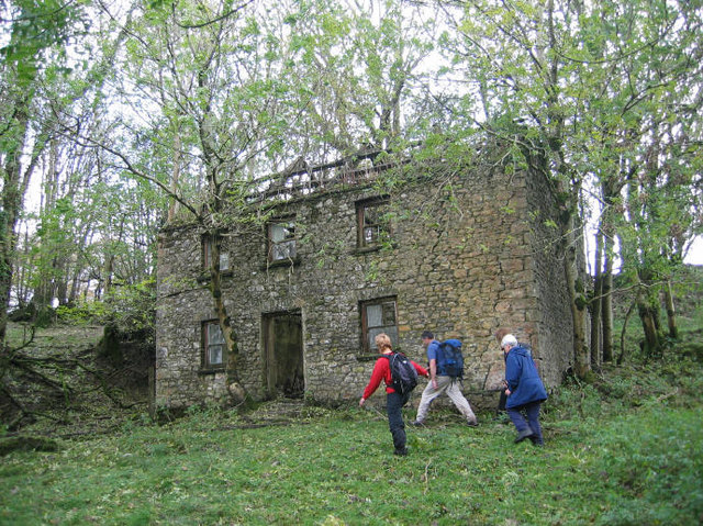
Allt Rhwng-ddeugoed, located in Carmarthenshire, Wales, is a picturesque woodland area that offers a tranquil retreat for nature lovers and outdoor enthusiasts. Covering an area of approximately 50 acres, Allt Rhwng-ddeugoed is a diverse forest with a rich variety of flora and fauna.

The woodland consists of a mixture of deciduous and coniferous trees, including oak, beech, pine, and fir. These trees create a dense canopy that provides shade and shelter for a range of wildlife species. Visitors can expect to see a variety of bird species, such as woodpeckers, owls, and finches, as well as small mammals like squirrels and badgers.

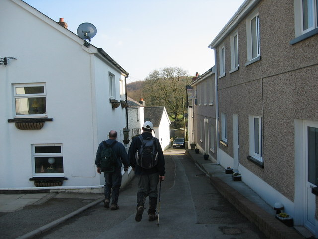
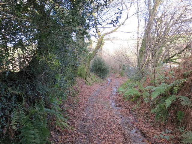
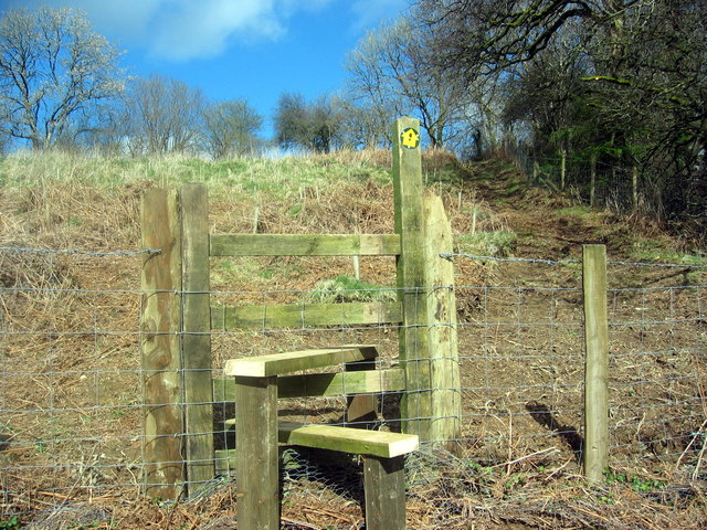
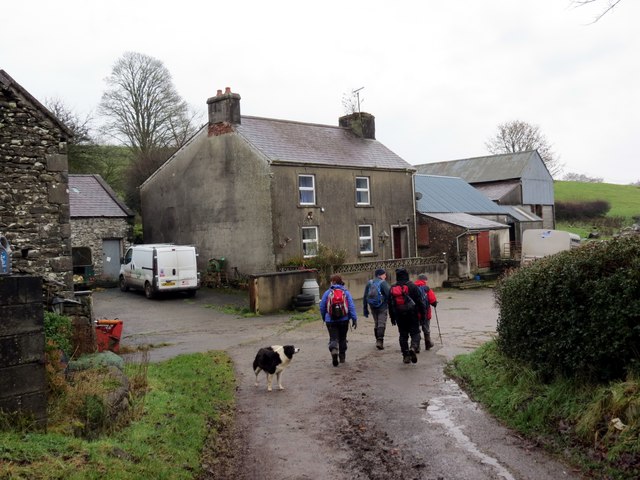
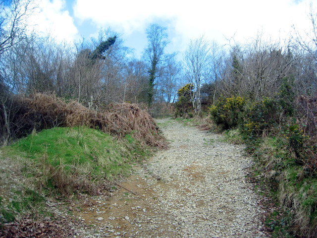
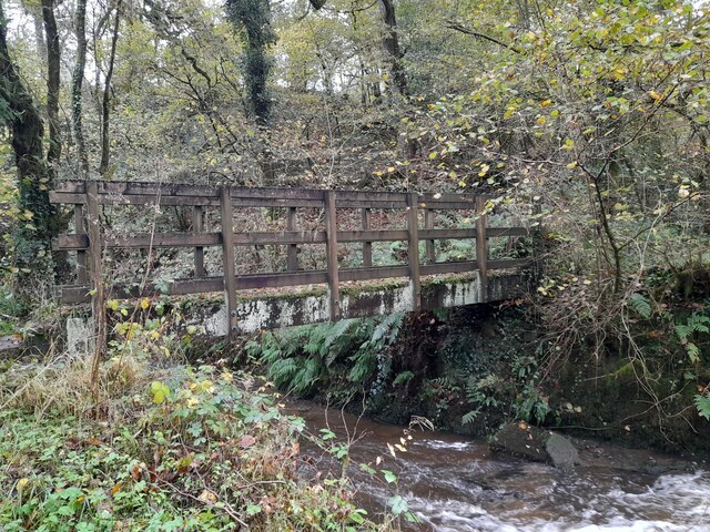
The forest is crisscrossed with a network of well-maintained footpaths and trails, allowing visitors to explore the area at their own pace. These paths lead through enchanting woodland, past babbling brooks and small waterfalls, and up to breathtaking viewpoints that offer stunning vistas of the surrounding countryside.

Allt Rhwng-ddeugoed is particularly popular among hikers and nature photographers, who are drawn to the area's natural beauty and diverse wildlife. It also serves as an educational resource for schools and nature conservation groups, providing an opportunity for hands-on learning about woodland ecosystems.

The woodland is open to the public year-round, with no admission fees. Visitors are encouraged to respect the environment and adhere to designated trails to minimize their impact on the delicate ecosystem. Allt Rhwng-ddeugoed is a true gem of Carmarthenshire, offering a peaceful and rejuvenating experience for all who venture into its leafy embrace.

If you have any feedback on the listing, please let us know in the comments section below.

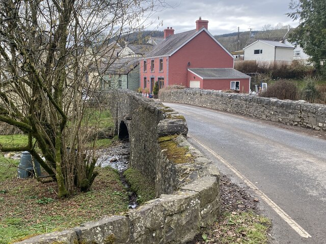
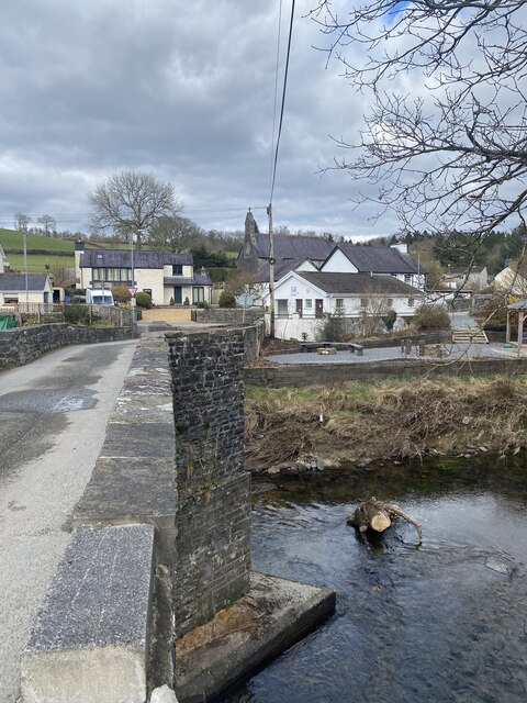
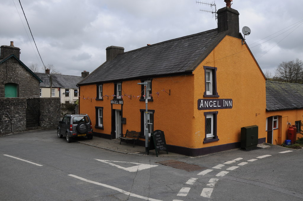
Allt Rhwng-ddeugoed Images

Images are sourced within 2km of 51.980359/-4.0453214 or Grid Reference SN5933. Thanks to Geograph Open Source API. All images are credited.

Llwyncelyn, Abergorlech Adfail o dy o'r enw Llwyncelyn yn Abergorlech / A ruined house known as Llwyncelyn (trans. 'hollybush') near Abergorlech
Llwyncelyn, Abergorlech
Adfail o dy o'r enw Llwyncelyn yn Abergorlech / A ruined house known as Llwyncelyn (trans. 'hollybush') near Abergorlech
Abergorlech Cerddwyr yn cyrraedd pentre Abergorlech.

Walkers arriving at Abergorelch village.
Abergorlech
Cerddwyr yn cyrraedd pentre Abergorlech. Walkers arriving at Abergorelch village.
Bank of Trees above the Gorlech At the confluence of Nant Llewele and the Gorlech
Bank of Trees above the Gorlech
At the confluence of Nant Llewele and the Gorlech
Hen Heol Marchoglwyn Uchaf Old Road Hen heol ger Marchoglwyn Uchaf yn arwain i lawr y waered i gyfeiriad Nant Ffrainc a Ffarm Blaenwaun. 

Old road near Marchoglwyn Uchaf Farm descending the hill towards Nant Ffrainc Stream and Blaenwaun Farm
Hen Heol Marchoglwyn Uchaf Old Road
Hen heol ger Marchoglwyn Uchaf yn arwain i lawr y waered i gyfeiriad Nant Ffrainc a Ffarm Blaenwaun. Old road near Marchoglwyn Uchaf Farm descending the hill towards Nant Ffrainc Stream and Blaenwaun Farm
Llwybr Blaen Cwm Stile Llwybr cyhoeddus yn dringo'r tyle i gyfeiriad pentre Llansawel.

A public footpath ascending the hill in the direction of Llansawel (trans. St Sawel's Church)
Llwybr Blaen Cwm Stile
Llwybr cyhoeddus yn dringo'r tyle i gyfeiriad pentre Llansawel. A public footpath ascending the hill in the direction of Llansawel (trans. St Sawel's Church)
Blaenwaun Cerddwyr yn mynd heibio i Ffarm Blaenwaun. 

Walkers passing Blaenwaun Farm (trans. head of wet ground).
Blaenwaun
Cerddwyr yn mynd heibio i Ffarm Blaenwaun. Walkers passing Blaenwaun Farm (trans. head of wet ground).
Ordnance Survey Rivet This OS rivet can be found on the Milk Stand at Cilwr Farm. It marks a point 134.623m above mean sea level.
Ordnance Survey Rivet
This OS rivet can be found on the Milk Stand at Cilwr Farm. It marks a point 134.623m above mean sea level.
Llwybr Cyhoeddus i Lansawel / Path to Llansawel Llwybr cyhoeddus yn dringo'r tyle mas o Gwm Cothi ac yn mynd i gyfeiriad pentre Llansawel.

A public footpath climbing out of the Cothi Valley and heading in the direction of Llansawel (trans. church of St Sawel).
Llwybr Cyhoeddus i Lansawel / Path to Llansawel
Llwybr cyhoeddus yn dringo'r tyle mas o Gwm Cothi ac yn mynd i gyfeiriad pentre Llansawel. A public footpath climbing out of the Cothi Valley and heading in the direction of Llansawel (trans. church of St Sawel).
Llwybr yn gadael y cilffordd / Path exiting the byway Llwybr cyhoeddus ar y chwith yn gadael cilffordd yng nghwm Cothi. Yn y pellter gellir gweld talen bwthyn o'r enw Cwm.

A public footpath on the left exiting a byway in the Cothi valley. In the distance the gable end of a cottage known as Cwm can be seen.
Llwybr yn gadael y cilffordd / Path exiting the byway
Llwybr cyhoeddus ar y chwith yn gadael cilffordd yng nghwm Cothi. Yn y pellter gellir gweld talen bwthyn o'r enw Cwm. A public footpath on the left exiting a byway in the Cothi valley. In the distance the gable end of a cottage known as Cwm can be seen.
Llwybr uwchben Nant Ffrainc / Path above Nant Ffrainc Llwybr cyhoeddus yn mynd i lawr y waered i gyfeiriad Nant Ffrainc.

A public footpath descending towards Nant Ffrainc (trans. Ffrainc stream)
Llwybr uwchben Nant Ffrainc / Path above Nant Ffrainc
Llwybr cyhoeddus yn mynd i lawr y waered i gyfeiriad Nant Ffrainc. A public footpath descending towards Nant Ffrainc (trans. Ffrainc stream)
Heol ar bwys Tre-glôg / A road by near Tre-glôg Heol fach ar bwys anhedd-dy o'r enw Tre-glôg yn mynd i gyfeiriad y B4310.

A minor road near a property known as Tre-glôg (trans. settlement of the ?rock) heading towards the B4310.
Heol ar bwys Tre-glôg / A road by near Tre-glôg
Heol fach ar bwys anhedd-dy o'r enw Tre-glôg yn mynd i gyfeiriad y B4310. A minor road near a property known as Tre-glôg (trans. settlement of the ?rock) heading towards the B4310.
Foot Bridge
Foot Bridge
Track junction at Treglog
Farm track junction with B4310
Track across farmland above Abergorlech
Road towards Abergorlech
Pont Gorlech, Abergorlech
Pont Cothi Bridge over Afon Cothi, Abergorlech.
Pont Cothi
Bridge over Afon Cothi, Abergorlech.
Show me another place!

Allt Rhwng-ddeugoed is located at Grid Ref: SN5933 (Lat: 51.980359, Lng: -4.0453214)

Unitary Authority: Carmarthenshire

Police Authority: Dyfed Powys

What 3 Words

///impulses.hoped.spurted. Near Llansawel, Carmarthenshire

Related Wikis

Abergorlech

Abergorlech is a village 8 miles (13 km) to the north-west of Llandeilo in Carmarthenshire, Wales. It lies on the River Cothi on the B4310 road, between...

Talley Lakes

Upper Talley Lake (Welsh: Llyn Talyllychau Uchaf) and Lower Talley Lake (Welsh: Llyn Talyllychau Isaf) are two small lakes immediately north of the village...
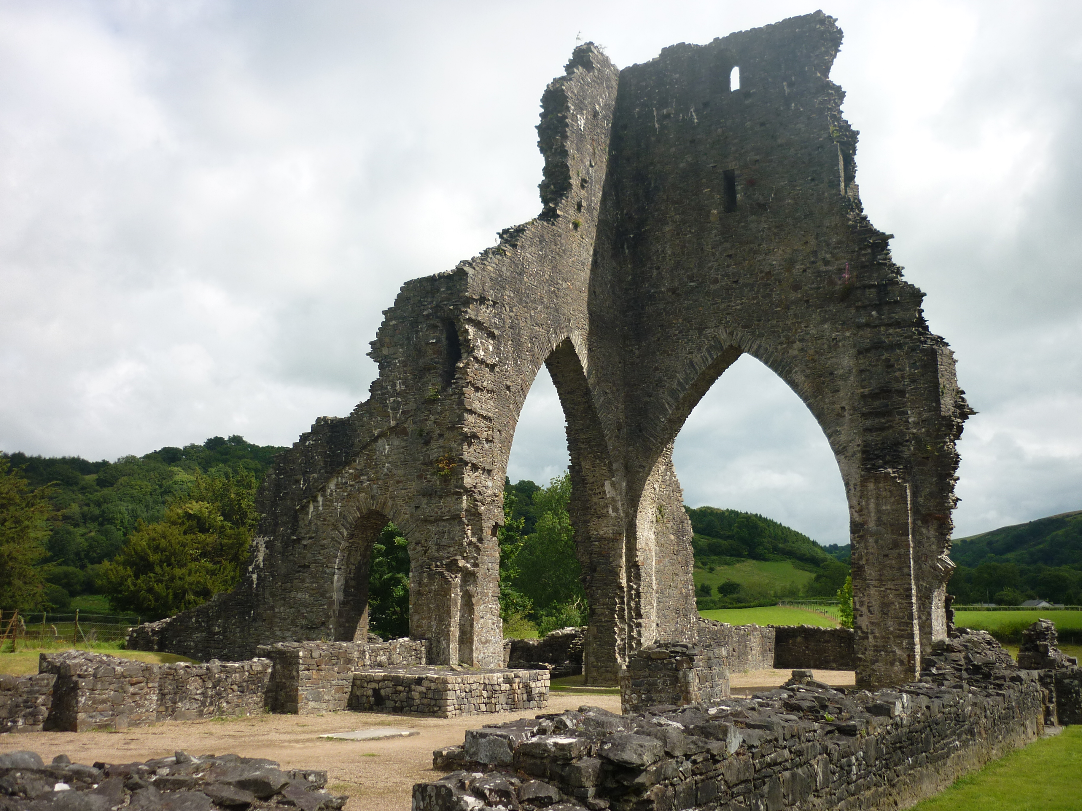
Talley Abbey

Talley Abbey (Welsh: Abaty Talyllychau) is a ruined former monastery of the Premonstratensians ("White Canons") in the village of Talley in Carmarthenshire...

Talley

Talley (Welsh: Talyllychau, historically Tal y Llychau) is a village and community in Carmarthenshire, Wales.The population taken at the 2011 census was...

Edwinsford

Edwinsford is a small hamlet situated about the historic Edwinsford Estate and fishery on the river Cothi, a tributary of the River Tywi, in Carmarthenshire...

Llansawel

Llansawel is a village and community in Carmarthenshire, Wales, about ten miles north of Llandeilo. It covers an area of 4,079 hectares (15.75 sq mi)....

Llansawel transmitting station

The Llansawel television relay station is sited on high ground to the north of the village of Llansawel in Carmarthenshire, South Wales. It was originally...

Talley transmitting station

The Talley television relay station is sited on high ground to the north of the village of Talley in Carmarthenshire. It was originally built in 1986 as...

Have you been to Allt Rhwng-ddeugoed?

Leave your review of Allt Rhwng-ddeugoed below (or comments, questions and feedback).