Burnham Overy Town

Settlement in Norfolk King's Lynn and West Norfolk

England

Burnham Overy Town

In All Saints Graveyard This gravestone marks the burial site of Martha and Mary Moxon, daughter and mother. Martha died in 1780, age 20 years, with Mary living until 1793 and 70 years of age. The stone records the two people side by side.
Carved across the top are a shining urn and two cherubs, which might be winged souls indicating the rise of the deceased to Heaven.
In All Saints Graveyard Credit: Mary and Angus Hogg

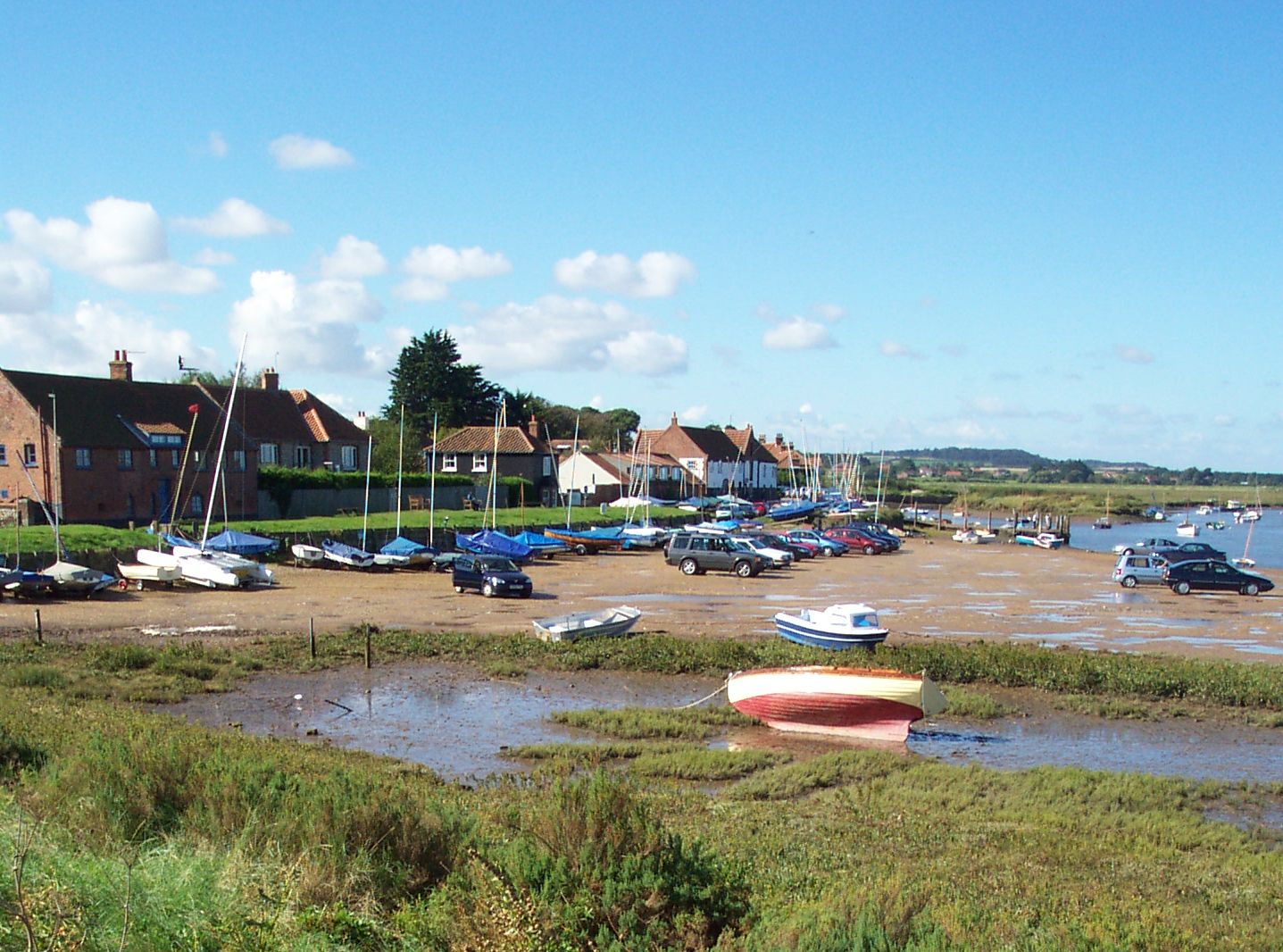
Burnham Overy Town is a small village located on the north coast of Norfolk, England. Situated within the larger Burnham Overy civil parish, it is surrounded by picturesque countryside and offers a charming rural setting. The village is positioned near the mouth of the River Burn, which flows into the nearby Brancaster Bay.

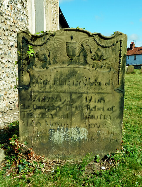
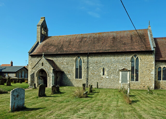
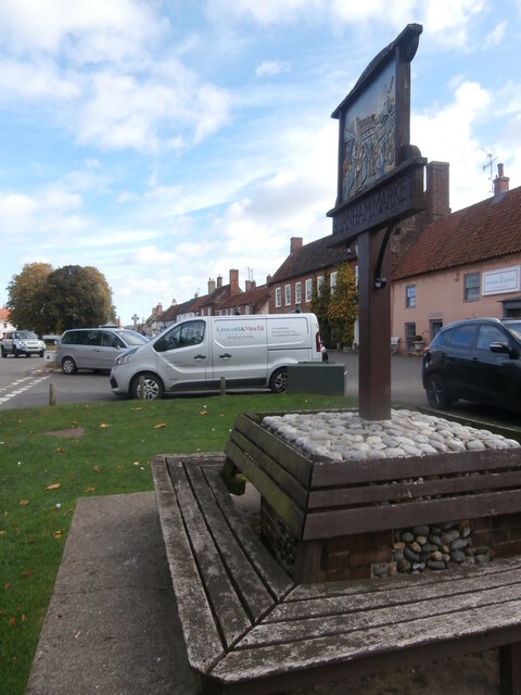
With a population of around 300 residents, Burnham Overy Town retains a close-knit community atmosphere. The village is known for its historic buildings, including a 14th-century church dedicated to St. Clement. This architectural gem features a striking tower and stained glass windows, showcasing the area's rich heritage.

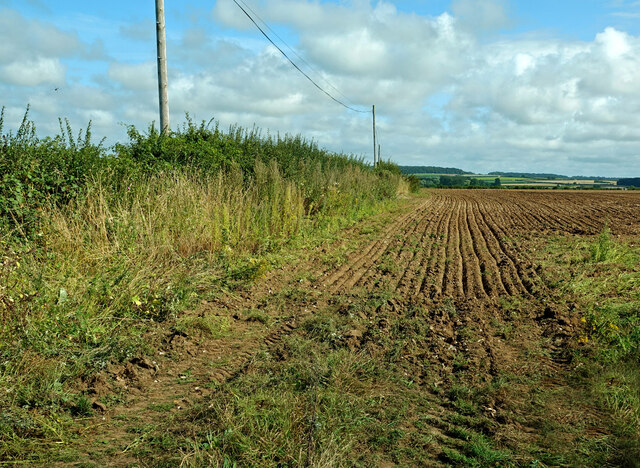
Nature enthusiasts are drawn to Burnham Overy Town due to its proximity to the North Norfolk Coast Area of Outstanding Natural Beauty. The village serves as an excellent base for exploring the surrounding landscapes, which feature salt marshes, sand dunes, and pristine beaches. The nearby Holkham National Nature Reserve is a haven for birdwatchers, boasting a diverse range of species such as avocets and pink-footed geese.

Visitors can also enjoy outdoor activities like walking, cycling, and horse riding along the numerous trails that crisscross the area. The village itself offers a few amenities, including a village hall and a quaint pub serving traditional English fare.

Overall, Burnham Overy Town presents a peaceful retreat for those seeking a tranquil escape amidst Norfolk's stunning natural beauty.

If you have any feedback on the listing, please let us know in the comments section below.

Burnham Overy Town Images

Images are sourced within 2km of 52.951589/0.740904 or Grid Reference TF8442. Thanks to Geograph Open Source API. All images are credited.

In All Saints Graveyard This gravestone marks the burial site of Martha and Mary Moxon, daughter and mother. Martha died in 1780, age 20 years, with Mary living until 1793 and 70 years of age. The stone records the two people side by side.
Carved across the top are a shining urn and two cherubs, which might be winged souls indicating the rise of the deceased to Heaven.
In All Saints Graveyard
This gravestone marks the burial site of Martha and Mary Moxon, daughter and mother. Martha died in 1780, age 20 years, with Mary living until 1793 and 70 years of age. The stone records the two people side by side. Carved across the top are a shining urn and two cherubs, which might be winged souls indicating the rise of the deceased to Heaven.
All Saints Church, Burnham Sutton cum Ulph During the 18th century the Reverend Nelson, father of Horatio, advised that the parish could no longer maintain its two churches. This resulted in Burnham Sutton church being demolished and the two congregations being amalgamated using the All Saints building.
All Saints Church, Burnham Sutton cum Ulph
During the 18th century the Reverend Nelson, father of Horatio, advised that the parish could no longer maintain its two churches. This resulted in Burnham Sutton church being demolished and the two congregations being amalgamated using the All Saints building.
Beacon Hill Road Viewed at the junction with Creake Road.
Beacon Hill Road
Viewed at the junction with Creake Road.
St Ethelbert’s Church ruins <a href="https://www.geograph.org.uk/photo/2047694">TF8341 : The ruins of St Ethelbert's church in Burnham Sutton</a> gives useful information about this site. The church was dedicated to St Ethelbert, an 8th century king of East Anglia.
St Ethelbert’s Church ruins
TF8341 : The ruins of St Ethelbert's church in Burnham Sutton gives useful information about this site. The church was dedicated to St Ethelbert, an 8th century king of East Anglia.
Fields near Burnham Market Already harvested and re-ploughed for the next crop.
Fields near Burnham Market
Already harvested and re-ploughed for the next crop.
Lowes Lane A summer view of Lowes Lane which continues to connect with Mill Lane.
Lowes Lane
A summer view of Lowes Lane which continues to connect with Mill Lane.
All Saints’ Church, Burnham Thorpe There has been a church on this site since the 13th century. The building has been completely restored.
All Saints’ Church, Burnham Thorpe
There has been a church on this site since the 13th century. The building has been completely restored.
In St Clement’s graveyard A simple coffin-shaped stone marks this grave. The surface was too badly weathered to make out any of the inscription.
In St Clement’s graveyard
A simple coffin-shaped stone marks this grave. The surface was too badly weathered to make out any of the inscription.
St Clement’s gravestone This stone marks the grave of Samuel Brookbank who died in 1776. The carving shows a beautiful winged soul that represents Samuel’s rise to Heaven.
St Clement’s gravestone
This stone marks the grave of Samuel Brookbank who died in 1776. The carving shows a beautiful winged soul that represents Samuel’s rise to Heaven.
In St Clement’s graveyard, Burnham Overy The skulls on this 18th century stone represent man’s mortality while the central cherub, or winged soul, indicates Heavenly life after death.
In St Clement’s graveyard, Burnham Overy
The skulls on this 18th century stone represent man’s mortality while the central cherub, or winged soul, indicates Heavenly life after death.
A carved stone in St Clement’s graveyard A lovely carved headstone marks this 18th century grave. The skull and crossed bones represent death and remind the passer-by that earthly life is limited. The two cherub-like faces may actually be winged souls which represent the rise of the deceased up to Heaven.
A carved stone in St Clement’s graveyard
A lovely carved headstone marks this 18th century grave. The skull and crossed bones represent death and remind the passer-by that earthly life is limited. The two cherub-like faces may actually be winged souls which represent the rise of the deceased up to Heaven.
St Clement’s Church, Burnham Overy Town There has been a church on this site since the 12th century. The Grade 1 listed building has been completely restored.
St Clement’s Church, Burnham Overy Town
There has been a church on this site since the 12th century. The Grade 1 listed building has been completely restored.
Village sign, Burnham Market This village sign has been combined with a four-sided bench, where you can rest after buying books, delicatessen goods and green wellies, all of which can be purchased in the eponymous Market Place. Behind the sign the former Grooms Bakery is now Bombay Sprout <span class="nowrap"><a title="https://bombaysprout.com/" rel="nofollow ugc noopener" href="https://bombaysprout.com/">Link</a><img style="margin-left:2px;" alt="External link" title="External link - shift click to open in new window" src="https://s1.geograph.org.uk/img/external.png" width="10" height="10"/></span> and Aurina <span class="nowrap"><a title="https://burnhammarket.co.uk/aurina/" rel="nofollow ugc noopener" href="https://burnhammarket.co.uk/aurina/">Link</a><img style="margin-left:2px;" alt="External link" title="External link - shift click to open in new window" src="https://s1.geograph.org.uk/img/external.png" width="10" height="10"/></span> , both homewares shops.
Village sign, Burnham Market
This village sign has been combined with a four-sided bench, where you can rest after buying books, delicatessen goods and green wellies, all of which can be purchased in the eponymous Market Place. Behind the sign the former Grooms Bakery is now Bombay Sprout LinkExternal link and Aurina LinkExternal link , both homewares shops.
West Harbour, Burnham Overy Staithe
East Harbour, Burnham Overy Staithe
Admiral Horatio Nelson of Trafalgar statue The wooden carving was designed and produced by a local chainsaw artist, and now sits on the village playing field.
The Norwegian maple tree from which it is carved suffered in 2021, from summer branch drop which rendered it unsafe. 
Rather than go to the expense of having the tree and stump removed the project was suggested by villager Fiona Bevington, and executed by chainsaw artist Henry Hepworth-Smith.
Admiral Horatio Nelson of Trafalgar statue
The wooden carving was designed and produced by a local chainsaw artist, and now sits on the village playing field. The Norwegian maple tree from which it is carved suffered in 2021, from summer branch drop which rendered it unsafe. Rather than go to the expense of having the tree and stump removed the project was suggested by villager Fiona Bevington, and executed by chainsaw artist Henry Hepworth-Smith.
Burnham Overy windmill, A149, Burnham Overy Staithe Grade II* Listed tower windmill. The mill was built in 1816 by Edmund Savory. Savory worked the mill until his death on 9 February 1827, when it passed to his son John. The mill was six storeys high, with a ground floor diameter of 24 feet and had a stage set around the first floor. It had four double shuttered sails with a span of 81 feet, each had 12 bays of 3 shutters and drove 3 pairs of stones. The mill ceased working between 1912 and 1921 depending on who you believe. Mr. Hugh Hughes architect bought the mill in 1926 and by then all the machinery had been removed. Hughes converted the mill for use as holiday lets and added the single storey extensions. Restoration was carried out by R. Thompson & Son of Alford, Lincs. who added a fixed cap, skeleton sails, stage and fan in 1957. The following year Hughes donated the mill to the National Trust who soon after had to again replace the sails as they had deteriorated badly. Plans by the Trust to restore the mill to working order were opposed by the Norfolk County Council due to the inadequate highway in the locality which did not have the capacity to cope with large numbers of visitors. The mill was renovated internally to meet fire safety regulations and retarred in 1981. The stocks and sails were removed in 1983. Two new 62 feet (18.90 m) long stocks of Jamaican Pitch pine were fitted on 17 July 1985, and four new sails the following day. The new stocks and sails cost £26,500. It is now used for holiday self catering accommodation by the National Trust.
Burnham Overy windmill, A149, Burnham Overy Staithe
Grade II* Listed tower windmill. The mill was built in 1816 by Edmund Savory. Savory worked the mill until his death on 9 February 1827, when it passed to his son John. The mill was six storeys high, with a ground floor diameter of 24 feet and had a stage set around the first floor. It had four double shuttered sails with a span of 81 feet, each had 12 bays of 3 shutters and drove 3 pairs of stones. The mill ceased working between 1912 and 1921 depending on who you believe. Mr. Hugh Hughes architect bought the mill in 1926 and by then all the machinery had been removed. Hughes converted the mill for use as holiday lets and added the single storey extensions. Restoration was carried out by R. Thompson & Son of Alford, Lincs. who added a fixed cap, skeleton sails, stage and fan in 1957. The following year Hughes donated the mill to the National Trust who soon after had to again replace the sails as they had deteriorated badly. Plans by the Trust to restore the mill to working order were opposed by the Norfolk County Council due to the inadequate highway in the locality which did not have the capacity to cope with large numbers of visitors. The mill was renovated internally to meet fire safety regulations and retarred in 1981. The stocks and sails were removed in 1983. Two new 62 feet (18.90 m) long stocks of Jamaican Pitch pine were fitted on 17 July 1985, and four new sails the following day. The new stocks and sails cost £26,500. It is now used for holiday self catering accommodation by the National Trust.
Barn conversion in Burnham Norton
Show me another place!

Burnham Overy Town is located at Grid Ref: TF8442 (Lat: 52.951589, Lng: 0.740904)

Administrative County: Norfolk

District: King's Lynn and West Norfolk

Police Authority: Norfolk

What 3 Words

///skews.batches.tastings. Near Wells-next-the-Sea, Norfolk

Related Wikis

Norfolk Burnhams

The Norfolk Burnhams are a group of adjacent villages on the north coast of Norfolk, England. The villages are located near a large natural bay named Brancaster...

Burnham Norton Friary

Burnham Norton Friary was a Carmelite (White Friars) friary near Burnham Market in Norfolk, England. It is now a ruin. The friary was founded by Sir William...

Burnham Overy

Burnham Overy is a civil parish on the north coast of Norfolk, England. In modern times a distinction is often made between the two settlements of Burnham...

St Margaret's Church, Burnham Norton

St Margaret's Church is a round-tower church in Burnham Norton, Norfolk, England. Likely to have been built in the 11th century, the building retains many...

Nearby Amenities

Located within 500m of 52.951589,0.740904
Entrance: main
Lat/Long: 52.9520196/0.7419086
Burnham Overy
Place: village
Lat/Long: 52.952297/0.7413082
Post Box
Church Hill
Addr City: Burnham Overy
Addr Street: Mill Road
Collection Times: Mo-Fr 15:45; Sa 08:00
Operator: Royal Mail
Postal Code: PE31
Ref: PE31 381
Lat/Long: 52.9516002/0.7406645
Ostrich House, adj
Naptan AtcoCode: 2900B643
Naptan Bearing: N
Naptan BusStopType: CUS
Naptan CommonName: Ostrich House
Naptan Indicator: adj
Naptan Landmark: Mill Road
Naptan Locality: Burnham Overy Staithe
Naptan NaptanCode: nfoagpjm
Naptan ShortCommonName: Ostrich House
Naptan Street: B1155
Naptan Verified: no
Source: naptan_import
Lat/Long: 52.9518469/0.7405661
Ostrich House, opp
Naptan AtcoCode: 2900B646
Naptan Bearing: S
Naptan BusStopType: CUS
Naptan CommonName: Ostrich House
Naptan Indicator: opp
Naptan Landmark: Mill Road
Naptan Locality: Burnham Overy Staithe
Naptan NaptanCode: nfoagpjt
Naptan ShortCommonName: Ostrich House
Naptan Street: B1155
Naptan Verified: no
Source: naptan_import
Lat/Long: 52.9517067/0.7404083
Historic: memorial
Lat/Long: 52.9516203/0.7407411
Power: pole
Lat/Long: 52.9503388/0.7455737
Power: pole
Lat/Long: 52.9504842/0.7429532
Power: pole
Lat/Long: 52.9505893/0.7411534
Power: pole
Lat/Long: 52.9505392/0.7387153
Power: pole
Lat/Long: 52.950502/0.7363871
Location Transition: yes
Power: pole
Lat/Long: 52.9502766/0.7343479
Entrance: yes
Lat/Long: 52.9508838/0.7345946
Priory church of Saint Mary
Abandoned Amenity: place_of_worship
Denomination: anglican
Historic: ruins
Listed Status: Grade II*
Material: stone
Religion: christian
Ruins: church
Short Name: Saint Mary
Website: http://www.heritage.norfolk.gov.uk/record-details?MNF1738
Lat/Long: 52.9509828/0.734708
Bench
Backrest: yes
Lat/Long: 52.9526224/0.7420914
Disused Entrance: yes
Lat/Long: 52.9521722/0.742132
Disused Entrance: yes
Lat/Long: 52.9521588/0.7418925
The data included in this document is from www.openstreetmap.org. The data is made available under ODbL.

Have you been to Burnham Overy Town?

Leave your review of Burnham Overy Town below (or comments, questions and feedback).