Burnham Overy Staithe

Settlement in Norfolk King's Lynn and West Norfolk

England

Burnham Overy Staithe

In St Clement’s graveyard A simple coffin-shaped stone marks this grave. The surface was too badly weathered to make out any of the inscription.
In St Clement’s graveyard Credit: Mary and Angus Hogg

Burnham Overy Staithe is a picturesque village located on the north coast of Norfolk, England. Situated within the Norfolk Coast Area of Outstanding Natural Beauty, it is renowned for its stunning natural landscapes and tranquil atmosphere. The village is nestled on the banks of the River Burn, which flows into the nearby North Sea.

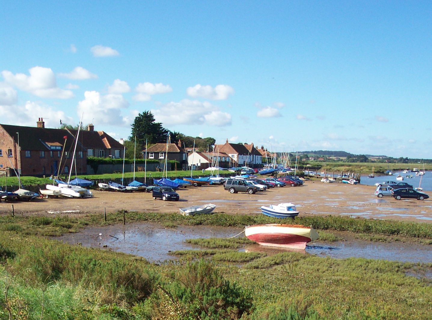
The main focal point of Burnham Overy Staithe is its small harbor, which has been a hub for local fishing and sailing activities for centuries. The harbor also serves as a popular starting point for boating trips to the nearby Holkham Bay and the National Nature Reserve.

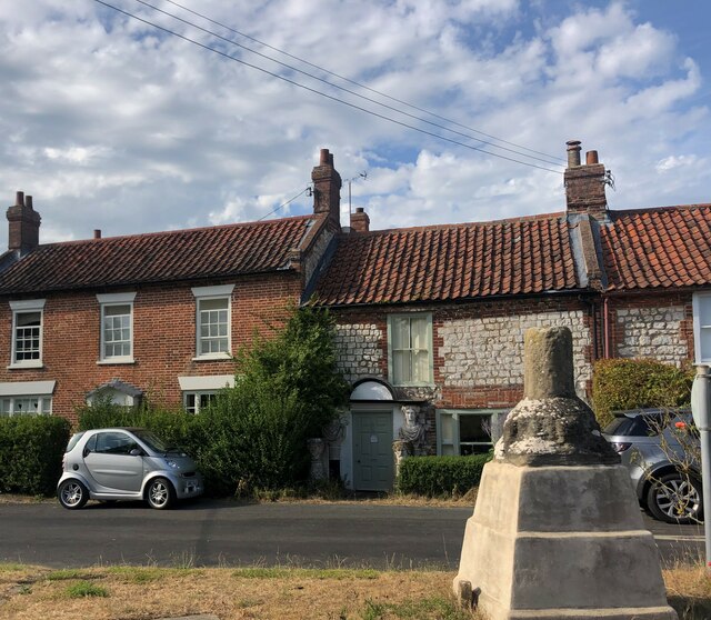
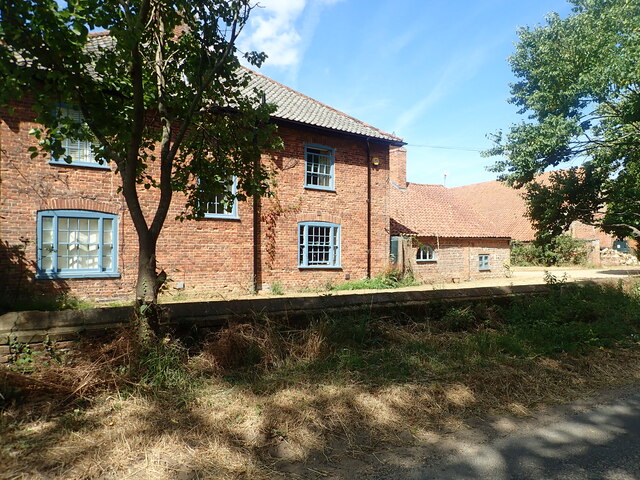
The village itself is characterized by charming traditional cottages made from local flint and brick, giving it a quintessentially English feel. It is also home to a few local businesses, including a pub, a café, and a small village store.

Nature enthusiasts are drawn to Burnham Overy Staithe for its stunning salt marshes and sand dunes. These habitats support a diverse range of wildlife, including migratory birds, seals, and rare plants. The area is a designated Site of Special Scientific Interest, reflecting its ecological importance.

Visitors to Burnham Overy Staithe can enjoy various outdoor activities such as walking, birdwatching, and sailing. The village offers easy access to the Norfolk Coast Path, which provides breathtaking views of the coastline and opportunities to explore the surrounding countryside.

Overall, Burnham Overy Staithe is a charming and peaceful village that offers a slice of tranquility amidst the natural beauty of Norfolk's coastal landscape.

If you have any feedback on the listing, please let us know in the comments section below.

Burnham Overy Staithe Images

Images are sourced within 2km of 52.963866/0.744645 or Grid Reference TF8444. Thanks to Geograph Open Source API. All images are credited.

In St Clement’s graveyard A simple coffin-shaped stone marks this grave. The surface was too badly weathered to make out any of the inscription.
In St Clement’s graveyard
A simple coffin-shaped stone marks this grave. The surface was too badly weathered to make out any of the inscription.
St Clement’s gravestone This stone marks the grave of Samuel Brookbank who died in 1776. The carving shows a beautiful winged soul that represents Samuel’s rise to Heaven.
St Clement’s gravestone
This stone marks the grave of Samuel Brookbank who died in 1776. The carving shows a beautiful winged soul that represents Samuel’s rise to Heaven.
In St Clement’s graveyard, Burnham Overy The skulls on this 18th century stone represent man’s mortality while the central cherub, or winged soul, indicates Heavenly life after death.
In St Clement’s graveyard, Burnham Overy
The skulls on this 18th century stone represent man’s mortality while the central cherub, or winged soul, indicates Heavenly life after death.
A carved stone in St Clement’s graveyard A lovely carved headstone marks this 18th century grave. The skull and crossed bones represent death and remind the passer-by that earthly life is limited. The two cherub-like faces may actually be winged souls which represent the rise of the deceased up to Heaven.
A carved stone in St Clement’s graveyard
A lovely carved headstone marks this 18th century grave. The skull and crossed bones represent death and remind the passer-by that earthly life is limited. The two cherub-like faces may actually be winged souls which represent the rise of the deceased up to Heaven.
St Clement’s Church, Burnham Overy Town There has been a church on this site since the 12th century. The Grade 1 listed building has been completely restored.
St Clement’s Church, Burnham Overy Town
There has been a church on this site since the 12th century. The Grade 1 listed building has been completely restored.
West Harbour, Burnham Overy Staithe
East Harbour, Burnham Overy Staithe
Burnham Overy windmill, A149, Burnham Overy Staithe Grade II* Listed tower windmill. The mill was built in 1816 by Edmund Savory. Savory worked the mill until his death on 9 February 1827, when it passed to his son John. The mill was six storeys high, with a ground floor diameter of 24 feet and had a stage set around the first floor. It had four double shuttered sails with a span of 81 feet, each had 12 bays of 3 shutters and drove 3 pairs of stones. The mill ceased working between 1912 and 1921 depending on who you believe. Mr. Hugh Hughes architect bought the mill in 1926 and by then all the machinery had been removed. Hughes converted the mill for use as holiday lets and added the single storey extensions. Restoration was carried out by R. Thompson & Son of Alford, Lincs. who added a fixed cap, skeleton sails, stage and fan in 1957. The following year Hughes donated the mill to the National Trust who soon after had to again replace the sails as they had deteriorated badly. Plans by the Trust to restore the mill to working order were opposed by the Norfolk County Council due to the inadequate highway in the locality which did not have the capacity to cope with large numbers of visitors. The mill was renovated internally to meet fire safety regulations and retarred in 1981. The stocks and sails were removed in 1983. Two new 62 feet (18.90 m) long stocks of Jamaican Pitch pine were fitted on 17 July 1985, and four new sails the following day. The new stocks and sails cost £26,500. It is now used for holiday self catering accommodation by the National Trust.
Burnham Overy windmill, A149, Burnham Overy Staithe
Grade II* Listed tower windmill. The mill was built in 1816 by Edmund Savory. Savory worked the mill until his death on 9 February 1827, when it passed to his son John. The mill was six storeys high, with a ground floor diameter of 24 feet and had a stage set around the first floor. It had four double shuttered sails with a span of 81 feet, each had 12 bays of 3 shutters and drove 3 pairs of stones. The mill ceased working between 1912 and 1921 depending on who you believe. Mr. Hugh Hughes architect bought the mill in 1926 and by then all the machinery had been removed. Hughes converted the mill for use as holiday lets and added the single storey extensions. Restoration was carried out by R. Thompson & Son of Alford, Lincs. who added a fixed cap, skeleton sails, stage and fan in 1957. The following year Hughes donated the mill to the National Trust who soon after had to again replace the sails as they had deteriorated badly. Plans by the Trust to restore the mill to working order were opposed by the Norfolk County Council due to the inadequate highway in the locality which did not have the capacity to cope with large numbers of visitors. The mill was renovated internally to meet fire safety regulations and retarred in 1981. The stocks and sails were removed in 1983. Two new 62 feet (18.90 m) long stocks of Jamaican Pitch pine were fitted on 17 July 1985, and four new sails the following day. The new stocks and sails cost £26,500. It is now used for holiday self catering accommodation by the National Trust.
Barn conversion in Burnham Norton
Wayside Cross, Burnham Overy The remains of the village Cross at the junction of Mill Road and Wells Road. Grade II listed
Wayside Cross, Burnham Overy
The remains of the village Cross at the junction of Mill Road and Wells Road. Grade II listed
Leith House
Leith House
Wayside stall at Leith House Orchards Jams, fresh plums and liquors as well as local wine and cider for sale here
Wayside stall at Leith House Orchards
Jams, fresh plums and liquors as well as local wine and cider for sale here
River Burn near Burnham Overy Mill
Grass field at Norton Street In the far distance can be seen the church of Burnham Norton.
Grass field at Norton Street
In the far distance can be seen the church of Burnham Norton.
Burnham Overy Staithe: Sand dunes and beach
Agricultural North Norfolk Fields and track by New Road above the village of Burnham Overy Staithe.
Agricultural North Norfolk
Fields and track by New Road above the village of Burnham Overy Staithe.
The Granary, Burnham Overy Staithe Historic red brick building, now residential, on the harbourside overlooking Overy Creek.
The Granary, Burnham Overy Staithe
Historic red brick building, now residential, on the harbourside overlooking Overy Creek.
Overy Creek, Low Tide Pleasure boats and yachts left high and dry on the sands at Burnham Overy Staithe.
Overy Creek, Low Tide
Pleasure boats and yachts left high and dry on the sands at Burnham Overy Staithe.
Show me another place!

Burnham Overy Staithe is located at Grid Ref: TF8444 (Lat: 52.963866, Lng: 0.744645)

Administrative County: Norfolk

District: King's Lynn and West Norfolk

Police Authority: Norfolk

What 3 Words

///resembles.stand.splint. Near Wells-next-the-Sea, Norfolk

Related Wikis

Burnham Overy

Burnham Overy is a civil parish on the north coast of Norfolk, England. In modern times a distinction is often made between the two settlements of Burnham...

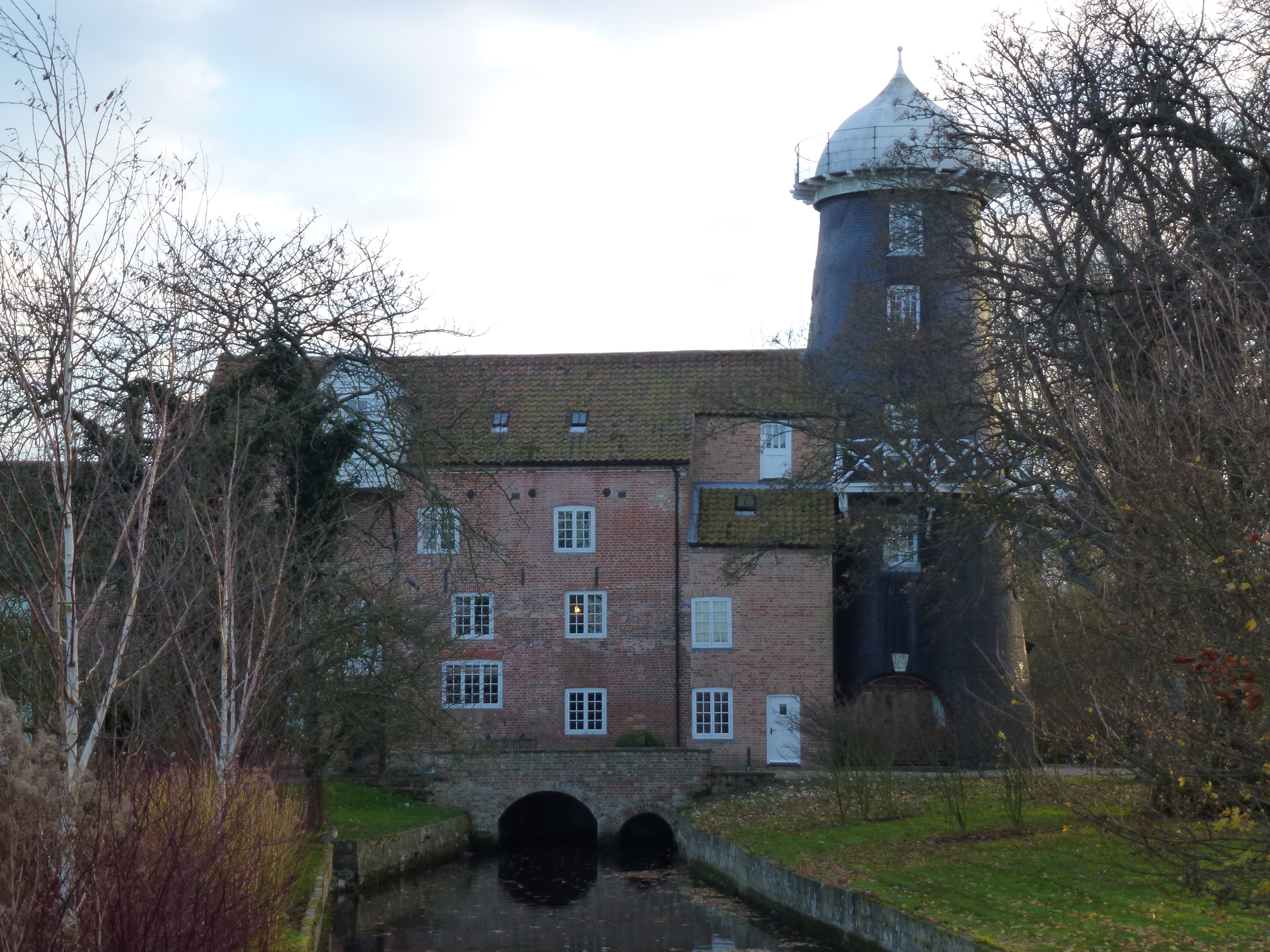
Union Mills, Burnham Overy

Union Mills or Roy's Mills are a Grade II listed combined tower mill and watermill at Burnham Overy, Norfolk, England which has been converted to residential...

Burnham Overy Staithe Windmill

Burnham Overy Staithe Windmill is a Grade II* listed building tower mill at Burnham Overy Staithe, Norfolk, England which has been converted to holiday...
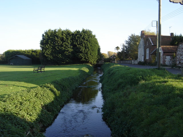
River Burn, Norfolk

The River Burn (also known as "Nelsons River") is a river in the northwest of the County of Norfolk, in the East of England. From its source to its mouth...

Nearby Amenities

Located within 500m of 52.963866,0.744645
Source: PGS
Lat/Long: 52.9649333/0.7467328
Source: PGS
Lat/Long: 52.9655214/0.746706
Source: PGS
Lat/Long: 52.965247/0.745403
Historic: memorial
Inscription: Captain Richard Woodget, Master of the Cutty Sark lived here 1899-1926
Memorial: plaque
Lat/Long: 52.9646127/0.745211
Milestone
Lat/Long: 52.962729/0.7400715
Post Box
Brand: Royal Mail
Brand Wikidata: Q638098
Collection Times: Mo-Fr 15:30; Sa 07:30
Operator: Royal Mail
Operator Wikidata: Q638098
Post Box Type: wall
Ref: PE31 240
Royal Cypher: GR
Royal Cypher Wikidata: Q33102273
Source: survey
Survey Date: 2019-09-16
Lat/Long: 52.9637379/0.7419468
Burnham Overy Staithe
Alt Name: Overy Staithe
Place: hamlet
Lat/Long: 52.9642128/0.7439615
Bus Stop
Hero
Bus: yes
Naptan AtcoCode: 2900B641
Naptan Bearing: W
Naptan CommonName: Hero
Naptan Indicator: adj
Naptan Landmark: public house
Naptan Latitude: 52.963704
Naptan Locality: Burnham Overy Staithe
Naptan Longitude: 0.7446227
Naptan NaptanCode: nfoagpjg
Naptan ShortCommonName: Hero
Naptan Street: Wells Road
Public Transport: platform
Source: naptan_import;survey
Lat/Long: 52.9636748/0.7448228
Bus Stop
Hero
Bus: yes
Naptan AtcoCode: 2900B644
Naptan Bearing: E
Naptan CommonName: Hero
Naptan Indicator: opp
Naptan Landmark: public house
Naptan Locality: Burnham Overy Staithe
Naptan NaptanCode: nfoagpjp
Naptan ShortCommonName: Hero
Naptan Street: Wells Road
Public Transport: platform
Source: naptan_import;survey
Lat/Long: 52.9637711/0.7452565
Mill cottages, adj
Naptan AtcoCode: 2900B647
Naptan Bearing: N
Naptan BusStopType: CUS
Naptan CommonName: Mill cottages
Naptan Indicator: adj
Naptan Landmark: cottages
Naptan Locality: Burnham Overy Staithe
Naptan NaptanCode: nfoagpjw
Naptan ShortCommonName: Mill cottages
Naptan Street: New Road
Naptan Verified: no
Source: naptan_import
Lat/Long: 52.9625231/0.7431926
Mill cottages, opp
Naptan AtcoCode: 2900B648
Naptan Bearing: S
Naptan BusStopType: CUS
Naptan CommonName: Mill cottages
Naptan Indicator: opp
Naptan Landmark: cottages
Naptan Locality: Burnham Overy Staithe
Naptan NaptanCode: nfoagpma
Naptan ShortCommonName: Mill cottages
Naptan Street: New Road
Naptan Verified: no
Source: naptan_import
Lat/Long: 52.9624848/0.7432944
Pub
The Hero
Addr City: King's Lynn
Addr Postcode: PE31 8JE
Addr Street: Wells Road
Addr Village: Burnham Overy Staithe
Fhrs Id: 908912
Source Addr: FHRS Open Data
Lat/Long: 52.9635818/0.7453261
Historic: memorial
Lat/Long: 52.9636625/0.744089
Post Box
Collection Times: Mo-Fr 15:30; Sa 08:00
Post Box Type: wall
Ref: PE31 209
Royal Cypher: GR
Royal Cypher Wikidata: Q33102273
Lat/Long: 52.9631432/0.745759
Leisure: slipway
Lat/Long: 52.9648188/0.744192
Overy Staithe Sailing Club
Club: sailing
Lat/Long: 52.9646764/0.7443572
Bench
Lat/Long: 52.9648435/0.7455692
Bench
Lat/Long: 52.9648493/0.7457014
Bench
Lat/Long: 52.9648495/0.7456331
Bench
Garry's Seat
Material: stone
Openbenches Id: 2803
Seats: 4
Source: survey; Bing; GPS
Lat/Long: 52.967216/0.749228
Burnham Overy Staithe
Man Made: village_sign
Material: metal
Lat/Long: 52.9614033/0.743566
Bench
Lat/Long: 52.9648535/0.7458186
Bench
Lat/Long: 52.9648559/0.7459393
Telephone
Booth: K6
Covered: booth
Fee: yes
Operator: BT
Lat/Long: 52.9638543/0.7427018
Bench
Lat/Long: 52.9647541/0.7450954
Bench
Lat/Long: 52.9647059/0.7443925
Vending Machine
Vending: coffee
Lat/Long: 52.9646657/0.7442551
Direction: 175
Generator Method: photovoltaic
Generator Output Electricity: yes
Generator Solar Modules: 16
Generator Source: solar
Generator Type: solar_photovoltaic_panel
Location: roof
Power: generator
Lat/Long: 52.9623364/0.7462411
The data included in this document is from www.openstreetmap.org. The data is made available under ODbL.

Have you been to Burnham Overy Staithe?

Leave your review of Burnham Overy Staithe below (or comments, questions and feedback).