Rick Field Covert

Wood, Forest in Caernarfonshire

Wales

Rick Field Covert

The Menai Straits from Plas Newydd High tide.
The Menai Straits from Plas Newydd Credit: Eric Marsh

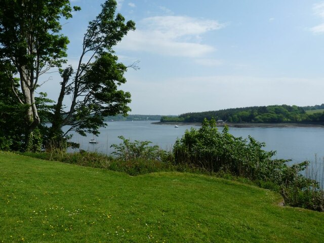
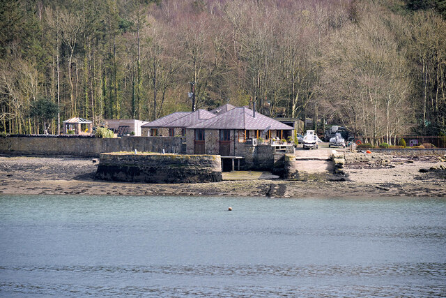
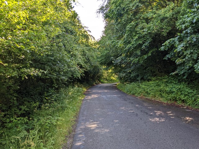
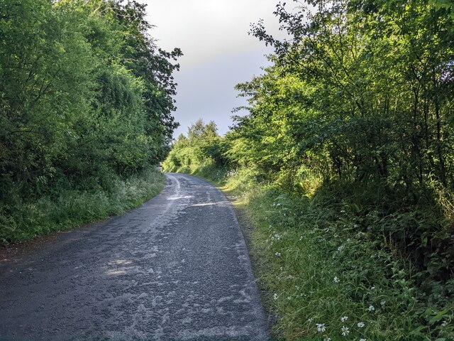
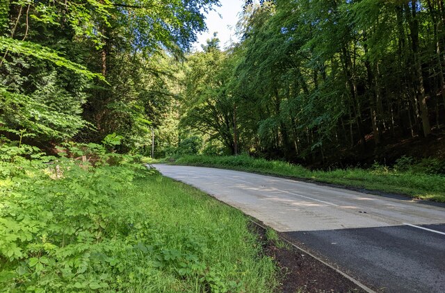
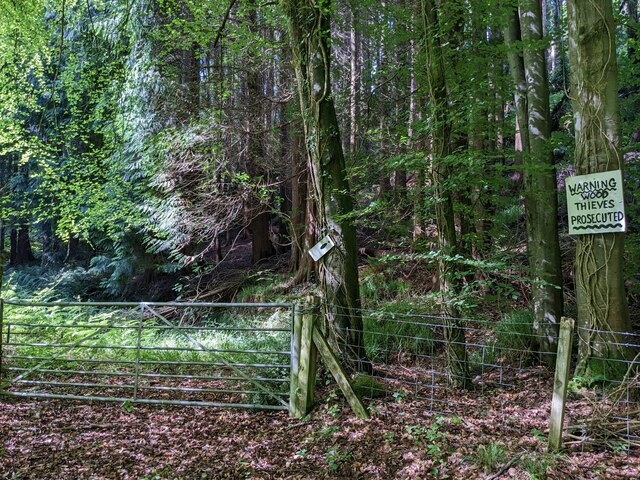
Rick Field Covert is a dense woodland area located in Caernarfonshire, Wales. The forest is known for its rich biodiversity and lush greenery, making it a popular destination for nature lovers and hikers. The woodland is home to a variety of wildlife species, including deer, foxes, and a wide range of bird species.

The forest is characterized by its tall, old-growth trees, including oak, beech, and pine. The canopy of the forest provides a cool and shaded environment, perfect for a leisurely stroll or a peaceful picnic. The forest floor is covered in a thick layer of moss and ferns, adding to the serene and mystical atmosphere of the woodland.

Visitors to Rick Field Covert can enjoy a network of walking trails that wind through the forest, offering stunning views of the surrounding countryside. The forest is also home to a variety of plant species, including bluebells, wild garlic, and ferns.

Overall, Rick Field Covert is a tranquil and picturesque woodland area that offers a peaceful escape from the hustle and bustle of everyday life.

If you have any feedback on the listing, please let us know in the comments section below.

Rick Field Covert Images

Images are sourced within 2km of 53.206514/-4.184303 or Grid Reference SH5469. Thanks to Geograph Open Source API. All images are credited.

The Menai Straits from Plas Newydd High tide.
The Menai Straits from Plas Newydd
High tide.
Bridge over the B4547 The B4547 passes under the A487 (Y Felinheli bypass).
Bridge over the B4547
The B4547 passes under the A487 (Y Felinheli bypass).
A487 at Junction 9 of the North Wales Expressway
A487, Y Felinheli Bypass
Tourist boat on the Menai Strait (Afon Menai) A tourist boat on the Menai Strait next to Plas Newydd.
Tourist boat on the Menai Strait (Afon Menai)
A tourist boat on the Menai Strait next to Plas Newydd.
Dock at NW edge of Vaynol Park Constructed in the mid-nineteenth century (before 1871) to facilitate the transportation of supplies, particularly coal, to and from Vaynol Park.
Dock at NW edge of Vaynol Park
Constructed in the mid-nineteenth century (before 1871) to facilitate the transportation of supplies, particularly coal, to and from Vaynol Park.
Y Faenol yn ystod Gwyl Gȇm Cymru / The Vaynol during the Welsh Game Fair
Gwyl Gȇm Cymru / Welsh Game Fair
Roundabout on Penrhos Road, Bangor
Hydrant marker on Ffordd Cynan, Bangor
Almost a green tunnel The busy A487 is just a few yards to the left, hidden by the trees.
Almost a green tunnel
The busy A487 is just a few yards to the left, hidden by the trees.
The minor road next to the A487
Vegetation and trees by the B4547
A warning sign in Coed Nant-y-garth "Thieves will be prosecuted" has been amended to specify that this means 'wood' thieves will be prosecuted. It looks like there isn't much else to steal - maybe the gate?
A warning sign in Coed Nant-y-garth
"Thieves will be prosecuted" has been amended to specify that this means 'wood' thieves will be prosecuted. It looks like there isn't much else to steal - maybe the gate?
A large field near Fodol Newydd
Cattle near Pont Cae-cerig
The lane to Brithdir Mawr The larger sign is for Cae Lai 'campio glampio' - an invented phrase, I think! But it does sound better than 'glamping'.
The lane to Brithdir Mawr
The larger sign is for Cae Lai 'campio glampio' - an invented phrase, I think! But it does sound better than 'glamping'.
The grassy lane to Brithdir
Show me another place!

Rick Field Covert is located at Grid Ref: SH5469 (Lat: 53.206514, Lng: -4.184303)

Unitary Authority: Gwynedd

Police Authority: North Wales

What 3 Words

///indicates.cubed.bitters. Near Llanfairpwllgwyngyll, Isle of Anglesey

Related Wikis

Ysgol Glanaethwy

Ysgol Glanaethwy is a drama school in Bangor, Gwynedd, Wales. It is known in particular for its choir, Côr Glanaethwy. == History == Ysgol Glanaethwy was...

Treborth railway station

Treborth railway station was a railway station located on the Bangor and Carnarvon Railway, about half a mile south of the Britannia Bridge, Caernarfonshire...
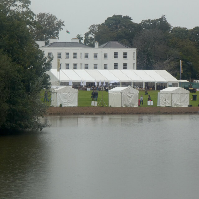
Vaynol

Vaynol or Y Faenol (Welsh [ə ˈveɨnɔl]) is a country estate dating from the Tudor period near Y Felinheli in Gwynedd, North Wales (grid reference SH536695...

Faenol Festival

The Faenol Festival (Welsh: Gŵyl y Faenol) is a music festival organised by Welsh singer Bryn Terfel, originally held annually on the Faenol Estate (Welsh...

Nearby Amenities

Located within 500m of 53.206514,-4.184303
Give Way
Direction: backward
Lat/Long: 53.203622/-4.1791124
Post Box
Ref: LL57 339
Lat/Long: 53.2049587/-4.1805149
Bus Stop
Bus: yes
Naptan AtcoCode: 5400WDB48322
Naptan NaptanCode: gwntpwm
Public Transport: platform
Lat/Long: 53.206647/-4.1804685
Bus Stop
Bus: yes
Public Transport: platform
Lat/Long: 53.2078544/-4.1853552
Man Made: tower
Lat/Long: 53.2066336/-4.1838571
Bench
Backrest: yes
Lat/Long: 53.2058655/-4.1795079
Bench
Lat/Long: 53.2068183/-4.1781681
Note: Not a stub... this actually does just stop in a field
Lat/Long: 53.2061692/-4.1845977
Bus Stop
Bus: yes
Public Transport: stop_position
Tactile Paving: yes
Lat/Long: 53.2063699/-4.1835257
Barrier: block
Lat/Long: 53.2080951/-4.1863867
Barrier: block
Bicycle: yes
Foot: yes
Lat/Long: 53.2026197/-4.1807891
Barrier: block
Bicycle: yes
Foot: yes
Lat/Long: 53.2038735/-4.1830339
Entrance: yes
Lat/Long: 53.2075673/-4.1848946
Power: pole
Lat/Long: 53.2095051/-4.1792844
Bus Stop
Bench: no
Bin: no
Bus: yes
Public Transport: platform
Shelter: no
Lat/Long: 53.2040553/-4.1787593
Bus Stop
Bus: yes
Naptan AtcoCode: 5400AWP26300
Naptan NaptanCode: gwndgtd
Public Transport: platform
Shelter: yes
Lat/Long: 53.2042956/-4.1797818
Bench
Backrest: yes
Lat/Long: 53.2063101/-4.179446
Bus Stop
Bus: yes
Public Transport: stop_position
Lat/Long: 53.2066012/-4.1832283
Bus: yes
Public Transport: stop_position
Lat/Long: 53.2040933/-4.1787543
Bus Stop
Bus: yes
Naptan AtcoCode: 5400AWF80878
Naptan NaptanCode: gwnpmdp
Public Transport: platform
Lat/Long: 53.2063564/-4.1836777
Bus Stop
Bus: yes
Naptan AtcoCode: 5400AWF80877
Naptan NaptanCode: gwndgpt
Public Transport: platform
Lat/Long: 53.2066517/-4.183232
Bus: yes
Public Transport: stop_position
Lat/Long: 53.2066025/-4.1805116
Bus: yes
Public Transport: stop_position
Lat/Long: 53.2042576/-4.1797795
Power: transformer
Lat/Long: 53.2075144/-4.1848382
Treborth
Historic Railway: station
Railway: site
Wikidata: Q23073755
Wikipedia: en:Treborth railway station
Lat/Long: 53.2102523/-4.1810352
Power: transformer
Lat/Long: 53.2094523/-4.1809305
Crossing
Lat/Long: 53.2042595/-4.1791558
Crossing
Crossing: unmarked
Crossing Island: no
Crossing Markings: no
Tactile Paving: no
Lat/Long: 53.2041414/-4.1786125
Tactile Paving: yes
Lat/Long: 53.203727/-4.1784126
Entrance: main
Lat/Long: 53.2038308/-4.1782973
Barrier: kerb
Kerb: flush
Tactile Paving: yes
Lat/Long: 53.2038019/-4.178318
Entrance: emergency
Level: 1
Lat/Long: 53.203896/-4.1788547
Crossing
Crossing: unmarked
Crossing Island: no
Crossing Markings: no
Lat/Long: 53.2039123/-4.1792745
Give Way
Direction: forward
Lat/Long: 53.2046421/-4.1775301
The data included in this document is from www.openstreetmap.org. The data is made available under ODbL.

Have you been to Rick Field Covert?

Leave your review of Rick Field Covert below (or comments, questions and feedback).