Coed Tan-ffynnon

Wood, Forest in Anglesey

Wales

Coed Tan-ffynnon

View towards the Stable Block, Plas Newydd The Plas Newydd stable block is an elaborate Gothic confection, built in a similar style to the mansion. Built by Joseph Porter in 1797 to designs of James Wyatt.  
They were designed to accommodate two coaches and fourteen horses. It is now a training school.
Grade II listed. It is currently under renovation and generally not open to the public.
A National Trust property.
View towards the Stable Block, Plas Newydd Credit: Richard Hoare

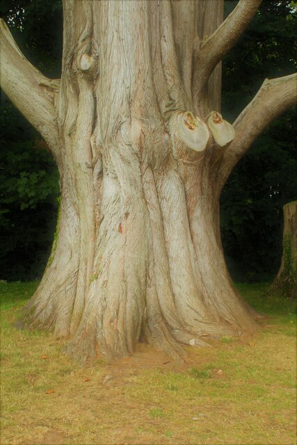
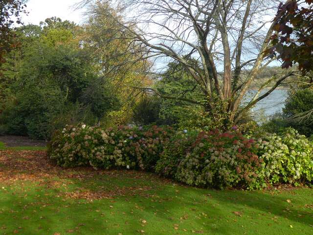
Coed Tan-ffynnon is a picturesque woodland located in Anglesey, Wales. Spanning over an area of approximately 200 acres, it is a haven for nature enthusiasts and those seeking tranquility in the midst of nature. The name "Tan-ffynnon" translates to "under the well" in Welsh, which refers to the natural spring that can be found within the woodland.

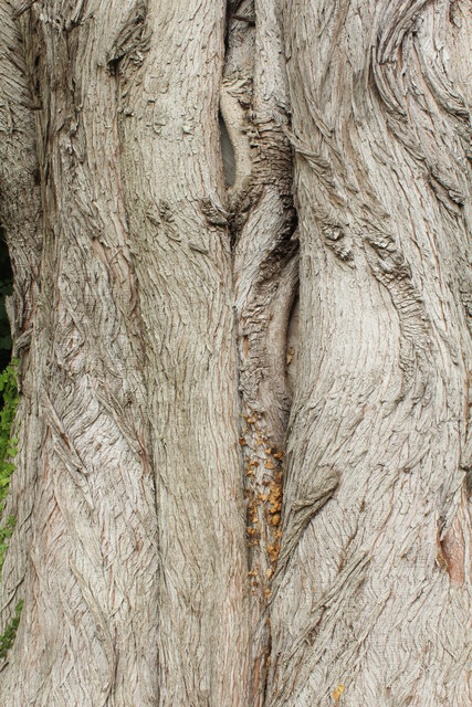
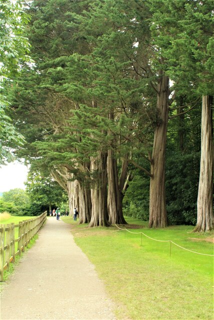
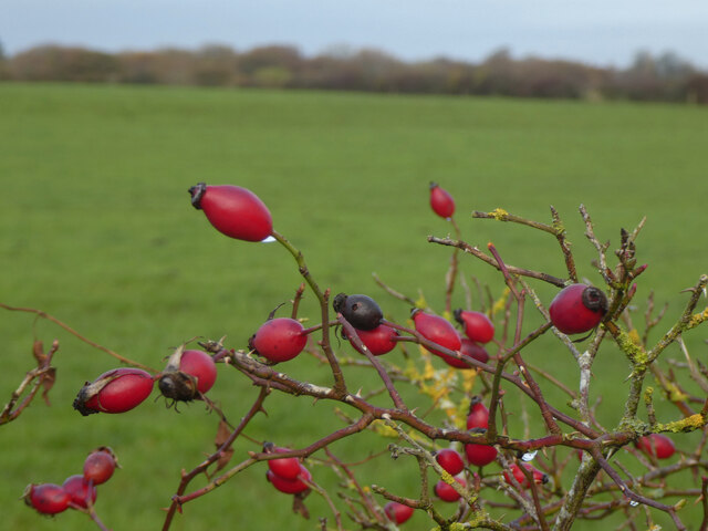
The woodland is primarily composed of native broadleaf trees such as oak, birch, and ash, providing a diverse and vibrant habitat for a variety of flora and fauna. A network of well-maintained footpaths and trails wind through the woodland, allowing visitors to explore and appreciate the natural beauty of the area. These paths are suitable for walkers of all abilities, including families with young children.

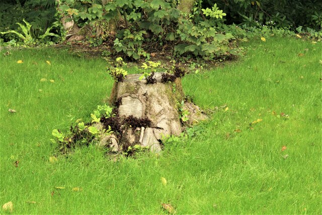
Coed Tan-ffynnon is home to a rich array of wildlife, including several species of birds, mammals, and insects. Birdwatchers may spot woodpeckers, buzzards, and jays, among others. The woodland also provides a suitable habitat for small mammals like squirrels, badgers, and foxes.

In addition to its natural beauty, Coed Tan-ffynnon also boasts historical significance. The woodland holds remnants of ancient settlements, with archaeological finds dating back thousands of years. These historical features add an extra layer of fascination for visitors interested in the area's past.

Coed Tan-ffynnon is managed by a local conservation organization, ensuring that the woodland remains protected and accessible for generations to come. Whether it's for a leisurely stroll, birdwatching, or simply enjoying the tranquility of nature, Coed Tan-ffynnon offers a delightful experience for visitors of all ages.

If you have any feedback on the listing, please let us know in the comments section below.

Coed Tan-ffynnon Images

Images are sourced within 2km of 53.208067/-4.2214016 or Grid Reference SH5170. Thanks to Geograph Open Source API. All images are credited.

View towards the Stable Block, Plas Newydd The Plas Newydd stable block is an elaborate Gothic confection, built in a similar style to the mansion. Built by Joseph Porter in 1797 to designs of James Wyatt.  
They were designed to accommodate two coaches and fourteen horses. It is now a training school.
Grade II listed. It is currently under renovation and generally not open to the public.
A National Trust property.
View towards the Stable Block, Plas Newydd
The Plas Newydd stable block is an elaborate Gothic confection, built in a similar style to the mansion. Built by Joseph Porter in 1797 to designs of James Wyatt. They were designed to accommodate two coaches and fourteen horses. It is now a training school. Grade II listed. It is currently under renovation and generally not open to the public. A National Trust property.
View of Plas Newydd Grade II* listed building, in the care of the National Trust.
View of Plas Newydd
Grade II* listed building, in the care of the National Trust.
Monterey Cypress (Cupressus macrocarpa) An avenue of such trees were planted in 1916 at Plas Newydd.
For a closer example of the bark see <a href="https://www.geograph.org.uk/photo/6939209">SH5169 : Close up of the trunk of a Monterey Cypress (Cupressus macrocarpa)</a>
Monterey Cypress (Cupressus macrocarpa)
An avenue of such trees were planted in 1916 at Plas Newydd. For a closer example of the bark see SH5169 : Close up of the trunk of a Monterey Cypress (Cupressus macrocarpa)
Close up of the trunk of a Monterey Cypress (Cupressus macrocarpa) This forms part of an avenue of such trees planted in 1916 at Plas Newydd.
An example of the same trunk is at <a href="https://www.geograph.org.uk/photo/6939155">SH5169 : Monterey Cypress (Cupressus macrocarpa)</a>
Close up of the trunk of a Monterey Cypress (Cupressus macrocarpa)
This forms part of an avenue of such trees planted in 1916 at Plas Newydd. An example of the same trunk is at SH5169 : Monterey Cypress (Cupressus macrocarpa)
Avenue of Monterey Cypress (Cupressus macrocarpa) Planted in 1916.
Avenue of Monterey Cypress (Cupressus macrocarpa)
Planted in 1916.
This old tree never died The stump of a Monterey Cypress / Cupressus macrocarpa, originally planted in 1916 as an avenue of trees, the majority of which survive. <a href="https://www.geograph.org.uk/photo/6939317">SH5169 : Avenue of Monterey Cypress (Cupressus macrocarpa)</a>
This old tree never died
The stump of a Monterey Cypress / Cupressus macrocarpa, originally planted in 1916 as an avenue of trees, the majority of which survive. SH5169 : Avenue of Monterey Cypress (Cupressus macrocarpa)
Plas Newydd
Plas Newydd
Trilliw-ar-ddeg / Hydrangea
Lliwiau'r hydref / Autumn colours
Bochau cochion / Rosehips
Plas Newydd View of the house and the Menai Straits beyond.
Plas Newydd
View of the house and the Menai Straits beyond.
The Menai Straits from Plas Newydd High tide.
The Menai Straits from Plas Newydd
High tide.
Defending Plas Newydd Cannons  facing the Menai Straits
Defending Plas Newydd
Cannons facing the Menai Straits
Bus Stop on Brynsiencyn Road The A4080 road runs for 24½ miles along the southwestern side of Anglesey. It starts on the A5 at Llanfair Pwllgwyngyll and passes through several villages before terminating on the A5 between Bryngwran and Gwalchmai.
Bus Stop on Brynsiencyn Road
The A4080 road runs for 24½ miles along the southwestern side of Anglesey. It starts on the A5 at Llanfair Pwllgwyngyll and passes through several villages before terminating on the A5 between Bryngwran and Gwalchmai.
Parking Area on the A4080 near Llanedwen The A4080 road runs for 24½ miles along the southwestern side of Anglesey. It starts on the A5 at Llanfair Pwllgwyngyll and passes through several villages before terminating on the A5 between Bryngwran and Gwalchmai.
Parking Area on the A4080 near Llanedwen
The A4080 road runs for 24½ miles along the southwestern side of Anglesey. It starts on the A5 at Llanfair Pwllgwyngyll and passes through several villages before terminating on the A5 between Bryngwran and Gwalchmai.
Vaynol Estate Wall, Menai Straits
Plas Newydd
Plas Newydd
Garden feature at Plas Newydd A fountain in the upper terrace garden at Plas Newydd.
Garden feature at Plas Newydd
A fountain in the upper terrace garden at Plas Newydd.
Show me another place!

Coed Tan-ffynnon is located at Grid Ref: SH5170 (Lat: 53.208067, Lng: -4.2214016)

Unitary Authority: Isle of Anglesey

Police Authority: North Wales

What 3 Words

///animal.collision.messy. Near Llanfairpwllgwyngyll, Isle of Anglesey

Nearby Locations

Coed Tan-ffynnon

Related Wikis

HMS Conway (school ship)

HMS Conway was a naval training school or "school ship", founded in 1859 and housed for most of her life aboard a 19th-century wooden ship of the line...

Plas Newydd (Anglesey)

Plas Newydd is a country house set in gardens, parkland and surrounding woodland on the north bank of the Menai Strait, in Llanddaniel Fab, near Llanfairpwllgwyngyll...
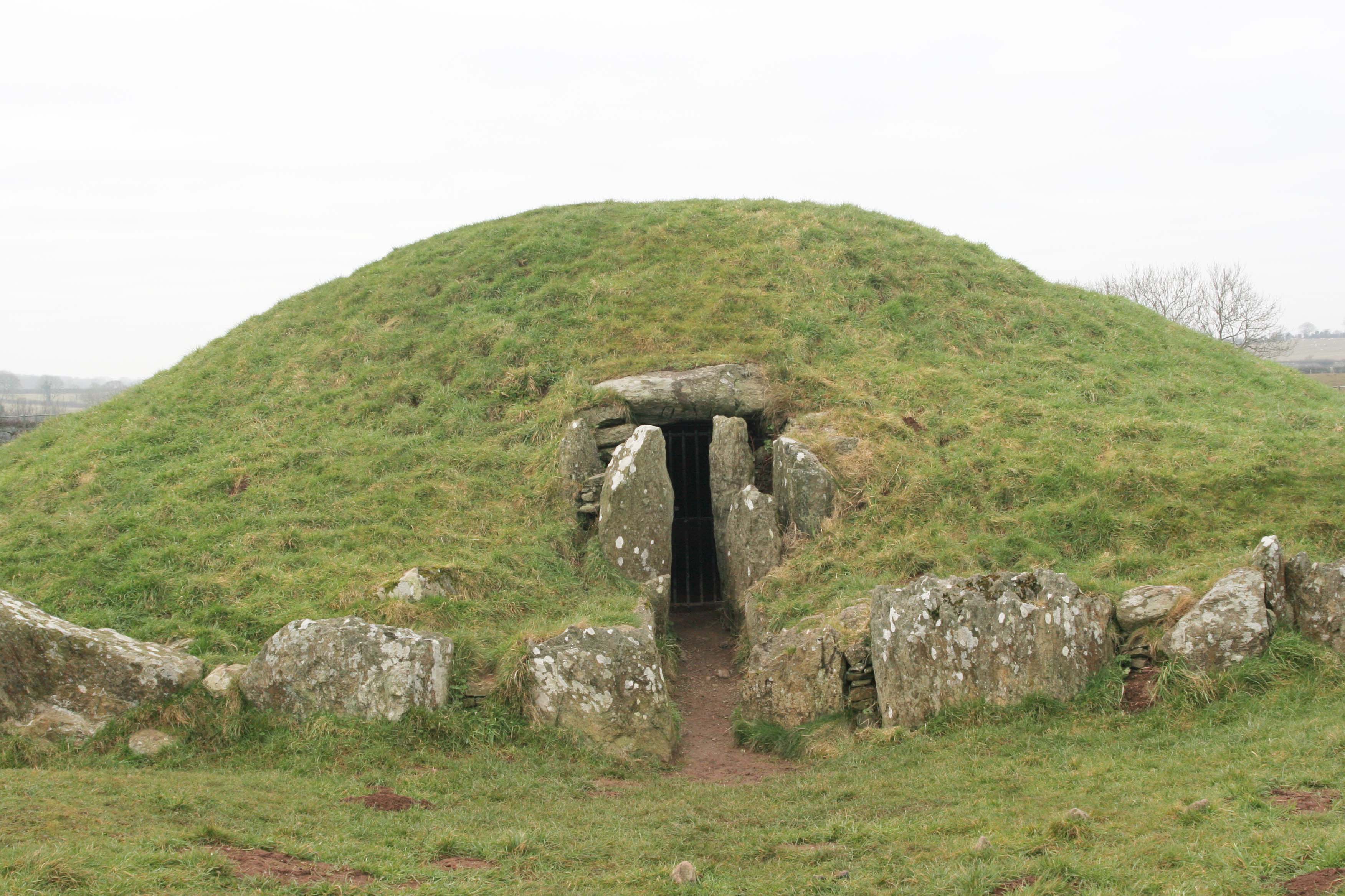
Bryn Celli Ddu

Bryn Celli Ddu (Welsh pronunciation: [ˌbrɪn kɛɬi ˈðɨː]) is a prehistoric site on the Welsh island of Anglesey located near Llanddaniel Fab. Its name means...

Pwllfanogl

Pwllfanogl is a hamlet in the community of Llanfair Pwllgwyngyll, Anglesey, Wales, which is 127.4 miles (205.1 km) from Cardiff and 208.5 miles (335.5...

Nearby Amenities

Located within 500m of 53.208067,-4.2214016
Cafe
The Old Dairy
Lat/Long: 53.2041227/-4.2205309
Toilets
Lat/Long: 53.2041742/-4.2206937
Leisure: playground
Lat/Long: 53.2038697/-4.221366
Barrier: kissing_gate
Lat/Long: 53.2081337/-4.2264802
Barrier: kissing_gate
Lat/Long: 53.2089581/-4.2228961
Barrier: kissing_gate
Lat/Long: 53.2090009/-4.2173386
Entrance: yes
Lat/Long: 53.2059664/-4.2164865
The data included in this document is from www.openstreetmap.org. The data is made available under ODbL.

Have you been to Coed Tan-ffynnon?

Leave your review of Coed Tan-ffynnon below (or comments, questions and feedback).