Cae-Woods Plantation

Wood, Forest in Anglesey

Wales

Cae-Woods Plantation

Tir Plas Porthamel / Land at Plas Porthamel
Tir Plas Porthamel / Land at Plas Porthamel Credit: Ceri Thomas

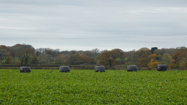
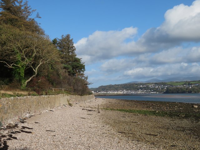
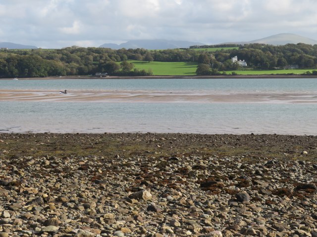
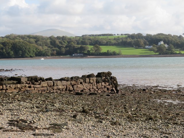
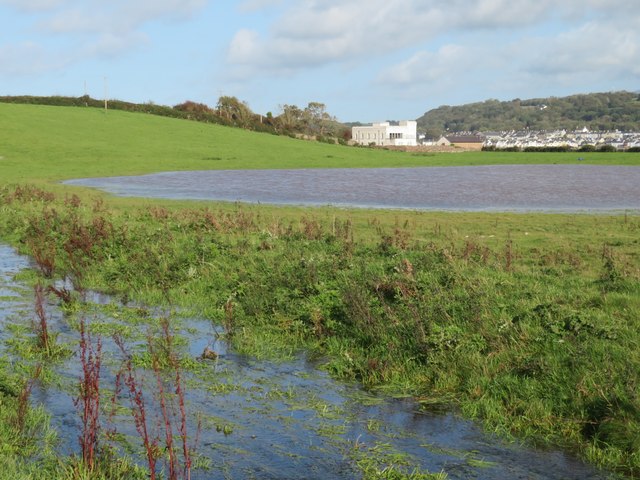
Cae-Woods Plantation is a picturesque woodland area located in Anglesey, Wales. Spanning over a vast expanse of land, the plantation is renowned for its dense forests and beautiful woodlands. It covers an area of approximately 500 acres and is home to a diverse range of flora and fauna.

The woodland is predominantly composed of native tree species such as oak, beech, ash, and birch, creating a rich and varied ecosystem. The lush undergrowth is adorned with a carpet of wildflowers, adding to the scenic beauty of the plantation. The woods are also home to various wildlife species including deer, foxes, badgers, and a wide variety of bird species.

Cae-Woods Plantation offers numerous walking trails and footpaths, making it a popular destination for nature enthusiasts and hikers. The well-marked trails provide opportunities for visitors to explore the natural surroundings and observe the diverse flora and fauna that thrive within the woodland.

Moreover, the plantation serves as an important habitat for conservation efforts, with several protected species finding refuge within its boundaries. The management of the woodland follows sustainable practices, ensuring the preservation of the natural environment.

Cae-Woods Plantation is not only a haven for nature lovers but also offers recreational activities such as camping, picnicking, and birdwatching. The tranquil atmosphere and scenic beauty of this woodland make it an ideal destination for those seeking a peaceful retreat surrounded by the wonders of nature.

If you have any feedback on the listing, please let us know in the comments section below.

Cae-Woods Plantation Images

Images are sourced within 2km of 53.187027/-4.2544863 or Grid Reference SH4967. Thanks to Geograph Open Source API. All images are credited.

Tir Plas Porthamel / Land at Plas Porthamel
Parking Area on the A4080 near Llanedwen The A4080 road runs for 24½ miles along the southwestern side of Anglesey. It starts on the A5 at Llanfair Pwllgwyngyll and passes through several villages before terminating on the A5 between Bryngwran and Gwalchmai.
Parking Area on the A4080 near Llanedwen
The A4080 road runs for 24½ miles along the southwestern side of Anglesey. It starts on the A5 at Llanfair Pwllgwyngyll and passes through several villages before terminating on the A5 between Bryngwran and Gwalchmai.
Post Box at Llanedwen LL61 214. Royal Mail list this box as 'Llanedwen'.
Post Box at Llanedwen
LL61 214. Royal Mail list this box as 'Llanedwen'.
The coast path takes to the beach A surprise to find that the Anglesey Coast Path follows the shoreline of the Menai Strait for around half a mile at this point.
The coast path takes to the beach
A surprise to find that the Anglesey Coast Path follows the shoreline of the Menai Strait for around half a mile at this point.
Sandbank in Menai Strait The latest OS map, as used on the Geograph website seems to have shrunk this sandbank, which is quite extensive at low tide. The person with the sailboard collected it and then walked to the shore on this side, never going more than chest deep.
Sandbank in Menai Strait
The latest OS map, as used on the Geograph website seems to have shrunk this sandbank, which is quite extensive at low tide. The person with the sailboard collected it and then walked to the shore on this side, never going more than chest deep.
Old jetty on the Anglesey shore This might have seen use a long time ago, but now it is in a ruinous state.
Old jetty on the Anglesey shore
This might have seen use a long time ago, but now it is in a ruinous state.
Stream and pond close to the shore The stream follows an artificial course down to the shore here, whilst the pond, though quite large, appears to be unnamed. The white building in the distance looks like a cross between a power station and a fort, but is actually a house, known as Castell Gwylan, an early 19th century building which is Grade II listed.
Stream and pond close to the shore
The stream follows an artificial course down to the shore here, whilst the pond, though quite large, appears to be unnamed. The white building in the distance looks like a cross between a power station and a fort, but is actually a house, known as Castell Gwylan, an early 19th century building which is Grade II listed.
The coast path follows a lane This section of the Anglesey Coast Path heads a short way inland and follows this tarmacked lane towards Moel -y - Don, after which it is forced to turn well inland for a mile or two.
The coast path follows a lane
This section of the Anglesey Coast Path heads a short way inland and follows this tarmacked lane towards Moel -y - Don, after which it is forced to turn well inland for a mile or two.
Approaching A4080 at Cefn Cottages On road from Gaerwen
Approaching A4080 at Cefn Cottages
On road from Gaerwen
Cross roads at Cefn Cottages
The foreshore at Llanfair-Is-Gaer Next to the watersports centre at Plas Menai.
The foreshore at Llanfair-Is-Gaer
Next to the watersports centre at Plas Menai.
St Idans Church, Llanidan A splendid square turret steeple.
St Idans Church, Llanidan
A splendid square turret steeple.
A stairway to heaven The title facetiously, depicts an interesting stepway into the churchyard at St Idan's Church. It also descends the other side to the graveyard.
A stairway to heaven
The title facetiously, depicts an interesting stepway into the churchyard at St Idan's Church. It also descends the other side to the graveyard.
View towards Llanberis Pass As seen from the road beside St Idan's Church. Snowdon is clearly visible as the more 'pointed' one, just off-centre and to the right.
View towards Llanberis Pass
As seen from the road beside St Idan's Church. Snowdon is clearly visible as the more 'pointed' one, just off-centre and to the right.
Brynsiencyn church
Brynsiencyn church
Church of St Nidan, Llanidan The original church stood about 400 yards from the Menai Strait and was demolished long ago. Today's church, built in 1843, stands besides the A4080 on the outskirts of Brynsiencyn. It has an unusual square clock tower with a ground floor porch which also provides access to a balcony. The vestry and organ are housed in part circular rooms off the transepts. The decorated circular bowl font, standing on an octagonal base, is early 13th century and came from the old church as did the 14th century bell.
Church of St Nidan, Llanidan
The original church stood about 400 yards from the Menai Strait and was demolished long ago. Today's church, built in 1843, stands besides the A4080 on the outskirts of Brynsiencyn. It has an unusual square clock tower with a ground floor porch which also provides access to a balcony. The vestry and organ are housed in part circular rooms off the transepts. The decorated circular bowl font, standing on an octagonal base, is early 13th century and came from the old church as did the 14th century bell.
Churchyard steps at St Nidan, Llanidan
Church of St Nidan, Llanidan The original church stood about 400 yards from the Menai Strait and was demolished long ago. Today's church, built in 1843, stands besides the A4080 on the outskirts of Brynsiencyn. It has an unusual square clock tower with a ground floor porch which also provides access to a balcony. The vestry and organ are housed in part circular rooms off the transepts. The decorated circular bowl font, standing on an octagonal base, is early 13th century and came from the old church as did the 14th century bell.
Church of St Nidan, Llanidan
The original church stood about 400 yards from the Menai Strait and was demolished long ago. Today's church, built in 1843, stands besides the A4080 on the outskirts of Brynsiencyn. It has an unusual square clock tower with a ground floor porch which also provides access to a balcony. The vestry and organ are housed in part circular rooms off the transepts. The decorated circular bowl font, standing on an octagonal base, is early 13th century and came from the old church as did the 14th century bell.
Show me another place!

Cae-Woods Plantation is located at Grid Ref: SH4967 (Lat: 53.187027, Lng: -4.2544863)

Unitary Authority: Isle of Anglesey

Police Authority: North Wales

What 3 Words

///invested.expensive.weeps. Near Y Felinheli, Gwynedd

Related Wikis

St Nidan's Church, Llanidan

St Nidan's Church, Llanidan is a 19th-century parish church near the village of Brynsiencyn, in Anglesey, north Wales. Built between 1839 and 1843, it...

Old Church of St Nidan, Llanidan

The Old Church of St Nidan, Llanidan is a medieval church in the community of Llanidan, in Anglesey, North Wales, close to the Menai Strait. The first...

Llanedwen

Llanedwen is a village in the community of Llanddaniel Fab, Anglesey, Wales, which is 126.5 miles (203.6 km) from Cardiff and 208.8 miles (336 km) from...

Llanidan

Llanidan is a community in the south of Anglesey, Wales which includes the village of Brynsiencyn (). The parish is along the Menai Strait, about 4 miles...

Nearby Amenities

Located within 500m of 53.187027,-4.2544863
Power: pole
Lat/Long: 53.1837384/-4.2518029
Power: pole
Lat/Long: 53.184477/-4.2530648
Power: pole
Lat/Long: 53.1850267/-4.2539138
Power: pole
Lat/Long: 53.1857692/-4.2551462
Power: pole
Lat/Long: 53.1864853/-4.2570332
Power: pole
Lat/Long: 53.1877164/-4.2593037
Power: pole
Lat/Long: 53.1883239/-4.2604195
Shop: farm
Lat/Long: 53.1846693/-4.2598463
The data included in this document is from www.openstreetmap.org. The data is made available under ODbL.

Have you been to Cae-Woods Plantation?

Leave your review of Cae-Woods Plantation below (or comments, questions and feedback).