Caer Idris

Heritage Site in Anglesey

Wales

Caer Idris

Tir Plas Porthamel / Land at Plas Porthamel
Tir Plas Porthamel / Land at Plas Porthamel Credit: Ceri Thomas

Caer Idris is an ancient heritage site located on the Isle of Anglesey, off the northwest coast of Wales. Believed to date back to the Iron Age, it is a significant historical and archaeological site that has captured the interest of researchers and visitors alike.

The site is dominated by the remains of a hillfort, situated on a hilltop overlooking the surrounding landscape. The fortification is believed to have been built around 300 BC and was inhabited by a Celtic tribe known as the Ordovices. The hillfort covers an area of approximately 5 acres and is protected by multiple defensive earthworks and ditches.

The name "Caer Idris" is associated with the legendary Welsh hero and poet, Idris Gawr, who is said to have used the site as a retreat and a place of inspiration. This connection adds to the site's cultural and historical significance.

Exploring Caer Idris allows visitors to experience the rich history of the region. The remains of circular huts and storage pits can still be seen within the hillfort, providing insight into the daily lives of its ancient inhabitants. Additionally, the strategic location of the site offers breathtaking views of the surrounding landscape, including the Irish Sea and the Snowdonia mountain range.

Caer Idris is not only a place of historical importance but also a tranquil and picturesque destination for those seeking to connect with Wales' ancient past. The site continues to be a source of fascination and research, shedding light on the island's Iron Age civilization and its enduring legacy.

If you have any feedback on the listing, please let us know in the comments section below.
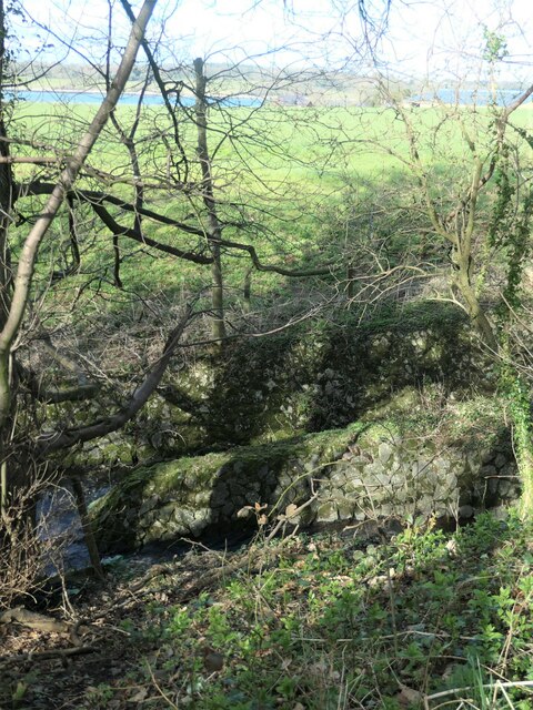
Caer Idris Images

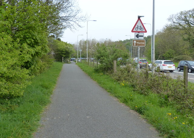
Images are sourced within 2km of 53.183/-4.252 or Grid Reference SH4967. Thanks to Geograph Open Source API. All images are credited.

Tir Plas Porthamel / Land at Plas Porthamel
Coed ym Mhlas Coch / Trees at Plas Coch
Parking Area on the A4080 near Llanedwen The A4080 road runs for 24½ miles along the southwestern side of Anglesey. It starts on the A5 at Llanfair Pwllgwyngyll and passes through several villages before terminating on the A5 between Bryngwran and Gwalchmai.
Parking Area on the A4080 near Llanedwen
The A4080 road runs for 24½ miles along the southwestern side of Anglesey. It starts on the A5 at Llanfair Pwllgwyngyll and passes through several villages before terminating on the A5 between Bryngwran and Gwalchmai.
A487 at Plas Menai Roundabout Roadworks at the Plas Menai Roundabout as the diversion to the A487 (the new Caernarfon to Bontnewydd bypass <span class="nowrap"><a title="https://gov.wales/a487-caernarfon-bontnewydd-bypass" rel="nofollow ugc noopener" href="https://gov.wales/a487-caernarfon-bontnewydd-bypass">Link</a><img style="margin-left:2px;" alt="External link" title="External link - shift click to open in new window" src="https://s1.geograph.org.uk/img/external.png" width="10" height="10"/></span> ) is nearing completion (it would be opened later in the week).
A487 at Plas Menai Roundabout
Roadworks at the Plas Menai Roundabout as the diversion to the A487 (the new Caernarfon to Bontnewydd bypass LinkExternal link ) is nearing completion (it would be opened later in the week).
This way to Griffiths Crossing and Caernarfon Lon Las Menai, heading south-west. Built on the track bed of the former railway between Bangor and Caernarfon.
This way to Griffiths Crossing and Caernarfon
Lon Las Menai, heading south-west. Built on the track bed of the former railway between Bangor and Caernarfon.
Unknown structures in a stream bed At the downstream end of a culvert under the former Bangor - Caernarfon railway.
Unknown structures in a stream bed
At the downstream end of a culvert under the former Bangor - Caernarfon railway.
A487, old and new In the foreground, the old A487 from Y Felinheli to Caernarfon [now the A4871]. Cutting through the hillside, the new A487 from Y Felinheli, bypassing both Caernarfon and Bontnewydd.
A487, old and new
In the foreground, the old A487 from Y Felinheli to Caernarfon [now the A4871]. Cutting through the hillside, the new A487 from Y Felinheli, bypassing both Caernarfon and Bontnewydd.
Lon Las Menai, near Llanfair Hall Farm The end of a short stretch along the pavement of Ffordd Caernarfon / Caernarfon Road.
Lon Las Menai, near Llanfair Hall Farm
The end of a short stretch along the pavement of Ffordd Caernarfon / Caernarfon Road.
The southern edge of Llanfair Wood Descending to the shore of the Menai Straits.
The southern edge of Llanfair Wood
Descending to the shore of the Menai Straits.
Trees along a field boundary, near Plas Llanfair Seen from Lon Las Menai.
Trees along a field boundary, near Plas Llanfair
Seen from Lon Las Menai.
Public footpath heading south-east towards Bethel On the south side of Caernarfon Road, near Llanfair Hall Farm.
Public footpath heading south-east towards Bethel
On the south side of Caernarfon Road, near Llanfair Hall Farm.
An entrance to Llanfair Hall Farm On the north side of Caernarfon Road.
An entrance to Llanfair Hall Farm
On the north side of Caernarfon Road.
The A487, just west of Y Felinheli The new road descends to the roundabout at the western end of the Y Felinheli bypass.
The A487, just west of Y Felinheli
The new road descends to the roundabout at the western end of the Y Felinheli bypass.
National Cycle Route 8 along the A4871 Caernarfon Road Route 8 of the National Cycle Network, also known as Lôn Las Cymru, runs for 436km (271 miles) between Cardiff and Holyhead via Brecon, Builth Wells, Machynlleth, Porthmadog and Bangor.  Between Machynlleth and Porthmadog there are alternative routes - one coastal, the other inland via Dolgellau, Coed y Brenin and Trawsfynydd.
National Cycle Route 8 along the A4871 Caernarfon Road
Route 8 of the National Cycle Network, also known as Lôn Las Cymru, runs for 436km (271 miles) between Cardiff and Holyhead via Brecon, Builth Wells, Machynlleth, Porthmadog and Bangor. Between Machynlleth and Porthmadog there are alternative routes - one coastal, the other inland via Dolgellau, Coed y Brenin and Trawsfynydd.
Wales Coast Path along the A4871 The Wales Coast Path (Welsh: Llwybr Arfordir Cymru) is a long distance footpath which follows the whole of the coastline of Wales. It opened on 5 May 2012, and offers a 870 mile long route from Chepstow in the south to Queensferry in the north.
Wales is the first country in the world to provide a dedicated footpath along its entire coastline. The Path runs through eleven National Nature Reserves and other nature reserves, including those managed by The Wildlife Trusts or Royal Society for the Protection of Birds (RSPB).
Logo can be seen at<a href="https://www.geograph.org.uk/photo/3738617">SS0897 : Logo, Wales Coast Path</a>.
Website: <span class="nowrap"><a title="http://www.walescoastpath.gov.uk/default.aspx" rel="nofollow ugc noopener" href="http://www.walescoastpath.gov.uk/default.aspx">Link</a><img style="margin-left:2px;" alt="External link" title="External link - shift click to open in new window" src="https://s1.geograph.org.uk/img/external.png" width="10" height="10"/></span>
Wales Coast Path along the A4871
The Wales Coast Path (Welsh: Llwybr Arfordir Cymru) is a long distance footpath which follows the whole of the coastline of Wales. It opened on 5 May 2012, and offers a 870 mile long route from Chepstow in the south to Queensferry in the north. Wales is the first country in the world to provide a dedicated footpath along its entire coastline. The Path runs through eleven National Nature Reserves and other nature reserves, including those managed by The Wildlife Trusts or Royal Society for the Protection of Birds (RSPB). Logo can be seen atSS0897 : Logo, Wales Coast Path. Website: LinkExternal link
Wales Coast Path along the Caernarfon Road The Wales Coast Path (Welsh: Llwybr Arfordir Cymru) is a long distance footpath which follows the whole of the coastline of Wales. It opened on 5 May 2012, and offers a 870 mile long route from Chepstow in the south to Queensferry in the north.
Wales is the first country in the world to provide a dedicated footpath along its entire coastline. The Path runs through eleven National Nature Reserves and other nature reserves, including those managed by The Wildlife Trusts or Royal Society for the Protection of Birds (RSPB).
Logo can be seen at<a href="https://www.geograph.org.uk/photo/3738617">SS0897 : Logo, Wales Coast Path</a>.
Website: <span class="nowrap"><a title="http://www.walescoastpath.gov.uk/default.aspx" rel="nofollow ugc noopener" href="http://www.walescoastpath.gov.uk/default.aspx">Link</a><img style="margin-left:2px;" alt="External link" title="External link - shift click to open in new window" src="https://s1.geograph.org.uk/img/external.png" width="10" height="10"/></span>
Wales Coast Path along the Caernarfon Road
The Wales Coast Path (Welsh: Llwybr Arfordir Cymru) is a long distance footpath which follows the whole of the coastline of Wales. It opened on 5 May 2012, and offers a 870 mile long route from Chepstow in the south to Queensferry in the north. Wales is the first country in the world to provide a dedicated footpath along its entire coastline. The Path runs through eleven National Nature Reserves and other nature reserves, including those managed by The Wildlife Trusts or Royal Society for the Protection of Birds (RSPB). Logo can be seen atSS0897 : Logo, Wales Coast Path. Website: LinkExternal link
The coast path takes to the beach A surprise to find that the Anglesey Coast Path follows the shoreline of the Menai Strait for around half a mile at this point.
The coast path takes to the beach
A surprise to find that the Anglesey Coast Path follows the shoreline of the Menai Strait for around half a mile at this point.
Sandbank in Menai Strait The latest OS map, as used on the Geograph website seems to have shrunk this sandbank, which is quite extensive at low tide. The person with the sailboard collected it and then walked to the shore on this side, never going more than chest deep.
Sandbank in Menai Strait
The latest OS map, as used on the Geograph website seems to have shrunk this sandbank, which is quite extensive at low tide. The person with the sailboard collected it and then walked to the shore on this side, never going more than chest deep.
Show me another place!

Caer Idris is located at Grid Ref: SH4967 (Lat: 53.183, Lng: -4.252)

Unitary Authority: Isle of Anglesey

Police Authority: North Wales

What 3 Words

///chilling.piglets.reshaping. Near Y Felinheli, Gwynedd

Related Wikis

Old Church of St Nidan, Llanidan

The Old Church of St Nidan, Llanidan is a medieval church in the community of Llanidan, in Anglesey, North Wales, close to the Menai Strait. The first...

St Nidan's Church, Llanidan

St Nidan's Church, Llanidan is a 19th-century parish church near the village of Brynsiencyn, in Anglesey, north Wales. Built between 1839 and 1843, it...

Menai Strait

The Menai Strait (Welsh: Afon Menai, the "river Menai") is a narrow stretch of shallow tidal water about 25 km (16 mi) long, which separates the island...

Llanidan

Llanidan is a community in the south of Anglesey, Wales which includes the village of Brynsiencyn (). The parish is along the Menai Strait, about 4 miles...

Llanfair-is-gaer

Llanfair-is-gaer was an ecclesiastical parish in Caernarfon, Gwynedd: the parish church was St Mary's. == References ==

Llanedwen

Llanedwen is a village in the community of Llanddaniel Fab, Anglesey, Wales, which is 126.5 miles (203.6 km) from Cardiff and 208.8 miles (336 km) from...

Perthi-Duon Burial Chamber

Perthi-Duon Burial Chamber is a Neolithic dolmen located to the west of Brynsiencyn, Anglesey, Wales. == Description == The monument is a collapsed burial...

Trefarthen

Trefarthen is a village in the community of Llanidan, Anglesey, Wales, which is 125.6 miles (202.1 km) from Cardiff and 209.2 miles (336.7 km) from London...

Nearby Amenities

Located within 500m of 53.183,-4.252
Barrier: stile
Lat/Long: 53.1849991/-4.2454185
Location Transition: yes
Power: pole
Lat/Long: 53.1803774/-4.2485628
Power: pole
Lat/Long: 53.1812157/-4.2496182
Power: pole
Lat/Long: 53.1819712/-4.2506079
Power: pole
Lat/Long: 53.1828094/-4.2511699
Power: pole
Lat/Long: 53.1837384/-4.2518029
Power: pole
Lat/Long: 53.184477/-4.2530648
Power: pole
Lat/Long: 53.1850267/-4.2539138
Power: pole
Lat/Long: 53.1857692/-4.2551462
The data included in this document is from www.openstreetmap.org. The data is made available under ODbL.

Have you been to Caer Idris?

Leave your review of Caer Idris below (or comments, questions and feedback).