Allt Ty-llŵyd

Wood, Forest in Carmarthenshire

Wales

Allt Ty-llŵyd

Rhan o fferm wynt De Brechfa / Part of South Brechfa wind farm
Rhan o fferm wynt De Brechfa / Part of South Brechfa wind farm Credit: David Jones

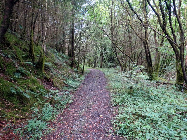
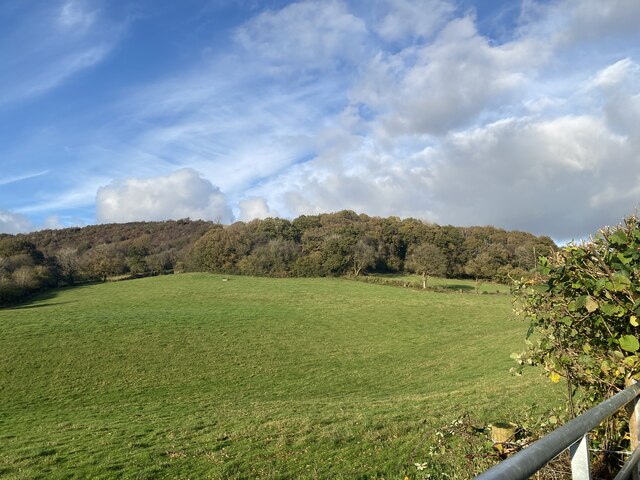
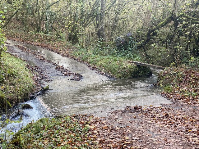
Allt Ty-llŵyd, located in Carmarthenshire, Wales, is a picturesque woodland area known for its natural beauty and tranquil atmosphere. With its name translating to "Wood, Forest" in English, it aptly describes the essence of this enchanting location.

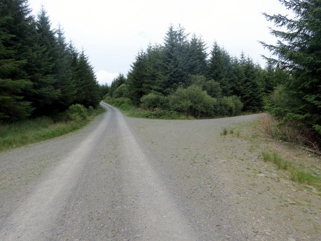
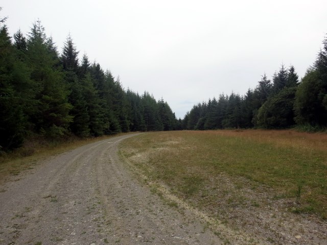
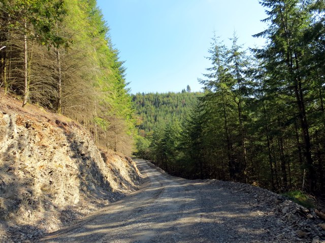
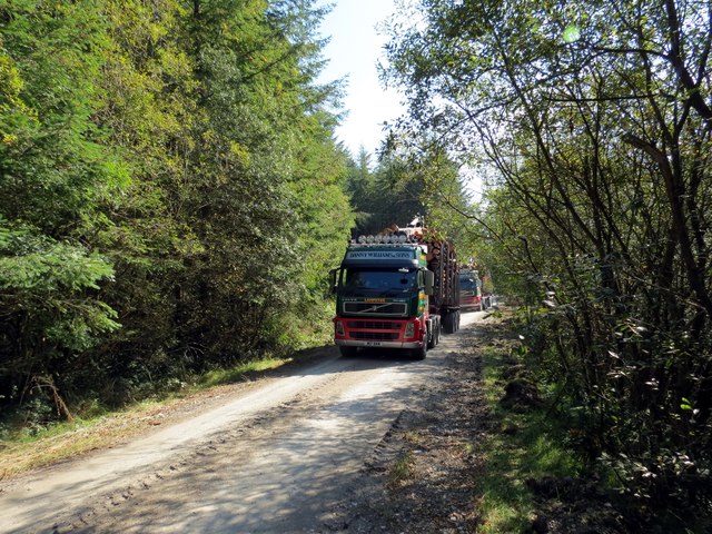
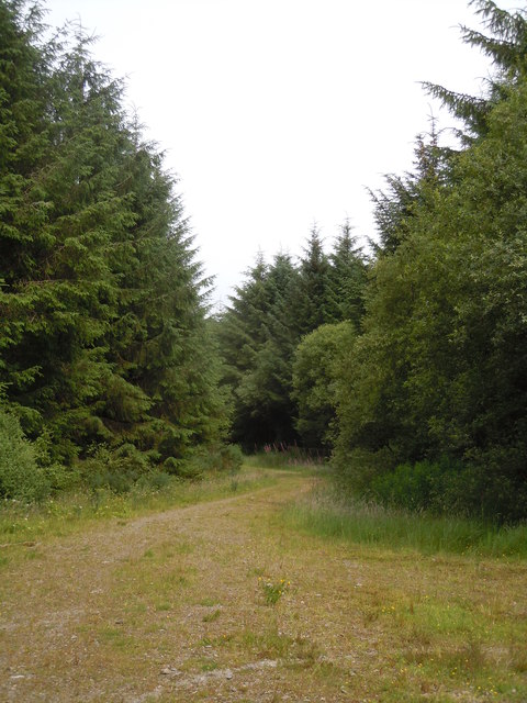
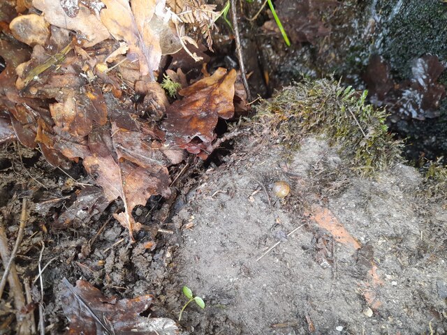
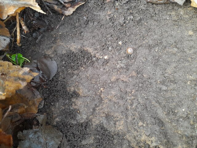
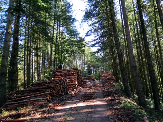
Spread across a vast area, Allt Ty-llŵyd is characterized by its dense and diverse collection of trees, including oak, beech, and birch, which create a rich and vibrant forest canopy. The forest floor is adorned with an array of wildflowers, ferns, and mosses, adding to the overall charm of the landscape.

The woodland is home to a variety of wildlife, making it a popular destination for nature enthusiasts. Visitors can spot a range of bird species, such as woodpeckers and owls, as well as squirrels, badgers, and foxes. The peaceful ambiance and secluded nature of Allt Ty-llŵyd make it an ideal habitat for these creatures.

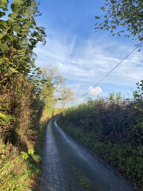
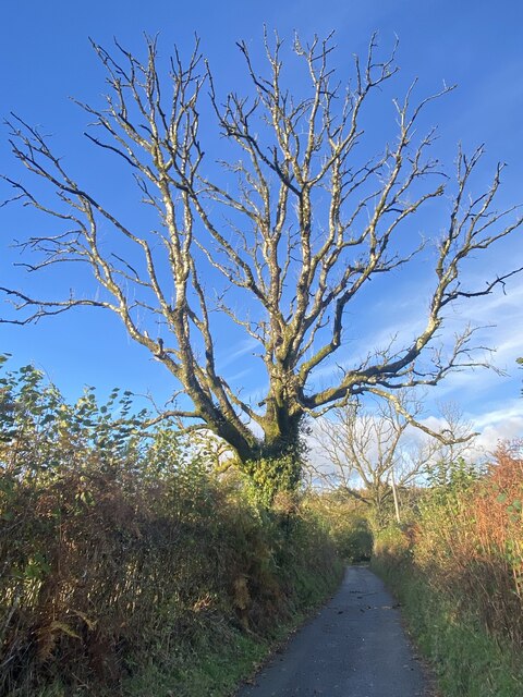
For those seeking outdoor activities, the woodland offers numerous walking trails that wind through its serene surroundings. These paths provide opportunities for visitors to immerse themselves in the natural beauty of the area, breathe in the fresh air, and enjoy the sights and sounds of the forest.

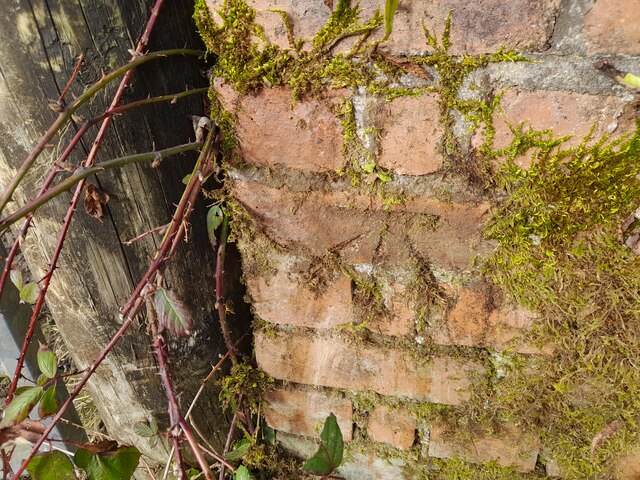
In addition to its natural allure, Allt Ty-llŵyd holds historical significance, with remnants of old stone walls and ruins scattered throughout the woodland. These remnants serve as a reminder of the rich cultural heritage that is intertwined with the natural landscape.

Allt Ty-llŵyd is a captivating destination that appeals to both nature lovers and history enthusiasts alike, offering a peaceful retreat from the hustle and bustle of everyday life.

If you have any feedback on the listing, please let us know in the comments section below.

Allt Ty-llŵyd Images

Images are sourced within 2km of 51.945409/-4.200719 or Grid Reference SN4829. Thanks to Geograph Open Source API. All images are credited.

Rhan o fferm wynt De Brechfa / Part of South Brechfa wind farm
Country lane towards Brechfa
Pen-crug-melyn Easy stroll from the narrow road, enough room to park 2 cars. Dry and sunny still.
Name: Pen-crug-melyn
Hill number: 2222
Height: 326m / 1070ft
Area: 31C: South-West Wales
Class: Ma
Grid ref: SN 50274 28509
Summit feature: trig point
Drop: 184m
Col: 142m  SN487293
Pen-crug-melyn
Easy stroll from the narrow road, enough room to park 2 cars. Dry and sunny still. Name: Pen-crug-melyn Hill number: 2222 Height: 326m / 1070ft Area: 31C: South-West Wales Class: Ma Grid ref: SN 50274 28509 Summit feature: trig point Drop: 184m Col: 142m SN487293
Crug Melyn Piler triongli ar garn o'r Oes Efydd. Enw'r garn yw Crug Melyn. Yn y pellter gwelir planhigfa goniferaidd enfawr Brechfa.

A trig point located on a Bronze Age mound known as Crug Melyn (trans. yellow or brown mound). In the distance is the huge Brechfa conifer plantation.
Crug Melyn
Piler triongli ar garn o'r Oes Efydd. Enw'r garn yw Crug Melyn. Yn y pellter gwelir planhigfa goniferaidd enfawr Brechfa. A trig point located on a Bronze Age mound known as Crug Melyn (trans. yellow or brown mound). In the distance is the huge Brechfa conifer plantation.
Uwchben Nant Hafren / Above Nant Hafren Llwybr dymunol ac yn hollol annisgwyl wrth droedio drwy goedwigoedd conifferaidd Llanllawddog. Dim heolydd cludo diflas yn y rhan hon o'r coed. 

A surprisingly pleasant path within the dense conifer plantation in Llanllawddog (trans. St Llawddog Church). No boring haulage roads in this neck of the woods!
Uwchben Nant Hafren / Above Nant Hafren
Llwybr dymunol ac yn hollol annisgwyl wrth droedio drwy goedwigoedd conifferaidd Llanllawddog. Dim heolydd cludo diflas yn y rhan hon o'r coed. A surprisingly pleasant path within the dense conifer plantation in Llanllawddog (trans. St Llawddog Church). No boring haulage roads in this neck of the woods!
Cyffordd mewn coedwig / Junction in forestry Cyffordd o lwybrau yng nghanol planhigfa goniferaidd fawr.

A junction in the middle of a large conifer plantation.
Cyffordd mewn coedwig / Junction in forestry
Cyffordd o lwybrau yng nghanol planhigfa goniferaidd fawr. A junction in the middle of a large conifer plantation.
Llannerch mewn coedwigoedd / Glade in a forestry Llannerch annisgwyl mewn planhigfa goniferaidd. 

An unexpected glade in a conifer plantation.
Llannerch mewn coedwigoedd / Glade in a forestry
Llannerch annisgwyl mewn planhigfa goniferaidd. An unexpected glade in a conifer plantation.
Cwm Pib Heol halio yng Nghwm Pib ger Brechfa.

A haulage road in Cwm Pib near Brechfa (trans. mottled place).
Cwm Pib
Heol halio yng Nghwm Pib ger Brechfa. A haulage road in Cwm Pib near Brechfa (trans. mottled place).
Cwm Pib Loriau halio yn cludo boncyffion yng Nghwm Pib.

Haulage lorries transporting logs in Cwm Pib.
Cwm Pib
Loriau halio yn cludo boncyffion yng Nghwm Pib. Haulage lorries transporting logs in Cwm Pib.
Track, South Brechfa Forest Llanllawddog
Skeletal tree Above Nant Goleu ford.
Skeletal tree
Above Nant Goleu ford.
Field and woodland
Field and woodland
Ordnance Survey Rivet This OS rivet can be found on the drain SE side of the road. It marks a point 124.791m above mean sea level.
Ordnance Survey Rivet
This OS rivet can be found on the drain SE side of the road. It marks a point 124.791m above mean sea level.
Ordnance Survey Rivet This OS rivet can be found on the NW parapet of the bridge over Nant Cwm Marydd. It marks a point 105.086m above mean sea level.
Ordnance Survey Rivet
This OS rivet can be found on the NW parapet of the bridge over Nant Cwm Marydd. It marks a point 105.086m above mean sea level.
Ordnance Survey Cut Mark This OS cut mark can be found on the farm building north side of the road. It marks a point 127.775m above mean sea level.
Ordnance Survey Cut Mark
This OS cut mark can be found on the farm building north side of the road. It marks a point 127.775m above mean sea level.
Cwm Pib Boncyffion yn aros i gael eu cludo yng Nghwm Pib.

Logs awaiting to be transported in Cwm Pib.
Cwm Pib
Boncyffion yn aros i gael eu cludo yng Nghwm Pib. Logs awaiting to be transported in Cwm Pib.
Nant Goleu ford
Nant Goleu ford
Ordnance Survey Rivet This OS rivet can be found on the churn stand NE side of the road. It marks a point 298.610m above mean sea level. <a title="https://www.geograph.org.uk/photo/7399295" href="https://www.geograph.org.uk/photo/7399295">Link</a>
Ordnance Survey Rivet
This OS rivet can be found on the churn stand NE side of the road. It marks a point 298.610m above mean sea level. Link
Show me another place!

Allt Ty-llŵyd is located at Grid Ref: SN4829 (Lat: 51.945409, Lng: -4.200719)

Unitary Authority: Carmarthenshire

Police Authority: Dyfed Powys

What 3 Words

///tributes.commands.taking. Near Llanfynydd, Carmarthenshire

Nearby Locations

Allt Ty-llŵyd

Related Wikis

Brechfa transmitting station

The Brechfa television relay station is sited on high ground to the east of the village of Brechfa to the northeast of Carmarthen. It was originally built...

Llanllawddog

Llanllawddog () is a community located in Carmarthenshire, south-west Wales. The population of the community taken at the 2011 census was 703.Llanllawddog...

Mynydd Ystyfflau-Carn

Mynydd Ystyfflau-Carn is a Site of Special Scientific Interest in Carmarthenshire, Wales. == See also == List of Sites of Special Scientific Interest in...

Brechfa

Brechfa, situated between Llandeilo and Carmarthen in the county of Carmarthenshire, Wales, is a village that has existed since the 6th century at the...
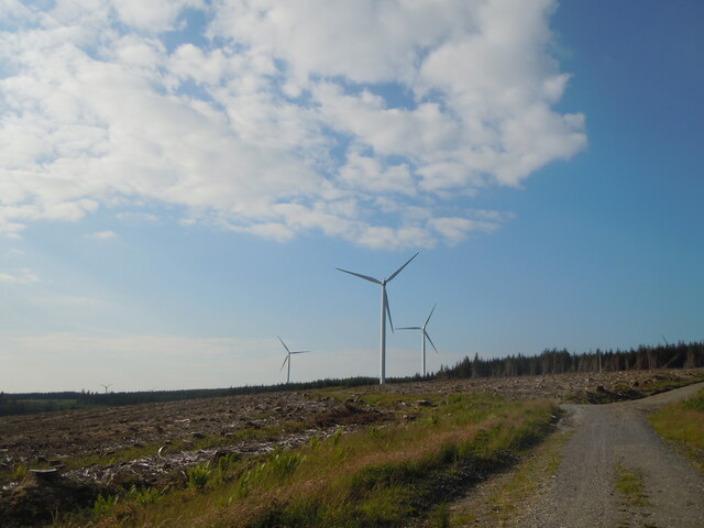
Alltwalis Wind Farm

The Alltwalis Wind Farm is a wind farm near Brechfa Forest located to the north of the town of Carmarthen in Wales. The facility is composed of 10 wind...

Alltwalis

Alltwalis is a village in Carmarthen, Carmarthenshire, Wales. It has a wind farm called Alltwalis Wind Farm. == References == == External links == Media...

Afon Marlais, Carmarthenshire

The Afon Marlais is a right-bank tributary of the Afon Cothi in Carmarthenshire, West Wales. It rises on the slopes of Mynydd Llanfihangel-rhos-y-corn...

Pontarsais

Pontarsais is a village in Carmarthenshire, Wales, 5 miles (8 km) north of Carmarthen and 57 miles (92 km) miles northwest of Cardiff (Caerdydd). The nearest...

Nearby Amenities

Located within 500m of 51.945409,-4.200719
Building: yes
Lat/Long: 51.9432624/-4.2035851
The data included in this document is from www.openstreetmap.org. The data is made available under ODbL.

Have you been to Allt Ty-llŵyd?

Leave your review of Allt Ty-llŵyd below (or comments, questions and feedback).