Allt y Commins

Wood, Forest in Cardiganshire

Wales

Allt y Commins

Tollhouse, Aberaeron North Turnpike The gate-post on the opposite side of the road bore an Ordnance Survey benchmark:

The mark was used on the Warrington to Pembroke Docks line of the First Primary Levelling of England & Wales in 1851-1852. It was levelled with a height of 61.650' above OD (Liverpool). Description: 664. Mark on West post of Aberaeron North Turnpike-gate ; 1.93 ft. above surface. Page 534 of the abstract: <span class="nowrap"><a title="https://www.bench-marks.org.uk/abstract/ew1gl/1GLA_534.png" rel="nofollow ugc noopener" href="https://www.bench-marks.org.uk/abstract/ew1gl/1GLA_534.png">Link</a><img style="margin-left:2px;" alt="External link" title="External link - shift click to open in new window" src="https://s1.geograph.org.uk/img/external.png" width="10" height="10"/></span>

From the West: <a href="https://www.geograph.org.uk/photo/7056118">SN4663 : Tollhouse, Aberaeron North Turnpike</a>
Tollhouse, Aberaeron North Turnpike Credit: N Scott

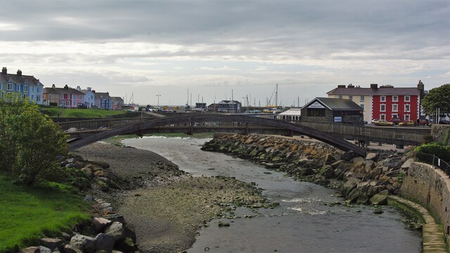
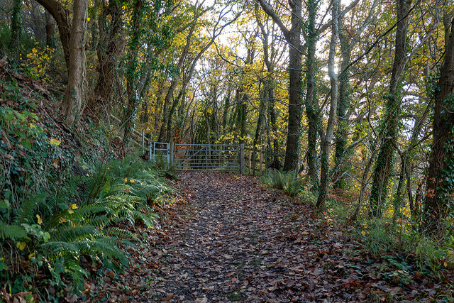
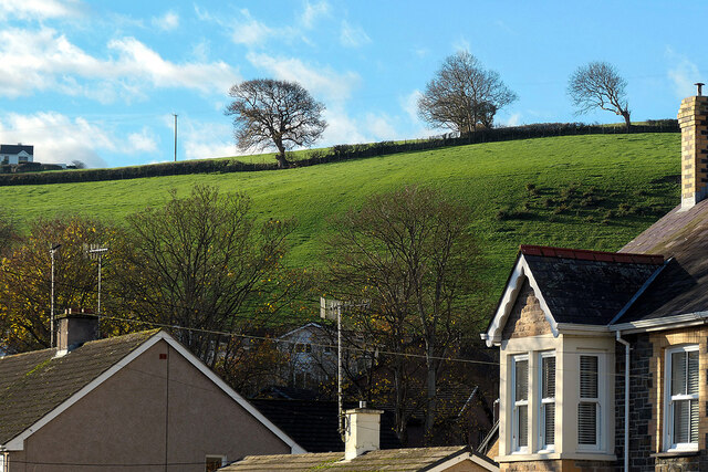
Allt y Commins is a picturesque wood located in Cardiganshire, a county in Wales. This forested area covers a vast expanse of land and is renowned for its natural beauty and diverse ecology. It is situated in close proximity to the small village of Llangrannog, adding to its charm and accessibility.

The wood is primarily composed of deciduous trees, including oak, beech, and ash, creating a vibrant and colorful landscape throughout the year. The lush vegetation provides a habitat for various wildlife species, such as deer, foxes, and numerous bird species, making it a popular destination for nature enthusiasts and birdwatchers.

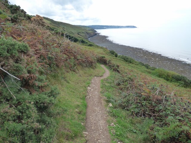
The forest offers several well-maintained walking trails, allowing visitors to explore its tranquil surroundings. These paths meander through the woodland, offering breathtaking views of the surrounding hills and valleys. Additionally, there is a small stream that flows through the wood, enhancing the overall serenity and natural appeal of the area.

Allt y Commins is also steeped in history and folklore. It is believed to have ancient roots, dating back to prehistoric times, and has played a significant role in local legends and traditions. The wood has been carefully preserved and protected, ensuring its conservation and the preservation of its historical and ecological significance.

Overall, Allt y Commins is a captivating and enchanting forest, offering a peaceful retreat from the hustle and bustle of modern life. Its natural beauty, diverse flora and fauna, and historical importance make it a must-visit destination for nature lovers and those seeking a connection with the rich heritage of Cardiganshire.

If you have any feedback on the listing, please let us know in the comments section below.

Allt y Commins Images

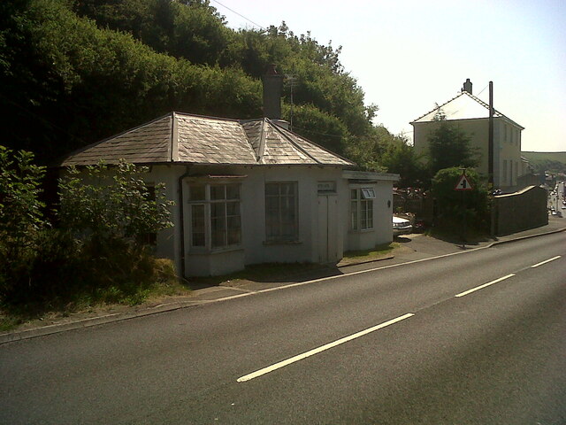
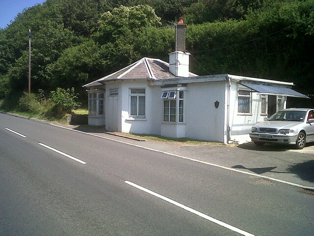
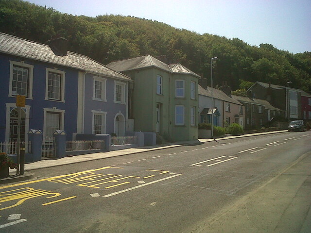
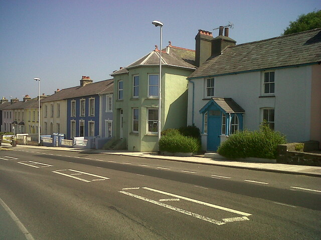
Images are sourced within 2km of 52.233754/-4.2501808 or Grid Reference SN4661. Thanks to Geograph Open Source API. All images are credited.
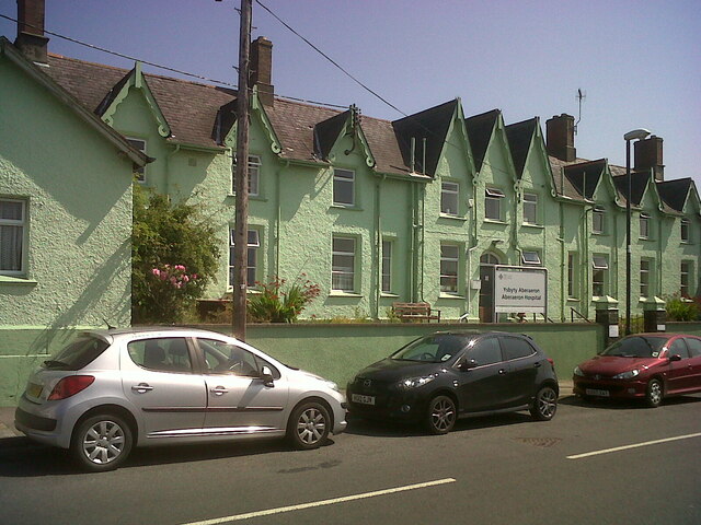
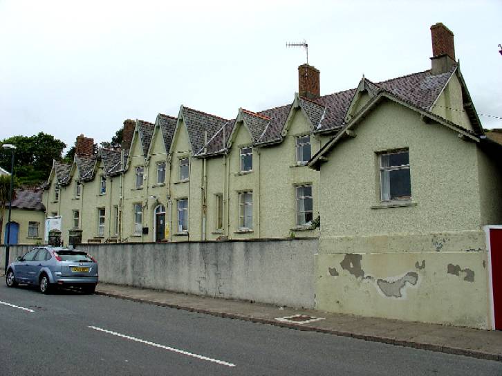
Tollhouse, Aberaeron North Turnpike The gate-post on the opposite side of the road bore an Ordnance Survey benchmark:

The mark was used on the Warrington to Pembroke Docks line of the First Primary Levelling of England & Wales in 1851-1852. It was levelled with a height of 61.650' above OD (Liverpool). Description: 664. Mark on West post of Aberaeron North Turnpike-gate ; 1.93 ft. above surface. Page 534 of the abstract: <span class="nowrap"><a title="https://www.bench-marks.org.uk/abstract/ew1gl/1GLA_534.png" rel="nofollow ugc noopener" href="https://www.bench-marks.org.uk/abstract/ew1gl/1GLA_534.png">Link</a><img style="margin-left:2px;" alt="External link" title="External link - shift click to open in new window" src="https://s1.geograph.org.uk/img/external.png" width="10" height="10"/></span>

From the West: <a href="https://www.geograph.org.uk/photo/7056118">SN4663 : Tollhouse, Aberaeron North Turnpike</a>
Tollhouse, Aberaeron North Turnpike
The gate-post on the opposite side of the road bore an Ordnance Survey benchmark: The mark was used on the Warrington to Pembroke Docks line of the First Primary Levelling of England & Wales in 1851-1852. It was levelled with a height of 61.650' above OD (Liverpool). Description: 664. Mark on West post of Aberaeron North Turnpike-gate ; 1.93 ft. above surface. Page 534 of the abstract: LinkExternal link From the West: SN4663 : Tollhouse, Aberaeron North Turnpike
Tollhouse, Aberaeron North Turnpike The gate-post on the opposite side of the road bore an Ordnance Survey benchmark:

The mark was used on the Warrington to Pembroke Docks line of the First Primary Levelling of England & Wales in 1851-1852. It was levelled with a height of 61.650' above OD (Liverpool). Description: 664. Mark on West post of Aberaeron North Turnpike-gate ; 1.93 ft. above surface. Page 534 of the abstract: <span class="nowrap"><a title="https://www.bench-marks.org.uk/abstract/ew1gl/1GLA_534.png" rel="nofollow ugc noopener" href="https://www.bench-marks.org.uk/abstract/ew1gl/1GLA_534.png">Link</a><img style="margin-left:2px;" alt="External link" title="External link - shift click to open in new window" src="https://s1.geograph.org.uk/img/external.png" width="10" height="10"/></span>

From the North-east: <a href="https://www.geograph.org.uk/photo/7056115">SN4663 : Tollhouse, Aberaeron North Turnpike</a>
Tollhouse, Aberaeron North Turnpike
The gate-post on the opposite side of the road bore an Ordnance Survey benchmark: The mark was used on the Warrington to Pembroke Docks line of the First Primary Levelling of England & Wales in 1851-1852. It was levelled with a height of 61.650' above OD (Liverpool). Description: 664. Mark on West post of Aberaeron North Turnpike-gate ; 1.93 ft. above surface. Page 534 of the abstract: LinkExternal link From the North-east: SN4663 : Tollhouse, Aberaeron North Turnpike
Tollhouse, Aberaeron West Turnpike The house to the West (right) of the tollhouse bore an Ordnance Survey benchmark:

The mark was used on the Warrington to Pembroke Docks line of the First Primary Levelling of England & Wales in 1851-1852. It was levelled with a height of 79.263' above OD (Liverpool). Description: 666. Mark on front of John Jones's house, at West side of Aberaeron West Turnpike-gate ; 0.87 ft. above surface. Page 535 of the abstract: <span class="nowrap"><a title="https://www.bench-marks.org.uk/abstract/ew1gl/1GLA_535.png" rel="nofollow ugc noopener" href="https://www.bench-marks.org.uk/abstract/ew1gl/1GLA_535.png">Link</a><img style="margin-left:2px;" alt="External link" title="External link - shift click to open in new window" src="https://s1.geograph.org.uk/img/external.png" width="10" height="10"/></span>

From the West: <a href="https://www.geograph.org.uk/photo/7056132">SN4562 : Tollhouse, Aberaeron West Turnpike</a>
Tollhouse, Aberaeron West Turnpike
The house to the West (right) of the tollhouse bore an Ordnance Survey benchmark: The mark was used on the Warrington to Pembroke Docks line of the First Primary Levelling of England & Wales in 1851-1852. It was levelled with a height of 79.263' above OD (Liverpool). Description: 666. Mark on front of John Jones's house, at West side of Aberaeron West Turnpike-gate ; 0.87 ft. above surface. Page 535 of the abstract: LinkExternal link From the West: SN4562 : Tollhouse, Aberaeron West Turnpike
Tollhouse, Aberaeron West Turnpike The house to the West (right) of the tollhouse bore an Ordnance Survey benchmark:

The mark was used on the Warrington to Pembroke Docks line of the First Primary Levelling of England & Wales in 1851-1852. It was levelled with a height of 79.263' above OD (Liverpool). Description: 666. Mark on front of John Jones's house, at West side of Aberaeron West Turnpike-gate ; 0.87 ft. above surface. Page 535 of the abstract: <span class="nowrap"><a title="https://www.bench-marks.org.uk/abstract/ew1gl/1GLA_535.png" rel="nofollow ugc noopener" href="https://www.bench-marks.org.uk/abstract/ew1gl/1GLA_535.png">Link</a><img style="margin-left:2px;" alt="External link" title="External link - shift click to open in new window" src="https://s1.geograph.org.uk/img/external.png" width="10" height="10"/></span>

From the North: <a href="https://www.geograph.org.uk/photo/7056127">SN4562 : Tollhouse, Aberaeron West Turnpike</a>
Tollhouse, Aberaeron West Turnpike
The house to the West (right) of the tollhouse bore an Ordnance Survey benchmark: The mark was used on the Warrington to Pembroke Docks line of the First Primary Levelling of England & Wales in 1851-1852. It was levelled with a height of 79.263' above OD (Liverpool). Description: 666. Mark on front of John Jones's house, at West side of Aberaeron West Turnpike-gate ; 0.87 ft. above surface. Page 535 of the abstract: LinkExternal link From the North: SN4562 : Tollhouse, Aberaeron West Turnpike
Afon Aeron Footbridge View from the road bridge
Afon Aeron Footbridge
View from the road bridge
New Sea Defences The limestone barrier being created in 2009
New Sea Defences
The limestone barrier being created in 2009
Sea defences at Aberaeron Boulders and groynes protect the promenade
Sea defences at Aberaeron
Boulders and groynes protect the promenade
Start of the Aberaeron to Lampeter Trail Leading out of Aberaeron.
Start of the Aberaeron to Lampeter Trail
Leading out of Aberaeron.
Aberaeron Integrated Care Centre Beside Afon Aeron and built on the site of the Aberaeron railway branch terminus.
Aberaeron Integrated Care Centre
Beside Afon Aeron and built on the site of the Aberaeron railway branch terminus.
The sun shines on Aberaeron! Sunlit houses in South Street.
The sun shines on Aberaeron!
Sunlit houses in South Street.
Panteg fields On the edge of Aberaeron.
Panteg fields
On the edge of Aberaeron.
The bridge over the Aeron At Aberaeron on a fine winter's day.
The bridge over the Aeron
At Aberaeron on a fine winter's day.
Aberaeron Union Workhouse/Cottage Hospital Aberayron Poor Law Union was the first in Cardiganshire to open a workhouse, which was built in 1839-40, by William Green, to designs of George Wilkinson.  It was converted for use as a hospital for injured soldiers in 1914 and became a cottage hospital in 1930.  The hospital closed in 2019, when the new Integrated Care Centre opened at the Minaeron site, Vicarage Hill.  The building was demolished in 2021.

Side: <a href="https://www.geograph.org.uk/photo/7358085">SN4662 : Aberaeron Union Workhouse/Cottage Hospital</a>
Aberaeron Union Workhouse/Cottage Hospital
Aberayron Poor Law Union was the first in Cardiganshire to open a workhouse, which was built in 1839-40, by William Green, to designs of George Wilkinson. It was converted for use as a hospital for injured soldiers in 1914 and became a cottage hospital in 1930. The hospital closed in 2019, when the new Integrated Care Centre opened at the Minaeron site, Vicarage Hill. The building was demolished in 2021. Side: SN4662 : Aberaeron Union Workhouse/Cottage Hospital
Aberaeron Union Workhouse/Cottage Hospital This face of the building bore OSBM flush bracket S0449 at the East (left) angle:

The bracket was used on the Aberystwyth to Lampeter secondary line of the Second Geodetic Levelling of England & Wales in 1942. It was levelled with a height of 43.956' above OD (Newlyn). Description: E angle of workhouse, Aberayron. Abstract A 483: <span class="nowrap"><a title="http://discovery.nationalarchives.gov.uk/details/r/C11178827" rel="nofollow ugc noopener" href="http://discovery.nationalarchives.gov.uk/details/r/C11178827">Link</a><img style="margin-left:2px;" alt="External link" title="External link - shift click to open in new window" src="https://s1.geograph.org.uk/img/external.png" width="10" height="10"/></span> [OS 54/148]

The bracket, which had been obscured by rendering, was replaced by G2986 on the Midland Bank for the Third Geodetic Levelling in 1956.

Front: <a href="https://www.geograph.org.uk/photo/7358078">SN4662 : Aberaeron Union Workhouse/Cottage Hospital</a>
Aberaeron Union Workhouse/Cottage Hospital
This face of the building bore OSBM flush bracket S0449 at the East (left) angle: The bracket was used on the Aberystwyth to Lampeter secondary line of the Second Geodetic Levelling of England & Wales in 1942. It was levelled with a height of 43.956' above OD (Newlyn). Description: E angle of workhouse, Aberayron. Abstract A 483: LinkExternal link [OS 54/148] The bracket, which had been obscured by rendering, was replaced by G2986 on the Midland Bank for the Third Geodetic Levelling in 1956. Front: SN4662 : Aberaeron Union Workhouse/Cottage Hospital
Ceredigion Coast Path Well trodden along this length.
Ceredigion Coast Path
Well trodden along this length.
Low tide at Aberaeron
Footbridge over the River Aeron
Groynes at Aberaeron
Show me another place!

Allt y Commins is located at Grid Ref: SN4661 (Lat: 52.233754, Lng: -4.2501808)

Unitary Authority: Ceredigion

Police Authority: Dyfed Powys

What 3 Words

///piglets.fragments.gala. Near Aberaeron, Ceredigion

Related Wikis

Nearby Amenities

Located within 500m of 52.233754,-4.2501808
Created By: POI Editor
Source: npe
Lat/Long: 52.2360135/-4.2553851
Source: npe
Lat/Long: 52.2325748/-4.2534738
Source: npe
Lat/Long: 52.2323363/-4.2520605
Source: npe
Lat/Long: 52.230698/-4.2498368
Bus Stop
Llys Aeron
Public Transport: platform
Shelter: no
Timetable: yes
Lat/Long: 52.2341882/-4.2567753
Bus Stop
Llys Aeron
Public Transport: platform
Shelter: no
Timetable: yes
Lat/Long: 52.2342223/-4.257078
Power: pole
Lat/Long: 52.2333727/-4.2569614
Power: pole
Lat/Long: 52.2331024/-4.2570875
Power: pole
Lat/Long: 52.2329924/-4.2571706
Power: pole
Lat/Long: 52.2327443/-4.2573329
Tourism: picnic_site
Lat/Long: 52.2339098/-4.25349
Fixme: longer than this
Lat/Long: 52.235008/-4.2524788
Direction: SW
Generator Method: photovoltaic
Generator Output Electricity: yes
Generator Solar Modules: 6
Generator Source: solar
Generator Type: solar_photovoltaic_panel
Location: roof
Power: generator
Lat/Long: 52.2347455/-4.2570124
Direction: 145
Generator Method: photovoltaic
Generator Output Electricity: yes
Generator Solar Modules: 15
Generator Source: solar
Generator Type: solar_photovoltaic_panel
Location: roof
Power: generator
Lat/Long: 52.2337431/-4.2569822
Direction: 235
Generator Method: photovoltaic
Generator Output Electricity: yes
Generator Solar Modules: 14
Generator Source: solar
Generator Type: solar_photovoltaic_panel
Location: roof
Power: generator
Lat/Long: 52.2337743/-4.2562312
Direction: SE
Generator Method: photovoltaic
Generator Output Electricity: yes
Generator Solar Modules: 8
Generator Source: solar
Generator Type: solar_photovoltaic_panel
Location: roof
Power: generator
Lat/Long: 52.2344113/-4.2562741
Direction: SE
Generator Method: photovoltaic
Generator Output Electricity: yes
Generator Solar Modules: 8
Generator Source: solar
Generator Type: solar_photovoltaic_panel
Location: roof
Power: generator
Lat/Long: 52.2344466/-4.2562131
Direction: SE
Generator Method: photovoltaic
Generator Output Electricity: yes
Generator Solar Modules: 11
Generator Source: solar
Generator Type: solar_photovoltaic_panel
Location: roof
Power: generator
Lat/Long: 52.2347057/-4.25706
Direction: 145
Generator Method: photovoltaic
Generator Output Electricity: yes
Generator Solar Modules: 14
Generator Source: solar
Generator Type: solar_photovoltaic_panel
Location: roof
Power: generator
Lat/Long: 52.2350671/-4.253549
The data included in this document is from www.openstreetmap.org. The data is made available under ODbL.

Have you been to Allt y Commins?

Leave your review of Allt y Commins below (or comments, questions and feedback).