Allt Cwmneuadd

Wood, Forest in Cardiganshire

Wales

Allt Cwmneuadd

Church of St David Panorama Viewed from a lay-by on the A487
Church of St David Panorama Credit: Kevin Waterhouse

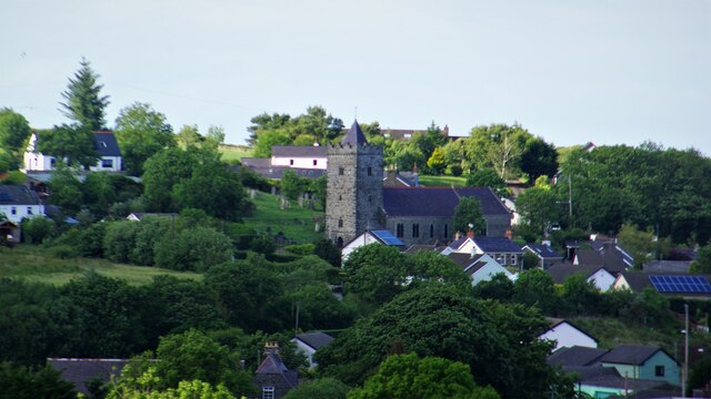
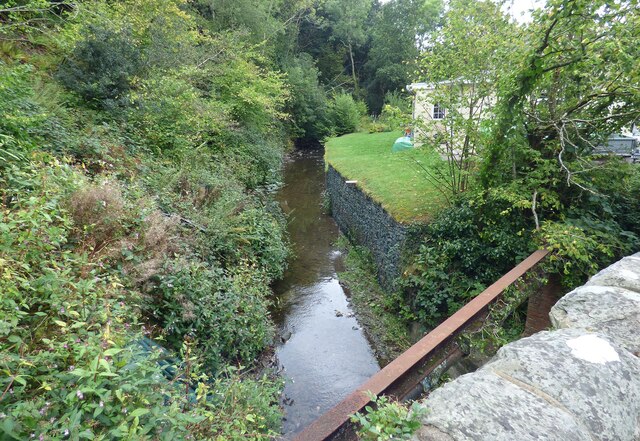
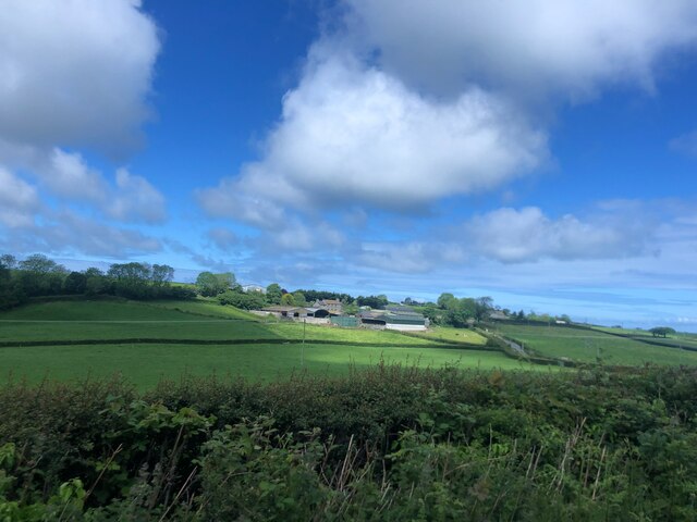
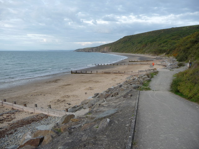
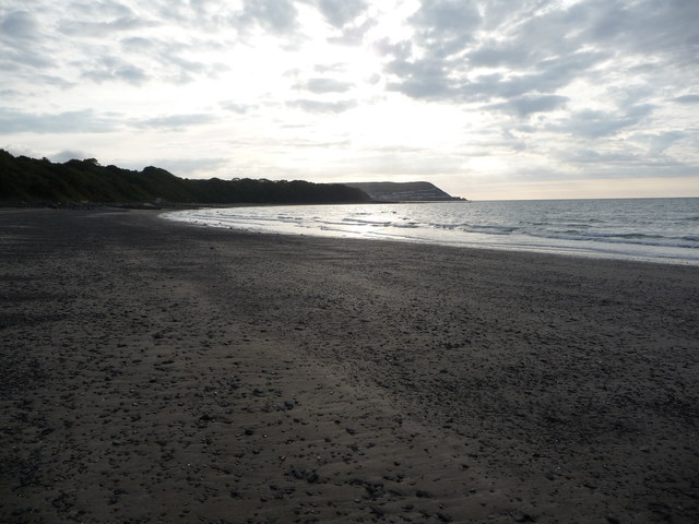
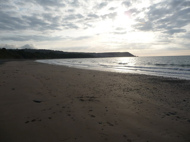
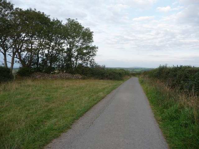
Allt Cwmneuadd is a picturesque woodland area located in the county of Cardiganshire, Wales. Spread across a vast area, the woodland is known for its natural beauty, tranquil atmosphere, and diverse flora and fauna.

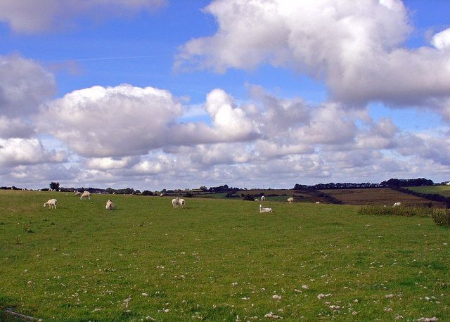
The woodland is predominantly composed of native tree species such as oak, beech, and birch, which create a dense and lush canopy overhead. The forest floor is covered with a rich carpet of ferns, mosses, and wildflowers, providing a habitat for a variety of small mammals, birds, and insects.

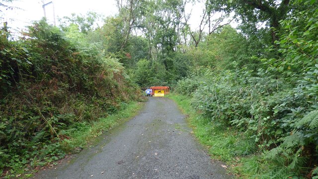
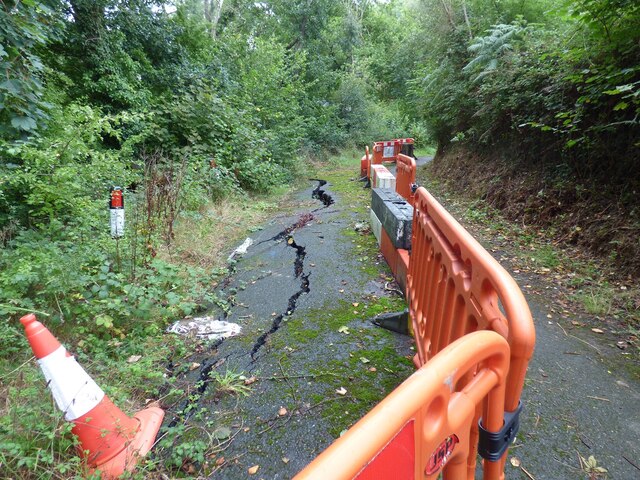
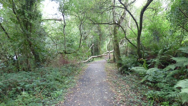
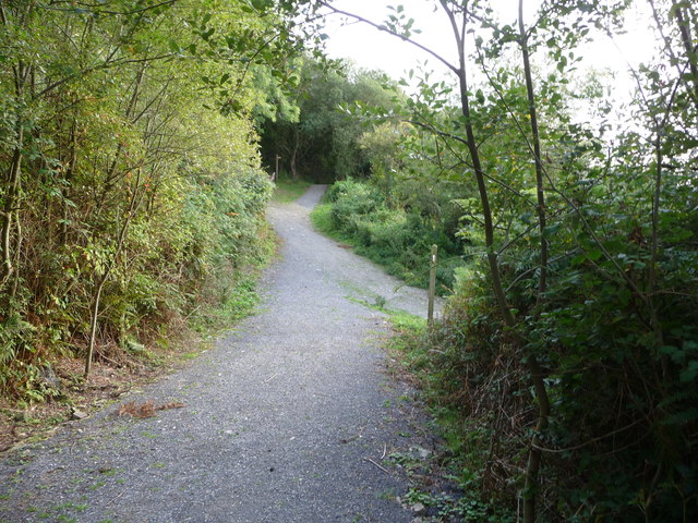
Numerous walking trails wind through the woodland, allowing visitors to explore its hidden corners and discover its hidden treasures. These trails provide breathtaking views of the surrounding countryside and are a popular choice for nature enthusiasts and hikers.

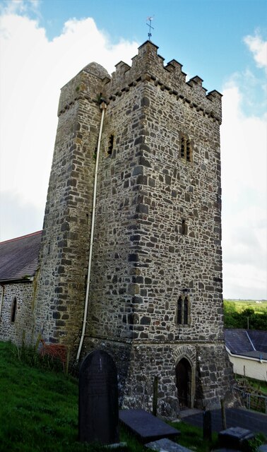
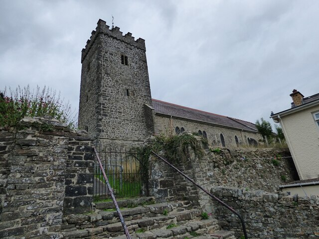
Allt Cwmneuadd also has a significant historical and cultural importance. In the heart of the woodland, there are remnants of ancient settlements, including stone circles and burial mounds, which hint at the area's rich past. These historical features attract archaeologists and history buffs from near and far.

The woodland is managed and protected by local authorities to preserve its natural habitat and ensure its sustainability. It is a designated Site of Special Scientific Interest (SSSI) due to its ecological importance. Visitors are encouraged to respect the environment, follow designated paths, and adhere to any guidelines or restrictions in place.

In summary, Allt Cwmneuadd is a stunning woodland in Cardiganshire, offering a tranquil escape from the hustle and bustle of everyday life. With its diverse wildlife, scenic trails, and historical significance, it is a must-visit destination for nature lovers and history enthusiasts alike.

If you have any feedback on the listing, please let us know in the comments section below.

Allt Cwmneuadd Images

Images are sourced within 2km of 52.200498/-4.3277161 or Grid Reference SN4158. Thanks to Geograph Open Source API. All images are credited.

Church of St David Panorama Viewed from a lay-by on the A487
Church of St David Panorama
Viewed from a lay-by on the A487
Church of St David The west tower with the staircase tower
Church of St David
The west tower with the staircase tower
Church of St David The church is cut into the hillside so very difficult to photograph. Under the bell tower is a good inscribed cross grave stone (or marker)
Church of St David
The church is cut into the hillside so very difficult to photograph. Under the bell tower is a good inscribed cross grave stone (or marker)
Closed Road Only walkers can pass.
Closed Road
Only walkers can pass.
Road Subsidence This road appears to be sliding down the hill.
Road Subsidence
This road appears to be sliding down the hill.
Afon Llethi at Gilfachreda
Ceredigion Coast Path A tree fallen across the path at this point.
Ceredigion Coast Path
A tree fallen across the path at this point.
St David's Church <span class="nowrap"><a title="https://www.dyfedarchaeology.org.uk/wp/discovery/projects/churches/st-david-llanarth-ceredigion/" rel="nofollow ugc noopener" href="https://www.dyfedarchaeology.org.uk/wp/discovery/projects/churches/st-david-llanarth-ceredigion/">Link</a><img style="margin-left:2px;" alt="External link" title="External link - shift click to open in new window" src="https://s1.geograph.org.uk/img/external.png" width="10" height="10"/></span>
St David's Church
A487 approaching Llanarth
Sun shining on Castell-y-Geifr farm
B4342 near Cefn Garsi
A487 north of Llanarth
B4342 in Llanarth
B4342 in Llanarth
Part of Little Quay Bay and Cei-bach beach Looking north up the coast of Cardigan Bay over this isolated and quiet beach with its storm defences to prevent erosion of the sands and foreshore.
Part of Little Quay Bay and Cei-bach beach
Looking north up the coast of Cardigan Bay over this isolated and quiet beach with its storm defences to prevent erosion of the sands and foreshore.
On Cei-bach Beach Looking westwards towards the headland and the New Quay headland beyond.
On Cei-bach Beach
Looking westwards towards the headland and the New Quay headland beyond.
On Cei-bach beach, looking westwards An August evening beside the sea, who would want to be anywhere else?
On Cei-bach beach, looking westwards
An August evening beside the sea, who would want to be anywhere else?
Junction of paths above the Ceredigion coast Paths contour along the steep hillside above Little Quay Bay and some run down to the beach and up to the fields above.
Junction of paths above the Ceredigion coast
Paths contour along the steep hillside above Little Quay Bay and some run down to the beach and up to the fields above.
Lane with a hardcore store beside it Rubble, pebbles, stone and building or demolition rubble is piled here, available for filling potholes in the nearby farms.
Lane with a hardcore store beside it
Rubble, pebbles, stone and building or demolition rubble is piled here, available for filling potholes in the nearby farms.
Show me another place!

Allt Cwmneuadd is located at Grid Ref: SN4158 (Lat: 52.200498, Lng: -4.3277161)

Unitary Authority: Ceredigion

Police Authority: Dyfed Powys

What 3 Words

///reshape.blockage.wordplay. Near Llanarth, Ceredigion

Related Wikis

Gilfachrheda

Gilfachrheda or Gilfachreda is a village in the community of Llanarth, Ceredigion, Wales, at the confluence of two small rivers, the Afon Gido and the...

Llaingarreglwyd

Llaingarreglwyd is a hamlet in the community of Llanarth, Ceredigion, Wales, which is 70 miles (112.6 km) from Cardiff and 185.3 miles (298.1 km) from...

Llanarth, Ceredigion

Llanarth is both a small village and a community in Ceredigion, Wales. It is on the A487 road and is about 3 miles (4.8 km) from both Aberaeron and New...

Llanllwchaiarn, Ceredigion

Llanllwchaiarn is a community in Ceredigion, Wales, surrounding New Quay and had a population of 848 at the 2011 UK census. The community council uses...

Nearby Amenities

Located within 500m of 52.200498,-4.3277161
Bus Stop
Kerb: raised
Shelter: yes
Lat/Long: 52.2040145/-4.3280645
Bus Stop
Kerb: raised
Naptan AtcoCode: 5230AWD71995
Naptan NaptanCode: cejatgt
Shelter: yes
Lat/Long: 52.2040472/-4.327687
Telephone
Booth: KX100
Covered: booth
Lat/Long: 52.2040676/-4.3277975
Gilfachrheda
Alt Name: Gilfachreda
Place: hamlet
Source Name: OS_OpenData_StreetView
Wikidata: Q16001002
Wikipedia: en:Gilfachrheda
Lat/Long: 52.2046192/-4.3270596
Direction: 195
Generator Method: photovoltaic
Generator Output Electricity: yes
Generator Solar Modules: 12
Generator Source: solar
Generator Type: solar_photovoltaic_panel
Location: roof
Power: generator
Lat/Long: 52.2040147/-4.3263307
Direction: 195
Generator Method: photovoltaic
Generator Output Electricity: yes
Generator Solar Modules: 12
Generator Source: solar
Generator Type: solar_photovoltaic_panel
Location: roof
Power: generator
Lat/Long: 52.2040318/-4.3264357
Direction: 185
Generator Method: photovoltaic
Generator Output Electricity: yes
Generator Solar Modules: 6
Generator Source: solar
Generator Type: solar_photovoltaic_panel
Location: roof
Power: generator
Lat/Long: 52.2044355/-4.3291886
Direction: 185
Generator Method: photovoltaic
Generator Output Electricity: yes
Generator Solar Modules: 6
Generator Source: solar
Generator Type: solar_photovoltaic_panel
Location: roof
Power: generator
Lat/Long: 52.2044444/-4.3292959
The data included in this document is from www.openstreetmap.org. The data is made available under ODbL.

Have you been to Allt Cwmneuadd?

Leave your review of Allt Cwmneuadd below (or comments, questions and feedback).