Allt Godre-Cynnen

Wood, Forest in Carmarthenshire

Wales

Allt Godre-Cynnen

Pontdroed Felin Newydd  / Felin Newydd footbridge Pontdroed yn rhychwantu nant ddi-enw gerllaw'r Felin Newydd (jyst mewn golwg yn y pellter). Mae'r nant hefyd yn ffinio dau blwyf, sef Abernant a Llannewydd. Noder y rhyd. Mae'r hen heol yn dringo'r bryn i gyfeiriad Ffarm Shidenyn a phan roedd y felin yn ei hanterth gwelid, yn sicr, lawer o fynd a dod arni. Heddiw, ambell gerddwr sydd yn ei defnyddio. 

A footbridge spanning an unnamed stream near Felin Newydd (trans. New Mill), just visible in the distance. The stream also acts an administrative boundary for two parishes, Abernant and Newchurch. Note the ford. The road leads up the hill in the direction of Shidenyn Farm. Without doubt, when the mill was working the old road would have seen much coming and going. Today, only the occasional walker uses it.
Pontdroed Felin Newydd / Felin Newydd footbridge Credit: Alan Richards

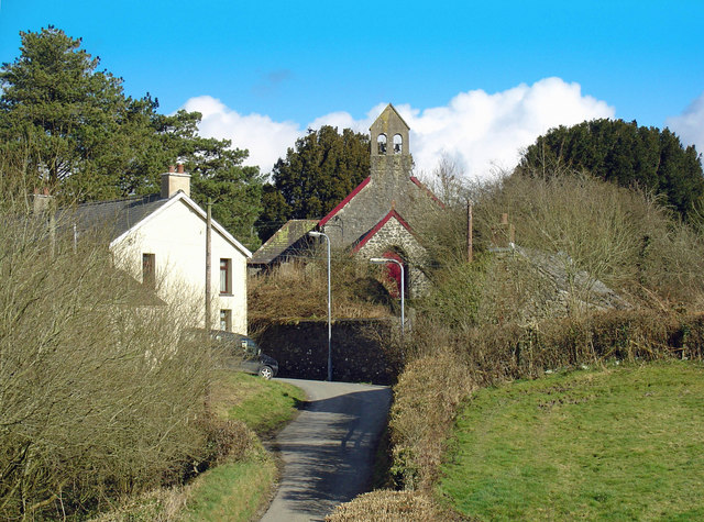
Allt Godre-Cynnen is a picturesque woodland located in Carmarthenshire, Wales. Spread across a vast area, this ancient forest is a haven for nature enthusiasts and offers a tranquil escape from the bustling city life. The name "Allt Godre-Cynnen" translates to "Wood of the Cynnen Ridge" in English, alluding to the forest's location on the slopes of the Cynnen Ridge.

The woodland is characterized by a diverse range of trees, including oak, ash, beech, and silver birch, which create a dense canopy overhead. The forest floor is covered in a carpet of lush green moss and ferns, providing a habitat for a multitude of flora and fauna.

A network of well-maintained walking trails winds through the forest, allowing visitors to explore its beauty at their own pace. Along these paths, one may stumble upon hidden streams, babbling brooks, and small waterfalls, adding to the enchanting ambiance of the woodland.

Allt Godre-Cynnen is not only a sanctuary for plants and animals but also a site of historical significance. The area is home to ancient ruins and remnants of Celtic settlements, providing a glimpse into the rich cultural heritage of the region.

The forest is a popular destination for outdoor activities such as hiking, birdwatching, and photography. It also offers opportunities for educational visits and guided tours, allowing visitors to learn about the forest's ecology and history.

In summary, Allt Godre-Cynnen is a captivating woodland in Carmarthenshire, offering a serene environment, a diverse range of flora and fauna, and a glimpse into the area's historical past.

If you have any feedback on the listing, please let us know in the comments section below.

Allt Godre-Cynnen Images

Images are sourced within 2km of 51.87766/-4.3772077 or Grid Reference SN3622. Thanks to Geograph Open Source API. All images are credited.

Pontdroed Felin Newydd  / Felin Newydd footbridge Pontdroed yn rhychwantu nant ddi-enw gerllaw'r Felin Newydd (jyst mewn golwg yn y pellter). Mae'r nant hefyd yn ffinio dau blwyf, sef Abernant a Llannewydd. Noder y rhyd. Mae'r hen heol yn dringo'r bryn i gyfeiriad Ffarm Shidenyn a phan roedd y felin yn ei hanterth gwelid, yn sicr, lawer o fynd a dod arni. Heddiw, ambell gerddwr sydd yn ei defnyddio. 

A footbridge spanning an unnamed stream near Felin Newydd (trans. New Mill), just visible in the distance. The stream also acts an administrative boundary for two parishes, Abernant and Newchurch. Note the ford. The road leads up the hill in the direction of Shidenyn Farm. Without doubt, when the mill was working the old road would have seen much coming and going. Today, only the occasional walker uses it.
Pontdroed Felin Newydd / Felin Newydd footbridge
Pontdroed yn rhychwantu nant ddi-enw gerllaw'r Felin Newydd (jyst mewn golwg yn y pellter). Mae'r nant hefyd yn ffinio dau blwyf, sef Abernant a Llannewydd. Noder y rhyd. Mae'r hen heol yn dringo'r bryn i gyfeiriad Ffarm Shidenyn a phan roedd y felin yn ei hanterth gwelid, yn sicr, lawer o fynd a dod arni. Heddiw, ambell gerddwr sydd yn ei defnyddio. A footbridge spanning an unnamed stream near Felin Newydd (trans. New Mill), just visible in the distance. The stream also acts an administrative boundary for two parishes, Abernant and Newchurch. Note the ford. The road leads up the hill in the direction of Shidenyn Farm. Without doubt, when the mill was working the old road would have seen much coming and going. Today, only the occasional walker uses it.
Plough and Harrow Inn Alternative view from <a href="https://www.geograph.org.uk/photo/738441">SN3822 : Plough and Harrows Inn</a>
Plough and Harrow Inn
Alternative view from SN3822 : Plough and Harrows Inn
Triangulation Pillar (S2341) Merthyr Secondary Triangulation Pillar carries Flush Bracket S2341 which marks a point 164.400m above mean sea level.
Triangulation Pillar (S2341)
Merthyr Secondary Triangulation Pillar carries Flush Bracket S2341 which marks a point 164.400m above mean sea level.
Llwybr Pantycendy Hall  / Pantycendy path Gât fochyn ar lwybr cyhoeddus sy'n mynd heibio i Neuadd Pantycendy.

Kissing gate on a path that goes past Pantycendy Hall (poss. from Pantycefndu  i.e. black ridge hollow?)
Llwybr Pantycendy Hall / Pantycendy path
Gât fochyn ar lwybr cyhoeddus sy'n mynd heibio i Neuadd Pantycendy. Kissing gate on a path that goes past Pantycendy Hall (poss. from Pantycefndu i.e. black ridge hollow?)
Llwybr Felin Newydd  / Felin Newydd path Gatiau a gwifren bigog yn rhwystro'r llwybr cyhoeddus uwchlaw'r Felin Newydd. 

Gates and barbed wire obstruct a public footpath above Felin Newydd (trans. new mill).
Llwybr Felin Newydd / Felin Newydd path
Gatiau a gwifren bigog yn rhwystro'r llwybr cyhoeddus uwchlaw'r Felin Newydd. Gates and barbed wire obstruct a public footpath above Felin Newydd (trans. new mill).
Ordnance Survey Cut Mark This OS cut mark can be found on the gatepost on the north side of the road. It marks a point 128.827m above mean sea level.
Ordnance Survey Cut Mark
This OS cut mark can be found on the gatepost on the north side of the road. It marks a point 128.827m above mean sea level.
Ford below Penygaer Farm This ford is found at Felin Newydd at the start of the now blocked byway leading up to Shidenyn Farm.
The next farm upstream is Pen Y Gaer Farm which featured in the BBC film Borrowed Pasture which  featured two Polish soldiers trying to make a living on the farm and was narrated by Richard Burton.
Ford below Penygaer Farm
This ford is found at Felin Newydd at the start of the now blocked byway leading up to Shidenyn Farm. The next farm upstream is Pen Y Gaer Farm which featured in the BBC film Borrowed Pasture which featured two Polish soldiers trying to make a living on the farm and was narrated by Richard Burton.
Track to Waungochen Farm
Araf - Slow Approaching a bend near Bwlchnewydd.
Araf - Slow
Approaching a bend near Bwlchnewydd.
Esgairhir Isaf
Esgairhir Isaf
Gateway to Neuadd Deg
Noddfa Welsh Baptist Chapel
Postbox at road junction Typical single-track road in this hilly rural area of Carmarthenshire.
Postbox at road junction
Typical single-track road in this hilly rural area of Carmarthenshire.
Old and New A pylon built on the indistinct remains of the fortifications of an ancient settlement.
Old and New
A pylon built on the indistinct remains of the fortifications of an ancient settlement.
Blaencynnen Smallholding with stream, ponds and waterfowl.
Blaencynnen
Smallholding with stream, ponds and waterfowl.
Baptist Church
Baptist Church
Plough and Harrows Inn Country public house with old ploughs.
Plough and Harrows Inn
Country public house with old ploughs.
Trawsmawr's valley Showing the southern part of Trawsmawr (taken from in front of the houses at the road junction on the eastern square edge).
Trawsmawr's valley
Showing the southern part of Trawsmawr (taken from in front of the houses at the road junction on the eastern square edge).
Show me another place!

Allt Godre-Cynnen is located at Grid Ref: SN3622 (Lat: 51.87766, Lng: -4.3772077)

Unitary Authority: Carmarthenshire

Police Authority: Dyfed Powys

What 3 Words

///maddening.sunbeam.manages. Near Abernant, Carmarthenshire

Related Wikis

Newchurch and Merthyr

Newchurch and Merthyr is a community located in Carmarthenshire, Wales including the villages of Newchurch (Welsh: Eglwysnewydd) and Merthyr. The community...

Abernant, Carmarthenshire

Abernant is a hamlet and community in Carmarthenshire, Wales. The population taken at the 2011 census was 297. == Location == Abernant is a small hamlet...

Maesyprior

Maesyprior is a Site of Special Scientific Interest in Carmarthen & Dinefwr, Wales. A system of glacial meltwater channels preserved at this site contains...

Llannewydd

Llannewydd or Newchurch is a parish in Carmarthenshire, Wales. It is 3 miles (5 km) north of Carmarthen on the banks of the Gwili. The church was rebuilt...

Llanllwch

Llanllwch is a hamlet in Carmarthenshire, Wales approximately 2 miles (3.2 km) west of Carmarthen. == History == The name Llanllwch derives from a lake...

St David's Hospital, Carmarthen

St David's Hospital (Welsh: Ysbyty Dewi Sant) was a psychiatric hospital in Carmarthen, Wales. The main Victorian building is Grade II listed. == History... ==

Elvet Hundred

Elvet was a hundred, a geographic division, in the northwest of the traditional county of Carmarthenshire, Wales. Boundaries Extent of the Elvet Hundreds...

Cors Goch National Nature Reserve (Llanllwch)

Cors Goch National Nature Reserve, a couple of miles west of Carmarthen and near the hamlet of Llanllwch, is one of the few raised bogs in West Wales....

Nearby Amenities

Located within 500m of 51.87766,-4.3772077
Place: farm
Lat/Long: 51.8794759/-4.3785352
Place: farm
Lat/Long: 51.8817939/-4.3799299
The data included in this document is from www.openstreetmap.org. The data is made available under ODbL.

Have you been to Allt Godre-Cynnen?

Leave your review of Allt Godre-Cynnen below (or comments, questions and feedback).