Allt Ty-côch

Wood, Forest in Caernarfonshire

Wales

Allt Ty-côch

Approaching the entrance to The Warren
Approaching the entrance to The Warren Credit: Anthony Parkes

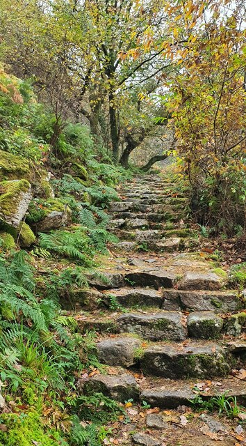
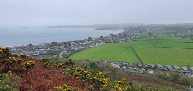
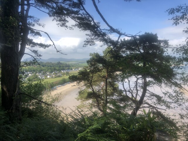
Allt Ty-côch is a picturesque woodland located in Caernarfonshire, Wales. Situated near the village of Beddgelert, this enchanting forest covers an area of approximately 500 acres. The name "Allt Ty-côch" translates to "Red House Slope" in English, named after a now-vanished red farmhouse that once stood in the vicinity.

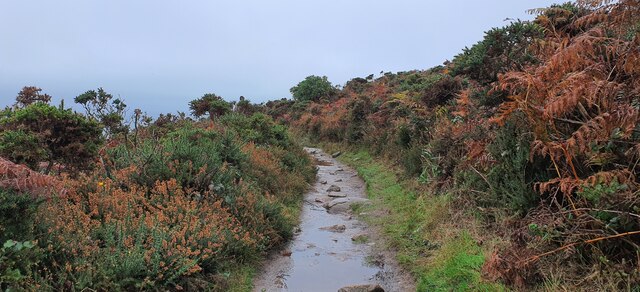
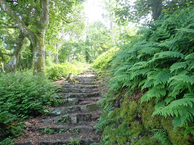
The woodland is characterized by its diverse range of tree species, including oak, beech, birch, and rowan. These towering trees form a dense canopy, creating a cool and shady environment, particularly on hot summer days. The forest floor is covered with a lush carpet of ferns, mosses, and wildflowers, adding to the natural beauty of the landscape.

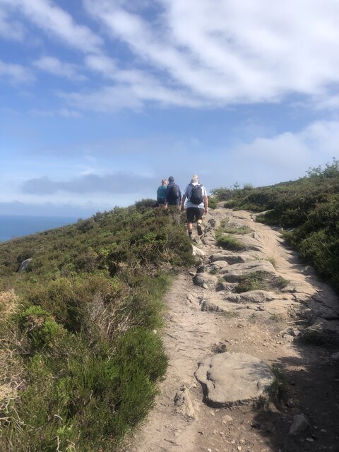
Allt Ty-côch offers a tranquil retreat for nature enthusiasts and hikers alike. There are several well-marked walking trails that wind through the forest, allowing visitors to explore its hidden gems. The trails vary in difficulty, offering options for both casual strollers and more experienced hikers.

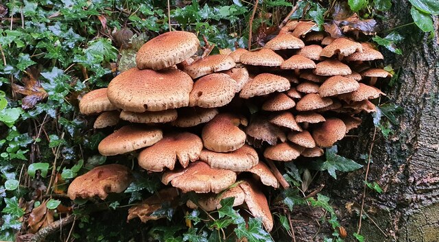
The woodland is home to a rich and diverse array of wildlife. Birdwatchers can spot various species of woodland birds, including woodpeckers, thrushes, and warblers. Red squirrels are also frequently seen darting between the trees, adding a touch of charm to the already idyllic setting.

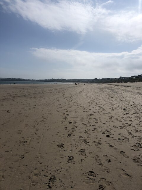
Allt Ty-côch is a popular destination for those seeking a peaceful escape from the hustle and bustle of everyday life. Its natural beauty, combined with its accessibility from nearby villages and towns, makes it a must-visit location for nature enthusiasts and anyone seeking solace in the embrace of the Welsh countryside.

If you have any feedback on the listing, please let us know in the comments section below.
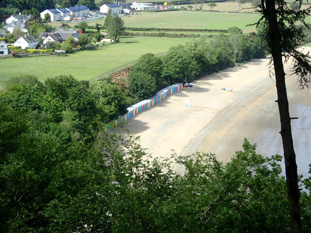
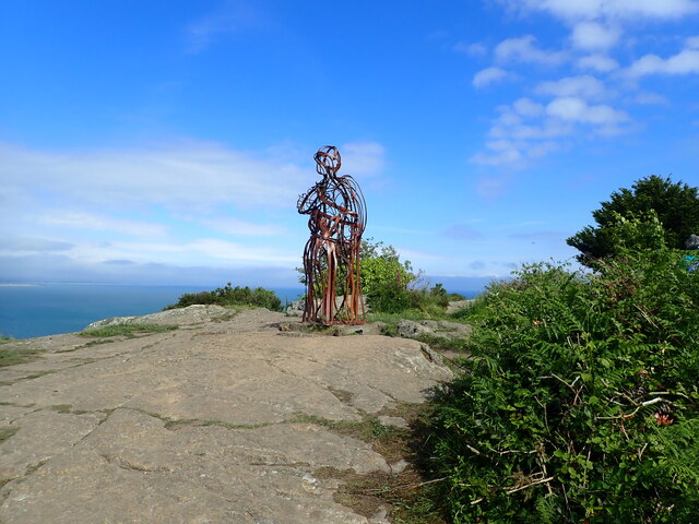
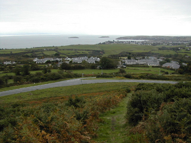
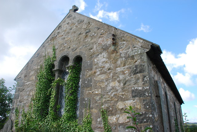
Allt Ty-côch Images

Images are sourced within 2km of 52.852872/-4.4812387 or Grid Reference SH3331. Thanks to Geograph Open Source API. All images are credited.

Approaching the entrance to The Warren
The Warren
The Warren
Beach Bar at The Warren
Chalets in The Warren Holiday Park
A499 east of Llanbedrog
Glyn Y Weddw Arms, Llanbedrog
Llanbedrog, Gwynedd Beach huts moth-balled for the winter at Llanbedrog.
Llanbedrog, Gwynedd
Beach huts moth-balled for the winter at Llanbedrog.
Llanbedrog, Gwynedd Steep, slippery steps up through woodland from Llanbedrog to the high ground of Mynydd Tir-y-cwmwd.
Llanbedrog, Gwynedd
Steep, slippery steps up through woodland from Llanbedrog to the high ground of Mynydd Tir-y-cwmwd.
Mynydd Tir-y-cwmwd, Gwynedd A muddy track cutting though gorse and heather on Mynydd Tir-y-cwmwd.
Mynydd Tir-y-cwmwd, Gwynedd
A muddy track cutting though gorse and heather on Mynydd Tir-y-cwmwd.
Mynydd Tir-y-cwmwd, Gwynedd Looking over gorse and heather on Mynydd Tir-y-cwmwd to the holiday homes on The Warren.
Mynydd Tir-y-cwmwd, Gwynedd
Looking over gorse and heather on Mynydd Tir-y-cwmwd to the holiday homes on The Warren.
Llanbedrog, Gwynedd A fine collection of mushrooms - possibly Honey Mushrooms.
Llanbedrog, Gwynedd
A fine collection of mushrooms - possibly Honey Mushrooms.
Llanbedrog, Gwynedd Plas Glyn y Weddw is now a gallery and arts centre. It was built in 1857 for Elizabeth Jones Parry, widow of Sir Love Jones Parry of Madryn. Following the death of Lady Parry and her son Thomas Love Duncombe Jones Parry, the mansion was sold to Cardiff businessman Solomon Andrews. An art gallery was first established in the house in 1896. The gallery was closed at the outbreak of the Second World War and the Land Army girls stayed in part of the house. The Andrews family sold the mansion and the grounds in 1945. During this period the building was turned into residential flats and by the late 1970’s it was in a bad state. In 1979 the artist Gwyneth ap Tomos and her husband Dafydd bought Plas Glyn y Weddw and through their hard work the Plas was saved from becoming a ruin. A charitable trust was formed during the mid 1990’s to take over the running of the gallery.
Llanbedrog, Gwynedd
Plas Glyn y Weddw is now a gallery and arts centre. It was built in 1857 for Elizabeth Jones Parry, widow of Sir Love Jones Parry of Madryn. Following the death of Lady Parry and her son Thomas Love Duncombe Jones Parry, the mansion was sold to Cardiff businessman Solomon Andrews. An art gallery was first established in the house in 1896. The gallery was closed at the outbreak of the Second World War and the Land Army girls stayed in part of the house. The Andrews family sold the mansion and the grounds in 1945. During this period the building was turned into residential flats and by the late 1970’s it was in a bad state. In 1979 the artist Gwyneth ap Tomos and her husband Dafydd bought Plas Glyn y Weddw and through their hard work the Plas was saved from becoming a ruin. A charitable trust was formed during the mid 1990’s to take over the running of the gallery.
Llanbedrog and its beach A row of gaily coloured huts line the back of the beach. This is a view from the Welsh Coast Path on Mynydd Tir-y-Cwmwd
Llanbedrog and its beach
A row of gaily coloured huts line the back of the beach. This is a view from the Welsh Coast Path on Mynydd Tir-y-Cwmwd
Walkers on the Wales Coast Path On Mynydd Tir-y-Cwmwd
Walkers on the Wales Coast Path
On Mynydd Tir-y-Cwmwd
Quarry Beach Heading towards Abersoch on the Wales Coast Path
Quarry Beach
Heading towards Abersoch on the Wales Coast Path
Welsh Coast Path climbing south from Plas Glyn y Weddw
Beach huts, Llanbedrog beach For £450, you can book a beach hut for the whole season from the National Trust.
Beach huts, Llanbedrog beach
For £450, you can book a beach hut for the whole season from the National Trust.
The Tin Man, Mynydd Tir-y-Cwmwd This is the third figurehead to have been placed here on the headland. The original was a wooden ship's figurehead but it was burnt by vandals in the late 1970's. This was replaced by a metal statue by sculptor Simon van de Put in 1981. Over the years this rusted and the local council commissioned the present statue which was placed here in 2002.
The Tin Man, Mynydd Tir-y-Cwmwd
This is the third figurehead to have been placed here on the headland. The original was a wooden ship's figurehead but it was burnt by vandals in the late 1970's. This was replaced by a metal statue by sculptor Simon van de Put in 1981. Over the years this rusted and the local council commissioned the present statue which was placed here in 2002.
Show me another place!

Allt Ty-côch is located at Grid Ref: SH3331 (Lat: 52.852872, Lng: -4.4812387)

Unitary Authority: Gwynedd

Police Authority: North Wales

What 3 Words

///vacancies.president.marsh. Near Pwllheli, Gwynedd

Related Wikis

Mynydd Tir y Cwmwd

Mynydd Tir y Cwmwd (The Headland) is an area of about 175 acres (708,000 m2) in north Wales to the south of the village of Llanbedrog. From the top of...

Llanbedrog

Llanbedrog is a village and community on the Llŷn peninsula of Gwynedd in Wales. It is situated on the south side of the peninsula on the A499 between...

Mynytho

Mynytho is a small village in the parish of Llanengan near the southern coast of the Llŷn Peninsula in northwestern Wales. It consists of a few houses...

RAF Penrhos

Royal Air Force Penrhos, or more simply RAF Penrhos, is a former Royal Air Force airfield located near Penrhos, Gwynedd and 14.7 miles (23.7 km) west of...

Penyberth

Penyberth was a farmhouse at Penrhos, on the Llŷn Peninsula near Pwllheli, Gwynedd, which had been the home to generations of patrons of poets, and also...

Afon Soch

The Afon Soch is a short river on the Llŷn peninsula, Gwynedd, Wales. It arises to the north of the village of Sarn Meyllteyrn, through which it then flows...

Penrhos, Gwynedd

Penrhos is a village and former civil parish in the Welsh county of Gwynedd, located on the Llŷn Peninsula. The parish was abolished in 1934, and incorporated...

Rhydyclafdy

Rhydyclafdy (or Rhyd-y-clafdy) is a small village close to the southern coast of the Llŷn Peninsula in the Welsh county of Gwynedd. It lies 2.8 miles...

Nearby Amenities

Located within 500m of 52.852872,-4.4812387
Source: PGS
Lat/Long: 52.8521477/-4.475189
Source: PGS
Lat/Long: 52.8524839/-4.4756729
Source: PGS
Lat/Long: 52.8525878/-4.4761665
Source: PGS
Lat/Long: 52.852738/-4.4765928
Source: PGS
Lat/Long: 52.8527975/-4.4770469
Source: PGS
Lat/Long: 52.8528739/-4.4773172
Source: PGS
Lat/Long: 52.8532614/-4.4786305
Source: PGS
Lat/Long: 52.8536941/-4.4790461
Source: PGS
Lat/Long: 52.8543243/-4.4789641
Source: PGS
Lat/Long: 52.8546032/-4.4788484
Source: PGS
Lat/Long: 52.8551558/-4.4785454
Source: PGS
Lat/Long: 52.8556678/-4.4782192
Source: PGS
Lat/Long: 52.8563451/-4.4777144
Post Box
Ref: LL53 18
Lat/Long: 52.8562901/-4.4824525
Restaurant
Y Gali
Name Cy: Y Gali
Name En: The Galley
Lat/Long: 52.8541625/-4.4799431
Mynydd Tir-Y-Cwmwd
Ele: 132.6
Natural: peak
Lat/Long: 52.8500255/-4.4829015
Mini Roundabout
Direction: clockwise
Lat/Long: 52.8541062/-4.4829292
Barrier: swing_gate
Bicycle: dismount
Foot: yes
Motor Vehicle: private
Lat/Long: 52.8541576/-4.4796538
Bicycle Parking
Access: yes
Capacity: 12
Lat/Long: 52.8541914/-4.4796131
Toilets
Access: yes
Building: yes
Check Date: 2023-09-03
Female: yes
Male: yes
Lat/Long: 52.8544786/-4.4806758
Hall
Nuadd Plwyf Sant Pedrog
Name Cy: Nuadd Plwyf Sant Pedrog
Name En: St. Pedrog's Church Hall
Lat/Long: 52.8562893/-4.4829483
Iron Man
Tourism: artwork
Lat/Long: 52.8520018/-4.4764984
Mynydd Tir-Y-Cwmwd
Description: OS trig pillar
Ele: 132.670
Man Made: survey_point
Ref: S8379
Source: Ordnance Survey and Trigpointing.uk
Survey Point: pillar
Tpuk Ref: TP5039
Lat/Long: 52.8497961/-4.4832286
Tourism: viewpoint
Lat/Long: 52.8499602/-4.4828387
Parking
Fee: yes
Parking: surface
Lat/Long: 52.8537051/-4.482481
Board Type: nature
Information: board
Man Made: utility_pole
Tourism: information
Utility: telecom
Lat/Long: 52.8528742/-4.4803814
Bench
Material: wood
Seats: 3
Lat/Long: 52.8528548/-4.4802013
Covered: yes
Leisure: picnic_table
Lat/Long: 52.8544673/-4.4827209
Covered: yes
Leisure: picnic_table
Lat/Long: 52.8543256/-4.48278
Covered: yes
Leisure: picnic_table
Lat/Long: 52.854115/-4.48278
Covered: yes
Leisure: picnic_table
Lat/Long: 52.8541539/-4.4827169
Covered: yes
Leisure: picnic_table
Lat/Long: 52.8541693/-4.4828001
Covered: yes
Leisure: picnic_table
Lat/Long: 52.8542114/-4.4828296
Covered: yes
Leisure: picnic_table
Lat/Long: 52.8542389/-4.4827223
Covered: yes
Leisure: picnic_table
Lat/Long: 52.8542672/-4.4827893
Artwork Type: statue
Tourism: artwork
Lat/Long: 52.8542996/-4.4827954
Addr City: Llanbedrog
Addr Housename: Argoed
Addr Housenumber: 1
Tourism: chalet
Lat/Long: 52.8566704/-4.48507
Addr City: Llanbedrog
Lat/Long: 52.8567337/-4.4850607
Information: board
Tourism: information
Lat/Long: 52.8556296/-4.4822282
Bench
Lat/Long: 52.855611/-4.4822405
Give Way
Direction: forward
Lat/Long: 52.856311/-4.4826659
Ford: yes
Lat/Long: 52.8541088/-4.4795214
Colour: yellow
Seamark Type: buoy_special_purpose
Lat/Long: 52.8539248/-4.4779093
Colour: yellow
Seamark Type: buoy_special_purpose
Lat/Long: 52.8540089/-4.4783777
Colour: yellow
Seamark Type: buoy_special_purpose
Lat/Long: 52.8538939/-4.4773719
Colour: yellow
Seamark Type: buoy_special_purpose
Lat/Long: 52.8538227/-4.476983
Colour: yellow
Seamark Type: buoy_special_purpose
Lat/Long: 52.8537644/-4.4766075
Colour: yellow
Seamark Type: buoy_special_purpose
Lat/Long: 52.8538567/-4.4765109
Colour: yellow
Seamark Type: buoy_special_purpose
Lat/Long: 52.8539911/-4.4764466
Colour: yellow
Seamark Type: buoy_special_purpose
Lat/Long: 52.8541757/-4.4762105
Colour: yellow
Seamark Type: buoy_special_purpose
Lat/Long: 52.8543361/-4.4761005
Colour: yellow
Seamark Type: buoy_special_purpose
Lat/Long: 52.8545197/-4.4759131
Colour: yellow
Seamark Type: buoy_special_purpose
Lat/Long: 52.8546597/-4.4757505
Colour: yellow
Seamark Type: buoy_special_purpose
Lat/Long: 52.854807/-4.4756814
Colour: yellow
Seamark Type: buoy_special_purpose
Lat/Long: 52.8549739/-4.4757952
Colour: yellow
Seamark Type: buoy_special_purpose
Lat/Long: 52.8552169/-4.4759863
Colour: yellow
Seamark Type: buoy_special_purpose
Lat/Long: 52.855379/-4.476279
Colour: yellow
Seamark Type: buoy_special_purpose
Lat/Long: 52.8555312/-4.4766327
Colour: yellow
Seamark Type: buoy_special_purpose
Lat/Long: 52.8557226/-4.477149
Life Ring
Emergency: life_ring
Lat/Long: 52.8542108/-4.4796091
Information: board
Tourism: information
Lat/Long: 52.8542322/-4.4796003
The data included in this document is from www.openstreetmap.org. The data is made available under ODbL.

Have you been to Allt Ty-côch?

Leave your review of Allt Ty-côch below (or comments, questions and feedback).