Allt y Ddinas

Wood, Forest in Cardiganshire

Wales

Allt y Ddinas

Road junction at Blaen-Cil-Llech
Road junction at Blaen-Cil-Llech Credit: John Firth

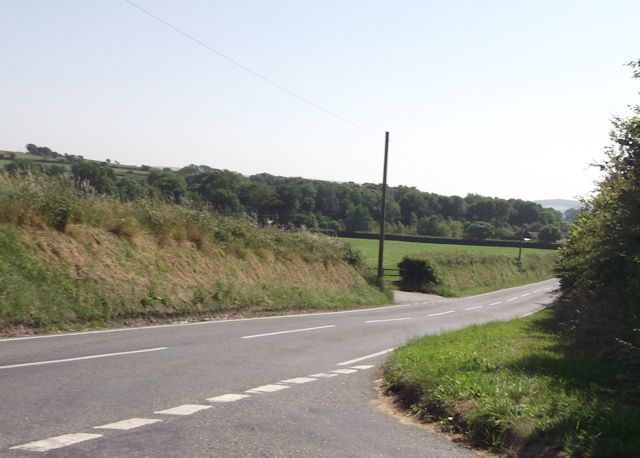
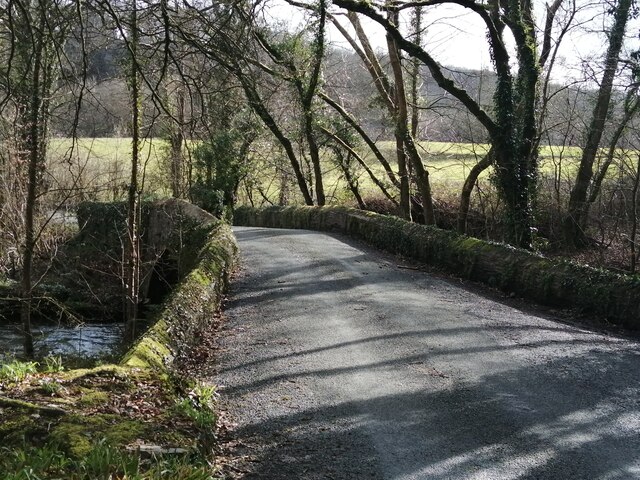
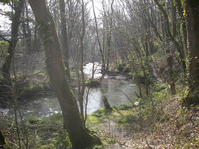
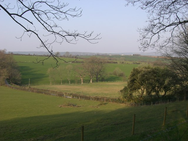
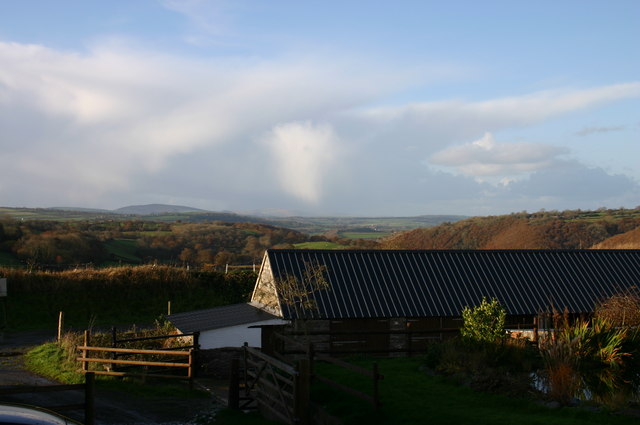
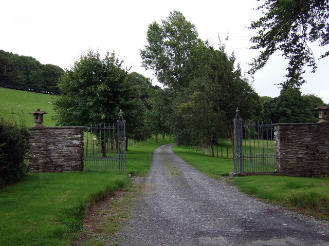
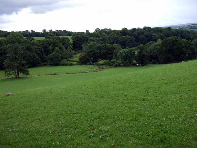
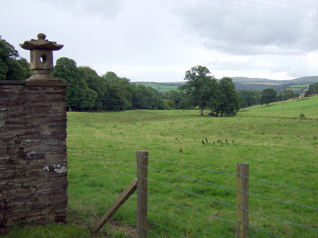
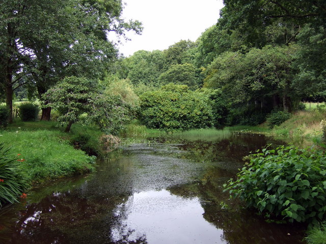
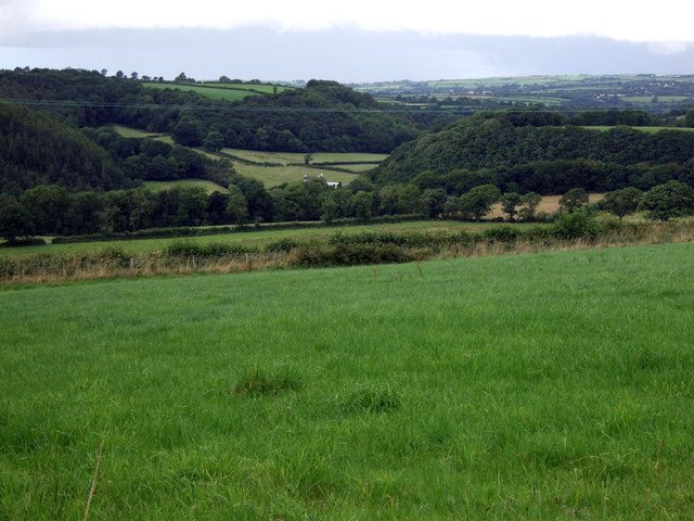
Allt y Ddinas is a woodland area located in Cardiganshire, Wales. Covering approximately 500 acres, it is known for its picturesque beauty and diverse range of flora and fauna. The woodland is situated in the foothills of the Cambrian Mountains, offering stunning views of the surrounding countryside.

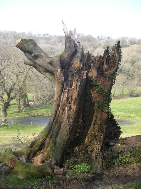
The forest is predominantly made up of native broadleaf trees, such as oak, beech, and ash, which create a dense and enchanting canopy. These trees provide a habitat for a variety of wildlife, including deer, badgers, and a wide range of bird species. Nature enthusiasts can explore the numerous walking trails that wind through the woods, allowing them to observe the natural wonders up close.

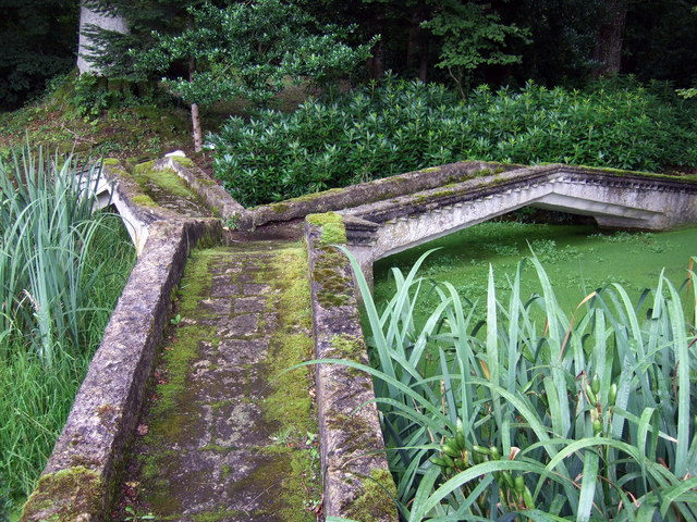
Allt y Ddinas is also home to a number of historic features, adding to its charm and cultural significance. The remains of an Iron Age hillfort can be found within the woodland, providing a glimpse into the area's rich history. Additionally, there are several old mining pits that date back to the 19th century, serving as a reminder of the region's industrial past.

The woodland offers visitors a tranquil and peaceful escape from the hustle and bustle of everyday life. It is a popular destination for hikers, nature lovers, and photographers, who are drawn to the beauty and serenity of Allt y Ddinas. With its diverse range of flora and fauna, stunning views, and historical significance, Allt y Ddinas is a must-visit destination for anyone seeking a connection with nature and a glimpse into the past.

If you have any feedback on the listing, please let us know in the comments section below.

Allt y Ddinas Images

Images are sourced within 2km of 52.06234/-4.4518277 or Grid Reference SN3243. Thanks to Geograph Open Source API. All images are credited.

Road junction at Blaen-Cil-Llech
Stone bridge at Cwmdu Georgian stone bridge, dated 1812, at Cwmdu, crossing over the River Ceri.
Stone bridge at Cwmdu
Georgian stone bridge, dated 1812, at Cwmdu, crossing over the River Ceri.
Storm Torn Tree Having been damaged in a storm this tree is now host to fungi and ivy.
Storm Torn Tree
Having been damaged in a storm this tree is now host to fungi and ivy.
Bridleway This bridleway through forestry is near to the now disused Felin Geri Watermill.
Bridleway
This bridleway through forestry is near to the now disused Felin Geri Watermill.
The Afon Ceri The Afon Ceri is a tributary to the Afon Teifi that weaves its fluid path through the Teifi Valley of West Wales. The word 'afon' is welsh for 'river'.
The Afon Ceri
The Afon Ceri is a tributary to the Afon Teifi that weaves its fluid path through the Teifi Valley of West Wales. The word 'afon' is welsh for 'river'.
Pasture Land Pasture land for grazing sheep and cattle.
Pasture Land
Pasture land for grazing sheep and cattle.
Bridleway near to the Afon Ceri This is a beautiful walk through forestry over looking the Afon Ceri to the north.
Bridleway near to the Afon Ceri
This is a beautiful walk through forestry over looking the Afon Ceri to the north.
Winter's afternoon Distant storm brewing.
Winter's afternoon
Distant storm brewing.
Bryndioddef/Hill of suffering What a desperate name has been conferred by the two eponymous farms, higher and lower, to this tidy hamlet north of Adpar!
Bryndioddef/Hill of suffering
What a desperate name has been conferred by the two eponymous farms, higher and lower, to this tidy hamlet north of Adpar!
Entrance to Old Cilgwyn Old Cilgwyn, at the centre of a 900-acre estate, possesses a remarkable 14-acre garden filled with rare plants and specimen trees, open to the public at specified times.
Entrance to Old Cilgwyn
Old Cilgwyn, at the centre of a 900-acre estate, possesses a remarkable 14-acre garden filled with rare plants and specimen trees, open to the public at specified times.
Blaenant Farm at the top of the old carriage road leading down to Llandyfriog.
Blaenant
Farm at the top of the old carriage road leading down to Llandyfriog.
The view towards Old Cilgwyn This sheltered, well-watered valley contains a series of ornamental lakes and ponds (just visible through the trees) that form part of the garden of Old Cilgwyn.
The view towards Old Cilgwyn
This sheltered, well-watered valley contains a series of ornamental lakes and ponds (just visible through the trees) that form part of the garden of Old Cilgwyn.
Cottage once a pub Cottage standing opposite the entrance to Old Cilgwyn was once a pub and its sign still hangs at the end (right).
Cottage once a pub
Cottage standing opposite the entrance to Old Cilgwyn was once a pub and its sign still hangs at the end (right).
Parkland Seen here from the entrance to Old Cilgwyn is part of a 900-acre estate running down towards the Teifi. It includes Sites of Special Scientific Interest.
Parkland
Seen here from the entrance to Old Cilgwyn is part of a 900-acre estate running down towards the Teifi. It includes Sites of Special Scientific Interest.
Three-way bridge at Old Cilgwyn Unusual concrete bridge designed by the early C20 land-owner to span an ornamental pond in the grounds.
Three-way bridge at Old Cilgwyn
Unusual concrete bridge designed by the early C20 land-owner to span an ornamental pond in the grounds.
Ornamental water features at Old Cilgwyn One of a series of pools in this beautiful woodland garden, open to the public by appointment or for fund-raising days. The rhododendrons, when in bloom, are a special attraction.
Ornamental water features at Old Cilgwyn
One of a series of pools in this beautiful woodland garden, open to the public by appointment or for fund-raising days. The rhododendrons, when in bloom, are a special attraction.
Cwm Ceri to the northeast View towards Cafan Farm and beyond that the upper valley of the Afon Ceri which snakes down towards its confluence with the Teifi at Cwm-cou.
Cwm Ceri to the northeast
View towards Cafan Farm and beyond that the upper valley of the Afon Ceri which snakes down towards its confluence with the Teifi at Cwm-cou.
Cwm Ceri, looking northwest Lush pasture land above the wooded river valley.
Cwm Ceri, looking northwest
Lush pasture land above the wooded river valley.
Show me another place!

Allt y Ddinas is located at Grid Ref: SN3243 (Lat: 52.06234, Lng: -4.4518277)

Unitary Authority: Ceredigion

Police Authority: Dyfed Powys

What 3 Words

///exile.hobbyists.hamster. Near Newcastle Emlyn, Ceredigion

Related Wikis

Bryndioddef-isaf

Bryndioddef-isaf is a hamlet in the community of Llandyfriog, Ceredigion, Wales, which is 67.6 miles (108.8 km) from Cardiff and 189.1 miles (304.2 km...

Brongest

Brongest is a small village in the community of Troedyraur, Ceredigion, Wales, which is 68.4 miles (110.1 km) from Cardiff and 188.9 miles (303.9 km)...

Llandyfriog

Llandyfriog is a community in Ceredigion, Wales. It includes the Adpar part of Newcastle Emlyn and the villages, Bangor Teifi, Trebedw, Bryndioddef-isaf...

Bryngwyn, Ceredigion

Bryngwyn (Welsh: "White hill") is a small village in the community of Beulah, Ceredigion, Wales. Bryngwyn is represented in the Senedd by Elin Jones (Plaid...

Have you been to Allt y Ddinas?

Leave your review of Allt y Ddinas below (or comments, questions and feedback).