Allt Fagwr

Wood, Forest in Cardiganshire

Wales

Allt Fagwr

Road junction at Blaen-Cil-Llech
Road junction at Blaen-Cil-Llech Credit: John Firth

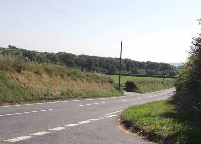
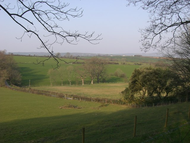
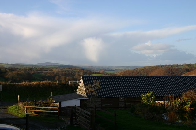
Allt Fagwr, located in Cardiganshire, is a picturesque wood or forest that covers a significant area of land. This natural wonder is renowned for its awe-inspiring beauty and diverse range of flora and fauna.

The wood is nestled within the stunning landscape of Cardiganshire, which is known for its rolling hills and lush greenery. Allt Fagwr contributes greatly to this landscape, providing a serene and tranquil environment for both locals and visitors to enjoy.

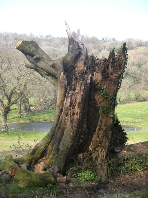
The forest is home to an abundance of plant species, including native trees such as oak, beech, and birch. These trees create a dense canopy that allows only dappled sunlight to filter through to the forest floor, creating a magical atmosphere. The undergrowth is filled with various wildflowers, adding bursts of color to the scene.

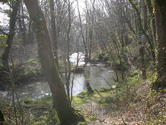
Allt Fagwr is also a haven for wildlife. Numerous bird species can be spotted, including woodpeckers, owls, and various songbirds. Small mammals such as squirrels and rabbits can be seen scurrying through the trees, while the occasional deer can be spotted grazing in the clearing.

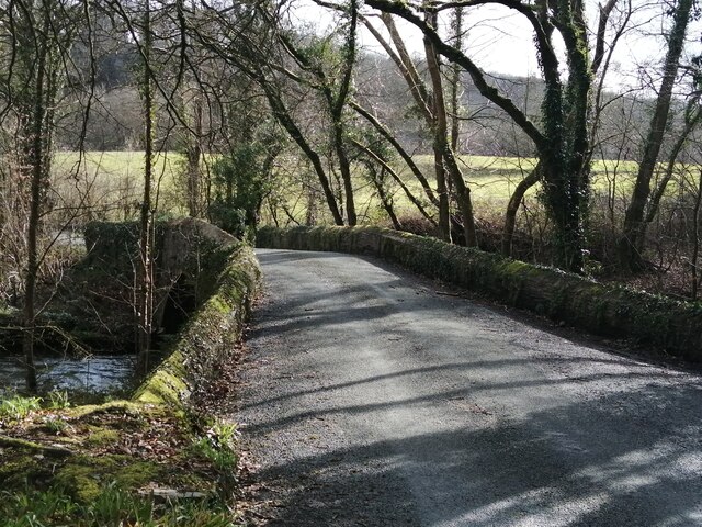
Visitors to Allt Fagwr can enjoy a variety of activities. There are numerous walking trails that wind through the forest, allowing explorers to immerse themselves in the natural surroundings. The wood is also a popular spot for picnicking, with designated areas providing the perfect place to relax and enjoy the peaceful ambiance.

Overall, Allt Fagwr in Cardiganshire is a true natural gem, offering a stunning display of beauty and biodiversity. It is a must-visit destination for nature enthusiasts and those seeking a tranquil escape from the fast-paced world.

If you have any feedback on the listing, please let us know in the comments section below.

Allt Fagwr Images

Images are sourced within 2km of 52.066455/-4.4585024 or Grid Reference SN3143. Thanks to Geograph Open Source API. All images are credited.

Road junction at Blaen-Cil-Llech
Stone bridge at Cwmdu Georgian stone bridge, dated 1812, at Cwmdu, crossing over the River Ceri.
Stone bridge at Cwmdu
Georgian stone bridge, dated 1812, at Cwmdu, crossing over the River Ceri.
Ordnance Survey Cut Mark This OS cut mark can be found on the SW parapet of the bridge. It marks a point 59.227m above mean sea level.
Ordnance Survey Cut Mark
This OS cut mark can be found on the SW parapet of the bridge. It marks a point 59.227m above mean sea level.
Ordnance Survey Cut Mark This OS cut mark can be found on the wall north side of the road. It marks a point 89.114m above mean sea level.
Ordnance Survey Cut Mark
This OS cut mark can be found on the wall north side of the road. It marks a point 89.114m above mean sea level.
Ordnance Survey Cut Mark This OS cut mark can be found on the stone gatepost west side of the road. It marks a point 114.558m above mean sea level.
Ordnance Survey Cut Mark
This OS cut mark can be found on the stone gatepost west side of the road. It marks a point 114.558m above mean sea level.
Ordnance Survey Cut Mark This OS cut mark can be found on the wall at Blaen-y-ffynnon. It marks a point 155.351m above mean sea level.
Ordnance Survey Cut Mark
This OS cut mark can be found on the wall at Blaen-y-ffynnon. It marks a point 155.351m above mean sea level.
Ordnance Survey Rivet This OS rivet can be found on the concrete base in front of the house which was once a Smithy. It marks a point 155.846m above mean sea level.
Ordnance Survey Rivet
This OS rivet can be found on the concrete base in front of the house which was once a Smithy. It marks a point 155.846m above mean sea level.
Bryn-einon, Brongwyn
The hamlet of Groesffordd
Bryngwyn Congregationalist.
Built 1845, rebuilt 1900. 
The adjacent vestry was built in 1903.
Bryngwyn
Congregationalist. Built 1845, rebuilt 1900. The adjacent vestry was built in 1903.
Storm Torn Tree Having been damaged in a storm this tree is now host to fungi and ivy.
Storm Torn Tree
Having been damaged in a storm this tree is now host to fungi and ivy.
Bridleway This bridleway through forestry is near to the now disused Felin Geri Watermill.
Bridleway
This bridleway through forestry is near to the now disused Felin Geri Watermill.
The Afon Ceri The Afon Ceri is a tributary to the Afon Teifi that weaves its fluid path through the Teifi Valley of West Wales. The word 'afon' is welsh for 'river'.
The Afon Ceri
The Afon Ceri is a tributary to the Afon Teifi that weaves its fluid path through the Teifi Valley of West Wales. The word 'afon' is welsh for 'river'.
Pasture Land Pasture land for grazing sheep and cattle.
Pasture Land
Pasture land for grazing sheep and cattle.
Bridleway near to the Afon Ceri This is a beautiful walk through forestry over looking the Afon Ceri to the north.
Bridleway near to the Afon Ceri
This is a beautiful walk through forestry over looking the Afon Ceri to the north.
St Michael's church, Troedyraur Some churches are frankly churches and some chapels are plainly chapels.
St Michael's church, Troedyraur
Some churches are frankly churches and some chapels are plainly chapels.
Converted schoolroom up the hill from Brongest
Winter's afternoon Distant storm brewing.
Winter's afternoon
Distant storm brewing.
Show me another place!

Allt Fagwr is located at Grid Ref: SN3143 (Lat: 52.066455, Lng: -4.4585024)

Unitary Authority: Ceredigion

Police Authority: Dyfed Powys

What 3 Words

///richly.emerald.flush. Near Newcastle Emlyn, Ceredigion

Related Wikis

Brongest

Brongest is a small village in the community of Troedyraur, Ceredigion, Wales, which is 68.4 miles (110.1 km) from Cardiff and 188.9 miles (303.9 km)...

Bryngwyn, Ceredigion

Bryngwyn (Welsh: "White hill") is a small village in the community of Beulah, Ceredigion, Wales. Bryngwyn is represented in the Senedd by Elin Jones (Plaid...

Bryndioddef-isaf

Bryndioddef-isaf is a hamlet in the community of Llandyfriog, Ceredigion, Wales, which is 67.6 miles (108.8 km) from Cardiff and 189.1 miles (304.2 km...

Pont Ceri

Pont Ceri is a small village in the community of Llandyfriog, Ceredigion, Wales, located where the Afon Ceri flows into the River Teifi, two miles (3...

Nearby Amenities

Located within 500m of 52.066455,-4.4585024
The data included in this document is from www.openstreetmap.org. The data is made available under ODbL.

Have you been to Allt Fagwr?

Leave your review of Allt Fagwr below (or comments, questions and feedback).