Allt Cwm-du

Wood, Forest in Cardiganshire

Wales

Allt Cwm-du

Redevelopment near Adpar This old place has seen better days and redevelopment has started but might have been suspended for some reason.
Redevelopment near Adpar Credit: Jeremy Bolwell

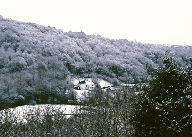
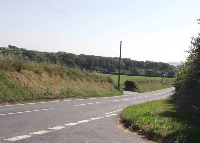
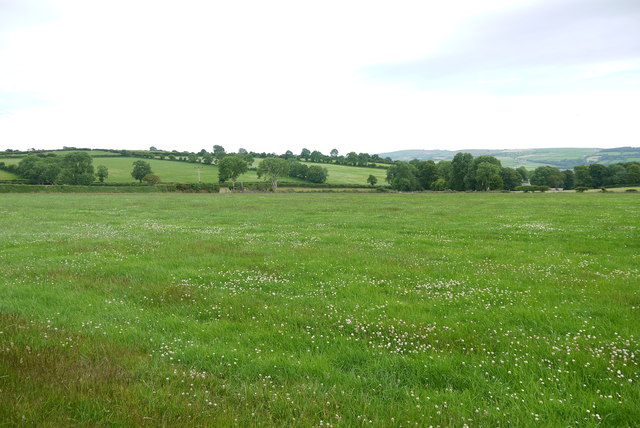
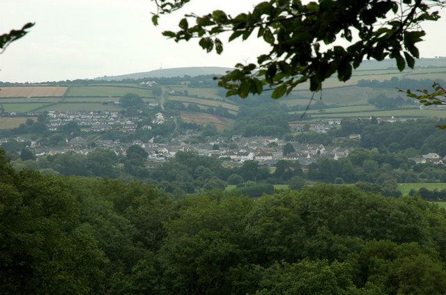
Allt Cwm-du is a picturesque woodland area located in Cardiganshire, Wales. With its abundance of trees and lush vegetation, it is often referred to as a forest. The woodland covers a vast area, spanning several miles and is nestled within the scenic countryside of Cardiganshire. Allt Cwm-du is renowned for its natural beauty and attracts nature enthusiasts, hikers, and photographers alike.

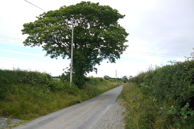
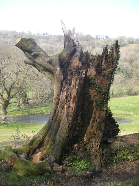
The woodland is predominantly composed of native tree species such as oak, beech, and birch, which create a dense canopy overhead. This canopy provides shelter and habitat for a wide variety of wildlife, including birds, mammals, and insects. The forest floor is covered in a thick blanket of moss and ferns, adding to the enchanting atmosphere of the woodland.

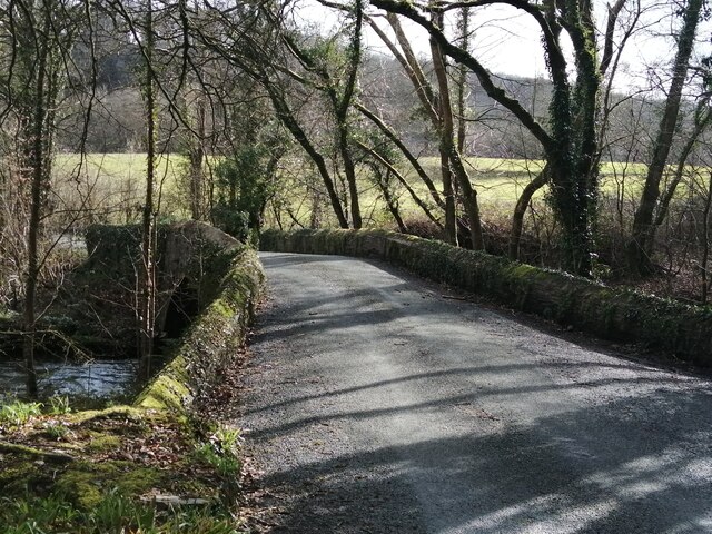
Traversing through Allt Cwm-du, visitors can find a network of well-maintained trails and paths, allowing for easy exploration of the area. These trails lead to hidden gems such as babbling brooks, cascading waterfalls, and tranquil ponds. The sound of birdsong and the rustling of leaves create a soothing ambiance, making Allt Cwm-du a perfect destination for those seeking a peaceful retreat in nature.

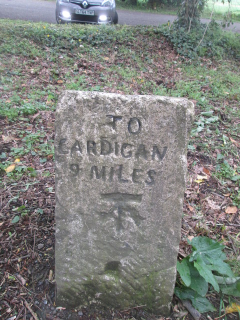
The woodland is also steeped in history, with remnants of ancient settlements and burial sites scattered throughout. Archaeological discoveries suggest that the area has been inhabited for centuries, adding an extra layer of intrigue to Allt Cwm-du.

Overall, Allt Cwm-du in Cardiganshire is a captivating woodland area that offers a serene escape into nature. With its diverse flora and fauna, scenic trails, and rich history, it truly is a haven for nature lovers and explorers.

If you have any feedback on the listing, please let us know in the comments section below.
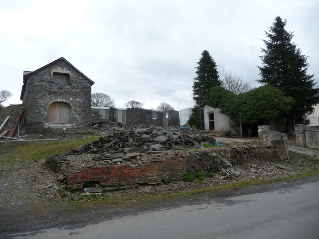
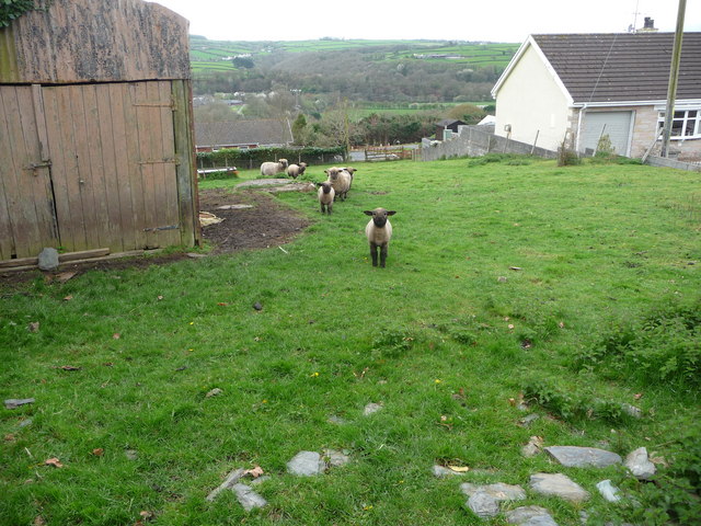
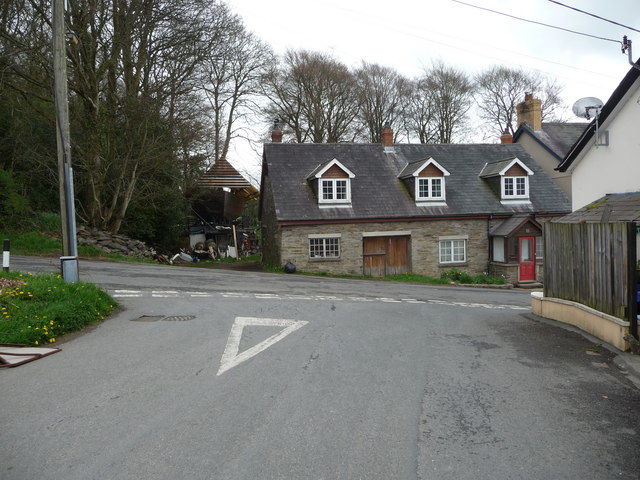
Allt Cwm-du Images

Images are sourced within 2km of 52.060568/-4.4626286 or Grid Reference SN3143. Thanks to Geograph Open Source API. All images are credited.

Redevelopment near Adpar This old place has seen better days and redevelopment has started but might have been suspended for some reason.
Redevelopment near Adpar
This old place has seen better days and redevelopment has started but might have been suspended for some reason.
Sheep and lambs in Adpar These are Oxford Down sheep and lambs - very distinctive facially - and beautiful. This confident little lamb approached when I called and was curious, intelligent and adventurous.
Sheep and lambs in Adpar
These are Oxford Down sheep and lambs - very distinctive facially - and beautiful. This confident little lamb approached when I called and was curious, intelligent and adventurous.
Cottage in Adpar Yes, that's a boat being built behind the cottage.
Cottage in Adpar
Yes, that's a boat being built behind the cottage.
Banc-lâs, Cwmceri
Banc-lâs, Cwmceri
Road junction at Blaen-Cil-Llech
Milestone - Cardigan 9 There is an Ordnance Survey cut mark on the milestone. It marks a point 80.3090ft above mean sea level.
Milestone - Cardigan 9
There is an Ordnance Survey cut mark on the milestone. It marks a point 80.3090ft above mean sea level.
Stone bridge at Cwmdu Georgian stone bridge, dated 1812, at Cwmdu, crossing over the River Ceri.
Stone bridge at Cwmdu
Georgian stone bridge, dated 1812, at Cwmdu, crossing over the River Ceri.
Houses on Morris Row, Adpar
Country Lane near Panteinon This solitary oak tree is on the minor road between Brongwyn and Groesffordd about a mile north of Cwm Cou.
Country Lane near Panteinon
This solitary oak tree is on the minor road between Brongwyn and Groesffordd about a mile north of Cwm Cou.
Field at Groesffordd This lush pasture meadow is just off the minor road between Brongwyn and Groessffordd. The view is south towards Cilfallen.
Field at Groesffordd
This lush pasture meadow is just off the minor road between Brongwyn and Groessffordd. The view is south towards Cilfallen.
Ordnance Survey Cut Mark This OS cut mark can be found on the wall at Blaen-y-ffynnon. It marks a point 155.351m above mean sea level.
Ordnance Survey Cut Mark
This OS cut mark can be found on the wall at Blaen-y-ffynnon. It marks a point 155.351m above mean sea level.
Bryn-einon, Brongwyn
The hamlet of Groesffordd
Felin Geri Mill Wooden Fort This wooden fort was originally built to attract tourists and was part of an activity centre for families visiting the Felin Geri Mill.  Paid for with a government grant this play fort was also to be used by local children. But is now disused.
Felin Geri Mill Wooden Fort
This wooden fort was originally built to attract tourists and was part of an activity centre for families visiting the Felin Geri Mill. Paid for with a government grant this play fort was also to be used by local children. But is now disused.
Disused Water Mill Now disused Felin Geri Mill was formerly a tourist attraction and originally a working water mill producing flour, semolina and bran.
Disused Water Mill
Now disused Felin Geri Mill was formerly a tourist attraction and originally a working water mill producing flour, semolina and bran.
Storm Torn Tree Having been damaged in a storm this tree is now host to fungi and ivy.
Storm Torn Tree
Having been damaged in a storm this tree is now host to fungi and ivy.
Bridle Path How to train for the London Marathon on a muddy bridle path in Wales without getting your trainers dirty!
Bridle Path
How to train for the London Marathon on a muddy bridle path in Wales without getting your trainers dirty!
Bridleway This bridleway through forestry is near to the now disused Felin Geri Watermill.
Bridleway
This bridleway through forestry is near to the now disused Felin Geri Watermill.
Show me another place!

Allt Cwm-du is located at Grid Ref: SN3143 (Lat: 52.060568, Lng: -4.4626286)

Unitary Authority: Ceredigion

Police Authority: Dyfed Powys

What 3 Words

///firework.earth.renew. Near Newcastle Emlyn, Ceredigion

Related Wikis

Bryndioddef-isaf

Bryndioddef-isaf is a hamlet in the community of Llandyfriog, Ceredigion, Wales, which is 67.6 miles (108.8 km) from Cardiff and 189.1 miles (304.2 km...

Pont Ceri

Pont Ceri is a small village in the community of Llandyfriog, Ceredigion, Wales, located where the Afon Ceri flows into the River Teifi, two miles (3...

Bryngwyn, Ceredigion

Bryngwyn (Welsh: "White hill") is a small village in the community of Beulah, Ceredigion, Wales. Bryngwyn is represented in the Senedd by Elin Jones (Plaid...

Adpar

Adpar, formerly Trefhedyn, is a village in Ceredigion, Wales, in the community of Llandyfriog, now considered as a part of Newcastle Emlyn to which it...

Tre-Wen

Tre-Wen is a small village in the community of Beulah, Ceredigion, Wales, which is 68.6 miles (110.4 km) from Cardiff and 190.2 miles (306.1 km) from...

Brongest

Brongest is a small village in the community of Troedyraur, Ceredigion, Wales, which is 68.4 miles (110.1 km) from Cardiff and 188.9 miles (303.9 km)...
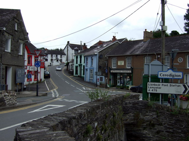
Newcastle Emlyn

Newcastle Emlyn (Welsh: Castellnewydd Emlyn) is a town on the River Teifi, straddling the counties of Ceredigion and Carmarthenshire in West Wales. It...

Newcastle Emlyn Castle

Newcastle Emlyn Castle (Welsh: Castell Newydd Emlyn) is a ruined castle in the market town of Newcastle Emlyn in Carmarthenshire, Wales. It is strategically...

Nearby Amenities

Located within 500m of 52.060568,-4.4626286
Ford: yes
Lat/Long: 52.0587381/-4.4662814
Direction: 215
Generator Method: photovoltaic
Generator Output Electricity: yes
Generator Solar Modules: 13
Generator Source: solar
Generator Type: solar_photovoltaic_panel
Location: roof
Power: generator
Lat/Long: 52.0596516/-4.4661918
Direction: 215
Generator Method: photovoltaic
Generator Output Electricity: yes
Generator Solar Modules: 3
Generator Source: solar
Generator Type: solar_photovoltaic_panel
Location: roof
Power: generator
Lat/Long: 52.059706/-4.4663005
Direction: 215
Generator Method: photovoltaic
Generator Output Electricity: yes
Generator Solar Modules: 4
Generator Source: solar
Generator Type: solar_photovoltaic_panel
Location: roof
Power: generator
Lat/Long: 52.0597406/-4.4664104
The data included in this document is from www.openstreetmap.org. The data is made available under ODbL.

Have you been to Allt Cwm-du?

Leave your review of Allt Cwm-du below (or comments, questions and feedback).