Coed Bryn Hendre

Wood, Forest in Caernarfonshire

Wales

Coed Bryn Hendre

B4354 at Gorphwysfa
B4354 at Gorphwysfa Credit: Alpin Stewart

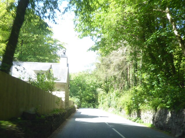
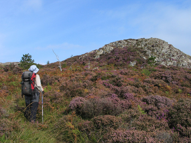
Coed Bryn Hendre is a picturesque woodland located in Caernarfonshire, Wales. Spread over an area of approximately 200 acres, it is a popular destination for nature enthusiasts, hikers, and wildlife lovers. The woodland is situated in the northern part of Caernarfonshire, near the village of Brynrefail.

Coed Bryn Hendre is characterized by its diverse range of tree species, including oak, beech, ash, and birch. The dense forest provides a natural habitat for a variety of wildlife, including deer, foxes, badgers, and numerous bird species. Visitors can catch glimpses of these creatures as they explore the woodland's well-maintained trails.

The woodland offers an idyllic escape from the hustle and bustle of urban life, providing a tranquil environment for relaxation and rejuvenation. The peaceful atmosphere is enhanced by the gentle babbling of the nearby river and the soothing sounds of birdsong.

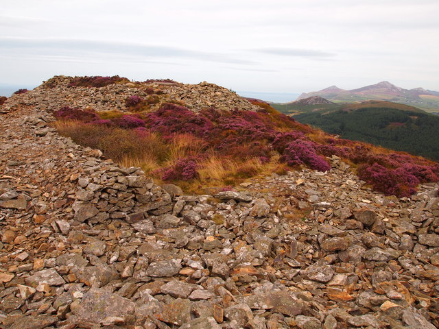
Coed Bryn Hendre also holds historical significance, as it is believed to have been part of an ancient Celtic settlement. The remains of old stone walls and Celtic artifacts have been discovered within the woodland, adding an element of intrigue and mystery to the area.

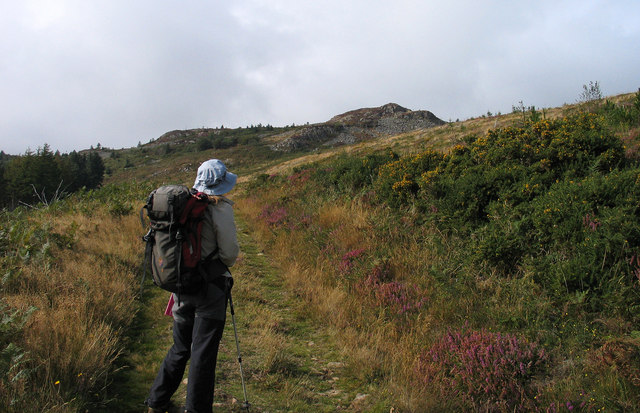
Visitors to Coed Bryn Hendre can partake in a range of activities, such as hiking, picnicking, and photography. The woodland is equipped with well-marked trails, ensuring easy navigation for visitors of all ages and fitness levels.

Overall, Coed Bryn Hendre is a natural haven that offers a unique blend of beauty, tranquility, and historical interest. It is a must-visit destination for anyone seeking to connect with nature and explore the rich heritage of Caernarfonshire.

If you have any feedback on the listing, please let us know in the comments section below.

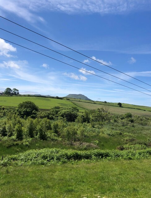
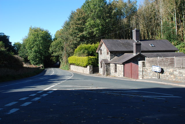
Coed Bryn Hendre Images

Images are sourced within 2km of 52.907412/-4.5066647 or Grid Reference SH3137. Thanks to Geograph Open Source API. All images are credited.

B4354 at Gorphwysfa
B4354 at Gorphwysfa
View south-west from the A497 Wooded valley of the River Ceirch, then pasture and Carn Fadryn on the horizon
View south-west from the A497
Wooded valley of the River Ceirch, then pasture and Carn Fadryn on the horizon
Garn Boduan This hill is the site of an Iron Age hillfort
Garn Boduan
This hill is the site of an Iron Age hillfort
Eglwys Buan Sant Boduan Deconsecrated church at Boduan. See Alan Fryer's contribution <a href="https://www.geograph.org.uk/photo/618261">SH3237 : Eglwys Buan Sant Boduan</a> for more information.
Eglwys Buan Sant Boduan
Deconsecrated church at Boduan. See Alan Fryer's contribution SH3237 : Eglwys Buan Sant Boduan for more information.
Eglwys Buan Sant Since earlier pictures were taken the churchyard has become overgrown with brambles.
Eglwys Buan Sant
Since earlier pictures were taken the churchyard has become overgrown with brambles.
Mynwent Eglwys Buan Sant Graveyard The extent to which the older part of the graveyard at <a href="https://www.geograph.org.uk/photo/3072427">SH3237 : Eglwys Buan Sant</a> has been neglected
Mynwent Eglwys Buan Sant Graveyard
The extent to which the older part of the graveyard at SH3237 : Eglwys Buan Sant has been neglected
Eglwys Buan Sant Inside the lych gate biblical texts beginning in English and continuing in Welsh
Eglwys Buan Sant
Inside the lych gate biblical texts beginning in English and continuing in Welsh
Eglwys Buan Sant Inside the lych gate biblical texts beginning in English and continuing in Welsh
Eglwys Buan Sant
Inside the lych gate biblical texts beginning in English and continuing in Welsh
Path rising to Garn Boduan Garn Boduan is one of a number of relatively low yet prominent hills of the Lleyn Peninsula; there are ramparts of an old iron age hill fort about the top which can be seen in the distance. The path rises from the B4354 on the south side of the hill.
Path rising to Garn Boduan
Garn Boduan is one of a number of relatively low yet prominent hills of the Lleyn Peninsula; there are ramparts of an old iron age hill fort about the top which can be seen in the distance. The path rises from the B4354 on the south side of the hill.
Rocks and heathers on Garn Boduan Garn Boduan is one of a number of relatively low yet prominent hills of the Lleyn Peninsula; there are ramparts of an old iron age hill fort about the top. The view here is from the south with the rise directly ahead not being the actual summit which lies beyond. More than one heather species can be seen in flower, now past their best.
Rocks and heathers on Garn Boduan
Garn Boduan is one of a number of relatively low yet prominent hills of the Lleyn Peninsula; there are ramparts of an old iron age hill fort about the top. The view here is from the south with the rise directly ahead not being the actual summit which lies beyond. More than one heather species can be seen in flower, now past their best.
AA Box number 580 On the side of the A497 road.
AA Box number 580
On the side of the A497 road.
Lych gate to St Buan's Church The church of St Buan was founded in 595 AD. No traces of it remain. The present building was first erected by the Wynne family of Plas Boduan in 1765 and after falling into disrepair rebuilt between 1890 and 1894. After falling into disrepair again in the 20th century it was deconsecrated in 1991 and reopened in 2004 as the Buan centre. It is now closed.
Lych gate to St Buan's Church
The church of St Buan was founded in 595 AD. No traces of it remain. The present building was first erected by the Wynne family of Plas Boduan in 1765 and after falling into disrepair rebuilt between 1890 and 1894. After falling into disrepair again in the 20th century it was deconsecrated in 1991 and reopened in 2004 as the Buan centre. It is now closed.
Eglwys Buan Sant, Boduan I am obliged to Alan Fryer for the following:-
The present building was first erected by the Wynne family of Plas Boduan in 1765 and after falling into disrepair rebuilt between 1890 and 1894. After falling into disrepair again in the 20th century it was deconsecrated in 1991 and reopened in 2004 as the Buan centre. It is now closed.
Eglwys Buan Sant, Boduan
I am obliged to Alan Fryer for the following:- The present building was first erected by the Wynne family of Plas Boduan in 1765 and after falling into disrepair rebuilt between 1890 and 1894. After falling into disrepair again in the 20th century it was deconsecrated in 1991 and reopened in 2004 as the Buan centre. It is now closed.
House by the A497
House by the A497
Cottages near St Buan's Church
Hillfort Garn Boduan This is at the summit of the site and is a refortified area within the earlier iron age fort, thought to date from the post Roman period.
Hillfort Garn Boduan
This is at the summit of the site and is a refortified area within the earlier iron age fort, thought to date from the post Roman period.
Boduan The junction of the B4354 and the A497 from Pwllheli to Nefyn
Boduan
The junction of the B4354 and the A497 from Pwllheli to Nefyn
AA box by the A497 AA box number 580 stands by the A497 Pwllheli to Nefyn road. These were a familiar sight by UK roads when I was a child. AA members had a special key to open the telephone boxes if help was required, whilst a yellow metal badge could be attached to the front bumper of the car. AA patrol men were usually on a motorcycle with side box that contained tools, and would salute as they passed any car bearing an AA badge. I believe the salute was eventually dropped as traffic levels increased.  The AA themselves seem unsure as to how many of these boxes were originally installed. Their own website suggests 862, of which there are supposed to be 19 remaining.
AA box by the A497
AA box number 580 stands by the A497 Pwllheli to Nefyn road. These were a familiar sight by UK roads when I was a child. AA members had a special key to open the telephone boxes if help was required, whilst a yellow metal badge could be attached to the front bumper of the car. AA patrol men were usually on a motorcycle with side box that contained tools, and would salute as they passed any car bearing an AA badge. I believe the salute was eventually dropped as traffic levels increased. The AA themselves seem unsure as to how many of these boxes were originally installed. Their own website suggests 862, of which there are supposed to be 19 remaining.
Show me another place!

Coed Bryn Hendre is located at Grid Ref: SH3137 (Lat: 52.907412, Lng: -4.5066647)

Unitary Authority: Gwynedd

Police Authority: North Wales

What 3 Words

///chose.irrigate.pinging. Near Nefyn, Gwynedd

Nearby Locations

Coed Bryn Hendre

Related Wikis

Boduan

Boduan is a village in Gwynedd, Wales, about 4 miles from Pwllheli. It is in the historic county of Caernarfonshire. It was due to host the National Eisteddfod...

Buan, Gwynedd

Buan is a community in the Welsh county of Gwynedd, located on the Llŷn Peninsula. It includes the villages of Boduan and Rhydyclafdy, and has a population...

Cors Geirch National Nature Reserve

Cors Geirch National Nature Reserve is an extensive wetland site on the Llŷn Peninsula, in the central part of the valley that runs between Nefyn and Pwllheli...
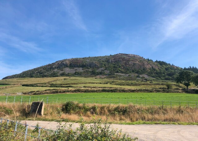
Garn Boduan

Garn Boduan is an Iron Age hillfort and hill near Nefyn, on the Llŷn Peninsula in Wales. In a survey in the 1950s the traces of over 170 round houses were...

Have you been to Coed Bryn Hendre?

Leave your review of Coed Bryn Hendre below (or comments, questions and feedback).