Bures

Settlement in Suffolk Babergh

England

Bures

The Ferriers The barn is disappearing behind brambles and other vegetation. The horse chestnut tree in the top left of the picture has produced a fine crop of 'conkers'.
The Ferriers Credit: Peter Wyatt

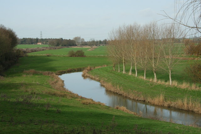
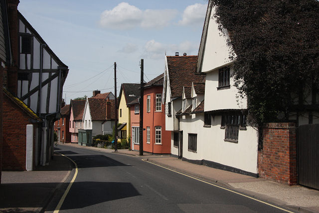
Bures is a small village located in Suffolk, England. Situated on the River Stour, it is part of the Babergh district and lies close to the border with Essex. Bures is divided into two parts: Bures Hamlet on the Suffolk side of the river and Bures St. Mary on the Essex side.

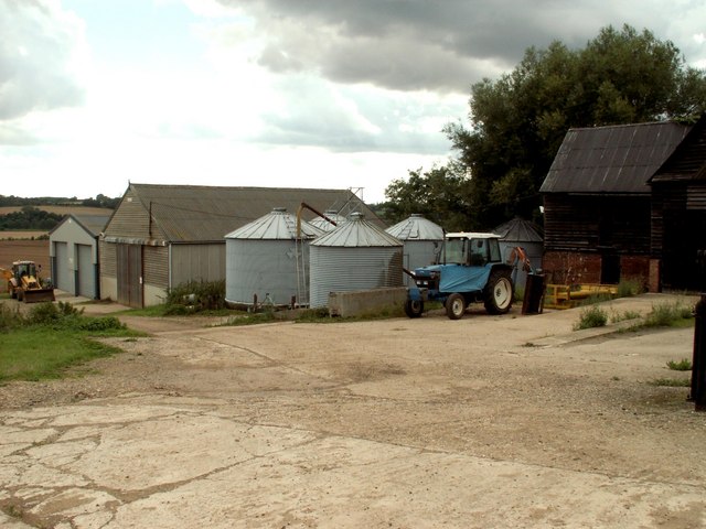
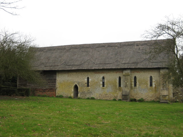
The village boasts a rich history, with evidence of settlement dating back to the Roman period. It is believed that Bures was an important center for trade and industry during the medieval era, and remnants of this can still be seen today, including the remains of a Norman castle.

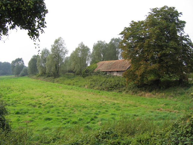
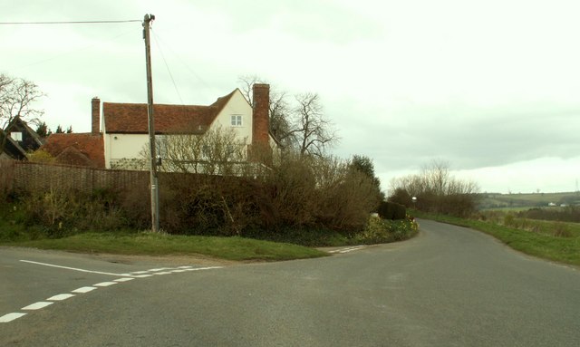
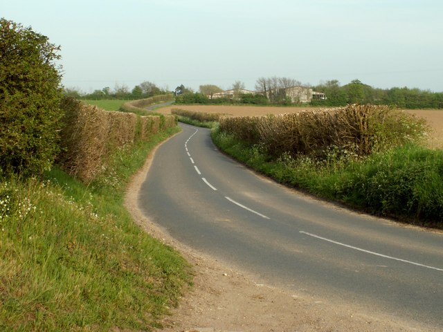
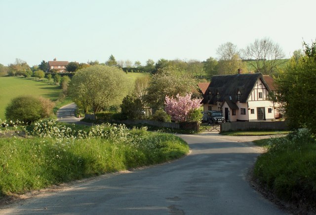
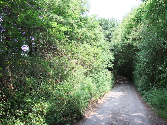
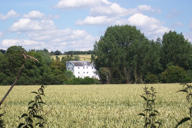
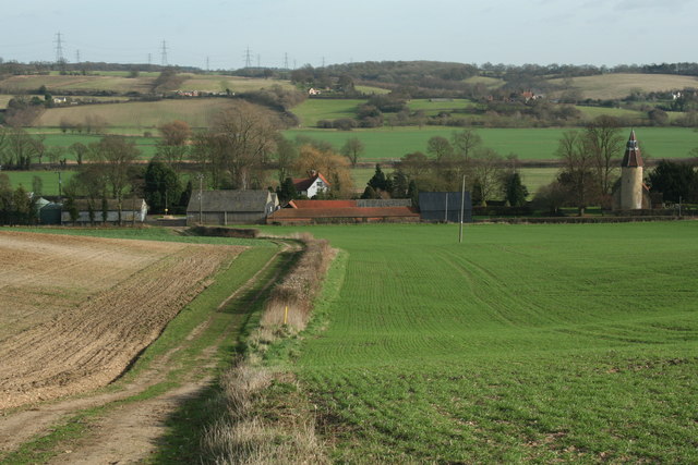
Bures is known for its picturesque scenery, surrounded by rolling hills, meadows, and woodlands. The River Stour, which flows through the village, offers opportunities for boating and fishing, attracting both locals and visitors. The area is also popular for walking and cycling, with several trails and pathways winding through the countryside.

The village itself is home to a close-knit community, with a range of amenities including a village hall, primary school, post office, and local shops. Bures also has a number of historic buildings, including the 14th-century St. Mary's Church, which features a unique round tower.

Bures is well-connected to neighboring towns and cities, with regular bus services and a train station providing links to Colchester and London. The village's proximity to the A12 and A14 makes it easily accessible by road as well.

Overall, Bures offers a charming rural retreat with a strong sense of community, making it an attractive place to live or visit for those seeking a peaceful countryside setting.

If you have any feedback on the listing, please let us know in the comments section below.

Bures Images

Images are sourced within 2km of 51.972562/0.776409 or Grid Reference TL9034. Thanks to Geograph Open Source API. All images are credited.

The Ferriers The barn is disappearing behind brambles and other vegetation. The horse chestnut tree in the top left of the picture has produced a fine crop of 'conkers'.
The Ferriers
The barn is disappearing behind brambles and other vegetation. The horse chestnut tree in the top left of the picture has produced a fine crop of 'conkers'.
A view of Hill Farm on Springett's Hill There are some lovely views from this hill when looking east.
A view of Hill Farm on Springett's Hill
There are some lovely views from this hill when looking east.
River Stour, Lamarsh
Colne Road leading to Bures
Part of Springetts Hill
Bell Hill, Lamarsh
Bell Hill, Lamarsh
Bures Mill, near Bures, Suffolk
St. John's church, Mount Bures, Essex Mount Bures once had a Norman castle, which may explain the cruciform shape of the church. Most of the church dates from Norman times but the crossing tower and transepts were rebuilt in 1875. Like many churches around the Colchester area, the building material includes re-used Roman bricks.
St. John's church, Mount Bures, Essex
Mount Bures once had a Norman castle, which may explain the cruciform shape of the church. Most of the church dates from Norman times but the crossing tower and transepts were rebuilt in 1875. Like many churches around the Colchester area, the building material includes re-used Roman bricks.
High Street, Bures, Suffolk Bures has many old timber-framed buildings and the High Street has good examples.
High Street, Bures, Suffolk
Bures has many old timber-framed buildings and the High Street has good examples.
Railway Bridge at Bures, Essex Bures is one of those places that sits on the border of two counties and, although Bures is a Suffolk village, its station and the bridge in this picture is just over the border in Essex.
Railway Bridge at Bures, Essex
Bures is one of those places that sits on the border of two counties and, although Bures is a Suffolk village, its station and the bridge in this picture is just over the border in Essex.
Woolman's Farm, near Bures, Suffolk
Road to Staunch Farm, just west of Wormingford
Stream and pasture - Stour valley The remains of an old sluice beside the road controlled the flow on this tributary to the Stour
Stream and pasture - Stour valley
The remains of an old sluice beside the road controlled the flow on this tributary to the Stour
Village sign at Bures Hamlet
Farmhouse at Fysh House Farm A footpath, known as St Edmund Way, runs through the grounds of this farm.
Farmhouse at Fysh House Farm
A footpath, known as St Edmund Way, runs through the grounds of this farm.
Houses at Bures Green
"Over the hill" Part of the St Edmunds Way, east of Bures in Suffolk
"Over the hill"
Part of the St Edmunds Way, east of Bures in Suffolk
Bridge over the Stour A farm bridge across the River Stour, between Essex and Suffolk. It's quite new, and not yet shown on the map. The long distance Stour Valley Path runs close by.
Bridge over the Stour
A farm bridge across the River Stour, between Essex and Suffolk. It's quite new, and not yet shown on the map. The long distance Stour Valley Path runs close by.
Show me another place!

Bures is located at Grid Ref: TL9034 (Lat: 51.972562, Lng: 0.776409)

Administrative County: Suffolk

District: Babergh

Police Authority: Suffolk

What 3 Words

///stung.claims.carriage. Near Bures St Mary, Suffolk

Related Wikis

Bures St Mary

Bures St Mary is a civil parish in the Babergh district of the English county of Suffolk. In 2005 it had a population of 940, reducing to 918 at the 2011...

Bures Hamlet

Bures Hamlet is a civil parish in the Braintree district of Essex, England. At the 2011 census, it had a population of 749.The parish covers the western...

Bures, England

Bures is a village in eastern England that straddles the Essex/Suffolk border, made up of two civil parishes: Bures Hamlet in Essex and Bures St. Mary...

Bures railway station

Bures railway station is on the Gainsborough Line, a branch off the Great Eastern Main Line to Sudbury, in the East of England, serving the village of...

Lamarsh

Lamarsh is a village and a civil parish in the Braintree District, in the county of Essex, England. It is near the large village of Bures and the village...

Smallbridge Hall

Smallbridge Hall is a Grade II* listed English country house in Bures St. Mary, Suffolk, near Colchester, England. The house is partially surrounded by...

Tiger Hill, Suffolk

Tiger Hill is a 21 hectare Local Nature Reserve between Bures St Mary and Leavenheath in Suffolk. It is owned by [a group of landowners and declared under...

Mount Bures

Mount Bures is a small village in England on the Essex and Suffolk borders. It takes its name from the mount or motte believed to have been built shortly...

Nearby Amenities

Located within 500m of 51.972562,0.776409
Turning Circle
Lat/Long: 51.9709588/0.7712999
Bures
Alt Name: Bures St. Mary
Is In County: Suffolk
Is In District: Babergh
Place: village
Wikidata: Q2315726
Lat/Long: 51.9711466/0.7763495
Bus Stop
Church
Naptan AtcoCode: 390010094
Naptan Bearing: W
Naptan BusStopType: CUS
Naptan CommonName: The Bridge
Naptan Indicator: adj
Naptan Landmark: The Bridge
Naptan NaptanCode: sufadgwg
Naptan Street: High Street
Naptan Verified: no
Public Transport: platform
Source: naptan_import
Lat/Long: 51.9722083/0.7745802
Bus Stop
Church
Naptan AtcoCode: 390010095
Naptan Bearing: E
Naptan BusStopType: CUS
Naptan CommonName: The Bridge
Naptan Indicator: opp
Naptan Landmark: The Bridge
Naptan NaptanCode: sufadgwj
Naptan Street: High Street
Naptan Verified: no
Public Transport: platform
Source: naptan_import
Lat/Long: 51.9722741/0.7745514
The Swan Pub and Bistro
Disused Amenity: pub
Lat/Long: 51.9718902/0.7716706
Defibrillator
Booth: K6
Covered: booth
Defibrillator Location: inside old red phone box by Church in Bures
Disused Amenity: telephone
Emergency: defibrillator
Indoor: no
Man Made: telephone_box
Operator: Community Heartbeat
Ref: CHT-10-522
Ref GB The Circuit: 18C14637-E2E7-4877-8301-AF5B017BBE7F
Lat/Long: 51.9718818/0.7752992
Pilgrim's Garage
Shop: car_repair
Lat/Long: 51.9739046/0.7781979
Eight Bells
Naptan AtcoCode: 1500IM744
Naptan Bearing: W
Naptan BusStopType: CUS
Naptan CommonName: The Swan
Naptan Crossing: Colchester Road
Naptan Indicator: o/s
Naptan Landmark: The Swan
Naptan NaptanCode: esxdjpat
Naptan Street: Station Hill
Naptan Verified: no
Public Transport: platform
Source: naptan_import
Lat/Long: 51.9719225/0.7724154
Eight Bells
Naptan AtcoCode: 1500IM744B
Naptan Bearing: N
Naptan BusStopType: CUS
Naptan CommonName: The Swan
Naptan Crossing: Station Hill
Naptan Indicator: N-bound
Naptan Landmark: The Swan
Naptan NaptanCode: esxdjpwd
Naptan Street: Colchester Road
Naptan Verified: no
Public Transport: platform
Source: naptan_import
Lat/Long: 51.9718193/0.7720849
Post Box
Collection Times: Mo-Fr 16:30; Sa 10:30
Operator: Royal Mail
Post Box Apertures: 1
Post Box Type: lamp
Ref: CO8 439
Royal Cypher: EIIR
Royal Cypher Wikidata: Q33102113
Lat/Long: 51.9715583/0.7701607
Post Box
Post Box Mounting: brick_pillar
Post Box Type: wall
Ref: CO8 311
Royal Cypher: GR
Royal Cypher Wikidata: Q33102273
Lat/Long: 51.9712098/0.7719115
Bures Hamlet
Is In County: Essex
Is In District: Braintree
Place: village
Lat/Long: 51.9717225/0.7714892
Post Box
Collection Times: Mo-Fr 16:45; Sa 11:30
Note: Ludlow plate, but appears to be a custom box. Modern collection plate appears in nearby window.
Operator: Royal Mail
Post Box Apertures: 1
Post Box Mounting: building
Post Box Type: wall
Ref: CO8 326
Royal Cypher: GR
Royal Cypher Wikidata: Q33102273
Lat/Long: 51.9718872/0.775435
Crossing
Crossing: uncontrolled
Crossing Island: yes
Lat/Long: 51.9717653/0.7721369
Bench
Lat/Long: 51.9707347/0.7739183
Bench
Lat/Long: 51.9709231/0.774167
Bbq
Lat/Long: 51.9694411/0.7748316
Leisure: picnic_table
Lat/Long: 51.9695089/0.7748683
Leisure: picnic_table
Lat/Long: 51.9694561/0.7749213
Leisure: picnic_table
Lat/Long: 51.9694009/0.7748764
Post Office
Bures Post Office
Addr City: Bures
Addr Postcode: CO8 5BT
Addr Street: Church Square
Brand: Post Office
Brand Wikidata: Q1783168
Contact Website: https://www.postoffice.co.uk/branch-finder/0611166/bures
Opening Hours: Mo,Tu,Th,Fr 09:00-13:00,14:00-17:30; We,Sa 09:00-12:30
Ref Pol Id: 314
Lat/Long: 51.9718572/0.7754669
Crossing
Crossing: uncontrolled
Crossing Island: yes
Lat/Long: 51.9719332/0.7721007
Rose’s General Store
Addr City: Bures
Addr Housenumber: 13
Addr Postcode: CO8 5AD
Addr Street: Bridge Street
Addr Village: Bures Hamlet
Fhrs Id: 300208
Shop: convenience
Source Addr: FHRS Open Data
Lat/Long: 51.9720757/0.7728343
Village Deli
Addr City: Bures
Addr Housenumber: 9A
Addr Postcode: CO8 5AD
Addr Street: Bridge Street
Addr Village: Bures Hamlet
Fhrs Id: 300752
Shop: convenience
Source Addr: FHRS Open Data
Lat/Long: 51.9720662/0.7726264
Beautiful You, Hairdresser
Shop: hairdresser
Lat/Long: 51.9720382/0.772212
Barrier: kissing_gate
Lat/Long: 51.9698731/0.7782336
Speed Display
Lat/Long: 51.9701933/0.7789779
Bures village sign
Man Made: village_sign
Tourism: artwork
Lat/Long: 51.9718265/0.7723959
Silver Jubilee
Tourism: artwork
Lat/Long: 51.9717654/0.7723557
Telephone
Booth: K6
Covered: booth
Listed Status: Grade II
Phone: +44 1787 227301
Lat/Long: 51.971898/0.7718567
Bench
Lat/Long: 51.9718114/0.7723774
Advertising: board
Lat/Long: 51.971785/0.7723953
Give Way
Direction: backward
Lat/Long: 51.9719115/0.7721729
Addr Housename: Pilgrims Rest
Addr Street: Sudbury Road
Lat/Long: 51.9741132/0.7775781
The data included in this document is from www.openstreetmap.org. The data is made available under ODbL.

Have you been to Bures?

Leave your review of Bures below (or comments, questions and feedback).