Burdrop

Settlement in Oxfordshire Cherwell

England

Burdrop

SS Peter & Paul, Swalcliffe
SS Peter & Paul, Swalcliffe Credit: Geoff Pick

Burdrop is a small village located in the county of Oxfordshire, England. Situated in the Cherwell Valley, it is nestled amidst picturesque countryside, offering residents and visitors a serene and idyllic setting. The village is part of the civil parish of Swalcliffe, and its nearest town is Banbury, which is approximately 7 miles to the southeast.

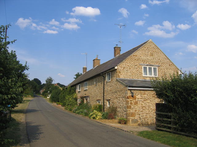
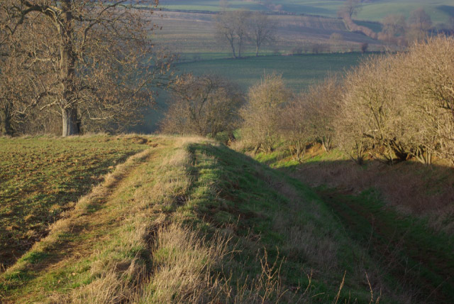
With a population of around 150 people, Burdrop is a tight-knit community that exudes a charming and friendly atmosphere. The village is characterized by its traditional stone-built cottages, many of which date back several centuries, giving it a quintessentially English feel. The surrounding countryside offers breathtaking views and ample opportunities for outdoor activities such as hiking, cycling, and nature walks.

Despite its small size, Burdrop boasts a rich history. It is mentioned in the Domesday Book of 1086, where it is recorded as "Buretrope." Over the centuries, the village has remained relatively untouched, preserving its historic character. St. Peter's Church, a Grade II listed building, stands as a testament to the village's heritage.

Although Burdrop lacks its own amenities, it benefits from its proximity to nearby towns and villages. Residents have easy access to shops, schools, healthcare facilities, and other services in Banbury and other nearby towns. The village is well-connected by road, with the A422 and A361 providing convenient links to the wider region.

Burdrop offers a tranquil and picturesque lifestyle for those seeking a peaceful retreat in the heart of Oxfordshire's beautiful countryside.

If you have any feedback on the listing, please let us know in the comments section below.
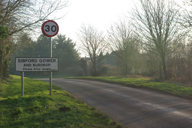
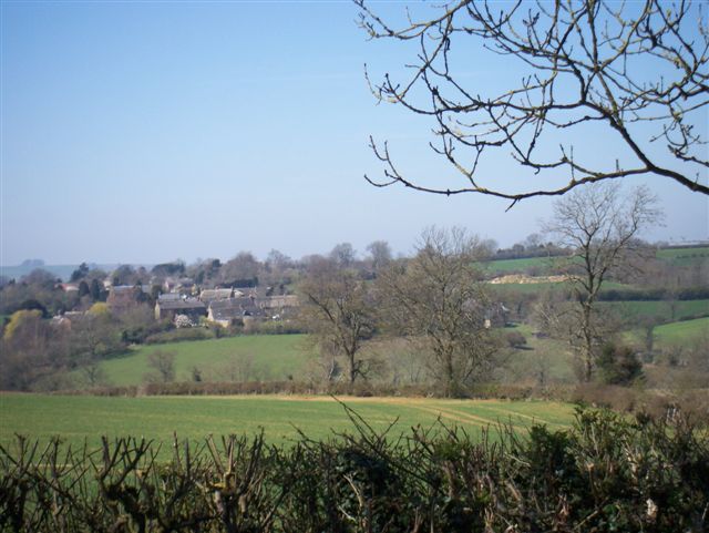
Burdrop Images

Images are sourced within 2km of 52.037854/-1.47732 or Grid Reference SP3537. Thanks to Geograph Open Source API. All images are credited.

SS Peter & Paul, Swalcliffe
Wykham Arms, Sibford Gower
The Colony The Colony consists of several rows of cottages beside the road approaching Sibford Gower from the south west.
The Colony
The Colony consists of several rows of cottages beside the road approaching Sibford Gower from the south west.
The Manor House, Sibford Gower According to the <a href="https://www.geograph.org.uk/photo/273647">SP3537 : Blue Plaque at the Manor House</a> this was the home of Frank William Thomas Charles Lascelles.
The Manor House, Sibford Gower
According to the SP3537 : Blue Plaque at the Manor House this was the home of Frank William Thomas Charles Lascelles.
Blue Plaque at the Manor House A close up of the blue plaque on the gateway of <a href="https://www.geograph.org.uk/photo/273646">SP3537 : The Manor House, Sibford Gower</a>.
Blue Plaque at the Manor House
A close up of the blue plaque on the gateway of SP3537 : The Manor House, Sibford Gower.
Bridleway west of Sibford Gower The bridleway is sunk below the level of the surrounding farmland as it makes its way into the valley of one of the headwaters of the River Stour. It leads from Sibford Gower to Gallow Hill Farm, across the valley on the B4035.
Bridleway west of Sibford Gower
The bridleway is sunk below the level of the surrounding farmland as it makes its way into the valley of one of the headwaters of the River Stour. It leads from Sibford Gower to Gallow Hill Farm, across the valley on the B4035.
Farm Buildings north of Sibford Gower Barn stacked with hay and straw just off the lane leading north out of Sibford Gower village.
Farm Buildings north of Sibford Gower
Barn stacked with hay and straw just off the lane leading north out of Sibford Gower village.
Sheep at Sibford Ferris Four sheep tuck into their winter hay rations while keeping a wary eye on the photographer. They were in a field between Sibford Ferris and Burdrop, with Sibford Gower in the distance.
Sheep at Sibford Ferris
Four sheep tuck into their winter hay rations while keeping a wary eye on the photographer. They were in a field between Sibford Ferris and Burdrop, with Sibford Gower in the distance.
Walford Road, Sibford Ferris Up-market housing development with a nod to traditional Cotswold architecture.
Walford Road, Sibford Ferris
Up-market housing development with a nod to traditional Cotswold architecture.
Approaching Sibford Gower Heading into Sibford Gower village from the north. 'Gower' is a manorial affix indicating ownership by the Guher family, distinguishing it from nearby Sibford Ferris which was in the possession of the de Ferrers. Burdrop is an adjoining hamlet.
Approaching Sibford Gower
Heading into Sibford Gower village from the north. 'Gower' is a manorial affix indicating ownership by the Guher family, distinguishing it from nearby Sibford Ferris which was in the possession of the de Ferrers. Burdrop is an adjoining hamlet.
Open road
Open road
Bridleway
Bridleway
Farmland Swalcliffe church in the distance
Farmland
Swalcliffe church in the distance
Blenheim Farm
Blenheim Farm
Farmland Bridleway and entrance road to Blenheim Farm
Farmland
Bridleway and entrance road to Blenheim Farm
Bikes this way! National cycle route 5
Bikes this way!
National cycle route 5
Farmland
Farmland
Show me another place!

Burdrop is located at Grid Ref: SP3537 (Lat: 52.037854, Lng: -1.47732)

Administrative County: Oxfordshire

District: Cherwell

Police Authority: Thames Valley

What 3 Words

///name.snippets.ensemble. Near Lower Brailes, Warwickshire

Related Wikis

Burdrop

Burdrop is a village in Sibford Gower civil parish, about 6.5 miles (10.5 km) west of Banbury in Oxfordshire, England. Burdrop is contiguous with Sibford...

Sibford Ferris

Sibford Ferris is a village and civil parish about 6.5 miles (10.5 km) west of Banbury in Oxfordshire. It is on the south side of the Sib valley opposite...

Sibford School

Sibford School is a British co-educational independent school in Sibford Ferris, west of Banbury in north Oxfordshire, linked with the Religious Society...

Swalcliffe

Swalcliffe is a village and civil parish about 5 miles (8 km) west of Banbury in Oxfordshire. The parish is about 2+1⁄2 miles (4 km) long north–south and...

Nearby Amenities

Located within 500m of 52.037854,-1.47732
Barrier: stile
Lat/Long: 52.0384889/-1.4796564
Sibford Gower Church
Created By: GPSBabel-1.3.6
Lat/Long: 52.037593/-1.482277
Post Office
Sibford Ferris Post Office
Addr Postcode: OX15 5RG
Branch: Sibford Ferris
Brand: Post Office
Brand Wikidata: Q1783168
Check Date: 2020-02-20
Contact Website: https://www.postoffice.co.uk/branch-finder/2961377/sibford-ferris
Ref Pol Id: 11875
Lat/Long: 52.0340778/-1.4778419
Bus Stop
School
Bus: yes
Naptan AtcoCode: 340000667SCH
Naptan Bearing: W
Naptan BusStopType: CUS
Naptan CommonName: School
Naptan Indicator: Main St Westbound
Naptan Landmark: School
Naptan NaptanCode: oxfaptmp
Naptan Street: Main Street
Naptan Verified: no
Public Transport: platform
Source: naptan_import
Lat/Long: 52.0338659/-1.4801788
Bus Stop
School
Bus: yes
Naptan AtcoCode: 340000667SCO
Naptan Bearing: E
Naptan BusStopType: CUS
Naptan CommonName: School
Naptan Indicator: Main St Eastbound
Naptan Landmark: School
Naptan NaptanCode: oxfgapgm
Naptan Street: Main Street
Naptan Verified: no
Public Transport: platform
Shelter: no
Source: naptan_import
Lat/Long: 52.0337675/-1.4802966
Bus Stop
Acre Ditch
Bus: yes
Naptan AtcoCode: 340001480CHU
Naptan Bearing: W
Naptan CommonName: Acre Ditch
Naptan Indicator: Corner
Naptan Landmark: Church
Naptan NaptanCode: oxfagpmj
Naptan Street: Hawks Lane
Naptan Verified: no
Public Transport: platform
Source: naptan_import
Lat/Long: 52.0378133/-1.4802642
Bus Stop
Acre Ditch
Bus: yes
Naptan AtcoCode: 340001480OPC
Naptan Bearing: S
Naptan BusStopType: CUS
Naptan CommonName: Acre Ditch
Naptan Indicator: Opposite
Naptan Landmark: Church
Naptan NaptanCode: oxfagpmg
Naptan Street: Village Road
Naptan Verified: no
Public Transport: platform
Source: naptan_import
Lat/Long: 52.0377134/-1.4800321
Burdrop
Place: village
Source: OS_OpenData_StreetView
Wikidata: Q4998314
Wikipedia: en:Burdrop
Lat/Long: 52.0375991/-1.4796602
Power: pole
Lat/Long: 52.0369116/-1.4843775
Power: pole
Lat/Long: 52.0376019/-1.4836864
Power: pole
Lat/Long: 52.0394609/-1.4836006
Power: pole
Lat/Long: 52.0386166/-1.4831077
Power: pole
Lat/Long: 52.0380822/-1.4834155
Line Management: branch
Power: pole
Lat/Long: 52.0351555/-1.4827194
Power: pole
Lat/Long: 52.0348081/-1.4815151
Sibford Ferris North
Power: pole
Transformer: distribution
Voltage Primary: 11000
Lat/Long: 52.0345109/-1.48051
Burdrop West
Power: pole
Transformer: distribution
Voltage Primary: 11000
Lat/Long: 52.0387844/-1.4811781
Power: pole
Lat/Long: 52.0393629/-1.4800546
Power: pole
Lat/Long: 52.0393757/-1.4781734
Power: pole
Lat/Long: 52.0395015/-1.477441
Power: pole
Lat/Long: 52.0396381/-1.4766121
Power: pole
Lat/Long: 52.0397798/-1.4757873
Power: pole
Lat/Long: 52.0399362/-1.4749181
Power: pole
Lat/Long: 52.038998/-1.476827
Power: pole
Lat/Long: 52.0379449/-1.4771872
Burdrop East
Power: pole
Transformer: distribution
Voltage Primary: 11000
Lat/Long: 52.0373423/-1.4773881
Power: pole
Lat/Long: 52.0401638/-1.4736175
Power: pole
Lat/Long: 52.0401925/-1.4726248
Power: pole
Lat/Long: 52.0402086/-1.4715946
Post Box
Brand: Royal Mail
Brand Wikidata: Q638098
Brand Wikipedia: en:Royal Mail
Operator: Royal Mail
Operator Wikidata: Q638098
Post Box Type: wall
Ref: OX15 1054D
Royal Cypher: GR
Royal Cypher Wikidata: Q33102273
Lat/Long: 52.0344936/-1.4802709
Power: pole
Lat/Long: 52.0390785/-1.4833867
Power: pole
Lat/Long: 52.0353967/-1.4813128
Power: pole
Lat/Long: 52.0355521/-1.4803754
Power: pole
Lat/Long: 52.0354314/-1.4794993
Power: pole
Lat/Long: 52.035297/-1.4786085
Power: pole
Lat/Long: 52.0351883/-1.4777718
Banbury Road
Power: pole
Transformer: distribution
Voltage Primary: 11000
Lat/Long: 52.0344079/-1.4773448
Power: pole
Lat/Long: 52.0393437/-1.4827614
Power: pole
Lat/Long: 52.0393561/-1.4813519
Power: pole
Lat/Long: 52.0383315/-1.477055
The data included in this document is from www.openstreetmap.org. The data is made available under ODbL.

Have you been to Burdrop?

Leave your review of Burdrop below (or comments, questions and feedback).