Y Garn

Hill, Mountain in Caernarfonshire

Wales

Y Garn

The beginning of the steep descent from Cwm Cneifio to Llyn Idwal The Carneddau Mountains form the background.
The beginning of the steep descent from Cwm Cneifio to Llyn Idwal Credit: Eric Jones

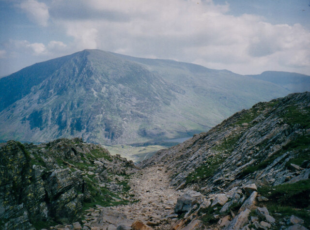
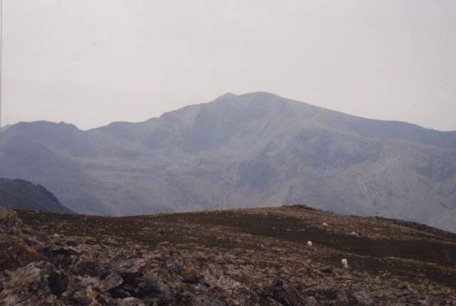
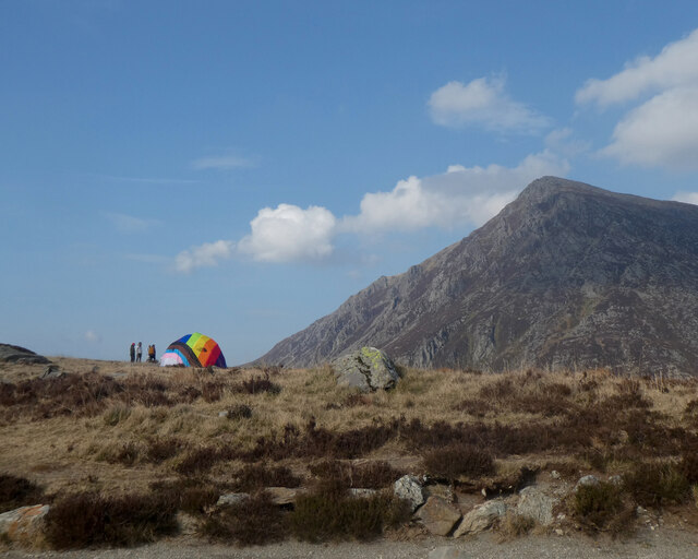
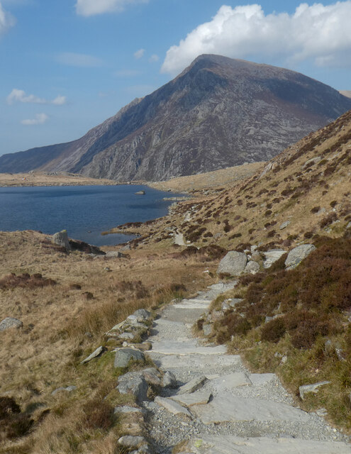
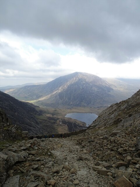
Y Garn is a prominent hill located in the county of Caernarfonshire, Wales. It is part of the Snowdonia National Park and is situated approximately 6 miles south of the town of Caernarfon. Standing at a height of 947 meters (3,107 feet), Y Garn is classified as a mountain and is a popular destination for hikers and mountaineers.

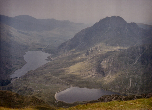
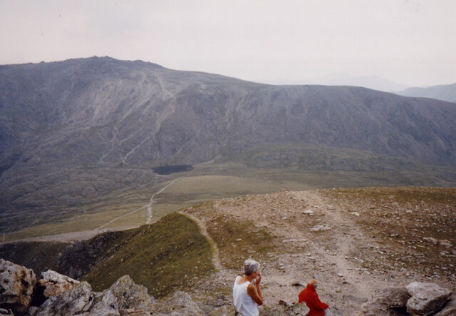
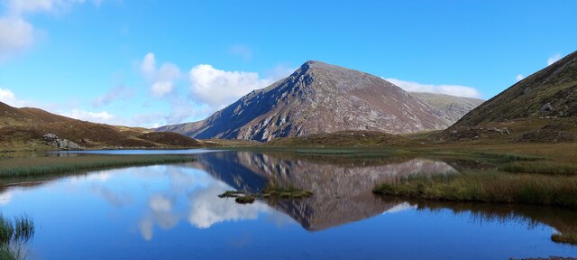
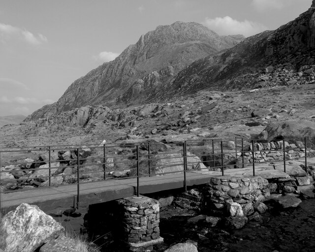
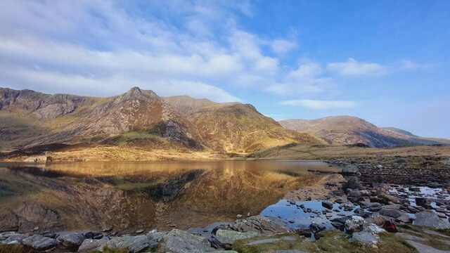
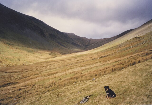
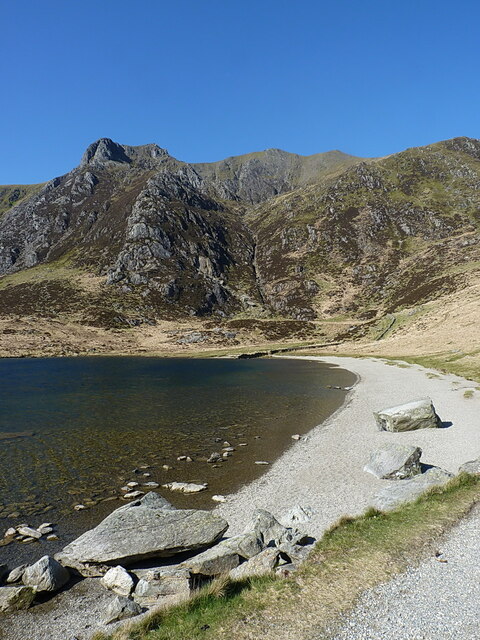
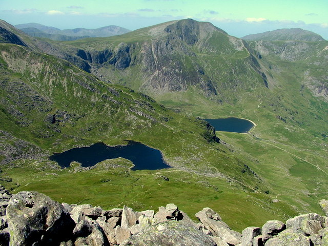
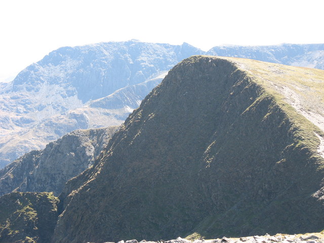
The hill is part of the Glyderau range, which is renowned for its rugged and dramatic landscapes. Y Garn is characterized by its steep and rocky slopes, making it a challenging yet rewarding climb for outdoor enthusiasts. From the summit, visitors are rewarded with breathtaking panoramic views of the surrounding Snowdonia mountains, including Snowdon itself, the highest peak in Wales.

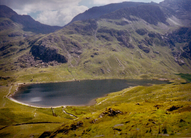
The ascent to Y Garn can be accessed from several routes, including one from the Ogwen Valley and another from the Nant Peris village. Both routes offer stunning scenery and the opportunity to spot local wildlife, such as mountain goats and birds of prey.

Y Garn is also notable for its geological features, including the Devil's Kitchen, a large gully on its eastern face that attracts climbers and photographers alike. This natural amphitheater is formed by the erosion of the rocks over thousands of years and adds to the allure of Y Garn as a destination for outdoor enthusiasts.

Overall, Y Garn in Caernarfonshire is a majestic mountain that offers a challenging but rewarding experience for those seeking adventure and stunning views in the beautiful Snowdonia National Park.

If you have any feedback on the listing, please let us know in the comments section below.

Y Garn Images

Images are sourced within 2km of 53.115033/-4.0483722 or Grid Reference SH6359. Thanks to Geograph Open Source API. All images are credited.

The beginning of the steep descent from Cwm Cneifio to Llyn Idwal The Carneddau Mountains form the background.
The beginning of the steep descent from Cwm Cneifio to Llyn Idwal
The Carneddau Mountains form the background.
Llynnau Idwal and Ogwen from the slopes of Y Garn The rugged peak on the right is Y Tryfan.
Llynnau Idwal and Ogwen from the slopes of Y Garn
The rugged peak on the right is Y Tryfan.
Llyn Idwal and Clogwyn y Tarw/Gribin Facet
View South from the summit of Y Garn The background features Llyn y Cwn and the towering cliffs of Glyder Fawr and Esgair Felen.
View South from the summit of Y Garn
The background features Llyn y Cwn and the towering cliffs of Glyder Fawr and Esgair Felen.
View SSE across the Garn Plateau The Snowdon Massif occupies the background.
View SSE across the Garn Plateau
The Snowdon Massif occupies the background.
Llyn Idwal and Pen yr Ole Wen, Snowdonia A late September morning with beautiful, almost clear blue skies.   A short walk from Pont Pen-y-Benglog up into the Glyderau mountains brings you to the shores of Llyn Idwal.  Looking north across the calm waters to the peak of Pen yr Ole Wen in the Carneddau mountains.
Llyn Idwal and Pen yr Ole Wen, Snowdonia
A late September morning with beautiful, almost clear blue skies. A short walk from Pont Pen-y-Benglog up into the Glyderau mountains brings you to the shores of Llyn Idwal. Looking north across the calm waters to the peak of Pen yr Ole Wen in the Carneddau mountains.
Pont droed / Footbridge
Pabell amryliw / A multicoloured tent
Pabell amryliw / A multicoloured tent (2)
Llyn Idwal
Llyn Idwal
Ffens yng Nghwm Idwal / Fence in Cwm Idwal
Glacial rock feature/ Nodwedd craig rhewlifol
Llyn Idwal & Pen yr Ole Wen
Path down to Cwm Idwal
Llyn Idwal in the Glyderau Mountains Just before 8a.m. on a beautiful, late April morning.  No traffic to speak of on the A5 as I drove to the Ogwen Valley earlier; plenty of places to park; peaceful and quiet; glorious weather. 
The path from Pont Pen-y-Benglog takes you up into the Glyderau Mountains. 
Then - to have an hour by Llyn Idwal, with only one other person in sight in the distance for that entire time - wonderful!  I've walked round Llyn Idwal in each of the seasons and in every type of weather - but the peace and quiet that morning was a beautiful gift! 
For that hour it was just me, the Llyn and the mountains - incredible!
Llyn Idwal in the Glyderau Mountains
Just before 8a.m. on a beautiful, late April morning. No traffic to speak of on the A5 as I drove to the Ogwen Valley earlier; plenty of places to park; peaceful and quiet; glorious weather. The path from Pont Pen-y-Benglog takes you up into the Glyderau Mountains. Then - to have an hour by Llyn Idwal, with only one other person in sight in the distance for that entire time - wonderful! I've walked round Llyn Idwal in each of the seasons and in every type of weather - but the peace and quiet that morning was a beautiful gift! For that hour it was just me, the Llyn and the mountains - incredible!
Summit plateau of Glyder Fawr View from the summit rocks towards the path to Pen-y-Pas, between the two rocky outcrops on the left side.
Summit plateau of Glyder Fawr
View from the summit rocks towards the path to Pen-y-Pas, between the two rocky outcrops on the left side.
The upper section of Cwm Dudodyn from the slopes of Y Garn
Shingle beach at the northern end of Llyn Idwal The beach was the find-spot in 2015 of a couple of prehistoric stone implements - the business end of a thick and broken flake, and a possible awl, as described briefly at <span class="nowrap"><a title="https://archwilio.org.uk/arch/query/page.php?watprn=GAT71265&dbname=gat&tbname=core" rel="nofollow ugc noopener" href="https://archwilio.org.uk/arch/query/page.php?watprn=GAT71265&dbname=gat&tbname=core">Link</a><img style="margin-left:2px;" alt="External link" title="External link - shift click to open in new window" src="https://s1.geograph.org.uk/img/external.png" width="10" height="10"/></span>. We are looking up towards Cwm Clyd beneath the summit of Y Garn.
Shingle beach at the northern end of Llyn Idwal
The beach was the find-spot in 2015 of a couple of prehistoric stone implements - the business end of a thick and broken flake, and a possible awl, as described briefly at LinkExternal link. We are looking up towards Cwm Clyd beneath the summit of Y Garn.
Show me another place!

Y Garn is located at Grid Ref: SH6359 (Lat: 53.115033, Lng: -4.0483722)

Unitary Authority: Gwynedd

Police Authority: North Wales

What 3 Words

///corrode.pinks.quickly. Near Llanberis, Gwynedd

Related Wikis

Y Garn (Glyderau)

Y Garn is a mountain in Snowdonia, North Wales, part of the Glyderau. It is one of the Welsh 3000s — the 15 summits in Wales over 3,000 feet (914.4 metres...

Devil's Appendix

The Devil's Appendix (Welsh: Nant Clogwyn y Geifr) is the tallest single-drop waterfall in Wales and one of the tallest in the United Kingdom. It is a...

Cwm Idwal

Cwm Idwal is a cirque (or corrie) in the Glyderau range of mountains in northern Snowdonia, the national park in the mountainous region of North Wales...
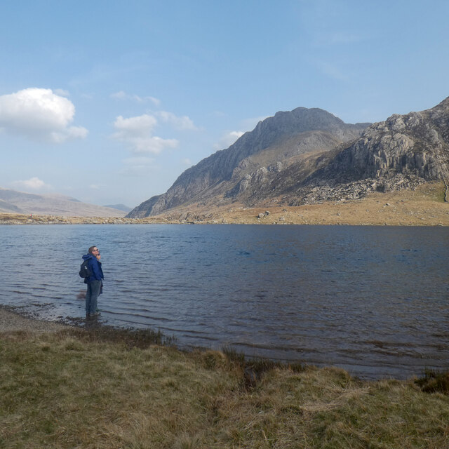
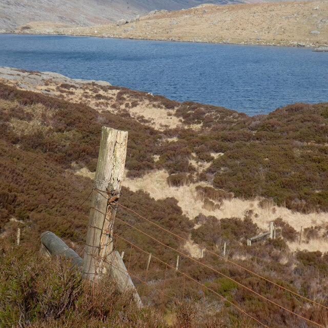
Llyn Idwal

Llyn Idwal is a small lake (approximately 800 m by 300 m, or 28 acres) that lies within Cwm Idwal in the Glyderau mountains of Snowdonia.It is named after...

Foel-goch

Foel-goch is a mountain in Snowdonia, north-west Wales, and forms part of the Glyderau range, in Gwynedd. It lies in between Y Garn and Mynydd Perfedd...

Glyderau

The Glyderau (a Welsh plural form, also known in English as the Glyders) are a mountain group in Snowdonia, North Wales. The name derives from the highest...

Nant Ffrancon Pass

The Nant Ffrancon Pass in Snowdonia, North Wales is at 312 metres (1,024 ft) at Pont Wern-gof, about one-third of a mile beyond the eastern end of Llyn...

Ogwen Cottage

Ogwen Cottage Outdoor Pursuits Centre is situated beside Llyn Ogwen, in Gwynedd, Wales. It is owned by the National Trust, who bought the property at auction...

Nearby Amenities

Located within 500m of 53.115033,-4.0483722
Y Garn
Ele: 947
Natural: peak
Wikidata: Q8519868
Wikipedia: en:Y Garn (Glyderau)
Lat/Long: 53.1157063/-4.0470806
The data included in this document is from www.openstreetmap.org. The data is made available under ODbL.

Have you been to Y Garn?

Leave your review of Y Garn below (or comments, questions and feedback).