Castell y Gwynt

Hill, Mountain in Caernarfonshire

Wales

Castell y Gwynt

The beginning of the steep descent from Cwm Cneifio to Llyn Idwal The Carneddau Mountains form the background.
The beginning of the steep descent from Cwm Cneifio to Llyn Idwal Credit: Eric Jones

Castell y Gwynt, located in Caernarfonshire, Wales, is a prominent and distinctive hill/mountain in the Snowdonia National Park. Its name translates to "Castle of the Wind" in English, which aptly describes the challenging and exposed conditions often experienced at its summit.

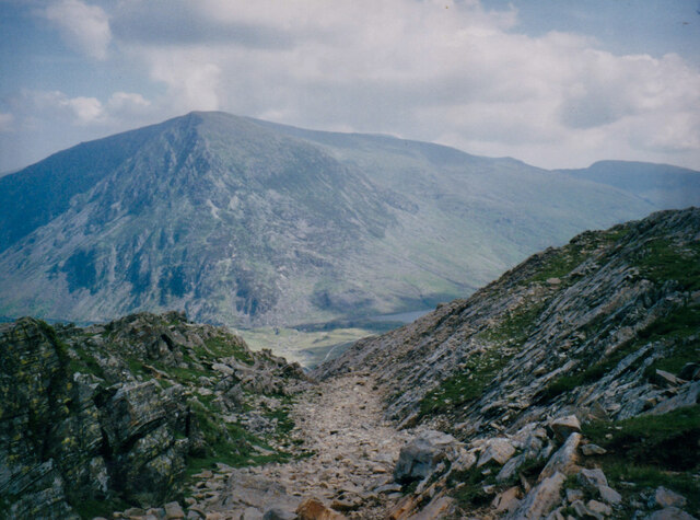
Standing at an elevation of approximately 2,865 feet (873 meters), Castell y Gwynt is part of the Glyderau mountain range. It is renowned for its unique and jagged rock formations, which resemble the battlements of a castle, hence its name. These formations were intricately shaped by millennia of glacial activity, resulting in an awe-inspiring landscape.

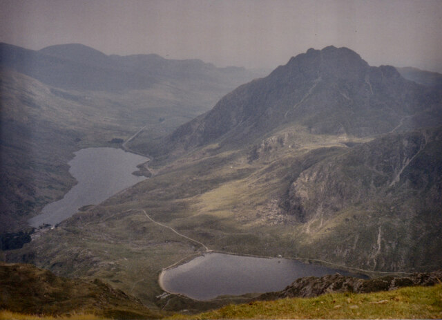
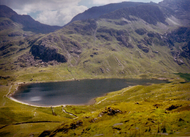
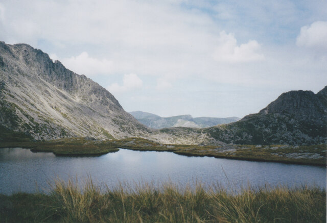
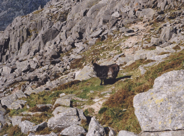
The hill/mountain is a popular destination for hikers and mountaineers, attracting outdoor enthusiasts from far and wide. The ascent to Castell y Gwynt is considered moderately difficult, with different routes available to suit various levels of experience and fitness. Along the way, the trail offers breathtaking views of the surrounding mountains and valleys, including the iconic Mount Snowdon.

At the summit, adventurers are rewarded with panoramic vistas that stretch as far as the eye can see. On a clear day, one can admire the rugged beauty of Snowdonia National Park, with its lakes, forests, and rolling hills. However, caution must be exercised due to the exposed nature of the summit, as strong winds and rapidly changing weather conditions can make the area treacherous.

Whether scaling its slopes or simply admiring its grandeur from afar, Castell y Gwynt is a must-visit destination for nature lovers and those seeking a challenge in the stunning Welsh countryside.

If you have any feedback on the listing, please let us know in the comments section below.

Castell y Gwynt Images

Images are sourced within 2km of 53.103042/-4.0134435 or Grid Reference SH6558. Thanks to Geograph Open Source API. All images are credited.

The beginning of the steep descent from Cwm Cneifio to Llyn Idwal The Carneddau Mountains form the background.
The beginning of the steep descent from Cwm Cneifio to Llyn Idwal
The Carneddau Mountains form the background.
Llynnau Idwal and Ogwen from the slopes of Y Garn The rugged peak on the right is Y Tryfan.
Llynnau Idwal and Ogwen from the slopes of Y Garn
The rugged peak on the right is Y Tryfan.
Llyn Idwal and Clogwyn y Tarw/Gribin Facet
The West face of Tryfan from Cwm Idwal
Llyn Caseg Fraith with Bwlch Tryfan in the middle ground Llyn Caseg Fraith, (meaning 'Lake of the Brindled Mare') is a shallow lake on the edge of a precipice. Bwlch Tryfan is the col which separates the semi-detached Tryfan from the rest of the Glyderau.
Llyn Caseg Fraith with Bwlch Tryfan in the middle ground
Llyn Caseg Fraith, (meaning 'Lake of the Brindled Mare') is a shallow lake on the edge of a precipice. Bwlch Tryfan is the col which separates the semi-detached Tryfan from the rest of the Glyderau.
Path on the North West face of Tryfan
Preparing to jump between Adam and Eve on the summit of Y Tryfan Adam and Eve are two exposed boulders on the summit of Tryfan surrounded by steep precipices on all sides. A visit to the summit is not complete without a leap between the two boulders.
Preparing to jump between Adam and Eve on the summit of Y Tryfan
Adam and Eve are two exposed boulders on the summit of Tryfan surrounded by steep precipices on all sides. A visit to the summit is not complete without a leap between the two boulders.
Feral goat high on Tryfan's rocky slopes
The Eastern flank of Tryfan from the Miners'Path
The NE slopes of Glyder Fach from the shores of Llyn Caseg Fraith
Grib Bigod/Bristly Ridge on the Glyder Fach The image was taken from Llyn Caseg Fraith.
Grib Bigod/Bristly Ridge on the Glyder Fach
The image was taken from Llyn Caseg Fraith.
Tryfan from Llyn Caseg Fraith The smaller peak, nearest the camera is Tryfan's Far South Peak.
Tryfan from Llyn Caseg Fraith
The smaller peak, nearest the camera is Tryfan's Far South Peak.
Tryfan from the col between Glyder Fach and Foel Goch
Feral Goat close to the summit of Glyder Fawr
Tryfan viewed across Cwm Bochlwyd
A section of the Glyder Fach summit blockfield The dense block-field makes movement across the summit of Glyder Fach difficult, and can be a nightmare in low cloud. Fortunately, this image was created on a fine sunny summer's day.
A section of the Glyder Fach summit blockfield
The dense block-field makes movement across the summit of Glyder Fach difficult, and can be a nightmare in low cloud. Fortunately, this image was created on a fine sunny summer's day.
The summit of Glyder Fach
The not to be missed Cantilever Stone on the summit of Glyder Fach On most summer days, there is a queue of people waiting to walk along the Cantilever Stone.
The not to be missed Cantilever Stone on the summit of Glyder Fach
On most summer days, there is a queue of people waiting to walk along the Cantilever Stone.
Show me another place!

Castell y Gwynt is located at Grid Ref: SH6558 (Lat: 53.103042, Lng: -4.0134435)

Unitary Authority: Conwy

Police Authority: North Wales

What 3 Words

///magpie.extremes.samplers. Near Llanberis, Gwynedd

Related Wikis

Glyder Fach

Glyder Fach is a mountain in Snowdonia, north-west Wales, and is the second highest of the Glyderau and the sixth highest in Wales. Routes to the summit...

Castell y Gwynt

Castell y Gwynt is a top of Glyder Fach in Snowdonia, north-west Wales. It has the merit of being the only 3000 ft Welsh summit classed as only a Nuttall...
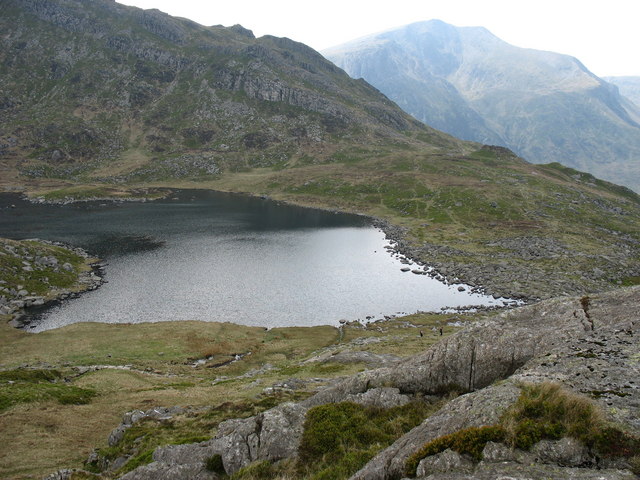
Llyn Bochlwyd

Llyn Bochlwyd (Welsh pronunciation: [ɬɨ̞n boːχluːɨ̯d, ɬɪn boːχlʊi̯d]) is a lake in Snowdonia, Wales, in Conwy County Borough. It lies in Cwm Bochlwyd,...

Glyderau

The Glyderau (a Welsh plural form, also known in English as the Glyders) are a mountain group in Snowdonia, North Wales. The name derives from the highest...

Nearby Amenities

Located within 500m of 53.103042,-4.0134435
Glyder Fach
Ele: 994
Natural: peak
Source Ref: NPE maps
Source Ref Name: npe
Wikidata: Q5572805
Wikipedia: en:Glyder Fach
Lat/Long: 53.1048299/-4.0083794
Castell Y Gwynt
Ele: 972
Natural: peak
Wikidata: Q5049676
Wikipedia: en:Castell y Gwynt
Lat/Long: 53.1037392/-4.0120632
Man Made: cairn
Source: interpolation of two waypoints where the second got collected 1 hour after the first
Lat/Long: 53.10239/-4.0206176
Man Made: cairn
Source: interpolation of two waypoints where the second got collected 1 hour after the first
Lat/Long: 53.1024385/-4.0202905
Man Made: cairn
Source: interpolation of two waypoints where the second got collected 1 hour after the first
Lat/Long: 53.1024892/-4.0200651
Man Made: cairn
Source: interpolation of two waypoints where the second got collected 1 hour after the first
Lat/Long: 53.1025142/-4.0197816
Man Made: cairn
Source: interpolation of two waypoints where the second got collected 1 hour after the first
Lat/Long: 53.1025905/-4.0194463
Man Made: cairn
Source: interpolation of two waypoints where the second got collected 1 hour after the first
Lat/Long: 53.1026877/-4.019276
Man Made: cairn
Source: interpolation of two waypoints where the second got collected 1 hour after the first
Lat/Long: 53.1031262/-4.0181663
Man Made: cairn
Source: interpolation of two waypoints where the second got collected 1 hour after the first
Lat/Long: 53.103214/-4.0178459
Man Made: cairn
Source: interpolation of two waypoints where the second got collected 1 hour after the first
Lat/Long: 53.103288/-4.0173165
Man Made: cairn
Source: interpolation of two waypoints where the second got collected 1 hour after the first
Lat/Long: 53.1033053/-4.0175777
Man Made: cairn
Lat/Long: 53.10372/-4.01115
Man Made: cairn
Source: interpolation of two waypoints where the second got collected ~2 minutes after the first
Lat/Long: 53.1044749/-4.0167756
Man Made: cairn
Source: interpolation of two waypoints where the second got collected 1 hour after the first
Lat/Long: 53.1033649/-4.0159015
Man Made: cairn
Source: interpolation of two waypoints where the second got collected 1 hour after the first
Lat/Long: 53.103025/-4.0185164
Glyder Fach
County: Conwy
County Id: 197
Description: OS trig location
Ele: 993.648
Man Made: survey_point
Note: Accurate location import for imagery offset calibration. Please do not move.
Ref: SH57/T21
Source: Ordnance Survey (OGL)
Survey Point: pin
Tpuk Ref: TP7318
Lat/Long: 53.104813/-4.0083606
Y Gwyliwr
Name Cy: Y Gwyliwr
Name En: The Cantilever
Natural: stone
Lat/Long: 53.1051025/-4.0068501
The data included in this document is from www.openstreetmap.org. The data is made available under ODbL.

Have you been to Castell y Gwynt?

Leave your review of Castell y Gwynt below (or comments, questions and feedback).