Carnedd y Filiast North Top

Hill, Mountain in Caernarfonshire

Wales

Carnedd y Filiast North Top

Sunset from above the Marchlyn Road The Menai Strait can be seen in the distance.
Sunset from above the Marchlyn Road Credit: Eric Jones

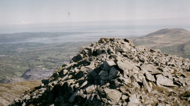
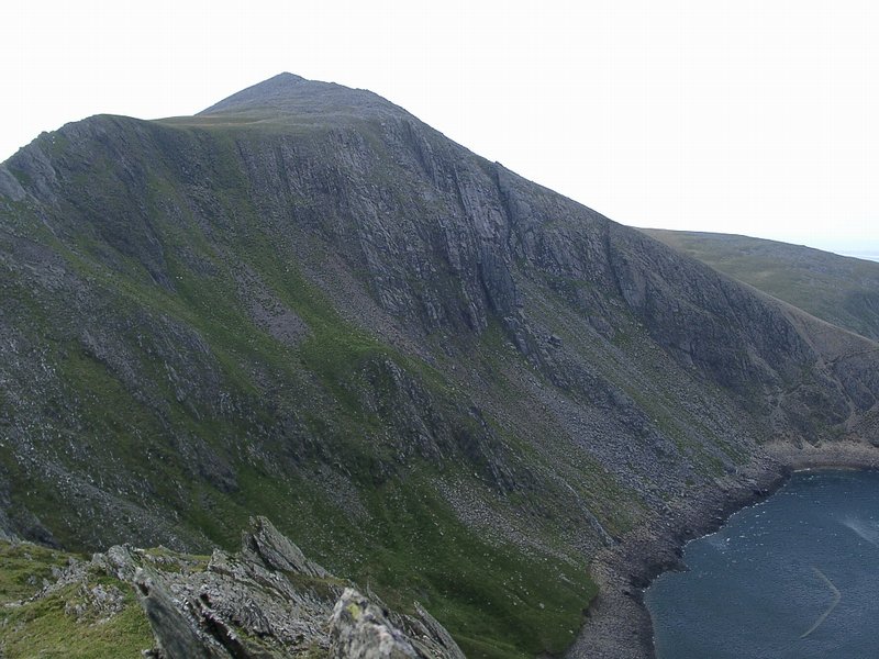
Carnedd y Filiast North Top is a prominent hill located in the county of Caernarfonshire, Wales. It is part of the Carneddau mountain range within the Snowdonia National Park. Standing at an elevation of 709 meters (2,326 feet), it is often considered a subsidiary summit of its neighbor, Carnedd y Filiast.

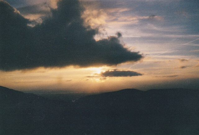
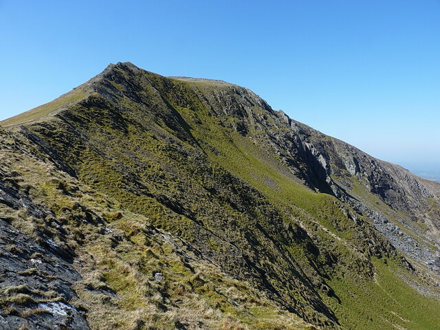
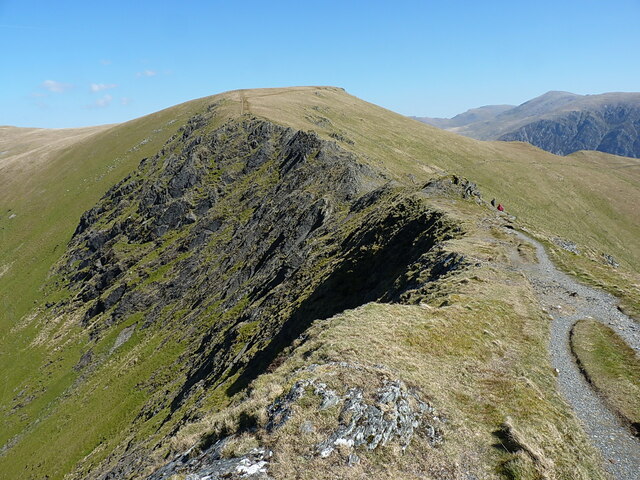
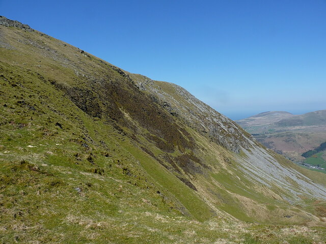
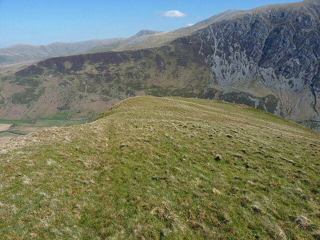
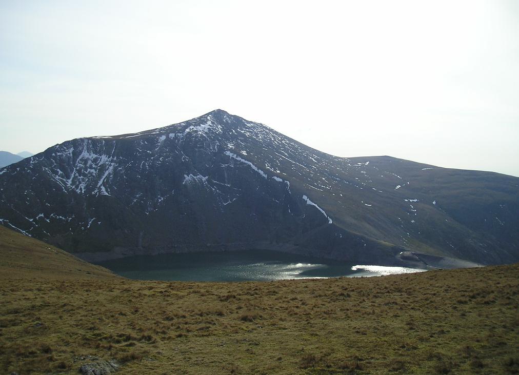
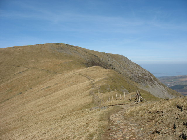
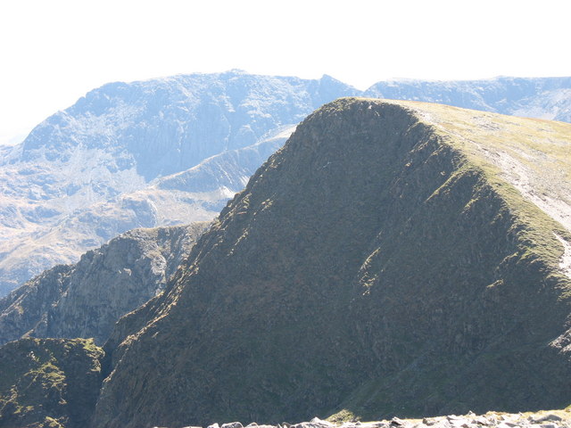
The hill is characterized by its rugged and rocky terrain, typical of the Carneddau range. Its summit offers stunning panoramic views of the surrounding landscape, including nearby mountains such as Snowdon, Glyder Fawr, and Foel Grach. On clear days, it is even possible to catch glimpses of the Irish Sea to the north.

Access to Carnedd y Filiast North Top can be achieved through various routes, including the popular ascent from the village of Bethesda to the south. The hill is often included in longer hiking routes across the Carneddau, attracting both experienced hikers and outdoor enthusiasts looking for a challenging yet rewarding climb.

Wildlife is abundant in the area, with the hill providing a habitat for various bird species, such as the red grouse and golden plover. Additionally, the area is known for its diverse plant life, including heather, bilberry, and mosses.

Carnedd y Filiast North Top offers a unique and picturesque experience for those seeking adventure and natural beauty. Whether it is exploring its rocky slopes or enjoying the breathtaking views from its summit, this hill is a must-visit for outdoor enthusiasts in Caernarfonshire.

If you have any feedback on the listing, please let us know in the comments section below.

Carnedd y Filiast North Top Images

Images are sourced within 2km of 53.147036/-4.0693356 or Grid Reference SH6163. Thanks to Geograph Open Source API. All images are credited.

Sunset from above the Marchlyn Road The Menai Strait can be seen in the distance.
Sunset from above the Marchlyn Road
The Menai Strait can be seen in the distance.
Cattle grid on the road up to Marchlyn Mawr, Dinorwig
Wild Goats on Elidir Fawr
Tai-newyddion (new houses) on the map Now this is the Snowdonia Mountain Hostel, in a wonderful setting.
Tai-newyddion (new houses) on the map
Now this is the Snowdonia Mountain Hostel, in a wonderful setting.
The old road up the Nant Ffrancon
Morainic deposits on the shores of the Marchlyn Bach Reservoir A snowy Carnedd y Filiast forms the background.
Morainic deposits on the shores of the Marchlyn Bach Reservoir
A snowy Carnedd y Filiast forms the background.
Blockfield on the summit of Elidir Fawr The waste tips of the Penrhyn Quarry  can be seen below on the left.
Blockfield on the summit of Elidir Fawr
The waste tips of the Penrhyn Quarry can be seen below on the left.
Cairn on the summit of Carnedd y Filiast On the other side of the Marchlyn Valley is Elidir Fach with the disused Marchlyn Quarry on its north-eastern flank.
Cairn on the summit of Carnedd y Filiast
On the other side of the Marchlyn Valley is Elidir Fach with the disused Marchlyn Quarry on its north-eastern flank.
Men and dogs at the Elidir Fawr summit wind shelter
Dew ponds in the col between Carnedd y Filiast and Y Fronllwyd The image was created on the summit ridge of Carnedd y Filiast.
Dew ponds in the col between Carnedd y Filiast and Y Fronllwyd
The image was created on the summit ridge of Carnedd y Filiast.
View directly down Cwm Dudodyn Something of a hanging valley above Nant Peris, Cwm Dudodyn has a stream which flows into Llyn Peris more or less here <a href="https://www.geograph.org.uk/photo/4169217">SH6058 : Looking over Llyn Peris</a>. On the far side of the valley are the hills of Yr Wyddfa, with Moel Cynghorion and the Nantlle Ridge beyond that again.
View directly down Cwm Dudodyn
Something of a hanging valley above Nant Peris, Cwm Dudodyn has a stream which flows into Llyn Peris more or less here SH6058 : Looking over Llyn Peris. On the far side of the valley are the hills of Yr Wyddfa, with Moel Cynghorion and the Nantlle Ridge beyond that again.
Elidir Fawr's north face Across the rocky outcrops of Craig Cwrwgl from Bwlch y Marchlyn. The sun is just picking out the steep rib of the Pillar of Elidir, the home of a series of respectable but little-frequented climbs on the north face of the mountain.
Elidir Fawr's north face
Across the rocky outcrops of Craig Cwrwgl from Bwlch y Marchlyn. The sun is just picking out the steep rib of the Pillar of Elidir, the home of a series of respectable but little-frequented climbs on the north face of the mountain.
View down towards Bwlch y Marchlyn A similar view to that in <a href="https://www.geograph.org.uk/photo/4277690">SH6161 : Bwlch y Marchlyn</a> but in rather more benign conditions (to be fair, it was colder than it looks in my photo, even though it was April).
View down towards Bwlch y Marchlyn
A similar view to that in SH6161 : Bwlch y Marchlyn but in rather more benign conditions (to be fair, it was colder than it looks in my photo, even though it was April).
Wind shelter and a standing stone on Mynydd Perfedd The wind shelter looks to have been recently rebuilt, it's certainly tidier than it was in 2007 <a href="https://www.geograph.org.uk/photo/543166">SH6261 : Cairn shelter on summit of Mynydd Perfedd</a>  and <a href="https://www.geograph.org.uk/photo/580782">SH6261 : Summit Cairn of Mynydd Perfedd</a>, and is a perfect place to sit and boil up a packet of soup. The slightly tilted standing stone in the foreground isn't marked on the OS maps, nor recorded by any of the archeological surveys that I can find, so I'm assuming it's not of antiquity.
Wind shelter and a standing stone on Mynydd Perfedd
The wind shelter looks to have been recently rebuilt, it's certainly tidier than it was in 2007 SH6261 : Cairn shelter on summit of Mynydd Perfedd and SH6261 : Summit Cairn of Mynydd Perfedd, and is a perfect place to sit and boil up a packet of soup. The slightly tilted standing stone in the foreground isn't marked on the OS maps, nor recorded by any of the archeological surveys that I can find, so I'm assuming it's not of antiquity.
On the plateau edge, north of Mynydd Perfedd Between Mynydd Perfedd and Carnedd y Filiast there's an extensive grassy plateau area with steep-walled cwms bitten out of the eastern side by glaciers. This is the view along the boundary line between those two habitats, with ever-steepening ground on the right.
On the plateau edge, north of Mynydd Perfedd
Between Mynydd Perfedd and Carnedd y Filiast there's an extensive grassy plateau area with steep-walled cwms bitten out of the eastern side by glaciers. This is the view along the boundary line between those two habitats, with ever-steepening ground on the right.
The steep eastern face of Mynydd Perfedd The 'headwall' of Cwm Perfedd is mainly comprised of steep(ish) scree and boulders with a partial covering of heather and grass.
The steep eastern face of Mynydd Perfedd
The 'headwall' of Cwm Perfedd is mainly comprised of steep(ish) scree and boulders with a partial covering of heather and grass.
Grassy spur between two cwms This grassy hillside separates Cwm Perfedd (off to the left) from Cwm Bual (down to the right) and initially at least provides a very reasonable descent route into the Nant Ffrancon from Bwlch Brecan, It becomes quite a bit steeper and more entertaining further down.
Grassy spur between two cwms
This grassy hillside separates Cwm Perfedd (off to the left) from Cwm Bual (down to the right) and initially at least provides a very reasonable descent route into the Nant Ffrancon from Bwlch Brecan, It becomes quite a bit steeper and more entertaining further down.
Grassy spur between two cwms Looking down the pleasant grassy ridge which separates Cwm Perfedd (off to the left) from Cwm Bual (down to the right), with the steep wall of Braich Ty Du in the background. Easy walking on grass to begin with, it gets noticeably steeper and rockier a bit lower down towards the floor of the Nant Ffrancon valley.
Grassy spur between two cwms
Looking down the pleasant grassy ridge which separates Cwm Perfedd (off to the left) from Cwm Bual (down to the right), with the steep wall of Braich Ty Du in the background. Easy walking on grass to begin with, it gets noticeably steeper and rockier a bit lower down towards the floor of the Nant Ffrancon valley.
Show me another place!

Carnedd y Filiast North Top is located at Grid Ref: SH6163 (Lat: 53.147036, Lng: -4.0693356)

Unitary Authority: Gwynedd

Police Authority: North Wales

What 3 Words

///splints.outbound.either. Near Bethesda, Gwynedd

Related Wikis

Carnedd y Filiast (Glyderau)

Carnedd y Filiast is a mountain in Snowdonia, Wales, forming part of the Glyderau. It, along with its top Y Fronllwyd (721 m), forms the most northerly...

Marchlyn Mawr

Marchlyn Mawr reservoir is a high level lake in Snowdonia behind Elidir Fawr mountain. It is used as the high level water source for Dinorwig power station...

Mynydd Perfedd

Mynydd Perfedd is a mountain in Snowdonia, Wales, forming part of the Glyderau. The summit has a shelter cairn, offering good views of Foel-goch's north...

Elidir Fawr

Elidir Fawr is a mountain in Snowdonia, north Wales, the northernmost peak in the Glyderau. Its name means 'Big Elidir', named after a legendary warrior...

Foel-goch

Foel-goch is a mountain in Snowdonia, north-west Wales, and forms part of the Glyderau range, in Gwynedd. It lies in between Y Garn and Mynydd Perfedd...
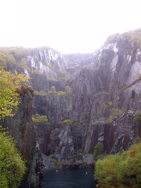
Penrhyn quarry

The Penrhyn quarry is a slate quarry located near Bethesda, North Wales. At the end of the nineteenth century it was the world's largest slate quarry;...

Mynydd Llandygai

Mynydd Llandygái (also spelt Mynydd Llandegai, [ˌmənɨðˌɬandəˈɡai] ; from Welsh mynydd "mountain", Llandygai "Church of St Tegai") is a small, partly forested...

Dinorwic quarry

Dinorwic quarry ( din-OR-wig; Welsh: [dɪˈnɔrwɪɡ]; also known as Dinorwig quarry) is a large former slate quarry, now home to the Welsh National Slate Museum...

Nearby Amenities

Located within 500m of 53.147036,-4.0693356
Carnedd Y Filiast
Ele: 821
Natural: peak
Source: GPS
Wikidata: Q15056727
Wikipedia: en:Carnedd y Filiast (Glyderau)
Lat/Long: 53.1439141/-4.0640912
Cwm Ceunant
Place: locality
Lat/Long: 53.1485864/-4.063407
Natural: spring
Lat/Long: 53.142742/-4.0685356
The data included in this document is from www.openstreetmap.org. The data is made available under ODbL.

Have you been to Carnedd y Filiast North Top?

Leave your review of Carnedd y Filiast North Top below (or comments, questions and feedback).