Bullington

Settlement in Lincolnshire West Lindsey

England

Bullington

Rivet: Bullington, Clay Bridge The remains of a rivet benchmark on the north parapet of a bridge, bypassed by an altered road junction.  The rivet is missing.  See <a title="https://www.geograph.org.uk/photo/6917813" href="https://www.geograph.org.uk/photo/6917813">Link</a> for a wider view and <span class="nowrap"><a title="https://www.bench-marks.org.uk/bm152158" rel="nofollow ugc noopener" href="https://www.bench-marks.org.uk/bm152158">Link</a><img style="margin-left:2px;" alt="External link" title="External link - shift click to open in new window" src="https://s1.geograph.org.uk/img/external.png" width="10" height="10"/></span> for details of the mark.
Rivet: Bullington, Clay Bridge Credit: Brian Westlake

Bullington is a small village located in the county of Lincolnshire, in eastern England. Situated approximately 10 miles north of the city of Lincoln, Bullington is a rural community known for its picturesque countryside and peaceful atmosphere.

The village itself is relatively small, with a population of around 300 residents. It is characterized by its charming historic buildings, including traditional thatched-roof cottages and a beautiful parish church dating back to the 12th century. The village is surrounded by rolling hills and farmland, providing a tranquil setting for those seeking a quiet and idyllic lifestyle.

Despite its small size, Bullington offers a range of amenities for its residents. These include a village hall, a local pub, and a primary school, ensuring that the community has access to essential services. Additionally, the village is well-connected to neighboring towns and cities via local road networks, making it easily accessible for both residents and visitors.

Bullington is renowned for its strong sense of community spirit. Regular events and gatherings, such as fairs and festivals, are organized throughout the year, providing opportunities for locals to come together and celebrate their shared heritage. The village also benefits from its proximity to the Lincolnshire Wolds, an Area of Outstanding Natural Beauty, offering residents and visitors a wealth of outdoor activities and scenic walks.

Overall, Bullington is a charming and close-knit village that offers a peaceful and rural lifestyle, making it an attractive place to live for those seeking a slower pace of life in the heart of the Lincolnshire countryside.

If you have any feedback on the listing, please let us know in the comments section below.
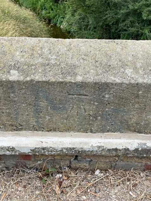
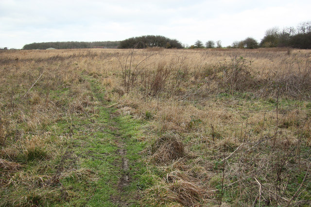
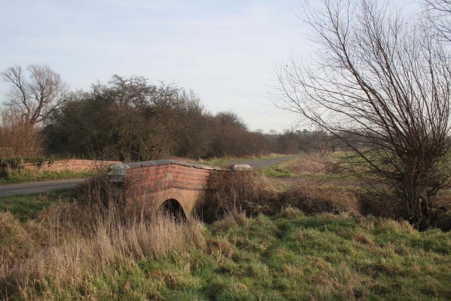
Bullington Images

Images are sourced within 2km of 53.286976/-0.360231 or Grid Reference TF0977. Thanks to Geograph Open Source API. All images are credited.

Rivet: Bullington, Clay Bridge The remains of a rivet benchmark on the north parapet of a bridge, bypassed by an altered road junction.  The rivet is missing.  See <a title="https://www.geograph.org.uk/photo/6917813" href="https://www.geograph.org.uk/photo/6917813">Link</a> for a wider view and <span class="nowrap"><a title="https://www.bench-marks.org.uk/bm152158" rel="nofollow ugc noopener" href="https://www.bench-marks.org.uk/bm152158">Link</a><img style="margin-left:2px;" alt="External link" title="External link - shift click to open in new window" src="https://s1.geograph.org.uk/img/external.png" width="10" height="10"/></span> for details of the mark.
Rivet: Bullington, Clay Bridge
The remains of a rivet benchmark on the north parapet of a bridge, bypassed by an altered road junction. The rivet is missing. See Link for a wider view and LinkExternal link for details of the mark.
The North Parapet of Clay Bridge There are remains of a rivet benchmark on the north parapet of this bridge, bypassed by an altered road junction.  The rivet is missing.  See <a title="https://www.geograph.org.uk/photo/6917811" href="https://www.geograph.org.uk/photo/6917811">Link</a> for a closer view and <span class="nowrap"><a title="https://www.bench-marks.org.uk/bm152158" rel="nofollow ugc noopener" href="https://www.bench-marks.org.uk/bm152158">Link</a><img style="margin-left:2px;" alt="External link" title="External link - shift click to open in new window" src="https://s1.geograph.org.uk/img/external.png" width="10" height="10"/></span> for details of the mark.
The North Parapet of Clay Bridge
There are remains of a rivet benchmark on the north parapet of this bridge, bypassed by an altered road junction. The rivet is missing. See Link for a closer view and LinkExternal link for details of the mark.
Cut Mark: Fulnetby, White Bridge Cut benchmark on a bridge now bypassed by a concrete bridge carrying the A158.  This section of the road now serves as a lay-by.  See <a title="https://www.geograph.org.uk/photo/7548108" href="https://www.geograph.org.uk/photo/7548108">Link</a> for a wider view and <span class="nowrap"><a title="https://www.bench-marks.org.uk/bm197779" rel="nofollow ugc noopener" href="https://www.bench-marks.org.uk/bm197779">Link</a><img style="margin-left:2px;" alt="External link" title="External link - shift click to open in new window" src="https://s1.geograph.org.uk/img/external.png" width="10" height="10"/></span> for details of the mark.
Cut Mark: Fulnetby, White Bridge
Cut benchmark on a bridge now bypassed by a concrete bridge carrying the A158. This section of the road now serves as a lay-by. See Link for a wider view and LinkExternal link for details of the mark.
White Bridge, A158 Lay-by Cut benchmark on a bridge now bypassed by a concrete bridge carrying the A158.  This section of the road now serves as a lay-by.  See <a title="https://www.geograph.org.uk/photo/7548105" href="https://www.geograph.org.uk/photo/7548105">Link</a> for a closer view and <span class="nowrap"><a title="https://www.bench-marks.org.uk/bm197779" rel="nofollow ugc noopener" href="https://www.bench-marks.org.uk/bm197779">Link</a><img style="margin-left:2px;" alt="External link" title="External link - shift click to open in new window" src="https://s1.geograph.org.uk/img/external.png" width="10" height="10"/></span> for details of the mark.
White Bridge, A158 Lay-by
Cut benchmark on a bridge now bypassed by a concrete bridge carrying the A158. This section of the road now serves as a lay-by. See Link for a closer view and LinkExternal link for details of the mark.
Rand Medieval Settlement: aerial 2021 (1) Rand was documented in the late 11th century as a manor of Wragby, but during the late 12th century a separate manor was established here by the Burdet family, who retained it until the mid 14th century.

See <span class="nowrap"><a title="https://www.heritagegateway.org.uk/Gateway/Results_Single.aspx?uid=MLI54189&resourceID=1006" rel="nofollow ugc noopener" href="https://www.heritagegateway.org.uk/Gateway/Results_Single.aspx?uid=MLI54189&resourceID=1006">Link</a><img style="margin-left:2px;" alt="External link" title="External link - shift click to open in new window" src="https://s1.geograph.org.uk/img/external.png" width="10" height="10"/></span>
Rand Medieval Settlement: aerial 2021 (1)
Rand was documented in the late 11th century as a manor of Wragby, but during the late 12th century a separate manor was established here by the Burdet family, who retained it until the mid 14th century. See LinkExternal link
Rand Medieval Settlement: aerial 2021 (2) Rand was documented in the late 11th century as a manor of Wragby, but during the late 12th century a separate manor was established here by the Burdet family, who retained it until the mid 14th century.

See <span class="nowrap"><a title="https://www.heritagegateway.org.uk/Gateway/Results_Single.aspx?uid=MLI54189&resourceID=1006" rel="nofollow ugc noopener" href="https://www.heritagegateway.org.uk/Gateway/Results_Single.aspx?uid=MLI54189&resourceID=1006">Link</a><img style="margin-left:2px;" alt="External link" title="External link - shift click to open in new window" src="https://s1.geograph.org.uk/img/external.png" width="10" height="10"/></span>
Rand Medieval Settlement: aerial 2021 (2)
Rand was documented in the late 11th century as a manor of Wragby, but during the late 12th century a separate manor was established here by the Burdet family, who retained it until the mid 14th century. See LinkExternal link
Rand Medieval Settlement: aerial 2021 (3) Rand was documented in the late 11th century as a manor of Wragby, but during the late 12th century a separate manor was established here by the Burdet family, who retained it until the mid 14th century.

See <span class="nowrap"><a title="https://www.heritagegateway.org.uk/Gateway/Results_Single.aspx?uid=MLI54189&resourceID=1006" rel="nofollow ugc noopener" href="https://www.heritagegateway.org.uk/Gateway/Results_Single.aspx?uid=MLI54189&resourceID=1006">Link</a><img style="margin-left:2px;" alt="External link" title="External link - shift click to open in new window" src="https://s1.geograph.org.uk/img/external.png" width="10" height="10"/></span> 

The moated site is first recorded in 1153: see <span class="nowrap"><a title="https://www.heritagegateway.org.uk/Gateway/Results_Single.aspx?uid=MLI54190&resourceID=1006" rel="nofollow ugc noopener" href="https://www.heritagegateway.org.uk/Gateway/Results_Single.aspx?uid=MLI54190&resourceID=1006">Link</a><img style="margin-left:2px;" alt="External link" title="External link - shift click to open in new window" src="https://s1.geograph.org.uk/img/external.png" width="10" height="10"/></span>

Former fishponds to the south of the moat: see <span class="nowrap"><a title="https://www.heritagegateway.org.uk/Gateway/Results_Single.aspx?uid=MLI51215&resourceID=1006" rel="nofollow ugc noopener" href="https://www.heritagegateway.org.uk/Gateway/Results_Single.aspx?uid=MLI51215&resourceID=1006">Link</a><img style="margin-left:2px;" alt="External link" title="External link - shift click to open in new window" src="https://s1.geograph.org.uk/img/external.png" width="10" height="10"/></span>
Rand Medieval Settlement: aerial 2021 (3)
Rand was documented in the late 11th century as a manor of Wragby, but during the late 12th century a separate manor was established here by the Burdet family, who retained it until the mid 14th century. See LinkExternal link The moated site is first recorded in 1153: see LinkExternal link Former fishponds to the south of the moat: see LinkExternal link
Monument to Anne Metham, St Oswald's church, Rand She was daughter of Robert Dymoke of Scrivelsby. She married Charles Metham and they had 8 children, one died young.
Monument to Anne Metham, St Oswald's church, Rand
She was daughter of Robert Dymoke of Scrivelsby. She married Charles Metham and they had 8 children, one died young.
Entrance to woodland near Goltho
Rand: aerial 2023 (1) Medieval site with village, manor, fishponds, moat and possible dovecote.
See: <span class="nowrap"><a title="https://www.heritagegateway.org.uk/Gateway/Results_Single.aspx?uid=MLI54189&resourceID=1006," rel="nofollow ugc noopener" href="https://www.heritagegateway.org.uk/Gateway/Results_Single.aspx?uid=MLI54189&resourceID=1006,">Link</a><img style="margin-left:2px;" alt="External link" title="External link - shift click to open in new window" src="https://s1.geograph.org.uk/img/external.png" width="10" height="10"/></span>
<span class="nowrap"><a title="https://www.heritagegateway.org.uk/Gateway/Results_Single.aspx?uid=MLI51215&resourceID=1006," rel="nofollow ugc noopener" href="https://www.heritagegateway.org.uk/Gateway/Results_Single.aspx?uid=MLI51215&resourceID=1006,">Link</a><img style="margin-left:2px;" alt="External link" title="External link - shift click to open in new window" src="https://s1.geograph.org.uk/img/external.png" width="10" height="10"/></span>
<span class="nowrap"><a title="https://www.heritagegateway.org.uk/Gateway/Results_Single.aspx?uid=MLI51214&resourceID=1006," rel="nofollow ugc noopener" href="https://www.heritagegateway.org.uk/Gateway/Results_Single.aspx?uid=MLI51214&resourceID=1006,">Link</a><img style="margin-left:2px;" alt="External link" title="External link - shift click to open in new window" src="https://s1.geograph.org.uk/img/external.png" width="10" height="10"/></span>
<span class="nowrap"><a title="https://www.heritagegateway.org.uk/Gateway/Results_Single.aspx?uid=MLI54190&resourceID=1006" rel="nofollow ugc noopener" href="https://www.heritagegateway.org.uk/Gateway/Results_Single.aspx?uid=MLI54190&resourceID=1006">Link</a><img style="margin-left:2px;" alt="External link" title="External link - shift click to open in new window" src="https://s1.geograph.org.uk/img/external.png" width="10" height="10"/></span>
Rand: aerial 2023 (1)
Medieval site with village, manor, fishponds, moat and possible dovecote. See: LinkExternal link LinkExternal link LinkExternal link LinkExternal link
Rand: aerial 2023 (2) Medieval site with village, manor, fishponds, moat and possible dovecote.
See: <span class="nowrap"><a title="https://www.heritagegateway.org.uk/Gateway/Results_Single.aspx?uid=MLI54189&resourceID=1006," rel="nofollow ugc noopener" href="https://www.heritagegateway.org.uk/Gateway/Results_Single.aspx?uid=MLI54189&resourceID=1006,">Link</a><img style="margin-left:2px;" alt="External link" title="External link - shift click to open in new window" src="https://s1.geograph.org.uk/img/external.png" width="10" height="10"/></span>
<span class="nowrap"><a title="https://www.heritagegateway.org.uk/Gateway/Results_Single.aspx?uid=MLI51215&resourceID=1006," rel="nofollow ugc noopener" href="https://www.heritagegateway.org.uk/Gateway/Results_Single.aspx?uid=MLI51215&resourceID=1006,">Link</a><img style="margin-left:2px;" alt="External link" title="External link - shift click to open in new window" src="https://s1.geograph.org.uk/img/external.png" width="10" height="10"/></span>
<span class="nowrap"><a title="https://www.heritagegateway.org.uk/Gateway/Results_Single.aspx?uid=MLI51214&resourceID=1006," rel="nofollow ugc noopener" href="https://www.heritagegateway.org.uk/Gateway/Results_Single.aspx?uid=MLI51214&resourceID=1006,">Link</a><img style="margin-left:2px;" alt="External link" title="External link - shift click to open in new window" src="https://s1.geograph.org.uk/img/external.png" width="10" height="10"/></span>
<span class="nowrap"><a title="https://www.heritagegateway.org.uk/Gateway/Results_Single.aspx?uid=MLI54190&resourceID=1006" rel="nofollow ugc noopener" href="https://www.heritagegateway.org.uk/Gateway/Results_Single.aspx?uid=MLI54190&resourceID=1006">Link</a><img style="margin-left:2px;" alt="External link" title="External link - shift click to open in new window" src="https://s1.geograph.org.uk/img/external.png" width="10" height="10"/></span>
Rand: aerial 2023 (2)
Medieval site with village, manor, fishponds, moat and possible dovecote. See: LinkExternal link LinkExternal link LinkExternal link LinkExternal link
Rand: aerial 2023 (3) Medieval site with village, manor, fishponds, moat and possible dovecote.
See: <span class="nowrap"><a title="https://www.heritagegateway.org.uk/Gateway/Results_Single.aspx?uid=MLI54189&resourceID=1006," rel="nofollow ugc noopener" href="https://www.heritagegateway.org.uk/Gateway/Results_Single.aspx?uid=MLI54189&resourceID=1006,">Link</a><img style="margin-left:2px;" alt="External link" title="External link - shift click to open in new window" src="https://s1.geograph.org.uk/img/external.png" width="10" height="10"/></span>
<span class="nowrap"><a title="https://www.heritagegateway.org.uk/Gateway/Results_Single.aspx?uid=MLI51215&resourceID=1006," rel="nofollow ugc noopener" href="https://www.heritagegateway.org.uk/Gateway/Results_Single.aspx?uid=MLI51215&resourceID=1006,">Link</a><img style="margin-left:2px;" alt="External link" title="External link - shift click to open in new window" src="https://s1.geograph.org.uk/img/external.png" width="10" height="10"/></span>
<span class="nowrap"><a title="https://www.heritagegateway.org.uk/Gateway/Results_Single.aspx?uid=MLI51214&resourceID=1006," rel="nofollow ugc noopener" href="https://www.heritagegateway.org.uk/Gateway/Results_Single.aspx?uid=MLI51214&resourceID=1006,">Link</a><img style="margin-left:2px;" alt="External link" title="External link - shift click to open in new window" src="https://s1.geograph.org.uk/img/external.png" width="10" height="10"/></span>
<span class="nowrap"><a title="https://www.heritagegateway.org.uk/Gateway/Results_Single.aspx?uid=MLI54190&resourceID=1006" rel="nofollow ugc noopener" href="https://www.heritagegateway.org.uk/Gateway/Results_Single.aspx?uid=MLI54190&resourceID=1006">Link</a><img style="margin-left:2px;" alt="External link" title="External link - shift click to open in new window" src="https://s1.geograph.org.uk/img/external.png" width="10" height="10"/></span>
Rand: aerial 2023 (3)
Medieval site with village, manor, fishponds, moat and possible dovecote. See: LinkExternal link LinkExternal link LinkExternal link LinkExternal link
Rand: aerial 2023 (4) Medieval site with village, manor, fishponds, moat and possible dovecote.
See: <span class="nowrap"><a title="https://www.heritagegateway.org.uk/Gateway/Results_Single.aspx?uid=MLI54189&resourceID=1006," rel="nofollow ugc noopener" href="https://www.heritagegateway.org.uk/Gateway/Results_Single.aspx?uid=MLI54189&resourceID=1006,">Link</a><img style="margin-left:2px;" alt="External link" title="External link - shift click to open in new window" src="https://s1.geograph.org.uk/img/external.png" width="10" height="10"/></span>
<span class="nowrap"><a title="https://www.heritagegateway.org.uk/Gateway/Results_Single.aspx?uid=MLI51215&resourceID=1006," rel="nofollow ugc noopener" href="https://www.heritagegateway.org.uk/Gateway/Results_Single.aspx?uid=MLI51215&resourceID=1006,">Link</a><img style="margin-left:2px;" alt="External link" title="External link - shift click to open in new window" src="https://s1.geograph.org.uk/img/external.png" width="10" height="10"/></span>
<span class="nowrap"><a title="https://www.heritagegateway.org.uk/Gateway/Results_Single.aspx?uid=MLI51214&resourceID=1006," rel="nofollow ugc noopener" href="https://www.heritagegateway.org.uk/Gateway/Results_Single.aspx?uid=MLI51214&resourceID=1006,">Link</a><img style="margin-left:2px;" alt="External link" title="External link - shift click to open in new window" src="https://s1.geograph.org.uk/img/external.png" width="10" height="10"/></span>
<span class="nowrap"><a title="https://www.heritagegateway.org.uk/Gateway/Results_Single.aspx?uid=MLI54190&resourceID=1006" rel="nofollow ugc noopener" href="https://www.heritagegateway.org.uk/Gateway/Results_Single.aspx?uid=MLI54190&resourceID=1006">Link</a><img style="margin-left:2px;" alt="External link" title="External link - shift click to open in new window" src="https://s1.geograph.org.uk/img/external.png" width="10" height="10"/></span>
Rand: aerial 2023 (4)
Medieval site with village, manor, fishponds, moat and possible dovecote. See: LinkExternal link LinkExternal link LinkExternal link LinkExternal link
Church of St Oswald, Rand Medieval church largely rebuilt in the nineteenth century <span class="nowrap"><a title="https://historicengland.org.uk/listing/the-list/list-entry/1308352?section=official-list-entry" rel="nofollow ugc noopener" href="https://historicengland.org.uk/listing/the-list/list-entry/1308352?section=official-list-entry">Link</a><img style="margin-left:2px;" alt="External link" title="External link - shift click to open in new window" src="https://s1.geograph.org.uk/img/external.png" width="10" height="10"/></span>
Church of St Oswald, Rand
Medieval church largely rebuilt in the nineteenth century LinkExternal link
Church Lane, Rand The no through road sign seems to be homemade.
Church Lane, Rand
The no through road sign seems to be homemade.
The churchyard, Rand Largely cleared of headstones.
The churchyard, Rand
Largely cleared of headstones.
Grassland, Rand Covers part of the site of the medieval village of Rand.
Grassland, Rand
Covers part of the site of the medieval village of Rand.
Thorne, Rand Manufacturers and retailers of beehives.
Thorne, Rand
Manufacturers and retailers of beehives.
Show me another place!

Bullington is located at Grid Ref: TF0977 (Lat: 53.286976, Lng: -0.360231)

Division: Parts of Lindsey

Administrative County: Lincolnshire

District: West Lindsey

Police Authority: Lincolnshire

What 3 Words

///attention.graver.grief. Near Wragby, Lincolnshire

Nearby Locations

Bullington Short Wood

Related Wikis

Bullington, Lincolnshire

Bullington is a village and civil parish in the West Lindsey district of Lincolnshire, England. It is situated approximately 8 miles (13 km) north-east...

Bullington Priory

Bullington Priory was a priory in Bullington, Lincolnshire, England. The priory was a house of the Gilbertine Order and dedicated to Saint Mary. It was...

Rand, Lincolnshire

Rand is a small village and civil parish in the West Lindsey district of Lincolnshire, England. It is situated approximately 9 miles (14 km) north-east...

Fulnetby

Fulnetby is a hamlet and civil parish in the West Lindsey district of Lincolnshire, England. It is situated approximately 8 miles (13 km) north-east from...

St George's Church, Goltho

St George's Church is a redundant Anglican church in the deserted village of Goltho, Lincolnshire, England. It is recorded in the National Heritage List...

Newball

Newball is a settlement and civil parish about 7 miles from Lincoln, in the West Lindsey district, in the county of Lincolnshire, England. In 2001 the...

Goltho

Goltho is a hamlet in the West Lindsey district of Lincolnshire, England. The population (including Bullington) was 157 at the 2011 census. It is situated...

Welton Rural District

Welton was a rural district in Lincolnshire, Parts of Lindsey from 1894 to 1974. It was formed under the Local Government Act 1894 from that part of the...

Nearby Amenities

Located within 500m of 53.286976,-0.360231
Bullington
Is In: Lincolnshire, England, UK
Place: hamlet
Source: NPE
Wikidata: Q4996941
Lat/Long: 53.2869449/-0.3603398
Bus Stop
Layby
Naptan AtcoCode: 270000010499
Naptan Bearing: E
Naptan CommonName: Layby
Naptan Indicator: opp
Naptan Landmark: Layby
Naptan NaptanCode: linjmtwp
Naptan Street: A158
Naptan Verified: no
Source: naptan_import
Lat/Long: 53.2874831/-0.3662777
Bus Stop
Layby
Naptan AtcoCode: 2700LB006170
Naptan Bearing: W
Naptan CommonName: Layby
Naptan Indicator: adj
Naptan Landmark: Layby
Naptan NaptanCode: lingapgj
Naptan Street: A158
Naptan Verified: no
Source: naptan_import
Lat/Long: 53.2873043/-0.3664166
The Turf Man
Shop: turf
Source: survey
Website: http://theturfman.co.uk/
Lat/Long: 53.2860662/-0.3532477
Brown Cow Farm
Place: farm
Source: Bing
Lat/Long: 53.2862825/-0.3530296
Bullington Hall
Place: isolated_dwelling
Source: Bing
Lat/Long: 53.2874874/-0.3628106
Power: pole
Lat/Long: 53.2856072/-0.3541134
Power: pole
Lat/Long: 53.2856897/-0.3554106
Power: pole
Lat/Long: 53.2858978/-0.3581464
Power: pole
Lat/Long: 53.2860863/-0.3608888
Power: pole
Lat/Long: 53.2861962/-0.3622747
Power: pole
Lat/Long: 53.2863051/-0.3538303
Power: pole
Lat/Long: 53.2869609/-0.3537055
Power: pole
Lat/Long: 53.2876265/-0.3535938
Power: pole
Lat/Long: 53.2884932/-0.353485
Power: pole
Lat/Long: 53.2857923/-0.3567592
Power: pole
Lat/Long: 53.2860187/-0.3599049
Man Made: tower
Tower Type: communication
Lat/Long: 53.2837038/-0.3583772
Man Made: tower
Tower Type: communication
Lat/Long: 53.2837987/-0.3577038
Man Made: tower
Tower Type: communication
Lat/Long: 53.2840313/-0.3584551
Man Made: tower
Tower Type: communication
Lat/Long: 53.2842263/-0.358485
Waste Basket
Lat/Long: 53.2870044/-0.359071
Toilets
Lat/Long: 53.2870153/-0.3591132
Power: pole
Lat/Long: 53.2862147/-0.3635522
Power: pole
Lat/Long: 53.2862223/-0.3647586
Power: pole
Lat/Long: 53.2862502/-0.3661004
Power: pole
Lat/Long: 53.2862729/-0.3673787
Fixme: See note
Note: Is this newly planted woodland open to the public? It has footpaths through it and is within the wider Limewoods area.
Lat/Long: 53.2854372/-0.3579127
Power: pole
Lat/Long: 53.286923/-0.360949
Power: pole
Lat/Long: 53.2870416/-0.3675539
Bench
Backrest: no
Material: wood
Lat/Long: 53.2871267/-0.3597446
Post Box
Operator: Royal Mail
Post Box Type: lamp
Lat/Long: 53.2871275/-0.3599813
The data included in this document is from www.openstreetmap.org. The data is made available under ODbL.

Have you been to Bullington?

Leave your review of Bullington below (or comments, questions and feedback).