Ewenny Priory

Heritage Site in Glamorgan

Wales

Ewenny Priory

Kissing gate on a public footpath north east of Corntown A public footpath here passes from a road at a golf complex onto a farm field which is part of the Ewenny Priory Estate. The path lies on the Bridgend Circular Walk.
Kissing gate on a public footpath north east of Corntown Credit: eswales

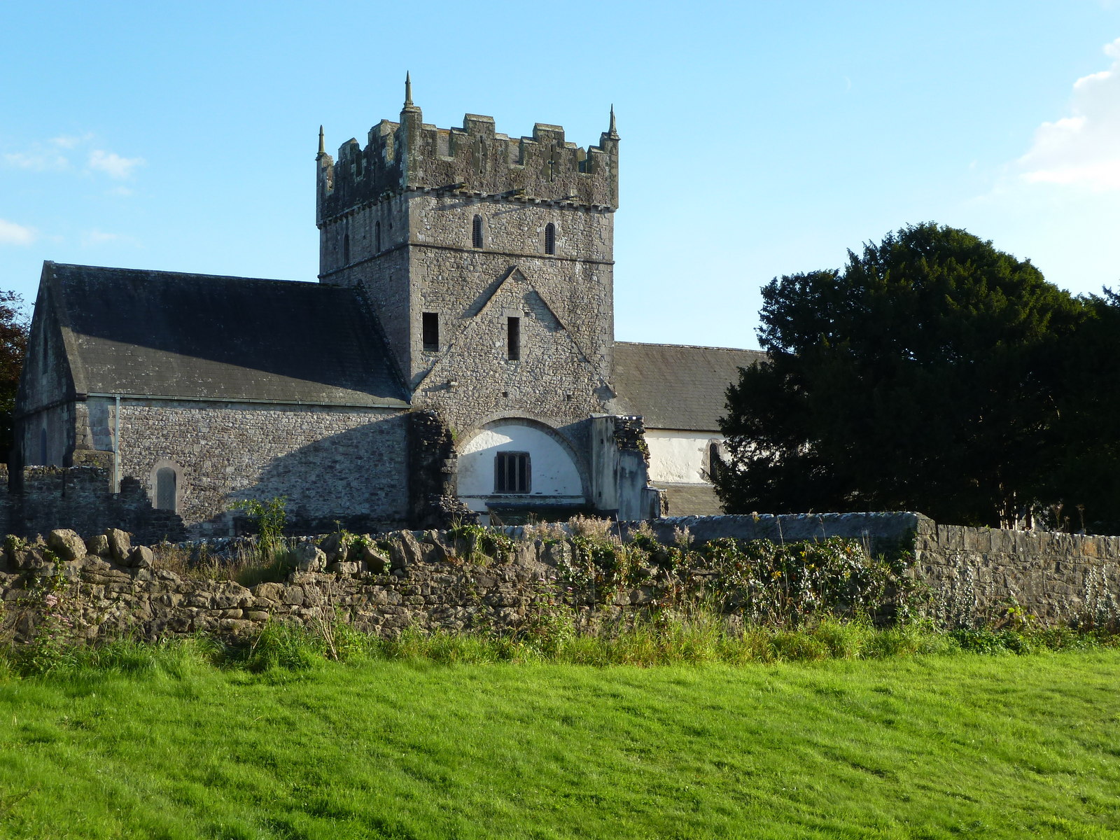
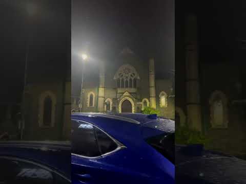
Ewenny Priory, located in the county of Glamorgan, Wales, is a historic and picturesque heritage site that holds significant religious and architectural importance. Dating back to the 12th century, this Benedictine priory is nestled within a charming countryside setting, just a few miles away from the town of Bridgend.

The priory was founded by Maurice de Londres, a Norman knight, around 1141. It was established as a daughter house of the Abbey of St. Peter in Gloucester, and its primary purpose was to provide religious services, including prayers and masses, for the local population. Ewenny Priory quickly gained prominence and became one of the most important religious institutions in the region.

The architectural style of Ewenny Priory is predominantly Norman, with additions and modifications made during the subsequent centuries. The priory features a cruciform layout, with a central tower and transepts. The intricate carvings on the arches and columns are particularly noteworthy, showcasing the skilled craftsmanship of the period.

Within the priory, visitors can explore the various chapels, including the St. Michael's Chapel, which houses a striking 15th-century rood screen. The priory also boasts a well-preserved cloister, where the monks would have once conducted their daily activities.

Today, Ewenny Priory remains an active place of worship, with regular services held in its beautiful medieval church. It is also open to visitors who can explore its rich history, admire its remarkable architecture, and enjoy the tranquil surroundings.

If you have any feedback on the listing, please let us know in the comments section below.

Ewenny Priory Images

Images are sourced within 2km of 51.4888/-3.5676 or Grid Reference SS9177. Thanks to Geograph Open Source API. All images are credited.

Kissing gate on a public footpath north east of Corntown A public footpath here passes from a road at a golf complex onto a farm field which is part of the Ewenny Priory Estate. The path lies on the Bridgend Circular Walk.
Kissing gate on a public footpath north east of Corntown
A public footpath here passes from a road at a golf complex onto a farm field which is part of the Ewenny Priory Estate. The path lies on the Bridgend Circular Walk.
Public footpath east of Corntown (2) A public footpath on the Bridgend Circular Walk runs alongside much of the line of hedge seen in the foreground before passing through a kissing gate in it onto a road at a golf complex. The kissing gate is seen in <a href="https://www.geograph.org.uk/photo/7691721">SS9277 : Kissing gate on a public footpath north east of Corntown</a>. The farmland here is part of the Ewenny Priory Estate.
Public footpath east of Corntown (2)
A public footpath on the Bridgend Circular Walk runs alongside much of the line of hedge seen in the foreground before passing through a kissing gate in it onto a road at a golf complex. The kissing gate is seen in SS9277 : Kissing gate on a public footpath north east of Corntown. The farmland here is part of the Ewenny Priory Estate.
The Ewenny River/Afon Ewenni between Waterton and Ewenny Priory Viewed from one of the spots beside the river which it’s possible to get down to from the public footpath which runs towards the priory from the A48. The riverside path seen in the image is not the public footpath, which is set back from the river here and for much of its length.
The Ewenny River/Afon Ewenni between Waterton and Ewenny Priory
Viewed from one of the spots beside the river which it’s possible to get down to from the public footpath which runs towards the priory from the A48. The riverside path seen in the image is not the public footpath, which is set back from the river here and for much of its length.
Course of public footpath at a playing field in Corntown OpenStreetMap shows a public footpath running along the field edge seen here. On Ordnance Survey maps, by contrast, it is shown cutting across the middle of the field. It seems possible that whereas the latter may be the ‘official’ route, the former is the one that tends to be followed in practice. Taking the route along the field edge would certainly seem to be less likely to cause disruption when sports are being played, and so will probably occur at least some of the time.

The green and white building seen is Corntown Sports Pavilion. This is used by Vale United FC which plays its home games on the field here.
Course of public footpath at a playing field in Corntown
OpenStreetMap shows a public footpath running along the field edge seen here. On Ordnance Survey maps, by contrast, it is shown cutting across the middle of the field. It seems possible that whereas the latter may be the ‘official’ route, the former is the one that tends to be followed in practice. Taking the route along the field edge would certainly seem to be less likely to cause disruption when sports are being played, and so will probably occur at least some of the time. The green and white building seen is Corntown Sports Pavilion. This is used by Vale United FC which plays its home games on the field here.
Ewenny in winter (2) Looking over farmland towards Corntown Road from the side of Abbey Road.
Ewenny in winter (2)
Looking over farmland towards Corntown Road from the side of Abbey Road.
Public footpath towards Ewenny Priory by Waterton Shortly after its start on the A48 a public footpath passes between a river monitoring station and a fence above the Ewenny River.
Public footpath towards Ewenny Priory by Waterton
Shortly after its start on the A48 a public footpath passes between a river monitoring station and a fence above the Ewenny River.
Cast iron milepost near Bridgend Located on what was once the main (Roman) road running roughly east to west across South Wales, passing through Newport, Cardiff, Cowbridge, Bridgend, Port Talbot, Neath and Carmarthen. 

The milepost is Grade II listed.
Cast iron milepost near Bridgend
Located on what was once the main (Roman) road running roughly east to west across South Wales, passing through Newport, Cardiff, Cowbridge, Bridgend, Port Talbot, Neath and Carmarthen. The milepost is Grade II listed.
Ewenny Moor An area of low lying land alongside the Ewenny River.
Ewenny Moor
An area of low lying land alongside the Ewenny River.
The Ewenny River by Waterton A view downstream at a point where the river passes a monitoring station – see <a href="https://www.geograph.org.uk/photo/7693943">SS9178 : Public footpath towards Ewenny Priory by Waterton</a>. Steps and cables, which will play a part in the monitoring of the river, can be seen on the concrete slope.
The Ewenny River by Waterton
A view downstream at a point where the river passes a monitoring station – see SS9178 : Public footpath towards Ewenny Priory by Waterton. Steps and cables, which will play a part in the monitoring of the river, can be seen on the concrete slope.
A very large field on the Ewenny Priory Estate Aerial photography online shows the field being used for the growing of cereals. 

The northern part of the field, not seen here, is shown in <a href="https://www.geograph.org.uk/photo/7690119">SS9177 : Farmland and track on the Ewenny Priory Estate</a>. The trees closest to the camera – in the left half of the image – are seen closer up in <a href="https://www.geograph.org.uk/photo/7688185">SS9177 : An island of trees east of Ewenny Priory</a>.
A very large field on the Ewenny Priory Estate
Aerial photography online shows the field being used for the growing of cereals. The northern part of the field, not seen here, is shown in SS9177 : Farmland and track on the Ewenny Priory Estate. The trees closest to the camera – in the left half of the image – are seen closer up in SS9177 : An island of trees east of Ewenny Priory.
THE NATIONAL LOTTERY- PLAY NOW, Brackla Street, Bridgend Sign on the pavement outside Wilko in April 2021.
THE NATIONAL LOTTERY- PLAY NOW, Brackla Street, Bridgend
Sign on the pavement outside Wilko in April 2021.
Kings Head, Bridgend Pub at 44 Nolton Street viewed from Brackla Street in April 2021.
Kings Head, Bridgend
Pub at 44 Nolton Street viewed from Brackla Street in April 2021.
The Kakadu Plum, Bridgend Health food store at 40 Nolton Street. The shop's website records that the  kakadu plum (grown in the Northern Territory of Australia) has the highest concentration of natural Vitamin C of any food.
The Kakadu Plum, Bridgend
Health food store at 40 Nolton Street. The shop's website records that the kakadu plum (grown in the Northern Territory of Australia) has the highest concentration of natural Vitamin C of any food.
Felicity, Nolton Street, Bridgend  In April 2021 the Felicity nameboard shows "Accessories" and "Jewellers".
Felicity, Nolton Street, Bridgend
In April 2021 the Felicity nameboard shows "Accessories" and "Jewellers".
Jackson Cabs office in Bridgend town centre Set back from the west side of Nolton Street.
Jackson Cabs office in Bridgend town centre
Set back from the west side of Nolton Street.
Optegydd in Bridgend town centre Welsh for Optician, Optegydd is on the side wall of Boots Opticians at 15 Nolton Street.
Optegydd in Bridgend town centre
Welsh for Optician, Optegydd is on the side wall of Boots Opticians at 15 Nolton Street.
Police hq open day Police headquarters open day at Bridgend
Police hq open day
Police headquarters open day at Bridgend
Bridgend Bridgend railway station with 34027 Taw Valley
Bridgend
Bridgend railway station with 34027 Taw Valley
Show me another place!

Ewenny Priory is located at Grid Ref: SS9177 (Lat: 51.4888, Lng: -3.5676)

Unitary Authority: The Vale of Glamorgan

Police Authority: South Wales

Also known as: Priordy Ewenni

What 3 Words

///roofs.guard.waving. Near Bridgend

Related Wikis

Ewenny Priory

Ewenny Priory (Welsh: Priordy Ewenni), in Ewenny in the Vale of Glamorgan, Wales, was a monastery of the Benedictine order, founded in the 12th century...

Ewenny Priory House

Ewenny Priory House is a privately owned Georgian mansion located immediately to the south of Ewenny Priory church, at Ewenny, Vale of Glamorgan, Wales...

Corntown

Corntown (Welsh: Corntwn) is a small village in the Vale of Glamorgan. It lies along the B4524 road, just outside Bridgend, 21.6 miles (34.8 km) west of...

Ewenny

Ewenny (Welsh: Ewenni) is a village and community (parish) on the River Ewenny in the Vale of Glamorgan, Wales. Over the years the village has grown into...

Brynteg School

Brynteg School (Welsh: Ysgol Brynteg) is one of the largest secondary schools in Wales. It is located on Ewenny Road in Bridgend, Wales. The school is...

Bridgend College

Bridgend College (Welsh: Coleg Penybont) is a further education college based in Bridgend, Wales. Founded in 1928 as the Bridgend Mining and Technical...

Schwyll Aquifer

Schwyll Aquifer (pronounced 'Shwill') was historically known as 'the Great Spring of Glamorgan'. Welsh Water uses the resurgence at the Schwyll Spring...
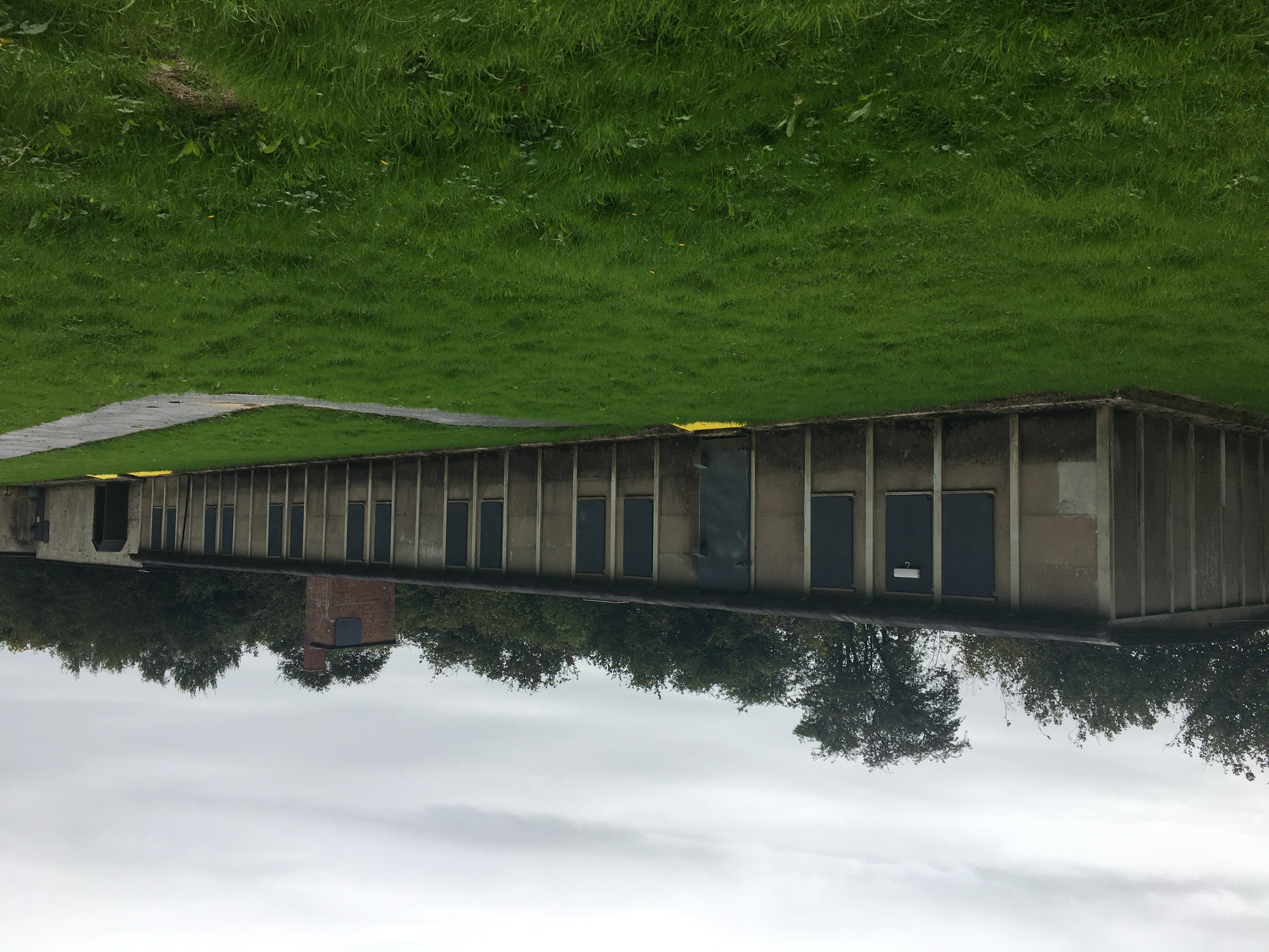
Island Farm

Island Farm, also called Camp 198, was a prisoner of war camp on the outskirts of the town of Bridgend, South Wales. It hosted a number of Axis prisoners...

Related Videos

Hut 9 on 5 SELECT with Arthur Williams - Walking Wartime Britain on Tue 19 Oct 2021 at 9pm

Brett Exton (HUT 9 Preservation Group at Island Farm in Bridgend) gave an interview to Channel 5 earlier this year. Acclaimed ...

BRIDGEND TOWN SOUTH WALES PAST AND PRESENT

Past and Present views of Bridgend Town South Wales UK https://www.touringwalesuk.com/

#nature#rainuk#bridgend

Night view in Bridgend,south wales,UK.

Nearby Amenities

Located within 500m of 51.4888,-3.5676
Ewenny Priory
Created By: Potlatch 0.10f
Historic: ruins
Name Cy: Abaty Eweni
Lat/Long: 51.4884988/-3.5685971
Power: tower
Lat/Long: 51.4917253/-3.5677249
Power: tower
Lat/Long: 51.4904428/-3.5732074
Ford: yes
Lat/Long: 51.4870729/-3.5622934
Power: pole
Lat/Long: 51.4923294/-3.563827
Power: pole
Lat/Long: 51.4920889/-3.5647953
Power: pole
Lat/Long: 51.4917632/-3.5660854
Power: pole
Lat/Long: 51.4914493/-3.567397
Power: pole
Lat/Long: 51.4910242/-3.5686442
Power: pole
Lat/Long: 51.4905692/-3.5699505
Power: pole
Lat/Long: 51.4899228/-3.5712942
Power: pole
Lat/Long: 51.4893467/-3.5725375
Power: pole
Lat/Long: 51.4886469/-3.5739899
Direction: SSE
Generator Method: photovoltaic
Generator Output Electricity: yes
Generator Solar Modules: 16
Generator Source: solar
Generator Type: solar_photovoltaic_panel
Location: roof
Power: generator
Lat/Long: 51.485827/-3.5722263
Place Of Worship
St Michael's Priory Church, Ewenny Priory
Denomination: anglican
Religion: christian
Lat/Long: 51.4888049/-3.5676039
Barrier: stile
Bicycle: no
Foot: designated
Horse: no
Material: stone
Motor Vehicle: no
Stile: stepover
Lat/Long: 51.4875455/-3.5630646
Barrier: stile
Lat/Long: 51.4905117/-3.5657365
Barrier: stile
Lat/Long: 51.4905215/-3.5657037
The data included in this document is from www.openstreetmap.org. The data is made available under ODbL.

Have you been to Ewenny Priory?

Leave your review of Ewenny Priory below (or comments, questions and feedback).