Yarcombe

Civil Parish in Devon East Devon

England

Yarcombe

The A303 at Newcott Beside the Route 303 restaurant & grill.
The A303 at Newcott Credit: Rod Allday

Yarcombe is a small civil parish located in the county of Devon, England. It is situated in the beautiful Blackdown Hills, a designated Area of Outstanding Natural Beauty. The parish covers an area of approximately 7 square miles and has a population of around 500 residents.

Yarcombe is a predominantly rural area with a charming and picturesque landscape. It is known for its rolling hills, lush green fields, and meandering streams. The village itself is nestled in a valley, surrounded by idyllic countryside.

The parish has a rich history, with evidence of human habitation dating back to the prehistoric era. There are several ancient landmarks in the area, including the Yarcombe Cross, a medieval wayside cross that stands as a reminder of the village's past.

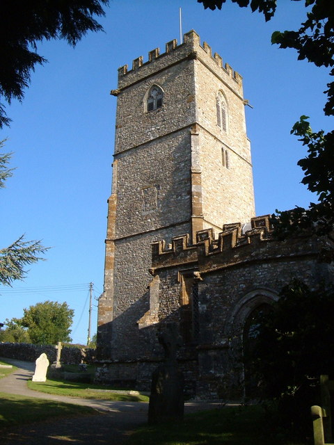
Yarcombe is a close-knit community, with a strong sense of local pride. It has a village hall, a primary school, and a beautiful parish church, St John the Baptist, which dates back to the 13th century. The church is known for its stunning stained glass windows and intricate woodwork.

The area offers excellent opportunities for outdoor activities, such as walking, cycling, and horse riding. There are numerous footpaths and bridleways that crisscross the countryside, providing access to the breathtaking scenery of the Blackdown Hills.

Despite its small size, Yarcombe is well-connected to neighboring towns and cities. It is located just a short drive from the market town of Honiton, which offers a range of amenities and services.

Overall, Yarcombe is a peaceful and picturesque village that offers a tranquil escape in the heart of the Devon countryside.

If you have any feedback on the listing, please let us know in the comments section below.
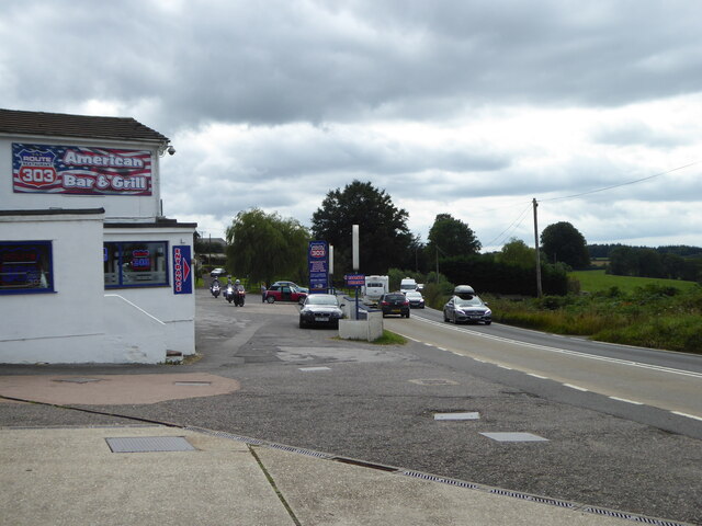
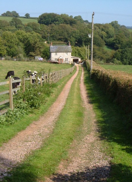
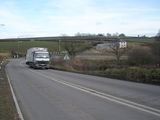
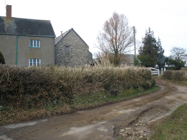
Yarcombe Images

Images are sourced within 2km of 50.879141/-3.077885 or Grid Reference ST2409. Thanks to Geograph Open Source API. All images are credited.

The A303 at Newcott Beside the Route 303 restaurant & grill.
The A303 at Newcott
Beside the Route 303 restaurant & grill.
Yarcombe: Marsh The cottage on the left offers bed and breakfast and also provides cream teas. This was clearly on the old London – Exeter road, with an inn and a garage nearby, but the hamlet had already been bypassed by the 1940s and is now bypassed by a dual-carriageway nearby in the Yarty valley. Looking north east in the London direction
Yarcombe: Marsh
The cottage on the left offers bed and breakfast and also provides cream teas. This was clearly on the old London – Exeter road, with an inn and a garage nearby, but the hamlet had already been bypassed by the 1940s and is now bypassed by a dual-carriageway nearby in the Yarty valley. Looking north east in the London direction
Yarcombe: Clifthayne Farm The farm stands high up above the Yarty valley although just sheltered from the prevailing winds. Looking north east
Yarcombe: Clifthayne Farm
The farm stands high up above the Yarty valley although just sheltered from the prevailing winds. Looking north east
Yarcombe: triangulation pillar Looking south east. The spot height at the triangulation post is 258m
Yarcombe: triangulation pillar
Looking south east. The spot height at the triangulation post is 258m
Yarcombe: towards Dennington Lane By Dennington Lane a side valley runs down to a confluence with the Otter below Stout Mill, where water from the stream once powered a waterwheel and machinery. Looking north-north-west from the B3170 Honiton to Corfe and Taunton road
Yarcombe: towards Dennington Lane
By Dennington Lane a side valley runs down to a confluence with the Otter below Stout Mill, where water from the stream once powered a waterwheel and machinery. Looking north-north-west from the B3170 Honiton to Corfe and Taunton road
Knightshayne Cottage and bend A sharp bend that will be recognised by motorists on the busy A303 across the Blackdown Hills, as the road descends into the Yarty valley at Marsh on its way out of Devon towards London. Given its noisy location, it is perhaps not surprising that the cottage has a rather neglected air.
Knightshayne Cottage and bend
A sharp bend that will be recognised by motorists on the busy A303 across the Blackdown Hills, as the road descends into the Yarty valley at Marsh on its way out of Devon towards London. Given its noisy location, it is perhaps not surprising that the cottage has a rather neglected air.
Sandy's Cottage A cottage in the Knightshayne side valley of the Yarty valley, close to the A303, and seen from the lane between Buckshots Cross and Knightshayne Farm.
Sandy's Cottage
A cottage in the Knightshayne side valley of the Yarty valley, close to the A303, and seen from the lane between Buckshots Cross and Knightshayne Farm.
The A303, near Knightshayne Farm
Knightshayne Farm
Knightshayne Farm
The Flintlock Inn, Marsh This hostelry was originally just a room in a Marsh Farm and it was then called the Globe.
The Flintlock Inn, Marsh
This hostelry was originally just a room in a Marsh Farm and it was then called the Globe.
Telephone box, Marsh A K6 style telephone box beside a narrow lane which runs beside the pub car park.
Telephone box, Marsh
A K6 style telephone box beside a narrow lane which runs beside the pub car park.
Sign for the Flintlock Inn The flintlock is technically a gun-lock fitted with a flint which produces a spark when struck by the hammer.  This then ignites the gunpowder.  Flintlock is commonly applied to the complete weapon, traditionally associated with old-time pirates, rather than to the lock.
Sign for the Flintlock Inn
The flintlock is technically a gun-lock fitted with a flint which produces a spark when struck by the hammer. This then ignites the gunpowder. Flintlock is commonly applied to the complete weapon, traditionally associated with old-time pirates, rather than to the lock.
Hot and Bothered Mid Saturday afternoon and the traffic grinds to a halt on the A303.
Hot and Bothered
Mid Saturday afternoon and the traffic grinds to a halt on the A303.
Fields by the A303
Fields by the A303
Minor road joins the A303
Higher Stout Farm The lane past the farm leads to Stout Cross on the B3170.
Higher Stout Farm
The lane past the farm leads to Stout Cross on the B3170.
Stile near Higher Stout Farm Yarcombe Footpath 16 crosses this stile and heads along the edge of the field on its way past a deserted medieval village near Williambeer Farm.
Stile near Higher Stout Farm
Yarcombe Footpath 16 crosses this stile and heads along the edge of the field on its way past a deserted medieval village near Williambeer Farm.
Track, Dennington The barn to which this track leads from Dennington Lane can just be seen.
Track, Dennington
The barn to which this track leads from Dennington Lane can just be seen.
Show me another place!

Yarcombe is located at Grid Ref: ST2409 (Lat: 50.879141, Lng: -3.077885)

Administrative County: Devon

District: East Devon

Police Authority: Devon & Cornwall

What 3 Words

///fighters.direction.finely. Near Chard, Somerset

Related Wikis

Yarcombe

Yarcombe is a village and civil parish in the county of Devon, England, situated in the East Devon administrative district on the A30 road near the towns...

Marsh, Devon

Marsh is a village in the Blackdown Hills, Devon, England. It is part of the East Devon district, and close to the River Yarty and border with Somerset...

Horse Pool Camp

Horse Pool Camp is a univallate Iron Age hill fort enclosure in the South Somerset district of Somerset, England. It is also known as Whitestaunton Camp...

Robin Hood's Butts

Robin Hood's Butts are a group of nine Bronze Age barrows near Otterford on the Blackdown Hills in Somerset, England. They have been scheduled as ancient...

Nearby Amenities

Located within 500m of 50.879141,-3.077885
Man Made: mast
Lat/Long: 50.8817897/-3.0761689
Power: pole
Source: bing
Lat/Long: 50.8801641/-3.0713828
Power: pole
Source: bing
Transformer: distribution
Lat/Long: 50.8774513/-3.0712755
Power: pole
Source: bing
Lat/Long: 50.8792926/-3.071643
Power: pole
Source: bing
Lat/Long: 50.8782983/-3.0719595
Power: pole
Source: bing
Lat/Long: 50.877645/-3.0724141
Power: pole
Source: bing
Lat/Long: 50.8769266/-3.0729184
Power: pole
Source: bing
Lat/Long: 50.8762615/-3.0734092
Power: pole
Source: bing
Transformer: distribution
Lat/Long: 50.8794627/-3.0847603
The data included in this document is from www.openstreetmap.org. The data is made available under ODbL.

Have you been to Yarcombe?

Leave your review of Yarcombe below (or comments, questions and feedback).