Womenswold

Civil Parish in Kent Canterbury

England

Womenswold

Westcourt Lane Towards Woolage Green.
Westcourt Lane Credit: Robin Webster

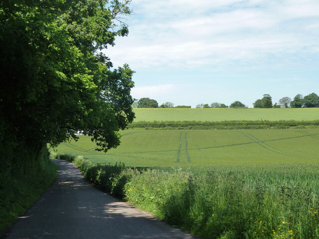
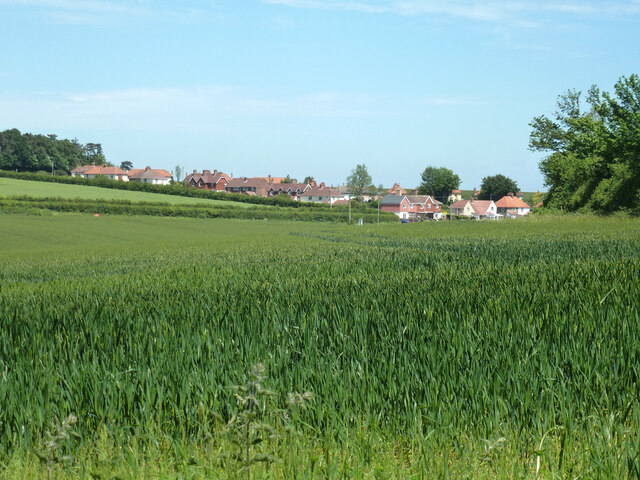
Womenswold is a small civil parish located in the county of Kent, England. Situated approximately 9 miles southwest of the city of Canterbury, Womenswold covers an area of around 4 square miles. The parish is surrounded by picturesque countryside and is part of the Kent Downs Area of Outstanding Natural Beauty.

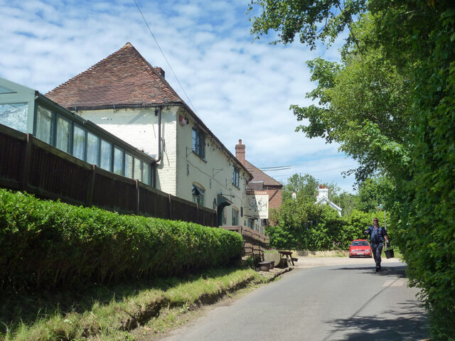
The village of Womenswold itself is a quaint and charming settlement with a population of around 300 residents. It is characterized by its traditional English village architecture, including a mix of old cottages and more modern houses. The village is centered around a beautiful 14th-century church, St. Margaret's, which is a Grade I listed building and a prominent feature of the local landscape.

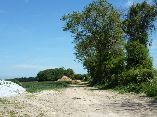
The area is known for its agricultural heritage, with farming playing a significant role in the local economy. The surrounding fields are predominantly used for arable farming and grazing livestock. The village is also home to a small number of local businesses, including a village pub and a post office.

Womenswold offers a peaceful and idyllic lifestyle, with its close-knit community and friendly atmosphere. The village is well-connected to nearby towns and cities, with good transport links and access to amenities. The surrounding countryside provides ample opportunities for outdoor activities such as walking, cycling, and horse riding, making Womenswold an attractive destination for nature enthusiasts and those seeking a rural retreat.

If you have any feedback on the listing, please let us know in the comments section below.
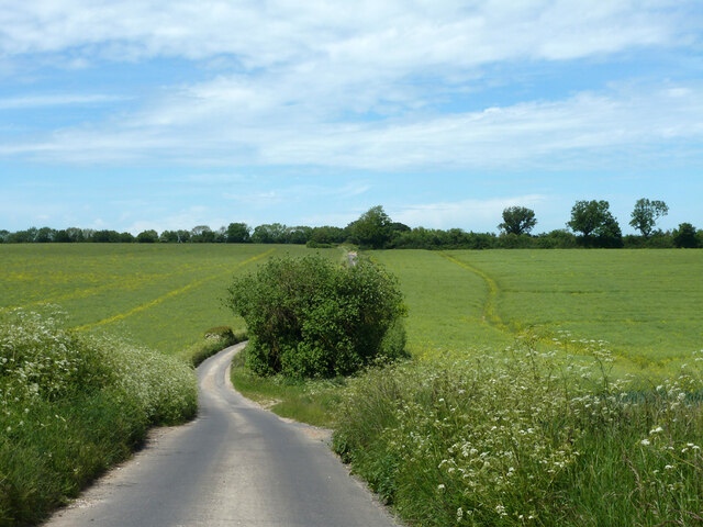
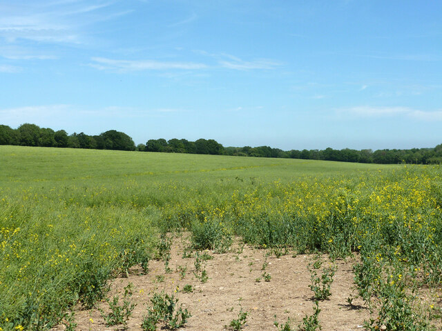
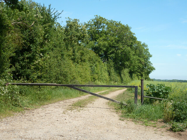
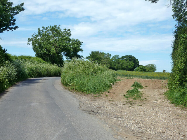
Womenswold Images

Images are sourced within 2km of 51.204319/1.196235 or Grid Reference TR2349. Thanks to Geograph Open Source API. All images are credited.

Westcourt Lane Towards Woolage Green.
Westcourt Lane
Towards Woolage Green.
Field north of Westcourt Lane Oil-seed Rape.
Field north of Westcourt Lane
Oil-seed Rape.
Farm track with barrier Off Westcourt Lane.
Farm track with barrier
Off Westcourt Lane.
Westcourt Lane and field entrance off it Looking towards Woolage Green.
Westcourt Lane and field entrance off it
Looking towards Woolage Green.
Farm track with heaps near Woolage Green The hedge is an administrative boundary - Canterbury this side, Dover the other.
Farm track with heaps near Woolage Green
The hedge is an administrative boundary - Canterbury this side, Dover the other.
Lane heading away from Woolage Green
View towards Woolage Village
Road closure, Woolage Green The road some way along was dug up for gas purposes.
Road closure, Woolage Green
The road some way along was dug up for gas purposes.
The Two Sawyers, Woolage Green
Leighgate Bottom
Leighgate Bottom
Byway to Woolage Green
Nethersole Rd
Nethersole Rd
Leighgate Bottom
Leighgate Bottom
Nethersole Rd
Nethersole Rd
North Downs Way A long distance path in southern England. It runs from Farnham to Dover, past Godalming, Guildford, Dorking, Merstham, Otford and Rochester, along the Surrey Hills Area of Outstanding Natural Beauty (AONB) and Kent Downs AONB. East of Boughton Lees, the path splits in two, the northern section running via Canterbury and the southern via Wye. The two sections of the path reunite at Dover. The northern route is 211 km long, and the southern route 201 km, the total length of the North Downs Way being 246 km.
The pathway is mixed in that it varies throughout its length from footpath status to bridleway, byway and road. Some 19% of the Way follows roads, though 75% of those are minor lanes. It is marked by an acorn. See <a href="https://www.geograph.org.uk/photo/1165027">TQ6561 : Crossover in Long Distance pathways</a>.
See <span class="nowrap"><a title="http://www.nationaltrail.co.uk/Northdowns/" rel="nofollow ugc noopener" href="http://www.nationaltrail.co.uk/Northdowns/">Link</a><img style="margin-left:2px;" alt="External link" title="External link - shift click to open in new window" src="https://s1.geograph.org.uk/img/external.png" width="10" height="10"/></span> for more details and an interactive map of the trail.
North Downs Way
A long distance path in southern England. It runs from Farnham to Dover, past Godalming, Guildford, Dorking, Merstham, Otford and Rochester, along the Surrey Hills Area of Outstanding Natural Beauty (AONB) and Kent Downs AONB. East of Boughton Lees, the path splits in two, the northern section running via Canterbury and the southern via Wye. The two sections of the path reunite at Dover. The northern route is 211 km long, and the southern route 201 km, the total length of the North Downs Way being 246 km. The pathway is mixed in that it varies throughout its length from footpath status to bridleway, byway and road. Some 19% of the Way follows roads, though 75% of those are minor lanes. It is marked by an acorn. See TQ6561 : Crossover in Long Distance pathways. See LinkExternal link for more details and an interactive map of the trail.
Farmland, Leightongate Bottom
North Downs Way A long distance path in southern England. It runs from Farnham to Dover, past Godalming, Guildford, Dorking, Merstham, Otford and Rochester, along the Surrey Hills Area of Outstanding Natural Beauty (AONB) and Kent Downs AONB. East of Boughton Lees, the path splits in two, the northern section running via Canterbury and the southern via Wye. The two sections of the path reunite at Dover. The northern route is 211 km long, and the southern route 201 km, the total length of the North Downs Way being 246 km.
The pathway is mixed in that it varies throughout its length from footpath status to bridleway, byway and road. Some 19% of the Way follows roads, though 75% of those are minor lanes. It is marked by an acorn. See <a href="https://www.geograph.org.uk/photo/1165027">TQ6561 : Crossover in Long Distance pathways</a>.
See <span class="nowrap"><a title="http://www.nationaltrail.co.uk/Northdowns/" rel="nofollow ugc noopener" href="http://www.nationaltrail.co.uk/Northdowns/">Link</a><img style="margin-left:2px;" alt="External link" title="External link - shift click to open in new window" src="https://s1.geograph.org.uk/img/external.png" width="10" height="10"/></span> for more details and an interactive map of the trail.
North Downs Way
A long distance path in southern England. It runs from Farnham to Dover, past Godalming, Guildford, Dorking, Merstham, Otford and Rochester, along the Surrey Hills Area of Outstanding Natural Beauty (AONB) and Kent Downs AONB. East of Boughton Lees, the path splits in two, the northern section running via Canterbury and the southern via Wye. The two sections of the path reunite at Dover. The northern route is 211 km long, and the southern route 201 km, the total length of the North Downs Way being 246 km. The pathway is mixed in that it varies throughout its length from footpath status to bridleway, byway and road. Some 19% of the Way follows roads, though 75% of those are minor lanes. It is marked by an acorn. See TQ6561 : Crossover in Long Distance pathways. See LinkExternal link for more details and an interactive map of the trail.
Three Barrows Down
Three Barrows Down
Show me another place!

Womenswold is located at Grid Ref: TR2349 (Lat: 51.204319, Lng: 1.196235)

Administrative County: Kent

District: Canterbury

Police Authority: Kent

What 3 Words

///withdraw.tabloid.slugs. Near Aylesham, Kent

Related Wikis

Woolage Village

Woolage Village is a former mining village situated midway between Canterbury and Dover in the English county of Kent. It is 1 mile (1.6 km) to the east...
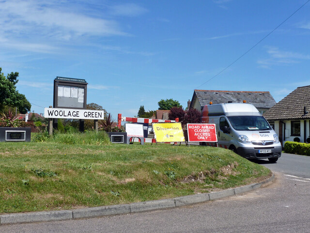
Woolage Green

Woolage Green is a small hamlet, situated about 7 miles (11 km) south-east of Canterbury, Kent, England, 1 mile to the east of the A2 road. Together with...

Womenswold

Womenswold is a village and civil parish centred 7 miles (11 km) south-east of Canterbury, Kent, England, 1 mile to the east of the A2 road. The parish...

Snowdown

Snowdown is a hamlet near Dover in Kent, England. It was the location of one of the four chief collieries of the Kent coalfield, which closed in 1987....

Snowdown railway station

Snowdown railway station is on the Dover branch of the Chatham Main Line in England, and serves the hamlet of Snowdown, Kent. It is 69 miles 60 chains...
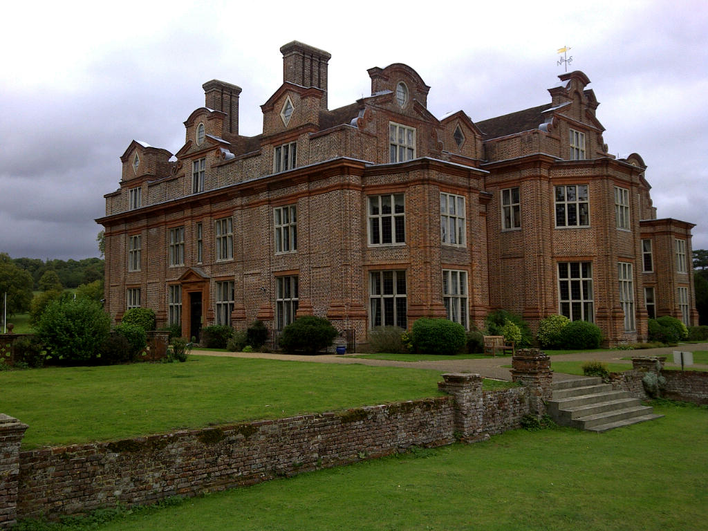
Broome Park

Broome Park is a country house in Barham, within the City of Canterbury, Kent, England. It was built for Basil Dixwell between 1635 and 1638. In the early...

Black Mill, Barham

Black Mill or Barham Downs Mill was a smock mill at Barham, Kent, England which was accidentally burnt down in 1970 while under restoration. == History... ==

Aylesham

Aylesham is a village and civil parish in the Dover district of Kent, England. The village is 6.5 miles (10.5 km) southeast of the cathedral city of Canterbury...

Nearby Amenities

Located within 500m of 51.204319,1.196235
Woolage Village
Is In: Kent, England, UK
Place: village
Source: survey
Wikidata: Q8033767
Lat/Long: 51.2059714/1.1993445
Post Box
Collection Times: Mo-Fr 09:00; Sa 07:00
Operator: Royal Mail
Operator Wikidata: Q638098
Post Box Mounting: brick_pillar
Post Box Type: wall
Postal Code: CT4
Ref: CT4 249
Royal Cypher: GR
Royal Cypher Wikidata: Q33102273
Source: survey
Lat/Long: 51.206587/1.197773
Bus Stop
Village Green
Flag: no
Naptan AtcoCode: 2400A073310A
Naptan Bearing: W
Naptan BusStopType: CUS
Naptan CommonName: Village
Naptan Indicator: W-bound
Naptan Landmark: Nr PO
Naptan NaptanCode: kntgjamp
Naptan Street: Nethersole Road
Naptan Verified: no
Public Transport: platform
Source: naptan_import
Lat/Long: 51.2066525/1.1981789
Barrier: stile
Lat/Long: 51.203016/1.1952178
Barrier: stile
Lat/Long: 51.203083/1.1951755
Old Phone: +44 1304 840313
Removed Amenity: telephone
Lat/Long: 51.2069791/1.1973283
Barrier: stile
Lat/Long: 51.2073349/1.1974625
Generator Method: photovoltaic
Generator Output Electricity: yes
Generator Source: solar
Generator Type: solar_photovoltaic_panel
Location: roof
Power: generator
Lat/Long: 51.2056357/1.1999144
Information: guidepost
Tourism: information
Lat/Long: 51.2069156/1.1973398
Bench
Survey Date: 2023-07-26
Lat/Long: 51.2065056/1.2013355
Bench
Survey Date: 2023-07-26
Lat/Long: 51.2066692/1.201377
Bench
Survey Date: 2023-07-26
Lat/Long: 51.206555/1.2013801
Bench
Survey Date: 2023-07-26
Lat/Long: 51.2066061/1.2014027
The data included in this document is from www.openstreetmap.org. The data is made available under ODbL.

Have you been to Womenswold?

Leave your review of Womenswold below (or comments, questions and feedback).