Aberaeron

Settlement in Cardiganshire

Wales

Aberaeron

Tollhouse, Aberaeron North Turnpike The gate-post on the opposite side of the road bore an Ordnance Survey benchmark:

The mark was used on the Warrington to Pembroke Docks line of the First Primary Levelling of England & Wales in 1851-1852. It was levelled with a height of 61.650' above OD (Liverpool). Description: 664. Mark on West post of Aberaeron North Turnpike-gate ; 1.93 ft. above surface. Page 534 of the abstract: <span class="nowrap"><a title="https://www.bench-marks.org.uk/abstract/ew1gl/1GLA_534.png" rel="nofollow ugc noopener" href="https://www.bench-marks.org.uk/abstract/ew1gl/1GLA_534.png">Link</a><img style="margin-left:2px;" alt="External link" title="External link - shift click to open in new window" src="https://s1.geograph.org.uk/img/external.png" width="10" height="10"/></span>

From the West: <a href="https://www.geograph.org.uk/photo/7056118">SN4663 : Tollhouse, Aberaeron North Turnpike</a>
Tollhouse, Aberaeron North Turnpike Credit: N Scott

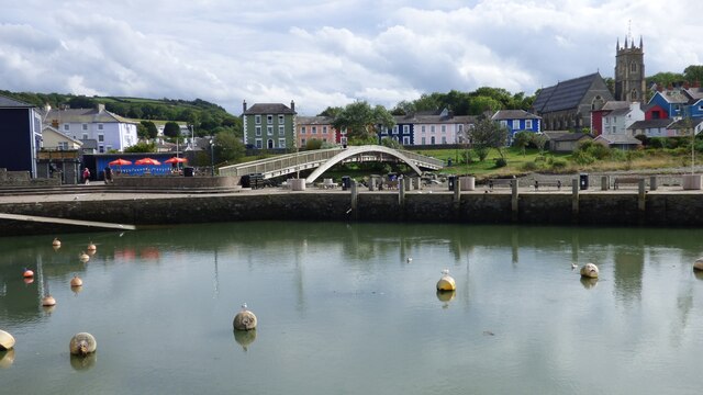
Aberaeron is a charming coastal town located in the county of Cardiganshire, Wales. Situated on the west coast of the country, it lies at the mouth of the River Aeron. With a population of around 1,500 residents, Aberaeron offers a peaceful and picturesque setting for both locals and visitors.

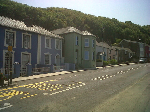
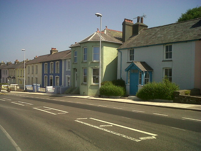
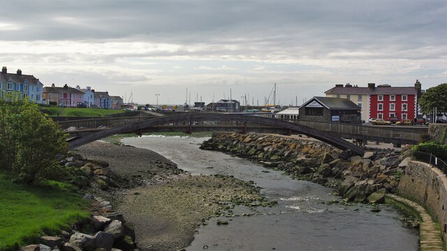
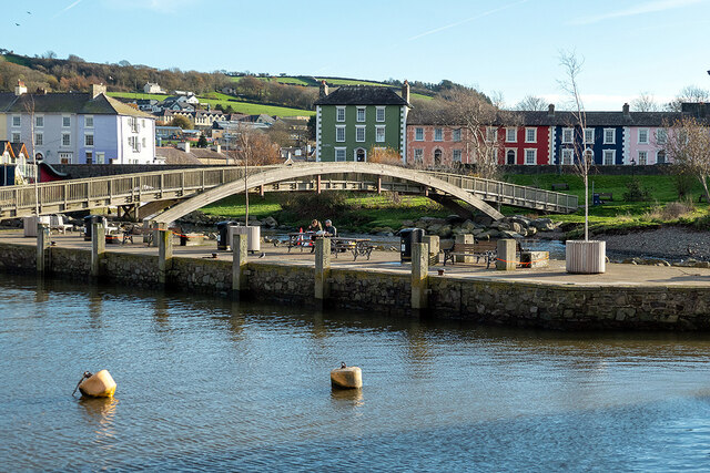
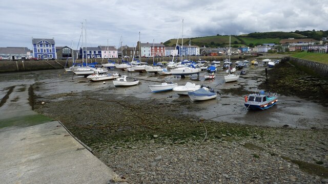
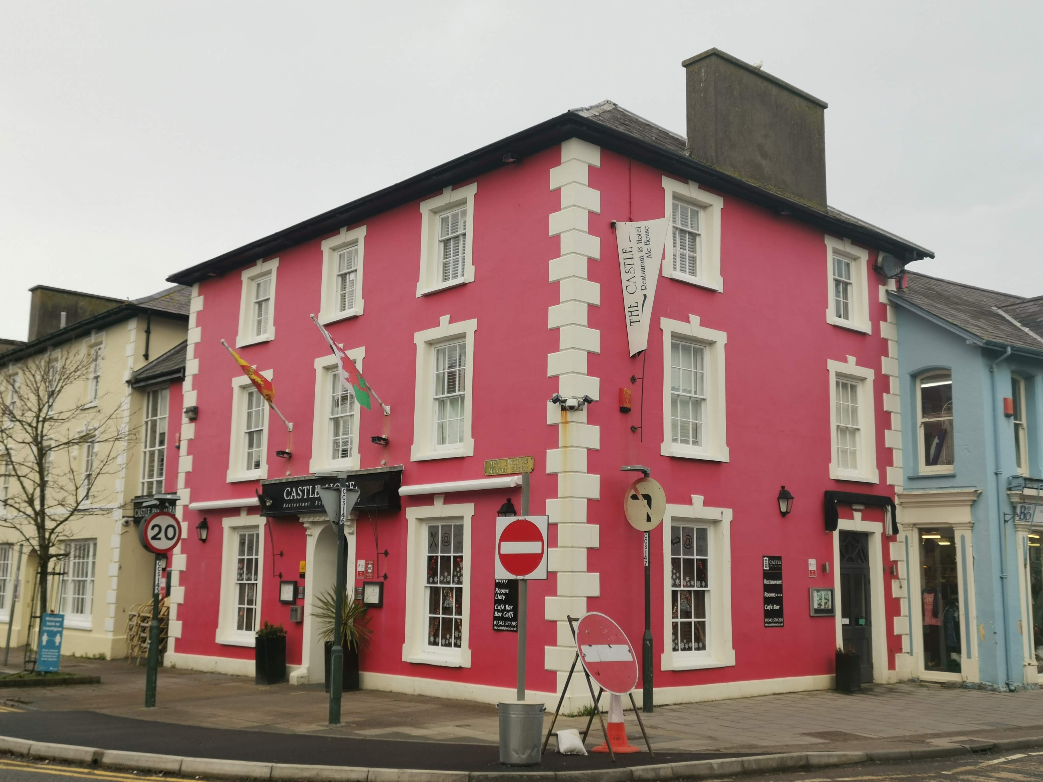
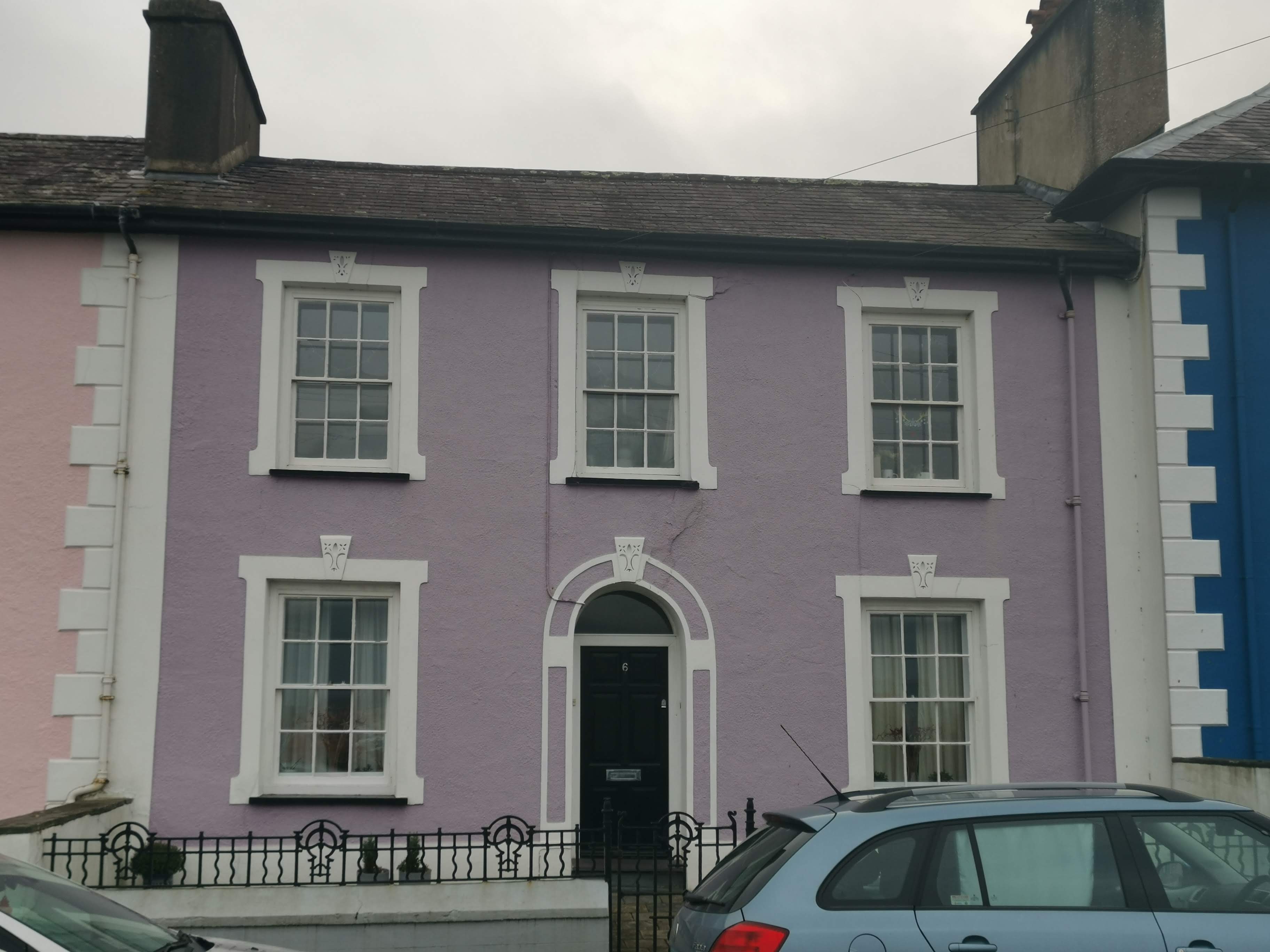
The town is renowned for its distinctive Georgian architecture, characterized by colorful houses lining the seafront. The buildings showcase a unique harmony of pastel shades, creating a visually striking scene. Aberaeron's Georgian charm is further enhanced by its elegant harbor, which serves as a focal point for both leisure and commercial activities.

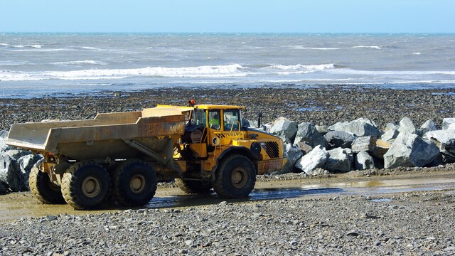
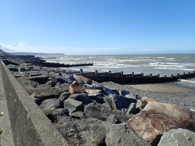
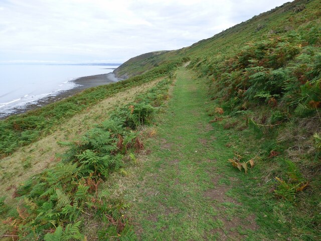
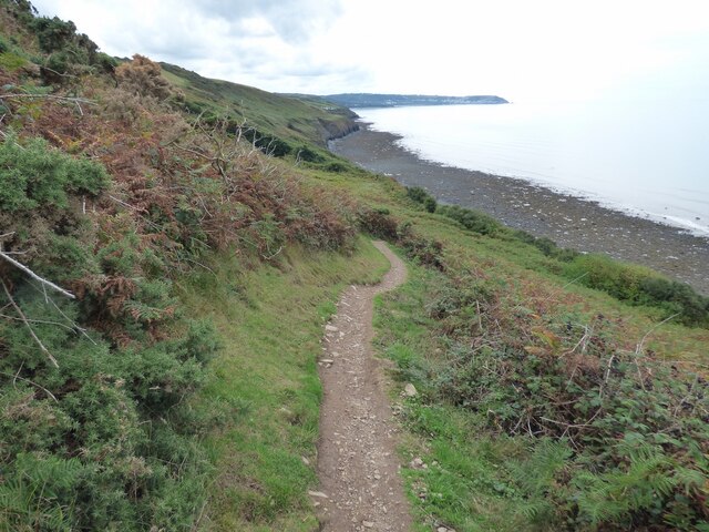
In addition to its visual appeal, Aberaeron boasts a thriving tourism industry. Visitors are drawn to the town's beautiful beaches, including the popular Aberaeron South Beach and Aberarth Beach. These sandy shores provide opportunities for sunbathing, swimming, and coastal walks. The presence of a bustling harbor also allows for various water-based activities such as fishing and boating.

Aberaeron offers a range of amenities for its residents and visitors, including quaint shops, cozy cafes, and traditional pubs. The town hosts various events throughout the year, including the annual Seafood Festival, which celebrates the local fishing heritage and showcases delicious seafood dishes.

Overall, Aberaeron is a delightful destination that blends natural beauty with architectural elegance. Its welcoming atmosphere, stunning coastline, and unique Georgian character make it a must-visit location for those seeking a tranquil getaway in the heart of Cardiganshire.

If you have any feedback on the listing, please let us know in the comments section below.

Aberaeron Images

Images are sourced within 2km of 52.242228/-4.259312 or Grid Reference SN4562. Thanks to Geograph Open Source API. All images are credited.
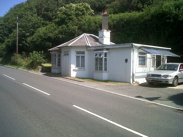
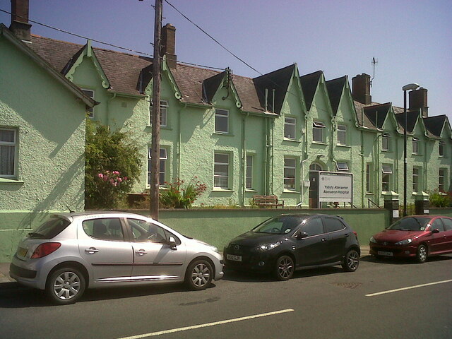
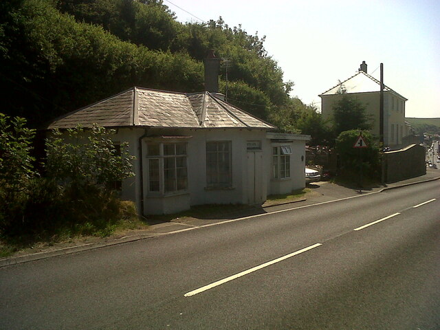
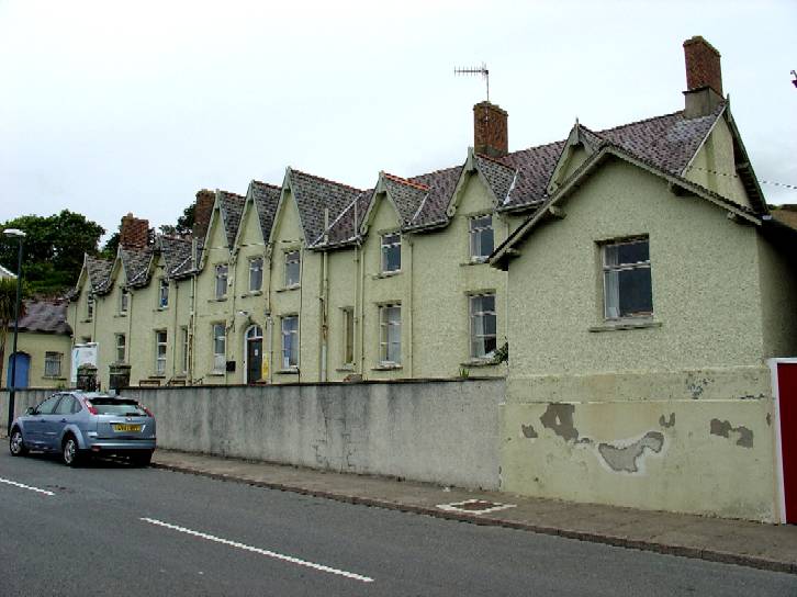
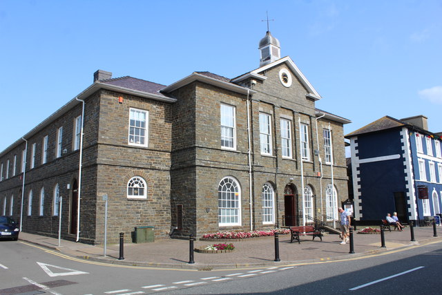
Tollhouse, Aberaeron North Turnpike The gate-post on the opposite side of the road bore an Ordnance Survey benchmark:

The mark was used on the Warrington to Pembroke Docks line of the First Primary Levelling of England & Wales in 1851-1852. It was levelled with a height of 61.650' above OD (Liverpool). Description: 664. Mark on West post of Aberaeron North Turnpike-gate ; 1.93 ft. above surface. Page 534 of the abstract: <span class="nowrap"><a title="https://www.bench-marks.org.uk/abstract/ew1gl/1GLA_534.png" rel="nofollow ugc noopener" href="https://www.bench-marks.org.uk/abstract/ew1gl/1GLA_534.png">Link</a><img style="margin-left:2px;" alt="External link" title="External link - shift click to open in new window" src="https://s1.geograph.org.uk/img/external.png" width="10" height="10"/></span>

From the West: <a href="https://www.geograph.org.uk/photo/7056118">SN4663 : Tollhouse, Aberaeron North Turnpike</a>
Tollhouse, Aberaeron North Turnpike
The gate-post on the opposite side of the road bore an Ordnance Survey benchmark: The mark was used on the Warrington to Pembroke Docks line of the First Primary Levelling of England & Wales in 1851-1852. It was levelled with a height of 61.650' above OD (Liverpool). Description: 664. Mark on West post of Aberaeron North Turnpike-gate ; 1.93 ft. above surface. Page 534 of the abstract: LinkExternal link From the West: SN4663 : Tollhouse, Aberaeron North Turnpike
Tollhouse, Aberaeron North Turnpike The gate-post on the opposite side of the road bore an Ordnance Survey benchmark:

The mark was used on the Warrington to Pembroke Docks line of the First Primary Levelling of England & Wales in 1851-1852. It was levelled with a height of 61.650' above OD (Liverpool). Description: 664. Mark on West post of Aberaeron North Turnpike-gate ; 1.93 ft. above surface. Page 534 of the abstract: <span class="nowrap"><a title="https://www.bench-marks.org.uk/abstract/ew1gl/1GLA_534.png" rel="nofollow ugc noopener" href="https://www.bench-marks.org.uk/abstract/ew1gl/1GLA_534.png">Link</a><img style="margin-left:2px;" alt="External link" title="External link - shift click to open in new window" src="https://s1.geograph.org.uk/img/external.png" width="10" height="10"/></span>

From the North-east: <a href="https://www.geograph.org.uk/photo/7056115">SN4663 : Tollhouse, Aberaeron North Turnpike</a>
Tollhouse, Aberaeron North Turnpike
The gate-post on the opposite side of the road bore an Ordnance Survey benchmark: The mark was used on the Warrington to Pembroke Docks line of the First Primary Levelling of England & Wales in 1851-1852. It was levelled with a height of 61.650' above OD (Liverpool). Description: 664. Mark on West post of Aberaeron North Turnpike-gate ; 1.93 ft. above surface. Page 534 of the abstract: LinkExternal link From the North-east: SN4663 : Tollhouse, Aberaeron North Turnpike
Tollhouse, Aberaeron West Turnpike The house to the West (right) of the tollhouse bore an Ordnance Survey benchmark:

The mark was used on the Warrington to Pembroke Docks line of the First Primary Levelling of England & Wales in 1851-1852. It was levelled with a height of 79.263' above OD (Liverpool). Description: 666. Mark on front of John Jones's house, at West side of Aberaeron West Turnpike-gate ; 0.87 ft. above surface. Page 535 of the abstract: <span class="nowrap"><a title="https://www.bench-marks.org.uk/abstract/ew1gl/1GLA_535.png" rel="nofollow ugc noopener" href="https://www.bench-marks.org.uk/abstract/ew1gl/1GLA_535.png">Link</a><img style="margin-left:2px;" alt="External link" title="External link - shift click to open in new window" src="https://s1.geograph.org.uk/img/external.png" width="10" height="10"/></span>

From the West: <a href="https://www.geograph.org.uk/photo/7056132">SN4562 : Tollhouse, Aberaeron West Turnpike</a>
Tollhouse, Aberaeron West Turnpike
The house to the West (right) of the tollhouse bore an Ordnance Survey benchmark: The mark was used on the Warrington to Pembroke Docks line of the First Primary Levelling of England & Wales in 1851-1852. It was levelled with a height of 79.263' above OD (Liverpool). Description: 666. Mark on front of John Jones's house, at West side of Aberaeron West Turnpike-gate ; 0.87 ft. above surface. Page 535 of the abstract: LinkExternal link From the West: SN4562 : Tollhouse, Aberaeron West Turnpike
Tollhouse, Aberaeron West Turnpike The house to the West (right) of the tollhouse bore an Ordnance Survey benchmark:

The mark was used on the Warrington to Pembroke Docks line of the First Primary Levelling of England & Wales in 1851-1852. It was levelled with a height of 79.263' above OD (Liverpool). Description: 666. Mark on front of John Jones's house, at West side of Aberaeron West Turnpike-gate ; 0.87 ft. above surface. Page 535 of the abstract: <span class="nowrap"><a title="https://www.bench-marks.org.uk/abstract/ew1gl/1GLA_535.png" rel="nofollow ugc noopener" href="https://www.bench-marks.org.uk/abstract/ew1gl/1GLA_535.png">Link</a><img style="margin-left:2px;" alt="External link" title="External link - shift click to open in new window" src="https://s1.geograph.org.uk/img/external.png" width="10" height="10"/></span>

From the North: <a href="https://www.geograph.org.uk/photo/7056127">SN4562 : Tollhouse, Aberaeron West Turnpike</a>
Tollhouse, Aberaeron West Turnpike
The house to the West (right) of the tollhouse bore an Ordnance Survey benchmark: The mark was used on the Warrington to Pembroke Docks line of the First Primary Levelling of England & Wales in 1851-1852. It was levelled with a height of 79.263' above OD (Liverpool). Description: 666. Mark on front of John Jones's house, at West side of Aberaeron West Turnpike-gate ; 0.87 ft. above surface. Page 535 of the abstract: LinkExternal link From the North: SN4562 : Tollhouse, Aberaeron West Turnpike
Afon Aeron Footbridge View from the road bridge
Afon Aeron Footbridge
View from the road bridge
New Sea Defences The limestone barrier being created in 2009
New Sea Defences
The limestone barrier being created in 2009
Sea defences at Aberaeron Boulders and groynes protect the promenade
Sea defences at Aberaeron
Boulders and groynes protect the promenade
Start of the Aberaeron to Lampeter Trail Leading out of Aberaeron.
Start of the Aberaeron to Lampeter Trail
Leading out of Aberaeron.
Aberaeron Integrated Care Centre Beside Afon Aeron and built on the site of the Aberaeron railway branch terminus.
Aberaeron Integrated Care Centre
Beside Afon Aeron and built on the site of the Aberaeron railway branch terminus.
The sun shines on Aberaeron! Sunlit houses in South Street.
The sun shines on Aberaeron!
Sunlit houses in South Street.
Panteg fields On the edge of Aberaeron.
Panteg fields
On the edge of Aberaeron.
The bridge over the Aeron At Aberaeron on a fine winter's day.
The bridge over the Aeron
At Aberaeron on a fine winter's day.
Aberaeron Union Workhouse/Cottage Hospital Aberayron Poor Law Union was the first in Cardiganshire to open a workhouse, which was built in 1839-40, by William Green, to designs of George Wilkinson.  It was converted for use as a hospital for injured soldiers in 1914 and became a cottage hospital in 1930.  The hospital closed in 2019, when the new Integrated Care Centre opened at the Minaeron site, Vicarage Hill.  The building was demolished in 2021.

Side: <a href="https://www.geograph.org.uk/photo/7358085">SN4662 : Aberaeron Union Workhouse/Cottage Hospital</a>
Aberaeron Union Workhouse/Cottage Hospital
Aberayron Poor Law Union was the first in Cardiganshire to open a workhouse, which was built in 1839-40, by William Green, to designs of George Wilkinson. It was converted for use as a hospital for injured soldiers in 1914 and became a cottage hospital in 1930. The hospital closed in 2019, when the new Integrated Care Centre opened at the Minaeron site, Vicarage Hill. The building was demolished in 2021. Side: SN4662 : Aberaeron Union Workhouse/Cottage Hospital
Aberaeron Union Workhouse/Cottage Hospital This face of the building bore OSBM flush bracket S0449 at the East (left) angle:

The bracket was used on the Aberystwyth to Lampeter secondary line of the Second Geodetic Levelling of England & Wales in 1942. It was levelled with a height of 43.956' above OD (Newlyn). Description: E angle of workhouse, Aberayron. Abstract A 483: <span class="nowrap"><a title="http://discovery.nationalarchives.gov.uk/details/r/C11178827" rel="nofollow ugc noopener" href="http://discovery.nationalarchives.gov.uk/details/r/C11178827">Link</a><img style="margin-left:2px;" alt="External link" title="External link - shift click to open in new window" src="https://s1.geograph.org.uk/img/external.png" width="10" height="10"/></span> [OS 54/148]

The bracket, which had been obscured by rendering, was replaced by G2986 on the Midland Bank for the Third Geodetic Levelling in 1956.

Front: <a href="https://www.geograph.org.uk/photo/7358078">SN4662 : Aberaeron Union Workhouse/Cottage Hospital</a>
Aberaeron Union Workhouse/Cottage Hospital
This face of the building bore OSBM flush bracket S0449 at the East (left) angle: The bracket was used on the Aberystwyth to Lampeter secondary line of the Second Geodetic Levelling of England & Wales in 1942. It was levelled with a height of 43.956' above OD (Newlyn). Description: E angle of workhouse, Aberayron. Abstract A 483: LinkExternal link [OS 54/148] The bracket, which had been obscured by rendering, was replaced by G2986 on the Midland Bank for the Third Geodetic Levelling in 1956. Front: SN4662 : Aberaeron Union Workhouse/Cottage Hospital
Ceredigion Coastal Path near Cilfforch
Ceredigion Coast Path Well trodden along this length.
Ceredigion Coast Path
Well trodden along this length.
Low tide at Aberaeron
Footbridge over the River Aeron
Show me another place!

Aberaeron is located at Grid Ref: SN4562 (Lat: 52.242228, Lng: -4.259312)

Unitary Authority: Ceredigion

Police Authority: Dyfed Powys

What 3 Words

///unless.sleep.reshaping. Near Aberaeron, Ceredigion

Related Wikis

Nearby Amenities

Located within 500m of 52.242228,-4.259312
Source: PGS
Lat/Long: 52.2465807/-4.2586366
Source: PGS
Lat/Long: 52.2463523/-4.2590719
Source: PGS
Lat/Long: 52.2457801/-4.2608909
Created By: dmgroom_coastlines
Source: PGS
Lat/Long: 52.245607/-4.261244
Source: PGS
Lat/Long: 52.2446779/-4.2623849
Source: PGS
Lat/Long: 52.2445423/-4.2630007
Source: PGS
Lat/Long: 52.2436937/-4.2646284
Source: PGS
Lat/Long: 52.2435124/-4.2640551
Source: PGS
Lat/Long: 52.2434557/-4.2638784
Source: PGS
Lat/Long: 52.2429121/-4.2625181
Source: PGS
Lat/Long: 52.2424572/-4.2617093
Source: PGS
Lat/Long: 52.2423459/-4.2615574
Source: PGS
Lat/Long: 52.2419625/-4.2620907
Source: PGS
Lat/Long: 52.2423347/-4.2629908
Source: PGS
Lat/Long: 52.2425331/-4.2644218
Source: PGS
Lat/Long: 52.2428391/-4.2648249
Source: PGS
Lat/Long: 52.2432139/-4.2641687
Source: PGS
Lat/Long: 52.243425/-4.2651228
Source: PGS
Lat/Long: 52.2425566/-4.265811
Source: PGS
Lat/Long: 52.2425196/-4.2657241
Source: PGS
Lat/Long: 52.2417395/-4.2663978
Aberaeron
Is In: Ceredigion, Wales, UK
Is In Historic County: Cardiganshire
Name Cy: Aberaeron
Place: town
Population: 1422
Population Date: 2011
Source: NPE
Source Population: Census
Wikidata: Q1765460
Lat/Long: 52.2431766/-4.2600153
Traffic Signals
Crossing: traffic_signals
Crossing Ref: pelican
Kerb: flush
Tactile Paving: yes
Lat/Long: 52.2424346/-4.2588959
Post Box
Lat/Long: 52.2411295/-4.2620404
Building: yes
Lat/Long: 52.2439903/-4.2569804
Bank
NatWest
Atm: yes
Brand: NatWest
Brand Wikidata: Q2740021
Lat/Long: 52.241008/-4.25736
Costcutter
Addr City: Aberaeron
Addr Country: GB
Addr Housenumber: 20-21
Addr Postcode: SA46 0AS
Addr Street: Market Street
Brand: Costcutter
Brand Wikidata: Q5175072
Fhrs Id: 863136
Opening Hours: Mo-Sa 08:00-21:00; Su 11:00-17:00
Shop: supermarket
Source Addr: FHRS Open Data
Toilets Wheelchair: no
Wheelchair: yes
Lat/Long: 52.2426221/-4.2594614
Pharmacy
Boots
Addr Housenumber: 5A
Addr Postcode: SA46 0AP
Addr Street: Bridge Street
Brand: Boots
Brand Wikidata: Q6123139
Brand Wikipedia: en:Boots UK
Dispensing: yes
Fhrs Id: 863385
Healthcare: pharmacy
Source Addr: FHRS Open Data
Toilets Wheelchair: no
Website: https://www.boots.com/stores/458-aberaeron-bridge-street-sa46-0ap
Wheelchair: yes
Lat/Long: 52.2422317/-4.2590272
Pub
Castle Hotel
Addr Postcode: SA46 0AU
Addr Street: Market Street
Fhrs Id: 863130
Heritage: 2
Heritage Operator: cadw
Ref Cadw: 10045
Source Addr: FHRS Open Data
Wheelchair: yes
Wikidata: Q5050147
Wikipedia: en:Castle Hotel, Aberaeron
Lat/Long: 52.2424408/-4.2592031
Aberaeron Sports Club
Leisure: sports_centre
Lat/Long: 52.2392875/-4.2585725
Restaurant
Monachty
Internet Access: wlan
Internet Access Fee: no
Internet Access Ssid: _the_cloud
Outdoor Seating: terrace
Tourism: hotel
Wheelchair: yes
Lat/Long: 52.2426856/-4.2601107
Post Box
Post Box Type: pillar
Ref: SA46 188
Royal Cypher: EIIR
Royal Cypher Wikidata: Q33102113
Lat/Long: 52.2428315/-4.25823
Pub
Prince of Wales
Addr Housenumber: 1
Addr Postcode: SA46 0BY
Addr Street: Queen Street
Fhrs Id: 978223
Name Cy: Pont Hafren
Source Addr: FHRS Open Data
Wikidata: Q29488756
Lat/Long: 52.2436768/-4.260309
Pub
Royal Oak
Food: yes
Wikidata: Q29488734
Lat/Long: 52.2430627/-4.2574099
Restaurant
Spice Cuisine - Victoria Hotel
Takeaway: yes
Wheelchair: limited
Lat/Long: 52.2431482/-4.259501
Telephone
Operator: BT
Lat/Long: 52.2431078/-4.260643
Recycling
Recycling Cans: yes
Recycling Glass: yes
Recycling Paper: yes
Lat/Long: 52.2456311/-4.2605667
Toilets
Access: yes
Fee: no
Operator: Aberaeron Town Council
Toilets Wheelchair: yes
Wheelchair: yes
Wheelchair Description: Radar Key
Lat/Long: 52.2428708/-4.2591135
Bus Stop
Alban Square
Kerb: raised
Local Ref: 3
Public Transport: platform
Shelter: yes
Lat/Long: 52.2427851/-4.258053
Bus Stop
Alban Square
Kerb: raised
Local Ref: 2
Naptan AtcoCode: 5230AWD71007
Naptan NaptanCode: cejadag
Public Transport: platform
Shelter: yes
Lat/Long: 52.2426981/-4.2582182
Gifted
Shop: florist
Lat/Long: 52.243408/-4.2571079
Bus Stop
Alban Square
Kerb: raised
Local Ref: 1
Naptan AtcoCode: 5230AWD71006
Naptan NaptanCode: cejadad
Public Transport: platform
Shelter: yes
Lat/Long: 52.242607/-4.2584151
Fuel
Aeron Coast
Addr Postcode: SA46 0JF
Addr Street: North Road
Brand: murco
Fhrs Id: 863186
Shop: newsagent
Source Addr: FHRS Open Data
Lat/Long: 52.2443152/-4.2554424
Bus Stop
Kerb: raised
Layby: yes
Shelter: yes
Lat/Long: 52.2397133/-4.2643597
Noexit: yes
Lat/Long: 52.2442175/-4.2630452
Bench
Backrest: yes
Lat/Long: 52.2404085/-4.2593391
Bench
Lat/Long: 52.2394479/-4.2593875
Bench
Backrest: yes
Lat/Long: 52.2394309/-4.2598335
Hazeldene
Addr Housenumber: 4
Addr Postcode: SA46 0DP
Addr Street: South Road
Fhrs Id: 863432
Source Addr: FHRS Open Data
Stars: 4
Tourism: guest_house
Lat/Long: 52.2403706/-4.2577137
Crossing
Crossing: uncontrolled
Lat/Long: 52.2419867/-4.2580107
Bench
Lat/Long: 52.2394823/-4.2595584
Bench
Backrest: yes
Lat/Long: 52.2405434/-4.2591477
Rosmary's Wool Shop
Shop: sewing
Lat/Long: 52.2415028/-4.2575239
Access: foot
Barrier: bollard
Lat/Long: 52.2426581/-4.2619632
Bench
Lat/Long: 52.2456199/-4.2609483
Waste Basket
Lat/Long: 52.2456069/-4.2609739
Bench
Backrest: yes
Lat/Long: 52.2436812/-4.264597
Waste Basket
Lat/Long: 52.2425369/-4.260677
Pub
Harbourmaster Hotel
Addr City: Aberaeron
Addr Housenumber: 1
Addr Postcode: SA46 0BT
Addr Street: Quay Parade
Fhrs Id: 863593
Food: yes
Name Cy: Harbwrfeistr
Toilets: yes
Toilets Wheelchair: yes
Tourism: hotel
Website: https://www.harbour-master.com/
Wheelchair: yes
Wikidata: Q5654909
Lat/Long: 52.2435063/-4.2631954
Source: PGS
Lat/Long: 52.2434298/-4.2651511
Crossing
Crossing: uncontrolled
Kerb: lowered
Tactile Paving: yes
Lat/Long: 52.2423647/-4.2593231
Bench
Backrest: yes
Lat/Long: 52.241872/-4.2621191
Aberaeron Stores
Alcohol: yes
Shop: convenience
Toilets Wheelchair: no
Wheelchair: yes
Lat/Long: 52.2421064/-4.2593139
Crossing
Crossing: uncontrolled
Kerb: lowered
Tactile Paving: yes
Lat/Long: 52.242588/-4.2587528
Bench
Backrest: yes
Lat/Long: 52.2422689/-4.2629996
Board Type: nature
Check Date: 2024-02-25
Information: board
Tourism: information
Lat/Long: 52.242972/-4.2655263
Bench
Backrest: yes
Lat/Long: 52.242289/-4.2630758
Welsh Cob Stallion
Artist Name: David Mayer
Artwork Type: sculpture
Landmark: statue
Note: Donated to Aberaeron town by the Aberaeron Festival of Welsh Ponies and Cobs to denote the area as Welsh Cob Country.
Source: survey
Tourism: artwork
Lat/Long: 52.2415347/-4.2569526
Lloyd Motors
Brand: Volvo
Shop: car
Lat/Long: 52.2418874/-4.2564557
Bank
Barclays
Atm: yes
Brand: Barclays
Brand Wikidata: Q245343
Operator: Barclays Bank PLC
Lat/Long: 52.2423765/-4.2567167
Crossing
Crossing: uncontrolled
Kerb: lowered
Tactile Paving: yes
Lat/Long: 52.2429644/-4.2576689
Life Ring
Emergency: life_ring
Lat/Long: 52.2463227/-4.2589252
Toilets
Lat/Long: 52.2456312/-4.2597539
Recycling
Lat/Long: 52.24573/-4.2598183
Information: board
Tourism: information
Lat/Long: 52.2458239/-4.2604069
Life Ring
Emergency: life_ring
Lat/Long: 52.2458262/-4.2605362
Bench
Backrest: yes
Lat/Long: 52.2427477/-4.2621446
Waste Basket
Check Date: 2024-02-25
Lat/Long: 52.2430096/-4.2613744
Bench
Backrest: yes
Lat/Long: 52.2431477/-4.2628604
Bench
Backrest: yes
Lat/Long: 52.2433537/-4.2632342
Bench
Backrest: yes
Lat/Long: 52.2436764/-4.2644231
Bench
Backrest: yes
Lat/Long: 52.2428707/-4.2623713
Ladder
Lat/Long: 52.2434004/-4.2635687
Information: board
Tourism: information
Lat/Long: 52.2436076/-4.2640629
Waste Basket
Lat/Long: 52.2434213/-4.2635062
Bench
Backrest: yes
Check Date: 2024-02-25
Material: wood
Lat/Long: 52.2429111/-4.2615054
Bench
Backrest: yes
Lat/Long: 52.2436471/-4.2642782
Waste Basket
Lat/Long: 52.2427188/-4.2620893
Bench
Backrest: yes
Lat/Long: 52.2434893/-4.2637825
Waste Basket
Lat/Long: 52.2431274/-4.2628238
Bench
Backrest: yes
Lat/Long: 52.2436271/-4.264133
Waste Basket
Check Date: 2024-02-25
Lat/Long: 52.2429081/-4.2615524
Bench
Backrest: yes
Lat/Long: 52.2434013/-4.2634147
Bench
Backrest: yes
Check Date: 2024-02-25
Material: wood
Lat/Long: 52.2430185/-4.2613484
Bench
Backrest: yes
Lat/Long: 52.2430294/-4.2626443
Bench
Backrest: yes
Lat/Long: 52.2434277/-4.2635153
Life Ring
Emergency: life_ring
Lat/Long: 52.2438213/-4.2637334
Bench
Backrest: yes
Lat/Long: 52.2439465/-4.2634933
Bench
Backrest: yes
Lat/Long: 52.2436994/-4.2637927
Coedmor
Tourism: guest_house
Lat/Long: 52.2428857/-4.2618339
Stars: 5
Tourism: guest_house
Lat/Long: 52.2433351/-4.2629515
Evans & Davies
Office: solicitor
Lat/Long: 52.2428224/-4.261915
Bus Stop
Aeron Coast Caravan Park
Bench: yes
Kerb: raised
Naptan AtcoCode: 5230WDB48205
Naptan NaptanCode: cejgjpa
Public Transport: platform
Shelter: yes
Lat/Long: 52.2445268/-4.2547848
Restaurant
The Hive
Addr Postcode: SA46 0BU
Addr Street: Cadwgan Place
Cuisine: international;ice_cream
Diet Vegan: no
Diet Vegetarian: yes
Indoor Seating: yes
Outdoor Seating: balcony
Payment Cash: yes
Payment Credit Cards: yes
Payment Debit Cards: yes
Toilets Wheelchair: no
Website: https://www.thehiveaberaeron.com/
Wheelchair: yes
Lat/Long: 52.2426226/-4.2616746
Toilets
Lat/Long: 52.2420149/-4.2656038
Seamark Light 1 Character: Fl
Seamark Light 1 Colour: green
Seamark Light 1 Group: 4
Seamark Light 1 Height: 10
Seamark Light 1 Period: 15
Seamark Light 1 Range: 6
Seamark Light 1 Sector End: 104
Seamark Light 1 Sector Start: 050
Seamark Light 2 Character: Fl
Seamark Light 2 Colour: white
Seamark Light 2 Group: 4
Seamark Light 2 Height: 10
Seamark Light 2 Period: 15
Seamark Light 2 Range: 6
Seamark Light 2 Sector End: 178
Seamark Light 2 Sector Start: 104
Seamark Light 3 Character: Fl
Seamark Light 3 Colour: red
Seamark Light 3 Group: 4
Seamark Light 3 Height: 10
Seamark Light 3 Period: 15
Seamark Light 3 Range: 6
Seamark Light 3 Sector End: 232
Seamark Light 3 Sector Start: 178
Seamark Light Reference: A 5257.2
Seamark Type: light_minor
Source: US NGA Pub. 114. 2011-05-26.
Lat/Long: 52.2436707/-4.264602
Seamark Light 1 Character: Fl
Seamark Light 1 Colour: green
Seamark Light 1 Group: 3
Seamark Light 1 Height: 11
Seamark Light 1 Period: 10
Seamark Light 1 Range: 6
Seamark Light 1 Sector End: 243
Seamark Light 1 Sector Start: 50
Seamark Light Reference: A 5257
Seamark Type: light_minor
Source: US NGA Pub. 114. 2011-05-26.
Lat/Long: 52.2436303/-4.2656299
Fast Food
Aberaeron Pizza
Cuisine: pizza
Lat/Long: 52.2431322/-4.2579834
Glan-y-Mor
Addr Housenumber: 4
Lat/Long: 52.2442333/-4.2616559
Addr Housenumber: 1
Addr Street: Glan-y-Mor
Lat/Long: 52.2440831/-4.2613913
Addr Housenumber: 15
Addr Street: Glan-y-Mor
Lat/Long: 52.2446133/-4.2619735
Addr Housenumber: 20
Addr Street: Glan-y-Mor
Lat/Long: 52.2448048/-4.2616848
Addr Housenumber: 28 / 29
Addr Street: Glan-y-Mor
Lat/Long: 52.2450994/-4.2612759
Addr Housenumber: 30 / 31
Addr Street: Glan-y-Mor
Lat/Long: 52.2450375/-4.2611797
Addr Housenumber: 38 / 39
Addr Street: Glan-y-Mor
Lat/Long: 52.2448342/-4.2608285
Addr Housenumber: 46 / 47
Addr Street: Glan-y-Mor
Lat/Long: 52.2446575/-4.2604917
Addr Housenumber: 5 / 6
Addr Street: Glan-y-Mor
Lat/Long: 52.244251/-4.2621418
Addr Housenumber: 54
Addr Street: Glan-y-Mor
Lat/Long: 52.2442863/-4.2611941
Addr Housenumber: 58
Addr Street: Glan-y-Mor
Lat/Long: 52.2445721/-4.2607563
Addr Housenumber: 7 / 8
Addr Street: Glan-y-Mor
Lat/Long: 52.2443482/-4.2623439
Access: no
Barrier: bollard
Bicycle: yes
Foot: yes
Lat/Long: 52.2440565/-4.2611367
Aberaeron Harbour
Leisure: marina
Source: Bing
Wheelchair: yes
Lat/Long: 52.2433088/-4.2636865
Restaurant
The New Celtic Restaurant
Addr Housenumber: 8
Addr Postcode: SA46 0AS
Addr Street: Market Street
Cuisine: fish_and_chips
Fhrs Id: 864331
Outdoor Seating: no
Smoking: no
Source Addr: FHRS Open Data
Takeaway: yes
Toilets Wheelchair: no
Wheelchair: no
Lat/Long: 52.2427311/-4.2602367
Seamark Mooring Category: buoy
Seamark Mooring Colour: white
Seamark Type: mooring
Lat/Long: 52.2426771/-4.261323
Seamark Mooring Category: buoy
Seamark Mooring Colour: white
Seamark Type: mooring
Lat/Long: 52.2427086/-4.2613213
Seamark Mooring Category: buoy
Seamark Mooring Colour: white
Seamark Type: mooring
Lat/Long: 52.242727/-4.2612515
Seamark Mooring Category: buoy
Seamark Mooring Colour: white
Seamark Type: mooring
Lat/Long: 52.2427504/-4.2607889
Seamark Mooring Category: buoy
Seamark Mooring Colour: white
Seamark Type: mooring
Lat/Long: 52.2427708/-4.2611866
Seamark Mooring Category: buoy
Seamark Mooring Colour: white
Seamark Type: mooring
Lat/Long: 52.2427718/-4.2608305
Seamark Mooring Category: buoy
Seamark Mooring Colour: white
Seamark Type: mooring
Lat/Long: 52.2427759/-4.2612481
Seamark Mooring Category: buoy
Seamark Mooring Colour: white
Seamark Type: mooring
Lat/Long: 52.2428044/-4.2608621
Seamark Mooring Category: buoy
Seamark Mooring Colour: white
Seamark Type: mooring
Lat/Long: 52.2428238/-4.2611832
Seamark Mooring Category: buoy
Seamark Mooring Colour: white
Seamark Type: mooring
Lat/Long: 52.2428431/-4.2608987
Seamark Mooring Category: buoy
Seamark Mooring Colour: white
Seamark Type: mooring
Lat/Long: 52.2428635/-4.260942
Seamark Mooring Category: buoy
Seamark Mooring Colour: white
Seamark Type: mooring
Lat/Long: 52.2428818/-4.2609886
Seamark Mooring Category: buoy
Seamark Mooring Colour: white
Seamark Type: mooring
Lat/Long: 52.2428992/-4.2610302
Life Ring
Emergency: life_ring
Lat/Long: 52.2444125/-4.2629479
Bar
HM Bar
Internet Access: wlan
Internet Access Ssid: HM Bar
Operator: Harbourmaster Hotel
Outdoor Seating: terrace
Smoking: outside
Source: survey
Toilets: yes
Toilets Wheelchair: yes
Wheelchair: yes
Lat/Long: 52.2435646/-4.2611139
Atm
Aberaeron Stores ATM
Drive Through: no
Operator: Cashzone
Wheelchair: yes
Lat/Long: 52.242239/-4.259257
Restaurant
The Cellar
Cuisine: regional
Diet Vegan: yes
Diet Vegetarian: yes
Indoor Seating: yes
Outdoor Seating: terrace
Payment Cash: yes
Payment Credit Cards: yes
Payment Debit Cards: yes
Smoking: outside
Takeaway: no
Wheelchair: no
Wikidata: Q80855888
Lat/Long: 52.2427244/-4.260372
Library
Aberaeron Library
Addr City: Aberaeron
Addr Housename: County Hall
Addr Postcode: SA46 0AT
Addr Street: Market Street
Internet Access: yes
Internet Access Fee: no
Opening Hours: Mo 09:00-13:00, 14:00-18:00; Tu-Th 09:00-13:00, 14:00-17:00; Fr 09:00-13:00, 14:00-16:30; Sa 10:00-12:00; PH closed
Operator: Ceredigion County Council
Phone: +44 1545 572500
Website: http://libraries.ceredigion.gov.uk/
Wikidata: Q47508744
Lat/Long: 52.2428289/-4.2597919
Vending Machine
Source: survey
Vending: parking_tickets
Lat/Long: 52.2453277/-4.2612221
Ceredigion Council Offices
Addr City: Aberaeron
Addr Housename: County Hall
Addr Postcode: SA46 0AT
Addr Street: Market Street
Government: county
Office: government
Opening Hours: Mo 09:00-13:00, 13:45-18:00; Tu-Th 09:00-13:00, 13:45-17:00; Fr 09:00-13:00, 13:45-16:30; PH closed
Phone: +44 1545 572290
Url: https://www.ceredigion.gov.uk/resident/contact/customer-service-centres-local-offices/
Wikidata: Q29488699
Wikipedia: en:County Hall, Aberaeron
Lat/Long: 52.2429127/-4.2596743
Direction: SW
Generator Method: photovoltaic
Generator Output Electricity: yes
Generator Solar Modules: 18
Generator Source: solar
Generator Type: solar_photovoltaic_panel
Location: roof
Power: generator
Lat/Long: 52.2442906/-4.2599292
Doctors
Tanyfron Primary Care (GP)
Addr City: Aberaeron
Addr Housename: Integrated Care Centre
Addr Postcode: SA46 0DY
Addr Street: Vicarage Hill
Healthcare: doctor
Healthcare Speciality: general
Opening Hours: Mo-Fr 08:00-18:15
Phone: +44 1545 570271
Website: https://www.tanyfronsurgery.co.uk/
Lat/Long: 52.2378916/-4.2576718
Access: customers
Door: hinged
Entrance: main
Level: 0
Lat/Long: 52.2413316/-4.2610227
Pub
The Cadwgan
Addr City: Aberaeron
Addr Housename: The Cadwgan
Addr Housenumber: 10
Addr Postcode: SA46 0AU
Addr Street: Market Street
Wikidata: Q29488692
Lat/Long: 52.2433299/-4.2607699
Bench
Source: survey;gps
Lat/Long: 52.2450586/-4.2618487
Bench
Source: survey;gps
Lat/Long: 52.2450473/-4.2618813
Tourism: picnic_site
Lat/Long: 52.2384697/-4.2602974
Fixme: longer than this
Lat/Long: 52.2393098/-4.2606018
Bench
Source: survey;gps
Lat/Long: 52.239585/-4.2605335
Waterway: weir
Lat/Long: 52.2401211/-4.259904
Waterway: weir
Lat/Long: 52.2398197/-4.2601112
Waterway: weir
Lat/Long: 52.2395098/-4.260298
Bench
Source: survey;gps
Lat/Long: 52.2401886/-4.2595491
Bench
Source: survey;gps
Lat/Long: 52.240214/-4.2595156
Bench
Source: survey;gps
Lat/Long: 52.2403471/-4.2594324
Ice Cream
Lat/Long: 52.242715/-4.2617599
Direction: 260
Generator Method: photovoltaic
Generator Output Electricity: yes
Generator Solar Modules: 16
Generator Source: solar
Generator Type: solar_photovoltaic_panel
Location: roof
Power: generator
Lat/Long: 52.237986/-4.2583273
Direction: 145
Generator Method: photovoltaic
Generator Output Electricity: yes
Generator Solar Modules: 16
Generator Source: solar
Generator Type: solar_photovoltaic_panel
Location: roof
Power: generator
Lat/Long: 52.2429018/-4.2539822
Direction: 230
Generator Method: photovoltaic
Generator Output Electricity: yes
Generator Solar Modules: 16
Generator Source: solar
Generator Type: solar_photovoltaic_panel
Location: roof
Power: generator
Lat/Long: 52.2436253/-4.2560381
Direction: 285
Generator Method: photovoltaic
Generator Output Electricity: yes
Generator Solar Modules: 15
Generator Source: solar
Generator Type: solar_photovoltaic_panel
Location: roof
Power: generator
Lat/Long: 52.2413629/-4.2558208
Direction: 285
Generator Method: photovoltaic
Generator Output Electricity: yes
Generator Solar Modules: 16
Generator Source: solar
Generator Type: solar_photovoltaic_panel
Location: roof
Power: generator
Lat/Long: 52.2411937/-4.2554453
Direction: 195
Generator Method: photovoltaic
Generator Output Electricity: yes
Generator Solar Modules: 16
Generator Source: solar
Generator Type: solar_photovoltaic_panel
Location: roof
Power: generator
Lat/Long: 52.2407191/-4.2564645
Direction: 190
Generator Method: photovoltaic
Generator Output Electricity: yes
Generator Solar Modules: 12
Generator Source: solar
Generator Type: solar_photovoltaic_panel
Location: roof
Power: generator
Lat/Long: 52.2407027/-4.2576621
Direction: 275
Generator Method: photovoltaic
Generator Output Electricity: yes
Generator Solar Modules: 12
Generator Source: solar
Generator Type: solar_photovoltaic_panel
Location: roof
Power: generator
Lat/Long: 52.2401319/-4.2577909
Direction: 275
Generator Method: photovoltaic
Generator Output Electricity: yes
Generator Solar Modules: 10
Generator Source: solar
Generator Type: solar_photovoltaic_panel
Location: roof
Power: generator
Lat/Long: 52.240072/-4.257807
Direction: 275
Generator Method: photovoltaic
Generator Output Electricity: yes
Generator Solar Modules: 6
Generator Source: solar
Generator Type: solar_photovoltaic_panel
Location: roof
Power: generator
Lat/Long: 52.2400826/-4.2578499
Direction: 125
Generator Method: photovoltaic
Generator Output Electricity: yes
Generator Solar Modules: 10
Generator Source: solar
Generator Type: solar_photovoltaic_panel
Location: roof
Power: generator
Lat/Long: 52.2449153/-4.2614414
Direction: 215
Fixme: is this really solar?
Generator Method: photovoltaic
Generator Output Electricity: yes
Generator Solar Modules: 16
Generator Source: solar
Generator Type: solar_photovoltaic_panel
Location: roof
Power: generator
Lat/Long: 52.2434216/-4.2628174
Direction: SW
Generator Method: photovoltaic
Generator Output Electricity: yes
Generator Solar Modules: 16
Generator Source: solar
Generator Type: solar_photovoltaic_panel
Location: roof
Power: generator
Lat/Long: 52.2434914/-4.2624807
Direction: WSW
Generator Method: photovoltaic
Generator Output Electricity: yes
Generator Solar Modules: 20
Generator Source: solar
Generator Type: solar_photovoltaic_panel
Location: roof
Power: generator
Lat/Long: 52.2419082/-4.2651039
Direction: 125
Generator Method: photovoltaic
Generator Output Electricity: yes
Generator Solar Modules: 14
Generator Source: solar
Generator Type: solar_photovoltaic_panel
Location: roof
Power: generator
Lat/Long: 52.2403725/-4.2635027
Sion Evans Fitness
Leisure: sports_hall
Lat/Long: 52.2381942/-4.2574084
Post Office
Post Office
Addr City: Aberaeron
Addr Country: GB
Addr Housename: Costcutter
Addr Housenumber: 20-21
Addr Postcode: SA46 0AS
Addr Street: Market Street
Brand: Post Office
Brand Wikidata: Q1783168
Opening Hours: Mo-Sa 08:00-21:00; Su 11:00-17:00
Ref Pol Id: 2988
Toilets Wheelchair: no
Wheelchair: yes
Lat/Long: 52.2425742/-4.2594646
The data included in this document is from www.openstreetmap.org. The data is made available under ODbL.

Have you been to Aberaeron?

Leave your review of Aberaeron below (or comments, questions and feedback).