Wimborne Minster

Civil Parish in Dorset East Dorset

England

Wimborne Minster

Wimborne First School On School Lane, in a building dated 1911.
Wimborne First School Credit: Mike Faherty

Wimborne Minster is a civil parish located in the county of Dorset, England. Situated approximately 8 miles north of Poole, it is part of the East Dorset district. The parish covers an area of approximately 8.6 square miles and is home to a population of around 7,000 residents.

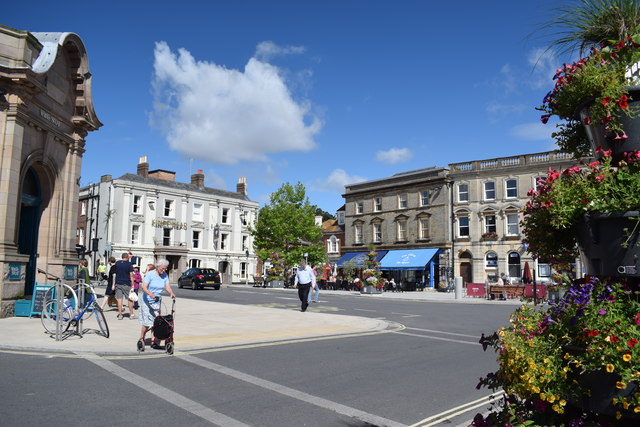
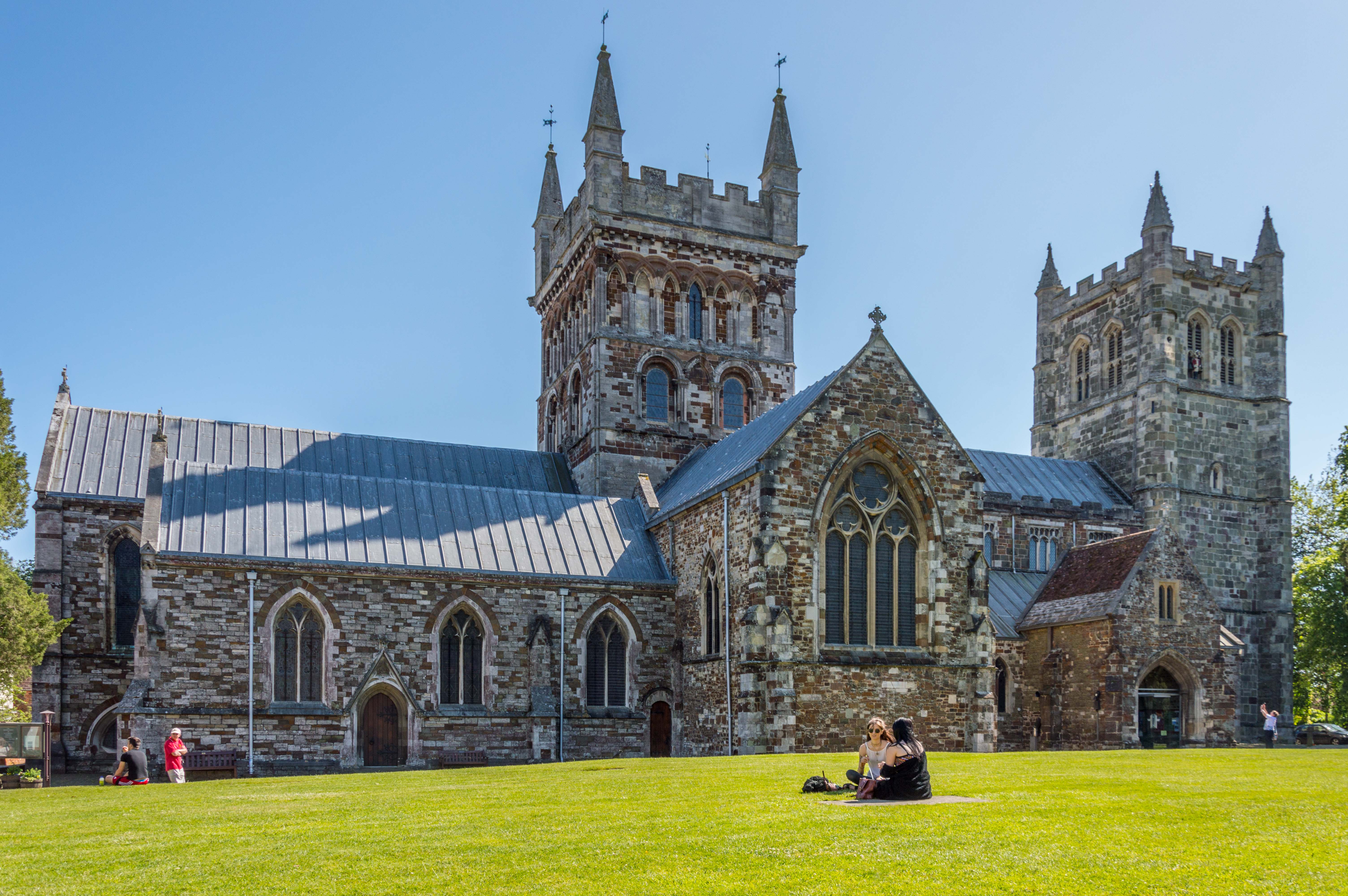
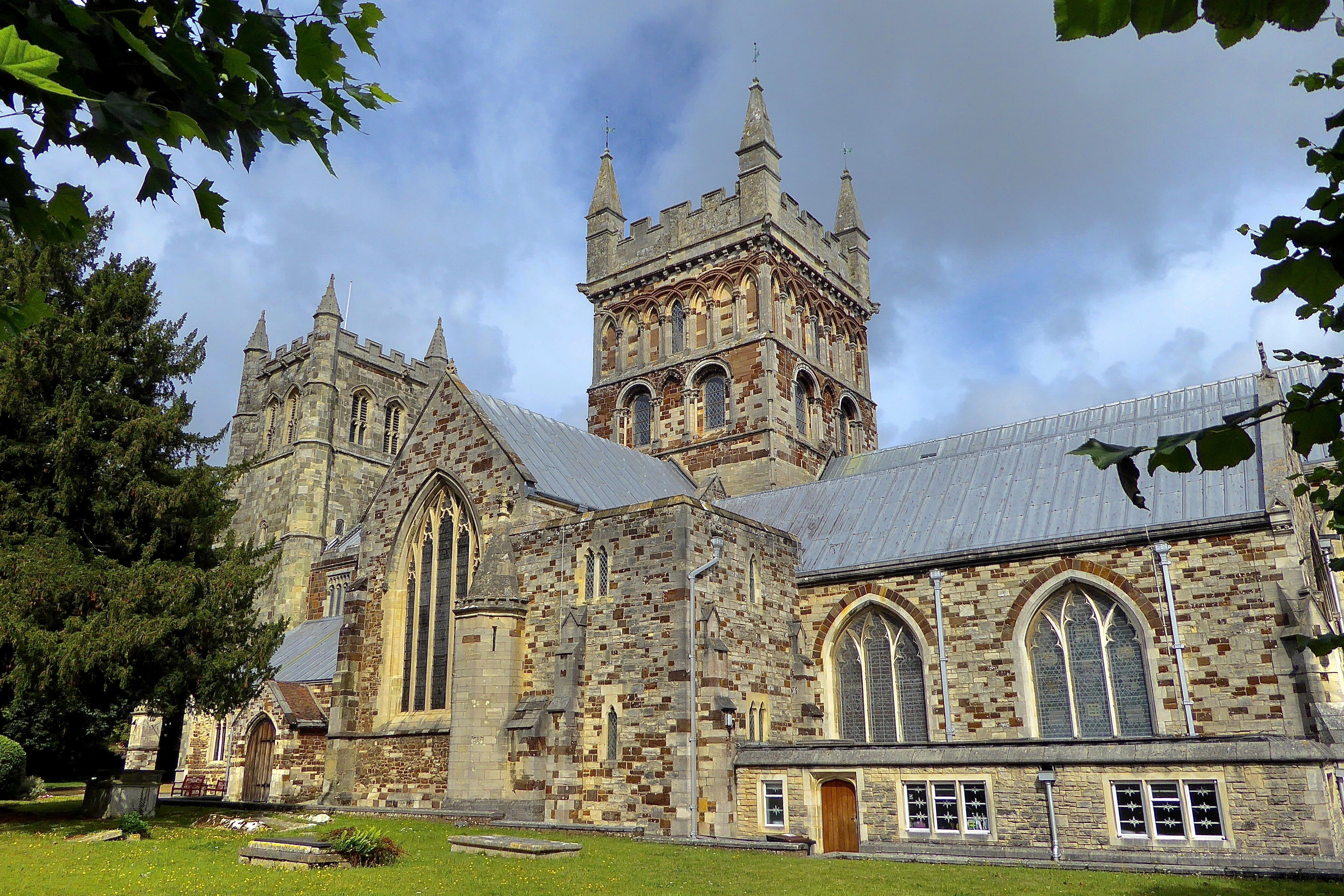
At the heart of Wimborne Minster is the historic market town of Wimborne, which dates back to the Saxon era. The town is known for its beautiful architecture, particularly the iconic Wimborne Minster church, a Grade I listed building that dominates the skyline. The church's origins can be traced back to the 8th century, with various additions and modifications made over the years. It is a major tourist attraction and serves as a vibrant place of worship.

Wimborne Minster offers a range of amenities and facilities, including local shops, restaurants, and pubs. The town has a strong sense of community and hosts regular events and festivals that draw visitors from near and far. The annual Wimborne Minster Folk Festival, for example, showcases traditional music and dance, attracting performers and enthusiasts from across the country.

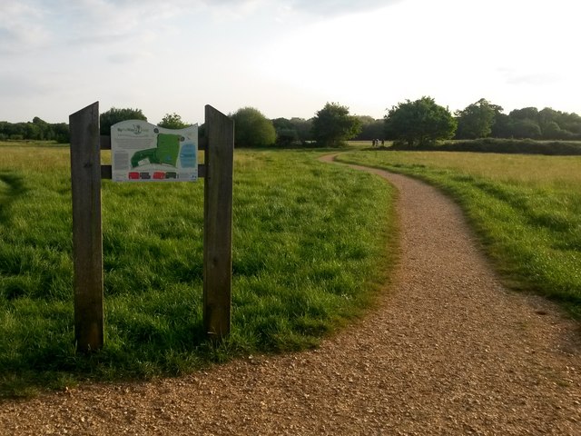
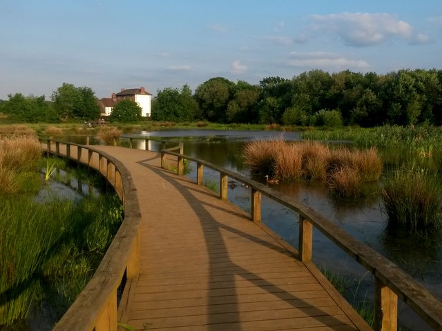
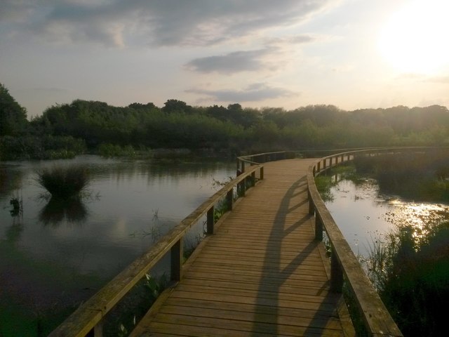
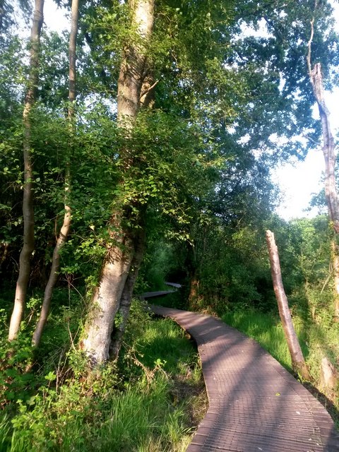
The parish is surrounded by picturesque countryside, including the nearby Moors Valley Country Park and Forest, which offers outdoor activities such as cycling, walking trails, and a treetop adventure course. The River Stour flows through the area, providing opportunities for water-based recreation.

Overall, Wimborne Minster, Dorset, is a charming and historic civil parish that combines a rich heritage with modern amenities, making it an appealing place to live and visit.

If you have any feedback on the listing, please let us know in the comments section below.

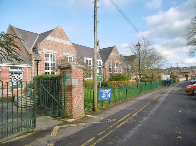
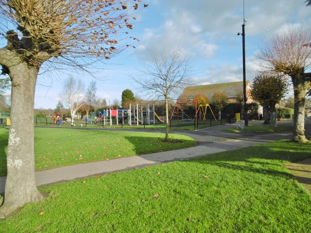
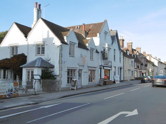
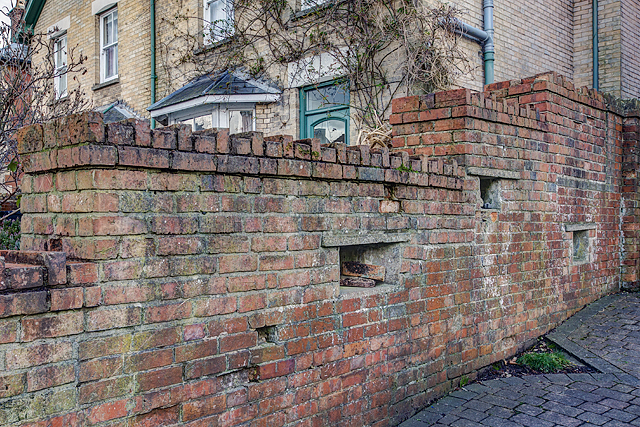
Wimborne Minster Images

Images are sourced within 2km of 50.798874/-1.977875 or Grid Reference SZ0199. Thanks to Geograph Open Source API. All images are credited.

Wimborne First School On School Lane, in a building dated 1911.
Wimborne First School
On School Lane, in a building dated 1911.
Wimborne, play area On Redcotts Recreation Ground, at the end of School Lane.
Wimborne, play area
On Redcotts Recreation Ground, at the end of School Lane.
Wimborne, Taphouse The latest addition to Wimborne's pub scene, opened in 2013 on West Borough. Straight bar to right, drinking front, left and back; simple decor with bare brick and wooden panelling, background music. Cask ales on offer at my visit: six, served on gravity, including two from the local Six Arch Brewery. <span class="nowrap"><a title="http://whatpub.com/pubs/SED/72/taphouse-wimborne" rel="nofollow ugc noopener" href="http://whatpub.com/pubs/SED/72/taphouse-wimborne">Link</a><img style="margin-left:2px;" alt="External link" title="External link - shift click to open in new window" src="https://s1.geograph.org.uk/img/external.png" width="10" height="10"/></span>
Wimborne, Taphouse
The latest addition to Wimborne's pub scene, opened in 2013 on West Borough. Straight bar to right, drinking front, left and back; simple decor with bare brick and wooden panelling, background music. Cask ales on offer at my visit: six, served on gravity, including two from the local Six Arch Brewery. LinkExternal link
Defending Dorset in 1940: Wimborne Anti-tank Island (1) -
Loopholed wall: DoB ID: e25267

Wimborne - West Borough - Loopholed Wall.  The only surviving structure in Wimborne of the town's defences when it was designated an anti-tank island in 1940. This loopholed wall between two properties in West Borough was built to bring fire to bear on the approach road from the crossing of the River Allen to the north. The house directly opposite (the Old Saddlery) on the other side of the road was also requisitioned at the time, and handed over to the Home Guard to be used as a defended house. The second floor with its tiny north-facing window overlooking the street, may have served as a discreet observation post.

<a href="https://www.geograph.org.uk/photo/4842582">SU0000 : Defending Dorset in 1940: Wimborne Anti-tank Island (2)</a>
Defending Dorset in 1940: Wimborne Anti-tank Island (1)
- Loopholed wall: DoB ID: e25267 Wimborne - West Borough - Loopholed Wall. The only surviving structure in Wimborne of the town's defences when it was designated an anti-tank island in 1940. This loopholed wall between two properties in West Borough was built to bring fire to bear on the approach road from the crossing of the River Allen to the north. The house directly opposite (the Old Saddlery) on the other side of the road was also requisitioned at the time, and handed over to the Home Guard to be used as a defended house. The second floor with its tiny north-facing window overlooking the street, may have served as a discreet observation post. SU0000 : Defending Dorset in 1940: Wimborne Anti-tank Island (2)
Defending Dorset in 1940: Wimborne Anti-tank Island (2) -
Loopholed wall: DoB ID: e25267

Wimborne - West Borough - Loopholed Wall.  A close-up of one of the three gunloops. Note that the construction of the aperture has been angled to the left of the photo and towards the direction of the perceived threat - the street outside.

<a href="https://www.geograph.org.uk/photo/4842581">SU0000 : Defending Dorset in 1940: Wimborne Anti-tank Island (1)</a>
Defending Dorset in 1940: Wimborne Anti-tank Island (2)
- Loopholed wall: DoB ID: e25267 Wimborne - West Borough - Loopholed Wall. A close-up of one of the three gunloops. Note that the construction of the aperture has been angled to the left of the photo and towards the direction of the perceived threat - the street outside. SU0000 : Defending Dorset in 1940: Wimborne Anti-tank Island (1)
Northleigh Lane The bridge over the old Southampton & Dorchester Railway on Northleigh Lane, saw its last passenger trains in 1964 and freight in 1974.
Northleigh Lane
The bridge over the old Southampton & Dorchester Railway on Northleigh Lane, saw its last passenger trains in 1964 and freight in 1974.
Colehill Lane Colehill Lane, near the entrance to St Michael's Middle School.
Colehill Lane
Colehill Lane, near the entrance to St Michael's Middle School.
Netherwood Mead towards the River Stour
The Square, Wimborne View across The Square towards The King's Head.
The Square, Wimborne
View across The Square towards The King's Head.
Old Milepost by the B3078, south west of Furzehill Cast iron post by the B3078, in parish of COLEHILL (EAST DORSET District), Wimborne, 150m South of turning to Furzehill, on grass verge by second lay-by, on West side of road. Poole cast iron post, erected by the Poole turnpike trust in the 19th century. 

Inscription reads:-
: 9 / CRAN- / -BORNE : : POOLE / TRUST : : 1 / WIM- / -BORNE :  

Milestone Society National ID: DO_CBWB09.
Old Milepost by the B3078, south west of Furzehill
Cast iron post by the B3078, in parish of COLEHILL (EAST DORSET District), Wimborne, 150m South of turning to Furzehill, on grass verge by second lay-by, on West side of road. Poole cast iron post, erected by the Poole turnpike trust in the 19th century. Inscription reads:- : 9 / CRAN- / -BORNE : : POOLE / TRUST : : 1 / WIM- / -BORNE : Milestone Society National ID: DO_CBWB09.
Isaac Gulliver's house, Wimborne Gulliver was a notorious smuggler based on the south coast of England during the 18th and 19th centuries.
Isaac Gulliver's house, Wimborne
Gulliver was a notorious smuggler based on the south coast of England during the 18th and 19th centuries.
Colehill: across Bytheway Field Looking westward across this vast, lovely open space from near the Churchmoor Road entrance, on its eastern side.

The information board proclaims it as "a great place for people and wildlife" and on an evening like this it was certainly very popular.

I recall in the early 1980s, as a child, passing the house called Bytheway just along here, and initially thinking it was Welsh!
Colehill: across Bytheway Field
Looking westward across this vast, lovely open space from near the Churchmoor Road entrance, on its eastern side. The information board proclaims it as "a great place for people and wildlife" and on an evening like this it was certainly very popular. I recall in the early 1980s, as a child, passing the house called Bytheway just along here, and initially thinking it was Welsh!
Colehill: across the pond at Bytheway Field The path rather splendidly goes across the northern corner of the wildlife pond in the centre of this fine open space, which has been established in relatively recent years.

It is the first SANG (Suitable Alternative Natural Green Space) in East Dorset district, and includes a self-led orienteering course. It is very well used by dog walkers and equally people just fancying a stroll in the fresh air.

One of the signboards proclaims Bytheway Field as "a great place for people and wildlife" which has a nice ring to it and is perhaps evidenced by the mallard taking her ducklings out for a swim, centre picture.
Colehill: across the pond at Bytheway Field
The path rather splendidly goes across the northern corner of the wildlife pond in the centre of this fine open space, which has been established in relatively recent years. It is the first SANG (Suitable Alternative Natural Green Space) in East Dorset district, and includes a self-led orienteering course. It is very well used by dog walkers and equally people just fancying a stroll in the fresh air. One of the signboards proclaims Bytheway Field as "a great place for people and wildlife" which has a nice ring to it and is perhaps evidenced by the mallard taking her ducklings out for a swim, centre picture.
Colehill: over the pond and into the sun Looking along the path that crosses the pond within Bytheway Field, in the opposite direction to <a href="https://www.geograph.org.uk/photo/5783609">SU0200 : Colehill: across the pond at Bytheway Field</a>.

Bytheway Field is the first SANG (Suitable Alternative Natural Green Space) in East Dorset district, and includes a self-led orienteering course. It is very well used by dog walkers and equally people just fancying a stroll in the fresh air.

One of the signboards proclaims Bytheway Field as "a great place for people and wildlife" which has a nice ring to it.
Colehill: over the pond and into the sun
Looking along the path that crosses the pond within Bytheway Field, in the opposite direction to SU0200 : Colehill: across the pond at Bytheway Field. Bytheway Field is the first SANG (Suitable Alternative Natural Green Space) in East Dorset district, and includes a self-led orienteering course. It is very well used by dog walkers and equally people just fancying a stroll in the fresh air. One of the signboards proclaims Bytheway Field as "a great place for people and wildlife" which has a nice ring to it.
Colehill: small footbridge in Bytheway Field Ahead is the rather lovely wildlife pond. See <a href="https://www.geograph.org.uk/photo/5783609">SU0200 : Colehill: across the pond at Bytheway Field</a> for more discussion on the Field.
Colehill: small footbridge in Bytheway Field
Ahead is the rather lovely wildlife pond. See SU0200 : Colehill: across the pond at Bytheway Field for more discussion on the Field.
Colehill: eastern edge of Leigh Common The Common features several paths - some gravelled and some, where necessary, elevated as a boardwalk - and is mainly woodland with a little open meadow.
Colehill: eastern edge of Leigh Common
The Common features several paths - some gravelled and some, where necessary, elevated as a boardwalk - and is mainly woodland with a little open meadow.
Colehill: boardwalk on Leigh Common The Common features several paths - some gravelled and some, where necessary, elevated as a boardwalk - and is mainly woodland with a little open meadow.

This boardwalk along the northern side of the common takes a rather splendidly meandering path.
Colehill: boardwalk on Leigh Common
The Common features several paths - some gravelled and some, where necessary, elevated as a boardwalk - and is mainly woodland with a little open meadow. This boardwalk along the northern side of the common takes a rather splendidly meandering path.
Wimborne Minster: ...but not close enough Pictured about 10 minutes after kick-off of the World Cup semi-final between England and Croatia, which England would lose 2-1 after extra time.

Three Lions Close is a modern development of infill housing around the back of the pub on the corner of West Street and Victoria Road, currently called the Minster Arms. The name has nothing to do with the England football team: the pub was previously known as the Pudding and Pye, before that the Pye Corner (the name of the junction), and originally the Three Lions, hence the name of the close.

See <a href="https://www.geograph.org.uk/photo/2785664">SU0000 : Wimborne, The Pudding and Pye</a> for the pub in its Pudding & Pye guise (in 2012), and
<a href="https://www.geograph.org.uk/photo/334906">SU0000 : Pye Corner</a> when it was the Pye Corner (2007).
Wimborne Minster: ...but not close enough
Pictured about 10 minutes after kick-off of the World Cup semi-final between England and Croatia, which England would lose 2-1 after extra time. Three Lions Close is a modern development of infill housing around the back of the pub on the corner of West Street and Victoria Road, currently called the Minster Arms. The name has nothing to do with the England football team: the pub was previously known as the Pudding and Pye, before that the Pye Corner (the name of the junction), and originally the Three Lions, hence the name of the close. See SU0000 : Wimborne, The Pudding and Pye for the pub in its Pudding & Pye guise (in 2012), and SU0000 : Pye Corner when it was the Pye Corner (2007).
Show me another place!

Wimborne Minster is located at Grid Ref: SZ0199 (Lat: 50.798874, Lng: -1.977875)

Administrative County: Dorset

District: East Dorset

Police Authority: Dorset

What 3 Words

///owls.describes.blaring. Near Wimborne Minster, Dorset

Related Wikis

Wimborne Market

Wimborne Market was an historic market in a large covered structure in Wimborne Minster, Dorset, England. It ceased to trade on 19 December 2021 after...

Wimborne railway station

Wimborne was a railway station in Wimborne Minster in the county of Dorset in England. Open from 1 June 1847 to 2 May 1977, it was sited just north of...

Wimborne Minster

Wimborne Minster (often referred to as Wimborne, ) is a market town in Dorset in South West England, and the name of the Church of England church in that...

Museum of East Dorset

The Museum of East Dorset (formerly known as the Priest's House Museum) is a local museum in the town of Wimborne Minster in Dorset, England. It is located...

River Allen, Dorset

The River Allen is a river in the county of Dorset in South West England. It flows for 14 miles (23 km) to its confluence with the River Stour immediately...

Wimborne Minster (church)

Wimborne Minster is the parish church of Wimborne, Dorset, England. The minster has existed for over 1300 years and is recognised for its unusual chained...

Wimborne Minster astronomical clock

Wimborne Minster astronomical clock is a fourteenth-century astronomical clock in Wimborne Minster in Dorset, regarded as "one of the most ancient working...

Colehill

Colehill is a parish neighbouring Wimborne Minster, in Dorset, England. It had a population of 7,000 in 2001, which shrunk slightly to 6,927 people at...

Nearby Amenities

Located within 500m of 50.798874,-1.977875
Mini Roundabout
Direction: clockwise
Lat/Long: 50.8004478/-1.9830173
Turning Circle
Lat/Long: 50.8014538/-1.9738632
Turning Circle
Lat/Long: 50.7998105/-1.9758261
Turning Circle
Lat/Long: 50.8014143/-1.9822528
Turning Circle
Lat/Long: 50.8018353/-1.9778774
Turning Circle
Lat/Long: 50.8001347/-1.9736947
Turning Circle
Lat/Long: 50.8006714/-1.9766007
Turning Circle
Lat/Long: 50.799571/-1.9764924
Turning Circle
Lat/Long: 50.8012951/-1.9726846
Pub
Cricketers
Addr County: Dorset
Addr Housenumber: 12
Addr Postcode: BH21 1LD
Addr Street: Park Lane
Addr Town: Wimborne Minster
Check Date Opening Hours: 2023-03-16
Fhrs Id: 1500636
Opening Hours Signed: no
Lat/Long: 50.7985145/-1.9847348
Bus Stop
Wimborne Police Station
Bearing: E
Bench: no
Bin: no
Bus: yes
Lit: no
Naptan AtcoCode: 1200POA10585
Naptan Indicator: E-bound
Naptan StopType: bus
Public Transport: platform
Shelter: no
Tactile Paving: no
Lat/Long: 50.8007185/-1.9836779
Bus Stop
Wimborne Police Station
Bearing: W
Bench: no
Bin: no
Bus: yes
Lit: no
Naptan AtcoCode: 1200POA10586
Naptan Indicator: W-bound
Naptan StopType: bus
Public Transport: platform
Shelter: no
Tactile Paving: no
Lat/Long: 50.8006297/-1.9842824
Bus Stop
St John's Church
Bearing: N
Bench: yes
Bin: no
Bus: yes
Lit: yes
Naptan AtcoCode: 1200POA10639
Naptan Indicator: N-bound
Naptan StopType: bus
Public Transport: platform
Shelter: yes
Tactile Paving: no
Lat/Long: 50.7983544/-1.978143
Bus Stop
St John's Church
Bearing: S
Bench: yes
Bin: no
Bus: yes
Lit: no
Naptan AtcoCode: 1200POA10638
Naptan Indicator: S-bound
Naptan StopType: bus
Public Transport: platform
Shelter: yes
Tactile Paving: no
Lat/Long: 50.7981889/-1.977989
Fast Food
Long John's Fish & Chips
Addr County: Dorset
Addr Housenumber: 73A
Addr Postcode: BH21 2AA
Addr Street: Leigh Road
Addr Town: Wimborne Minster
Contact Phone: +44 1202 883119
Contact Website: http://www.longjohnsfishandchips.co.uk/
Cuisine: fish_and_chips
Fhrs Id: 1598455
Opening Hours: Mo-Th 12:00-14:00,16:30-21:00; Fr-Sa 12:30-14:00,16:30-21:30; Su 16:30-21:00
Takeaway: only
Lat/Long: 50.7979394/-1.9776908
Bus Stop
Quarter Jack Surgery
Bearing: N
Bench: no
Bin: no
Bus: yes
Lit: no
Naptan AtcoCode: 1200POA10588
Naptan Indicator: N-bound
Naptan StopType: bus
Public Transport: platform
Shelter: no
Tactile Paving: no
Lat/Long: 50.7982776/-1.9825085
Bus Stop
Quarter Jack Surgery
Bearing: SE
Bench: no
Bin: no
Bus: yes
Lit: yes
Naptan AtcoCode: 1200POA10587
Naptan Indicator: SE-bound
Naptan StopType: bus
Public Transport: platform
Shelter: no
Tactile Paving: no
Lat/Long: 50.7982554/-1.9822115
Pub
Coach and Horses
Addr County: Dorset
Addr Housenumber: 73
Addr Postcode: BH21 1QB
Addr Street: Poole Road
Addr Town: Wimborne Minster
Brand: Greene King
Brand Wikidata: Q5564162
Fhrs Id: 1598334
Indoor Seating: yes
Opening Hours: Mo-Su 11:00-18:00+
Outdoor Seating: yes
Website: https://www.greeneking.co.uk/pubs/dorset/coach-and-horses
Lat/Long: 50.7950459/-1.9812618
Restaurant
Wimborne Tandoori
Addr County: Dorset
Addr Housenumber: 2
Addr Postcode: BH21 1AF
Addr Street: Leigh Road
Addr Town: Wimborne Minster
Fhrs Id: 1534273
Opening Hours Signed: no
Lat/Long: 50.797968/-1.9839852
Crossing
Button Operated: no
Crossing: traffic_signals
Crossing Ref: pelican
Tactile Paving: yes
Traffic Signals Sound: yes
Traffic Signals Vibration: no
Lat/Long: 50.797774/-1.9827413
Turning Circle
Lat/Long: 50.802365/-1.9770108
Turning Circle
Lat/Long: 50.8028242/-1.9796743
Mini Roundabout
Direction: clockwise
Lat/Long: 50.7991106/-1.9832366
Mini Roundabout
Direction: clockwise
Lat/Long: 50.7989453/-1.9839088
Barrier: bollard
Bollard: fixed
Lat/Long: 50.8001533/-1.9829701
Crossing
Crossing: zebra
Tactile Paving: no
Lat/Long: 50.7994245/-1.9835232
Post Box
Ref: BH21 2
Ref GB Uprn: 10015429693
Lat/Long: 50.8014561/-1.9781217
Post Box
Ref: BH21 1
Ref GB Uprn: 10015383133
Lat/Long: 50.7985946/-1.9780251
Post Box
Collection Times: Mo-Fr 05:15, Sa 12:15
Ref: BH21 216
Ref GB Uprn: 10015473028
Royal Cypher: scottish_crown
Lat/Long: 50.7984318/-1.9824132
Post Box
Collection Times: Mo-Fr 05:15, Sa 11:00
Ref: BH21 5
Royal Cypher: no
Lat/Long: 50.7951768/-1.9790658
Traffic Signals
Button Operated: no
Crossing: traffic_signals
Crossing Ref: pelican
Tactile Paving: yes
Traffic Signals Sound: yes
Traffic Signals Vibration: yes
Lat/Long: 50.7985616/-1.9826185
Man Made: surveillance
Lat/Long: 50.7987894/-1.9849576
Street Lamp
Lat/Long: 50.7987821/-1.9849434
Barrier: bollard
Lat/Long: 50.7988197/-1.9848632
Barrier: bollard
Lat/Long: 50.798806/-1.9848509
Atm
Check Date: 2021-09-25
Operator: John Lewis Finance
Lat/Long: 50.7993749/-1.9840311
Crossing
Button Operated: yes
Crossing: traffic_signals
Crossing Ref: toucan
Tactile Paving: yes
Lat/Long: 50.8006715/-1.9840861
Bicycle Parking
Bicycle Parking: stands
Capacity: 24
Covered: no
Lat/Long: 50.7992533/-1.9842158
Bus Stop
Coach & Horses
Bearing: N
Bench: no
Bin: no
Bus: yes
Lit: no
Naptan AtcoCode: 1200POA10640
Naptan Indicator: N-bound
Naptan StopType: bus
Public Transport: platform
Shelter: no
Tactile Paving: no
Lat/Long: 50.7956152/-1.9822246
Bus Stop
Top of St John's Hill
Bearing: N
Bus: yes
Naptan AtcoCode: 1200POA10637
Naptan Indicator: N-bound
Naptan StopType: bus
Public Transport: platform
Lat/Long: 50.8007906/-1.9783367
Bus Stop
Coach & Horses
Bearing: SE
Bench: no
Bin: no
Bus: yes
Lit: no
Naptan AtcoCode: 1200POA10641
Naptan Indicator: SE-bound
Naptan StopType: bus
Public Transport: platform
Shelter: no
Tactile Paving: no
Lat/Long: 50.7955235/-1.9819235
Bus Stop
Top of St John's Hill
Bearing: S
Bench: no
Bin: no
Bus: yes
Lit: no
Naptan AtcoCode: 1200POA10636
Naptan Indicator: S-bound
Naptan StopType: bus
Public Transport: platform
Shelter: no
Tactile Paving: no
Lat/Long: 50.8009165/-1.9782089
Bus Stop
Avenue Road
Bearing: W
Bench: no
Bin: no
Bus: yes
Lit: yes
Naptan AtcoCode: 1200POA10589
Naptan Indicator: W-bound
Naptan StopType: bus
Public Transport: platform
Shelter: yes
Tactile Paving: no
Lat/Long: 50.7977602/-1.978707
Fuel
Brand: BP
Lat/Long: 50.7977759/-1.9760907
Bus Stop
Gordon Road
Bench: yes
Bin: yes
Bus: yes
Lit: yes
Naptan AtcoCode: 1200POA10591
Naptan Bearing: W
Naptan CommonName: Gordon Road
Naptan Indicator: W-bound
Naptan NaptanCode: dordawgt
Naptan PlusbusZoneRef: BOMO
Naptan Street: Leigh Road
Naptan Verified: no
Public Transport: platform
Shelter: yes
Tactile Paving: no
Lat/Long: 50.7978971/-1.9712922
Bus Stop
Grenville Road
Bus: yes
Naptan AtcoCode: 1200POA10590
Naptan Bearing: E
Naptan CommonName: St John's Hill
Naptan Indicator: E-bound
Naptan NaptanCode: dordatwd
Naptan PlusbusZoneRef: BOMO
Naptan Street: Leigh Road
Naptan Verified: no
Public Transport: platform
Lat/Long: 50.7979861/-1.9759646
Bicycle Repair Station
Hewett Cycle Services
Description: Cycle repair and maintenance. Tel: 0784 308 9526.
Opening Hours: By appointment
Operator: Hewett Cycle Services
Service Bicycle Repair: yes
Lat/Long: 50.7962511/-1.9779272
Frequency: 50
Location: outdoor
Power: transformer
Source: bing
Voltage Primary: 33000
Voltage Secondary: 11000
Lat/Long: 50.7993161/-1.9723517
Frequency: 50
Location: outdoor
Power: transformer
Source: bing
Voltage Primary: 33000
Voltage Secondary: 11000
Lat/Long: 50.799433/-1.972176
Bicycle Rental
St John's Hill
Bicycle Rental: dropoff_point
Capacity: 10
Email: support@beryl.cc
Fee: yes
Name Signed: no
Network: Beryl - Bournemouth Poole Christchurch
Official Name: St John's Hill
Operator: Beryl
Operator Wikidata: Q106575369
Payment App: yes
Payment App Android: cc.beryl.basis
Payment App Ios: 1386768364
Payment Cash: no
Payment Credit Cards: no
Payment Cryptocurrencies: no
Payment Debit Cards: no
Payment Electronic Purses: no
Phone: +44 20 3003 5044
Ref Gbfs: beryl_bcp:4018
Rental: city_bike
Website: https://beryl.cc/scheme/bournemouth-christchurch-and-poole
Lat/Long: 50.800548/-1.978164
Bicycle Rental
The Quarter Jack Surgery
Bicycle Rental: dropoff_point
Capacity: 10
Email: support@beryl.cc
Fee: yes
Name Signed: no
Network: Beryl - Bournemouth Poole Christchurch
Official Name: The Quarter Jack Surgery
Operator: Beryl
Operator Wikidata: Q106575369
Payment App: yes
Payment App Android: cc.beryl.basis
Payment App Ios: 1386768364
Payment Cash: no
Payment Credit Cards: no
Payment Cryptocurrencies: no
Payment Debit Cards: no
Payment Electronic Purses: no
Phone: +44 20 3003 5044
Ref Gbfs: beryl_bcp:3980
Rental: city_bike
Website: https://beryl.cc/scheme/bournemouth-christchurch-and-poole
Lat/Long: 50.798051/-1.981997
Barrier: bollard
Lat/Long: 50.797618/-1.9755579
Barrier: bollard
Lat/Long: 50.7976191/-1.9755381
Barrier: bollard
Lat/Long: 50.7976197/-1.975518
Barrier: bollard
Lat/Long: 50.7976206/-1.9754989
Barrier: bollard
Lat/Long: 50.7976214/-1.9754808
Wimborne Motors
Addr Postcode: BH21 1RF
Addr Street: Station Terrace
Email: Info@wimbornemotors.co.uk
Phone: +44 1202 883534
Shop: car_repair
Website: http://www.wimbornemotors.co.uk/
Lat/Long: 50.7951073/-1.9769958
Addr Postcode: BH21 1AQ
Addr Street: Leigh Road
Shop: convenience
Lat/Long: 50.7977686/-1.9801368
The data included in this document is from www.openstreetmap.org. The data is made available under ODbL.

Have you been to Wimborne Minster?

Leave your review of Wimborne Minster below (or comments, questions and feedback).