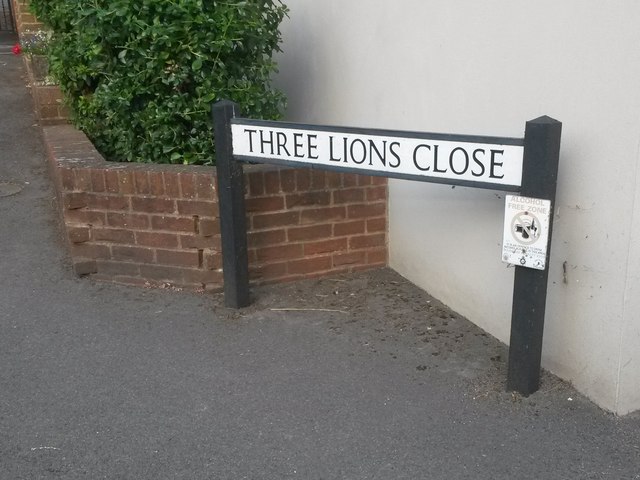
East Brook

Settlement in Dorset

England

East Brook

Wimborne First School On School Lane, in a building dated 1911.
Wimborne First School Credit: Mike Faherty

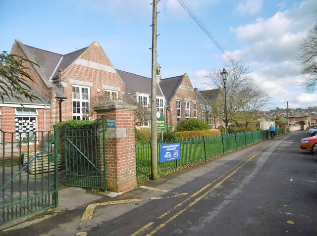
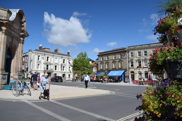
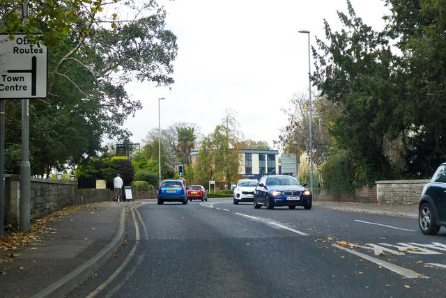
East Brook is a picturesque village located in the county of Dorset, England. Situated about 8 miles west of the county town of Dorchester, it is nestled in the breathtaking countryside of the West Dorset Area of Outstanding Natural Beauty. The village is known for its idyllic setting, with rolling hills, charming thatched cottages, and meandering brooks that add to its rustic charm.

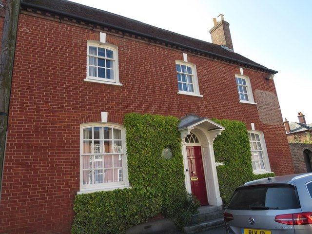
East Brook is a small and close-knit community, consisting of approximately 200 residents. The village is known for its strong sense of community spirit and friendly atmosphere. The locals take great pride in maintaining the village's traditional character and preserving its historical buildings.

The heart of East Brook is its historic parish church, St. Mary's, which dates back to the 12th century. The church serves as a focal point for the community, hosting regular services as well as social events. The village also boasts a traditional pub, The Brook Arms, which offers a warm welcome to both locals and visitors alike.

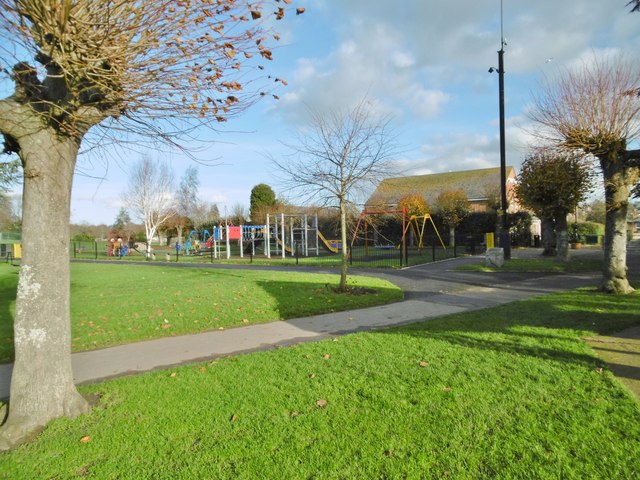
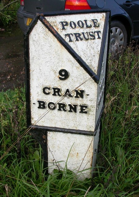
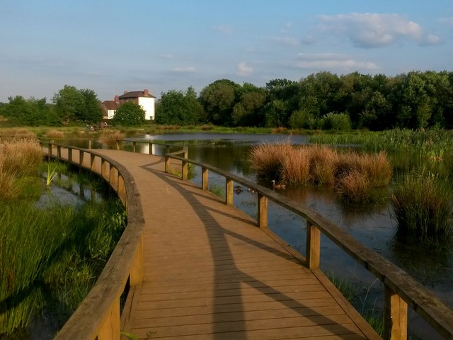
Surrounded by stunning countryside, East Brook provides ample opportunities for outdoor activities and exploration. The nearby Wessex Ridgeway offers scenic walking and cycling routes, allowing visitors to immerse themselves in the natural beauty of the area. The village is also conveniently located near several popular tourist attractions, including the famous Jurassic Coast, which is a UNESCO World Heritage Site.

In conclusion, East Brook is a charming and picturesque village in Dorset, offering a tranquil and friendly community atmosphere, beautiful natural surroundings, and easy access to the region's notable attractions.

If you have any feedback on the listing, please let us know in the comments section below.
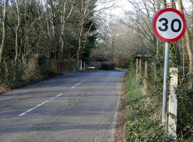
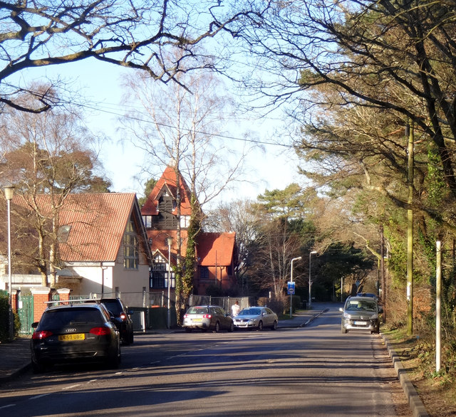
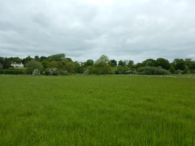
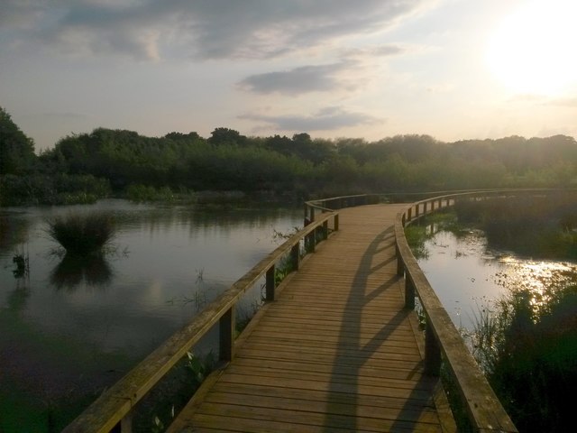
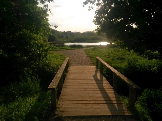
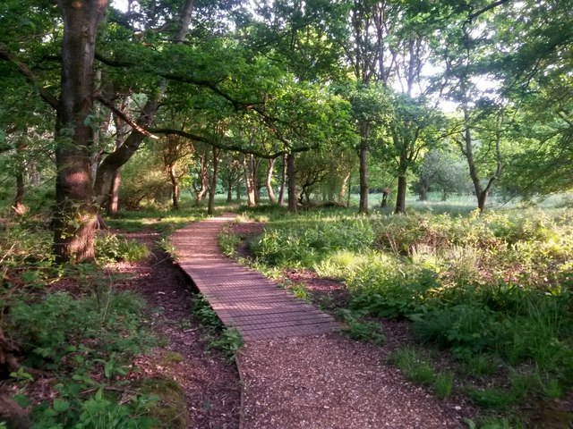
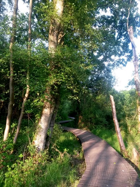
East Brook Images

Images are sourced within 2km of 50.798579/-1.9847229 or Grid Reference SZ0199. Thanks to Geograph Open Source API. All images are credited.

Wimborne First School On School Lane, in a building dated 1911.
Wimborne First School
On School Lane, in a building dated 1911.
Wimborne, play area On Redcotts Recreation Ground, at the end of School Lane.
Wimborne, play area
On Redcotts Recreation Ground, at the end of School Lane.
Wimborne, Taphouse The latest addition to Wimborne's pub scene, opened in 2013 on West Borough. Straight bar to right, drinking front, left and back; simple decor with bare brick and wooden panelling, background music. Cask ales on offer at my visit: six, served on gravity, including two from the local Six Arch Brewery. <span class="nowrap"><a title="http://whatpub.com/pubs/SED/72/taphouse-wimborne" rel="nofollow ugc noopener" href="http://whatpub.com/pubs/SED/72/taphouse-wimborne">Link</a><img style="margin-left:2px;" alt="External link" title="External link - shift click to open in new window" src="https://s1.geograph.org.uk/img/external.png" width="10" height="10"/></span>
Wimborne, Taphouse
The latest addition to Wimborne's pub scene, opened in 2013 on West Borough. Straight bar to right, drinking front, left and back; simple decor with bare brick and wooden panelling, background music. Cask ales on offer at my visit: six, served on gravity, including two from the local Six Arch Brewery. LinkExternal link
Defending Dorset in 1940: Wimborne Anti-tank Island (1) -
Loopholed wall: DoB ID: e25267

Wimborne - West Borough - Loopholed Wall.  The only surviving structure in Wimborne of the town's defences when it was designated an anti-tank island in 1940. This loopholed wall between two properties in West Borough was built to bring fire to bear on the approach road from the crossing of the River Allen to the north. The house directly opposite (the Old Saddlery) on the other side of the road was also requisitioned at the time, and handed over to the Home Guard to be used as a defended house. The second floor with its tiny north-facing window overlooking the street, may have served as a discreet observation post.

<a href="https://www.geograph.org.uk/photo/4842582">SU0000 : Defending Dorset in 1940: Wimborne Anti-tank Island (2)</a>
Defending Dorset in 1940: Wimborne Anti-tank Island (1)
- Loopholed wall: DoB ID: e25267 Wimborne - West Borough - Loopholed Wall. The only surviving structure in Wimborne of the town's defences when it was designated an anti-tank island in 1940. This loopholed wall between two properties in West Borough was built to bring fire to bear on the approach road from the crossing of the River Allen to the north. The house directly opposite (the Old Saddlery) on the other side of the road was also requisitioned at the time, and handed over to the Home Guard to be used as a defended house. The second floor with its tiny north-facing window overlooking the street, may have served as a discreet observation post. SU0000 : Defending Dorset in 1940: Wimborne Anti-tank Island (2)
Defending Dorset in 1940: Wimborne Anti-tank Island (2) -
Loopholed wall: DoB ID: e25267

Wimborne - West Borough - Loopholed Wall.  A close-up of one of the three gunloops. Note that the construction of the aperture has been angled to the left of the photo and towards the direction of the perceived threat - the street outside.

<a href="https://www.geograph.org.uk/photo/4842581">SU0000 : Defending Dorset in 1940: Wimborne Anti-tank Island (1)</a>
Defending Dorset in 1940: Wimborne Anti-tank Island (2)
- Loopholed wall: DoB ID: e25267 Wimborne - West Borough - Loopholed Wall. A close-up of one of the three gunloops. Note that the construction of the aperture has been angled to the left of the photo and towards the direction of the perceived threat - the street outside. SU0000 : Defending Dorset in 1940: Wimborne Anti-tank Island (1)
Northleigh Lane The bridge over the old Southampton & Dorchester Railway on Northleigh Lane, saw its last passenger trains in 1964 and freight in 1974.
Northleigh Lane
The bridge over the old Southampton & Dorchester Railway on Northleigh Lane, saw its last passenger trains in 1964 and freight in 1974.
Colehill Lane Colehill Lane, near the entrance to St Michael's Middle School.
Colehill Lane
Colehill Lane, near the entrance to St Michael's Middle School.
Netherwood Mead towards the River Stour
The Square, Wimborne View across The Square towards The King's Head.
The Square, Wimborne
View across The Square towards The King's Head.
Old Milepost by the B3078, south west of Furzehill Cast iron post by the B3078, in parish of COLEHILL (EAST DORSET District), Wimborne, 150m South of turning to Furzehill, on grass verge by second lay-by, on West side of road. Poole cast iron post, erected by the Poole turnpike trust in the 19th century. 

Inscription reads:-
: 9 / CRAN- / -BORNE : : POOLE / TRUST : : 1 / WIM- / -BORNE :  

Milestone Society National ID: DO_CBWB09.
Old Milepost by the B3078, south west of Furzehill
Cast iron post by the B3078, in parish of COLEHILL (EAST DORSET District), Wimborne, 150m South of turning to Furzehill, on grass verge by second lay-by, on West side of road. Poole cast iron post, erected by the Poole turnpike trust in the 19th century. Inscription reads:- : 9 / CRAN- / -BORNE : : POOLE / TRUST : : 1 / WIM- / -BORNE : Milestone Society National ID: DO_CBWB09.
Isaac Gulliver's house, Wimborne Gulliver was a notorious smuggler based on the south coast of England during the 18th and 19th centuries.
Isaac Gulliver's house, Wimborne
Gulliver was a notorious smuggler based on the south coast of England during the 18th and 19th centuries.
Colehill: across the pond at Bytheway Field The path rather splendidly goes across the northern corner of the wildlife pond in the centre of this fine open space, which has been established in relatively recent years.

It is the first SANG (Suitable Alternative Natural Green Space) in East Dorset district, and includes a self-led orienteering course. It is very well used by dog walkers and equally people just fancying a stroll in the fresh air.

One of the signboards proclaims Bytheway Field as "a great place for people and wildlife" which has a nice ring to it and is perhaps evidenced by the mallard taking her ducklings out for a swim, centre picture.
Colehill: across the pond at Bytheway Field
The path rather splendidly goes across the northern corner of the wildlife pond in the centre of this fine open space, which has been established in relatively recent years. It is the first SANG (Suitable Alternative Natural Green Space) in East Dorset district, and includes a self-led orienteering course. It is very well used by dog walkers and equally people just fancying a stroll in the fresh air. One of the signboards proclaims Bytheway Field as "a great place for people and wildlife" which has a nice ring to it and is perhaps evidenced by the mallard taking her ducklings out for a swim, centre picture.
Colehill: over the pond and into the sun Looking along the path that crosses the pond within Bytheway Field, in the opposite direction to <a href="https://www.geograph.org.uk/photo/5783609">SU0200 : Colehill: across the pond at Bytheway Field</a>.

Bytheway Field is the first SANG (Suitable Alternative Natural Green Space) in East Dorset district, and includes a self-led orienteering course. It is very well used by dog walkers and equally people just fancying a stroll in the fresh air.

One of the signboards proclaims Bytheway Field as "a great place for people and wildlife" which has a nice ring to it.
Colehill: over the pond and into the sun
Looking along the path that crosses the pond within Bytheway Field, in the opposite direction to SU0200 : Colehill: across the pond at Bytheway Field. Bytheway Field is the first SANG (Suitable Alternative Natural Green Space) in East Dorset district, and includes a self-led orienteering course. It is very well used by dog walkers and equally people just fancying a stroll in the fresh air. One of the signboards proclaims Bytheway Field as "a great place for people and wildlife" which has a nice ring to it.
Colehill: small footbridge in Bytheway Field Ahead is the rather lovely wildlife pond. See <a href="https://www.geograph.org.uk/photo/5783609">SU0200 : Colehill: across the pond at Bytheway Field</a> for more discussion on the Field.
Colehill: small footbridge in Bytheway Field
Ahead is the rather lovely wildlife pond. See SU0200 : Colehill: across the pond at Bytheway Field for more discussion on the Field.
Colehill: eastern edge of Leigh Common The Common features several paths - some gravelled and some, where necessary, elevated as a boardwalk - and is mainly woodland with a little open meadow.
Colehill: eastern edge of Leigh Common
The Common features several paths - some gravelled and some, where necessary, elevated as a boardwalk - and is mainly woodland with a little open meadow.
Colehill: boardwalk on Leigh Common The Common features several paths - some gravelled and some, where necessary, elevated as a boardwalk - and is mainly woodland with a little open meadow.

This boardwalk along the northern side of the common takes a rather splendidly meandering path.
Colehill: boardwalk on Leigh Common
The Common features several paths - some gravelled and some, where necessary, elevated as a boardwalk - and is mainly woodland with a little open meadow. This boardwalk along the northern side of the common takes a rather splendidly meandering path.
Wimborne Minster: ...but not close enough Pictured about 10 minutes after kick-off of the World Cup semi-final between England and Croatia, which England would lose 2-1 after extra time.

Three Lions Close is a modern development of infill housing around the back of the pub on the corner of West Street and Victoria Road, currently called the Minster Arms. The name has nothing to do with the England football team: the pub was previously known as the Pudding and Pye, before that the Pye Corner (the name of the junction), and originally the Three Lions, hence the name of the close.

See <a href="https://www.geograph.org.uk/photo/2785664">SU0000 : Wimborne, The Pudding and Pye</a> for the pub in its Pudding & Pye guise (in 2012), and
<a href="https://www.geograph.org.uk/photo/334906">SU0000 : Pye Corner</a> when it was the Pye Corner (2007).
Wimborne Minster: ...but not close enough
Pictured about 10 minutes after kick-off of the World Cup semi-final between England and Croatia, which England would lose 2-1 after extra time. Three Lions Close is a modern development of infill housing around the back of the pub on the corner of West Street and Victoria Road, currently called the Minster Arms. The name has nothing to do with the England football team: the pub was previously known as the Pudding and Pye, before that the Pye Corner (the name of the junction), and originally the Three Lions, hence the name of the close. See SU0000 : Wimborne, The Pudding and Pye for the pub in its Pudding & Pye guise (in 2012), and SU0000 : Pye Corner when it was the Pye Corner (2007).
Hanham Road, Wimborne Minster
Show me another place!

East Brook is located at Grid Ref: SZ0199 (Lat: 50.798579, Lng: -1.9847229)

Unitary Authority: Dorset

Police Authority: Dorset

What 3 Words

///waged.truffles.shark. Near Wimborne Minster, Dorset

Related Wikis

Museum of East Dorset

The Museum of East Dorset (formerly known as the Priest's House Museum) is a local museum in the town of Wimborne Minster in Dorset, England. It is located...

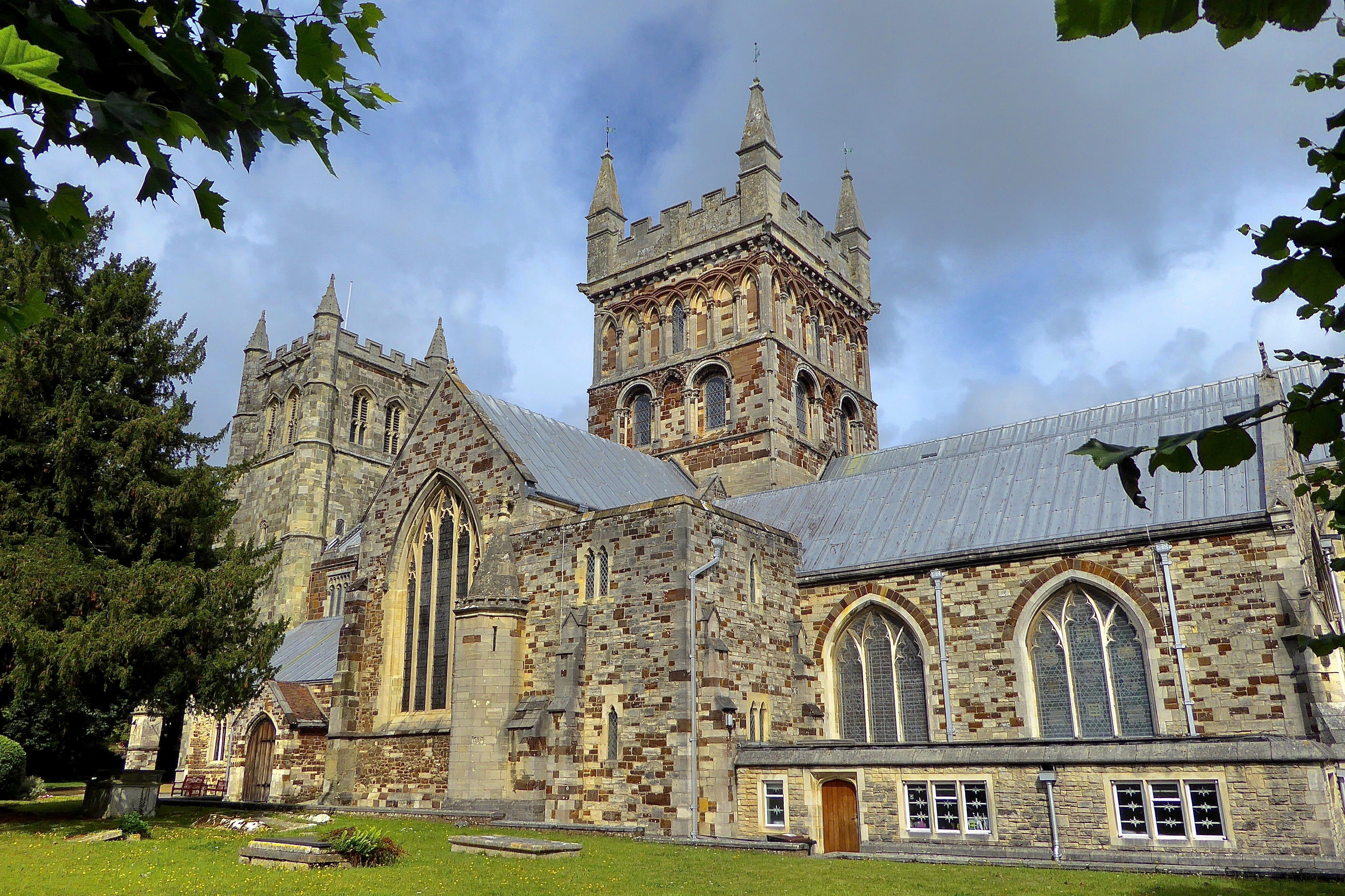
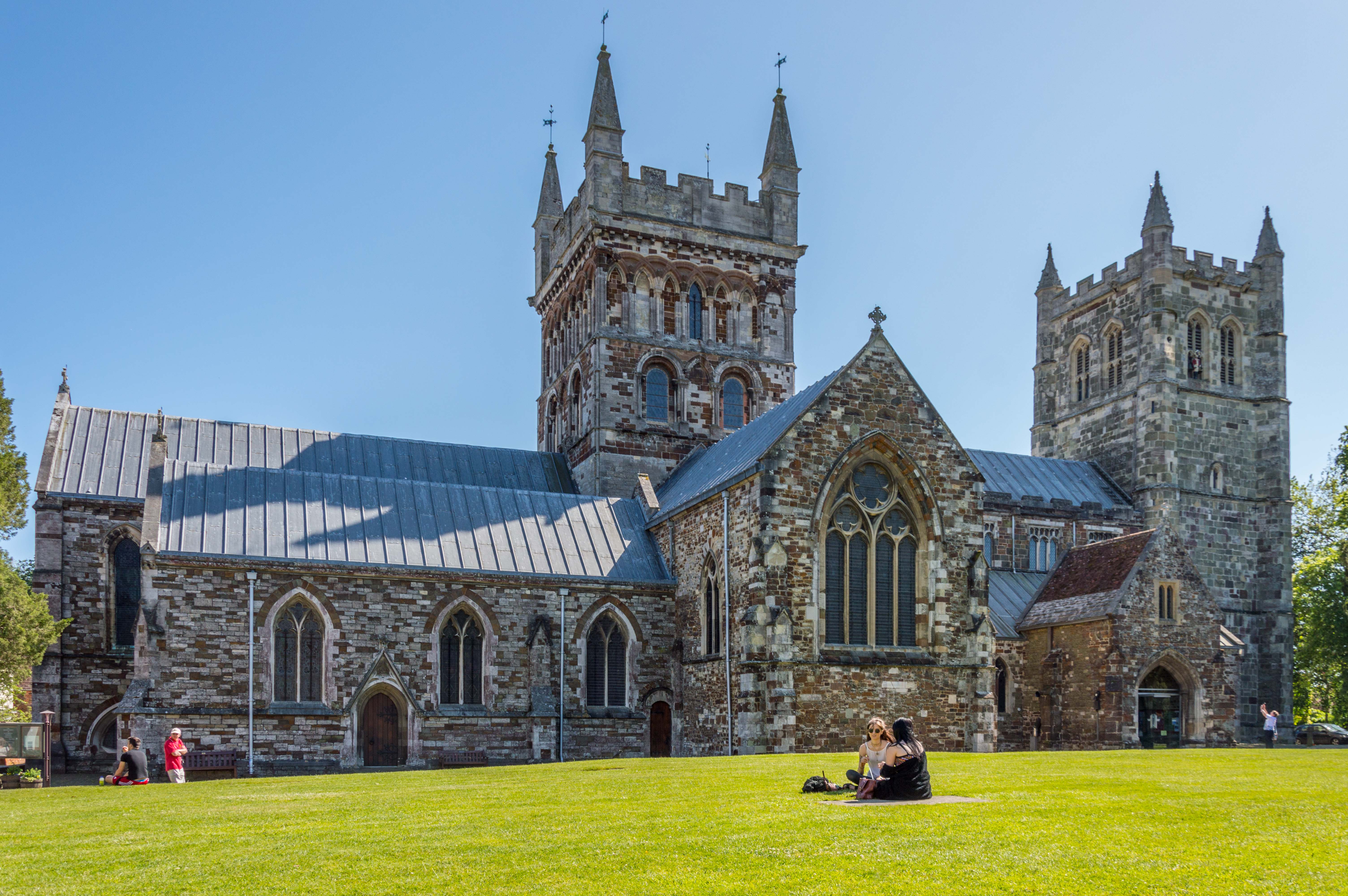
Wimborne Minster (church)

Wimborne Minster is the parish church of Wimborne, Dorset, England. The minster has existed for over 1300 years and is recognised for its unusual chained...

Wimborne Minster astronomical clock

Wimborne Minster astronomical clock is a fourteenth-century astronomical clock in Wimborne Minster in Dorset, regarded as "one of the most ancient working...

Wimborne Model Town

Wimborne Model Town, situated on the edge of the town of Wimborne Minster, Dorset, England, is one of the largest and most established model towns in England...

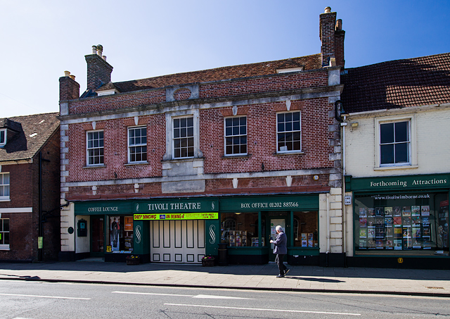
Tivoli Theatre (Wimborne Minster)

The Tivoli Theatre in Wimborne Minster, Dorset, England, was built in 1936 as a theatre and cinema. It has a variety of Art Deco features, including original...

Wimborne Market

Wimborne Market was an historic market in a large covered structure in Wimborne Minster, Dorset, England. It ceased to trade on 19 December 2021 after...

Wimborne railway station

Wimborne was a railway station in Wimborne Minster in the county of Dorset in England. Open from 1 June 1847 to 2 May 1977, it was sited just north of...

Wimborne Minster

Wimborne Minster (often referred to as Wimborne, ) is a market town in Dorset in South West England, and the name of the Church of England church in that...

Nearby Amenities

Located within 500m of 50.798579,-1.9847229
Wimborne Minster
Place: town
Wikidata: Q535233
Wikipedia: en:Wimborne Minster
Lat/Long: 50.7995189/-1.987339
Mini Roundabout
Direction: clockwise
Lat/Long: 50.800742/-1.9845334
Mini Roundabout
Direction: clockwise
Lat/Long: 50.8004478/-1.9830173
Mini Roundabout
Direction: clockwise
Lat/Long: 50.8007249/-1.9853318
Pub
The Rising Sun
Addr Country: GB
Addr County: Dorset
Addr Housenumber: 38
Addr Postcode: BH21 1DX
Addr Street: East Street
Addr Town: Wimborne Minster
Brand: Hall & Woodhouse
Brand Wikidata: Q5642555
Brand Wikipedia: en:Hall & Woodhouse
Fhrs Id: 1598520
Opening Hours Signed: no
Wikidata: Q26591392
Lat/Long: 50.7982374/-1.9856438
Bench
Backrest: yes
Check Date: 2021-08-14
Lat/Long: 50.8017958/-1.9880649
Doctors
The Old Dispensary
Healthcare: doctor
Lat/Long: 50.8020643/-1.9870266
Turning Circle
Lat/Long: 50.8014143/-1.9822528
Pub
Oddfellows
Addr Country: GB
Addr County: Dorset
Addr Housenumber: 2
Addr Postcode: BH21 1JH
Addr Street: Church Street
Addr Town: Wimborne Minster
Brand: Hall & Woodhouse
Brand Wikidata: Q5642555
Brand Wikipedia: en:Hall & Woodhouse
Fhrs Id: 1526034
Lat/Long: 50.7998303/-1.9882646
Pub
Cricketers
Addr County: Dorset
Addr Housenumber: 12
Addr Postcode: BH21 1LD
Addr Street: Park Lane
Addr Town: Wimborne Minster
Check Date Opening Hours: 2023-03-16
Fhrs Id: 1500636
Opening Hours Signed: no
Lat/Long: 50.7985145/-1.9847348
Pub
The White Hart
Addr County: Dorset
Addr Housename: Corn Market
Addr Housenumber: 6
Addr Postcode: BH21 1JL
Addr Street: Corn Market
Addr Town: Wimborne Minster
Fhrs Id: 1598500
Website: http://www.whitehartwimborne.co.uk/
Wikidata: Q26412875
Lat/Long: 50.7993469/-1.9890623
Bus Stop
Wimborne Police Station
Bearing: E
Bench: no
Bin: no
Bus: yes
Lit: no
Naptan AtcoCode: 1200POA10585
Naptan Indicator: E-bound
Naptan StopType: bus
Public Transport: platform
Shelter: no
Tactile Paving: no
Lat/Long: 50.8007185/-1.9836779
Bus Stop
Wimborne Police Station
Bearing: W
Bench: no
Bin: no
Bus: yes
Lit: no
Naptan AtcoCode: 1200POA10586
Naptan Indicator: W-bound
Naptan StopType: bus
Public Transport: platform
Shelter: no
Tactile Paving: no
Lat/Long: 50.8006297/-1.9842824
Bus Stop
St John's Church
Bearing: N
Bench: yes
Bin: no
Bus: yes
Lit: yes
Naptan AtcoCode: 1200POA10639
Naptan Indicator: N-bound
Naptan StopType: bus
Public Transport: platform
Shelter: yes
Tactile Paving: no
Lat/Long: 50.7983544/-1.978143
Bus Stop
St John's Church
Bearing: S
Bench: yes
Bin: no
Bus: yes
Lit: no
Naptan AtcoCode: 1200POA10638
Naptan Indicator: S-bound
Naptan StopType: bus
Public Transport: platform
Shelter: yes
Tactile Paving: no
Lat/Long: 50.7981889/-1.977989
Fast Food
Long John's Fish & Chips
Addr County: Dorset
Addr Housenumber: 73A
Addr Postcode: BH21 2AA
Addr Street: Leigh Road
Addr Town: Wimborne Minster
Contact Phone: +44 1202 883119
Contact Website: http://www.longjohnsfishandchips.co.uk/
Cuisine: fish_and_chips
Fhrs Id: 1598455
Opening Hours: Mo-Th 12:00-14:00,16:30-21:00; Fr-Sa 12:30-14:00,16:30-21:30; Su 16:30-21:00
Takeaway: only
Lat/Long: 50.7979394/-1.9776908
Bus Stop
The Square, Wimborne
Bearing: W
Bench: yes
Bin: no
Bus: yes
Lit: yes
Local Ref: B
Naptan AtcoCode: 1200POA10579
Naptan Indicator: Stop B
Naptan StopType: bus
Public Transport: platform
Route Ref: 6;6h;13
Shelter: yes
Tactile Paving: no
Wheelchair: yes
Lat/Long: 50.8000014/-1.9880395
Grape Tree
Addr City: Wimborne
Addr County: Dorset
Addr Housenumber: 9
Addr Postcode: BH21 1JA
Addr Street: The Square
Brand: Grape Tree
Brand Wikidata: Q87071497
Fhrs Id: 1063750
Opening Hours: Mo-Sa 09:00-17:30; Su 10:00-16:00
Shop: health_food
Website: https://www.grapetree.co.uk/stores/locator/store/l/wimborne/9-the-square/3423661
Lat/Long: 50.8001637/-1.987571
Pharmacy
Superdrug
Brand: Superdrug
Brand Wikidata: Q7643261
Contact Website: https://www.superdrug.com/store/wimborne
Healthcare: pharmacy
Opening Hours Signed: no
Lat/Long: 50.8000439/-1.9875861
Bank
Nationwide
Brand: Nationwide
Brand Wikidata: Q846735
Contact Website: https://locations.nationwidebranches.co.uk/wimborne/16/16a-the-square
Lat/Long: 50.8000021/-1.9881634
Scrivens
Brand: Scrivens
Brand Wikidata: Q79424133
Opening Hours: Mo-Sa 09:00-17:00
Shop: optician
Lat/Long: 50.8003493/-1.9877744
Restaurant
Piazzo Lounge
Lat/Long: 50.800351/-1.98793
1777
Addr City: Wimborne Minster
Addr Housename: The Albion
Addr Housenumber: 19
Addr Postcode: BH21 1HR
Addr Street: High Street
Rooms: 10
Tourism: guest_house
Website: https://www.1777.co.uk/
Lat/Long: 50.7996343/-1.9875938
Pub
The Dancing Moose
Addr City: Wimborne Minster
Addr County: Dorset
Addr Housenumber: 71
Addr Postcode: BH21 1HT
Addr Street: High Street
Addr Town: Wimborne Minster
Fhrs Id: 1598351
Opening Hours: We 16:00-23:00, Th 12:00-24:00, Fr 12:00-01:00, Sa 09:00-01:00, Su 09:00-21:00
Outdoor Seating: terrace
Smoking: outside
Website: https://www.dancingmoose.co.uk
Lat/Long: 50.798818/-1.9870417
Bank
Santander
Brand: Santander
Brand Wikidata: Q7420065
Opening Hours Signed: no
Lat/Long: 50.7997922/-1.9878965
Bus Stop
Quarter Jack Surgery
Bearing: N
Bench: no
Bin: no
Bus: yes
Lit: no
Naptan AtcoCode: 1200POA10588
Naptan Indicator: N-bound
Naptan StopType: bus
Public Transport: platform
Shelter: no
Tactile Paving: no
Lat/Long: 50.7982776/-1.9825085
Bus Stop
Quarter Jack Surgery
Bearing: SE
Bench: no
Bin: no
Bus: yes
Lit: yes
Naptan AtcoCode: 1200POA10587
Naptan Indicator: SE-bound
Naptan StopType: bus
Public Transport: platform
Shelter: no
Tactile Paving: no
Lat/Long: 50.7982554/-1.9822115
Pub
Coach and Horses
Addr County: Dorset
Addr Housenumber: 73
Addr Postcode: BH21 1QB
Addr Street: Poole Road
Addr Town: Wimborne Minster
Brand: Greene King
Brand Wikidata: Q5564162
Fhrs Id: 1598334
Indoor Seating: yes
Opening Hours: Mo-Su 11:00-18:00+
Outdoor Seating: yes
Website: https://www.greeneking.co.uk/pubs/dorset/coach-and-horses
Lat/Long: 50.7950459/-1.9812618
Restaurant
Wimborne Tandoori
Addr County: Dorset
Addr Housenumber: 2
Addr Postcode: BH21 1AF
Addr Street: Leigh Road
Addr Town: Wimborne Minster
Fhrs Id: 1534273
Opening Hours Signed: no
Lat/Long: 50.797968/-1.9839852
Addr Street: East Street
Lat/Long: 50.7983376/-1.9860111
Restaurant
Cloisters
Addr County: Dorset
Addr Housenumber: 40
Addr Postcode: BH21 1DX
Addr Street: East Street
Addr Town: Wimborne Minster
Fhrs Id: 1500629
Lat/Long: 50.7983484/-1.9860886
Cafe
Costa
Addr County: Dorset
Addr Housename: Crown Court East Borough
Addr Postcode: BH21 1LP
Addr Street: East Borough
Addr Town: Wimborne Minster
Addr Unit: 1-4
Brand: Costa
Brand Wikidata: Q608845
Brand Wikipedia: en:Costa Coffee
Cuisine: coffee_shop
Fhrs Id: 1598340
Opening Hours: Mo-Sa 07:30-18:00; Su 08:00-17:00
Takeaway: yes
Lat/Long: 50.8004018/-1.9876349
Morrisons Daily
Addr County: Dorset
Addr Housenumber: 7
Addr Postcode: BH21 1HR
Addr Street: High Street
Addr Town: Wimborne Minster
Brand: Morrisons Daily
Brand Wikidata: Q99752411
Fhrs Id: 1518943
Opening Hours: Mo-Sa 07:00-19:00; Su 08:00-19:00
Operator: McColl's
Operator Wikidata: Q16997477
Shop: convenience
Website: https://my.morrisons.com/storefinder/60590/morrisons-daily-wimborne-high-street
Lat/Long: 50.7997396/-1.9875728
Post Office
Wimborne Post Office
Addr Country: GB
Addr Housenumber: 7
Addr Postcode: BH21 1HR
Addr Street: High Street
Branch: Wimborne
Brand: Post Office
Brand Wikidata: Q1783168
Contact Website: https://www.postoffice.co.uk/branch-finder/3275086/wimborne
Ref Pol Id: 111479
Lat/Long: 50.7997295/-1.9874921
Minster Greens
Addr Housenumber: 16
Addr Postcode: BH21 1HU
Addr Street: High Street
Fhrs Id: 340790
Opening Hours: Mo,Th 09:30-16:00; Tu,We,Fr,Sa 08:30-16:00
Shop: greengrocer
Source Addr: FHRS Open Data
Lat/Long: 50.7995212/-1.9878844
Crossing
Button Operated: no
Crossing: traffic_signals
Crossing Ref: pelican
Tactile Paving: yes
Traffic Signals Sound: yes
Traffic Signals Vibration: no
Lat/Long: 50.797774/-1.9827413
Pub
The Man in the Wall
Addr Housenumber: 10
Addr Postcode: BH21 1NF
Addr Street: West Borough
Brand: Wetherspoon
Brand Wikidata: Q6109362
Fhrs Id: 340742
Source Addr: FHRS Open Data
Website: https://www.jdwetherspoon.com/pubs/all-pubs/england/dorset/the-man-in-the-wall-wimborne
Wikidata: Q88915759
Lat/Long: 50.8008139/-1.9883538
Cafe
The Cafe On The Square
Addr County: Dorset
Addr Housenumber: 3
Addr Postcode: BH21 1JA
Addr Street: The Square
Addr Town: Wimborne Minster
Fhrs Id: 1598308
Lat/Long: 50.8003281/-1.9880949
Mini Roundabout
Direction: clockwise
Lat/Long: 50.7991106/-1.9832366
Mini Roundabout
Direction: clockwise
Lat/Long: 50.7989453/-1.9839088
Crossing
Crossing: marked
Tactile Paving: no
Lat/Long: 50.8017336/-1.9854525
Traffic Signals
Traffic Signals: signal
Traffic Signals Direction: forward
Lat/Long: 50.801714/-1.9883301
Crossing
Button Operated: yes
Crossing: traffic_signals
Crossing Ref: pelican
Tactile Paving: yes
Traffic Signals Vibration: yes
Lat/Long: 50.8017458/-1.988584
Traffic Signals
Traffic Signals: signal
Traffic Signals Direction: forward
Lat/Long: 50.8018766/-1.9885788
Crossing
Button Operated: yes
Crossing: traffic_signals
Crossing Ref: pelican
Tactile Paving: yes
Traffic Signals Vibration: yes
Lat/Long: 50.8016682/-1.9886356
Crossing
Button Operated: yes
Crossing: traffic_signals
Crossing Ref: pelican
Tactile Paving: yes
Traffic Signals Vibration: yes
Lat/Long: 50.8018514/-1.9885648
Crossing
Button Operated: no
Crossing: traffic_signals
Crossing Ref: pelican
Tactile Paving: yes
Traffic Signals Sound: no
Traffic Signals Vibration: yes
Lat/Long: 50.7983146/-1.9851682
Crossing
Button Operated: yes
Crossing: traffic_signals
Crossing Ref: pelican
Tactile Paving: yes
Traffic Signals Vibration: yes
Lat/Long: 50.8016659/-1.9885543
Barrier: bollard
Lat/Long: 50.7994251/-1.9889683
Barrier: bollard
Lat/Long: 50.7993729/-1.988689
Barrier: bollard
Lat/Long: 50.7993547/-1.9889279
Barrier: bollard
Lat/Long: 50.7994441/-1.988689
Crossing
Button Operated: yes
Crossing: traffic_signals
Crossing Island: no
Crossing Ref: pelican
Tactile Paving: yes
Traffic Signals Sound: yes
Traffic Signals Vibration: yes
Lat/Long: 50.8010821/-1.9866181
Barrier: bollard
Bollard: fixed
Lat/Long: 50.8001533/-1.9829701
Barrier: bollard
Bollard: fixed
Lat/Long: 50.7986488/-1.9876057
Traffic Signals
Button Operated: yes
Crossing: traffic_signals
Crossing Ref: pelican
Tactile Paving: yes
Traffic Signals: signal
Traffic Signals Sound: yes
Traffic Signals Vibration: no
Lat/Long: 50.7985493/-1.9884567
Kerb: no
Lat/Long: 50.8000825/-1.9863069
Fisks Estate Agents
Building: office
Lat/Long: 50.7984662/-1.9858703
Museum of East Dorset
Addr Postcode: BH21 1HR
Email: museum@museumofeastdorset.co.uk
Fee: yes
Opening Hours: Mo-Sa 10:00-16:30
Phone: +44 1202 882533
Tourism: museum
Website: https://www.museumofeastdorset.co.uk/
Wikidata: Q7242870
Wikipedia: en:Museum of East Dorset
Lat/Long: 50.7994782/-1.9876357
Crossing
Crossing: zebra
Tactile Paving: no
Lat/Long: 50.7994245/-1.9835232
Traffic Signals
Traffic Signals: signal
Traffic Signals Direction: forward
Lat/Long: 50.8016389/-1.9885637
Traffic Signals
Traffic Signals: signal
Traffic Signals Direction: forward
Lat/Long: 50.8016435/-1.9886331
Post Box
Brand: Royal Mail
Brand Wikidata: Q638098
Collection Times: Mo-Fr 17:00; Sa 12:15
Operator: Royal Mail
Operator Wikidata: Q638098
Post Box Apertures: 2
Post Box Design: type_c
Post Box Type: pillar
Ref: BH21 7003;BH21 3
Ref GB Uprn: 10015803250
Royal Cypher: EIIR
Royal Cypher Wikidata: Q33102113
Source: survey
Lat/Long: 50.7997389/-1.9876717
Post Box
Collection Times: Mo-Fr 06:00, Sa 01:00
Ref: BH21 2000
Royal Cypher: no
Lat/Long: 50.7981131/-1.9850203
Post Box
Ref: BH21 1
Ref GB Uprn: 10015383133
Lat/Long: 50.7985946/-1.9780251
Post Box
Collection Times: Mo-Fr 05:15, Sa 12:15
Ref: BH21 216
Ref GB Uprn: 10015473028
Royal Cypher: scottish_crown
Lat/Long: 50.7984318/-1.9824132
Traffic Signals
Button Operated: no
Crossing: traffic_signals
Crossing Ref: pelican
Tactile Paving: yes
Traffic Signals Sound: yes
Traffic Signals Vibration: yes
Lat/Long: 50.7985616/-1.9826185
War Memorial
Historic: memorial
Memorial: obelisk
Lat/Long: 50.799239/-1.988254
Man Made: surveillance
Lat/Long: 50.7987894/-1.9849576
Street Lamp
Lat/Long: 50.7987821/-1.9849434
Entrance: yes
Lat/Long: 50.7992139/-1.9859285
Restaurant
Prezzo
Addr Housenumber: 5
Addr Postcode: BH21 1LT
Addr Street: West Borough
Brand: Prezzo
Brand Wikidata: Q7242489
Brand Wikipedia: en:Prezzo (restaurant)
Cuisine: italian
Fhrs Id: 340397
Source Addr: FHRS Open Data
Lat/Long: 50.8006117/-1.9886657
Restaurant
Renoufs Cheese and Wine Bar
Lat/Long: 50.8007389/-1.9886443
Present Company
Opening Hours Signed: no
Shop: gift
Lat/Long: 50.7998645/-1.9878941
Barrier: bollard
Lat/Long: 50.7988197/-1.9848632
Barrier: bollard
Lat/Long: 50.798806/-1.9848509
Clarks
Brand: Clarks
Brand Wikidata: Q1095857
Opening Hours Signed: no
Shop: shoes
Lat/Long: 50.7994059/-1.9876591
Crew Clothing Company
Brand: Crew Clothing Company
Brand Wikidata: Q5184783
Clothes: men;women
Opening Hours: Mo-Sa 09:30-17:30;Su 10:00-16:00
Shop: clothes
Lat/Long: 50.799266/-1.987643
Holland & Barrett
Brand: Holland & Barrett
Brand Wikidata: Q5880870
Shop: health_food
Lat/Long: 50.7999865/-1.9875665
Phase Eight
Brand: Phase Eight
Brand Wikidata: Q17020730
Opening Hours Signed: no
Shop: clothes
Lat/Long: 50.7996958/-1.9878991
Rohan
Brand: Rohan
Brand Wikidata: Q17025822
Opening Hours: Mo-Sa 09:30-17:00
Shop: outdoor
Lat/Long: 50.8002035/-1.9875813
Saville Travel
Shop: travel_agency
Lat/Long: 50.7995788/-1.9875987
Disused Shop: yes
Lat/Long: 50.7998746/-1.9875665
Design Flooring
Opening Hours Signed: no
Shop: flooring
Lat/Long: 50.7995703/-1.9879018
The Card Gallery
Opening Hours Signed: no
Shop: gift
Lat/Long: 50.7994695/-1.987879
Disused Shop: yes
Lat/Long: 50.7996186/-1.9879072
Going For Bust
Opening Hours: Mo-Sa 09:30-16:30
Shop: clothes
Lat/Long: 50.7996839/-1.987584
Cafe
Aroma
Addr City: Wimborne Minster
Addr County: Dorset
Addr Housenumber: 12
Addr Postcode: BH21 1JA
Addr Street: The Square
Addr Town: Wimborne Minster
Brand: Aroma
Brand Wikidata: Q2909872
Cuisine: coffee_shop
Fhrs Id: 1598305
Outdoor Seating: yes
Takeaway: yes
Lat/Long: 50.799934/-1.9875638
Moshulu
Brand: Moshulu
Brand Wikidata: Q81555702
Opening Hours Signed: no
Shop: shoes
Lat/Long: 50.7993474/-1.987651
Barrier: lift_gate
Lat/Long: 50.8002242/-1.9849351
Atm
Check Date: 2021-09-25
Operator: John Lewis Finance
Lat/Long: 50.7993749/-1.9840311
Pub
The Butcher's Dog
Addr Housenumber: 6
Addr Postcode: BH21 1DS
Addr Street: East Street
Fhrs Id: 1063722
Opening Hours: We-Fr 04:00-18:00+; Sa 12:00-18:00+; Su 12:00-19:00
Outdoor Seating: no
Smoking: no
Source Addr Postcode: FHRS Open Data
Lat/Long: 50.7985747/-1.9865513
P. Keating
Addr City: Wimborne Minster
Addr Housenumber: 39
Addr Postcode: BH21 1DX
Addr Street: East Street
Fhrs Id: 340638
Opening Hours: Mo-Fr 07:00-17:00; Sa 07:00-16:00; Su off
Opening Hours Signed: no
Phone: +44 1202 883078
Shop: butcher
Website: https://www.pkeatingbutchers.co.uk/
Lat/Long: 50.7982764/-1.9858834
Pub
The Tap House
Addr City: Wimborne Minster
Addr Housenumber: 11
Addr Postcode: BH21 1LT
Addr Street: West Borough
Fhrs Id: 628132
Opening Hours: 11:00ma - 11:30pm
Outdoor Seating: terrace
Phone: +44 1202 911200
Smoking: outside
Website: https://thetaphousewimborne.co.uk/
Lat/Long: 50.8011125/-1.9886461
Bar
The Gin House
Addr City: Wimborne Minster
Addr Housenumber: 13
Addr Postcode: BH21 1LT
Addr Street: West Borough
Opening Hours: Tu-Th 18:00-23:00; Fr,Sa 17:00-23:00; Su,Mo off
Outdoor Seating: no
Smoking: no
Website: http://theginhousewimborne.co.uk/
Lat/Long: 50.8011651/-1.9886515
Restaurant
Rimjhim
Addr City: Wimborne Minster
Addr County: Dorset
Addr Housenumber: 4
Addr Postcode: BH21 1JN
Addr Street: West Street
Addr Town: Wimborne Minster
Cuisine: Nepalese,_Indian
Delivery: yes
Fhrs Id: 1598415
Opening Hours: Tu-Su 12:00-14:30,17:30-23:00; Mo off
Outdoor Seating: no
Smoking: no
Takeaway: yes
Website: http://rimjhimwimborne.co.uk/
Lat/Long: 50.8000055/-1.9890404
Dentist
mydentist
Addr City: Wimborne
Addr Country: GB
Addr Housename: Mill Lane Dental Practice, 1st Floor Jessop House
Addr Postcode: BH21 1HG
Addr Street: Mill Lane
Brand: mydentist
Brand Wikidata: Q65118035
Healthcare: dentist
Phone: +44 1202 881338
Website: https://www.mydentist.co.uk/dentists/practices/england/south-west-england/wimborne/mill-lane-dental-practice
Lat/Long: 50.8000685/-1.9867042
Crossing
Button Operated: yes
Crossing: traffic_signals
Crossing Ref: toucan
Tactile Paving: yes
Lat/Long: 50.8006715/-1.9840861
Bar
Renouf’s Cheese and Wine Bar
Addr County: Dorset
Addr Housenumber: 9
Addr Postcode: BH21 1LT
Addr Street: West Borough
Addr Town: Wimborne Minster
Email: info@renoufs.co.uk
Fhrs Id: 1598417
Opening Hours: Mo-Fr 17:00-23:00; Sa 11:00-23:00
Phone: +44 7473074733
Website: http://www.renoufs.co.uk
Lat/Long: 50.8010507/-1.9886375
Le Petit Prince
Addr County: Dorset
Addr Housenumber: 9
Addr Postcode: BH21 1DS
Addr Street: East Street
Addr Town: Wimborne Minster
Fhrs Id: 1598433
Opening Hours Signed: no
Shop: bakery
Lat/Long: 50.798536/-1.9863925
608 Skateshop
Addr City: Wimborne
Addr Housename: 4
Addr Postcode: BH21 1DS
Addr Street: Quarterjack Mews
Contact Instagram: 608skateshop
Email: steveskateshop@gmail.com
Opening Hours: Tu-Sa 11:00-17:00
Phone: +441202888899
Shop: sports
Sport: skateboard
Website: https://www.608skateshop.com
Lat/Long: 50.7984797/-1.9858433
Bicycle Parking
Bicycle Parking: stands
Capacity: 24
Covered: no
Lat/Long: 50.7992533/-1.9842158
Bicycle Parking
Bicycle Parking: stands
Capacity: 2
Covered: no
Lat/Long: 50.7986237/-1.9870331
Bicycle Parking
Bicycle Parking: stands
Capacity: 4
Covered: no
Lat/Long: 50.800031/-1.9880211
Bicycle Parking
Bicycle Parking: stands
Capacity: 4
Covered: no
Lat/Long: 50.7999751/-1.987832
Bus Stop
Coach & Horses
Bearing: N
Bench: no
Bin: no
Bus: yes
Lit: no
Naptan AtcoCode: 1200POA10640
Naptan Indicator: N-bound
Naptan StopType: bus
Public Transport: platform
Shelter: no
Tactile Paving: no
Lat/Long: 50.7956152/-1.9822246
Bus Stop
Coach & Horses
Bearing: SE
Bench: no
Bin: no
Bus: yes
Lit: no
Naptan AtcoCode: 1200POA10641
Naptan Indicator: SE-bound
Naptan StopType: bus
Public Transport: platform
Shelter: no
Tactile Paving: no
Lat/Long: 50.7955235/-1.9819235
Bus Stop
Avenue Road
Bearing: W
Bench: no
Bin: no
Bus: yes
Lit: yes
Naptan AtcoCode: 1200POA10589
Naptan Indicator: W-bound
Naptan StopType: bus
Public Transport: platform
Shelter: yes
Tactile Paving: no
Lat/Long: 50.7977602/-1.978707
Bus Stop
West Borough, Wimborne
Bench: no
Bin: yes
Bus: yes
Lit: yes
Local Ref: A
Naptan AtcoCode: 1200DOA25217
Naptan Bearing: N
Naptan CommonName: The Square
Naptan Indicator: Stop A
Naptan NaptanCode: dordmptd
Naptan PlusbusZoneRef: BOMO
Naptan Street: West Borough
Naptan Verified: no
Public Transport: platform
Ref: 1200DOA25217
Route Ref: 3;4;88
Shelter: yes
Tactile Paving: no
Wheelchair: yes
Lat/Long: 50.8008652/-1.9885383
Bus Stop
High Street, Wimborne
Bench: yes
Bin: no
Bus: yes
Covered: no
Lit: yes
Local Ref: C
Naptan AtcoCode: 1200POA10582
Naptan Bearing: S
Naptan CommonName: The Square
Naptan Indicator: Stop C
Naptan NaptanCode: dordapwa
Naptan PlusbusZoneRef: BOMO
Naptan Street: High Street
Naptan Verified: no
Passenger Information Display: yes
Public Transport: platform
Route Ref: 88
Shelter: yes
Tactile Paving: no
Lat/Long: 50.7998276/-1.9876678
Telephone
Booth: K6
Colour: red
Covered: booth
Listed Status: Grade II
Operator: BT
Operator Wikidata: Q593786
Payment Coins: yes
Payment Telephone Cards: yes
Lat/Long: 50.8002885/-1.9878352
Telephone
Booth: K6
Colour: red
Covered: booth
Listed Status: Grade II
Operator: BT
Operator Wikidata: Q593786
Payment Coins: yes
Payment Telephone Cards: yes
Lat/Long: 50.8002715/-1.9882168
Taxi
Lat/Long: 50.8004205/-1.9884238
Ouba & Co
Shop: clothes
Lat/Long: 50.7992016/-1.987231
Salamander
Addr Housenumber: 57
Addr Street: High Street
Opening Hours: Mo-Sa 9-17
Payment American Express: yes
Payment Mastercard: yes
Payment Visa: yes
Phone: +44 1202 840144
Shop: houseware
Lat/Long: 50.7991057/-1.9871173
Gullivers Bookshop
Phone: +441202882677
Shop: books
Lat/Long: 50.7992165/-1.9872916
goadsby
Addr Housenumber: 55
Addr Street: High Street
Office: estate_agent
Lat/Long: 50.7991801/-1.98717
Bicycle Parking
Bicycle Parking: stands
Capacity: 6
Covered: no
Fee: no
Lat/Long: 50.801446/-1.9886408
Barrier: bollard
Lat/Long: 50.8000564/-1.9883246
Bicycle Rental
Allendale
Bicycle Rental: dropoff_point
Capacity: 12
Email: support@beryl.cc
Fee: yes
Name Signed: no
Network: Beryl - Bournemouth Poole Christchurch
Official Name: Allendale
Operator: Beryl
Operator Wikidata: Q106575369
Payment App: yes
Payment App Android: cc.beryl.basis
Payment App Ios: 1386768364
Payment Cash: no
Payment Credit Cards: no
Payment Cryptocurrencies: no
Payment Debit Cards: no
Payment Electronic Purses: no
Phone: +44 20 3003 5044
Ref Gbfs: beryl_bcp:3998
Rental: city_bike
Website: https://beryl.cc/scheme/bournemouth-christchurch-and-poole
Lat/Long: 50.801284/-1.986187
Bicycle Rental
The Tivoli
Bicycle Rental: dropoff_point
Capacity: 8
Email: support@beryl.cc
Fee: yes
Name Signed: no
Network: Beryl - Bournemouth Poole Christchurch
Official Name: The Tivoli
Operator: Beryl
Operator Wikidata: Q106575369
Payment App: yes
Payment App Android: cc.beryl.basis
Payment App Ios: 1386768364
Payment Cash: no
Payment Credit Cards: no
Payment Cryptocurrencies: no
Payment Debit Cards: no
Payment Electronic Purses: no
Phone: +44 20 3003 5044
Ref Gbfs: beryl_bcp:4017
Rental: city_bike
Website: https://beryl.cc/scheme/bournemouth-christchurch-and-poole
Lat/Long: 50.8015603/-1.988672
Bicycle Rental
King Street Car Park
Bicycle Rental: dropoff_point
Capacity: 8
Email: support@beryl.cc
Fee: yes
Name Signed: no
Network: Beryl - Bournemouth Poole Christchurch
Official Name: King Street Car Park
Operator: Beryl
Operator Wikidata: Q106575369
Payment App: yes
Payment App Android: cc.beryl.basis
Payment App Ios: 1386768364
Payment Cash: no
Payment Credit Cards: no
Payment Cryptocurrencies: no
Payment Debit Cards: no
Payment Electronic Purses: no
Phone: +44 20 3003 5044
Ref Gbfs: beryl_bcp:3982
Rental: city_bike
Website: https://beryl.cc/scheme/bournemouth-christchurch-and-poole
Lat/Long: 50.798948/-1.990463
Bicycle Rental
The Quarter Jack Surgery
Bicycle Rental: dropoff_point
Capacity: 10
Email: support@beryl.cc
Fee: yes
Name Signed: no
Network: Beryl - Bournemouth Poole Christchurch
Official Name: The Quarter Jack Surgery
Operator: Beryl
Operator Wikidata: Q106575369
Payment App: yes
Payment App Android: cc.beryl.basis
Payment App Ios: 1386768364
Payment Cash: no
Payment Credit Cards: no
Payment Cryptocurrencies: no
Payment Debit Cards: no
Payment Electronic Purses: no
Phone: +44 20 3003 5044
Ref Gbfs: beryl_bcp:3980
Rental: city_bike
Website: https://beryl.cc/scheme/bournemouth-christchurch-and-poole
Lat/Long: 50.798051/-1.981997
Bicycle Rental
Wimborne Library
Bicycle Rental: dropoff_point
Capacity: 8
Email: support@beryl.cc
Fee: yes
Network: Beryl - Bournemouth Poole Christchurch
Operator: Beryl
Operator Wikidata: Q106575369
Payment App: yes
Payment Cash: no
Payment Credit Cards: no
Payment Cryptocurrencies: no
Payment Debit Cards: no
Payment Electronic Purses: no
Phone: +44 20 3003 5044
Ref Gbfs: beryl_bcp:4003
Rental: city_bike
Website: https://beryl.cc/scheme/bournemouth-christchurch-and-poole
Lat/Long: 50.799193/-1.986735
Addr Postcode: BH21 1AQ
Addr Street: Leigh Road
Shop: convenience
Lat/Long: 50.7977686/-1.9801368
Vending Machine
Vending: parking_tickets
Lat/Long: 50.7991224/-1.9902553
Generator Method: photovoltaic
Generator Output Electricity: 5kW
Generator Plant: output
Generator Source: solar
Generator Type: solar_photovoltaic_panel
Power: generator
Lat/Long: 50.8000738/-1.9900221
Place Of Worship
The Salvation Army - Wimborne
Addr City: Wimborne
Addr Country: GB
Addr Postcode: BH21 1JH
Addr Street: Church Street
Denomination: salvation_army
Email: wimborne@salvationarmy.org.uk
Phone: 01202 841726
Religion: christian
Website: https://www.salvationarmy.org.uk/wimborne
Lat/Long: 50.7995347/-1.988465
Entrance: yes
Lat/Long: 50.799093/-1.9878483
Entrance: main
Lat/Long: 50.7990835/-1.9883225
Cafe
No. 9 on the Green
Lat/Long: 50.7993888/-1.9883991
The data included in this document is from www.openstreetmap.org. The data is made available under ODbL.

Have you been to East Brook?

Leave your review of East Brook below (or comments, questions and feedback).