Wimborne St. Giles

Civil Parish in Dorset East Dorset

England

Wimborne St. Giles

Road junction west of Edmonsham Looking up the B3078 towards Cranborne.
Road junction west of Edmonsham Credit: David Martin

Wimborne St. Giles is a civil parish located in the county of Dorset, England. Situated in the South West region of the country, it lies approximately 10 miles north-east of the town of Blandford Forum. The parish covers an area of approximately 16 square kilometers and is home to a population of around 300 residents.

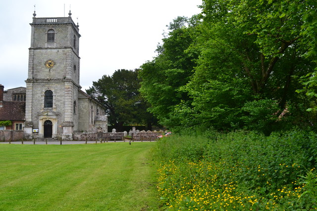
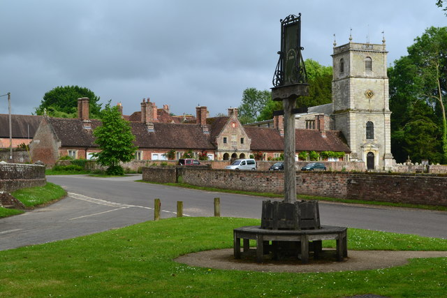
The village of Wimborne St. Giles is the main settlement within the civil parish. It is known for its picturesque rural setting and charming traditional architecture. The village is centered around the St. Giles Church, a Grade I listed building that dates back to the 12th century. The church is a prominent feature of the village and serves as a place of worship for local residents.

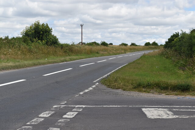
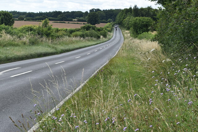
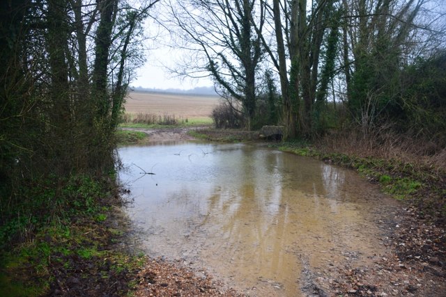
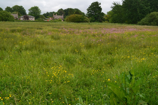
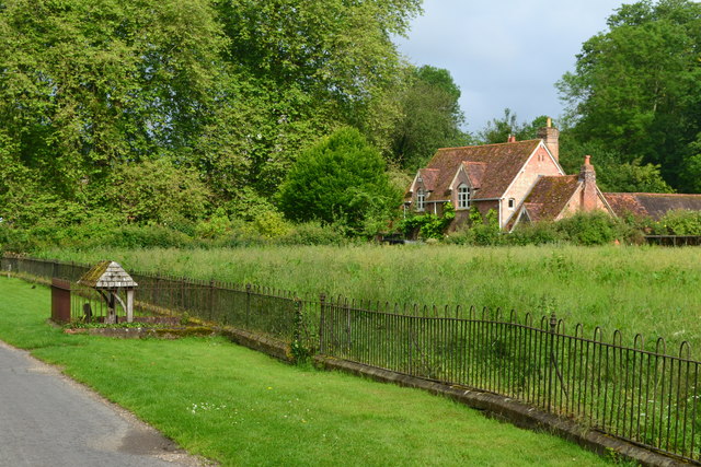
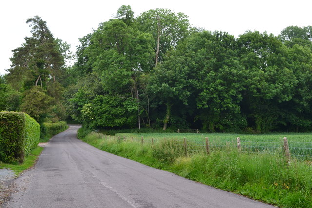
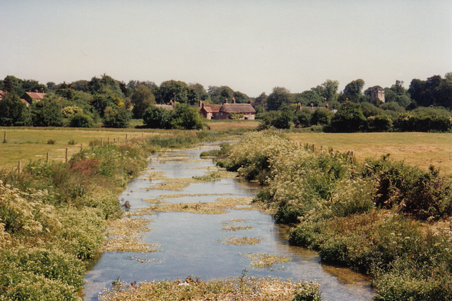
The parish is surrounded by beautiful countryside, with rolling hills and meandering rivers. It is a popular destination for outdoor enthusiasts, offering scenic walks and cycling routes. Additionally, the nearby Cranborne Chase Area of Outstanding Natural Beauty provides further opportunities for exploring the stunning landscapes.

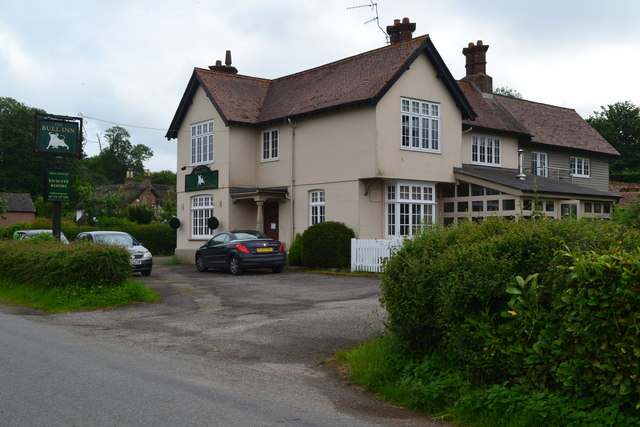
Despite its small size, Wimborne St. Giles has a strong sense of community and offers a range of amenities for its residents. These include a village hall, a primary school, and a local pub. The village also hosts various events throughout the year, such as the annual summer fete and Christmas festivities.

Overall, Wimborne St. Giles is a tranquil and idyllic civil parish, offering a peaceful countryside retreat for both residents and visitors alike.

If you have any feedback on the listing, please let us know in the comments section below.

Wimborne St. Giles Images

Images are sourced within 2km of 50.917677/-1.953194 or Grid Reference SU0313. Thanks to Geograph Open Source API. All images are credited.

Road junction west of Edmonsham Looking up the B3078 towards Cranborne.
Road junction west of Edmonsham
Looking up the B3078 towards Cranborne.
B3078 south of Cranborne
Pumping Station, Cranborne Seen from the Jubilee Trail heading through The Close. The pumping station is on the River Crane.
Pumping Station, Cranborne
Seen from the Jubilee Trail heading through The Close. The pumping station is on the River Crane.
Crossing the River Crane A footbridge takes the Jubilee Trail and the Hardy Way (and footpath E38 22) over the diminutive river.
Crossing the River Crane
A footbridge takes the Jubilee Trail and the Hardy Way (and footpath E38 22) over the diminutive river.
Ford at Waterlake Bottom This ford on the River Crane is found at Waterlake Bottom.
Ford at Waterlake Bottom
This ford on the River Crane is found at Waterlake Bottom.
Ford at Cranborne Farm This ford on the River Crane is found at Cranborne Farm. A video of the ford can be seen at:
<span class="nowrap"><a title="https://youtu.be/_IcLg3vCPUA" rel="nofollow ugc noopener" href="https://youtu.be/_IcLg3vCPUA">Link</a><img style="margin-left:2px;" alt="External link" title="External link - shift click to open in new window" src="https://s1.geograph.org.uk/img/external.png" width="10" height="10"/></span>
Ford at Cranborne Farm
This ford on the River Crane is found at Cranborne Farm. A video of the ford can be seen at: LinkExternal link
Church and edge of green, Wimborne St Giles
Village sign and seat, Wimborne St Giles
Village hall, Wimborne St Giles
The Bull Inn, Wimborne St Giles
Field opposite The Bull Inn
By the stocks, Wimborne St Giles
Baileys Hill approaching Bull Bridge
River Allen near Wimborne St Giles Wimborne church tower can be seen amid the trees in the distance
River Allen near Wimborne St Giles
Wimborne church tower can be seen amid the trees in the distance
Arable crop in field
Old Direction Sign - Signpost by Baileys Hill, Wimborne St Giles Annulus & bar finial - 3 arms; Dorset halo with NGR by the UC road, in parish of Wimborne St Giles (East Dorset District), Wimborne St Giles, T-junction with UC road to Monkton Up Wimborne, against hedge.

Surveyed

Milestone Society National ID: DO_SU0212
Old Direction Sign - Signpost by Baileys Hill, Wimborne St Giles
Annulus & bar finial - 3 arms; Dorset halo with NGR by the UC road, in parish of Wimborne St Giles (East Dorset District), Wimborne St Giles, T-junction with UC road to Monkton Up Wimborne, against hedge. Surveyed Milestone Society National ID: DO_SU0212
Old Direction Sign - Signpost by Wimborne St Giles village green Village sign finial - 2 arms; by the UC road, in parish of Wimborne St Giles (East Dorset District), Wimborne St Giles, junction of UC road to Monkton Up Wimborne, on green triangle.

Surveyed

Milestone Society National ID: DO_SU0312
Old Direction Sign - Signpost by Wimborne St Giles village green
Village sign finial - 2 arms; by the UC road, in parish of Wimborne St Giles (East Dorset District), Wimborne St Giles, junction of UC road to Monkton Up Wimborne, on green triangle. Surveyed Milestone Society National ID: DO_SU0312
Line of trees on The Close, Cranborne On the Cranborne Estate.
Line of trees on The Close, Cranborne
On the Cranborne Estate.
Show me another place!

Wimborne St. Giles is located at Grid Ref: SU0313 (Lat: 50.917677, Lng: -1.953194)

Administrative County: Dorset

District: East Dorset

Police Authority: Dorset

What 3 Words

///saying.decoding.sharpen. Near Verwood, Dorset

Nearby Locations

Wimborne St. Giles

Related Wikis

Wimborne St Giles Hundred

Wimborne St Giles Hundred was a hundred in the county of Dorset, England, containing the following parishes: Wimborne All Saints (absorbed by Wimborne...

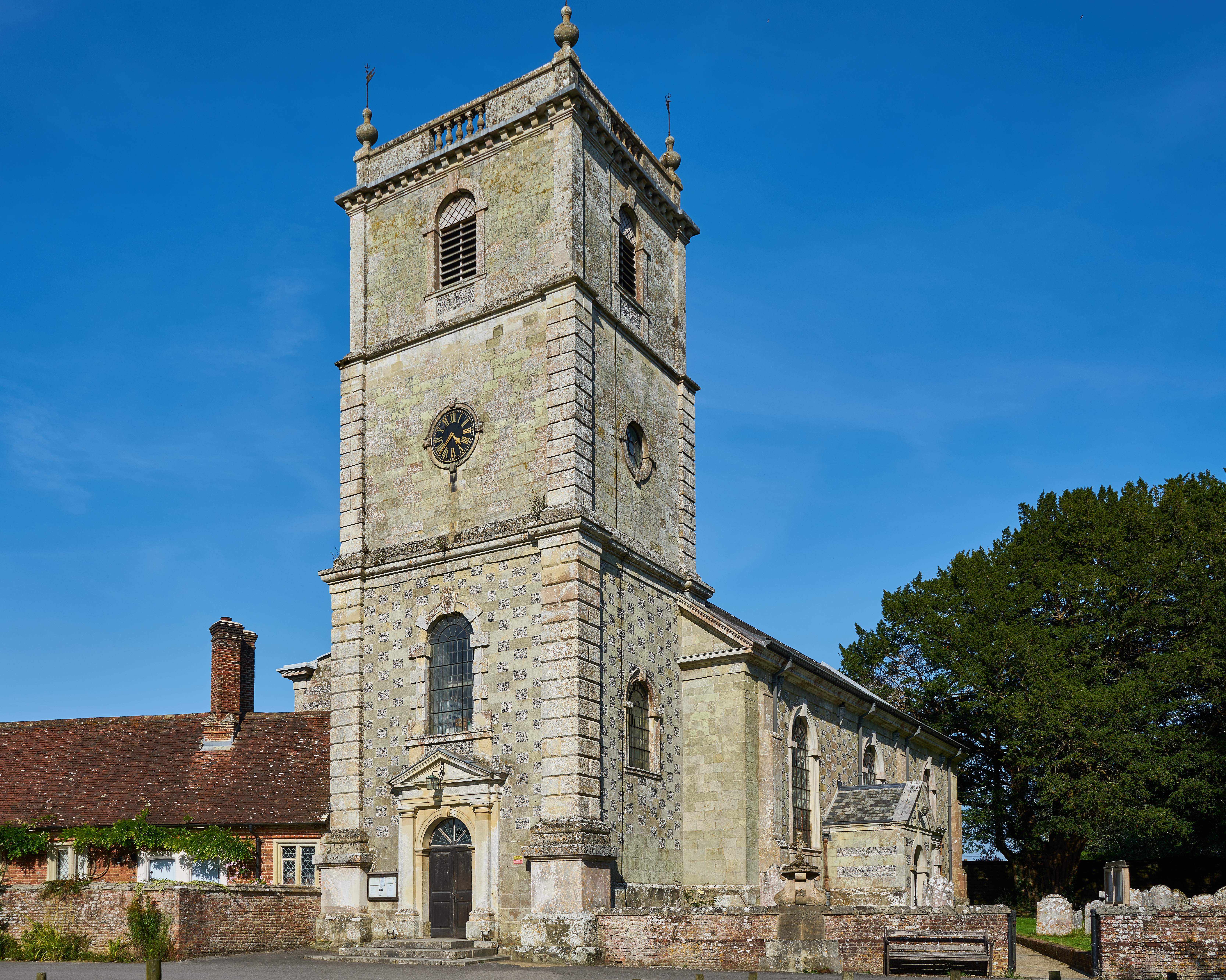
Church of St Giles, Wimborne St Giles

The Church of St Giles is the Church of England parish church for the village of Wimborne St Giles, Dorset. Originally founded in the 13th century and...

Wimborne St Giles

Wimborne St Giles is a village and civil parish in east Dorset, England, on Cranborne Chase, 7 miles (11 km) north of Wimborne Minster and 12 miles (19...

St Giles House, Wimborne St Giles

St Giles House is located at Wimborne St Giles in East Dorset in England, just south of Cranborne Chase. It is the ancestral seat of the Ashley-Cooper...

Nearby Amenities

Located within 500m of 50.917677,-1.953194
Material: wood
Power: pole
Source: bing
Lat/Long: 50.9140728/-1.9567146
Material: wood
Power: pole
Source: bing
Lat/Long: 50.9143333/-1.9553574
Material: wood
Power: pole
Source: bing
Lat/Long: 50.9146022/-1.9540163
Material: wood
Power: pole
Source: bing
Lat/Long: 50.9148795/-1.952635
Material: wood
Power: pole
Source: bing
Lat/Long: 50.9148981/-1.9476487
Material: wood
Power: pole
Source: bing
Lat/Long: 50.915167/-1.9512456
Material: wood
Power: pole
Source: bing
Lat/Long: 50.9151754/-1.948735
Material: wood
Power: pole
Source: bing
Lat/Long: 50.9154595/-1.949824
Material: wood
Power: pole
Source: bing
Lat/Long: 50.9157521/-1.9484561
Material: wood
Power: pole
Source: bing
Lat/Long: 50.9174634/-1.9474744
Material: wood
Power: pole
Source: bing
Lat/Long: 50.9183241/-1.9469755
Material: wood
Power: pole
Source: bing
Lat/Long: 50.9191695/-1.9465007
Material: wood
Power: pole
Source: bing
Lat/Long: 50.9200708/-1.9472531
Power: pole
Source: bing
Lat/Long: 50.9165967/-1.9479761
The data included in this document is from www.openstreetmap.org. The data is made available under ODbL.

Have you been to Wimborne St. Giles?

Leave your review of Wimborne St. Giles below (or comments, questions and feedback).