Whitchurch Canonicorum

Civil Parish in Dorset West Dorset

England

Whitchurch Canonicorum

Looking ENE from Hardown Hill, Morcombelake In the middle distance is the short range of low hills that includes Copper Hill and Jan's Hill. Hardown Hill, 207m, is one of Dorset's five Marilyns.
Looking ENE from Hardown Hill, Morcombelake Credit: David Purchase

Whitchurch Canonicorum is a civil parish located in the county of Dorset, England. Situated in the West Dorset district, it covers an area of approximately 7.5 square kilometers. The parish is made up of several small settlements including Whitchurch Canonicorum itself, Fishpond Bottom, and the hamlets of Blackdown, Brockhampton, and Seatown.

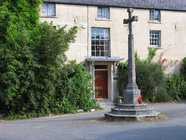
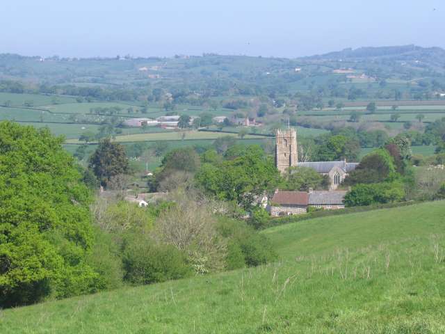
The village of Whitchurch Canonicorum is known for its historical significance and charming rural setting. It is home to the Church of St. Candida and Holy Cross, which dates back to the 12th century and is the only church in England to be named after a woman saint. The church boasts a remarkable collection of ancient artifacts, including a Saxon font and a medieval stone pulpit.

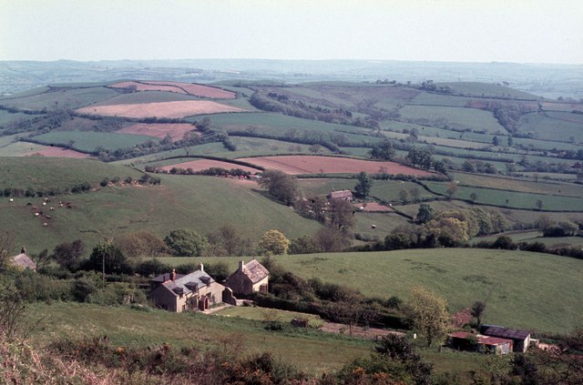
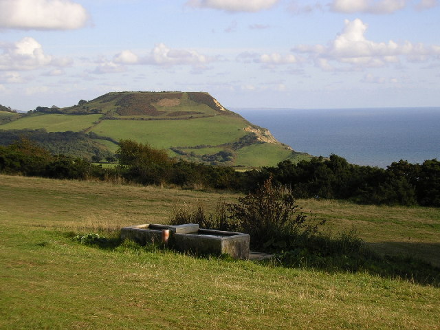
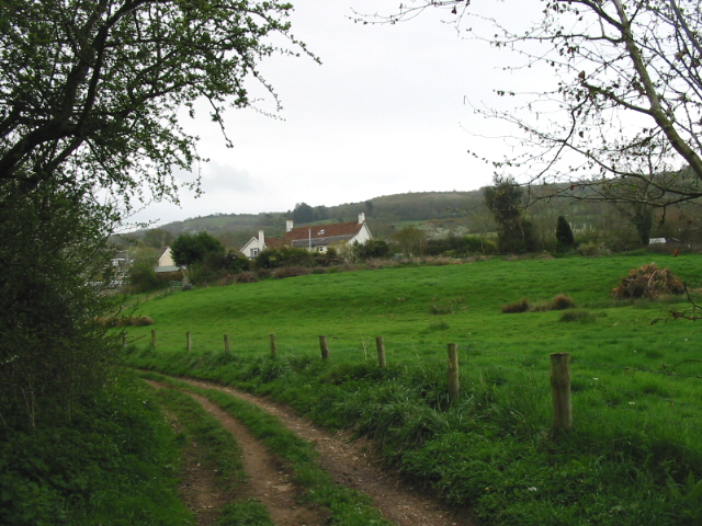
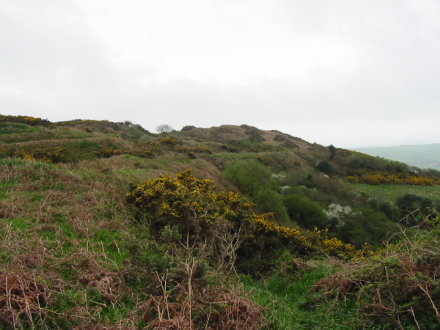
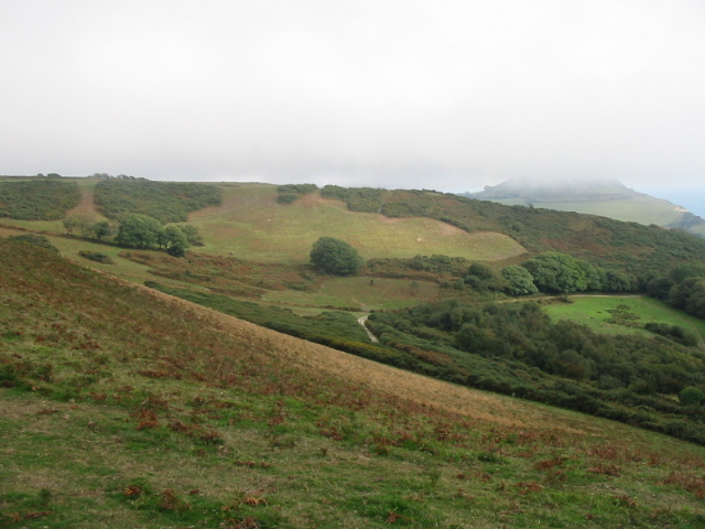
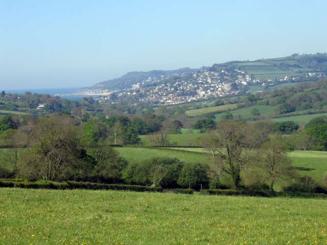
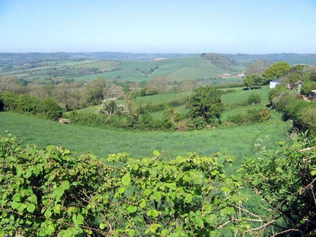
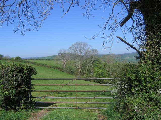
The surrounding countryside of Whitchurch Canonicorum offers stunning natural beauty and is a popular destination for outdoor enthusiasts. The nearby Jurassic Coast, a UNESCO World Heritage site, provides opportunities for scenic walks, fossil hunting, and breathtaking coastal views. Seatown, situated on the coast, offers a pebble beach and a pub, making it a popular spot for visitors.

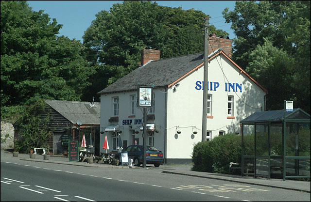
Whitchurch Canonicorum is a close-knit community with a population of around 500 residents. It has a primary school, a village hall, and amenities such as a post office and a pub. The annual Whitchurch Canonicorum Flower Festival attracts visitors from far and wide, showcasing the village's vibrant community spirit and love for horticulture.

If you have any feedback on the listing, please let us know in the comments section below.

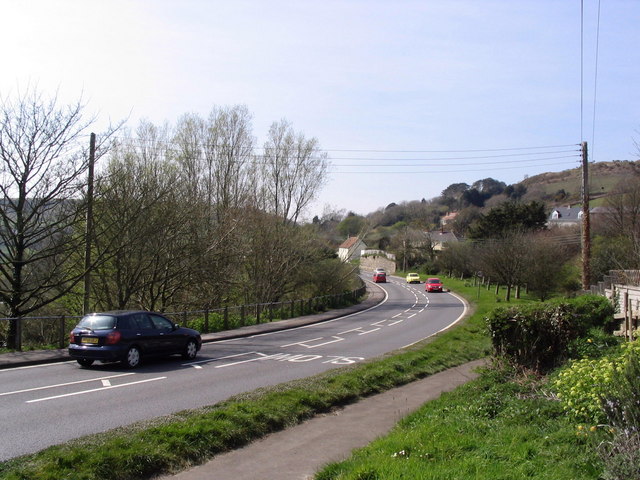
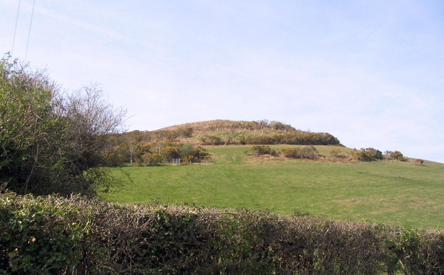
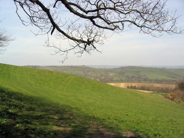
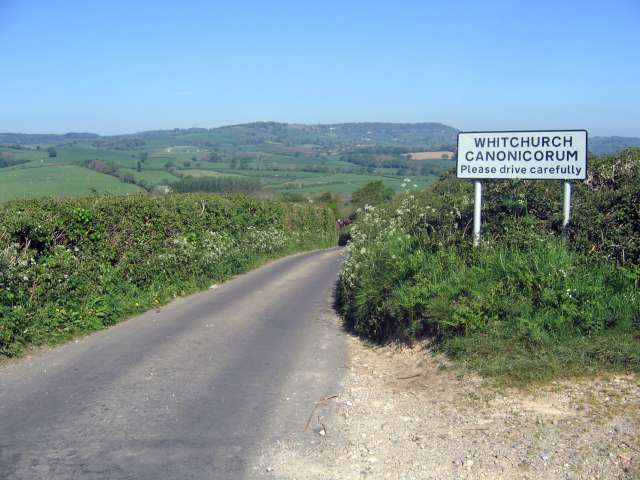
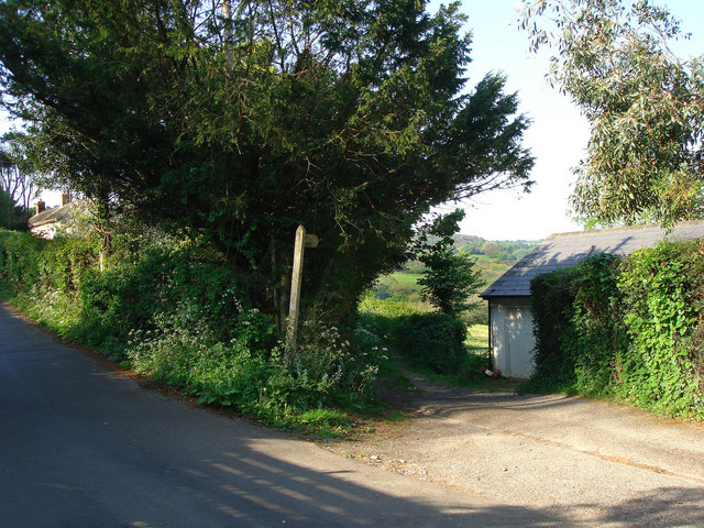
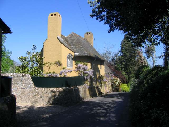
Whitchurch Canonicorum Images

Images are sourced within 2km of 50.753226/-2.859636 or Grid Reference SY3995. Thanks to Geograph Open Source API. All images are credited.

Looking ENE from Hardown Hill, Morcombelake In the middle distance is the short range of low hills that includes Copper Hill and Jan's Hill. Hardown Hill, 207m, is one of Dorset's five Marilyns.
Looking ENE from Hardown Hill, Morcombelake
In the middle distance is the short range of low hills that includes Copper Hill and Jan's Hill. Hardown Hill, 207m, is one of Dorset's five Marilyns.
View to Chardown Hill  From Felicity's Farm Shop
View to Chardown Hill
From Felicity's Farm Shop
Ship Inn, Morcombelake Situated on the main A35 at the west end of the village.
Ship Inn, Morcombelake
Situated on the main A35 at the west end of the village.
Whitchurch Canonicorum War Memorial At the bottom of the short lane leading up to the church
Whitchurch Canonicorum War Memorial
At the bottom of the short lane leading up to the church
View from Stonebarrow Hill Looking towards Golden Cap.
View from Stonebarrow Hill
Looking towards Golden Cap.
Befferlands Farm
Befferlands Farm
Hardown Hill, Morcombelake
Chardown Hill
Chardown Hill
A35 near Morcombelake This is the A35 at the junction with Carter's Lane, looking west towards Morcombelake. Hardown Hill is in the distance on the right.
A35 near Morcombelake
This is the A35 at the junction with Carter's Lane, looking west towards Morcombelake. Hardown Hill is in the distance on the right.
Hardown Hill from the road to Ryall A view of Hardown Hill, Morcombelake, seen from the minor road leading up to Ryall.
Hardown Hill from the road to Ryall
A view of Hardown Hill, Morcombelake, seen from the minor road leading up to Ryall.
Bridleway near Morcombelake It's not very apparent on the ground, but this bridleway is signposted from the road and clearly marked on all OS maps. It basically goes straight across this field.
Bridleway near Morcombelake
It's not very apparent on the ground, but this bridleway is signposted from the road and clearly marked on all OS maps. It basically goes straight across this field.
View looking west from near Whitchurch Canonicorum The Jurassic Coast can be seen in the distance.
To see some 360°Panoramas of Dorset please visit this <span class="nowrap"><a title="www.360panoramas.co.uk" rel="nofollow ugc noopener" href="http://www.360panoramas.co.uk">Link</a><img style="margin-left:2px;" alt="External link" title="External link - shift click to open in new window" src="https://s1.geograph.org.uk/img/external.png" width="10" height="10"/></span>
View looking west from near Whitchurch Canonicorum
The Jurassic Coast can be seen in the distance. To see some 360°Panoramas of Dorset please visit this LinkExternal link
Approaching Whitchurch Canonicorum from the south To see some 360°Panoramas of Dorset please visit this <span class="nowrap"><a title="www.360panoramas.co.uk" rel="nofollow ugc noopener" href="http://www.360panoramas.co.uk">Link</a><img style="margin-left:2px;" alt="External link" title="External link - shift click to open in new window" src="https://s1.geograph.org.uk/img/external.png" width="10" height="10"/></span>
Approaching Whitchurch Canonicorum from the south
To see some 360°Panoramas of Dorset please visit this LinkExternal link
Sign posted farm track
View from roadside looking east
A Dorset cottage Cottage on the road from Morecombelake to Whitchurch Canonicorum
To see some 360°Panoramas of Dorset please visit this <span class="nowrap"><a title="www.360panoramas.co.uk" rel="nofollow ugc noopener" href="http://www.360panoramas.co.uk">Link</a><img style="margin-left:2px;" alt="External link" title="External link - shift click to open in new window" src="https://s1.geograph.org.uk/img/external.png" width="10" height="10"/></span>
A Dorset cottage
Cottage on the road from Morecombelake to Whitchurch Canonicorum To see some 360°Panoramas of Dorset please visit this LinkExternal link
View looking east from Whitchurch Canonicorum
Church at Whitchurch Canonicorum This church lying in the beautiful Marshwood Vale is said to house the relics of the female Saint Wite from the Viking era. The shrine in the north transept dates from the 13th century.
To see some 360°Panoramas of Dorset please visit this <span class="nowrap"><a title="www.360panoramas.co.uk" rel="nofollow ugc noopener" href="http://www.360panoramas.co.uk">Link</a><img style="margin-left:2px;" alt="External link" title="External link - shift click to open in new window" src="https://s1.geograph.org.uk/img/external.png" width="10" height="10"/></span>
Church at Whitchurch Canonicorum
This church lying in the beautiful Marshwood Vale is said to house the relics of the female Saint Wite from the Viking era. The shrine in the north transept dates from the 13th century. To see some 360°Panoramas of Dorset please visit this LinkExternal link
Show me another place!

Whitchurch Canonicorum is located at Grid Ref: SY3995 (Lat: 50.753226, Lng: -2.859636)

Administrative County: Dorset

District: West Dorset

Police Authority: Dorset

What 3 Words

///crust.discusses.squeaking. Near Charmouth, Dorset

Related Wikis

Whitchurch Canonicorum

Whitchurch Canonicorum () is a village and civil parish in southwest Dorset, England, situated in the Marshwood Vale 5 miles (8.0 km) west-northwest of...

Church of St Candida and Holy Cross

The Church of St Candida and Holy Cross is an Anglican church in Whitchurch Canonicorum, Dorset, England. A Saxon church stood on the site but nothing...

Whitchurch Canonicorum Hundred

Whitchurch Canonicorum Hundred or Whitechurch Canonicorum Hundred was a hundred in the county of Dorset, England, containing the following parishes: Burstock...

Ryall, Dorset

Ryall is a small village in the county of Dorset, on the south coast of Great Britain. It is situated roughly midway between the towns of Bridport and...

Nearby Amenities

Located within 500m of 50.753226,-2.859636
Post Box
Description: By pub sign of Five Bells.
Post Box Type: lamp
Ref: DT6 123
Ref GB Uprn: 10015345088
Lat/Long: 50.7540679/-2.8532977
Post Box
Post Box Type: lamp
Ref: DT6 78
Ref GB Uprn: 10015338532
Lat/Long: 50.755245/-2.860394
Whitchurch Canonicorum
Place: village
Lat/Long: 50.7537667/-2.8587394
Historic: memorial
Memorial: war_memorial
Lat/Long: 50.7550413/-2.857768
Pub
The Five Bells Inn
Lat/Long: 50.7539727/-2.8531773
Material: wood
Power: pole
Source: bing
Lat/Long: 50.7519979/-2.8535068
Material: wood
Power: pole
Source: bing
Lat/Long: 50.7522641/-2.8543587
Material: wood
Power: pole
Source: bing
Lat/Long: 50.7551635/-2.8657657
Material: wood
Power: pole
Source: bing
Lat/Long: 50.7553824/-2.8556905
Material: wood
Power: pole
Source: bing
Lat/Long: 50.7553853/-2.864559
Material: wood
Power: pole
Source: bing
Lat/Long: 50.7555706/-2.8634538
Material: wood
Power: pole
Source: bing
Lat/Long: 50.7557136/-2.8627402
Material: wood
Power: pole
Source: bing
Lat/Long: 50.755808/-2.8622477
Material: wood
Power: pole
Source: bing
Lat/Long: 50.7560385/-2.8609579
Material: wood
Power: pole
Source: bing
Lat/Long: 50.7560816/-2.8596001
Material: wood
Power: pole
Source: bing
Lat/Long: 50.7561289/-2.8584912
Material: wood
Power: pole
Source: bing
Lat/Long: 50.7561461/-2.8570536
Material: wood
Power: pole
Source: bing
Lat/Long: 50.7561544/-2.8556223
Material: wood
Power: pole
Source: bing
Lat/Long: 50.7561655/-2.8543749
Material: wood
Power: pole
Source: bing
Lat/Long: 50.7565219/-2.8630788
Berehayes Holiday Cottages
Addr Street: Gassons Lane
Email: info@berehayes.co.uk
Internet Access: wlan
Name En: Berehayes Holiday Cottages
Operator: Mr & Mrs Clausner
Phone: +44 1297489093
Tourism: hotel
Website: https://www.berehayes.co.uk/
Lat/Long: 50.7551281/-2.8591664
Defibrillator
Emergency: defibrillator
Indoor: no
Opening Hours: 24/7
Lat/Long: 50.754572/-2.8622
Telephone
Booth: K6
Covered: booth
Lat/Long: 50.7546059/-2.8620954
Direction: 215
Generator Method: photovoltaic
Generator Output Electricity: yes
Generator Solar Modules: 12
Generator Source: solar
Generator Type: solar_photovoltaic_panel
Location: roof
Power: generator
Lat/Long: 50.7550855/-2.8618607
Direction: 215
Generator Method: photovoltaic
Generator Output Electricity: yes
Generator Solar Modules: 16
Generator Source: solar
Generator Type: solar_photovoltaic_panel
Location: roof
Power: generator
Lat/Long: 50.7533089/-2.8602842
Direction: 175
Generator Method: photovoltaic
Generator Output Electricity: yes
Generator Solar Modules: 16
Generator Source: solar
Generator Type: solar_photovoltaic_panel
Location: roof
Power: generator
Lat/Long: 50.7550166/-2.8599587
Direction: 165
Generator Method: photovoltaic
Generator Output Electricity: yes
Generator Solar Modules: 18
Generator Source: solar
Generator Type: solar_photovoltaic_panel
Location: roof
Power: generator
Lat/Long: 50.7540237/-2.8554472
Direction: 215
Fixme: possibly solar hot water
Generator Method: photovoltaic
Generator Output Electricity: yes
Generator Solar Modules: 4
Generator Source: solar
Generator Type: solar_photovoltaic_panel
Location: roof
Power: generator
Lat/Long: 50.7545298/-2.8539167
Direction: 215
Fixme: possibly solar hot water
Generator Method: photovoltaic
Generator Output Electricity: yes
Generator Solar Modules: 4
Generator Source: solar
Generator Type: solar_photovoltaic_panel
Location: roof
Power: generator
Lat/Long: 50.7544897/-2.8538292
Direction: 215
Fixme: possibly solar hot water
Generator Method: photovoltaic
Generator Output Electricity: yes
Generator Solar Modules: 4
Generator Source: solar
Generator Type: solar_photovoltaic_panel
Location: roof
Power: generator
Lat/Long: 50.7544496/-2.8537383
Entrance: yes
Lat/Long: 50.7554061/-2.85679
Entrance: main
Lat/Long: 50.7553363/-2.8565514
The data included in this document is from www.openstreetmap.org. The data is made available under ODbL.

Have you been to Whitchurch Canonicorum?

Leave your review of Whitchurch Canonicorum below (or comments, questions and feedback).