Whitchurch

Civil Parish in Devon West Devon

England

Whitchurch

Tavistock Viaduct Tavistock Viaduct was part of the closed LSWR line from Exeter to Plymouth. This picture is taken from Taylor Square.  The line was the London & South Western, later Southern Railway main line to Plymouth, closed in 1968.  It has been suggested that this line should be re-opened to provide an alternative route to Plymouth and Cornwall as the old Great Western Railway route from Exeter to Plymouth is now the only access and can be subject to storm damage along the coast around Dawlish.
Tavistock Viaduct Credit: Bob Walters

Whitchurch is a civil parish located in the county of Devon, England. Situated in the picturesque Dartmoor National Park, it covers an area of approximately 20 square kilometers. The parish is nestled within the South Hams district, which is known for its rural beauty and historic charm.

Whitchurch is a small village with a population of around 500 residents. It is characterized by its idyllic countryside setting, with rolling hills, lush green fields, and charming stone cottages. The parish is surrounded by natural beauty, with the River Dart flowing nearby and the Dartmoor tors visible on the horizon.

The village itself has a sense of tranquility and community spirit. It boasts a 12th-century church, St. Andrew's, which is a prominent landmark and a testament to the area's rich history. Whitchurch also has a primary school, providing education for the local children.

The parish is a popular destination for outdoor enthusiasts due to its proximity to Dartmoor National Park. The park offers a wide range of activities, including hiking, cycling, and horse riding, allowing residents and visitors to explore the stunning landscapes and diverse wildlife.

In terms of amenities, Whitchurch has a village hall that hosts various community events and gatherings. While there are no major shops or supermarkets within the village, nearby towns such as Tavistock and Plymouth provide access to a wider range of facilities and services.

Overall, Whitchurch is a charming and peaceful civil parish that offers a quintessential English countryside experience. Its natural beauty, community spirit, and proximity to Dartmoor National Park make it an attractive place to live or visit for those seeking a rural retreat.

If you have any feedback on the listing, please let us know in the comments section below.
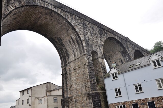
Whitchurch Images

Images are sourced within 2km of 50.542789/-4.147203 or Grid Reference SX4773. Thanks to Geograph Open Source API. All images are credited.

Tavistock Viaduct Tavistock Viaduct was part of the closed LSWR line from Exeter to Plymouth. This picture is taken from Taylor Square.  The line was the London & South Western, later Southern Railway main line to Plymouth, closed in 1968.  It has been suggested that this line should be re-opened to provide an alternative route to Plymouth and Cornwall as the old Great Western Railway route from Exeter to Plymouth is now the only access and can be subject to storm damage along the coast around Dawlish.
Tavistock Viaduct
Tavistock Viaduct was part of the closed LSWR line from Exeter to Plymouth. This picture is taken from Taylor Square. The line was the London & South Western, later Southern Railway main line to Plymouth, closed in 1968. It has been suggested that this line should be re-opened to provide an alternative route to Plymouth and Cornwall as the old Great Western Railway route from Exeter to Plymouth is now the only access and can be subject to storm damage along the coast around Dawlish.
Tavistock golf course in the early morning, looking towards Cox Tor
Green Lane, Tavistock
Old Boundary Marker on the B3357 near Sunny Mount Parish Boundary Marker on the north side of the B3357 Mount Tavy Road near Sunny Mount. On the boundary of Peter Tavy and Tavistock parishes.

Milestone Society National ID: DV_PTTV01pb
Old Boundary Marker on the B3357 near Sunny Mount
Parish Boundary Marker on the north side of the B3357 Mount Tavy Road near Sunny Mount. On the boundary of Peter Tavy and Tavistock parishes. Milestone Society National ID: DV_PTTV01pb
Former railway station, Tavistock Now converted to accommodation and seen from the public road that ends by the gate to the property. The railway line is now a footpath.
Former railway station, Tavistock
Now converted to accommodation and seen from the public road that ends by the gate to the property. The railway line is now a footpath.
Former railway viaduct, Tavistock Now a public path. There are good views to be had from the viaduct over the town below.
Former railway viaduct, Tavistock
Now a public path. There are good views to be had from the viaduct over the town below.
Old Boundary Marker on the boundary of the Tavistock Cricket Club on Whitchurch Down Parish Boundary Marker, one of the circle of (six?) granite posts that form the boundary of the Tavistock Cricket Club on Whitchurch Down. Inscribed T and W on opposite faces. Until 1898 this was on the boundary of Tavistock and Whitchurch parishes, then until 1998 Tavistock Hamlets and Whitchurch, and now entirely in Tavistock parish

Milestone Society National ID: DV_WCTV05pb
Old Boundary Marker on the boundary of the Tavistock Cricket Club on Whitchurch Down
Parish Boundary Marker, one of the circle of (six?) granite posts that form the boundary of the Tavistock Cricket Club on Whitchurch Down. Inscribed T and W on opposite faces. Until 1898 this was on the boundary of Tavistock and Whitchurch parishes, then until 1998 Tavistock Hamlets and Whitchurch, and now entirely in Tavistock parish Milestone Society National ID: DV_WCTV05pb
Old Boundary Marker on Tavistock golf course, Whitchurch parish Parish Boundary Marker on Tavistock golf course on Whitchurch Down. Inscribed W and T on opposite sides. Originally on the boundary of Tavistock and Whitchurch parishes. From 1898 to 1998 on the boundary of Tavistock Hamlets and Whitchurch parishes. Now entirely in Whitchurch parish.

Milestone Society National ID: DV_WCTV07pb
Old Boundary Marker on Tavistock golf course, Whitchurch parish
Parish Boundary Marker on Tavistock golf course on Whitchurch Down. Inscribed W and T on opposite sides. Originally on the boundary of Tavistock and Whitchurch parishes. From 1898 to 1998 on the boundary of Tavistock Hamlets and Whitchurch parishes. Now entirely in Whitchurch parish. Milestone Society National ID: DV_WCTV07pb
Foot and cycle bridge over River Tavy The Tavy is a river that rises on Dartmoor. It has given its name to the town of Tavistock and the villages of Mary Tavy and Peter Tavy. It is a tributary of the River Tamar and has as its own tributaries. It is crossed by the Tamar Valley Line near its mouth.
Foot and cycle bridge over River Tavy
The Tavy is a river that rises on Dartmoor. It has given its name to the town of Tavistock and the villages of Mary Tavy and Peter Tavy. It is a tributary of the River Tamar and has as its own tributaries. It is crossed by the Tamar Valley Line near its mouth.
Retail units, south of Tavistock
Foot and cycle bridge over River Tavy looking west The Tavy is a river that rises on Dartmoor. It has given its name to the town of Tavistock and the villages of Mary Tavy and Peter Tavy. It is a tributary of the River Tamar and has as its own tributaries. It is crossed by the Tamar Valley Line near its mouth.
Foot and cycle bridge over River Tavy looking west
The Tavy is a river that rises on Dartmoor. It has given its name to the town of Tavistock and the villages of Mary Tavy and Peter Tavy. It is a tributary of the River Tamar and has as its own tributaries. It is crossed by the Tamar Valley Line near its mouth.
Former railway bridge over Pixon Lane, Tavistock
St John's Well <span class="nowrap"><a title="https://www.heritagegateway.org.uk/gateway/Results_Single.aspx?uid=MDV43885&resourceID=104" rel="nofollow ugc noopener" href="https://www.heritagegateway.org.uk/gateway/Results_Single.aspx?uid=MDV43885&resourceID=104">Link</a><img style="margin-left:2px;" alt="External link" title="External link - shift click to open in new window" src="https://s1.geograph.org.uk/img/external.png" width="10" height="10"/></span>
St John's Well
King Street View up King Street to the former railway viaduct now route 270 of the National Cycle Network
King Street
View up King Street to the former railway viaduct now route 270 of the National Cycle Network
The Union Inn Cycle friendly hostelry on King Street
The Union Inn
Cycle friendly hostelry on King Street
The Guildhall Grade II* listed former Guildhall by John Foulston and Theophilus Jones for the Duke of Bedford in 1848.
Originally purpose built as a Police Station and court with adjacent fire engine house.
The Guildhall
Grade II* listed former Guildhall by John Foulston and Theophilus Jones for the Duke of Bedford in 1848. Originally purpose built as a Police Station and court with adjacent fire engine house.
Former Midland Bank Grade II listed former Midland / HSBC bank on the corner of Drake Road and Duke Street
Former Midland Bank
Grade II listed former Midland / HSBC bank on the corner of Drake Road and Duke Street
Former Cornmarket Grade II listed former Cornmarket for the Duke of Bedford 1835 on the site of the Green Dragon Inn. It was the town's first cinema 1913-1957, listed as Cook's Hardware Stores, now Fat Face clothing shop.
Former Cornmarket
Grade II listed former Cornmarket for the Duke of Bedford 1835 on the site of the Green Dragon Inn. It was the town's first cinema 1913-1957, listed as Cook's Hardware Stores, now Fat Face clothing shop.
Show me another place!

Whitchurch is located at Grid Ref: SX4773 (Lat: 50.542789, Lng: -4.147203)

Administrative County: Devon

District: West Devon

Police Authority: Devon & Cornwall

What 3 Words

///jaws.events.boxer. Near Tavistock, Devon

Nearby Locations

Whitchurch

Related Wikis

Tiddy Brook Meadows, Devon

Tiddy Brook Meadows,(sometimes called Tiddybrook Meadows) is a settlement in Devon. It lies south of Whitchurch and just east of Tavistock, and sits on...

Tavistock

Tavistock ( TAV-iss-tok) is an ancient stannary and market town within West Devon, England. It is situated on the River Tavy from which its name derives...

Tavistock A.F.C.

Tavistock Association Football Club is a football club based in Tavistock, Devon, England. They play in the Southern League Division One South. == History... ==

Tavistock College

Tavistock College is a coeducational secondary school and sixth form located in Tavistock, Devon, England. It had (as of April 2020) approximately 1800...

Nearby Amenities

Located within 500m of 50.542789,-4.147203
Crossing
Crossing: marked
Crossing Markings: yes
Mapillary: 182171250677416
Survey Date: 2021-08-24
Tactile Paving: yes
Lat/Long: 50.5460246/-4.1513066
Mini Roundabout
Direction: clockwise
Lat/Long: 50.543364/-4.1509337
Crossing
Lat/Long: 50.5419072/-4.1509029
Mini Roundabout
Direction: clockwise
Lat/Long: 50.5393052/-4.149653
Turning Circle
Lat/Long: 50.5411569/-4.1450344
Post Box
Brand: Royal Mail
Brand Wikidata: Q638098
Brand Wikipedia: en:Royal Mail
Collection Times: Mo-Fr 09:00; Sa 07:00; Su off
Drive Through: no
Operator: Royal Mail
Operator Wikidata: Q638098
Post Box Design: 2010_pattern
Post Box Mounting: pier
Post Box Type: lamp
Ref: PL19 43D
Royal Cypher: EIIR
Royal Cypher Wikidata: Q33102113
Source: survey;streetlevel imagery;aerial imagery
Lat/Long: 50.5405594/-4.1418967
Bus Stop
Bus: yes
Public Transport: platform
Lat/Long: 50.5402578/-4.1416252
Historic: bus_stop
Lat/Long: 50.5421127/-4.1510237
Historic: bus_stop
Lat/Long: 50.5424465/-4.1506803
Sir Francis Drake
Artwork Type: statue
Historic: memorial
Material: metal
Memorial: statue
Tourism: artwork
Wikidata: Q26611707
Lat/Long: 50.5452785/-4.152754
Dartmoor Memorials
Addr Housename: Unit 5a, Pixon Trading Centre
Addr Postcode: PL19 8DH
Addr Street: Pixon Lane
Lat/Long: 50.54387/-4.14867
Sar Base
Dartmoor Search & Rescue Team
Addr Housename: The Rescue Centre
Addr Postcode: PL19 9BB
Addr Street: Whitchurch Road
Lat/Long: 50.54674/-4.14448
Police
Tavistock Police Station
Lat/Long: 50.5462986/-4.1455423
Number 58
Tourism: guest_house
Lat/Long: 50.5465979/-4.1508277
Generator Method: photovoltaic
Generator Output Electricity: yes
Generator Source: solar
Generator Type: solar_thermal_collector
Location: roof
Power: generator
Lat/Long: 50.5399435/-4.1462432
Generator Method: photovoltaic
Generator Output Electricity: yes
Generator Source: solar
Generator Type: solar_thermal_collector
Location: roof
Power: generator
Lat/Long: 50.5419495/-4.1492591
Generator Method: photovoltaic
Generator Output Electricity: yes
Generator Source: solar
Generator Type: solar_thermal_collector
Location: roof
Power: generator
Lat/Long: 50.5419987/-4.1469703
Generator Method: photovoltaic
Generator Output Electricity: yes
Generator Source: solar
Generator Type: solar_thermal_collector
Location: roof
Power: generator
Lat/Long: 50.5418666/-4.1484246
Generator Method: photovoltaic
Generator Output Electricity: yes
Generator Source: solar
Generator Type: solar_thermal_collector
Location: roof
Power: generator
Lat/Long: 50.5417119/-4.1474545
Generator Method: photovoltaic
Generator Output Electricity: yes
Generator Source: solar
Generator Type: solar_thermal_collector
Location: roof
Power: generator
Lat/Long: 50.5418136/-4.1493176
Generator Method: photovoltaic
Generator Output Electricity: yes
Generator Source: solar
Generator Type: solar_thermal_collector
Location: roof
Power: generator
Lat/Long: 50.5417819/-4.148905
Generator Method: photovoltaic
Generator Output Electricity: yes
Generator Source: solar
Generator Type: solar_thermal_collector
Location: roof
Power: generator
Lat/Long: 50.5407766/-4.1477268
Generator Method: photovoltaic
Generator Output Electricity: yes
Generator Source: solar
Generator Type: solar_thermal_collector
Location: roof
Power: generator
Lat/Long: 50.5421323/-4.1470926
Generator Method: photovoltaic
Generator Output Electricity: yes
Generator Source: solar
Generator Type: solar_thermal_collector
Location: roof
Power: generator
Lat/Long: 50.5420507/-4.1476502
Generator Method: photovoltaic
Generator Output Electricity: yes
Generator Source: solar
Generator Type: solar_thermal_collector
Location: roof
Power: generator
Lat/Long: 50.5401341/-4.1451396
Generator Method: photovoltaic
Generator Output Electricity: yes
Generator Source: solar
Generator Type: solar_thermal_collector
Location: roof
Power: generator
Lat/Long: 50.5418619/-4.1487521
Generator Method: photovoltaic
Generator Output Electricity: yes
Generator Source: solar
Generator Type: solar_thermal_collector
Location: roof
Power: generator
Lat/Long: 50.5407184/-4.1434462
Generator Method: photovoltaic
Generator Output Electricity: yes
Generator Source: solar
Generator Type: solar_thermal_collector
Location: roof
Power: generator
Lat/Long: 50.5423987/-4.1421969
Generator Method: photovoltaic
Generator Output Electricity: yes
Generator Source: solar
Generator Type: solar_thermal_collector
Location: roof
Power: generator
Lat/Long: 50.5407549/-4.149044
Generator Method: photovoltaic
Generator Output Electricity: yes
Generator Source: solar
Generator Type: solar_thermal_collector
Location: roof
Power: generator
Lat/Long: 50.5417642/-4.1493107
Generator Method: photovoltaic
Generator Output Electricity: yes
Generator Source: solar
Generator Type: solar_thermal_collector
Location: roof
Power: generator
Lat/Long: 50.5418647/-4.1485035
Generator Method: photovoltaic
Generator Output Electricity: yes
Generator Source: solar
Generator Type: solar_thermal_collector
Location: roof
Power: generator
Lat/Long: 50.5417823/-4.1488028
Generator Method: photovoltaic
Generator Output Electricity: yes
Generator Source: solar
Generator Type: solar_thermal_collector
Location: roof
Power: generator
Lat/Long: 50.5418579/-4.148564
Generator Method: photovoltaic
Generator Output Electricity: yes
Generator Source: solar
Generator Type: solar_thermal_collector
Location: roof
Power: generator
Lat/Long: 50.5411412/-4.1478979
Generator Method: photovoltaic
Generator Output Electricity: yes
Generator Source: solar
Generator Type: solar_thermal_collector
Location: roof
Power: generator
Lat/Long: 50.5418289/-4.1475018
Generator Method: photovoltaic
Generator Output Electricity: yes
Generator Source: solar
Generator Type: solar_thermal_collector
Location: roof
Power: generator
Lat/Long: 50.5419284/-4.1475393
Generator Method: photovoltaic
Generator Output Electricity: yes
Generator Source: solar
Generator Type: solar_thermal_collector
Location: roof
Power: generator
Lat/Long: 50.5442735/-4.1430286
Generator Method: photovoltaic
Generator Output Electricity: yes
Generator Source: solar
Generator Type: solar_thermal_collector
Location: roof
Power: generator
Lat/Long: 50.5438904/-4.1429836
Generator Method: photovoltaic
Generator Output Electricity: yes
Generator Source: solar
Generator Type: solar_thermal_collector
Location: roof
Power: generator
Lat/Long: 50.5439059/-4.1419591
Generator Method: photovoltaic
Generator Output Electricity: yes
Generator Source: solar
Generator Type: solar_photovoltaic_panel
Location: roof
Power: generator
Lat/Long: 50.5462493/-4.1456
Generator Method: photovoltaic
Generator Output Electricity: yes
Generator Source: solar
Generator Type: solar_photovoltaic_panel
Location: roof
Power: generator
Lat/Long: 50.5462715/-4.1454619
Generator Method: photovoltaic
Generator Output Electricity: yes
Generator Source: solar
Generator Type: solar_photovoltaic_panel
Location: roof
Power: generator
Lat/Long: 50.541902/-4.1469603
Generator Method: photovoltaic
Generator Output Electricity: yes
Generator Source: solar
Generator Type: solar_photovoltaic_panel
Location: roof
Power: generator
Lat/Long: 50.5410931/-4.1477274
Generator Method: photovoltaic
Generator Output Electricity: yes
Generator Source: solar
Generator Type: solar_photovoltaic_panel
Location: roof
Power: generator
Lat/Long: 50.5407556/-4.1496237
Generator Method: photovoltaic
Generator Output Electricity: yes
Generator Source: solar
Generator Type: solar_photovoltaic_panel
Location: roof
Power: generator
Lat/Long: 50.5407607/-4.1498235
Generator Method: photovoltaic
Generator Output Electricity: yes
Generator Source: solar
Generator Type: solar_photovoltaic_panel
Location: roof
Power: generator
Lat/Long: 50.5407522/-4.149912
Generator Method: photovoltaic
Generator Output Electricity: yes
Generator Source: solar
Generator Type: solar_photovoltaic_panel
Location: roof
Power: generator
Lat/Long: 50.5409908/-4.1498356
Generator Method: photovoltaic
Generator Output Electricity: yes
Generator Source: solar
Generator Type: solar_photovoltaic_panel
Location: roof
Power: generator
Lat/Long: 50.5410104/-4.1496827
Generator Method: photovoltaic
Generator Output Electricity: yes
Generator Source: solar
Generator Type: solar_photovoltaic_panel
Location: roof
Power: generator
Lat/Long: 50.5410309/-4.1493179
Generator Method: photovoltaic
Generator Output Electricity: yes
Generator Source: solar
Generator Type: solar_photovoltaic_panel
Location: roof
Power: generator
Lat/Long: 50.5399751/-4.1439358
Generator Method: photovoltaic
Generator Output Electricity: yes
Generator Source: solar
Generator Type: solar_photovoltaic_panel
Location: roof
Power: generator
Lat/Long: 50.5400467/-4.1425115
Generator Method: photovoltaic
Generator Output Electricity: yes
Generator Source: solar
Generator Type: solar_photovoltaic_panel
Location: roof
Power: generator
Lat/Long: 50.5398342/-4.1420542
Bus Stop
Bench: no
Bin: no
Bus: yes
Mapillary: 557652332306319
Public Transport: platform
Shelter: no
Survey Date: 2019-08-23
Lat/Long: 50.5457487/-4.1517494
Barrier: bollard
Lat/Long: 50.5421259/-4.1508358
Crossing
Lat/Long: 50.5456992/-4.1476429
Addr Housenumber: 22
Lat/Long: 50.5444063/-4.1479982
Tavistock Hire Centre
Shop: tool_hire
Lat/Long: 50.5440313/-4.1492159
Post Box
Brand: Royal Mail
Brand Wikidata: Q638098
Brand Wikipedia: en:Royal Mail
Collection Times: Mo-Fr 17:30; Sa 13:00; Su off
Operator: Royal Mail
Operator Wikidata: Q638098
Post Box Design: type_k
Post Box Type: pillar
Ref: PL19 106
Royal Cypher: EIIR
Royal Cypher Wikidata: Q33102113
Source: survey;streetlevel imagery;aerial imagery
Lat/Long: 50.5444896/-4.147204
Tyre Marks
Shop: tyres
Lat/Long: 50.544113/-4.1494839
Richard Walke Car Sales
Shop: car
Lat/Long: 50.5442186/-4.1497145
Dartprint
Addr Housenumber: 4
Lat/Long: 50.5449824/-4.14751
New Generation Energy
Addr Housenumber: 24
Lat/Long: 50.5442904/-4.1478695
Allied Precision Tooling
Addr Housenumber: 20
Lat/Long: 50.5445902/-4.1480304
Post Box
Brand: Royal Mail
Brand Wikidata: Q638098
Brand Wikipedia: en:Royal Mail
Collection Times: Mo-Sa 12:00; Su off
Note: Post box mounted in a brick pillar in a stone wall with a slate cap
Operator: Royal Mail
Operator Wikidata: Q638098
Post Box Mounting: brick_pillar
Post Box Type: lamp
Ref: PL19 13
Royal Cypher: EIIR
Royal Cypher Wikidata: Q33102113
Source: survey;streetlevel imagery;aerial imagery
Lat/Long: 50.5425578/-4.1509778
Post Box
Brand: Royal Mail
Brand Wikidata: Q638098
Brand Wikipedia: en:Royal Mail
Collection Times: Mo-Fr 09:00; Sa 07:00; Su off
Operator: Royal Mail
Operator Wikidata: Q638098
Post Box Mounting: concrete_post
Post Box Type: lamp
Ref: PL19 63D
Royal Cypher: GVIR
Royal Cypher Wikidata: Q33102169
Source: survey;streetlevel imagery;aerial imagery
Lat/Long: 50.5435208/-4.1439087
Post Box
Brand: Royal Mail
Brand Wikidata: Q638098
Brand Wikipedia: en:Royal Mail
Collection Times: Mo-Fr 12:00; Sa 11:30; Su off
Operator: Royal Mail
Operator Wikidata: Q638098
Post Box Mounting: pier
Post Box Type: lamp
Ref: PL19 100
Source: survey;streetlevel imagery;aerial imagery
Lat/Long: 50.5409372/-4.1471961
Bench
Backrest: yes
Lat/Long: 50.5472644/-4.1467281
Defibrillator
Emergency: defibrillator
Indoor: no
Survey Date: 2023-10-07
Lat/Long: 50.545172/-4.1446364
Communication 4g: yes
Communication Lte: yes
Communication Mobile Phone: yes
Description: This Mast is located on roof of a BT Telephone Exchange. Confirmed List of Providers using this mast: EE Three 3
Man Made: mast
Tower Type: communication
Lat/Long: 50.5438683/-4.1497933
Playground: trampoline
Lat/Long: 50.5458142/-4.149387
Playground: slide
Lat/Long: 50.5458376/-4.1495346
Playground: roundabout
Lat/Long: 50.545749/-4.1496945
Baby: yes
Capacity: 2
Playground: swing
Lat/Long: 50.5456097/-4.1500046
Bus Stop
Bus: yes
Public Transport: platform
Lat/Long: 50.5418265/-4.1522184
Bus Stop
Bus: yes
Public Transport: platform
Shelter: yes
Lat/Long: 50.5441277/-4.1516712
Bus Stop
Bus: yes
Public Transport: platform
Shelter: yes
Lat/Long: 50.5444481/-4.1523551
Tavy Signs
Addr City: Tavistock
Addr Housenumber: 18-20
Addr Postcode: PL19 9QN
Addr Street: Plymouth Road Industrial Estate
Craft: signmaker
Website: https://tavysigns.co.uk/
Lat/Long: 50.5388103/-4.1442806
Tavistock Bathrooms & Tiles
Addr City: Tavistock
Addr Housenumber: 6-8
Addr Postcode: PL19 9QN
Addr Street: Plymouth Road Industrial Estate
Shop: bathroom_furnishing
Website: https://www.tavistockbathrooms-tiles.co.uk/
Lat/Long: 50.5388432/-4.1449498
The data included in this document is from www.openstreetmap.org. The data is made available under ODbL.

Have you been to Whitchurch?

Leave your review of Whitchurch below (or comments, questions and feedback).