Westrill and Starmore

Civil Parish in Leicestershire Harborough

England

Westrill and Starmore
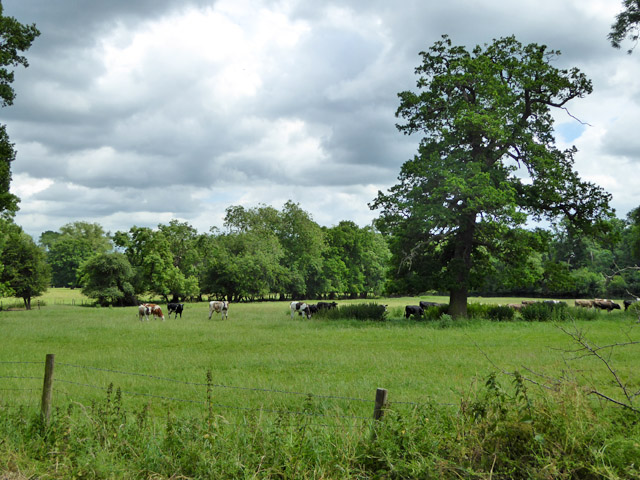
Cattle, Stanford Park East of the road to South Kilworth.
Cattle, Stanford Park Credit: Robin Webster

Westrill and Starmore is a civil parish located in the county of Leicestershire, England. It is situated in the rural countryside, approximately 10 miles east of Leicester city center.

The parish covers an area of around 5 square miles and is home to a small population of just over 200 residents. It is primarily an agricultural area, with lush green fields and picturesque countryside views. The landscape is characterized by rolling hills and small streams, creating a tranquil and idyllic setting.

Westrill and Starmore is known for its rich history, with evidence of human habitation dating back to the prehistoric era. There are several ancient landmarks and historical sites within the parish, including Starmore Iron Age Hill Fort, which offers panoramic views of the surrounding area.

The parish has a close-knit community, with a strong sense of community spirit. There is a village hall that serves as a hub for social events and gatherings, providing a space for residents to come together and engage in various activities.

Despite its rural setting, Westrill and Starmore benefits from good transport links, with easy access to major roads and nearby towns. This allows residents to enjoy the tranquility of rural living while still having convenient access to essential amenities and services.

Overall, Westrill and Starmore is a charming and peaceful civil parish, offering a serene countryside lifestyle for its residents.

If you have any feedback on the listing, please let us know in the comments section below.

Westrill and Starmore Images

Images are sourced within 2km of 52.421387/-1.145783 or Grid Reference SP5880. Thanks to Geograph Open Source API. All images are credited.
Cattle, Stanford Park East of the road to South Kilworth.
Cattle, Stanford Park
East of the road to South Kilworth.
Cattle, Stanford Park West of the road to South Kilworth.
Cattle, Stanford Park
West of the road to South Kilworth.
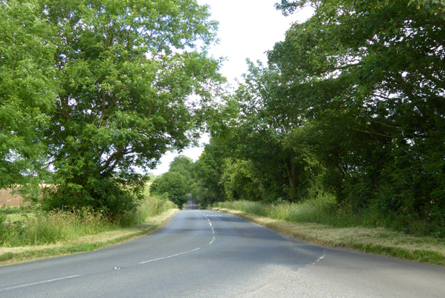
Rugby Road Looking towards South Kilworth.
Rugby Road
Looking towards South Kilworth.
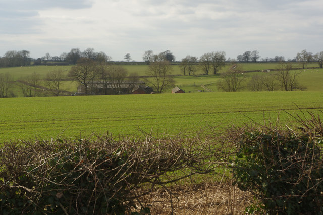
View towards Denyers Barn Seen from Lutterworth Road just north of Swinford village.
View towards Denyers Barn
Seen from Lutterworth Road just north of Swinford village.
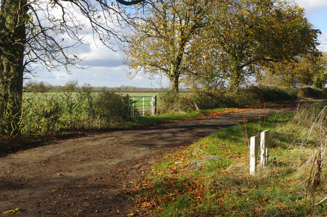
Lane towards Swinford Road A similar shot to Matt Fascione's <a href="https://www.geograph.org.uk/photo/3432191">SP5782 : Lane heading towards Swinford Road</a> which was taken five years earlier but in a different season. The lane exists only to access to farms and is not a public road - although there is public access.
Lane towards Swinford Road
A similar shot to Matt Fascione's SP5782 : Lane heading towards Swinford Road which was taken five years earlier but in a different season. The lane exists only to access to farms and is not a public road - although there is public access.
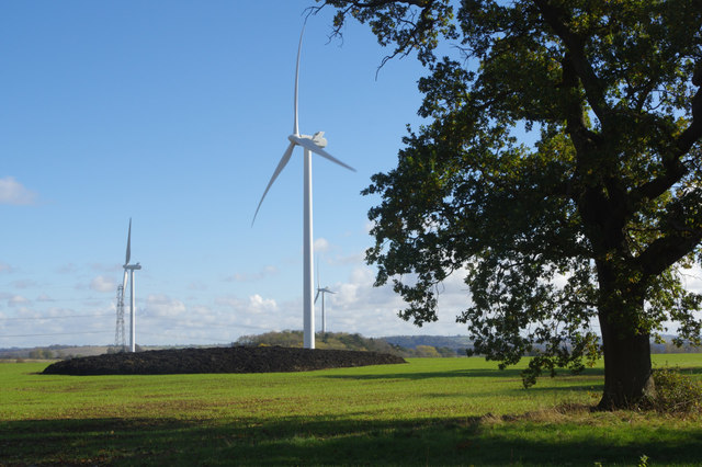
Swinford Wind Farm Part of an 11-turbine wind farm commissioned in November 2012.
Swinford Wind Farm
Part of an 11-turbine wind farm commissioned in November 2012.
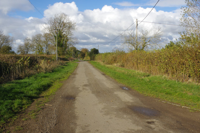
Lane towards Swinford Road This lane or track, running from near Stanford on Avon to Swinford Road at Walcote, is signed as unsuitable for motor vehicles but there is public access.
Lane towards Swinford Road
This lane or track, running from near Stanford on Avon to Swinford Road at Walcote, is signed as unsuitable for motor vehicles but there is public access.
Old Milepost by Rugby Road, South Kilworth Parish Illston iron casting by the UC road, in parish of South Kilworth (Harborough District), Rugby Road, by the North side of road.

Inscription read:- : (Market Harborough 10) : : (Rugby 8) :

Lost since 1970

NB Incorrect photo. Photo shows: MSSid: LE_SFHN. <a href="https://www.geograph.org.uk/photo/6068552">SP5981 : Old Milestone by the B5414, Rugby Road, South Kilworth Parish</a>

Milestone Society National ID: LE_MHRY10
Old Milepost by Rugby Road, South Kilworth Parish
Illston iron casting by the UC road, in parish of South Kilworth (Harborough District), Rugby Road, by the North side of road. Inscription read:- : (Market Harborough 10) : : (Rugby 8) : Lost since 1970 NB Incorrect photo. Photo shows: MSSid: LE_SFHN. SP5981 : Old Milestone by the B5414, Rugby Road, South Kilworth Parish Milestone Society National ID: LE_MHRY10
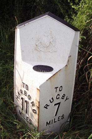
Old Milepost by Rugby Road, Westrill and Starmore parish Cast iron post by the UC road, in parish of WESTRILL AND STARMORE (HARBOROUGH District), Rugby Road; North of Gravel Hill, on the verge, on North side of road. Illston iron casting, erected by the Market Harborough & Brampton turnpike trust in the 19th century. (Lost?)

Inscription reads:-
: TO / HARBORO / 11 / MILES : : {Royal Arms of Queen Victoria} : : TO / RUGBY / 7 / MILES :
Maker:-
: JOSEPH / ILLSTON / VICTORIA FOUNDRY / LEICESTER : 

Milestone Society National ID: LE_MHRY11.
Old Milepost by Rugby Road, Westrill and Starmore parish
Cast iron post by the UC road, in parish of WESTRILL AND STARMORE (HARBOROUGH District), Rugby Road; North of Gravel Hill, on the verge, on North side of road. Illston iron casting, erected by the Market Harborough & Brampton turnpike trust in the 19th century. (Lost?) Inscription reads:- : TO / HARBORO / 11 / MILES : : {Royal Arms of Queen Victoria} : : TO / RUGBY / 7 / MILES : Maker:- : JOSEPH / ILLSTON / VICTORIA FOUNDRY / LEICESTER : Milestone Society National ID: LE_MHRY11.
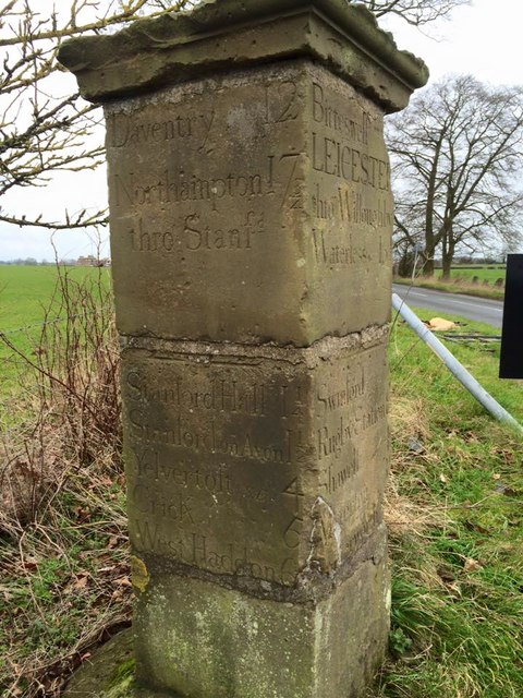
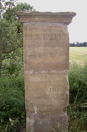
Old Milestone by the B5414, Rugby Road, South Kilworth Parish Carved stone post by the B5414, in parish of SOUTH KILWORTH (HARBOROUGH District), Rugby Road, at junction with Stanford Road, end of old drive to Stanford Hall, on verge by junction, on South East side of road. Stanford Hall Marker, erected by a private estate in the 19th century. 

Inscription reads:-
: Daventry 12 / Northampton 17¾ / thro Stanfd / Stanford Hall 1¼ / Stanford on Avon 1½ / Yelvercroft (S.E.) 4 / Crick 6 / West Haddon  6½ : : Bitteswell / LEICESTER / thro Willoughby / Waterless  16½ / Swinford  2 / Rugby Station 8 / Shawell 4 / Misterton 3½ / Lutterworth : : LEICESTER / thro N.Kilth 16½ / Northampton / thro S.Kilth  17¾ / S.Kilworth ¾ / N.Kilworth 2 / Market Harboro 10½ / Thronby 6½ / Brixworth 12½ : 

Grade II listed.
List Entry Number: 1061428 <span class="nowrap"><a title="https://historicengland.org.uk/listing/the-list/list-entry/1061428" rel="nofollow ugc noopener" href="https://historicengland.org.uk/listing/the-list/list-entry/1061428">Link</a><img style="margin-left:2px;" alt="External link" title="External link - shift click to open in new window" src="https://s1.geograph.org.uk/img/external.png" width="10" height="10"/></span>

Milestone Society National ID: LE_SFHN
Old Milestone by the B5414, Rugby Road, South Kilworth Parish
Carved stone post by the B5414, in parish of SOUTH KILWORTH (HARBOROUGH District), Rugby Road, at junction with Stanford Road, end of old drive to Stanford Hall, on verge by junction, on South East side of road. Stanford Hall Marker, erected by a private estate in the 19th century. Inscription reads:- : Daventry 12 / Northampton 17¾ / thro Stanfd / Stanford Hall 1¼ / Stanford on Avon 1½ / Yelvercroft (S.E.) 4 / Crick 6 / West Haddon 6½ : : Bitteswell / LEICESTER / thro Willoughby / Waterless 16½ / Swinford 2 / Rugby Station 8 / Shawell 4 / Misterton 3½ / Lutterworth : : LEICESTER / thro N.Kilth 16½ / Northampton / thro S.Kilth 17¾ / S.Kilworth ¾ / N.Kilworth 2 / Market Harboro 10½ / Thronby 6½ / Brixworth 12½ : Grade II listed. List Entry Number: 1061428 LinkExternal link Milestone Society National ID: LE_SFHN
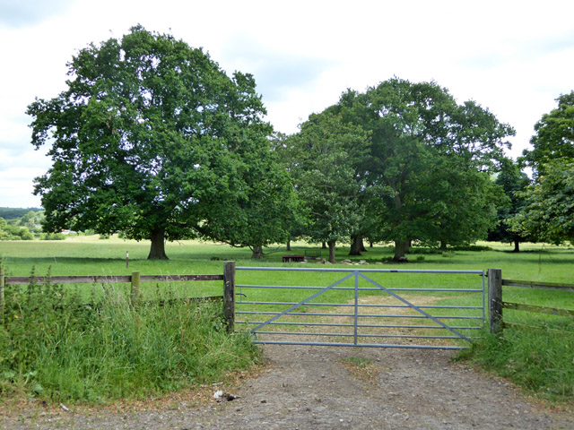
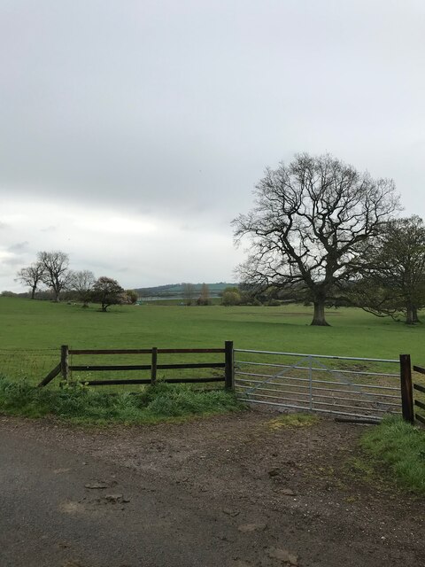
Gated access to farmland
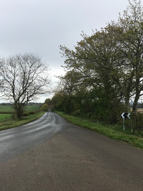
Road to South Kilworth
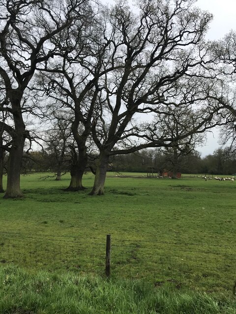
Sheep field - with remains of the OS listed building visible
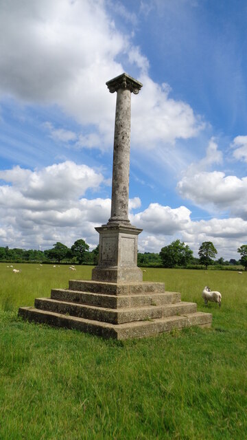
Pilcher Monument Records the powered flight and untimely death of an early aviation pioneer in 1899 at Stanford Park
Pilcher Monument
Records the powered flight and untimely death of an early aviation pioneer in 1899 at Stanford Park
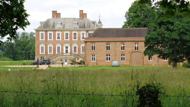
Stanford Hall and Stable Block View from the east on South Kilworth Road
Stanford Hall and Stable Block
View from the east on South Kilworth Road
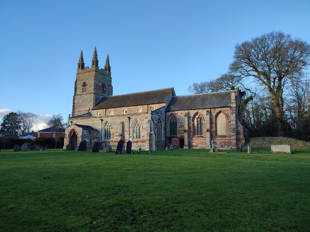
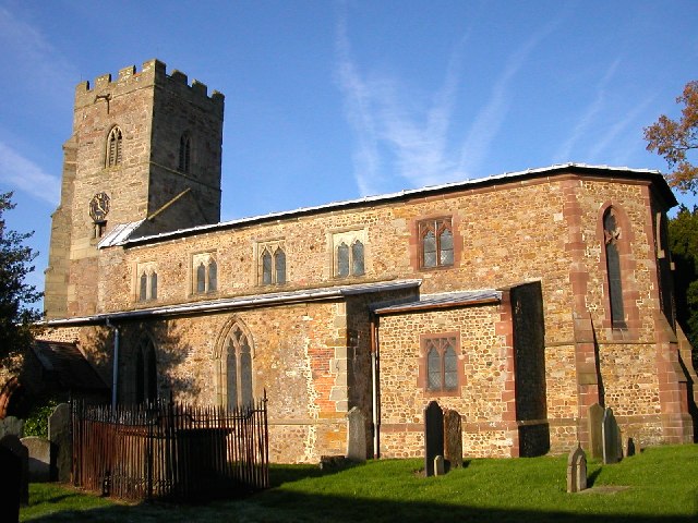
St Nicholas's Church, Stanford-on-Avon
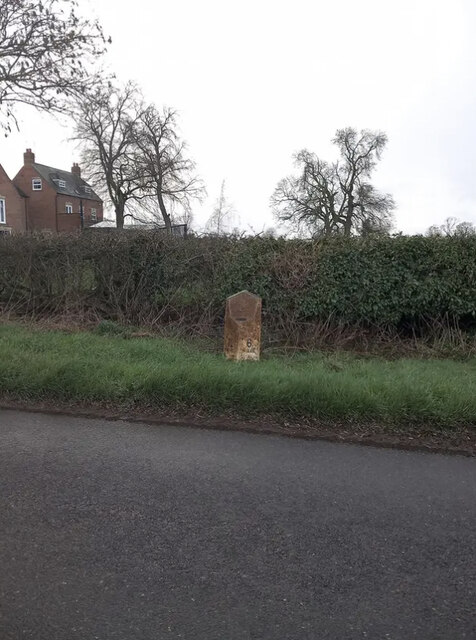
Old Milepost, Rugby road, northeast of Swinford Cast iron post by the UC road, in parish of Swinford (HARBOROUGH District), Rugby Road; on the verge, on North side of road. Illston iron casting, erected by the Market Harborough & Brampton turnpike trust in the 19th century. 

Inscription reads:-
: TO / HARBORO / 12 / MILES : : {Royal Arms of Queen Victoria} : : TO / RUGBY / 6 / MILES :
Maker:-
: JOSEPH / ILLSTON / VICTORIA FOUNDRY / LEICESTER : 

Milestone Society National ID: LE_MHRY12.
Old Milepost, Rugby road, northeast of Swinford
Cast iron post by the UC road, in parish of Swinford (HARBOROUGH District), Rugby Road; on the verge, on North side of road. Illston iron casting, erected by the Market Harborough & Brampton turnpike trust in the 19th century. Inscription reads:- : TO / HARBORO / 12 / MILES : : {Royal Arms of Queen Victoria} : : TO / RUGBY / 6 / MILES : Maker:- : JOSEPH / ILLSTON / VICTORIA FOUNDRY / LEICESTER : Milestone Society National ID: LE_MHRY12.
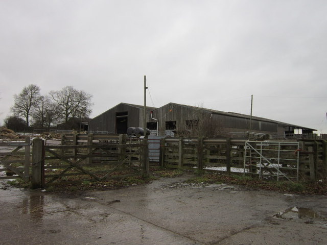
Barns near Top Barn Farm
Show me another place!

Westrill and Starmore is located at Grid Ref: SP5880 (Lat: 52.421387, Lng: -1.145783)

Administrative County: Leicestershire

District: Harborough

Police Authority: Leicestershire

What 3 Words

///though.occupiers.chins. Near Lutterworth, Leicestershire

Related Wikis

Westrill and Starmore

Westrill and Starmore is a civil parish in the Harborough district of Leicestershire, England. It has no settlement as such as it is one of the least populated...

Stanford Hall, Leicestershire

Stanford Hall is a stately home in Leicestershire, England, near the village of Stanford on Avon (which is in Northamptonshire) and the town of Lutterworth...

Stanford Park

Stanford Park is a 20.4 hectares (50 acres) biological Site of Special Scientific Interest east of Swinford in Leicestershire. The park has avenues of...

Swinford, Leicestershire

Swinford is a nucleated village and civil parish in the Harborough district of the English county of Leicestershire. The population of the civil parish...

Nearby Amenities

Located within 500m of 52.421387,-1.145783
Power: tower
Source: Bing
Lat/Long: 52.422366/-1.1509684
Power: tower
Source: Bing
Lat/Long: 52.418885/-1.1512688
The data included in this document is from www.openstreetmap.org. The data is made available under ODbL.

Have you been to Westrill and Starmore?

Leave your review of Westrill and Starmore below (or comments, questions and feedback).