Westborough and Dry Doddington

Civil Parish in Lincolnshire South Kesteven

England

Westborough and Dry Doddington

Dry Doddington
Dry Doddington Credit: Christopher Hilton

Westborough and Dry Doddington is a civil parish located in the county of Lincolnshire, England. Situated in the East Midlands region, this rural area is known for its picturesque landscapes and a small, close-knit community.

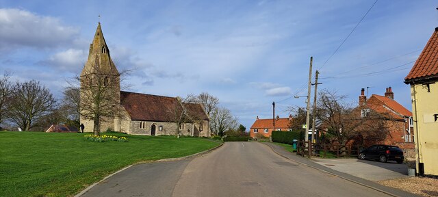
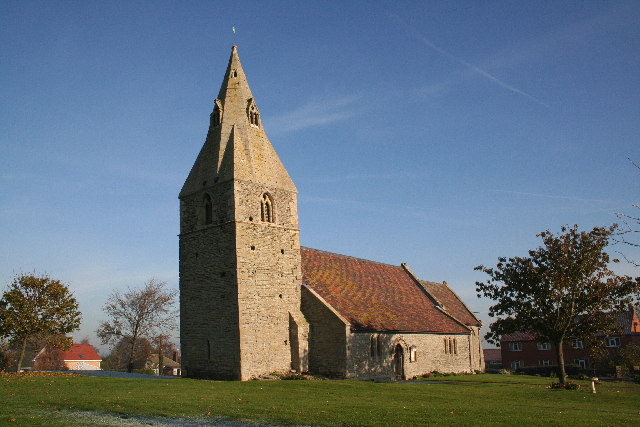
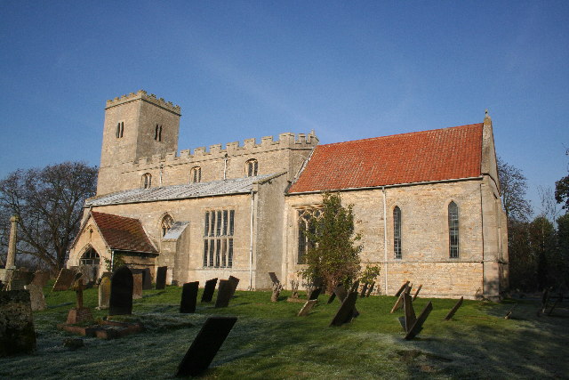
Westborough, the larger of the two villages, is situated on the eastern side of the parish. It is characterized by its charming collection of stone cottages and a beautiful 12th-century church, St. Helen's. The village is surrounded by lush green fields and offers a peaceful, countryside atmosphere. It is home to a small number of residents, fostering a strong sense of community.

On the western side of the parish lies Dry Doddington, a smaller village with a population of around 200 people. Here, one can find a mix of architectural styles, including traditional thatched-roof cottages and modern houses. The village is known for its well-preserved medieval church, St. James, which dates back to the 13th century.

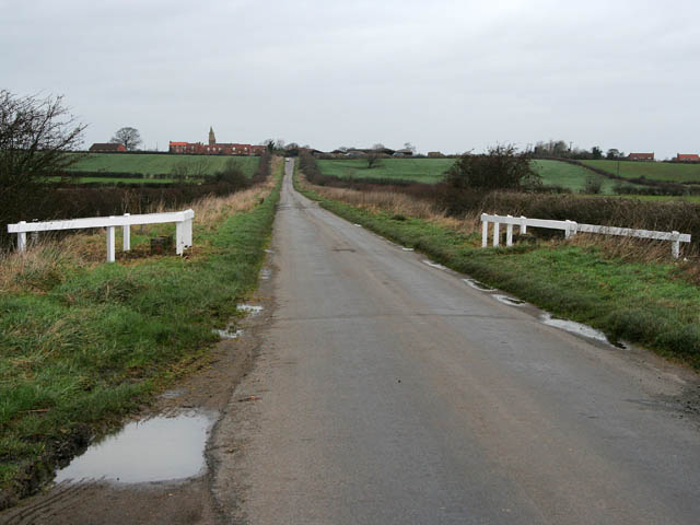
Both villages benefit from their proximity to the larger towns of Grantham and Newark-on-Trent, providing residents with access to a wider range of amenities and services. The surrounding countryside offers ample opportunities for outdoor activities, such as walking, cycling, and horseback riding.

Overall, Westborough and Dry Doddington provide a tranquil and idyllic setting for those seeking a rural lifestyle. With their rich history, natural beauty, and close community ties, these villages offer a unique and charming place to call home.

If you have any feedback on the listing, please let us know in the comments section below.

Westborough and Dry Doddington Images

Images are sourced within 2km of 53.009611/-0.727971 or Grid Reference SK8546. Thanks to Geograph Open Source API. All images are credited.

Dry Doddington
Dry Doddington
Lane from Dry Doddington to Westborough
Town Street, Westborough
Bennington Lane, Long Bennington
The entrance to Long Bennington sewage works There's no sign there but you can follow your nose.
The entrance to Long Bennington sewage works
There's no sign there but you can follow your nose.
Bus shelter in Westborough
Ease Lane, Westborough
Ease Lane at the junction of Hougham Road
Tree on Hougham Road, Westborough
Martin's Plantation
Martin's Plantation
Saint James Church, Dry Doddington The Anglican parish church is dedicated to Saint James and is an ancient structure. It was restored in 1876. The church has no graveyard, so parishioners bury their dead at Westborough.
Saint James Church, Dry Doddington
The Anglican parish church is dedicated to Saint James and is an ancient structure. It was restored in 1876. The church has no graveyard, so parishioners bury their dead at Westborough.
Doddington Bridge Doddington bridge taking Doddington Lane over the river Witham.
Doddington Bridge
Doddington bridge taking Doddington Lane over the river Witham.
St.James' church, Dry Doddington, Lincs. A lovely church in sleepy Dry Doddington, the tower leans precariously !
St.James' church, Dry Doddington, Lincs.
A lovely church in sleepy Dry Doddington, the tower leans precariously !
Mill Farm Bridge & Millpond, Claypole.
Claypole Weir, Mill Farm.
Long Bennington from Lincoln Hill Looking down Lincoln Hill towards Long Bennington
Long Bennington from Lincoln Hill
Looking down Lincoln Hill towards Long Bennington
River Witham Looking south-west towards Long Bennington
River Witham
Looking south-west towards Long Bennington
Path to Claypole
Path to Claypole
Show me another place!

Westborough and Dry Doddington is located at Grid Ref: SK8546 (Lat: 53.009611, Lng: -0.727971)

Administrative County: Lincolnshire

District: South Kesteven

Police Authority: Lincolnshire

What 3 Words

///tastier.spells.rooks. Near Long Bennington, Lincolnshire

Related Wikis

Dry Doddington

Dry Doddington is a small village in the civil parish of Westborough and Dry Doddington, in the north-west of the South Kesteven district of Lincolnshire...

Westborough and Dry Doddington

Westborough and Dry Doddington is a civil parish in the north-west of South Kesteven in the county of Lincolnshire. The population of the civil parish...

Westborough, Lincolnshire

Westborough is a village in the civil parish of Westborough and Dry Doddington, in the South Kesteven district of Lincolnshire, England. It is situated...

Claypole railway station

Claypole railway station was a station in Claypole, Lincolnshire that was in operation from 1852 to 1957. == History == The station was opened by the Great...

Related Videos

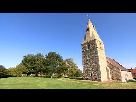
Dry Doddington Village Walk Around

A glorious walk around the Lincolnshire village of Dry Doddington on a sunny spring afternoon. 18 March 2022. Try my Blogs: ...

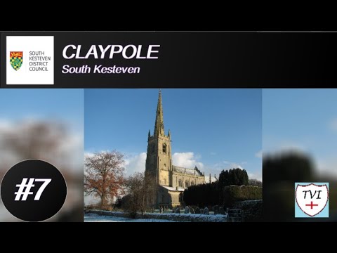
CLAYPOLE: South Kesteven Parish #7 of 83

SOUTH KESTEVEN PARISH #7: CLAYPOLE Here we go again with another run in South Kesteven. Welcome to Claypole, a ...

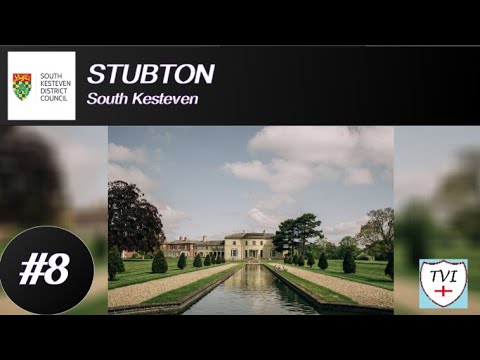
STUBTON: South Kesteven Parish #8 of 83

SOUTH KESTEVEN PARISH #8: STUBTON South Kesteven this week brings us to Stubton, a tiny village which lies close to the ...

Sun's out - Bike's out

First ride in shorts this year around the Lincolnshire villages. Specialised Tricross set up for touring with a rack on the back and a ...

Nearby Amenities

Located within 500m of 53.009611,-0.727971
Dry Doddington
Is In: Lincolnshire, England, UK
Place: village
Source: NPE
Lat/Long: 53.0106971/-0.7322563
Bus Stop
Claypole Lane
Bus: yes
Naptan AtcoCode: 270000014474
Naptan Bearing: E
Naptan CommonName: Claypole Lane
Naptan Indicator: adj
Naptan Landmark: Claypole Lane
Naptan NaptanCode: linjptgw
Naptan Street: Main Street
Naptan Verified: no
Public Transport: platform
Source: naptan_import
Lat/Long: 53.0106167/-0.7338822
Bus Stop
Claypole Lane
Bus: yes
Naptan AtcoCode: 2700LDDB2313
Naptan Bearing: W
Naptan CommonName: Claypole Lane
Naptan Indicator: opp
Naptan Landmark: Claypole Lane
Naptan NaptanCode: linaptgj
Naptan Street: Main Street
Naptan Verified: no
Public Transport: platform
Source: naptan_import
Lat/Long: 53.0105349/-0.7337951
Pub
The Wheatsheaf
Addr City: Dry Doddington
Addr Postcode: NG23 5HU
Addr Street: Main Street
Fhrs Authority: South Kesteven
Fhrs Id: 237656
Fhrs Local Authority Id: 5914
Lat/Long: 53.0096284/-0.7350756
Silverdene Farm
Place: farm
Source: Bing
Lat/Long: 53.010451/-0.728562
Hill Farm
Alt Name: Cold Harbour
Place: farm
Source: Bing
Lat/Long: 53.0063572/-0.7231012
Red House Farm
Place: farm
Source: Bing
Lat/Long: 53.0095874/-0.7338868
The Cottages
Place: isolated_dwelling
Source: Bing
Lat/Long: 53.0108796/-0.7212939
Generator Method: photovoltaic
Generator Output Electricity: yes
Generator Source: solar
Generator Type: solar_photovoltaic_panel
Location: roof
Power: generator
Lat/Long: 53.0102475/-0.7313681
Generator Method: photovoltaic
Generator Output Electricity: yes
Generator Source: solar
Generator Type: solar_photovoltaic_panel
Location: roof
Power: generator
Lat/Long: 53.0101797/-0.7314245
Telephone
Defibrillator
Booth: KX300
Covered: booth
Defibrillator Location: inside phone box next to Wheatsheaf pub in Dry Doddingham
Emergency: defibrillator
Man Made: telephone_box
Lat/Long: 53.0097533/-0.7349917
The data included in this document is from www.openstreetmap.org. The data is made available under ODbL.

Have you been to Westborough and Dry Doddington?

Leave your review of Westborough and Dry Doddington below (or comments, questions and feedback).