Dry Doddington

Settlement in Lincolnshire North Kesteven

England

Dry Doddington

Dry Doddington
Dry Doddington Credit: Christopher Hilton

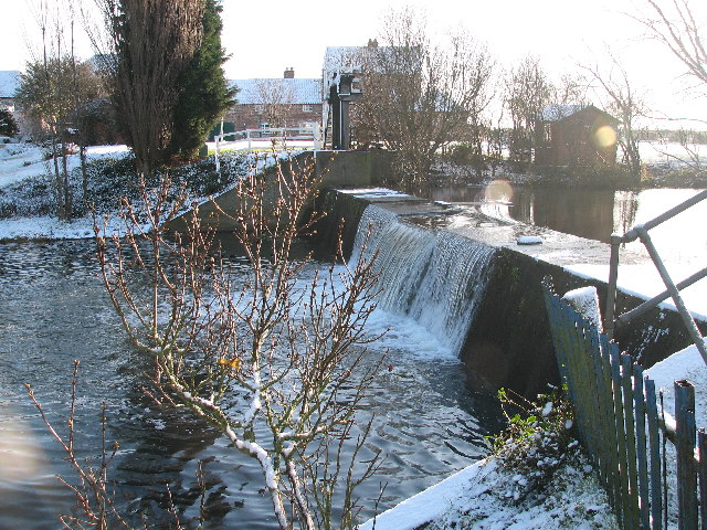
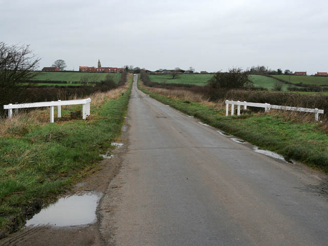
Dry Doddington is a small village located in the county of Lincolnshire, England. It is situated approximately 7 miles north of Grantham and 11 miles south of Newark-on-Trent. The village is known for its picturesque countryside setting, with rolling hills and farmland surrounding the area.

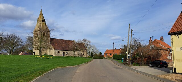
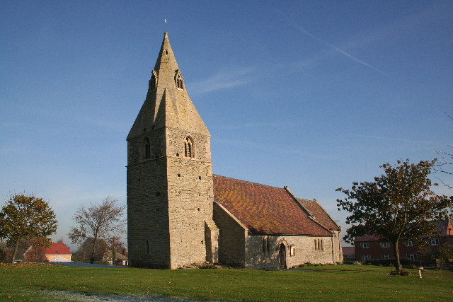
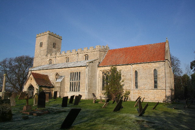
Dry Doddington is a historic village, with many of its buildings dating back to the 17th and 18th centuries. The village is home to a parish church, St James, which is a Grade I listed building and a prominent feature of the village skyline.

The village has a tight-knit community, with a population of around 200 residents. There are a few local amenities in the village, including a village hall and a pub, The Wheatsheaf Inn, which serves traditional pub food and drinks.

Dry Doddington is popular with walkers and cyclists, with many scenic routes and footpaths in the surrounding countryside. The village is also within easy reach of larger towns and cities, making it a desirable location for those looking for a peaceful rural retreat with access to urban amenities.

If you have any feedback on the listing, please let us know in the comments section below.

Dry Doddington Images

Images are sourced within 2km of 53.010597/-0.73340051 or Grid Reference SK8546. Thanks to Geograph Open Source API. All images are credited.

Dry Doddington
Dry Doddington
Lane from Dry Doddington to Westborough
Town Street, Westborough
Bennington Lane, Long Bennington
The entrance to Long Bennington sewage works There's no sign there but you can follow your nose.
The entrance to Long Bennington sewage works
There's no sign there but you can follow your nose.
Bus shelter in Westborough
Ease Lane, Westborough
Ease Lane at the junction of Hougham Road
Martin's Plantation
Martin's Plantation
Saint James Church, Dry Doddington The Anglican parish church is dedicated to Saint James and is an ancient structure. It was restored in 1876. The church has no graveyard, so parishioners bury their dead at Westborough.
Saint James Church, Dry Doddington
The Anglican parish church is dedicated to Saint James and is an ancient structure. It was restored in 1876. The church has no graveyard, so parishioners bury their dead at Westborough.
Doddington Bridge Doddington bridge taking Doddington Lane over the river Witham.
Doddington Bridge
Doddington bridge taking Doddington Lane over the river Witham.
St.James' church, Dry Doddington, Lincs. A lovely church in sleepy Dry Doddington, the tower leans precariously !
St.James' church, Dry Doddington, Lincs.
A lovely church in sleepy Dry Doddington, the tower leans precariously !
Mill Farm Bridge & Millpond, Claypole.
Claypole Weir, Mill Farm.
River Witham Looking north-west with new housing at Long Bennington
River Witham
Looking north-west with new housing at Long Bennington
River Witham looking south-east
Long Bennington from Lincoln Hill Looking down Lincoln Hill towards Long Bennington
Long Bennington from Lincoln Hill
Looking down Lincoln Hill towards Long Bennington
River Witham Looking south-west towards Long Bennington
River Witham
Looking south-west towards Long Bennington
Show me another place!

Dry Doddington is located at Grid Ref: SK8546 (Lat: 53.010597, Lng: -0.73340051)

Division: Parts of Kesteven

Administrative County: Lincolnshire

District: North Kesteven

Police Authority: Lincolnshire

What 3 Words

///forgiving.videos.nurses. Near Long Bennington, Lincolnshire

Related Wikis

Dry Doddington

Dry Doddington is a small village in the civil parish of Westborough and Dry Doddington, in the north-west of the South Kesteven district of Lincolnshire...

Westborough and Dry Doddington

Westborough and Dry Doddington is a civil parish in the north-west of South Kesteven in the county of Lincolnshire. The population of the civil parish...

Westborough, Lincolnshire

Westborough is a village in the civil parish of Westborough and Dry Doddington, in the South Kesteven district of Lincolnshire, England. It is situated...

Claypole railway station

Claypole railway station was a station in Claypole, Lincolnshire that was in operation from 1852 to 1957. == History == The station was opened by the Great...

Nearby Amenities

Located within 500m of 53.010597,-0.73340051
Dry Doddington
Is In: Lincolnshire, England, UK
Place: village
Source: NPE
Lat/Long: 53.0106971/-0.7322563
Created By: Merkaartor 0.12
Lat/Long: 53.0103164/-0.7396566
Bus Stop
Claypole Lane
Bus: yes
Naptan AtcoCode: 270000014474
Naptan Bearing: E
Naptan CommonName: Claypole Lane
Naptan Indicator: adj
Naptan Landmark: Claypole Lane
Naptan NaptanCode: linjptgw
Naptan Street: Main Street
Naptan Verified: no
Public Transport: platform
Source: naptan_import
Lat/Long: 53.0106167/-0.7338822
Bus Stop
Claypole Lane
Bus: yes
Naptan AtcoCode: 2700LDDB2313
Naptan Bearing: W
Naptan CommonName: Claypole Lane
Naptan Indicator: opp
Naptan Landmark: Claypole Lane
Naptan NaptanCode: linaptgj
Naptan Street: Main Street
Naptan Verified: no
Public Transport: platform
Source: naptan_import
Lat/Long: 53.0105349/-0.7337951
Passing Place
Lat/Long: 53.0139279/-0.7343089
Pub
The Wheatsheaf
Addr City: Dry Doddington
Addr Postcode: NG23 5HU
Addr Street: Main Street
Fhrs Authority: South Kesteven
Fhrs Id: 237656
Fhrs Local Authority Id: 5914
Lat/Long: 53.0096284/-0.7350756
Grummitts Farm
Place: farm
Source: Bing
Lat/Long: 53.0107462/-0.7353117
Manor Farm
Place: farm
Source: Bing
Lat/Long: 53.0114688/-0.7355147
Silverdene Farm
Place: farm
Source: Bing
Lat/Long: 53.010451/-0.728562
Red House Farm
Place: farm
Source: Bing
Lat/Long: 53.0095874/-0.7338868
Material: wood
Power: pole
Lat/Long: 53.0091674/-0.7371461
Material: wood
Power: pole
Lat/Long: 53.0097193/-0.7371461
Material: wood
Power: pole
Lat/Long: 53.010594/-0.7371837
Material: wood
Power: pole
Lat/Long: 53.0116139/-0.7372212
Material: wood
Power: pole
Lat/Long: 53.0126919/-0.7371837
Material: wood
Power: pole
Lat/Long: 53.0138344/-0.7371783
Material: wood
Power: pole
Lat/Long: 53.0123627/-0.7401019
Material: wood
Power: pole
Lat/Long: 53.0113767/-0.7400107
Material: wood
Power: pole
Lat/Long: 53.0104956/-0.7399437
Material: wood
Power: pole
Lat/Long: 53.0101067/-0.7400161
Material: wood
Power: pole
Lat/Long: 53.0096499/-0.7405673
Material: wood
Power: pole
Lat/Long: 53.00682/-0.7371354
Material: wood
Power: pole
Lat/Long: 53.0076609/-0.7371327
Natural: peak
Lat/Long: 53.0092062/-0.7368994
Generator Method: photovoltaic
Generator Output Electricity: yes
Generator Source: solar
Generator Type: solar_photovoltaic_panel
Location: roof
Power: generator
Lat/Long: 53.0102475/-0.7313681
Generator Method: photovoltaic
Generator Output Electricity: yes
Generator Source: solar
Generator Type: solar_photovoltaic_panel
Location: roof
Power: generator
Lat/Long: 53.0101797/-0.7314245
Generator Method: photovoltaic
Generator Output Electricity: yes
Generator Source: solar
Generator Type: solar_photovoltaic_panel
Location: roof
Power: generator
Lat/Long: 53.0113933/-0.7349596
Telephone
Defibrillator
Booth: KX300
Covered: booth
Defibrillator Location: inside phone box next to Wheatsheaf pub in Dry Doddingham
Emergency: defibrillator
Man Made: telephone_box
Lat/Long: 53.0097533/-0.7349917
The data included in this document is from www.openstreetmap.org. The data is made available under ODbL.

Have you been to Dry Doddington?

Leave your review of Dry Doddington below (or comments, questions and feedback).