West Crewkerne

Civil Parish in Somerset South Somerset

England

West Crewkerne

Crewkerne Hospital The current hospital building dates from 1904.
Crewkerne Hospital Credit: The Mallick Family

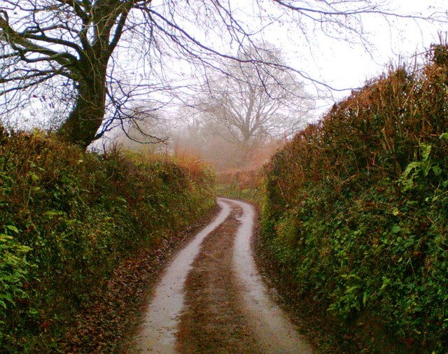
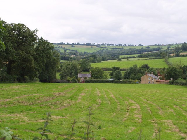
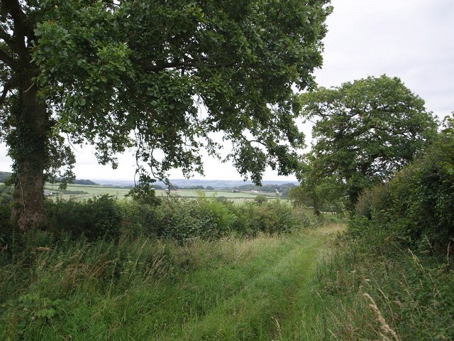
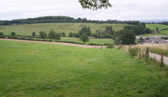
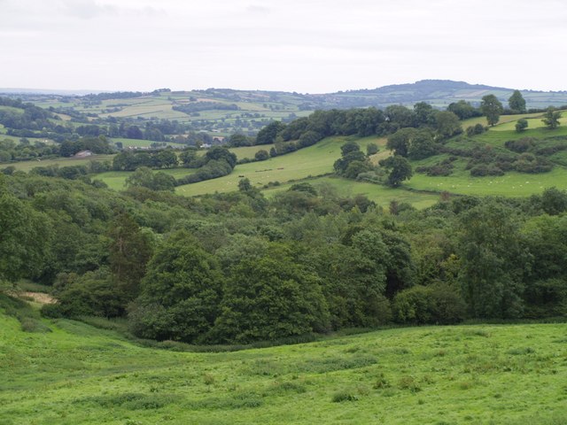
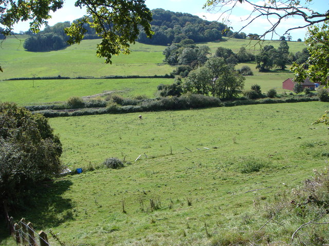
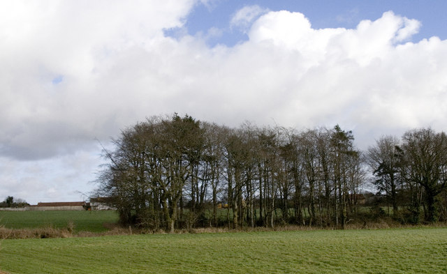
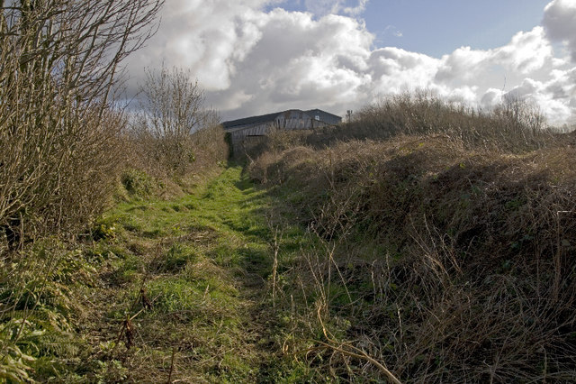
West Crewkerne is a civil parish located in Somerset, England. It is situated approximately 2 miles southwest of the town of Crewkerne, and covers an area of around 3.5 square miles. The parish is surrounded by beautiful countryside and offers a picturesque rural setting.

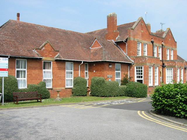
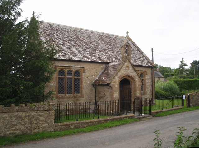
The village itself has a small population, estimated to be around 300 residents. It is characterized by its charming cottages and historic buildings, which give it a unique and timeless appeal. The architecture reflects the traditional English countryside style, with many buildings dating back to the 18th and 19th centuries.

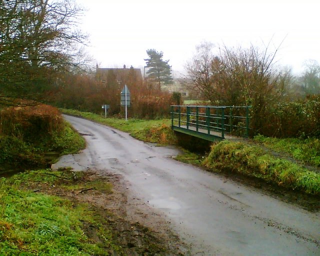
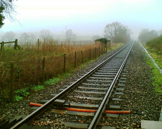
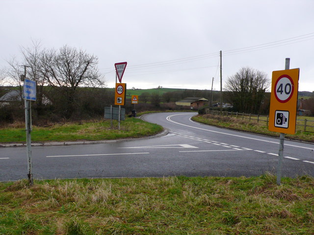
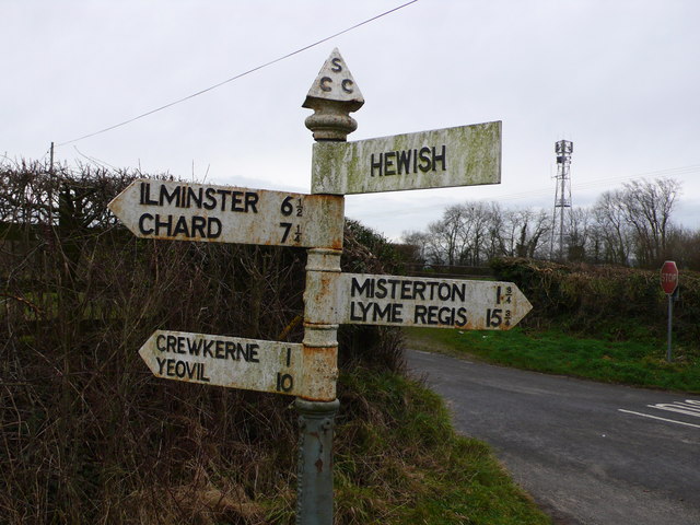
West Crewkerne is well-connected to nearby towns and cities. The A356 road runs through the parish, providing easy access to Crewkerne and the surrounding areas. The nearest railway station is Crewkerne Station, which offers regular services to Exeter and London Waterloo.

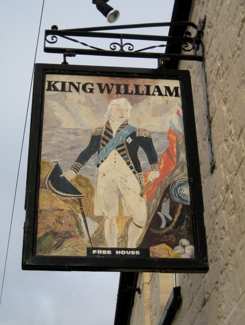
The parish boasts a strong sense of community, with several local amenities and facilities available to residents. These include a village hall, a primary school, a church, and a pub. The community actively participates in various events and activities throughout the year, fostering a friendly and welcoming atmosphere.

Nature lovers will appreciate the abundance of green spaces and scenic walks in the area. The surrounding countryside offers opportunities for outdoor activities such as hiking, cycling, and horse riding. The parish is also close to the South West Coast Path, providing access to stunning coastal landscapes.

Overall, West Crewkerne offers a tranquil and idyllic setting, making it an attractive place to live for those seeking a peaceful rural lifestyle in the heart of Somerset.

If you have any feedback on the listing, please let us know in the comments section below.

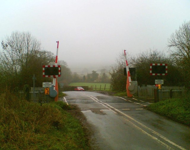
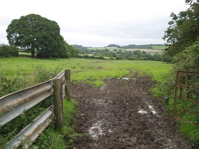
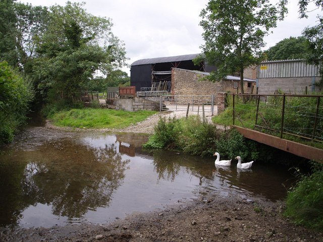
West Crewkerne Images

Images are sourced within 2km of 50.875827/-2.825901 or Grid Reference ST4108. Thanks to Geograph Open Source API. All images are credited.

Crewkerne Hospital The current hospital building dates from 1904.
Crewkerne Hospital
The current hospital building dates from 1904.
Shave Lane
Shave Lane
Ford near Hewish Sometimes referred to as an 'Irish Ford', the stream is piped and only covers the road after heavy rain.
Ford near Hewish
Sometimes referred to as an 'Irish Ford', the stream is piped and only covers the road after heavy rain.
Railway Formerly the main line of the London and South Western Railway, this route has declined in importance and now only supports an infrequent passenger service.
Railway
Formerly the main line of the London and South Western Railway, this route has declined in importance and now only supports an infrequent passenger service.
Hewish Crossing
Hewish Crossing
Field near Woolminstone Footpath CH27/13 crosses this long narrow field, connecting the lane between Woolminstone and Hewish with Hewish Mill. A small stream, hard to detect in the image, runs down the centre a few yards to the left.
Field near Woolminstone
Footpath CH27/13 crosses this long narrow field, connecting the lane between Woolminstone and Hewish with Hewish Mill. A small stream, hard to detect in the image, runs down the centre a few yards to the left.
Ford at Hewish Mill Farm Geese beneath the footbridge beside this ford on Watery Lane, with the farm buildings beyond. The former millhouse and millpond are out of sight to the right, near the railway. The mill's chequered history is described at <span class="nowrap"><a title="http://webapp1.somerset.gov.uk/her/details.asp?prn=54677" rel="nofollow ugc noopener" href="http://webapp1.somerset.gov.uk/her/details.asp?prn=54677">Link</a><img style="margin-left:2px;" alt="External link" title="External link - shift click to open in new window" src="https://s1.geograph.org.uk/img/external.png" width="10" height="10"/></span> . The stream is a tributary of the River Axe.
Ford at Hewish Mill Farm
Geese beneath the footbridge beside this ford on Watery Lane, with the farm buildings beyond. The former millhouse and millpond are out of sight to the right, near the railway. The mill's chequered history is described at LinkExternal link . The stream is a tributary of the River Axe.
Lower Hewish Seen across a field from the B3165 (Clapton Road), these cottages are on Watery Lane. The right-hand cottage is built across the gridline.
Lower Hewish
Seen across a field from the B3165 (Clapton Road), these cottages are on Watery Lane. The right-hand cottage is built across the gridline.
Church of the Good Shepherd, Hewish With its Ham stone mullioned windows, this little late C19 chapel of ease (in the parish of West Crewkerne) on Watery Lane manages to convey a medieval air. <span class="nowrap"><a title="http://webapp1.somerset.gov.uk/her/details.asp?prn=59153" rel="nofollow ugc noopener" href="http://webapp1.somerset.gov.uk/her/details.asp?prn=59153">Link</a><img style="margin-left:2px;" alt="External link" title="External link - shift click to open in new window" src="https://s1.geograph.org.uk/img/external.png" width="10" height="10"/></span>
Church of the Good Shepherd, Hewish
With its Ham stone mullioned windows, this little late C19 chapel of ease (in the parish of West Crewkerne) on Watery Lane manages to convey a medieval air. LinkExternal link
Venley Lane This pleasant hedged track, with oaks every few yards, carries footpath CH27/27 down from a ridge south of St Rayn Hill towards Crewkerne.
Venley Lane
This pleasant hedged track, with oaks every few yards, carries footpath CH27/27 down from a ridge south of St Rayn Hill towards Crewkerne.
Coombe The right hand part of the large farm is in ST4109. The history is outlined at <span class="nowrap"><a title="http://webapp1.somerset.gov.uk/her/details.asp?prn=54694" rel="nofollow ugc noopener" href="http://webapp1.somerset.gov.uk/her/details.asp?prn=54694">Link</a><img style="margin-left:2px;" alt="External link" title="External link - shift click to open in new window" src="https://s1.geograph.org.uk/img/external.png" width="10" height="10"/></span> , which describes it as a deserted medieval village. Certainly the slopes of St Rayn Hill, beyond, appear to show signs of human activity. Along the edge of the wood at the top runs the A30.
Coombe
The right hand part of the large farm is in ST4109. The history is outlined at LinkExternal link , which describes it as a deserted medieval village. Certainly the slopes of St Rayn Hill, beyond, appear to show signs of human activity. Along the edge of the wood at the top runs the A30.
Valley above Woolminstone The combe containing Blackmoor Wood (in the foreground) and Blackmore Farm (hidden behind the wood - and spelt differently on the maps) as seen from footpath CH27/12.
Valley above Woolminstone
The combe containing Blackmoor Wood (in the foreground) and Blackmore Farm (hidden behind the wood - and spelt differently on the maps) as seen from footpath CH27/12.
Shave Hill With railway and Maiden Beech Farm in foreground
Shave Hill
With railway and Maiden Beech Farm in foreground
Road Junction at Roundham, Crewkerne, Somerset The unclassified road known as Cathole Bridge Road running from Misterton round the southern edge of Crewkerne joins the A30 from Crewkerne to Chard at this junction just west of Crewkwerne.
Road Junction at Roundham, Crewkerne, Somerset
The unclassified road known as Cathole Bridge Road running from Misterton round the southern edge of Crewkerne joins the A30 from Crewkerne to Chard at this junction just west of Crewkwerne.
Signpost near Hewish and Crewkerne This is on a minor road just south of Crewkwerne. The reason the sign for Hewish is different to the others is that when the signs were made, the  Hewish sign was spelled incorrectly as "HUISH" (the spelling used for the far more famous Yeovil Town Football Club ground 10 miles away at Yeovil) and had to be replaced. The sign was replaced in 2009.

The   name Huish is common in Somerset (where it can be found 21 times in various forms) but is not at all common elsewhere in the country. It seems to have meant ‘household’ or ‘family farm’ many hundreds of years ago. It has been suggested that places with this name  are what is left of a pre-Saxon, farmstead settlement pattern that existed before villages became the norm. This farmstead pattern  was  replaced  by planned open-field villages in the later Saxon period.
Signpost near Hewish and Crewkerne
This is on a minor road just south of Crewkwerne. The reason the sign for Hewish is different to the others is that when the signs were made, the Hewish sign was spelled incorrectly as "HUISH" (the spelling used for the far more famous Yeovil Town Football Club ground 10 miles away at Yeovil) and had to be replaced. The sign was replaced in 2009. The name Huish is common in Somerset (where it can be found 21 times in various forms) but is not at all common elsewhere in the country. It seems to have meant ‘household’ or ‘family farm’ many hundreds of years ago. It has been suggested that places with this name are what is left of a pre-Saxon, farmstead settlement pattern that existed before villages became the norm. This farmstead pattern was replaced by planned open-field villages in the later Saxon period.
Roundham,  copse South of Travellers' Rest Inn This scene seems to embody the rural idyll but road noise from the A30 is loud and continuous.
Roundham, copse South of Travellers' Rest Inn
This scene seems to embody the rural idyll but road noise from the A30 is loud and continuous.
Brightwell Farm, footpath leading to Cathole Lane. The "farm" buildings in the background are home to a factory producing plastic mouldings.
Brightwell Farm, footpath leading to Cathole Lane.
The "farm" buildings in the background are home to a factory producing plastic mouldings.
The King William Inn sign, Barn Street, Crewkerne William of Orange stayed in Crewkerne on his journey to London but this looks more like William IV "the Sailor King".
The King William Inn sign, Barn Street, Crewkerne
William of Orange stayed in Crewkerne on his journey to London but this looks more like William IV "the Sailor King".
Show me another place!

West Crewkerne is located at Grid Ref: ST4108 (Lat: 50.875827, Lng: -2.825901)

Administrative County: Somerset

District: South Somerset

Police Authority: Avon and Somerset

What 3 Words

///economics.visions.muscular. Near Crewkerne, Somerset

Related Wikis

Crewkerne Castle

Crewkerne Castle (which is also known as Castle Hill or Croft Castle) was possibly a Norman motte and bailey castle on a mound that is situated north-west...

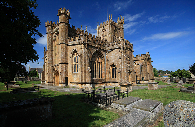
St Bartholomew's Church, Crewkerne

The Church of St Bartholomew in Crewkerne, Somerset, England dates from the 15th century and has been designated as a Grade I listed building.St Bartholomew...

Crewkerne Grammar School

Crewkerne Grammar School was a grammar school in the town of Crewkerne in the English county of Somerset. == History == The school was founded in 1499...

Millwater

Millwater (grid reference ST439100) is a 1.4 hectare (3.5 acre) biological Site of Special Scientific Interest at Crewkerne in Somerset, notified in 1989...

Nearby Amenities

Located within 500m of 50.875827,-2.825901
Hewish
Place: village
Lat/Long: 50.872453/-2.825417
Power: pole
Source: bing
Lat/Long: 50.8755312/-2.819746
Power: pole
Source: bing
Lat/Long: 50.8748499/-2.8215618
Power: pole
Source: bing
Lat/Long: 50.874547/-2.8223719
Power: pole
Source: bing
Lat/Long: 50.873435/-2.8234407
Power: pole
Source: bing
Lat/Long: 50.8726081/-2.8242494
Power: pole
Source: bing
Lat/Long: 50.8719429/-2.8248999
Power: pole
Source: bing
Lat/Long: 50.8719362/-2.8266057
The data included in this document is from www.openstreetmap.org. The data is made available under ODbL.

Have you been to West Crewkerne?

Leave your review of West Crewkerne below (or comments, questions and feedback).