West Compton

Civil Parish in Dorset West Dorset

England

West Compton

Eggardon Hill Eggardon Hill is a prehistoric hill fort built on chalk uplands.  The highest point stands at 252 metres above sea level and offers outstanding views to the Jurassic Coast.  The southern half of the site is owned by the National Trust.
Eggardon Hill Credit: Mark Percy

West Compton is a civil parish located in the county of Dorset, England. Situated in the southwest region of the country, it falls within the district of Purbeck. The parish is part of the larger area known as Compton Abbas, which also includes the neighboring East Compton.

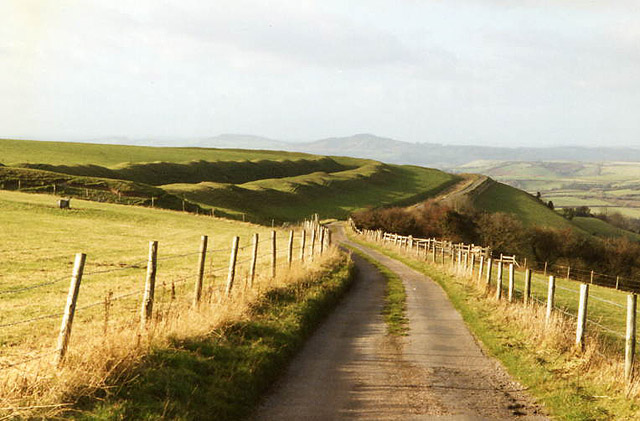
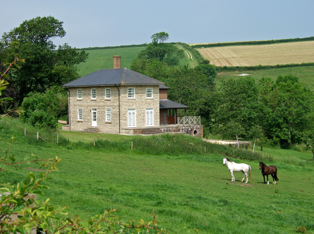
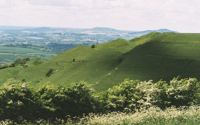
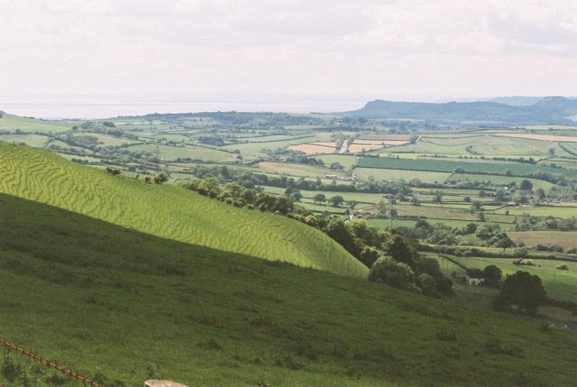
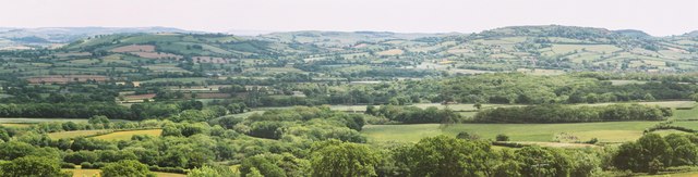
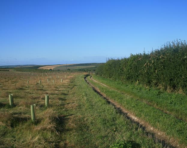
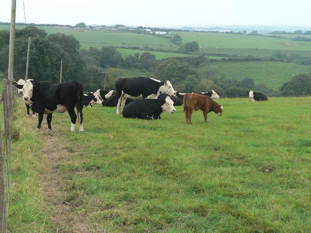
West Compton is a small, rural village with a population of around 100 residents. The village is characterized by its picturesque countryside setting, surrounded by rolling hills and farmland. It is situated within close proximity to the River Stour, which adds to the natural beauty of the area.

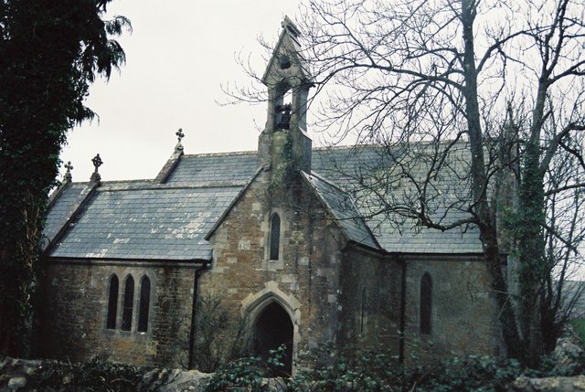
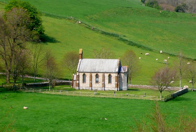
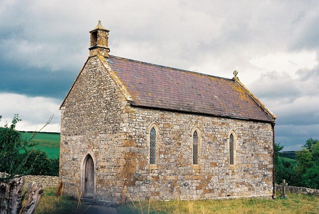
The village itself is quite compact, consisting of a few residential properties, a local church, and a village hall. The church, dedicated to St. Michael, is a notable feature in the area, dating back to the 12th century. It is a Grade I listed building and stands as a testament to the village's rich history.

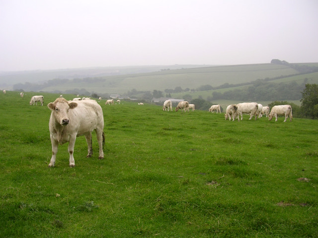
Being a rural area, West Compton primarily relies on agriculture as its main industry. The fertile land provides opportunities for farming and livestock rearing. The village is also known for its traditional village fete, which takes place annually and attracts visitors from nearby towns and villages.

Although small in size, West Compton offers a peaceful and close-knit community lifestyle, with residents enjoying the tranquility of the countryside while having easy access to larger towns and amenities in the surrounding area.

If you have any feedback on the listing, please let us know in the comments section below.
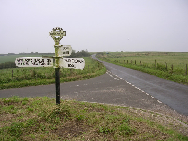
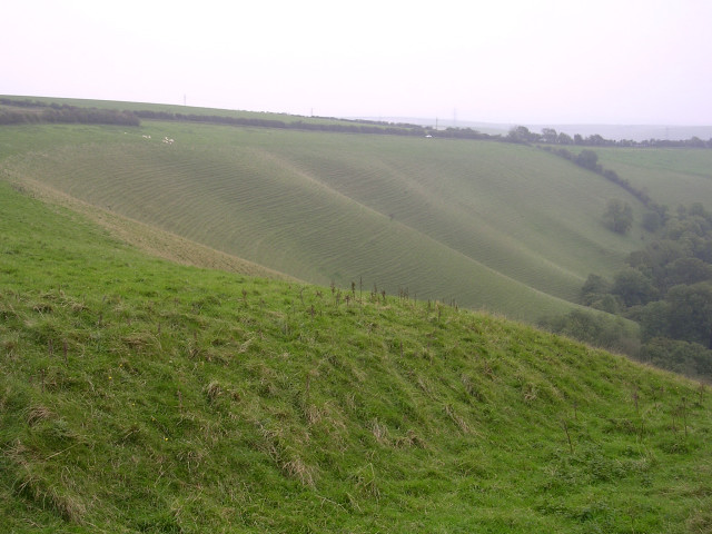
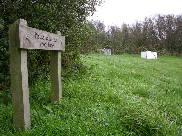
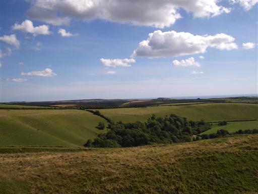
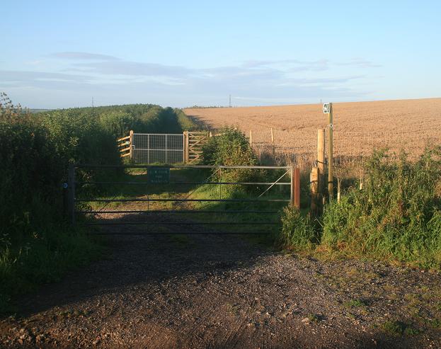
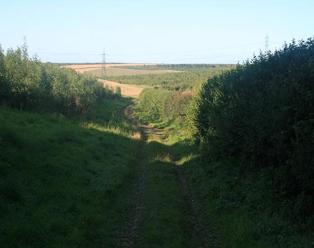
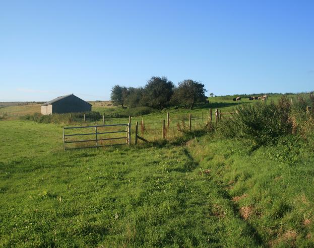
West Compton Images

Images are sourced within 2km of 50.747337/-2.623113 or Grid Reference SY5694. Thanks to Geograph Open Source API. All images are credited.

Eggardon Hill Eggardon Hill is a prehistoric hill fort built on chalk uplands.  The highest point stands at 252 metres above sea level and offers outstanding views to the Jurassic Coast.  The southern half of the site is owned by the National Trust.
Eggardon Hill
Eggardon Hill is a prehistoric hill fort built on chalk uplands. The highest point stands at 252 metres above sea level and offers outstanding views to the Jurassic Coast. The southern half of the site is owned by the National Trust.
Looking east along the Roman Road at Two Gates The thick fog in this photo was coming in from the sea (to the right) and making driving on this narrow (but straight) road quite difficult. It had been sunny only a few hours earlier, which shows how quickly the weather can change on this high ground (238m above sea level). The Roman road eventually leads to Dorchester.
Looking east along the Roman Road at Two Gates
The thick fog in this photo was coming in from the sea (to the right) and making driving on this narrow (but straight) road quite difficult. It had been sunny only a few hours earlier, which shows how quickly the weather can change on this high ground (238m above sea level). The Roman road eventually leads to Dorchester.
Eggardon hillfort Rampart of hill fort visible by minor road running north west to Powerstock
Eggardon hillfort
Rampart of hill fort visible by minor road running north west to Powerstock
View from Shatcombe Lane towards Eggardon Hill Farm Looking southeast from Shatcombe Lane, with Eggardon Hill Farm in the valley below. According to the map this field has 'celtic field systems' i.e. the earthwork remains of Bronze Age farming. Now it is home to some white bullocks.
View from Shatcombe Lane towards Eggardon Hill Farm
Looking southeast from Shatcombe Lane, with Eggardon Hill Farm in the valley below. According to the map this field has 'celtic field systems' i.e. the earthwork remains of Bronze Age farming. Now it is home to some white bullocks.
Road junction and signpost on Eggardon Hill This junction marks the higher end of Shatcombe Lane. The Eggardon Hill trig point can be seen on the horizon, left of centre. The top of the directional signpost features the number "548948" which I only later realised was the OS grid reference for this sign.
Road junction and signpost on Eggardon Hill
This junction marks the higher end of Shatcombe Lane. The Eggardon Hill trig point can be seen on the horizon, left of centre. The top of the directional signpost features the number "548948" which I only later realised was the OS grid reference for this sign.
Glaciated chalk landscape, Eggardon Hill Looking south from the south-east entrance to Eggardon iron-age hillfort, this glaciated chalk escarpment is beautifully contoured and reminiscent of <a href="https://www.geograph.org.uk/photo/25255">SU2986 : The Manger, north of Uffington Castle</a>. A few sheep can be seen perched on the edge of the steep slope, to the left of the photo.
Glaciated chalk landscape, Eggardon Hill
Looking south from the south-east entrance to Eggardon iron-age hillfort, this glaciated chalk escarpment is beautifully contoured and reminiscent of SU2986 : The Manger, north of Uffington Castle. A few sheep can be seen perched on the edge of the steep slope, to the left of the photo.
Flytipping at Shatcombe Lane picnic Area, Eggardon Hill A nearby sign (not pictured) asks visitors to PLEASE LEAVE THIS AREA AS YOU WOULD HOPE TO FIND IT. Someone obviously hoped to find it containing a broken fridge and washing machine. Why bring it up here to the top of a remote Dorset hill?
Flytipping at Shatcombe Lane picnic Area, Eggardon Hill
A nearby sign (not pictured) asks visitors to PLEASE LEAVE THIS AREA AS YOU WOULD HOPE TO FIND IT. Someone obviously hoped to find it containing a broken fridge and washing machine. Why bring it up here to the top of a remote Dorset hill?
View from Eggardon Hill to the sea
West Compton: parish church of St. Michael Although the village is immediately west of Compton Valence, the name West Compton actually refers to Compton Abbas, some 20 miles away – to which parish it was originally a detachment.
West Compton: parish church of St. Michael
Although the village is immediately west of Compton Valence, the name West Compton actually refers to Compton Abbas, some 20 miles away – to which parish it was originally a detachment.
House on the road southwest of Wynford Eagle
Hillfort slopes and broad view From the top of Eggardon Hill, looking out across the slopes of Eggardon hillfort to the west Dorset countryside.
Hillfort slopes and broad view
From the top of Eggardon Hill, looking out across the slopes of Eggardon hillfort to the west Dorset countryside.
Eggardon Hill: lush slopes and sea view
Green view from Eggardon This is a view across south Dorset from Eggardon Hill (exact position uncertain).

Where the horizon dips about ⅓ along from the left-hand edge, Portland is just recognisable.
Green view from Eggardon
This is a view across south Dorset from Eggardon Hill (exact position uncertain). Where the horizon dips about ⅓ along from the left-hand edge, Portland is just recognisable.
Bridleway as seen from the Roman road Note the high and sturdy gates/fencing beyond the metal gate - this area has been extensively planted to new woodland so high fences have been erected to keep deer away from the trees.
Bridleway as seen from the Roman road
Note the high and sturdy gates/fencing beyond the metal gate - this area has been extensively planted to new woodland so high fences have been erected to keep deer away from the trees.
Bridleway leading to North Barn Farm. Bridleway leading south from the Roman road through North Barn Farm to the A35.
Bridleway leading to North Barn Farm.
Bridleway leading south from the Roman road through North Barn Farm to the A35.
Isolated farm building Isolated farm building as viewed from the north east on Jubilee Trail.  Building currently used to shelter sheep.
Isolated farm building
Isolated farm building as viewed from the north east on Jubilee Trail. Building currently used to shelter sheep.
New tree planting Looking south along the bridleway, there are many acres of newly planted trees to the east.
New tree planting
Looking south along the bridleway, there are many acres of newly planted trees to the east.
Toller Porcorum: cows at Woolcombe Farm The calf does not match the colour of the adults.
Toller Porcorum: cows at Woolcombe Farm
The calf does not match the colour of the adults.
Show me another place!

West Compton is located at Grid Ref: SY5694 (Lat: 50.747337, Lng: -2.623113)

Administrative County: Dorset

District: West Dorset

Police Authority: Dorset

What 3 Words

///bookshelf.finally.tidal. Near Maiden Newton, Dorset

Related Wikis

West Compton, Dorset

West Compton is a hamlet and civil parish in the county of Dorset, England. It lies in western Dorset, about 7 miles to the east of the town of Bridport...
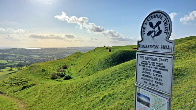
Eggardon Hill

Eggardon Hill is a prehistoric hillfort on a hill in Dorset, England. It is located on chalk uplands approximately four miles to the east of the town of...

Wynford Eagle

Wynford Eagle is a hamlet and small parish in Dorset, England, situated approximately 1.5 miles (2.4 km) southwest of Maiden Newton and 7.5 miles (12.1...

Toller Fratrum

Toller Fratrum () is a very small village and civil parish in Dorset, England, near Maiden Newton, anciently in Tollerford Hundred. The name is taken from...

Nearby Amenities

Located within 500m of 50.747337,-2.623113
West Compton
Place: hamlet
Source: NLS - OS 1:25k 1st Series 1937-61
Lat/Long: 50.7465529/-2.6206726
The data included in this document is from www.openstreetmap.org. The data is made available under ODbL.

Have you been to West Compton?

Leave your review of West Compton below (or comments, questions and feedback).